
Central Park Neighbourhood
https://search.heritageburnaby.ca/link/landmark688
- Repository
- Burnaby Heritage Planning
- Associated Dates
- 1925-1954
- Heritage Value
- Although still largely a rural area during the 1920s, subdivisions began appearing in the Central Park neighbourhood at this time. Development was slowed by the Great Depression of the 1930s but the influx of commercial buildings and new housing initiatives in the post-war boom led to a period of rapid growth especially in the Garden Village subdivision which was undertaken in 1953 with the plan to build 500 modern homes in the 140-acre site. Despite the closure of the interurban line in 1953, the neighbourhood remained an active commercial and residential centre.
- Historic Neighbourhood
- Central Park (Historic Neighbourhood)
- Planning Study Area
- Maywood Area
Images


Central Park Neighbourhood
https://search.heritageburnaby.ca/link/landmark751
- Repository
- Burnaby Heritage Planning
- Associated Dates
- 1905-1924
- Heritage Value
- In 1906, Maxwell Smith, President of the Central Park Farmer's Institute gave a speech in which he commented on the growth of this district and its ideal location during the boom years after 1905. He said: "Central Park is destined to become the epicentre of a great commercial metropolis, when Vancouver and New Westminster will have both expanded and prospered until they meet and fill up the intervening distances with residences of a new city, greater than few can now imagine, even in their wildest flights of fancy...we are proud of the two cities that lie on either side of us but they are, but mere hamlets compared with the great city that is to be on this peninsula. The time is coming when there will be one vast city, one commercial metropolis, and Central Park will be the heart of it."
- Historic Neighbourhood
- Central Park (Historic Neighbourhood)
- Planning Study Area
- Maywood Area
Images


Kelly-Douglas Company
https://search.heritageburnaby.ca/link/landmark697
- Repository
- Burnaby Heritage Planning
- Geographic Access
- Kingsway
- Associated Dates
- 1946
- Heritage Value
- The Kelly Douglas Company was founded in 1896 as a wholesale grocery business. It enjoyed rapid success during the Klondike Goldrush of 1898 when it became a primary supplier for prospectors. In 1946, its headquarters moved from Vancouver to Burnaby and a manufacturing plant and warehouse was built on the site.
- Historic Neighbourhood
- Central Park (Historic Neighbourhood)
- Planning Study Area
- Maywood Area
- Street Address
- 4700 Kingsway
Images


Newhoven Residence
https://search.heritageburnaby.ca/link/landmark626
- Repository
- Burnaby Heritage Planning
- Description
- Residential building.
- Associated Dates
- 1923
- Street View URL
- Google Maps Street View
- Repository
- Burnaby Heritage Planning
- Geographic Access
- Smith Avenue
- Associated Dates
- 1923
- Description
- Residential building.
- Heritage Value
- This large house was built in 1923 and first owned by Casper Newhoven, who managed the Empire Transfer & Storage Co. from this address. It would appear his parents, Cornelius (1879-1959), a barber at Joe’s Place on Granville Street, and Catherina (1883-1981) and his brother Martin (1905-1935), a taxi driver for Main Taxis, also lived here. It is a well-maintained example of a Late Craftsman bungalow, and typical of the style it features a gabled roof, tapered verandah piers, multi-paned windows and stained glass sidelights. The round verandah columns are an unusual feature. The Newhovens had left this address by the time of Martin’s death in 1935.
- Locality
- Central Park
- Historic Neighbourhood
- Central Park (Historic Neighbourhood)
- Planning Study Area
- Garden Village Area
- Area
- 675.80
- Contributing Resource
- Building
- Ownership
- Private
- Street Address
- 5488 Smith Avenue
- Street View URL
- Google Maps Street View
Images


Rev. James Black Residence
https://search.heritageburnaby.ca/link/landmark632
- Repository
- Burnaby Heritage Planning
- Description
- Residential building.
- Associated Dates
- 1925
- Street View URL
- Google Maps Street View
- Repository
- Burnaby Heritage Planning
- Geographic Access
- Sussex Avenue
- Associated Dates
- 1925
- Description
- Residential building.
- Heritage Value
- This home was built as a retirement home for Baptist Missionary Reverend James Black and his family in 1925; the Black family resided in the home until the early 1970s. The Black Residence is a good example of the Period Revival movement that occurred between the two World Wars. At the time, it was considered good taste for a house to have an identifiable historical style. The Black Residence was likely designed by a local architect or built by a contractor using a pattern book plan, and the British Arts and Crafts influence was typical of many middle class homes of the period built in Burnaby. The house was originally located facing Sardis Street with a beautiful garden landscape that was lost when the house was relocated in 2005.
- Locality
- Central Park
- Historic Neighbourhood
- Central Park (Historic Neighbourhood)
- Planning Study Area
- Marlborough Area
- Area
- 639.00
- Contributing Resource
- Building
- Ownership
- Private
- Street Address
- 5688 Sussex Avenue
- Street View URL
- Google Maps Street View
Images


1927 "Durant" Automobile
https://search.heritageburnaby.ca/link/archivedescription37733
- Repository
- City of Burnaby Archives
- Date
- [ca. 1941] (date of original), copied 1991
- Collection/Fonds
- Burnaby Historical Society fonds
- Description Level
- Item
- Physical Description
- 1 photograph : b&w ; 2.7 x 4.0 cm print on contact sheet 20.4 x 26.5 cm
- Scope and Content
- Photograph of a 1927 "Durant" automobile, parked in front of the home of Annie and Jim Ellis at 2924 Silver Avenue (later renumbered 6113 Silver Avenue). The Ford Motor plant is visible in the background.
- Repository
- City of Burnaby Archives
- Date
- [ca. 1941] (date of original), copied 1991
- Collection/Fonds
- Burnaby Historical Society fonds
- Subseries
- Burnaby Image Bank subseries
- Physical Description
- 1 photograph : b&w ; 2.7 x 4.0 cm print on contact sheet 20.4 x 26.5 cm
- Description Level
- Item
- Record No.
- 370-321
- Access Restriction
- No restrictions
- Reproduction Restriction
- No known restrictions
- Accession Number
- BHS1999-03
- Scope and Content
- Photograph of a 1927 "Durant" automobile, parked in front of the home of Annie and Jim Ellis at 2924 Silver Avenue (later renumbered 6113 Silver Avenue). The Ford Motor plant is visible in the background.
- Subjects
- Transportation - Automobiles
- Names
- Ford Motor Company
- Media Type
- Photograph
- Notes
- Title based on contents of photograph
- 1 b&w copy negative accompanying
- Negative has a pink cast
- Geographic Access
- Silver Avenue
- Street Address
- 6113 Silver Avenue
- Historic Neighbourhood
- Central Park (Historic Neighbourhood)
- Planning Study Area
- Maywood Area
Images

![1934 Chevrolet, [ca. 1940] (date of original), copied 1991 thumbnail](/media/hpo/_Data/_Archives_Images/_Unrestricted/370/370-650.jpg?width=280)
1934 Chevrolet
https://search.heritageburnaby.ca/link/archivedescription38063
- Repository
- City of Burnaby Archives
- Date
- [ca. 1940] (date of original), copied 1991
- Collection/Fonds
- Burnaby Historical Society fonds
- Description Level
- Item
- Physical Description
- 1 photograph : b&w ; 3.1 x 4.5 cm print on contact sheet 20.4 x 26.5 cm
- Scope and Content
- Photograph of a 1934 Chevrolet parked in the driveway of 2224 Antrim Avenue (later renumbered 6957 Antrim Avenue).
- Repository
- City of Burnaby Archives
- Date
- [ca. 1940] (date of original), copied 1991
- Collection/Fonds
- Burnaby Historical Society fonds
- Subseries
- Burnaby Image Bank subseries
- Physical Description
- 1 photograph : b&w ; 3.1 x 4.5 cm print on contact sheet 20.4 x 26.5 cm
- Description Level
- Item
- Record No.
- 370-650
- Access Restriction
- No restrictions
- Reproduction Restriction
- No known restrictions
- Accession Number
- BHS1999-03
- Scope and Content
- Photograph of a 1934 Chevrolet parked in the driveway of 2224 Antrim Avenue (later renumbered 6957 Antrim Avenue).
- Subjects
- Transportation - Automobiles
- Media Type
- Photograph
- Notes
- Title based on contents of photograph
- 1 b&w copy negative accompanying
- Negative has a pink cast
- Geographic Access
- Antrim Avenue
- Street Address
- 6957 Antrim Avenue
- Historic Neighbourhood
- Central Park (Historic Neighbourhood)
- Planning Study Area
- Windsor Area
Images
![1934 Chevrolet, [ca. 1940] (date of original), copied 1991 thumbnail](/media/hpo/_Data/_Archives_Images/_Unrestricted/370/370-650.jpg)
![2224 Antrim Avenue, [1940] (date of original), copied 1991 thumbnail](/media/hpo/_Data/_Archives_Images/_Unrestricted/370/370-602.jpg?width=280)
2224 Antrim Avenue
https://search.heritageburnaby.ca/link/archivedescription38015
- Repository
- City of Burnaby Archives
- Date
- [1940] (date of original), copied 1991
- Collection/Fonds
- Burnaby Historical Society fonds
- Description Level
- Item
- Physical Description
- 1 photograph : b&w ; 2.3 x 3.2 cm print on contact sheet 20.6 x 26.9 cm
- Scope and Content
- Photograph of the side of the house at 2224 Antrim Avenue (later renumbered 6957 Antrim Avenue).
- Repository
- City of Burnaby Archives
- Date
- [1940] (date of original), copied 1991
- Collection/Fonds
- Burnaby Historical Society fonds
- Subseries
- Burnaby Image Bank subseries
- Physical Description
- 1 photograph : b&w ; 2.3 x 3.2 cm print on contact sheet 20.6 x 26.9 cm
- Description Level
- Item
- Record No.
- 370-602
- Access Restriction
- No restrictions
- Reproduction Restriction
- No known restrictions
- Accession Number
- BHS1999-03
- Scope and Content
- Photograph of the side of the house at 2224 Antrim Avenue (later renumbered 6957 Antrim Avenue).
- Media Type
- Photograph
- Notes
- Title based on contents of photograph
- 1 b&w copy negative accompanying
- Negative has a pink cast
- Geographic Access
- Antrim Avenue
- Street Address
- 6957 Antrim Avenue
- Historic Neighbourhood
- Central Park (Historic Neighbourhood)
- Planning Study Area
- Windsor Area
Images
![2224 Antrim Avenue, [1940] (date of original), copied 1991 thumbnail](/media/hpo/_Data/_Archives_Images/_Unrestricted/370/370-602.jpg)
![2224 Antrim Avenue, [1940] (date of original), copied 1991 thumbnail](/media/hpo/_Data/_Archives_Images/_Unrestricted/370/370-603.jpg?width=280)
2224 Antrim Avenue
https://search.heritageburnaby.ca/link/archivedescription38016
- Repository
- City of Burnaby Archives
- Date
- [1940] (date of original), copied 1991
- Collection/Fonds
- Burnaby Historical Society fonds
- Description Level
- Item
- Physical Description
- 1 photograph : b&w ; 2.7 x 4.6 cm print on contact sheet 20.6 x 26.9 cm
- Scope and Content
- Photograph of the backyard of 2224 Antrim Avenue (later renumbered 6957 Antrim Avenue). A woman is standing in the yard.
- Repository
- City of Burnaby Archives
- Date
- [1940] (date of original), copied 1991
- Collection/Fonds
- Burnaby Historical Society fonds
- Subseries
- Burnaby Image Bank subseries
- Physical Description
- 1 photograph : b&w ; 2.7 x 4.6 cm print on contact sheet 20.6 x 26.9 cm
- Description Level
- Item
- Record No.
- 370-603
- Access Restriction
- No restrictions
- Reproduction Restriction
- No known restrictions
- Accession Number
- BHS1999-03
- Scope and Content
- Photograph of the backyard of 2224 Antrim Avenue (later renumbered 6957 Antrim Avenue). A woman is standing in the yard.
- Subjects
- Buildings - Residential - Houses
- Media Type
- Photograph
- Notes
- Title based on contents of photograph
- 1 b&w copy negative accompanying
- Negative has a pink cast
- Geographic Access
- Antrim Avenue
- Street Address
- 6957 Antrim Avenue
- Historic Neighbourhood
- Central Park (Historic Neighbourhood)
- Planning Study Area
- Windsor Area
Images
![2224 Antrim Avenue, [1940] (date of original), copied 1991 thumbnail](/media/hpo/_Data/_Archives_Images/_Unrestricted/370/370-603.jpg)
![2700 Block Willingdon Avenue, [1928] (date of original), copied 1991 thumbnail](/media/hpo/_Data/_Archives_Images/_Unrestricted/370/370-105.jpg?width=280)
2700 Block Willingdon Avenue
https://search.heritageburnaby.ca/link/archivedescription37517
- Repository
- City of Burnaby Archives
- Date
- [1928] (date of original), copied 1991
- Collection/Fonds
- Burnaby Historical Society fonds
- Description Level
- Item
- Physical Description
- 1 photograph : b&w ; 4.5 x 2.6 cm print on contact sheet 20.3 x 25.3 cm
- Scope and Content
- Photograph of neighbours of the Murley family on the 2700 block of Willingdon Avenue (later renumbered as the 6300 block of Willingdon Avenue). A woman and two children are standing in front of a house.
- Repository
- City of Burnaby Archives
- Date
- [1928] (date of original), copied 1991
- Collection/Fonds
- Burnaby Historical Society fonds
- Subseries
- Burnaby Image Bank subseries
- Physical Description
- 1 photograph : b&w ; 4.5 x 2.6 cm print on contact sheet 20.3 x 25.3 cm
- Description Level
- Item
- Record No.
- 370-105
- Access Restriction
- No restrictions
- Reproduction Restriction
- No known restrictions
- Accession Number
- BHS1999-03
- Scope and Content
- Photograph of neighbours of the Murley family on the 2700 block of Willingdon Avenue (later renumbered as the 6300 block of Willingdon Avenue). A woman and two children are standing in front of a house.
- Subjects
- Buildings - Residential - Houses
- Media Type
- Photograph
- Notes
- Title based on contents of photograph
- 1 b&w copy negative accompanying
- Geographic Access
- Willingdon Avenue
- Historic Neighbourhood
- Central Park (Historic Neighbourhood)
- Planning Study Area
- Maywood Area
Images
![2700 Block Willingdon Avenue, [1928] (date of original), copied 1991 thumbnail](/media/hpo/_Data/_Archives_Images/_Unrestricted/370/370-105.jpg)
![2924 Silver Avenue, [1941] (date of original), copied 1991 thumbnail](/media/hpo/_Data/_Archives_Images/_Unrestricted/370/370-333.jpg?width=280)
2924 Silver Avenue
https://search.heritageburnaby.ca/link/archivedescription37745
- Repository
- City of Burnaby Archives
- Date
- [1941] (date of original), copied 1991
- Collection/Fonds
- Burnaby Historical Society fonds
- Description Level
- Item
- Physical Description
- 1 photograph : b&w ; 2.6 x 4.6 cm print on contact sheet 20.3 x 26.6 cm
- Scope and Content
- Photograph of 2924 Silver Ave (later renumbered 6113 Silver Avenue), taken form across the street.
- Repository
- City of Burnaby Archives
- Date
- [1941] (date of original), copied 1991
- Collection/Fonds
- Burnaby Historical Society fonds
- Subseries
- Burnaby Image Bank subseries
- Physical Description
- 1 photograph : b&w ; 2.6 x 4.6 cm print on contact sheet 20.3 x 26.6 cm
- Description Level
- Item
- Record No.
- 370-333
- Access Restriction
- No restrictions
- Reproduction Restriction
- No known restrictions
- Accession Number
- BHS1999-03
- Scope and Content
- Photograph of 2924 Silver Ave (later renumbered 6113 Silver Avenue), taken form across the street.
- Subjects
- Buildings - Residential - Houses
- Media Type
- Photograph
- Notes
- Title based on contents of photograph
- 1 b&w copy negative accompanying
- Negative has a pink cast
- Geographic Access
- Silver Avenue
- Street Address
- 6113 Silver Avenue
- Historic Neighbourhood
- Central Park (Historic Neighbourhood)
- Planning Study Area
- Maywood Area
Images
![2924 Silver Avenue, [1941] (date of original), copied 1991 thumbnail](/media/hpo/_Data/_Archives_Images/_Unrestricted/370/370-333.jpg)
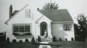
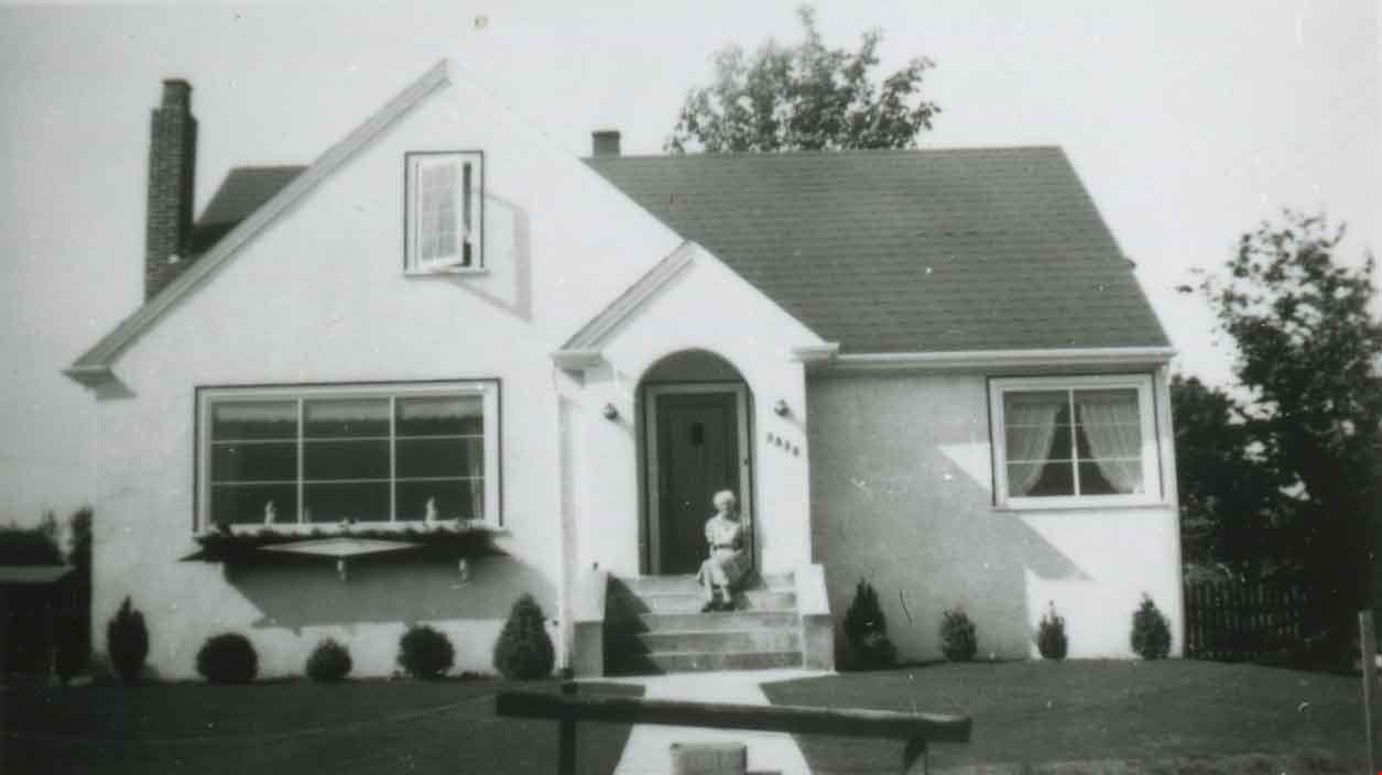
3830 Hazel Street
https://search.heritageburnaby.ca/link/archivedescription38159
- Repository
- City of Burnaby Archives
- Date
- 1945 (date of original), copied 1991
- Collection/Fonds
- Burnaby Historical Society fonds
- Description Level
- Item
- Physical Description
- 1 photograph : b&w ; 3.0 x 5.3 cm print on contact sheet 20.1 x 26.3 cm
- Scope and Content
- Photograph of 3830 Hazel Street (later renumbered 4662 Hazel Street) during the summer. A woman, probably Mrs. R.W. MacPhaden, is seated on the front steps.
- Repository
- City of Burnaby Archives
- Date
- 1945 (date of original), copied 1991
- Collection/Fonds
- Burnaby Historical Society fonds
- Subseries
- Burnaby Image Bank subseries
- Physical Description
- 1 photograph : b&w ; 3.0 x 5.3 cm print on contact sheet 20.1 x 26.3 cm
- Description Level
- Item
- Record No.
- 370-746
- Access Restriction
- No restrictions
- Reproduction Restriction
- No known restrictions
- Accession Number
- BHS1999-03
- Scope and Content
- Photograph of 3830 Hazel Street (later renumbered 4662 Hazel Street) during the summer. A woman, probably Mrs. R.W. MacPhaden, is seated on the front steps.
- Subjects
- Buildings - Residential - Houses
- Media Type
- Photograph
- Notes
- Title based on contents of photograph
- 1 b&w copy negative accompanying
- Negative has a pink cast
- Geographic Access
- Hazel Street
- Street Address
- 4662 Hazel Street
- Historic Neighbourhood
- Central Park (Historic Neighbourhood)
- Planning Study Area
- Marlborough Area
Images
![3830 Hazel Street, [ca. 1945] (date of original), copied 1991 thumbnail](/media/hpo/_Data/_Archives_Images/_Unrestricted/370/370-747.jpg?width=280)
3830 Hazel Street
https://search.heritageburnaby.ca/link/archivedescription38160
- Repository
- City of Burnaby Archives
- Date
- [ca. 1945] (date of original), copied 1991
- Collection/Fonds
- Burnaby Historical Society fonds
- Description Level
- Item
- Physical Description
- 1 photograph : b&w ; 3.0 x 5.4 cm print on contact sheet 20.1 x 26.3 cm
- Scope and Content
- Photograph of the view from 3830 Hazel Street (later renumbered 4662 Hazel Street) in the snow. Spud Murphy's car, a Desoto, can be seen in the street and the George family's house is in the background.
- Repository
- City of Burnaby Archives
- Date
- [ca. 1945] (date of original), copied 1991
- Collection/Fonds
- Burnaby Historical Society fonds
- Subseries
- Burnaby Image Bank subseries
- Physical Description
- 1 photograph : b&w ; 3.0 x 5.4 cm print on contact sheet 20.1 x 26.3 cm
- Description Level
- Item
- Record No.
- 370-747
- Access Restriction
- No restrictions
- Reproduction Restriction
- No known restrictions
- Accession Number
- BHS1999-03
- Scope and Content
- Photograph of the view from 3830 Hazel Street (later renumbered 4662 Hazel Street) in the snow. Spud Murphy's car, a Desoto, can be seen in the street and the George family's house is in the background.
- Media Type
- Photograph
- Notes
- Title based on contents of photograph
- 1 b&w copy negative accompanying
- Negative has a pink cast
- Geographic Access
- Hazel Street
- Street Address
- 4662 Hazel Street
- Historic Neighbourhood
- Central Park (Historic Neighbourhood)
- Planning Study Area
- Marlborough Area
Images
![3830 Hazel Street, [ca. 1945] (date of original), copied 1991 thumbnail](/media/hpo/_Data/_Archives_Images/_Unrestricted/370/370-747.jpg)
![6100 Block Kathleen Avenue, [1943 or 1944] (date of original), copied 1991 thumbnail](/media/hpo/_Data/_Archives_Images/_Unrestricted/370/370-241.jpg?width=280)
6100 Block Kathleen Avenue
https://search.heritageburnaby.ca/link/archivedescription37653
- Repository
- City of Burnaby Archives
- Date
- [1943 or 1944] (date of original), copied 1991
- Collection/Fonds
- Burnaby Historical Society fonds
- Description Level
- Item
- Physical Description
- 1 photograph : b&w ; 3.1 x 4.5 cm print on contact sheet 20.2 x 25.3 cm
- Scope and Content
- Photograph taken looking north on Kathleen Avenue from the 6100 block of Kathleen Avenue after a snowfall.
- Repository
- City of Burnaby Archives
- Date
- [1943 or 1944] (date of original), copied 1991
- Collection/Fonds
- Burnaby Historical Society fonds
- Subseries
- Burnaby Image Bank subseries
- Physical Description
- 1 photograph : b&w ; 3.1 x 4.5 cm print on contact sheet 20.2 x 25.3 cm
- Description Level
- Item
- Record No.
- 370-241
- Access Restriction
- No restrictions
- Reproduction Restriction
- No known restrictions
- Accession Number
- BHS1999-03
- Scope and Content
- Photograph taken looking north on Kathleen Avenue from the 6100 block of Kathleen Avenue after a snowfall.
- Media Type
- Photograph
- Notes
- Title based on contents of photograph
- 1 b&w copy negative accompanying
- Negative has a pink cast
- Geographic Access
- Kathleen Avenue
- Historic Neighbourhood
- Central Park (Historic Neighbourhood)
- Planning Study Area
- Maywood Area
Images
![6100 Block Kathleen Avenue, [1943 or 1944] (date of original), copied 1991 thumbnail](/media/hpo/_Data/_Archives_Images/_Unrestricted/370/370-241.jpg)
![6113 Silver Avenue, [between 1945 and 1949] (date of original), copied 1991 thumbnail](/media/hpo/_Data/_Archives_Images/_Unrestricted/370/370-357.jpg?width=280)
6113 Silver Avenue
https://search.heritageburnaby.ca/link/archivedescription37769
- Repository
- City of Burnaby Archives
- Date
- [between 1945 and 1949] (date of original), copied 1991
- Collection/Fonds
- Burnaby Historical Society fonds
- Description Level
- Item
- Physical Description
- 1 photograph : b&w ; 2.7 x 3.9 cm print on contact sheet 20.3 x 26.2 cm
- Scope and Content
- Photograph of 6113 Silver Avenue, the Ellis family home, in the snow.
- Repository
- City of Burnaby Archives
- Date
- [between 1945 and 1949] (date of original), copied 1991
- Collection/Fonds
- Burnaby Historical Society fonds
- Subseries
- Burnaby Image Bank subseries
- Physical Description
- 1 photograph : b&w ; 2.7 x 3.9 cm print on contact sheet 20.3 x 26.2 cm
- Description Level
- Item
- Record No.
- 370-357
- Access Restriction
- No restrictions
- Reproduction Restriction
- No known restrictions
- Accession Number
- BHS1999-03
- Scope and Content
- Photograph of 6113 Silver Avenue, the Ellis family home, in the snow.
- Media Type
- Photograph
- Notes
- Title based on contents of photograph
- 1 b&w copy negative accompanying
- Negative has a pink cast
- Geographic Access
- Silver Avenue
- Street Address
- 6113 Silver Avenue
- Historic Neighbourhood
- Central Park (Historic Neighbourhood)
- Planning Study Area
- Maywood Area
Images
![6113 Silver Avenue, [between 1945 and 1949] (date of original), copied 1991 thumbnail](/media/hpo/_Data/_Archives_Images/_Unrestricted/370/370-357.jpg)
![6113 Silver Avenue, [1948 or 1949] (date of original), copied 1991 thumbnail](/media/hpo/_Data/_Archives_Images/_Unrestricted/370/370-369.jpg?width=280)
6113 Silver Avenue
https://search.heritageburnaby.ca/link/archivedescription37781
- Repository
- City of Burnaby Archives
- Date
- [1948 or 1949] (date of original), copied 1991
- Collection/Fonds
- Burnaby Historical Society fonds
- Description Level
- Item
- Physical Description
- 1 photograph : b&w ; 2.8 x 4.2 cm print on contact sheet 20.3 x 27.0 cm
- Scope and Content
- Photograph of fire damage at the side of 6113 Silver Avenue, the Ellis family home. A ladder is leaning against the side of the house, and a person can be seen in the window.
- Repository
- City of Burnaby Archives
- Date
- [1948 or 1949] (date of original), copied 1991
- Collection/Fonds
- Burnaby Historical Society fonds
- Subseries
- Burnaby Image Bank subseries
- Physical Description
- 1 photograph : b&w ; 2.8 x 4.2 cm print on contact sheet 20.3 x 27.0 cm
- Description Level
- Item
- Record No.
- 370-369
- Access Restriction
- No restrictions
- Reproduction Restriction
- No known restrictions
- Accession Number
- BHS1999-03
- Scope and Content
- Photograph of fire damage at the side of 6113 Silver Avenue, the Ellis family home. A ladder is leaning against the side of the house, and a person can be seen in the window.
- Subjects
- Buildings - Residential - Houses
- Media Type
- Photograph
- Notes
- Title based on contents of photograph
- 1 b&w copy negative accompanying
- Negative has a pink cast
- Geographic Access
- Silver Avenue
- Street Address
- 6113 Silver Avenue
- Historic Neighbourhood
- Central Park (Historic Neighbourhood)
- Planning Study Area
- Maywood Area
Images
![6113 Silver Avenue, [1948 or 1949] (date of original), copied 1991 thumbnail](/media/hpo/_Data/_Archives_Images/_Unrestricted/370/370-369.jpg)
![6113 Silver Avenue addition, [1947] (date of original), copied 1991 thumbnail](/media/hpo/_Data/_Archives_Images/_Unrestricted/370/370-367.jpg?width=280)
6113 Silver Avenue addition
https://search.heritageburnaby.ca/link/archivedescription37779
- Repository
- City of Burnaby Archives
- Date
- [1947] (date of original), copied 1991
- Collection/Fonds
- Burnaby Historical Society fonds
- Description Level
- Item
- Physical Description
- 1 photograph : b&w ; 2.5 x 3.6 cm print on contact sheet 20.3 x 26.2 cm
- Scope and Content
- Photograph of the construction of an addition to 6113 Silver Avenue, the Ellis family home. Three people are sitting on the roof of the house.
- Repository
- City of Burnaby Archives
- Date
- [1947] (date of original), copied 1991
- Collection/Fonds
- Burnaby Historical Society fonds
- Subseries
- Burnaby Image Bank subseries
- Physical Description
- 1 photograph : b&w ; 2.5 x 3.6 cm print on contact sheet 20.3 x 26.2 cm
- Description Level
- Item
- Record No.
- 370-367
- Access Restriction
- No restrictions
- Reproduction Restriction
- No known restrictions
- Accession Number
- BHS1999-03
- Scope and Content
- Photograph of the construction of an addition to 6113 Silver Avenue, the Ellis family home. Three people are sitting on the roof of the house.
- Media Type
- Photograph
- Notes
- Title based on contents of photograph
- 1 b&w copy negative accompanying
- Negative has a pink cast
- Geographic Access
- Silver Avenue
- Street Address
- 6113 Silver Avenue
- Historic Neighbourhood
- Central Park (Historic Neighbourhood)
- Planning Study Area
- Maywood Area
Images
![6113 Silver Avenue addition, [1947] (date of original), copied 1991 thumbnail](/media/hpo/_Data/_Archives_Images/_Unrestricted/370/370-367.jpg)
![6113 Silver Avenue addition, [1947] (date of original), copied 1991 thumbnail](/media/hpo/_Data/_Archives_Images/_Unrestricted/370/370-368.jpg?width=280)
6113 Silver Avenue addition
https://search.heritageburnaby.ca/link/archivedescription37780
- Repository
- City of Burnaby Archives
- Date
- [1947] (date of original), copied 1991
- Collection/Fonds
- Burnaby Historical Society fonds
- Description Level
- Item
- Physical Description
- 1 photograph : b&w ; 2.5 x 3.6 cm print on contact sheet 20.3 x 26.2 cm
- Scope and Content
- Photograpm of the completed construction of an addition to 6113 Silver Avenue, the Ellis family home. Another house and car can be seen to the left.
- Repository
- City of Burnaby Archives
- Date
- [1947] (date of original), copied 1991
- Collection/Fonds
- Burnaby Historical Society fonds
- Subseries
- Burnaby Image Bank subseries
- Physical Description
- 1 photograph : b&w ; 2.5 x 3.6 cm print on contact sheet 20.3 x 26.2 cm
- Description Level
- Item
- Record No.
- 370-368
- Access Restriction
- No restrictions
- Reproduction Restriction
- No known restrictions
- Accession Number
- BHS1999-03
- Scope and Content
- Photograpm of the completed construction of an addition to 6113 Silver Avenue, the Ellis family home. Another house and car can be seen to the left.
- Media Type
- Photograph
- Notes
- Title based on contents of photograph
- 1 b&w copy negative accompanying
- Negative has a pink cast
- Geographic Access
- Silver Avenue
- Street Address
- 6113 Silver Avenue
- Historic Neighbourhood
- Central Park (Historic Neighbourhood)
- Planning Study Area
- Maywood Area
Images
![6113 Silver Avenue addition, [1947] (date of original), copied 1991 thumbnail](/media/hpo/_Data/_Archives_Images/_Unrestricted/370/370-368.jpg)
![Ada Smith and her friend, [1920] (date of original), copied 1986 thumbnail](/media/hpo/_Data/_Archives_Images/_Unrestricted/204/204-313.jpg?width=280)
Ada Smith and her friend
https://search.heritageburnaby.ca/link/archivedescription35455
- Repository
- City of Burnaby Archives
- Date
- [1920] (date of original), copied 1986
- Collection/Fonds
- Burnaby Historical Society fonds
- Description Level
- Item
- Physical Description
- 1 photograph : b&w ; 12.7 x 17.8 cm print
- Scope and Content
- Photograph of (right) Ada Smith and an unidentified friend. Ada was the daughter of James Smith and Agnes Smith, and lived in one of the first homes built at 6186 Royal Oak Road. This photograph was probably taken in the back yard of the family home.
- Repository
- City of Burnaby Archives
- Date
- [1920] (date of original), copied 1986
- Collection/Fonds
- Burnaby Historical Society fonds
- Subseries
- Pioneer Tales subseries
- Physical Description
- 1 photograph : b&w ; 12.7 x 17.8 cm print
- Description Level
- Item
- Record No.
- 204-313
- Access Restriction
- No restrictions
- Reproduction Restriction
- No known restrictions
- Accession Number
- BHS1988-03
- Scope and Content
- Photograph of (right) Ada Smith and an unidentified friend. Ada was the daughter of James Smith and Agnes Smith, and lived in one of the first homes built at 6186 Royal Oak Road. This photograph was probably taken in the back yard of the family home.
- Names
- Smith, Ada
- Media Type
- Photograph
- Notes
- Title based on contents of photograph
- Geographic Access
- Royal Oak Avenue
- Street Address
- 6186 Royal Oak Avenue
- Historic Neighbourhood
- Central Park (Historic Neighbourhood)
- Planning Study Area
- Windsor Area
Images
![Ada Smith and her friend, [1920] (date of original), copied 1986 thumbnail](/media/hpo/_Data/_Archives_Images/_Unrestricted/204/204-313.jpg)
![Alastair Macdonald, [1940] (date of original), copied 1991 thumbnail](/media/hpo/_Data/_Archives_Images/_Unrestricted/370/370-400.jpg?width=280)
Alastair Macdonald
https://search.heritageburnaby.ca/link/archivedescription37812
- Repository
- City of Burnaby Archives
- Date
- [1940] (date of original), copied 1991
- Collection/Fonds
- Burnaby Historical Society fonds
- Description Level
- Item
- Physical Description
- 1 photograph : b&w ; 3.9 x 2.6 cm print on contact sheet 20.3 x 26.4 cm
- Scope and Content
- Photograph of Alastair Macdonald, in uniform, standing in front of a house at McKay Avenue and Kingsway.
- Repository
- City of Burnaby Archives
- Date
- [1940] (date of original), copied 1991
- Collection/Fonds
- Burnaby Historical Society fonds
- Subseries
- Burnaby Image Bank subseries
- Physical Description
- 1 photograph : b&w ; 3.9 x 2.6 cm print on contact sheet 20.3 x 26.4 cm
- Description Level
- Item
- Record No.
- 370-400
- Access Restriction
- No restrictions
- Reproduction Restriction
- No known restrictions
- Accession Number
- BHS1999-03
- Scope and Content
- Photograph of Alastair Macdonald, in uniform, standing in front of a house at McKay Avenue and Kingsway.
- Names
- Macdonald, Alastair
- Media Type
- Photograph
- Notes
- Title based on contents of photograph
- 1 b&w copy negative accompanying
- Negative has a pink cast
- Geographic Access
- McKay Avenue
- Kingsway
- Historic Neighbourhood
- Central Park (Historic Neighbourhood)
Images
![Alastair Macdonald, [1940] (date of original), copied 1991 thumbnail](/media/hpo/_Data/_Archives_Images/_Unrestricted/370/370-400.jpg)