Narrow Results By
map
https://search.heritageburnaby.ca/link/museumartifact83653
- Repository
- Burnaby Village Museum
- Accession Code
- BV007.34.1
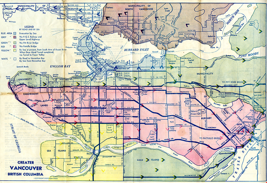
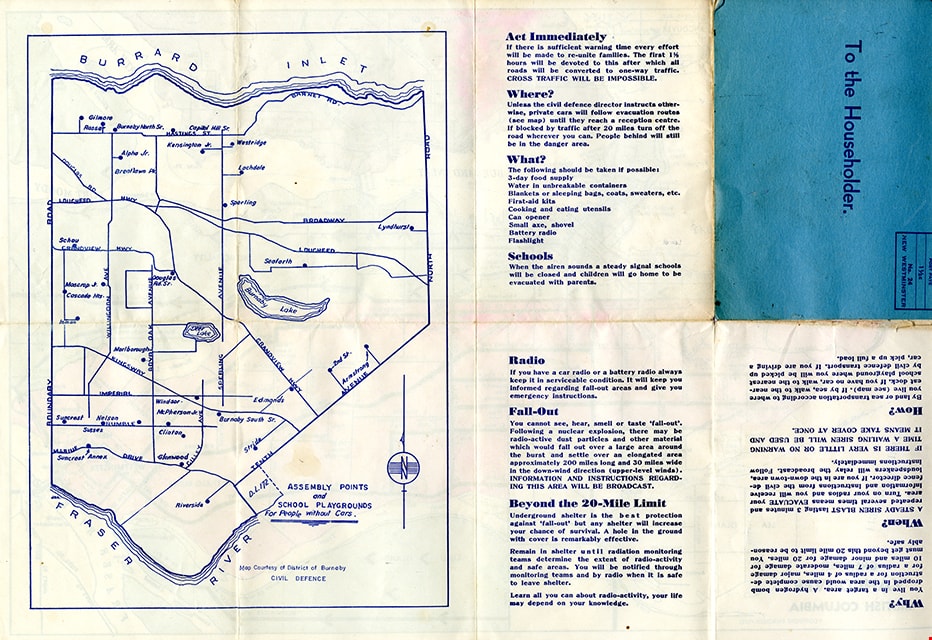
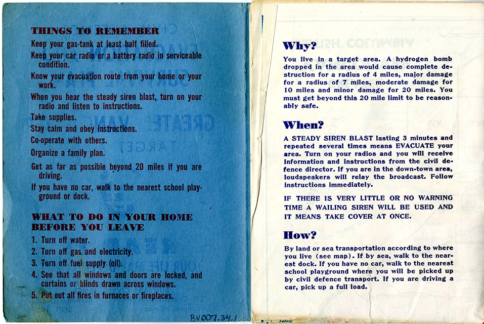
- Description
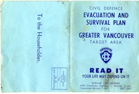
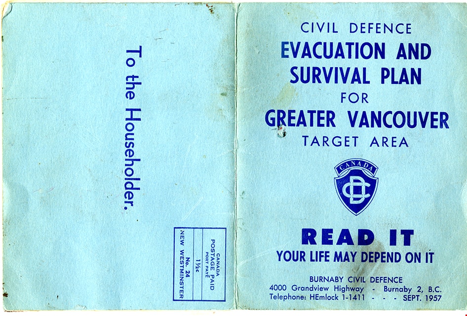
- Folded col. map within blue cover; printed both sides; Civil Defence Evacuation and Survival Plan - Map -- [1957] produced by Burnaby Civil Defence; title on front cover reads "CIVIL DEFENCE / EVACUATION AND SURVIVAL PLAN /FOR / GREATER VANCOUVER / TARGET AREA / READ IT / YOUR LIFE MAY DEPEND ON IT". Colour map inside is titled "GREATER / VANCOUVER / BRITISH COLUMBIA" and includes a legend with various evacuation routes by road and by sea; copyright Evergreen Press. Verso of map includes a map of Burnaby courtesy of District of Burnaby Civil Defence titled "ASSEMBLY POINTS / and / SCHOOL PLAYGROUNDS / for People without Cars" and detailed information about things to remember during an emergency evacuation.
- Object History
- Map was made available to citizens of Burnaby and was produced by Burnaby Civil Defence, 4000 Grandview Highway, Burnaby B.C.
- Category
- 08. Communication Artifacts
- Classification
- Documentary Artifacts - - Graphic Documents
- Object Term
- Cartograph, Map
- Colour
- Blue
- Measurements
- 30.5 x 34 cm folded to 15 x 11.5 cm
- Maker
- Evergreen Press Limited
- Country Made
- Canada
- Province Made
- British Columbia
- Publication Date
- Sept. 1957
- Names
- Burnaby Civil Defence
Images

map
https://search.heritageburnaby.ca/link/museumartifact91044
- Repository
- Burnaby Village Museum
- Accession Code
- BV020.5.1769
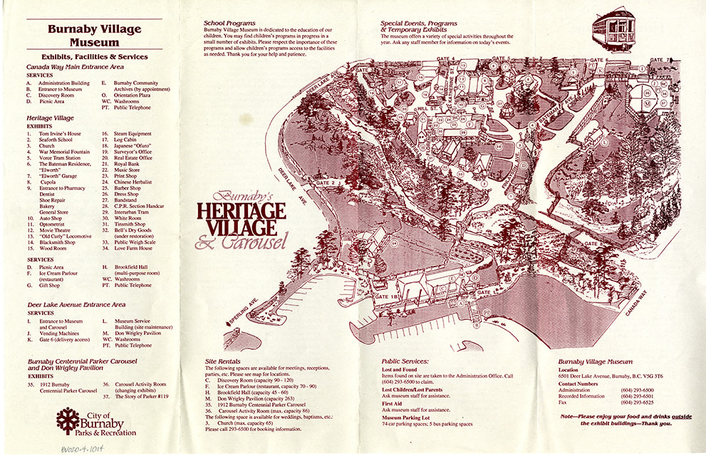
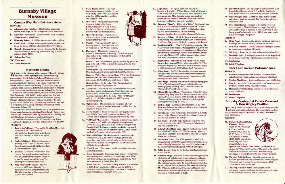
- Description
- Map; site Map printed on beige paper with burgundy ink; four section accordian fold; front includes site Map of Burnaby Village Museum with title "Burnaby's / HERITAGE / VILLAGE / & Carousel"; lists exhibits, facilities and services; back of Map includes detailed descriptions of services and exhibits along with three in line illustrations.
- Object History
- Item was found in Burnaby Village Museum printshop along with other Heritage Village / Burnaby Village Museum ephemera created between 1971 and 1990
- Category
- 08. Communication Artifacts
- Classification
- Documentary Artifacts - - Other Documents
- Object Term
- Cartograph, Map
- Measurements
- 28 x 43 cm
- Country Made
- Canada
- Province Made
- British Columbia
- Publication Date
- [1994]
- Subjects
- Documentary Artifacts
- Names
- Burnaby Village Museum
Images
map
https://search.heritageburnaby.ca/link/museumartifact91126
- Repository
- Burnaby Village Museum
- Accession Code
- BV011.44.10
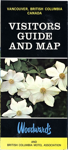
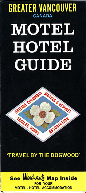
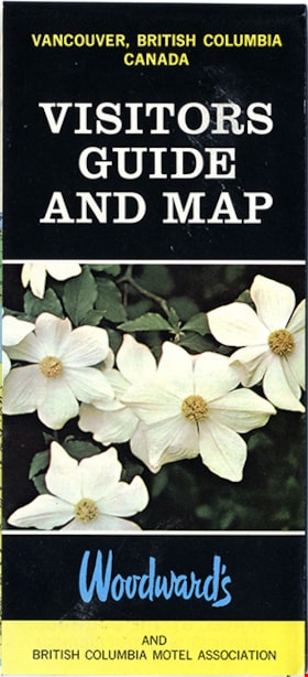
- Description
- map brochure; cover on one side reads "VANCOUVER, BRITISH COLUMBIA / CANADA / VISITORS / GUIDE / AND MAP" and the other side reads: "GREATER VANCOUVER / CANADA / MOTEL / HOTEL / GUIDE / TRAVEL BY THE DOGOOD'" and includes the logo for "British Columbia / Motels & Resorts / Trailer Parks / Association" with dogwood in centre. One side of fold-out includes map titled "Guide Map of Greater Vancouver / Woodwards" and includes inset map of Downtown Vancouver and Stanley Park and inset map of Lower Mainland and Fraser Valley Vancouver and Vicinity along with a list of Greater Vanouver Area Motels and Hotels. The other side of the fold-out includes colour adds for tourist sites and amenities in Greater Vancouver including Capilano Suspension bridge; Heritage Village, Burnaby, B.C.; MacMillan Planetarium; Bloedel Conservatory; Grouse Mountain; Gastown; The Ship of the Seven Seas restaurant and Woodwards stores and shopping centres. Map was published in the public interest by Woodward's (Lower Mainland) department stores; B.C. Motels and Resorts Association Branch "C" whose members appear on the map inside.
- Category
- 08. Communication Artifacts
- Classification
- Documentary Artifacts - - Graphic Documents
- Object Term
- Cartograph, Map
- Measurements
- 45.5 x 70 cm folded to 22.5 x 10 cm
- Country Made
- Canada
- Geographic Access
- Vancouver
Images