Narrow Results By

barometer
https://search.heritageburnaby.ca/link/museumartifact90178
- Repository
- Burnaby Village Museum
- Accession Code
- BV019.8.16
- Description
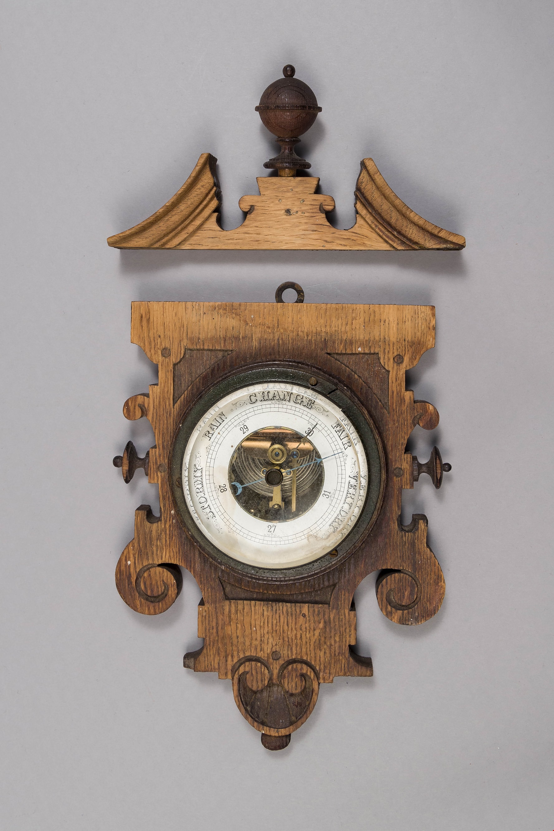
- barometer; aneroid barometer secured to a carved wood plaque; barometer has a calibrated dial to indicate air pressure; text on dial reads: "VERY DRY", "FAIR", "CHANGE", "RAIN", and "STORMY"; flat metal loop at top of wood plaque for hanging. Dark stained carved wood decorative scroll with finial; has detached from base plaque.
- Object History
- Object used in the Love Farmhouse, currently on site at Burnaby Village Museum.
- Geographic Access
- Cumberland Street
- Street Address
- 7651 Cumberland Street
- Historic Neighbourhood
- East Burnaby (Historic Neighbourhood)
- Planning Study Area
- Cariboo-Armstrong Area
Images

building
https://search.heritageburnaby.ca/link/museumartifact3846
- Repository
- Burnaby Village Museum
- Accession Code
- BV988.33.1
- Description
- The core of the Jessie Love farm house is a 1893 two story, pioneer tent style building. The home was added to over the years and became a large Craftsmen style farm house.
- Object History
- Built on Cumberland Road in Burnaby in 1893. Music Room/Parlour/Living Room and bedrooms above added c.1898. Kitchen added c.1908. The home of Jesse and Martha Love and their eleven children. One of Burnaby's oldest structures. The home was moved to Burnaby Village Museum in the late 1980s and has been partially restored to its 1920s appearance.
- Category
- 01. Built Environment Objects
- Classification
- Structures - - Dwellings
- Object Term
- House
- Colour
- Brown
- Culture
- Canadian
- Geographic Access
- Cumberland Street
- Street Address
- 6501 Deer Lake Avenue
- Historic Neighbourhood
- East Burnaby (Historic Neighbourhood)
- Planning Study Area
- Cariboo-Armstrong Area
Images


dining chair
https://search.heritageburnaby.ca/link/museumartifact90002
- Repository
- Burnaby Village Museum
- Accession Code
- BV019.8.15
- Description
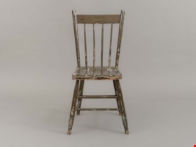
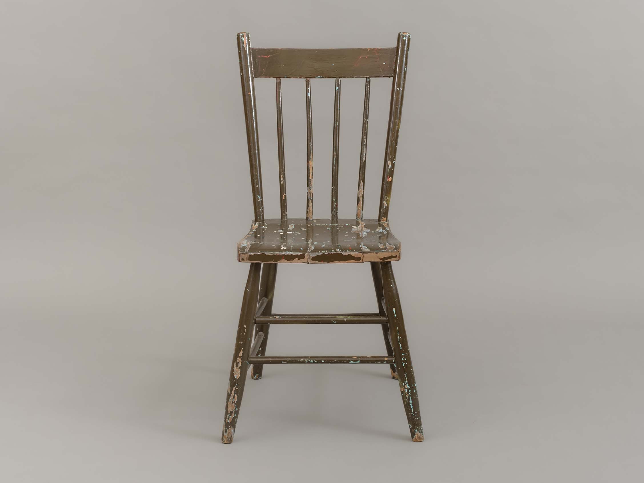
- dining chair; side chair; brown painted wood; chair back has four vertical spindles; two horizontal stretchers between front and side legs; one horizontal stretcher between back legs.
- Object History
- Object used in the dining room of the Love farmhouse. The layers of paint beneath the brown outer layer reveal past colours of the chair that are documented in BVM photographs of the interior of the Love farmhouse.
- Category
- 02. Furnishings
- Classification
- Furniture - - Seating Furniture
- Object Term
- Chair
- Subjects
- Furniture
- Geographic Access
- Cumberland Street
- Street Address
- 7651 Cumberland Street
- Historic Neighbourhood
- East Burnaby (Historic Neighbourhood)
- Planning Study Area
- Cariboo-Armstrong Area
Images

Plan of Subdivision of Block F Lot 1, D.L. 25 Group 1
https://search.heritageburnaby.ca/link/museumdescription18808
- Repository
- Burnaby Village Museum
- Date
- 17 Apr. 1912
- Collection/Fonds
- Love family fonds
- Description Level
- Item
- Physical Description
- 1 plan : black and red ink on linen ; 36 x 28.5 cm
- Scope and Content
- Item consists of Plan of Subdivision of Block F Lot 1, D.L. 25 Group 1 New Westminster District created by Provincial Land Surveyor Geoffrey K. Burnett.
- Repository
- Burnaby Village Museum
- Collection/Fonds
- Love family fonds
- Description Level
- Item
- Physical Description
- 1 plan : black and red ink on linen ; 36 x 28.5 cm
- Material Details
- Scale [1:1200]
- Scope and Content
- Item consists of Plan of Subdivision of Block F Lot 1, D.L. 25 Group 1 New Westminster District created by Provincial Land Surveyor Geoffrey K. Burnett.
- Creator
- Burnett, Geoffrey K.
- Names
- Burnett, Geoffrey K.
- Geographic Access
- Cumberland Street
- Accession Code
- BV992.26.28
- Access Restriction
- No restrictions
- Reproduction Restriction
- No known restrictions
- Date
- 17 Apr. 1912
- Media Type
- Cartographic Material
- Historic Neighbourhood
- East Burnaby (Historic Neighbourhood)
- Planning Study Area
- Cariboo-Armstrong Area
- Scan Resolution
- 600
- Scan Date
- 2022-07-11
- Scale
- 100
- Notes
- Title based on contents of item
- Scale is measured "100 FT = 1 INCH"
- "PLAN OF SUBDIVISION OF BLOCK "F" OF LOT 1, D.L. 25 GROUP 1. NEW WESTMINSTER DISTRICT"; Wright St., Sixth Ave., Fifth Ave., Cumberland St., L.1-8, 11-16; signature of Jesse Love, owner, witness S.P. King?; Geoffrey K. Burnett, P.L.S.; Fred A. Macpherson, Municipal Clerk, April 17, 1912; taxes paid to Dec. 31 1911, signed April 17 1912 by W.H. Griffin, collector"
Images


Plan of Subdivision of Block F Lot 1, D.L. 25 Group 1
https://search.heritageburnaby.ca/link/museumdescription18809
- Repository
- Burnaby Village Museum
- Date
- 17 Apr. 1912
- Collection/Fonds
- Love family fonds
- Description Level
- Item
- Physical Description
- 1 plan : black and red ink on linen ; 36 x 28.5 cm
- Scope and Content
- Item consists of Plan of Subdivision of Block F Lot 1, D.L. 25 Group 1 New Westminster District created by Provincial Land Surveyor Geoffrey K. Burnett.
- Repository
- Burnaby Village Museum
- Collection/Fonds
- Love family fonds
- Description Level
- Item
- Physical Description
- 1 plan : black and red ink on linen ; 36 x 28.5 cm
- Material Details
- Scale [1:1200]
- Scope and Content
- Item consists of Plan of Subdivision of Block F Lot 1, D.L. 25 Group 1 New Westminster District created by Provincial Land Surveyor Geoffrey K. Burnett.
- Creator
- Burnett, Geoffrey K.
- Names
- Burnett, Geoffrey K.
- Geographic Access
- Cumberland Street
- Accession Code
- BV992.26.29
- Access Restriction
- No restrictions
- Reproduction Restriction
- No known restrictions
- Date
- 17 Apr. 1912
- Media Type
- Cartographic Material
- Historic Neighbourhood
- East Burnaby (Historic Neighbourhood)
- Planning Study Area
- Cariboo-Armstrong Area
- Scan Resolution
- 600
- Scan Date
- 2022-07-11
- Scale
- 100
- Notes
- Title based on contents of item
- Scale is measured "100 FT = 1 INCH"
- "PLAN OF SUBDIVISION OF BLOCK "F" OF LOT 1, D.L. 25 GROUP 1. NEW WESTMINSTER DISTRICT"; Wright St., Sixth Ave., Fifth Ave., Cumberland St., L.1-8, 11-16; signature of Jesse Love, owner, witness S.P. King?; Geoffrey K. Burnett, P.L.S.; Fred A. Macpherson, Municipal Clerk, April 17, 1912; taxes paid to Dec. 31 1911, signed April 17 1912 by W.H. Griffin, collector"
Images
