Narrow Results By
Creator
- Associated Factory Mutual Fire Insurance Cos 1
- Bekins Moving and Storage Company Limited 1
- British Columbia Underwriters' Association 13
- Burnett, David H. 1
- Burnett, Geoffrey K. 1
- Century Park Museum Association 1
- City Map and White Print Co. 1
- Coast Map and Blue Print Co. 1
- Dominion Map and Blueprint Co. 2
- Draper, William Nelson 1
- Garden, Hermon and Burwell 3
- Garden, Hermon & Burwell 1
vey and Subdivision plans in New Westminster District Group 1 – Burnaby
https://search.heritageburnaby.ca/link/museumdescription6976
- Repository
- Burnaby Village Museum
- Date
- [1900-1910]
- Collection/Fonds
- Burnaby Village Museum Map collection
- Description Level
- File
- Physical Description
- 4 plans : blueprints on paper mounted on 2 sides of cardboard 76 x 102 cm
- Scope and Content
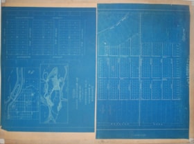
- Item consists of a large board of two New Westminster District plans mounted on one side and two New Westminster District subdivision plans mounted on the other side. Side A: 1. Blueprint "Plan / of Subdivision / of a portion / of / Lot 96 / Group One / New Westminster District / Scale 2 chs = …
- Repository
- Burnaby Village Museum
- Collection/Fonds
- Burnaby Village Museum Map collection
- Description Level
- File
- Physical Description
- 4 plans : blueprints on paper mounted on 2 sides of cardboard 76 x 102 cm
- Material Details
- Scales [between 1:120 and 1:1584]
- Index number on edge of board reads: "7"
- Scope and Content
- Item consists of a large board of two New Westminster District plans mounted on one side and two New Westminster District subdivision plans mounted on the other side. Side A: 1. Blueprint "Plan / of Subdivision / of a portion / of / Lot 96 / Group One / New Westminster District / Scale 2 chs = 1in." (Geographic locaiton: Burnaby) 2. Blueprint "Plan / North Road / from Holmes' Corner, North / Scale 100 ' = 1"" and "Profile on North Road / from / Holmes' Corner, North". The following are identified: Ravine filled, V.W. & Y. Railway, Brunette River, Holmes' Corner, Holmes' Crib, Private Road, North Road, Old Road and New Westminster Municipal Boundary. (Geographic locaiton: Burnaby) Side B: 1. Blueprint "Subdivision / of Blocks 14, 7 and 4 / In the Subdivision / of / Lot 53, Group 1 / New Westminster District / Scale 1 ch = 1 in." Plan also includes two inset Maps showing the location of DL 53 in relation to the City of New Westminster and Vancouver. The subdivision plans identifies: First Avenue, Second Avenue, Third Avenue, Fourth Avenue bordered by Seventeenth Street and Sixteenth Street. (Geographic locaiton: Burnaby) 2. Blueprint with handwritten title "No. 631 / Plan / of / Subdivision / Lots _ see sheets 1-19, 36-53, 69-75.../ Lot 30 Group 1 / ... Scale 2 chs = 1 in." Edmonds Street and Westminster & Vancouver Tramway are identified along with Walter Street, Kemp Street, Fortune Street, Alice Street, Henry Street, Beatrice Street and Humphries Avenue. (Geographic locaiton: Burnaby)
- Accession Code
- HV977.93.7
- Access Restriction
- No restrictions
- Reproduction Restriction
- No known restrictions
- Date
- [1900-1910]
- Media Type
- Cartographic Material
- Scan Resolution
- 300
- Scale
- 72
- Notes
- Title based on contents of file Scale is measured in chains and feet (One chain equals 792 inches)
- The term "Lot" can also refer to a "District Lot"
![vey and Subdivision plans in New Westminster District Group 1 – Burnaby
, [1900-1910] thumbnail](/media/hpo/_Data/_BVM_Cartographic_Material/1977/1977_0093_0007a_001.jpg?width=280)
