Narrow Results By
Subject
- Agriculture - Farms 1
- Agriculture - Fruit and Berries 3
- Animals - Dogs 2
- Buildings - Industrial - Sawmills 1
- Buildings - Residential - Houses 3
- Celebrations - Jubilee 4
- Education 1
- Furniture 1
- Geographic Features - Lakes and Ponds
- Geographic Features - Roads
- Geographic Features - Trails 1
- Holidays - Christmas 2
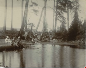
Burnaby Lake
https://search.heritageburnaby.ca/link/museumdescription1677
- Repository
- Burnaby Village Museum
- Date
- [between 1890 and 1909]
- Collection/Fonds
- Burnaby Village Museum Photograph collection
- Description Level
- Item
- Physical Description
- 1 photograph : sepia ; 5 x 7.5 cm, mounted on card 10 x 12.5 cm
- Scope and Content
- Photograph of Burnaby Lake.
- Repository
- Burnaby Village Museum
- Collection/Fonds
- Burnaby Village Museum Photograph collection
- Description Level
- Item
- Physical Description
- 1 photograph : sepia ; 5 x 7.5 cm, mounted on card 10 x 12.5 cm
- Scope and Content
- Photograph of Burnaby Lake.
- Geographic Access
- Burnaby Lake
- Accession Code
- BV003.61.3
- Access Restriction
- No restrictions
- Date
- [between 1890 and 1909]
- Media Type
- Photograph
- Historic Neighbourhood
- Burnaby Lake (Historic Neighbourhood)
- Planning Study Area
- Burnaby Lake Area
- Scan Resolution
- 600
- Scan Date
- 09-Jun-09
- Scale
- 100
- Notes
- Title based on contents of photograph
- Note in pencil on verso of photograph reads: "Near Burnaby Lake/ Burnaby, B.C."
Images
Clearing Deer Lake frontage
https://search.heritageburnaby.ca/link/archivedescription39523
- Repository
- City of Burnaby Archives
- Date
- [1891]
- Collection/Fonds
- Peers Family and Hill Family fonds
- Description Level
- Item
- Physical Description
- 1 photograph : b&w ; 9.5 x 14.3 cm on page 21.5 x 8 cm (pasted in album)
- Scope and Content
- Photograph of a man and his dog sitting on a large felled tree along the shore of Deer Lake. The man is most likely Claude Hill, and early resident of the Deer Lake area.
- Repository
- City of Burnaby Archives
- Date
- [1891]
- Collection/Fonds
- Peers Family and Hill Family fonds
- Physical Description
- 1 photograph : b&w ; 9.5 x 14.3 cm on page 21.5 x 8 cm (pasted in album)
- Description Level
- Item
- Record No.
- 477-842
- Access Restriction
- No restrictions
- Reproduction Restriction
- No known restrictions
- Accession Number
- 2007-12
- Scope and Content
- Photograph of a man and his dog sitting on a large felled tree along the shore of Deer Lake. The man is most likely Claude Hill, and early resident of the Deer Lake area.
- Media Type
- Photograph
- Notes
- Title based on caption accompanying photograph
- Geographic Access
- Deer Lake
- Historic Neighbourhood
- Burnaby Lake (Historic Neighbourhood)
Images
Deer Lake Near Outflow
https://search.heritageburnaby.ca/link/archivedescription39421
- Repository
- City of Burnaby Archives
- Date
- 1897
- Collection/Fonds
- Peers Family and Hill Family fonds
- Description Level
- Item
- Physical Description
- 1 photograph : b&w ; 10 x 12.6 cm
- Scope and Content
- Photograph of three unidentified people sitting on the bank of Deer Lake. Cleared land and felled trees can be seen in the background.
- Repository
- City of Burnaby Archives
- Date
- 1897
- Collection/Fonds
- Peers Family and Hill Family fonds
- Physical Description
- 1 photograph : b&w ; 10 x 12.6 cm
- Description Level
- Item
- Record No.
- 477-740
- Access Restriction
- No restrictions
- Reproduction Restriction
- No known restrictions
- Accession Number
- 2007-12
- Scope and Content
- Photograph of three unidentified people sitting on the bank of Deer Lake. Cleared land and felled trees can be seen in the background.
- Media Type
- Photograph
- Notes
- Title based on caption accompanying photograph
- Geographic Access
- Deer Lake
- Historic Neighbourhood
- Burnaby Lake (Historic Neighbourhood)
Images
Douglas Road
https://search.heritageburnaby.ca/link/archivedescription35897
- Repository
- City of Burnaby Archives
- Date
- 1895 (date of original), copied 1986
- Collection/Fonds
- Burnaby Historical Society fonds
- Description Level
- Item
- Physical Description
- 1 photograph : b&w ; 12.7 x 17.8 cm print
- Scope and Content
- Photograph of Douglas Road at Haszard Hill.
- Repository
- City of Burnaby Archives
- Date
- 1895 (date of original), copied 1986
- Collection/Fonds
- Burnaby Historical Society fonds
- Subseries
- Pioneer Tales subseries
- Physical Description
- 1 photograph : b&w ; 12.7 x 17.8 cm print
- Description Level
- Item
- Record No.
- 204-756
- Access Restriction
- No restrictions
- Reproduction Restriction
- No known restrictions
- Accession Number
- BHS1988-03
- Scope and Content
- Photograph of Douglas Road at Haszard Hill.
- Subjects
- Geographic Features - Roads
- Media Type
- Photograph
- Notes
- Title based on contents of photograph
- Type note under photograph reads, "Douglas Road, 1895. Deviation from old road, seen on right at, then, Haszard Hill, now Rayside Ave, looking eastward up the hill."
- Geographic Access
- Douglas Road
- Historic Neighbourhood
- Burnaby Lake (Historic Neighbourhood)
- Planning Study Area
- Morley-Buckingham Area
Images
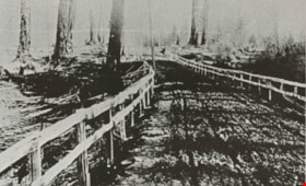
Douglas Road
https://search.heritageburnaby.ca/link/museumdescription447
- Repository
- Burnaby Village Museum
- Date
- [1897] (date of original), copied 1978
- Collection/Fonds
- Burnaby Village Museum Photograph collection
- Description Level
- Item
- Physical Description
- 1 photograph : b&w ; 20.2 x 25.2 cm print
- Scope and Content
- Photograph of Douglas Road (later renamed in part Canada Way), near Stanley Street. To the right is the Sprott family property, where a few wooden buildings are visible in the cleared area. Charles Sprott, head of the Sprott family, was an important Burnaby politician who was continuously elected t…
- Repository
- Burnaby Village Museum
- Collection/Fonds
- Burnaby Village Museum Photograph collection
- Description Level
- Item
- Physical Description
- 1 photograph : b&w ; 20.2 x 25.2 cm print
- Scope and Content
- Photograph of Douglas Road (later renamed in part Canada Way), near Stanley Street. To the right is the Sprott family property, where a few wooden buildings are visible in the cleared area. Charles Sprott, head of the Sprott family, was an important Burnaby politician who was continuously elected to serve in the municiality as councillor from 1895 to 1903 and as Reeve from 1904 to 1905.
- Subjects
- Geographic Features - Roads
- Land Clearing
- Geographic Access
- Douglas Road
- Canada Way
- Stanley Street
- Accession Code
- HV978.1.1
- Access Restriction
- No restrictions
- Reproduction Restriction
- No known restrictions
- Date
- [1897] (date of original), copied 1978
- Media Type
- Photograph
- Historic Neighbourhood
- Burnaby Lake (Historic Neighbourhood)
- Planning Study Area
- Lakeview-Mayfield Area
- Scan Resolution
- 600
- Scan Date
- 2023-07-25
- Notes
- Title based on contents of photograph
![Burnaby Lake, [between 1890 and 1909] thumbnail](/media/hpo/_Data/_BVM_Images/2000/200300610003.jpg?width=280)
![Clearing Deer Lake frontage, [1891] thumbnail](/media/hpo/_Data/_Archives_Images/_Unrestricted/477/477-842.jpg?width=280)


![Douglas Road, [1897] (date of original), copied 1978 thumbnail](/media/hpo/_Data/_BVM_Images/1978/1978_0001_0001_001.jpg?width=280)