Suncrest Neighbourhood
https://search.heritageburnaby.ca/link/landmark839
- Repository
- Burnaby Heritage Planning
- Associated Dates
- 1955-2008
- Heritage Value
- The Suncrest Neighbourhood is a small residential area south of Burnaby's Central Park. The Ocean View Burial Park takes up a large area of land in the north-east corner of this neighbourhood and the majority of the housing was built during the 1930-1960 period.
- Historic Neighbourhood
- Alta Vista (Historic Neighbourhood)
- Planning Study Area
- Suncrest Area
Images

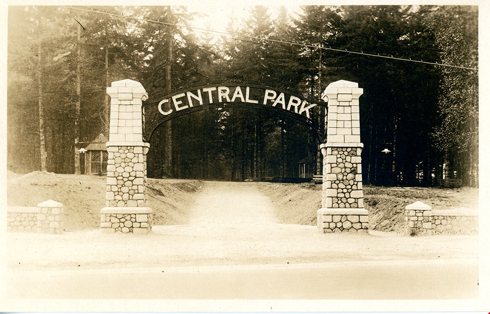
postcard
https://search.heritageburnaby.ca/link/museumartifact84668
- Repository
- Burnaby Village Museum
- Accession Code
- BV007.43.1
- Description
- postcard; black and white photograph of entrance arches to Central Park in Burnaby - [192-]. The postcard was published by the Gowen Sutton Company Limited of Vancouver, BC. Stamp in black ink on verso of postcard reads "PUBLISHED BY THE GOWEN SUTTON CO. LTD. VANCOUVER, B.C. / POSTCARD / CORRESPONDENCE_ADDRESS"
- Object History
- Souvenir postcard of Burnaby Central Park entrance arch.
- Classification
- Written Communication T&E - - Writing Media
- Object Term
- Postcard
- Colour
- Brown
- White
- Measurements
- w: 14 cm h: 9 cm
- Country Made
- Canada
- Province Made
- British Columbia
- Site/City Made
- Vancouver
- Subjects
- Structures - Arches
- Documentary Artifacts
- Documentary Artifacts - Postcards
- Geographic Features - Parks
- Geographic Access
- Central Park
- Imperial Street
- Street Address
- 3883 Imperial Street
- Historic Neighbourhood
- Central Park (Historic Neighbourhood)
- Planning Study Area
- Maywood Area
Images