Narrow Results By
Subject
- Advertising Medium - Signs and Signboards 2
- Agricultural Tools and Equipment 1
- Agriculture - Crops 5
- Agriculture - Farms 11
- Agriculture - Fruit and Berries 8
- Animals - Cats 2
- Animals - Dogs 4
- Animals - Horses 3
- Buildings 3
- Buildings - Agricultural - Barns 2
- Buildings - Civic - City Halls 1
- Buildings - Commercial 5
Creator
- Bateman, Caroline Mary Wettenhall 1
- Brown, William Thomas 1
- Burnaby Art Gallery 1
- Burnaby Public Library 1
- Burnett & McGugan, Engineers and Surveyors 7
- Buxton, George Searby 1
- Buxton, Leopold George 1
- Challoner-Courtenay, E.J. 2
- Cooksley, William Thomas 5
- Cornish, New Westminster, BC 2
- Davy, Gerald 1
- Dean, H.M. 7
Jim Wolf subseries
https://search.heritageburnaby.ca/link/archivedescription97451
- Repository
- City of Burnaby Archives
- Date
- 1909 (date of original)-1986
- Collection/Fonds
- Burnaby Historical Society fonds
- Description Level
- Subseries
- Physical Description
- Photographs
- Scope and Content
- Subseries consists of photographs compiled by Jim Wolf for the Burnaby Historical Society during his time working with the Society and as the Heritage Planner for the City of Burnaby. Photographs primarily depict notable Burnaby locations and buildings, including Barnet, Our Lady of Mercy Church M…
- Repository
- City of Burnaby Archives
- Date
- 1909 (date of original)-1986
- Collection/Fonds
- Burnaby Historical Society fonds
- Subseries
- Jim Wolf subseries
- Physical Description
- Photographs
- Description Level
- Subseries
- Accession Number
- BHS1986-39
- BHS1997-9
- BHS1998-13
- BHS2000-11
- BHS2004-9
- BHS2005-6
- Scope and Content
- Subseries consists of photographs compiled by Jim Wolf for the Burnaby Historical Society during his time working with the Society and as the Heritage Planner for the City of Burnaby. Photographs primarily depict notable Burnaby locations and buildings, including Barnet, Our Lady of Mercy Church Manse, and the D.C. Patterson house.
- Media Type
- Photograph
- Creator
- Wolf, Jim
- Notes
- Title based on creator of subseries
- PC188, PC349, PC350, PC363, PC410, PC401, PC474, PC466
Agricultural Exhibit
https://search.heritageburnaby.ca/link/archivedescription34530
- Repository
- City of Burnaby Archives
- Date
- [1909]
- Collection/Fonds
- Burnaby Historical Society fonds
- Description Level
- Item
- Physical Description
- 1 photograph : b&w ; 20.4 x 25.2 cm
- Scope and Content
- Photograph of Burnaby's Agricultural Exhibit at New Westminster showing a display of vegetables, fruit, flowers, plants, and trees inside of a building.
- Repository
- City of Burnaby Archives
- Date
- [1909]
- Collection/Fonds
- Burnaby Historical Society fonds
- Subseries
- Photographs subseries
- Physical Description
- 1 photograph : b&w ; 20.4 x 25.2 cm
- Description Level
- Item
- Record No.
- 041-001
- Access Restriction
- No restrictions
- Reproduction Restriction
- No known restrictions
- Accession Number
- BHS2007-04
- Scope and Content
- Photograph of Burnaby's Agricultural Exhibit at New Westminster showing a display of vegetables, fruit, flowers, plants, and trees inside of a building.
- Subjects
- Agriculture - Crops
- Exhibitions - Agricultural
- Agriculture - Fruit and Berries
- Plants - Flowers
- Media Type
- Photograph
- Notes
- Title based on contents of photograph
Images
St. Alban's Anglican Church
https://search.heritageburnaby.ca/link/archivedescription35003
- Repository
- City of Burnaby Archives
- Date
- [1909] (date of original), copied 1986
- Collection/Fonds
- Burnaby Historical Society fonds
- Description Level
- Item
- Physical Description
- 1 photograph : b&w postcard ; 8.5 x 11.8 cm
- Scope and Content
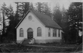
- Photograph on a postcard of the exterior of St. Alban's Anglican Church at 7717 19th Avenue, near Douglas Road (now Canada Way) and Edmonds Street.
- Repository
- City of Burnaby Archives
- Date
- [1909] (date of original), copied 1986
- Collection/Fonds
- Burnaby Historical Society fonds
- Subseries
- Patterson family subseries
- Physical Description
- 1 photograph : b&w postcard ; 8.5 x 11.8 cm
- Description Level
- Item
- Record No.
- 171-024
- Access Restriction
- No restrictions
- Reproduction Restriction
- No known restrictions
- Accession Number
- BHS1986-20
- Scope and Content
- Photograph on a postcard of the exterior of St. Alban's Anglican Church at 7717 19th Avenue, near Douglas Road (now Canada Way) and Edmonds Street.
- Media Type
- Photograph
- Notes
- Title based on contents of photograph
- Geographic Access
- 19th Avenue
- Street Address
- 7717 19th Avenue
- Historic Neighbourhood
- Edmonds (Historic Neighbourhood)
- Planning Study Area
- Edmonds Area
Images
Grace McGhee
https://search.heritageburnaby.ca/link/archivedescription35153
- Repository
- City of Burnaby Archives
- Date
- [1909] (date of original), copied 1986
- Collection/Fonds
- Burnaby Historical Society fonds
- Description Level
- Item
- Physical Description
- 1 photograph : b&w ; 12.7 x 17.8 cm print
- Scope and Content
- Photograph of Grace McGhee (nee George) at McKay station along the Central Park Interurban line.
- Repository
- City of Burnaby Archives
- Date
- [1909] (date of original), copied 1986
- Collection/Fonds
- Burnaby Historical Society fonds
- Subseries
- Pioneer Tales subseries
- Physical Description
- 1 photograph : b&w ; 12.7 x 17.8 cm print
- Description Level
- Item
- Record No.
- 204-010
- Access Restriction
- No restrictions
- Reproduction Restriction
- No known restrictions
- Accession Number
- BHS1988-03
- Scope and Content
- Photograph of Grace McGhee (nee George) at McKay station along the Central Park Interurban line.
- Media Type
- Photograph
- Notes
- Title based on contents of photograph
- Geographic Access
- McKay Avenue
- Central Park Interurban line
- Historic Neighbourhood
- Central Park (Historic Neighbourhood)
- Planning Study Area
- Maywood Area
Images
Jubilee Methodist Church
https://search.heritageburnaby.ca/link/archivedescription36018
- Repository
- City of Burnaby Archives
- Date
- 1909
- Collection/Fonds
- Burnaby Historical Society fonds
- Description Level
- Item
- Physical Description
- 1 photograph : sepia postcard ; 8 x 13 cm
- Scope and Content
- Photographic postcard of the Jubilee Methodist Church.
- Repository
- City of Burnaby Archives
- Date
- 1909
- Collection/Fonds
- Burnaby Historical Society fonds
- Subseries
- Ephemera subseries
- Physical Description
- 1 photograph : sepia postcard ; 8 x 13 cm
- Description Level
- Item
- Record No.
- 212-001
- Access Restriction
- No restrictions
- Reproduction Restriction
- No known restrictions
- Accession Number
- BHS1988-12
- Scope and Content
- Photographic postcard of the Jubilee Methodist Church.
- Media Type
- Photograph
- Notes
- Title based on contents of photograph
- Geographic Access
- Sussex Avenue
- Street Address
- 6050 Sussex Avenue
- Historic Neighbourhood
- Central Park (Historic Neighbourhood)
- Planning Study Area
- Marlborough Area
Images
B.G. Walker house
https://search.heritageburnaby.ca/link/archivedescription36021
- Repository
- City of Burnaby Archives
- Date
- 1909
- Collection/Fonds
- Burnaby Historical Society fonds
- Description Level
- Item
- Physical Description
- 1 photograph : sepia postcard ; 8 x 14 cm
- Scope and Content
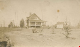
- Photographic postcard of the B.G. Walker House, at Edmonds & Kingsway.
- Repository
- City of Burnaby Archives
- Date
- 1909
- Collection/Fonds
- Burnaby Historical Society fonds
- Subseries
- Patterson family subseries
- Physical Description
- 1 photograph : sepia postcard ; 8 x 14 cm
- Description Level
- Item
- Record No.
- 213-003
- Access Restriction
- No restrictions
- Reproduction Restriction
- No known restrictions
- Accession Number
- BHS1988-13
- Scope and Content
- Photographic postcard of the B.G. Walker House, at Edmonds & Kingsway.
- Subjects
- Buildings - Residential - Houses
- Media Type
- Photograph
- Notes
- Title based on contents of photograph
- Geographic Access
- Edmonds Street
- Street Address
- 7328 Edmonds Street
- Historic Neighbourhood
- Edmonds (Historic Neighbourhood)
- Planning Study Area
- Richmond Park Area
Images
Pengelly's logging shack
https://search.heritageburnaby.ca/link/archivedescription36082
- Repository
- City of Burnaby Archives
- Date
- [1909]
- Collection/Fonds
- Burnaby Historical Society fonds
- Description Level
- Item
- Physical Description
- 1 photograph : b&w ; 9 x 11.5 cm
- Scope and Content
- Photograph of Pengelly's logging shack, believed to be at Union Street and Duthie Avenue. One lumberjack is standing just outside the shack with an axe in his hand, while another is wiping his face with a cloth and a third is standing with one foot bracing a felled log with a saw in his hand.
- Repository
- City of Burnaby Archives
- Date
- [1909]
- Collection/Fonds
- Burnaby Historical Society fonds
- Subseries
- Columbian Newspaper subseries
- Physical Description
- 1 photograph : b&w ; 9 x 11.5 cm
- Description Level
- Item
- Record No.
- 222-005
- Access Restriction
- No restrictions
- Reproduction Restriction
- No known restrictions
- Accession Number
- BHS1989-19
- Scope and Content
- Photograph of Pengelly's logging shack, believed to be at Union Street and Duthie Avenue. One lumberjack is standing just outside the shack with an axe in his hand, while another is wiping his face with a cloth and a third is standing with one foot bracing a felled log with a saw in his hand.
- Media Type
- Photograph
- Notes
- Title based on contents of photograph
- 2 b&w copy negatives accompanying
- Geographic Access
- Duthie Avenue
- Union Street
- Historic Neighbourhood
- Lochdale (Historic Neighbourhood)
- Planning Study Area
- Lochdale Area
Images
Barnet Mill being rebuilt
https://search.heritageburnaby.ca/link/archivedescription37363
- Repository
- City of Burnaby Archives
- Date
- [1909] (date of original), copied [1998]
- Collection/Fonds
- Burnaby Historical Society fonds
- Description Level
- Item
- Physical Description
- 1 photograph : b&w ; 10 x 15 cm print
- Scope and Content
- Photograph of lumber piled up and the skeleton of a building being framed during the rebuilding of the Barnet Mill after the fire of 1909. The Barnet Mill was called the North Pacific Lumber Company from 1889 to 1914.
- Repository
- City of Burnaby Archives
- Date
- [1909] (date of original), copied [1998]
- Collection/Fonds
- Burnaby Historical Society fonds
- Subseries
- Jim Wolf subseries
- Physical Description
- 1 photograph : b&w ; 10 x 15 cm print
- Description Level
- Item
- Record No.
- 363-002
- Access Restriction
- No restrictions
- Reproduction Restriction
- No known restrictions
- Accession Number
- BHS1998-13
- Scope and Content
- Photograph of lumber piled up and the skeleton of a building being framed during the rebuilding of the Barnet Mill after the fire of 1909. The Barnet Mill was called the North Pacific Lumber Company from 1889 to 1914.
- Names
- Barnet Mill
- Media Type
- Photograph
- Notes
- Title based on contents of photograph
- Geographic Access
- Barnet Village
- Texaco Drive
- Street Address
- 8059 Texaco Drive
- Historic Neighbourhood
- Barnet (Historic Neighbourhood)
- Planning Study Area
- Burnaby Mountain Area
Images
Mills Burning at Barnet
https://search.heritageburnaby.ca/link/archivedescription38342
- Repository
- City of Burnaby Archives
- Date
- May 6, 1909
- Collection/Fonds
- Burnaby Historical Society fonds
- Description Level
- Item
- Physical Description
- 1 photograph : sepia postcard ; 8 x 13.4 cm
- Scope and Content
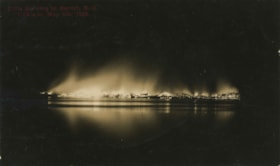
- Photographic postcard of the line of buildings burning at the North Pacific Lumber Company, with flames and smoke visible rising from the structures. A caption stamped at the top of the postcard reads: "Mills burning at Barnet BC. 1:30a.m. May 6th, 1909."
- Repository
- City of Burnaby Archives
- Date
- May 6, 1909
- Collection/Fonds
- Burnaby Historical Society fonds
- Subseries
- Charles Lee subseries
- Physical Description
- 1 photograph : sepia postcard ; 8 x 13.4 cm
- Description Level
- Item
- Record No.
- 411-001
- Access Restriction
- No restrictions
- Reproduction Restriction
- No known restrictions
- Accession Number
- BHS2000-13
- Scope and Content
- Photographic postcard of the line of buildings burning at the North Pacific Lumber Company, with flames and smoke visible rising from the structures. A caption stamped at the top of the postcard reads: "Mills burning at Barnet BC. 1:30a.m. May 6th, 1909."
- Names
- Barnet Mill
- Media Type
- Photograph
- Geographic Access
- Barnet Village
- Texaco Drive
- Street Address
- 8059 Texaco Drive
- Historic Neighbourhood
- Barnet (Historic Neighbourhood)
- Planning Study Area
- Burnaby Mountain Area
Images
Broadview
https://search.heritageburnaby.ca/link/archivedescription39426
- Repository
- City of Burnaby Archives
- Date
- 1909
- Collection/Fonds
- Peers Family and Hill Family fonds
- Description Level
- Item
- Physical Description
- 1 photograph : sepia ; 7.4 x 10 cm
- Scope and Content
- Photograph of the Hill family home, Broadview, in the Burnaby Lake district.
- Repository
- City of Burnaby Archives
- Date
- 1909
- Collection/Fonds
- Peers Family and Hill Family fonds
- Physical Description
- 1 photograph : sepia ; 7.4 x 10 cm
- Description Level
- Item
- Record No.
- 477-745
- Access Restriction
- No restrictions
- Reproduction Restriction
- No known restrictions
- Accession Number
- 2007-12
- Scope and Content
- Photograph of the Hill family home, Broadview, in the Burnaby Lake district.
- Subjects
- Buildings - Residential - Houses
- Media Type
- Photograph
- Notes
- Title based on caption accompanying photograph
- Geographic Access
- Buckingham Avenue
- Street Address
- 5730 Buckingham Avenue
- Historic Neighbourhood
- Burnaby Lake (Historic Neighbourhood)
- Planning Study Area
- Morley-Buckingham Area
Images
First School at Burnaby Lake
https://search.heritageburnaby.ca/link/archivedescription39549
- Repository
- City of Burnaby Archives
- Date
- 1909
- Collection/Fonds
- Peers Family and Hill Family fonds
- Description Level
- Item
- Physical Description
- 1 photograph : b&w ; 12.5 x 17 cm on page 21.5 x 28 cm (pasted in album)
- Scope and Content
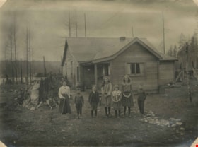
- Photograph of Harriet Woodward and her class of students outside the Woodward home near Deer Lake which served as the first school and post office in the Burnaby Lake area; (l to r): Harriet Woodward (Miss Harry), Bob Peers, Melvin Mawhinney, Muriel Sprott, Kitty Hill, Beatrice Clayton and Arthur P…
- Repository
- City of Burnaby Archives
- Date
- 1909
- Collection/Fonds
- Peers Family and Hill Family fonds
- Physical Description
- 1 photograph : b&w ; 12.5 x 17 cm on page 21.5 x 28 cm (pasted in album)
- Description Level
- Item
- Record No.
- 477-868
- Access Restriction
- No restrictions
- Reproduction Restriction
- No known restrictions
- Accession Number
- 2007-12
- Scope and Content
- Photograph of Harriet Woodward and her class of students outside the Woodward home near Deer Lake which served as the first school and post office in the Burnaby Lake area; (l to r): Harriet Woodward (Miss Harry), Bob Peers, Melvin Mawhinney, Muriel Sprott, Kitty Hill, Beatrice Clayton and Arthur Peers. The cottage was a prefabricated building designed by J.J. Mahoney and architect Joseph Bowman and was manufactured in Vancouver by the B.C. Mills Timber and Trading Company and erected here is 1904. The cottage was enlarged with several additions until 1912 when the Woodwards built a new house.
- Subjects
- Buildings - Residential - Houses
- Buildings - Public - Post Offices
- Buildings - Schools
- Occupations - Teachers
- Names
- Clayton, Beatrice
- Mawhinney, Melvin
- Peers, Arthur Francis "Mike"
- Peers, Katherine Maude Hill "Kitty"
- Peers, William John "Bob"
- Sprott, Muriel
- Woodward, Harriet
- Media Type
- Photograph
- Notes
- Title based on caption accompanying photograph
- Geographic Access
- Sperling Avenue
- Street Address
- 5141 Sperling Avenue
- Historic Neighbourhood
- Burnaby Lake (Historic Neighbourhood)
- Planning Study Area
- Morley-Buckingham Area
Images
Louis Claude Hill's Farm, Burnaby, BC
https://search.heritageburnaby.ca/link/museumdescription3064
- Repository
- Burnaby Village Museum
- Date
- [1909]
- Collection/Fonds
- Burnaby Village Museum Photograph collection
- Description Level
- Item
- Physical Description
- 1 photograph : b&w ; 12.2 x 17.6 cm mounted on cardboard 22.7 x 27.4 cm
- Scope and Content
- Photograph of a farm with men, a horse and wagon, and children in a field. An annotation on the back of one of the photos reads, "The foreground farm property stood at the corner of Sperling Avenue (formerly known as the Pole Line Road) and Buckingham. The white house in the left centre was the …
- Repository
- Burnaby Village Museum
- Collection/Fonds
- Burnaby Village Museum Photograph collection
- Description Level
- Item
- Physical Description
- 1 photograph : b&w ; 12.2 x 17.6 cm mounted on cardboard 22.7 x 27.4 cm
- Scope and Content
- Photograph of a farm with men, a horse and wagon, and children in a field. An annotation on the back of one of the photos reads, "The foreground farm property stood at the corner of Sperling Avenue (formerly known as the Pole Line Road) and Buckingham. The white house in the left centre was the residence of Miss Woodward, her mother and sister. It was the first post office at 'Burnaby Lake' and the site of the kindergarten school of Miss Harriet Woodward. It later became the United Church. / The open field in the distance above the horse's head and people in the field is the field in front of the 'Manor House' which was built by Mr. Bateman in the 1920's. To the right of and beyond the white house partly hidden by the trees can be seen some of the buildings associated with the Hill farm on Deer Lake Ave. which by the date (1909) of this photo had been sold. The distant tall trees (center) stand on the site of the Municipal Buildings (DesBirsays Woods)." An annotation on the back of the other photograph reads, "Formerly belonging to Malcom Nicolson / App. 1908." Annotations at the bottom front of the photograph read, "L. Claude Hill's Farm, Burnaby, BC."
- Subjects
- Agriculture - Crops
- Agricultural Tools and Equipment
- Animals - Horses
- Occupations - Farmers
- Agriculture - Farms
- Geographic Access
- Buckingham Avenue
- Sperling Avenue
- Accession Code
- HV973.40.4
- Access Restriction
- No restrictions
- Reproduction Restriction
- No known restrictions
- Date
- [1909]
- Media Type
- Photograph
- Historic Neighbourhood
- Burnaby Lake (Historic Neighbourhood)
- Planning Study Area
- Morley-Buckingham Area
- Scan Resolution
- 600
- Scan Date
- 2023-05-09
- Scale
- 100
- Notes
- Title based on contents of photograph
- 1 b&w duplicate photograph accompanying
- Text on first image "L Claude Hill's Farm, Burnaby B C", incorporated into the image at the bottom edge of the photograph. "app 1909" pencilled in following above on the bottom edge of the image "L. Claude / Hill / Broadview", pencilled on the matt below the image. "The foreground farm property stood at the / Corner of Sperling Ave. (formerly known as Pole Line Road) / and Buckingham. The white house in the left / centre was the residence of Miss Woodward, her mother / and sister. It was the first post ofice at "Burnaby Lake" / and the site of the kindergarten school of Miss / Harriet Woodward. It later became the United / Church. / The open field in the distance above / the horses head and people in the field is / the field in front of the "Manse House" which / was built by Mr. Bateman in the 1920's. To the / right of and beyond the white house partly hidden / by the trees can be seen some of the buildings / associated with the Hill farm on Deer Lake Ave. / which by the date (1909) of this photo had been / sold. The distant tall trees (center) stand on the site of / the Municipal Buildings (DesBirsays Woods)", hand written in blue ink on the reverse side of the matt. It is not indicated who wrote the note. "OR MASTER / 973.40.4", pencilled in the lower right corner of reverse side of matt. "W. T. COOKSLEY / NEW WESTMINSTER, B.C."printed with very little contrast on the gray mattboard, below the lower right corner of the photograph Text on second image. "L Claude Hill's Farm, Burnaby B C", incorporated into the image at the bottom edge of the photograph. "Claude surveying the haying", pencilled on the reverse side of the matt. "Formerly belonging to Malcolm Nicholson / app 1908", hand writen in blue ink on the reverse side of the matt. "H.V.973.40.4. OR. MASTER", hand printed on the bottom left corner of the reverse side of the matt. "W. T. COOKSLEY / NEW WESTMINSTER, B.C."printed with very little contrast on the gray mattboard, below the lower right corner of the photograph
Images
Broadview
https://search.heritageburnaby.ca/link/archivedescription66233
- Repository
- City of Burnaby Archives
- Date
- [1908]
- Collection/Fonds
- Peers Family and Hill Family fonds
- Description Level
- Item
- Physical Description
- 1 photograph : b&w ; 5 x 8 cm (oval, sight) on sheet 15 x 22.5 cm
- Scope and Content
- Photograph of the second home of Claude Hill in the Burnaby Lake district. It was known as Broadview.
- Repository
- City of Burnaby Archives
- Date
- [1908]
- Collection/Fonds
- Peers Family and Hill Family fonds
- Physical Description
- 1 photograph : b&w ; 5 x 8 cm (oval, sight) on sheet 15 x 22.5 cm
- Description Level
- Item
- Record No.
- 477-946
- Access Restriction
- No restrictions
- Reproduction Restriction
- No known restrictions
- Accession Number
- 2007-12
- Scope and Content
- Photograph of the second home of Claude Hill in the Burnaby Lake district. It was known as Broadview.
- Subjects
- Buildings - Residential - Houses
- Media Type
- Photograph
- Notes
- Title based on contents of photograph
- Geographic Access
- Buckingham Avenue
- Street Address
- 5730 Buckingham Avenue
- Historic Neighbourhood
- Burnaby Lake (Historic Neighbourhood)
- Planning Study Area
- Morley-Buckingham Area
Images
Broadview
https://search.heritageburnaby.ca/link/archivedescription66234
- Repository
- City of Burnaby Archives
- Date
- [1908]
- Collection/Fonds
- Peers Family and Hill Family fonds
- Description Level
- Item
- Physical Description
- 1 photograph : 5.5 x 7.5 cm on sheet 15 x 22.5 cm
- Scope and Content
- Photograph of a horse standing in the field in front of "Broadview," the home of Claude Hill in the Burnaby Lake district.
- Repository
- City of Burnaby Archives
- Date
- [1908]
- Collection/Fonds
- Peers Family and Hill Family fonds
- Physical Description
- 1 photograph : 5.5 x 7.5 cm on sheet 15 x 22.5 cm
- Description Level
- Item
- Record No.
- 477-947
- Access Restriction
- No restrictions
- Reproduction Restriction
- No known restrictions
- Accession Number
- 2007-12
- Scope and Content
- Photograph of a horse standing in the field in front of "Broadview," the home of Claude Hill in the Burnaby Lake district.
- Subjects
- Buildings - Residential - Houses
- Media Type
- Photograph
- Notes
- Title based on contents of photograph
- Geographic Access
- Buckingham Avenue
- Street Address
- 5730 Buckingham Avenue
- Historic Neighbourhood
- Burnaby Lake (Historic Neighbourhood)
- Planning Study Area
- Morley-Buckingham Area
Images
Kitty Hill with dog
https://search.heritageburnaby.ca/link/archivedescription66235
- Repository
- City of Burnaby Archives
- Date
- [1908]
- Collection/Fonds
- Peers Family and Hill Family fonds
- Description Level
- Item
- Physical Description
- 1 photograph : b&w ; 5.5 x 7.5 cm on sheet 15 x 22.5 cm
- Scope and Content
- Photograph of Kitty Hill, holding a dog on her lap. The photograph was likely taken at the Hill family home, Broadview.
- Repository
- City of Burnaby Archives
- Date
- [1908]
- Collection/Fonds
- Peers Family and Hill Family fonds
- Physical Description
- 1 photograph : b&w ; 5.5 x 7.5 cm on sheet 15 x 22.5 cm
- Description Level
- Item
- Record No.
- 477-948
- Access Restriction
- No restrictions
- Reproduction Restriction
- No known restrictions
- Accession Number
- 2007-12
- Scope and Content
- Photograph of Kitty Hill, holding a dog on her lap. The photograph was likely taken at the Hill family home, Broadview.
- Subjects
- Buildings - Residential - Houses
- Media Type
- Photograph
- Notes
- Title based on contents of photograph
- Geographic Access
- Buckingham Avenue
- Street Address
- 5730 Buckingham Avenue
- Historic Neighbourhood
- Burnaby Lake (Historic Neighbourhood)
- Planning Study Area
- Morley-Buckingham Area
Images
Jesse Love house
https://search.heritageburnaby.ca/link/archivedescription34497
- Repository
- City of Burnaby Archives
- Date
- [1908] (date of original), copied [between 1975 and 1985]
- Collection/Fonds
- Burnaby Historical Society fonds
- Description Level
- Item
- Physical Description
- 1 photograph : sepia ; 12.6 x 17.6 cm mounted on cardboard 13.5 x 18.8 cm
- Scope and Content
- Photograph of the Jesse Love house and family on Cumberland Road. Two women and four children are standing outside of the house. In 1988, this house was moved to the site of the Burnaby Village Museum at Deer Lake Avenue, where it remains today.
- Repository
- City of Burnaby Archives
- Date
- [1908] (date of original), copied [between 1975 and 1985]
- Collection/Fonds
- Burnaby Historical Society fonds
- Subseries
- Photographs subseries
- Physical Description
- 1 photograph : sepia ; 12.6 x 17.6 cm mounted on cardboard 13.5 x 18.8 cm
- Description Level
- Item
- Record No.
- 021-001
- Access Restriction
- No restrictions
- Reproduction Restriction
- No known restrictions
- Accession Number
- BHS2007-04
- Scope and Content
- Photograph of the Jesse Love house and family on Cumberland Road. Two women and four children are standing outside of the house. In 1988, this house was moved to the site of the Burnaby Village Museum at Deer Lake Avenue, where it remains today.
- Media Type
- Photograph
- Notes
- Title based on contents of photograph
- 1 b&w copy negative accompanying
- Geographic Access
- Cumberland Street
- Street Address
- 6501 Deer Lake Avenue
- Historic Neighbourhood
- East Burnaby (Historic Neighbourhood)
- Planning Study Area
- Cariboo-Armstrong Area
Images
C.F. Sprott's house
https://search.heritageburnaby.ca/link/archivedescription34498
- Repository
- City of Burnaby Archives
- Date
- 1908
- Collection/Fonds
- Burnaby Historical Society fonds
- Description Level
- Item
- Physical Description
- 1 photograph : sepia ; 12.8 x 17.7 cm mounted on cardboard 14.8 x 19.7 cm
- Scope and Content
- Photograph of C.F. Sprott's House at Douglas Road and Norland Avenue. A unidentified man is standing on the porch steps.
- Repository
- City of Burnaby Archives
- Date
- 1908
- Collection/Fonds
- Burnaby Historical Society fonds
- Subseries
- Photographs subseries
- Physical Description
- 1 photograph : sepia ; 12.8 x 17.7 cm mounted on cardboard 14.8 x 19.7 cm
- Description Level
- Item
- Record No.
- 022-001
- Access Restriction
- No restrictions
- Reproduction Restriction
- No known restrictions
- Accession Number
- BHS2007-04
- Scope and Content
- Photograph of C.F. Sprott's House at Douglas Road and Norland Avenue. A unidentified man is standing on the porch steps.
- Media Type
- Photograph
- Photographer
- Cooksley, William Thomas
- Notes
- Title based on contents of photograph
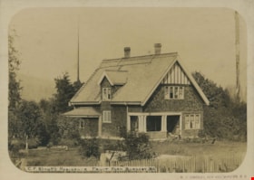
- Annotation at bottom of photograph reads, "C.F. Sprott's Residence, Fruit Farm, Burnaby B.C."
- Annotation underneath photograph reads, "W.T. Cooksley, New Westminster, B.C."
- Geographic Access
- Douglas Road
- Norland Avenue
- Historic Neighbourhood
- Burnaby Lake (Historic Neighbourhood)
- Planning Study Area
- Ardingley-Sprott Area
Images
D.C. Patterson house
https://search.heritageburnaby.ca/link/archivedescription34981
- Repository
- City of Burnaby Archives
- Date
- 1908 (date of original), copied 1986
- Collection/Fonds
- Burnaby Historical Society fonds
- Description Level
- Item
- Physical Description
- 1 photograph : b&w ; 8.8 x 12.5 cm print
- Scope and Content
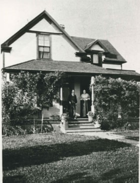
- Photograph of the home of Dugald C. Patterson, Sr., and his family. The house was originally located at 7260 Edmonds Street (near Kingsway). It was relocated in 1955 to 7106 18th Avenue and is a city heritage site.
- Repository
- City of Burnaby Archives
- Date
- 1908 (date of original), copied 1986
- Collection/Fonds
- Burnaby Historical Society fonds
- Subseries
- Patterson family subseries
- Physical Description
- 1 photograph : b&w ; 8.8 x 12.5 cm print
- Description Level
- Item
- Record No.
- 171-002
- Access Restriction
- No restrictions
- Reproduction Restriction
- No known restrictions
- Accession Number
- BHS1986-20
- Scope and Content
- Photograph of the home of Dugald C. Patterson, Sr., and his family. The house was originally located at 7260 Edmonds Street (near Kingsway). It was relocated in 1955 to 7106 18th Avenue and is a city heritage site.
- Subjects
- Buildings - Residential - Houses
- Media Type
- Photograph
- Notes
- Title based on contents of photograph
- Geographic Access
- Edmonds Street
- 18th Avenue
- Street Address
- 7260 Edmonds Street
- 7106 18th Avenue
- Historic Neighbourhood
- Edmonds (Historic Neighbourhood)
- Planning Study Area
- Stride Avenue Area
Images
O.G. Naud house
https://search.heritageburnaby.ca/link/archivedescription35005
- Repository
- City of Burnaby Archives
- Date
- [1908] (date of original), copied 1986
- Collection/Fonds
- Burnaby Historical Society fonds
- Description Level
- Item
- Physical Description
- 1 photograph : b&w ; 8.8 x 12.5 cm print
- Scope and Content
- Photograph is the left side of a three-part panorama (photos 172-002a to 172-002c) of the land beside the house of Onezime G. Naud, 4737 Victory Road (later renamed Victory Street). A garden and a fence with a woman standing beside it can be seen.
- Repository
- City of Burnaby Archives
- Date
- [1908] (date of original), copied 1986
- Collection/Fonds
- Burnaby Historical Society fonds
- Subseries
- O.G. Naud subseries
- Physical Description
- 1 photograph : b&w ; 8.8 x 12.5 cm print
- Description Level
- Item
- Record No.
- 172-002-1
- Access Restriction
- No restrictions
- Reproduction Restriction
- No known restrictions
- Accession Number
- BHS1986-21
- Scope and Content
- Photograph is the left side of a three-part panorama (photos 172-002a to 172-002c) of the land beside the house of Onezime G. Naud, 4737 Victory Road (later renamed Victory Street). A garden and a fence with a woman standing beside it can be seen.
- Subjects
- Buildings - Residential - Houses
- Media Type
- Photograph
- Notes
- Title based on contents of photograph
- b&w ; 5.5 x 24.5 cm photocopy of entire panorama accompanying in accession file
- Geographic Access
- Victory Street
- Street Address
- 4737 Victory Street
- Historic Neighbourhood
- Alta-Vista (Historic Neighbourhood)
- Planning Study Area
- Sussex-Nelson Area
Images
Tidball-Cram family home
https://search.heritageburnaby.ca/link/archivedescription35605
- Repository
- City of Burnaby Archives
- Date
- 1908 (date of original), copied 1986
- Collection/Fonds
- Burnaby Historical Society fonds
- Description Level
- Item
- Physical Description
- 1 photograph : b&w ; 12.7 x 17.8 cm print
- Scope and Content
- Photograph of the Tidball-Cram family home, 3267Kingsway (later renumbered 5489 Kingsway) at Denbigh Avenue (Denbigh did not exist at the time; the area was the family's orchard). Grandfather Tidball (left) and Grandmother Tidball (right) are on the porch. The Tidball's daughter and son-in-law, Ali…
- Repository
- City of Burnaby Archives
- Date
- 1908 (date of original), copied 1986
- Collection/Fonds
- Burnaby Historical Society fonds
- Subseries
- Pioneer Tales subseries
- Physical Description
- 1 photograph : b&w ; 12.7 x 17.8 cm print
- Description Level
- Item
- Record No.
- 204-463
- Access Restriction
- No restrictions
- Reproduction Restriction
- No known restrictions
- Accession Number
- BHS1988-03
- Scope and Content
- Photograph of the Tidball-Cram family home, 3267Kingsway (later renumbered 5489 Kingsway) at Denbigh Avenue (Denbigh did not exist at the time; the area was the family's orchard). Grandfather Tidball (left) and Grandmother Tidball (right) are on the porch. The Tidball's daughter and son-in-law, Alice and William Cram, and their family joined the Tidballs on their farm after moving to Burnaby from the United States. The Crams and Tidballs produced and sold fruit, produce, honey, and cottage cheese.
- Subjects
- Buildings - Residential - Houses
- Media Type
- Photograph
- Notes
- Title based on contents of photograph
- Geographic Access
- Kingsway
- Street Address
- 5489 Kingsway
- Historic Neighbourhood
- Central Park (Historic Neighbourhood)
- Planning Study Area
- Windsor Area
![Agricultural Exhibit, [1909] thumbnail](/media/hpo/_Data/_Archives_Images/_Unrestricted/001/041-001.jpg?width=280)
![St. Alban's Anglican Church, [1909] (date of original), copied 1986 thumbnail](/media/hpo/_Data/_Archives_Images/_Unrestricted/126/171-024.jpg?width=280)
![Grace McGhee, [1909] (date of original), copied 1986 thumbnail](/media/hpo/_Data/_Archives_Images/_Unrestricted/204/204-010.jpg?width=280)
![Pengelly's logging shack, [1909] thumbnail](/media/hpo/_Data/_Archives_Images/_Unrestricted/205/222-005.jpg?width=280)
![Barnet Mill being rebuilt, [1909] (date of original), copied [1998] thumbnail](/media/hpo/_Data/_Archives_Images/_Unrestricted/316/363-002.jpg?width=280)
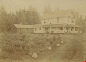
![Louis Claude Hill's Farm, Burnaby, BC, [1909] thumbnail](/media/hpo/_Data/_BVM_Images/1973/1973_0040_0004_001.jpg?width=280)

![Broadview, [1908] thumbnail](/media/hpo/_Data/_Archives_Images/_Unrestricted/477/477-946.jpg?width=280)
![Broadview, [1908] thumbnail](/media/hpo/_Data/_Archives_Images/_Unrestricted/477/477-947.jpg?width=280)
![Kitty Hill with dog, [1908] thumbnail](/media/hpo/_Data/_Archives_Images/_Unrestricted/477/477-948.jpg?width=280)
![Jesse Love house, [1908] (date of original), copied [between 1975 and 1985] thumbnail](/media/hpo/_Data/_Archives_Images/_Unrestricted/001/021-001.jpg?width=280)
![O.G. Naud house, [1908] (date of original), copied 1986 thumbnail](/media/hpo/_Data/_Archives_Images/_Unrestricted/126/172-002-001.jpg?width=280)
