Narrow Results By
![Tom, [1905] thumbnail](/media/hpo/_Data/_Archives_Images/_Unrestricted/477/477-851.jpg?width=280)
Tom
https://search.heritageburnaby.ca/link/archivedescription39532
- Repository
- City of Burnaby Archives
- Date
- [1905]
- Collection/Fonds
- Peers Family and Hill Family fonds
- Description Level
- Item
- Physical Description
- 1 photograph : b&w ; 5.5 x 5.5 cm on page 21.5 x 28 cm (pasted in album)
- Scope and Content
- Photograph of the Hill family horse, Tom, standing outside a barn at the Hill farm. The Hill family home was known as Brookfield and occupied the current site of the Burnaby Village Museum on Deer Lake Avenue.
- Repository
- City of Burnaby Archives
- Date
- [1905]
- Collection/Fonds
- Peers Family and Hill Family fonds
- Physical Description
- 1 photograph : b&w ; 5.5 x 5.5 cm on page 21.5 x 28 cm (pasted in album)
- Description Level
- Item
- Record No.
- 477-851
- Access Restriction
- No restrictions
- Reproduction Restriction
- No known restrictions
- Accession Number
- 2007-12
- Scope and Content
- Photograph of the Hill family horse, Tom, standing outside a barn at the Hill farm. The Hill family home was known as Brookfield and occupied the current site of the Burnaby Village Museum on Deer Lake Avenue.
- Media Type
- Photograph
- Notes
- Title based on contents of photograph
- Geographic Access
- Deer Lake Avenue
- Street Address
- 6501 Deer Lake Avenue
- Historic Neighbourhood
- Burnaby Lake (Historic Neighbourhood)
- Planning Study Area
- Morley-Buckingham Area
Images
![Tom, [1905] thumbnail](/media/hpo/_Data/_Archives_Images/_Unrestricted/477/477-851.jpg)
![Kitty riding Tom, [1905] thumbnail](/media/hpo/_Data/_Archives_Images/_Unrestricted/477/477-852.jpg?width=280)
Kitty riding Tom
https://search.heritageburnaby.ca/link/archivedescription39533
- Repository
- City of Burnaby Archives
- Date
- [1905]
- Collection/Fonds
- Peers Family and Hill Family fonds
- Description Level
- Item
- Physical Description
- 1 photograph : sepia ; 5.5 x 5.5 cm on page 21.5 x 28 cm (pasted in album)
- Scope and Content
- Photograph of Kitty Hill on her horse, Tom. A note with the photograph indicates that Tom lived from 1892 to 1914. The photograph was taken at the Hill family home known as Brookfield, on Deer Lake Avenue (the current site of the Burnaby Village Museum).
- Repository
- City of Burnaby Archives
- Date
- [1905]
- Collection/Fonds
- Peers Family and Hill Family fonds
- Physical Description
- 1 photograph : sepia ; 5.5 x 5.5 cm on page 21.5 x 28 cm (pasted in album)
- Description Level
- Item
- Record No.
- 477-852
- Access Restriction
- No restrictions
- Reproduction Restriction
- No known restrictions
- Accession Number
- 2007-12
- Scope and Content
- Photograph of Kitty Hill on her horse, Tom. A note with the photograph indicates that Tom lived from 1892 to 1914. The photograph was taken at the Hill family home known as Brookfield, on Deer Lake Avenue (the current site of the Burnaby Village Museum).
- Media Type
- Photograph
- Notes
- Title based on contents of photograph
- Geographic Access
- Deer Lake Avenue
- Street Address
- 6501 Deer Lake Avenue
- Historic Neighbourhood
- Burnaby Lake (Historic Neighbourhood)
- Planning Study Area
- Morley-Buckingham Area
Images
![Kitty riding Tom, [1905] thumbnail](/media/hpo/_Data/_Archives_Images/_Unrestricted/477/477-852.jpg)

Nicholson Farm
https://search.heritageburnaby.ca/link/archivedescription38255
- Repository
- City of Burnaby Archives
- Date
- 1910
- Collection/Fonds
- Burnaby Historical Society fonds
- Description Level
- Item
- Physical Description
- 1 photograph : b&w ; 10.2 x 15.2 cm
- Scope and Content
- Photograph of the home and barns at the farm of E.W. Nicholson and Elsie Nicholson.
- Repository
- City of Burnaby Archives
- Date
- 1910
- Collection/Fonds
- Burnaby Historical Society fonds
- Subseries
- Margaret McCallum subseries
- Physical Description
- 1 photograph : b&w ; 10.2 x 15.2 cm
- Description Level
- Item
- Record No.
- 375-017
- Access Restriction
- No restrictions
- Reproduction Restriction
- No known restrictions
- Accession Number
- BHS1986-42
- Scope and Content
- Photograph of the home and barns at the farm of E.W. Nicholson and Elsie Nicholson.
- Media Type
- Photograph
- Notes
- Title based on contents of photograph
- A note on the back of the photograph reads: "Home of E.W. Nicholson 1900-1951 and Elsie Nicholson 1934-1951. Boundary Road and Great Northern Railway. Property sold to Link-Belt Co. in 1951."
- Geographic Access
- Boundary Road
- Street Address
- 2550 Boundary Road
- Historic Neighbourhood
- Broadview (Historic Neighbourhood)
- Planning Study Area
- West Central Valley Area
Images

![Stride Gardens and Greenhouse, [1912] thumbnail](/media/hpo/_Data/_Archives_Images/_Unrestricted/001/001-005.jpg?width=280)
Stride Gardens and Greenhouse
https://search.heritageburnaby.ca/link/archivedescription34029
- Repository
- City of Burnaby Archives
- Date
- [1912]
- Collection/Fonds
- Burnaby Historical Society fonds
- Description Level
- Item
- Physical Description
- 1 photograph : sepia postcard ; 6.6 x 8.3 cm
- Scope and Content
- Photograph of the Stride family gardens and greenhouse.
- Repository
- City of Burnaby Archives
- Date
- [1912]
- Collection/Fonds
- Burnaby Historical Society fonds
- Subseries
- Stride family subseries
- Physical Description
- 1 photograph : sepia postcard ; 6.6 x 8.3 cm
- Description Level
- Item
- Record No.
- 001-005
- Access Restriction
- No restrictions
- Reproduction Restriction
- No known restrictions
- Accession Number
- BHS2007-04
- Scope and Content
- Photograph of the Stride family gardens and greenhouse.
- Media Type
- Photograph
- Notes
- Title based on contents of photograph
- Postcard has been cropped
- Historic Neighbourhood
- Edmonds (Historic Neighbourhood)
Images
![Stride Gardens and Greenhouse, [1912] thumbnail](/media/hpo/_Data/_Archives_Images/_Unrestricted/001/001-005.jpg)
![Stride Gardens and Greenhouses, [1912] thumbnail](/media/hpo/_Data/_Archives_Images/_Unrestricted/001/001-006.jpg?width=280)
Stride Gardens and Greenhouses
https://search.heritageburnaby.ca/link/archivedescription34030
- Repository
- City of Burnaby Archives
- Date
- [1912]
- Collection/Fonds
- Burnaby Historical Society fonds
- Description Level
- Item
- Physical Description
- 1 photograph : b&w ; 8.3 x 13.3 cm
- Scope and Content
- Photograph of the Stride family gardens with greenhouses in the foreground.
- Repository
- City of Burnaby Archives
- Date
- [1912]
- Collection/Fonds
- Burnaby Historical Society fonds
- Subseries
- Stride family subseries
- Physical Description
- 1 photograph : b&w ; 8.3 x 13.3 cm
- Description Level
- Item
- Record No.
- 001-006
- Access Restriction
- No restrictions
- Reproduction Restriction
- No known restrictions
- Accession Number
- BHS2007-04
- Scope and Content
- Photograph of the Stride family gardens with greenhouses in the foreground.
- Media Type
- Photograph
- Notes
- Title based on contents of photograph
- Historic Neighbourhood
- Edmonds (Historic Neighbourhood)
Images
![Stride Gardens and Greenhouses, [1912] thumbnail](/media/hpo/_Data/_Archives_Images/_Unrestricted/001/001-006.jpg)

Davies and Sons Nursery
https://search.heritageburnaby.ca/link/archivedescription34545
- Repository
- City of Burnaby Archives
- Date
- 1914
- Collection/Fonds
- Burnaby Historical Society fonds
- Description Level
- Item
- Physical Description
- 1 photograph : b&w ; 16.0 x 21.1 cm mounted on 19.1x 24.3 cm cardboard
- Scope and Content
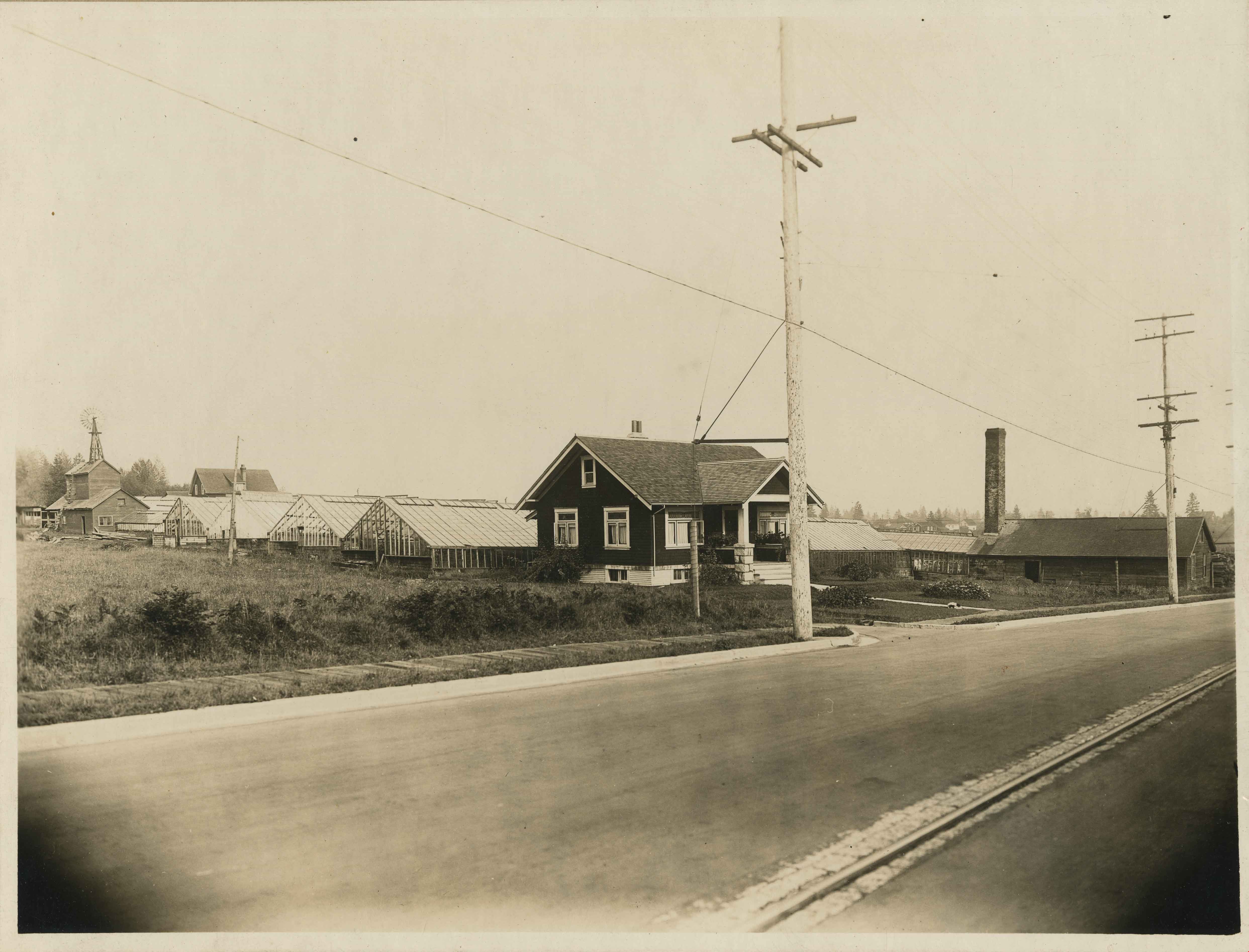
- Photograph of Davies & Sons nursery, 1349 Kingsway (later renumbered 7670 Kingsway), below Edmonds Street. Greenhouses, a board sidewalk, the road, and a windmill can be seen.
- Repository
- City of Burnaby Archives
- Date
- 1914
- Collection/Fonds
- Burnaby Historical Society fonds
- Subseries
- Photographs subseries
- Physical Description
- 1 photograph : b&w ; 16.0 x 21.1 cm mounted on 19.1x 24.3 cm cardboard
- Description Level
- Item
- Record No.
- 044-005
- Access Restriction
- No restrictions
- Reproduction Restriction
- No known restrictions
- Accession Number
- BHS2007-04
- Scope and Content
- Photograph of Davies & Sons nursery, 1349 Kingsway (later renumbered 7670 Kingsway), below Edmonds Street. Greenhouses, a board sidewalk, the road, and a windmill can be seen.
- Subjects
- Buildings - Agricultural - Nurseries
- Names
- Davies and Sons Nursery
- Media Type
- Photograph
- Notes
- Title based on contents of photograph
- Geographic Access
- Kingsway
- Street Address
- 7670 Kingsway
- Historic Neighbourhood
- Edmonds (Historic Neighbourhood)
- Planning Study Area
- Edmonds Area
Images
![Hill farm, [1915] thumbnail](/media/hpo/_Data/_Archives_Images/_Unrestricted/477/477-653.jpg?width=280)
Hill farm
https://search.heritageburnaby.ca/link/archivedescription39334
- Repository
- City of Burnaby Archives
- Date
- [1915]
- Collection/Fonds
- Peers Family and Hill Family fonds
- Description Level
- Item
- Physical Description
- 2 photographs : b&w ; 5 x 10.5 cm on page 24.5 x 32.5 cm (pasted in album and joined to form one panorama)
- Scope and Content
- Photograph of the Hill family farm near Deer Lake. The panorama shows the buildings and fields and off to the right can be seen the Pole Line Road (Sperling Avenue).
- Repository
- City of Burnaby Archives
- Date
- [1915]
- Collection/Fonds
- Peers Family and Hill Family fonds
- Physical Description
- 2 photographs : b&w ; 5 x 10.5 cm on page 24.5 x 32.5 cm (pasted in album and joined to form one panorama)
- Description Level
- Item
- Record No.
- 477-653
- Access Restriction
- No restrictions
- Reproduction Restriction
- No known restrictions
- Accession Number
- 2007-12
- Scope and Content
- Photograph of the Hill family farm near Deer Lake. The panorama shows the buildings and fields and off to the right can be seen the Pole Line Road (Sperling Avenue).
- Media Type
- Photograph
- Notes
- Title based on contents of photograph
- Geographic Access
- Sperling Avenue
- Historic Neighbourhood
- Burnaby Lake (Historic Neighbourhood)
- Planning Study Area
- Morley-Buckingham Area
Images
![Hill farm, [1915] thumbnail](/media/hpo/_Data/_Archives_Images/_Unrestricted/477/477-653.jpg)
Davies and Sons Nursery
https://search.heritageburnaby.ca/link/archivedescription35872
- Repository
- City of Burnaby Archives
- Date
- 1919 (date of original), copied 1986
- Collection/Fonds
- Burnaby Historical Society fonds
- Description Level
- Item
- Physical Description
- 1 photograph : b&w ; 12.7 x 17.8 cm print
- Scope and Content
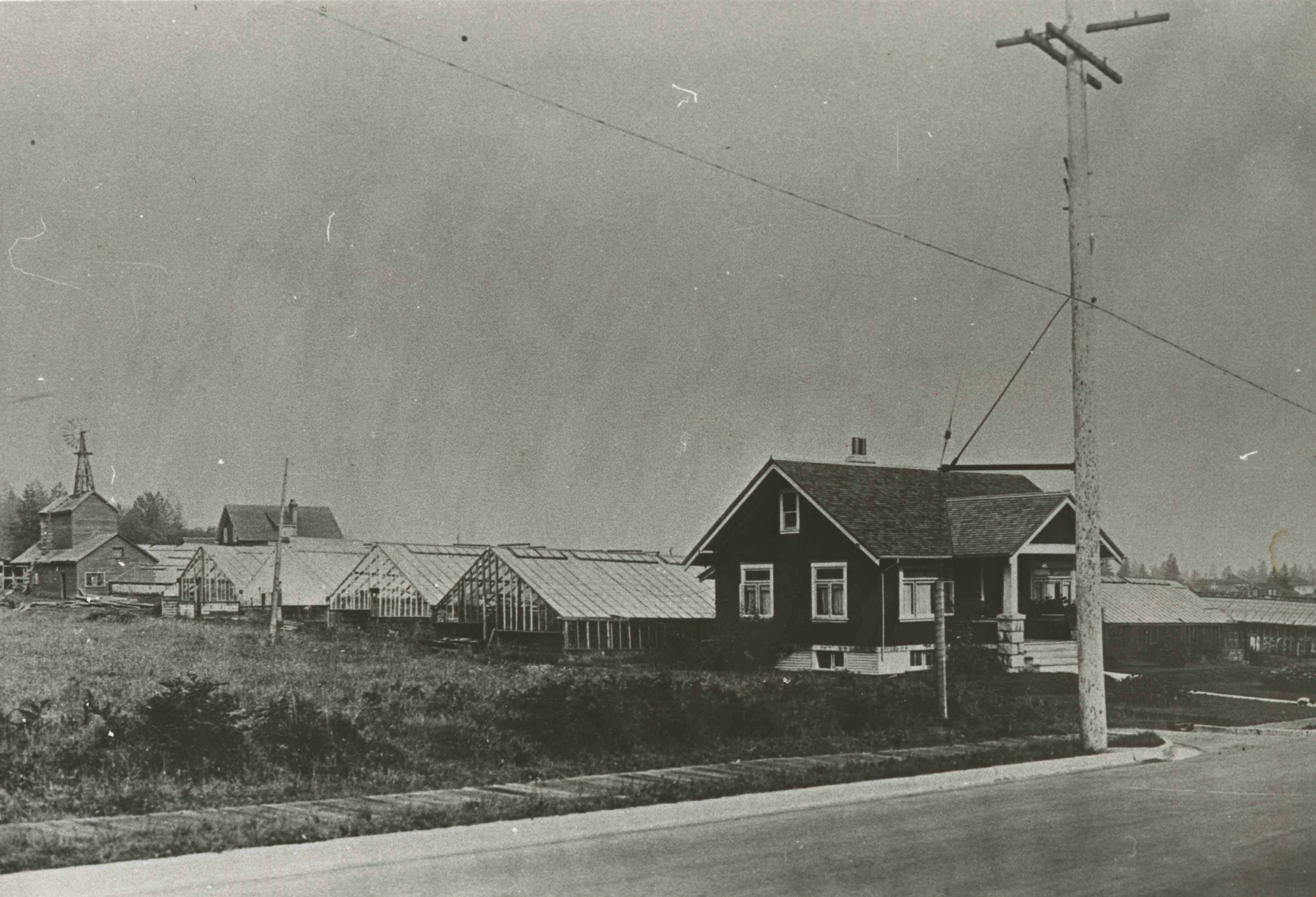
- Photograph of Davies & Sons nursery, 1349 Kingsway (later renumbered 7670 Kingsway).
- Repository
- City of Burnaby Archives
- Date
- 1919 (date of original), copied 1986
- Collection/Fonds
- Burnaby Historical Society fonds
- Subseries
- Pioneer Tales subseries
- Physical Description
- 1 photograph : b&w ; 12.7 x 17.8 cm print
- Description Level
- Item
- Record No.
- 204-731
- Access Restriction
- No restrictions
- Reproduction Restriction
- No known restrictions
- Accession Number
- BHS1988-03
- Scope and Content
- Photograph of Davies & Sons nursery, 1349 Kingsway (later renumbered 7670 Kingsway).
- Names
- Davies and Sons Nursery
- Media Type
- Photograph
- Notes
- Title based on contents of photograph
- Geographic Access
- Kingsway
- Street Address
- 7670 Kingsway
- Historic Neighbourhood
- Edmonds (Historic Neighbourhood)
- Planning Study Area
- Edmonds Area
Images
![Elgin Avenue farmhouse, [between 1920 and 1925] (date of original), copied 1986 thumbnail](/media/hpo/_Data/_Archives_Images/_Unrestricted/126/179-005.jpg?width=280)
Elgin Avenue farmhouse
https://search.heritageburnaby.ca/link/archivedescription35034
- Repository
- City of Burnaby Archives
- Date
- [between 1920 and 1925] (date of original), copied 1986
- Collection/Fonds
- Burnaby Historical Society fonds
- Description Level
- Item
- Physical Description
- 1 photograph : b&w ; 8.7 x 12.7 cm print
- Scope and Content
- Photograph of the exterior of an Elgin Avenue farmhouse and surrounding property. The farmhouse is at the left side of the photograph, and a chicken barn is at the right side. This may be 6389 Elgin Avenue.
- Repository
- City of Burnaby Archives
- Date
- [between 1920 and 1925] (date of original), copied 1986
- Collection/Fonds
- Burnaby Historical Society fonds
- Subseries
- Chamberlain family subseries
- Physical Description
- 1 photograph : b&w ; 8.7 x 12.7 cm print
- Description Level
- Item
- Record No.
- 179-005
- Access Restriction
- No restrictions
- Reproduction Restriction
- No known restrictions
- Accession Number
- BHS1986-27
- Scope and Content
- Photograph of the exterior of an Elgin Avenue farmhouse and surrounding property. The farmhouse is at the left side of the photograph, and a chicken barn is at the right side. This may be 6389 Elgin Avenue.
- Media Type
- Photograph
- Notes
- Title based on contents of photograph
- Geographic Access
- Elgin Avenue
- Street Address
- 6389 Elgin Avenue
- Historic Neighbourhood
- Central Park (Historic Neighbourhood)
- Planning Study Area
- Windsor Area
Images
![Elgin Avenue farmhouse, [between 1920 and 1925] (date of original), copied 1986 thumbnail](/media/hpo/_Data/_Archives_Images/_Unrestricted/126/179-005.jpg)
![Chamberlain Chicken Coop, [ca. 1920] (date of original), copied 1986 thumbnail](/media/hpo/_Data/_Archives_Images/_Unrestricted/126/179-006.jpg?width=280)
Chamberlain Chicken Coop
https://search.heritageburnaby.ca/link/archivedescription35035
- Repository
- City of Burnaby Archives
- Date
- [ca. 1920] (date of original), copied 1986
- Collection/Fonds
- Burnaby Historical Society fonds
- Description Level
- Item
- Physical Description
- 1 photograph : b&w ; 8.8 x 12.6 cm print
- Scope and Content
- Photograph of the exterior of the Chamberlain family chicken coop. The coop was originally a house. A man and three cows are seen outside it. This may be 6389 Elgin Avenue.
- Repository
- City of Burnaby Archives
- Date
- [ca. 1920] (date of original), copied 1986
- Collection/Fonds
- Burnaby Historical Society fonds
- Subseries
- Chamberlain family subseries
- Physical Description
- 1 photograph : b&w ; 8.8 x 12.6 cm print
- Description Level
- Item
- Record No.
- 179-006
- Access Restriction
- No restrictions
- Reproduction Restriction
- No known restrictions
- Accession Number
- BHS1986-27
- Scope and Content
- Photograph of the exterior of the Chamberlain family chicken coop. The coop was originally a house. A man and three cows are seen outside it. This may be 6389 Elgin Avenue.
- Subjects
- Animals - Cows
- Buildings - Agricultural
- Media Type
- Photograph
- Notes
- Title based on contents of photograph
- Street Address
- 6389 Elgin Avenue
- Historic Neighbourhood
- Central Park (Historic Neighbourhood)
- Planning Study Area
- Windsor Area
Images
![Chamberlain Chicken Coop, [ca. 1920] (date of original), copied 1986 thumbnail](/media/hpo/_Data/_Archives_Images/_Unrestricted/126/179-006.jpg)

Farrington Chicken Ranch
https://search.heritageburnaby.ca/link/archivedescription35226
- Repository
- City of Burnaby Archives
- Date
- 1920 (date of original), copied 1986
- Collection/Fonds
- Burnaby Historical Society fonds
- Description Level
- Item
- Physical Description
- 1 photograph : b&w ; 12.7 x 17.8 cm print
- Scope and Content
- Photograph of the Farrington brothers' chicken ranch near Central Park at 3907 Chesham Avenue (later renumbered 5384 Chesham Avenue). Brothers Thomas Farrington and Richard Farrington founded Wheat Sheaf Poultry Ranch in 1919. The laying house is at the left, and the family home is at the right.
- Repository
- City of Burnaby Archives
- Date
- 1920 (date of original), copied 1986
- Collection/Fonds
- Burnaby Historical Society fonds
- Subseries
- Pioneer Tales subseries
- Physical Description
- 1 photograph : b&w ; 12.7 x 17.8 cm print
- Description Level
- Item
- Record No.
- 204-083
- Access Restriction
- No restrictions
- Reproduction Restriction
- No known restrictions
- Accession Number
- BHS1988-03
- Scope and Content
- Photograph of the Farrington brothers' chicken ranch near Central Park at 3907 Chesham Avenue (later renumbered 5384 Chesham Avenue). Brothers Thomas Farrington and Richard Farrington founded Wheat Sheaf Poultry Ranch in 1919. The laying house is at the left, and the family home is at the right.
- Subjects
- Buildings - Agricultural
- Animals - Poultry
- Agriculture - Poultry
- Buildings - Residential - Houses
- Media Type
- Photograph
- Notes
- Title based on contents of photograph
- Geographic Access
- Chesham Avenue
- Street Address
- 5384 Chesham Avenue
- Historic Neighbourhood
- Central Park (Historic Neighbourhood)
- Planning Study Area
- Garden Village Area
Images


Farrington Laying House
https://search.heritageburnaby.ca/link/archivedescription35227
- Repository
- City of Burnaby Archives
- Date
- 1920 (date of original), copied 1986
- Collection/Fonds
- Burnaby Historical Society fonds
- Description Level
- Item
- Physical Description
- 1 photograph : b&w ; 12.7 x 17.8 cm print
- Scope and Content
- Photograph of Farrington brothers' chicken laying house. Brothers Thomas Farrington and Richard Farrington founded Wheat Sheaf Poultry Ranch in 1919. It was located at 3907 Chesham Avenue (later renumbered 5384 Chesham Avenue).
- Repository
- City of Burnaby Archives
- Date
- 1920 (date of original), copied 1986
- Collection/Fonds
- Burnaby Historical Society fonds
- Subseries
- Pioneer Tales subseries
- Physical Description
- 1 photograph : b&w ; 12.7 x 17.8 cm print
- Description Level
- Item
- Record No.
- 204-084
- Access Restriction
- No restrictions
- Reproduction Restriction
- No known restrictions
- Accession Number
- BHS1988-03
- Scope and Content
- Photograph of Farrington brothers' chicken laying house. Brothers Thomas Farrington and Richard Farrington founded Wheat Sheaf Poultry Ranch in 1919. It was located at 3907 Chesham Avenue (later renumbered 5384 Chesham Avenue).
- Media Type
- Photograph
- Notes
- Title based on contents of photograph
- Geographic Access
- Chesham Avenue
- Street Address
- 5384 Chesham Avenue
- Historic Neighbourhood
- Central Park (Historic Neighbourhood)
- Planning Study Area
- Garden Village Area
Images

![Thrussell barn construction, [1920] thumbnail](/media/hpo/_Data/_Archives_Images/_Unrestricted/251/275-011.jpg?width=280)
Thrussell barn construction
https://search.heritageburnaby.ca/link/archivedescription36479
- Repository
- City of Burnaby Archives
- Date
- [1920]
- Collection/Fonds
- Burnaby Historical Society fonds
- Description Level
- Item
- Physical Description
- 1 photograph : b&w ; 8.5 x 12.5 cm print
- Scope and Content
- Photograph of the construction of the new barn at the Thrussell farm.
- Repository
- City of Burnaby Archives
- Date
- [1920]
- Collection/Fonds
- Burnaby Historical Society fonds
- Subseries
- Thrussell family subseries
- Physical Description
- 1 photograph : b&w ; 8.5 x 12.5 cm print
- Description Level
- Item
- Record No.
- 275-011
- Access Restriction
- No restrictions
- Reproduction Restriction
- No known restrictions
- Accession Number
- BHS1992-05
- Scope and Content
- Photograph of the construction of the new barn at the Thrussell farm.
- Media Type
- Photograph
- Notes
- Title based on contents of photograph
- Geographic Access
- Marine Drive
- Nelson Avenue
- Historic Neighbourhood
- Fraser Arm (Historic Neighbourhood)
- Planning Study Area
- Big Bend Area
Images
![Thrussell barn construction, [1920] thumbnail](/media/hpo/_Data/_Archives_Images/_Unrestricted/251/275-011.jpg)
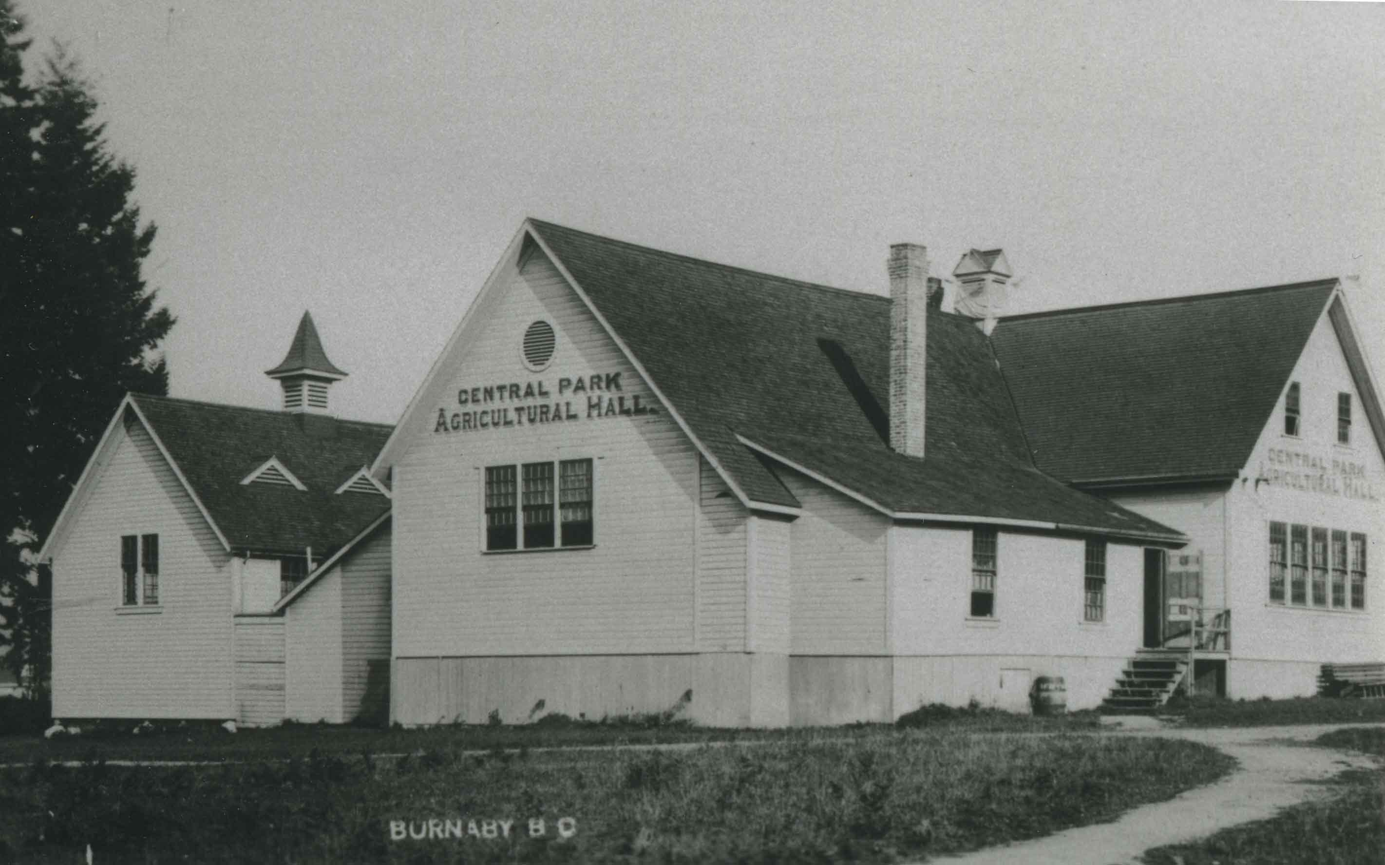
Central Park Agricultural Hall
https://search.heritageburnaby.ca/link/archivedescription36671
- Repository
- City of Burnaby Archives
- Date
- 1920 (date of original), copied 1992
- Collection/Fonds
- Burnaby Historical Society fonds
- Description Level
- Item
- Physical Description
- 1 photograph : b&w ; 10.1 x 14.9 cm print
- Scope and Content
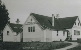
- Photograph of the Central Park Agricultural Hall which was built on the triangular part of the park at Kingsway near Patterson.
- Repository
- City of Burnaby Archives
- Date
- 1920 (date of original), copied 1992
- Collection/Fonds
- Burnaby Historical Society fonds
- Subseries
- Burnaby Centennial Anthology subseries
- Physical Description
- 1 photograph : b&w ; 10.1 x 14.9 cm print
- Description Level
- Item
- Record No.
- 315-026
- Access Restriction
- No restrictions
- Reproduction Restriction
- No known restrictions
- Accession Number
- BHS1994-04
- Scope and Content
- Photograph of the Central Park Agricultural Hall which was built on the triangular part of the park at Kingsway near Patterson.
- Subjects
- Buildings - Agricultural
- Media Type
- Photograph
- Notes
- Title based on contents of photograph
- Copy taken from original b&w photographic postcard
- Geographic Access
- Central Park
- Imperial Street
- Street Address
- 3883 Imperial Street
- Historic Neighbourhood
- Central Park (Historic Neighbourhood)
- Planning Study Area
- Maywood Area
Images
![Nicholson farm, [1921] thumbnail](/media/hpo/_Data/_Archives_Images/_Unrestricted/371/375-003.jpg?width=280)
Nicholson farm
https://search.heritageburnaby.ca/link/archivedescription38242
- Repository
- City of Burnaby Archives
- Date
- [1921]
- Collection/Fonds
- Burnaby Historical Society fonds
- Description Level
- Item
- Physical Description
- 1 photograph : b&w ; 9 x 12.5 cm
- Scope and Content
- Photograph of four men standing alongside a team of horses working in the field at the farm belonging to E.W. Nicholson. The house and barns can be seen in the background.
- Repository
- City of Burnaby Archives
- Date
- [1921]
- Collection/Fonds
- Burnaby Historical Society fonds
- Subseries
- Margaret McCallum subseries
- Physical Description
- 1 photograph : b&w ; 9 x 12.5 cm
- Description Level
- Item
- Record No.
- 375-003
- Access Restriction
- No restrictions
- Reproduction Restriction
- No known restrictions
- Accession Number
- BHS1986-42
- Scope and Content
- Photograph of four men standing alongside a team of horses working in the field at the farm belonging to E.W. Nicholson. The house and barns can be seen in the background.
- Media Type
- Photograph
- Notes
- Title based on contents of photograph
- Geographic Access
- Boundary Road
- Street Address
- 2550 Boundary Road
- Historic Neighbourhood
- Broadview (Historic Neighbourhood)
- Planning Study Area
- West Central Valley Area
Images
![Nicholson farm, [1921] thumbnail](/media/hpo/_Data/_Archives_Images/_Unrestricted/371/375-003.jpg)

Olive Farrington Barber
https://search.heritageburnaby.ca/link/archivedescription35225
- Repository
- City of Burnaby Archives
- Date
- 1928 (date of original), copied 1986
- Collection/Fonds
- Burnaby Historical Society fonds
- Description Level
- Item
- Physical Description
- 1 photograph : b&w ; 12.7 x 17.8 cm print
- Scope and Content
- Photograph of Olive Farrington Barber in front of the Farrington brothers' chicken shed. Brothers Thomas Farrington and Richard Farrington founded Wheat Sheaf Poultry Ranch in 1919. It was located at 3907 Chesham Avenue (later renumbered 5384 Chesham Avenue).
- Repository
- City of Burnaby Archives
- Date
- 1928 (date of original), copied 1986
- Collection/Fonds
- Burnaby Historical Society fonds
- Subseries
- Pioneer Tales subseries
- Physical Description
- 1 photograph : b&w ; 12.7 x 17.8 cm print
- Description Level
- Item
- Record No.
- 204-082
- Access Restriction
- No restrictions
- Reproduction Restriction
- No known restrictions
- Accession Number
- BHS1988-03
- Scope and Content
- Photograph of Olive Farrington Barber in front of the Farrington brothers' chicken shed. Brothers Thomas Farrington and Richard Farrington founded Wheat Sheaf Poultry Ranch in 1919. It was located at 3907 Chesham Avenue (later renumbered 5384 Chesham Avenue).
- Media Type
- Photograph
- Notes
- Title based on contents of photograph
- Geographic Access
- Chesham Avenue
- Street Address
- 5384 Chesham Avenue
- Historic Neighbourhood
- Central Park (Historic Neighbourhood)
- Planning Study Area
- Garden Village Area
Images

![Grandpa Kneale and Bob Haddon, [193-] (date of original), copied 1992 thumbnail](/media/hpo/_Data/_Archives_Images/_Unrestricted/315/315-401.jpg?width=280)
Grandpa Kneale and Bob Haddon
https://search.heritageburnaby.ca/link/archivedescription36943
- Repository
- City of Burnaby Archives
- Date
- [193-] (date of original), copied 1992
- Collection/Fonds
- Burnaby Historical Society fonds
- Description Level
- Item
- Physical Description
- 1 photograph : b&w ; 8.9 x 10.8 cm print
- Scope and Content
- Photograph of Grandpa Kneale and his grandson, Bob Haddon, beside a rowboat. They are outside the barn at the Kneale family home, 6726 Broadway (at Sperling).
- Repository
- City of Burnaby Archives
- Date
- [193-] (date of original), copied 1992
- Collection/Fonds
- Burnaby Historical Society fonds
- Subseries
- Burnaby Centennial Anthology subseries
- Physical Description
- 1 photograph : b&w ; 8.9 x 10.8 cm print
- Description Level
- Item
- Record No.
- 315-401
- Access Restriction
- No restrictions
- Reproduction Restriction
- No known restrictions
- Accession Number
- BHS1994-04
- Scope and Content
- Photograph of Grandpa Kneale and his grandson, Bob Haddon, beside a rowboat. They are outside the barn at the Kneale family home, 6726 Broadway (at Sperling).
- Names
- Haddon, Bob
- Kneale, Grandpa
- Media Type
- Photograph
- Notes
- Title based on contents of photograph
- Geographic Access
- Broadway
- Street Address
- 6726 Broadway
- Historic Neighbourhood
- Lochdale (Historic Neighbourhood)
- Planning Study Area
- Sperling-Broadway Area
Images
![Grandpa Kneale and Bob Haddon, [193-] (date of original), copied 1992 thumbnail](/media/hpo/_Data/_Archives_Images/_Unrestricted/315/315-401.jpg)
![Dog at Sperling and Broadway, [193-?] (date of original), copied 1992 thumbnail](/media/hpo/_Data/_Archives_Images/_Unrestricted/315/315-403.jpg?width=280)
Dog at Sperling and Broadway
https://search.heritageburnaby.ca/link/archivedescription36945
- Repository
- City of Burnaby Archives
- Date
- [193-?] (date of original), copied 1992
- Collection/Fonds
- Burnaby Historical Society fonds
- Description Level
- Item
- Physical Description
- 1 photograph : b&w ; 8.8 x 12.6 cm print
- Scope and Content
- Photograph of a dog in the yard between the Kneale family home and barn at 6726 Broadway (at Sperling).
- Repository
- City of Burnaby Archives
- Date
- [193-?] (date of original), copied 1992
- Collection/Fonds
- Burnaby Historical Society fonds
- Subseries
- Burnaby Centennial Anthology subseries
- Physical Description
- 1 photograph : b&w ; 8.8 x 12.6 cm print
- Description Level
- Item
- Record No.
- 315-403
- Access Restriction
- No restrictions
- Reproduction Restriction
- No known restrictions
- Accession Number
- BHS1994-04
- Scope and Content
- Photograph of a dog in the yard between the Kneale family home and barn at 6726 Broadway (at Sperling).
- Media Type
- Photograph
- Notes
- Title based on contents of photograph
- Geographic Access
- Broadway
- Street Address
- 6726 Broadway
- Historic Neighbourhood
- Lochdale (Historic Neighbourhood)
- Planning Study Area
- Sperling-Broadway Area
Images
![Dog at Sperling and Broadway, [193-?] (date of original), copied 1992 thumbnail](/media/hpo/_Data/_Archives_Images/_Unrestricted/315/315-403.jpg)

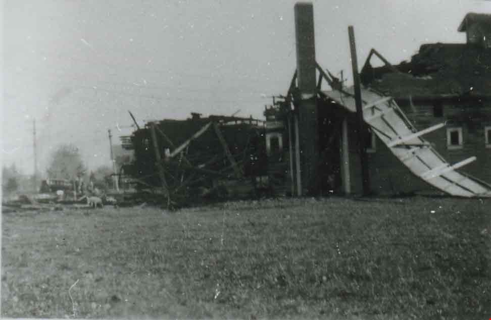
Hatchery
https://search.heritageburnaby.ca/link/archivedescription37458
- Repository
- City of Burnaby Archives
- Date
- 1931 (date of original), copied 1991
- Collection/Fonds
- Burnaby Historical Society fonds
- Description Level
- Item
- Physical Description
- 1 photograph : b&w ; 2.2 x 4.1 cm print on contact sheet 20.2 x 25.3 cm
- Scope and Content
- Photograph of the aftermath of a hatchery fire at Royal Oak, west of Kingsway.
- Repository
- City of Burnaby Archives
- Date
- 1931 (date of original), copied 1991
- Collection/Fonds
- Burnaby Historical Society fonds
- Subseries
- Burnaby Image Bank subseries
- Physical Description
- 1 photograph : b&w ; 2.2 x 4.1 cm print on contact sheet 20.2 x 25.3 cm
- Description Level
- Item
- Record No.
- 370-046
- Access Restriction
- No restrictions
- Reproduction Restriction
- No known restrictions
- Accession Number
- BHS1999-03
- Scope and Content
- Photograph of the aftermath of a hatchery fire at Royal Oak, west of Kingsway.
- Subjects
- Buildings - Agricultural
- Media Type
- Photograph
- Photographer
- Bellinger, Bernard
- Notes
- Title based on contents of photograph
- 1 b&w copy negative accompanying
- Geographic Access
- Royal Oak Avenue
- Kingsway
- Historic Neighbourhood
- Central Park (Historic Neighbourhood)
- Planning Study Area
- Marlborough Area
Images

Broadway Jersey Ranch
https://search.heritageburnaby.ca/link/archivedescription38259
- Repository
- City of Burnaby Archives
- Date
- 1931
- Collection/Fonds
- Burnaby Historical Society fonds
- Description Level
- Item
- Physical Description
- 1 photograph : b&w ; 10.5 x 15.4 cm
- Scope and Content
- Photograph of a house and barn identified as E.W. Nicholson's "Broadway Jersey Ranch." Three men and a team of horses can be seen to the right of the house. The men may be E.W. Nicholoson, John McCallum and George Dell.
- Repository
- City of Burnaby Archives
- Date
- 1931
- Collection/Fonds
- Burnaby Historical Society fonds
- Subseries
- Margaret McCallum subseries
- Physical Description
- 1 photograph : b&w ; 10.5 x 15.4 cm
- Description Level
- Item
- Record No.
- 375-021
- Access Restriction
- No restrictions
- Reproduction Restriction
- No known restrictions
- Accession Number
- BHS1986-42
- Scope and Content
- Photograph of a house and barn identified as E.W. Nicholson's "Broadway Jersey Ranch." Three men and a team of horses can be seen to the right of the house. The men may be E.W. Nicholoson, John McCallum and George Dell.
- Media Type
- Photograph
- Notes
- Title based on caption
- Geographic Access
- Boundary Road
- Street Address
- 2550 Boundary Road
- Historic Neighbourhood
- Broadview (Historic Neighbourhood)
- Planning Study Area
- West Central Valley Area
Images
