Narrow Results By
Creator
- Albert F. Arnold 1
- Bartel, Mario 33
- Bellinger, Bernard 2
- Bowman & Cullerne 1
- British Columbia Underwriters' Association 3
- Burnett and McGugan B.C. Land Surveyors, New Westminster 1
- Burnett & McGugan, Engineers and Surveyors 1
- Cheung, Nakita 2
- Cook, Alan 5
- Digney, Andy 4
- Disney, John Harold "Jack" 4
- Flanagan, Colleen 1

Riverway School site
https://search.heritageburnaby.ca/link/museumdescription11134
- Repository
- Burnaby Village Museum
- Date
- April 16, 1915
- Collection/Fonds
- Ronald G. Scobbie collection
- Description Level
- Item
- Physical Description
- 1 survey plan : blueprint on paper ; 56 x 54 cm
- Scope and Content
- Survey plan of "Riverway School Site / Burnaby Municipality" "Being a 1 acre portion of Lot 159 Group 1, and Lots 30 & 31 of subd. of Bks. 1, 1a, 2, 3, 4 & 5 of Lot 159, Group 1, New Westminster District".
- Repository
- Burnaby Village Museum
- Collection/Fonds
- Ronald G. Scobbie collection
- Description Level
- Item
- Physical Description
- 1 survey plan : blueprint on paper ; 56 x 54 cm
- Material Details
- Scale 40 feet = 1 inch
- Scope and Content
- Survey plan of "Riverway School Site / Burnaby Municipality" "Being a 1 acre portion of Lot 159 Group 1, and Lots 30 & 31 of subd. of Bks. 1, 1a, 2, 3, 4 & 5 of Lot 159, Group 1, New Westminster District".
- Creator
- Geoffrey K. Burnett
- Subjects
- Buildings - Schools
- Names
- Riverway East School
- Responsibility
- Burnett and McGugan B.C. Land Surveyors, New Westminster
- Geographic Access
- Gilley Avenue
- Marine Drive
- Street Address
- 5787 Marine Drive
- Accession Code
- BV003.83.13
- Access Restriction
- No restrictions
- Reproduction Restriction
- No known restrictions
- Date
- April 16, 1915
- Media Type
- Cartographic Material
- Historic Neighbourhood
- Alta Vista (Historic Neighbourhood)
- Planning Study Area
- Clinton-Glenwood Area
- Scan Resolution
- 440
- Scan Date
- 22-Dec-2020
- Scale
- 100
- Notes
- Title based on contents of plan
- Note in black ink on verso of plan reads: "1744" / "Riverway School"
- Oath on plan reads: "I, Geoffrey K. Burnett...and did personally superintend the survey..." "...completed on the 16th day of April 1915"; signed by Geoffrey K. Burnett and notarized by "K.A. Eastman", sworn "...19th day of April 1915"
Zoomable Images


Nelson Avenue School site
https://search.heritageburnaby.ca/link/museumdescription11135
- Repository
- Burnaby Village Museum
- Date
- April 12, 1915
- Collection/Fonds
- Ronald G. Scobbie collection
- Description Level
- Item
- Physical Description
- 1 survey plan : blueprint on paper ; 56 x 54 cm
- Scope and Content
- Survey plan of "Nelson Avenue School Site / Burnaby Municipality" "Being the south half of Block 19, except therefrom the north 33 feet, of Lot 99, Gp. 1. New Westminster District".
- Repository
- Burnaby Village Museum
- Collection/Fonds
- Ronald G. Scobbie collection
- Description Level
- Item
- Physical Description
- 1 survey plan : blueprint on paper ; 56 x 54 cm
- Material Details
- Scale 40 feet = 1 inch
- Scope and Content
- Survey plan of "Nelson Avenue School Site / Burnaby Municipality" "Being the south half of Block 19, except therefrom the north 33 feet, of Lot 99, Gp. 1. New Westminster District".
- Creator
- McGugan, Donald Johnston
- Subjects
- Buildings - Schools
- Names
- Nelson Avenue School
- Responsibility
- Burnett & McGugan, Engineers and Surveyors
- Geographic Access
- Irmin Street
- Street Address
- 4850 Irmin Street
- Accession Code
- BV003.83.14
- Access Restriction
- No restrictions
- Reproduction Restriction
- No known restrictions
- Date
- April 12, 1915
- Media Type
- Cartographic Material
- Historic Neighbourhood
- Alta Vista (Historic Neighbourhood)
- Planning Study Area
- Sussex-Nelson Area
- Scan Resolution
- 440
- Scan Date
- 22-Dec-2020
- Scale
- 100
- Notes
- Title based on contents of plan
- Note in black ink on verso of plan reads: "1745"
- Oath on plan reads: "I, D.G. McGugan..." "...and did person- ally superintend the survey..." "...completed on the 5th day of March 1915"; signed by D.J. McGugan, notarized by "R.E. Chapman", sworn "...12th day of April 1915" "Burnett and McGugan" "B.C. Land Surveyors Etc. New Westminster, B.C.."
Images

![Gough family, [1916] (date of original), copied 1986 thumbnail](/media/hpo/_Data/_Archives_Images/_Unrestricted/204/204-017.jpg?width=280)
Gough family
https://search.heritageburnaby.ca/link/archivedescription35160
- Repository
- City of Burnaby Archives
- Date
- [1916] (date of original), copied 1986
- Collection/Fonds
- Burnaby Historical Society fonds
- Description Level
- Item
- Physical Description
- 1 photograph : b&w ; 12.7 x 17.8 cm print
- Scope and Content
- Photograph of the Gough family children in front of their Nelson Avenue home. Left to right: Dorothy Gough Love, Phyllis Gough and Donald Gough. The address on Nelson Avenue was later changed from 2119 to 7126.
- Repository
- City of Burnaby Archives
- Date
- [1916] (date of original), copied 1986
- Collection/Fonds
- Burnaby Historical Society fonds
- Subseries
- Pioneer Tales subseries
- Physical Description
- 1 photograph : b&w ; 12.7 x 17.8 cm print
- Description Level
- Item
- Record No.
- 204-017
- Access Restriction
- No restrictions
- Reproduction Restriction
- No known restrictions
- Accession Number
- BHS1988-03
- Scope and Content
- Photograph of the Gough family children in front of their Nelson Avenue home. Left to right: Dorothy Gough Love, Phyllis Gough and Donald Gough. The address on Nelson Avenue was later changed from 2119 to 7126.
- Media Type
- Photograph
- Notes
- Title based on contents of photograph
- Geographic Access
- Nelson Avenue
- Street Address
- 7126 Nelson Avenue
- Historic Neighbourhood
- Alta-Vista (Historic Neighbourhood)
- Planning Study Area
- Sussex-Nelson Area
Images
![Gough family, [1916] (date of original), copied 1986 thumbnail](/media/hpo/_Data/_Archives_Images/_Unrestricted/204/204-017.jpg)
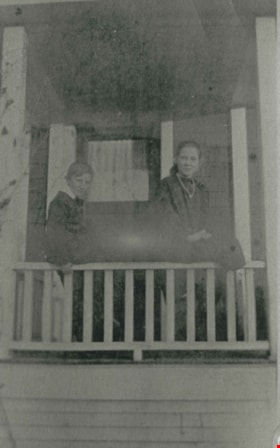
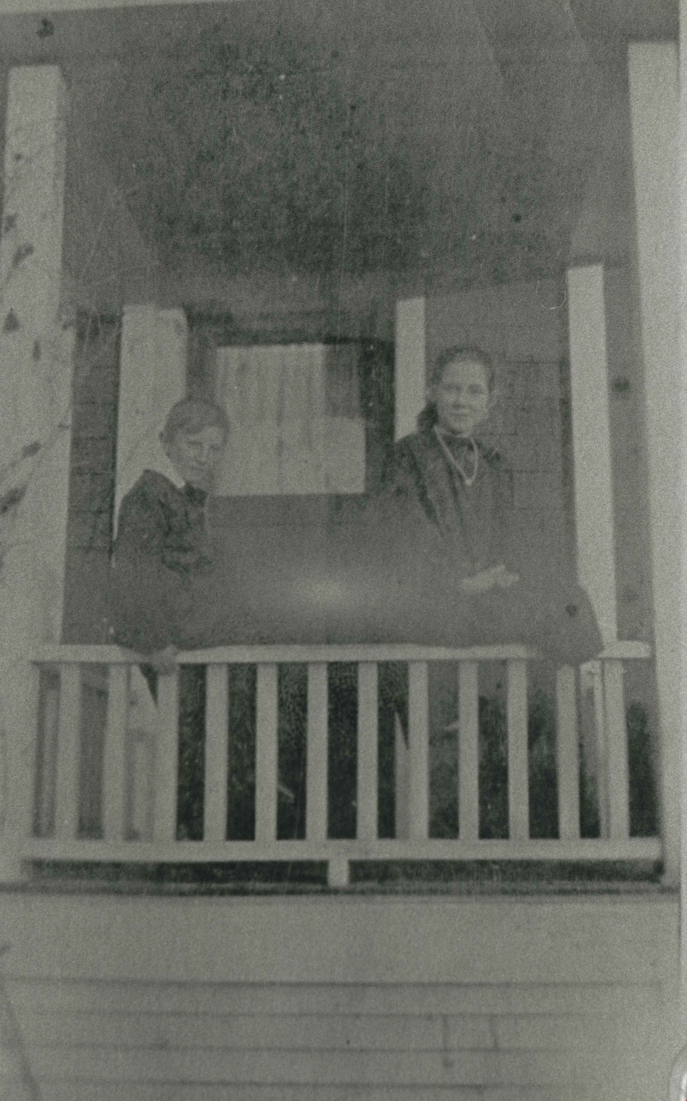
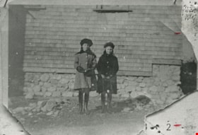
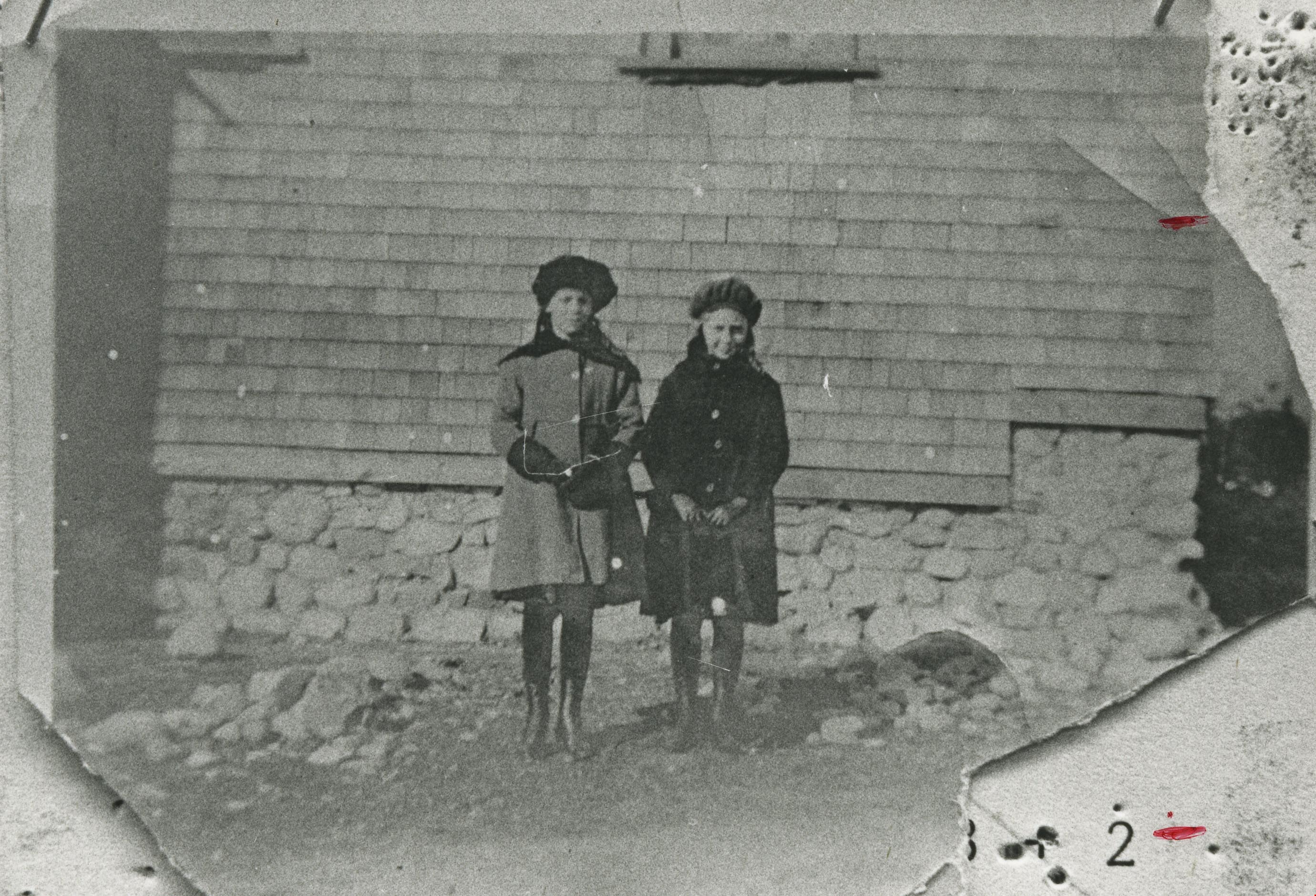
Gough children
https://search.heritageburnaby.ca/link/archivedescription35489
- Repository
- City of Burnaby Archives
- Date
- 1916 (date of original), copied 1986
- Collection/Fonds
- Burnaby Historical Society fonds
- Description Level
- Item
- Physical Description
- 1 photograph : b&w ; 12.7 x 17.8 cm print
- Scope and Content
- Photograph of (left) Leslie Gough and (right) Phyllis Gough, children of William and Agnes Gough, on the porch of of 2119 Nelson Avenue (later 7126 Nelson Avenue).
- Repository
- City of Burnaby Archives
- Date
- 1916 (date of original), copied 1986
- Collection/Fonds
- Burnaby Historical Society fonds
- Subseries
- Pioneer Tales subseries
- Physical Description
- 1 photograph : b&w ; 12.7 x 17.8 cm print
- Description Level
- Item
- Record No.
- 204-347
- Access Restriction
- No restrictions
- Reproduction Restriction
- No known restrictions
- Accession Number
- BHS1988-03
- Scope and Content
- Photograph of (left) Leslie Gough and (right) Phyllis Gough, children of William and Agnes Gough, on the porch of of 2119 Nelson Avenue (later 7126 Nelson Avenue).
- Names
- Gough, Leslie
- Gough, Phyllis
- Media Type
- Photograph
- Notes
- Title based on contents of photograph
- Geographic Access
- Nelson Avenue
- Street Address
- 7126 Nelson Avenue
- Historic Neighbourhood
- Alta-Vista (Historic Neighbourhood)
- Planning Study Area
- Sussex-Nelson Area
Images
![Riverway East School, [1916] thumbnail](/media/hpo/_Data/_Archives_Images/_Unrestricted/251/275-015.jpg?width=280)
Riverway East School
https://search.heritageburnaby.ca/link/archivedescription36483
- Repository
- City of Burnaby Archives
- Date
- [1916]
- Collection/Fonds
- Burnaby Historical Society fonds
- Description Level
- Item
- Physical Description
- 1 photograph : b&w ; 8.5 x 12.5 cm print
- Scope and Content
- Photograph of a Riverway East School class sitting and standing outside, in two rows, with their teacher standing behind them. Edith and Eva Thrussell are seated in the front row, sixth and seventh from the right, wearing matching dresses with large white collars.
- Repository
- City of Burnaby Archives
- Date
- [1916]
- Collection/Fonds
- Burnaby Historical Society fonds
- Subseries
- Thrussell family subseries
- Physical Description
- 1 photograph : b&w ; 8.5 x 12.5 cm print
- Description Level
- Item
- Record No.
- 275-015
- Access Restriction
- No restrictions
- Reproduction Restriction
- No known restrictions
- Accession Number
- BHS1992-05
- Scope and Content
- Photograph of a Riverway East School class sitting and standing outside, in two rows, with their teacher standing behind them. Edith and Eva Thrussell are seated in the front row, sixth and seventh from the right, wearing matching dresses with large white collars.
- Subjects
- Occupations - Teachers
- Media Type
- Photograph
- Notes
- Title based on contents of photograph
- Geographic Access
- Marine Drive
- Street Address
- 5787 Marine Drive
- Historic Neighbourhood
- Alta-Vista (Historic Neighbourhood)
- Planning Study Area
- Clinton-Glenwood Area
Images
![Riverway East School, [1916] thumbnail](/media/hpo/_Data/_Archives_Images/_Unrestricted/251/275-015.jpg)
![Burnaby's first lawn bowlers, [1916] thumbnail](/media/hpo/_Data/_BVM_Images/1974/197600710001.jpg?width=280)
Burnaby's first lawn bowlers
https://search.heritageburnaby.ca/link/museumdescription746
- Repository
- Burnaby Village Museum
- Date
- [1916]
- Collection/Fonds
- Burnaby Village Museum Photograph collection
- Description Level
- Item
- Physical Description
- 1 photograph : sepia ; 19 x 24 cm (sight), in mat 29 x 34 cm + 1 p.
- Scope and Content
- Photograph of lawn bowlers gathered together at the first bowling green in Burnaby, located at Victory Street and Gray Avenue (on Stan Wood's property). Standing in the back row (from left) are; M. Van George, Reverend A.C. Cameron, George Gascarth, Bennett, Oliver Goodacre and John Brown. Sitting …
- Repository
- Burnaby Village Museum
- Collection/Fonds
- Burnaby Village Museum Photograph collection
- Description Level
- Item
- Physical Description
- 1 photograph : sepia ; 19 x 24 cm (sight), in mat 29 x 34 cm + 1 p.
- Scope and Content
- Photograph of lawn bowlers gathered together at the first bowling green in Burnaby, located at Victory Street and Gray Avenue (on Stan Wood's property). Standing in the back row (from left) are; M. Van George, Reverend A.C. Cameron, George Gascarth, Bennett, Oliver Goodacre and John Brown. Sitting in the front row are; J.N. Durrell, Charles Mirren McInnes Harper, A.E.S. "Stan" Wood, William "Will" Taylor, and Edward Lumley Wriglesworth. Most of the men are wearing suit vests and pocket watches.
- Names
- Cameron, Reverend A.C.
- Gasgarth, George
- Goodacre, Oliver
- Brown, John
- Harper, Jack
- Wood, Anthony Ewart Stanley "Stan"
- Taylor, Will
- Harper, Charles Mirren McInnes
- Durrell, J.N.
- Wriglesworth, Edward Lumley
- Geographic Access
- Victory Street
- Gray Avenue
- Accession Code
- HV976.71.1
- Access Restriction
- No restrictions
- Reproduction Restriction
- No known restrictions
- Date
- [1916]
- Media Type
- Photograph
- Historic Neighbourhood
- Alta-Vista (Historic Neighbourhood)
- Planning Study Area
- Sussex-Nelson Area
- Scan Resolution
- 600
- Scan Date
- 1/6/2010
- Scale
- 100
- Photographer
- Rognon, Orville Jackson
- Notes
- Title based on contents of photograph
- Window mat and backing are glued together
- Photographer's writing on recto of photograph reads: "Photo by Rognon"
- 1 page accompanying identifies individuals
Images
![Burnaby's first lawn bowlers, [1916] thumbnail](/media/hpo/_Data/_BVM_Images/1974/197600710001.jpg)
Bezanson family home
https://search.heritageburnaby.ca/link/archivedescription35853
- Repository
- City of Burnaby Archives
- Date
- 1917 (date of original), copied 1986
- Collection/Fonds
- Burnaby Historical Society fonds
- Description Level
- Item
- Physical Description
- 1 photograph : b&w ; 12.7 x 17.8 cm print
- Scope and Content
- Photograph of the Bezanson family home (of Albert and Margaret Bezanson), 1407 Royal Oak Avenue and Portland Street (later renumbered 7883 Royal Oak Avenue). To the left is the Ericksons' family home; Mr. and Mrs. Erickson were Margaret Bezanson's parents. Note the gravelled Royal Oak Road.
- Repository
- City of Burnaby Archives
- Date
- 1917 (date of original), copied 1986
- Collection/Fonds
- Burnaby Historical Society fonds
- Subseries
- Pioneer Tales subseries
- Physical Description
- 1 photograph : b&w ; 12.7 x 17.8 cm print
- Description Level
- Item
- Record No.
- 204-712
- Access Restriction
- No restrictions
- Reproduction Restriction
- No known restrictions
- Accession Number
- BHS1988-03
- Scope and Content
- Photograph of the Bezanson family home (of Albert and Margaret Bezanson), 1407 Royal Oak Avenue and Portland Street (later renumbered 7883 Royal Oak Avenue). To the left is the Ericksons' family home; Mr. and Mrs. Erickson were Margaret Bezanson's parents. Note the gravelled Royal Oak Road.
- Subjects
- Buildings - Residential - Houses
- Media Type
- Photograph
- Notes
- Title based on contents of photograph
- Geographic Access
- Royal Oak Avenue
- Street Address
- 7883 Royal Oak Avenue
- Historic Neighbourhood
- Alta-Vista (Historic Neighbourhood)
- Planning Study Area
- Clinton-Glenwood Area
Images
![Lyle Le Grove and Fred Le Grove, [1918] (date of original), copied 1991 thumbnail](/media/hpo/_Data/_Archives_Images/_Unrestricted/370/370-673.jpg?width=280)
Lyle Le Grove and Fred Le Grove
https://search.heritageburnaby.ca/link/archivedescription38086
- Repository
- City of Burnaby Archives
- Date
- [1918] (date of original), copied 1991
- Collection/Fonds
- Burnaby Historical Society fonds
- Description Level
- Item
- Physical Description
- 1 photograph : b&w ; 3.4 x 3.4 cm print on contact sheet 21.5 x 26.8 cm
- Scope and Content
- Photograph of son and father, Lyle Le Grove and Fred Le Grove, standing at the back of 3250 Neville Street (later renumbered 5422 Neville Street).
- Repository
- City of Burnaby Archives
- Date
- [1918] (date of original), copied 1991
- Collection/Fonds
- Burnaby Historical Society fonds
- Subseries
- Burnaby Image Bank subseries
- Physical Description
- 1 photograph : b&w ; 3.4 x 3.4 cm print on contact sheet 21.5 x 26.8 cm
- Description Level
- Item
- Record No.
- 370-673
- Access Restriction
- No restrictions
- Reproduction Restriction
- No known restrictions
- Accession Number
- BHS1999-03
- Scope and Content
- Photograph of son and father, Lyle Le Grove and Fred Le Grove, standing at the back of 3250 Neville Street (later renumbered 5422 Neville Street).
- Media Type
- Photograph
- Notes
- Title based on contents of photograph
- 1 b&w copy negative accompanying
- Negative has a pink cast
- Geographic Access
- Neville Street
- Street Address
- 5422 Neville Street
- Historic Neighbourhood
- Alta-Vista (Historic Neighbourhood)
- Planning Study Area
- Clinton-Glenwood Area
Images
![Lyle Le Grove and Fred Le Grove, [1918] (date of original), copied 1991 thumbnail](/media/hpo/_Data/_Archives_Images/_Unrestricted/370/370-673.jpg)
![Lyle Le Grove and wagon, [1919] (date of original), copied 1991 thumbnail](/media/hpo/_Data/_Archives_Images/_Unrestricted/370/370-658.jpg?width=280)
Lyle Le Grove and wagon
https://search.heritageburnaby.ca/link/archivedescription38071
- Repository
- City of Burnaby Archives
- Date
- [1919] (date of original), copied 1991
- Collection/Fonds
- Burnaby Historical Society fonds
- Description Level
- Item
- Physical Description
- 1 photograph : b&w ; 4.6 x 3.6 cm print on contact sheet 20.2 x 26.2 cm
- Scope and Content
- Photograph of Lyle Le Grove kneeling on a wagon at the back of 3250 Neville Street (later renumbered 5422 Neville Street).
- Repository
- City of Burnaby Archives
- Date
- [1919] (date of original), copied 1991
- Collection/Fonds
- Burnaby Historical Society fonds
- Subseries
- Burnaby Image Bank subseries
- Physical Description
- 1 photograph : b&w ; 4.6 x 3.6 cm print on contact sheet 20.2 x 26.2 cm
- Description Level
- Item
- Record No.
- 370-658
- Access Restriction
- No restrictions
- Reproduction Restriction
- No known restrictions
- Accession Number
- BHS1999-03
- Scope and Content
- Photograph of Lyle Le Grove kneeling on a wagon at the back of 3250 Neville Street (later renumbered 5422 Neville Street).
- Subjects
- Toys
- Transportation - Wagons
- Media Type
- Photograph
- Notes
- Title based on contents of photograph
- 1 b&w copy negative accompanying
- Negative has a pink cast
- Geographic Access
- Neville Street
- Street Address
- 5422 Neville Street
- Historic Neighbourhood
- Alta-Vista (Historic Neighbourhood)
- Planning Study Area
- Clinton-Glenwood Area
Images
![Lyle Le Grove and wagon, [1919] (date of original), copied 1991 thumbnail](/media/hpo/_Data/_Archives_Images/_Unrestricted/370/370-658.jpg)

Ocean View Burial Park - Landscape
https://search.heritageburnaby.ca/link/landmark629
- Repository
- Burnaby Heritage Planning
- Description
- Cemetery site.
- Associated Dates
- 1919
- Street View URL
- Google Maps Street View
- Repository
- Burnaby Heritage Planning
- Geographic Access
- Imperial Street
- Associated Dates
- 1919
- Description
- Cemetery site.
- Heritage Value
- Burnaby’s landmark Ocean View Burial Park was British Columbia’s first non-sectarian cemetery created as a for-profit business enterprise. Organized by a group of local investors headed by Lieut. Col. G.H. Dorrell, the Ocean View Cemetery Company offered a place for burials that was not owned or associated with a civic government, religious or fraternal organization. The cemetery’s design was the vision of Albert F. Arnold, an officer of the Canadian Financiers Trust Company, who was “...always depressed by the lack of beauty in so many places of internment and inevitable neglect that finally reduced them to long-grassed places of unhappy memories.” One local newspaper described the landscape of the cemetery: "The design includes ornamental trees and shrubs, beautiful flower beds and smooth winding walks and drives, with a total absence of the usual somewhat ostentatious reminders of the harvest garnered by the grim reaper."
- Locality
- Alta Vista
- Historic Neighbourhood
- Alta Vista (Historic Neighbourhood)
- Planning Study Area
- Suncrest Area
- Architect
- Albert F. Arnold
- Area
- 359280.00
- Contributing Resource
- Landscape Feature
- Ownership
- Private
- Street Address
- 4000 Imperial Street
- Street View URL
- Google Maps Street View
Images


![Wray family, [1919] thumbnail](/media/hpo/_Data/_BVM_Images/1985/1985_0439_0002_001.jpg?width=280)
Wray family
https://search.heritageburnaby.ca/link/museumdescription215
- Repository
- Burnaby Village Museum
- Date
- [1919]
- Collection/Fonds
- Burnaby Village Museum Photograph collection
- Description Level
- Item
- Physical Description
- 1 photograph : sepia
- Scope and Content
- Photograph of the Wray family and friends on the verandah of their home at 2351 Dow Road (old street number), during the summer of 1919. The three depicted in the centre of the photograph are (l to r) a daughter of Mr and Mrs Wray, Mr. Edward Wray, and Mrs. Wray. On either side of them, there is a …
- Repository
- Burnaby Village Museum
- Collection/Fonds
- Burnaby Village Museum Photograph collection
- Description Level
- Item
- Physical Description
- 1 photograph : sepia
- Material Details
- inscribed in pencil, verso, t. "Mr + Mrs Wray + their daughter (middle/ three) on verandah of their home/ at 2351 Dow Rd.", l.l. "taken - summer of/ 1919"
- Scope and Content
- Photograph of the Wray family and friends on the verandah of their home at 2351 Dow Road (old street number), during the summer of 1919. The three depicted in the centre of the photograph are (l to r) a daughter of Mr and Mrs Wray, Mr. Edward Wray, and Mrs. Wray. On either side of them, there is a young woman, and a boy is sitting on the top of the stairs leading to the verandah. There is also a dog standing on the steps.
- Subjects
- Animals - Dogs
- Geographic Access
- Dow Avenue
- Street Address
- 6926 Dow Avenue
- Accession Code
- BV985.439.2
- Date
- [1919]
- Media Type
- Photograph
- Historic Neighbourhood
- Alta-Vista (Historic Neighbourhood)
- Planning Study Area
- Sussex-Nelson Area
- Scan Resolution
- 600
- Scan Date
- 16-Jan-24
- Scale
- 100
- Notes
- Title based on contents of photograph
Images
![Wray family, [1919] thumbnail](/media/hpo/_Data/_BVM_Images/1985/1985_0439_0002_001.jpg)
Doris Armitage and Phyllis Fisher
https://search.heritageburnaby.ca/link/archivedescription35473
- Repository
- City of Burnaby Archives
- Date
- 1920 (date of original), copied 1986
- Collection/Fonds
- Burnaby Historical Society fonds
- Description Level
- Item
- Physical Description
- 1 photograph : b&w ; 12.7 x 17.8 cm print
- Scope and Content
- Photograph of (left) Doris Armitage (later Doris Chadsey) and (right) Phyllis Fisher, in front of the Armitage family home, 4565 Portland Street, Alta Vista. Doris' father, Alfred Armitage, built the house himself. The foundation was built with boulders and rocks cleared from the property.
- Repository
- City of Burnaby Archives
- Date
- 1920 (date of original), copied 1986
- Collection/Fonds
- Burnaby Historical Society fonds
- Subseries
- Pioneer Tales subseries
- Physical Description
- 1 photograph : b&w ; 12.7 x 17.8 cm print
- Description Level
- Item
- Record No.
- 204-331
- Access Restriction
- No restrictions
- Reproduction Restriction
- No known restrictions
- Accession Number
- BHS1988-03
- Scope and Content
- Photograph of (left) Doris Armitage (later Doris Chadsey) and (right) Phyllis Fisher, in front of the Armitage family home, 4565 Portland Street, Alta Vista. Doris' father, Alfred Armitage, built the house himself. The foundation was built with boulders and rocks cleared from the property.
- Media Type
- Photograph
- Notes
- Title based on contents of photograph
- Geographic Access
- Portland Street
- Street Address
- 4565 Portland Street
- Historic Neighbourhood
- Alta-Vista (Historic Neighbourhood)
- Planning Study Area
- Clinton-Glenwood Area
Images
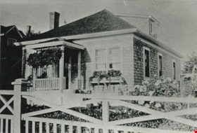
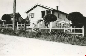
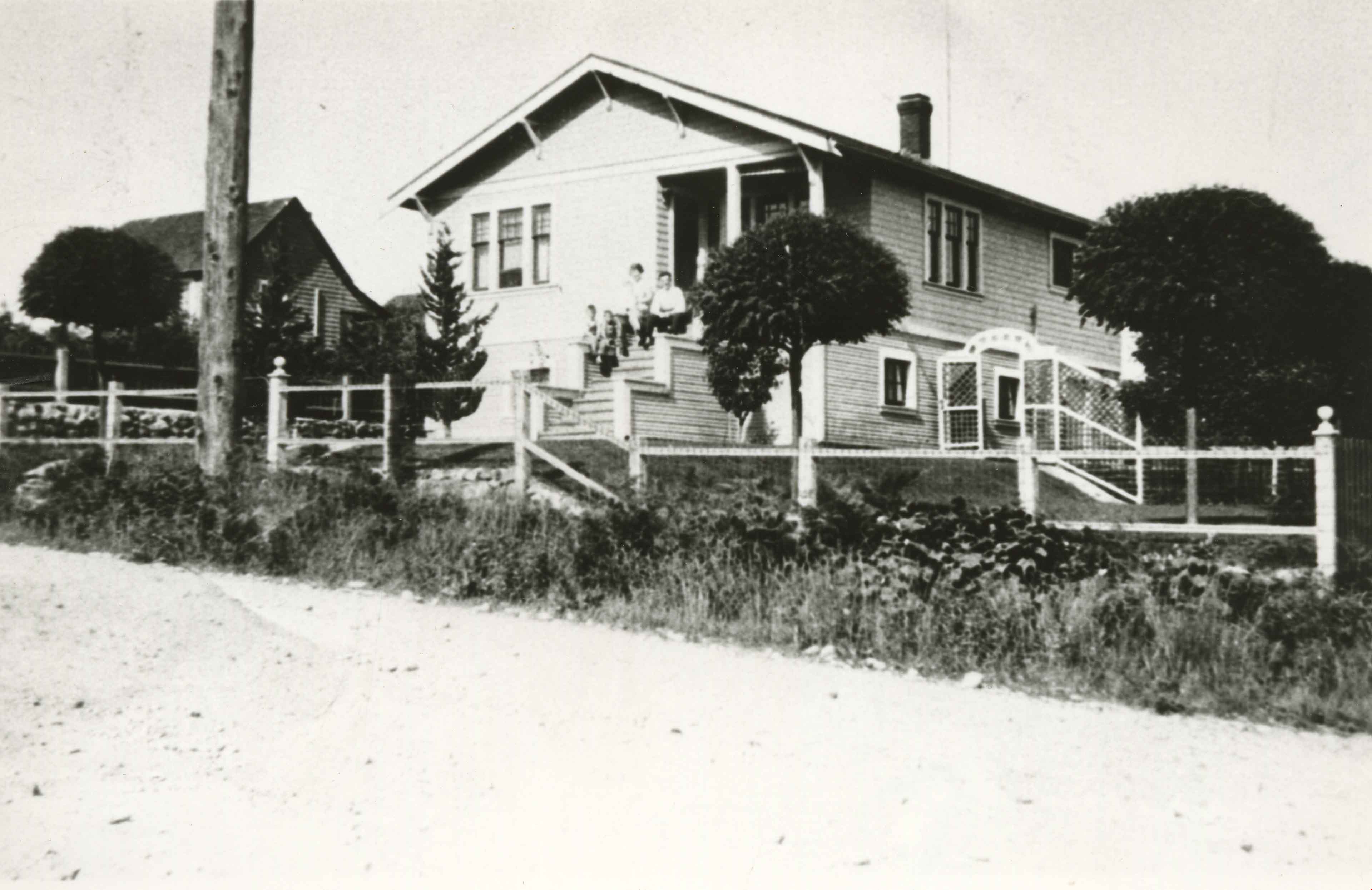
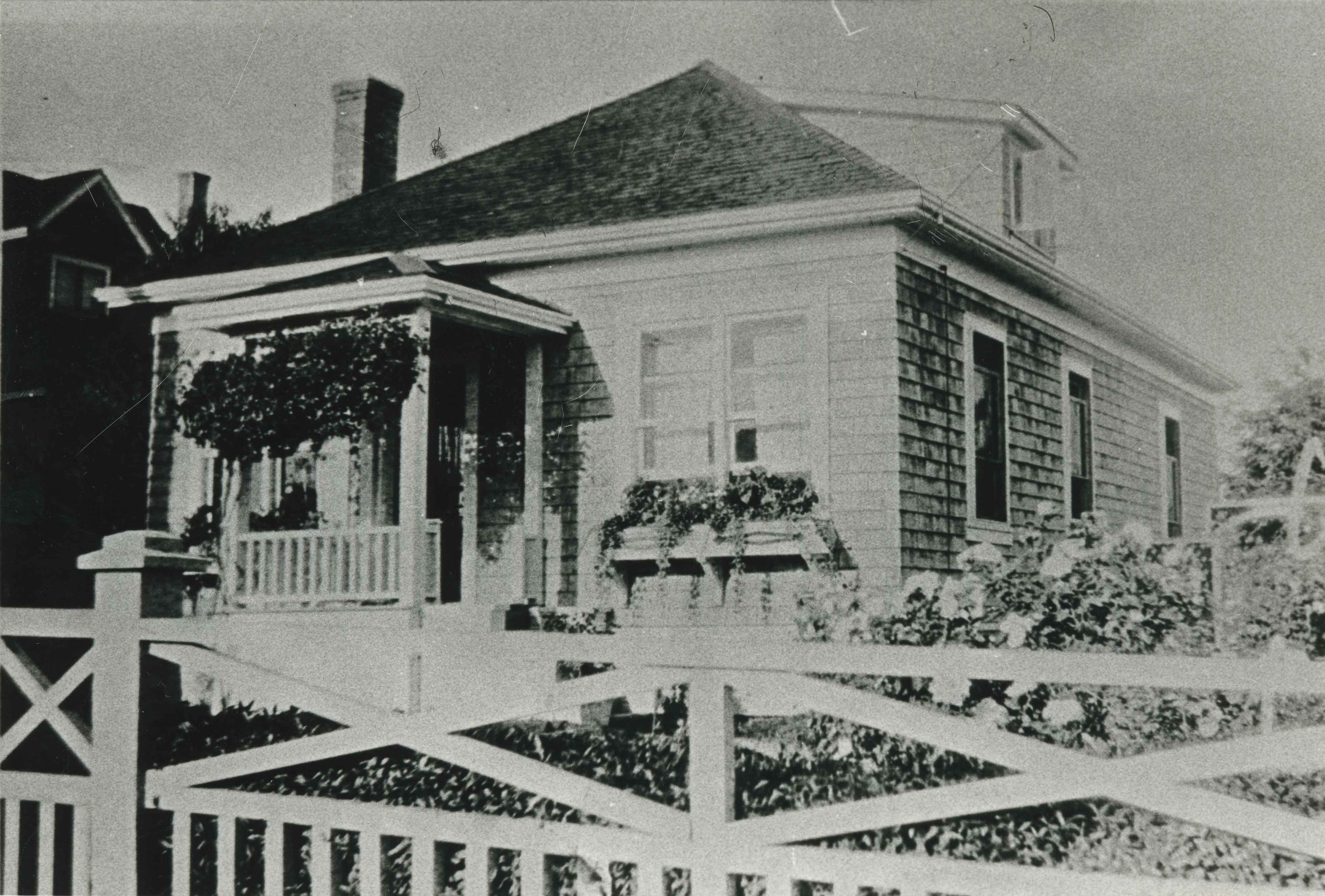
Gough family home
https://search.heritageburnaby.ca/link/archivedescription35491
- Repository
- City of Burnaby Archives
- Date
- 1920 (date of original), copied 1986
- Collection/Fonds
- Burnaby Historical Society fonds
- Description Level
- Item
- Physical Description
- 1 photograph : b&w ; 12.7 x 17.8 cm print
- Scope and Content
- Photograph of the Gough family home at 2119 Nelson Avenue (later 7126 Nelson Avenue). The house was built in 1912. William Gough was marble setter by trade, and he lived here with his wife, Agnes, and their children.
- Repository
- City of Burnaby Archives
- Date
- 1920 (date of original), copied 1986
- Collection/Fonds
- Burnaby Historical Society fonds
- Subseries
- Pioneer Tales subseries
- Physical Description
- 1 photograph : b&w ; 12.7 x 17.8 cm print
- Description Level
- Item
- Record No.
- 204-349
- Access Restriction
- No restrictions
- Reproduction Restriction
- No known restrictions
- Accession Number
- BHS1988-03
- Scope and Content
- Photograph of the Gough family home at 2119 Nelson Avenue (later 7126 Nelson Avenue). The house was built in 1912. William Gough was marble setter by trade, and he lived here with his wife, Agnes, and their children.
- Subjects
- Buildings - Residential - Houses
- Media Type
- Photograph
- Notes
- Title based on contents of photograph
- Geographic Access
- Nelson Avenue
- Street Address
- 2119 Nelson Avenue
- 7126 Nelson Avenue
- Historic Neighbourhood
- Alta-Vista (Historic Neighbourhood)
- Planning Study Area
- Sussex-Nelson Area
Images
![Children playing in a sand pile, [1920] (date of original), copied 1986 thumbnail](/media/hpo/_Data/_Archives_Images/_Unrestricted/204/204-354.jpg?width=280)
Children playing in a sand pile
https://search.heritageburnaby.ca/link/archivedescription35496
- Repository
- City of Burnaby Archives
- Date
- [1920] (date of original), copied 1986
- Collection/Fonds
- Burnaby Historical Society fonds
- Description Level
- Item
- Physical Description
- 1 photograph : b&w ; 12.7 x 17.8 cm print
- Scope and Content
- Photograph of children playing in a sand pile at the end of Patrick Street, in Buller Ravine (John Matthews Ravine Park). Identified: (2nd from left) Evelyn Hardy (later Evelyn Le Grove). The others are Quinn children, neighbourhood friends of the Hardies. Evelyn was the daughter of Marie and Archi…
- Repository
- City of Burnaby Archives
- Date
- [1920] (date of original), copied 1986
- Collection/Fonds
- Burnaby Historical Society fonds
- Subseries
- Pioneer Tales subseries
- Physical Description
- 1 photograph : b&w ; 12.7 x 17.8 cm print
- Description Level
- Item
- Record No.
- 204-354
- Access Restriction
- No restrictions
- Reproduction Restriction
- No known restrictions
- Accession Number
- BHS1988-03
- Scope and Content
- Photograph of children playing in a sand pile at the end of Patrick Street, in Buller Ravine (John Matthews Ravine Park). Identified: (2nd from left) Evelyn Hardy (later Evelyn Le Grove). The others are Quinn children, neighbourhood friends of the Hardies. Evelyn was the daughter of Marie and Archie Hardie, who lived on McKee Street.
- Names
- Le Grove, Evelyn Hardy
- Media Type
- Photograph
- Notes
- Title based on contents of photograph
- Geographic Access
- John Matthews Creek Ravine Park
- Patrick Street
- Historic Neighbourhood
- Alta-Vista (Historic Neighbourhood)
- Planning Study Area
- Clinton-Glenwood Area
Images
![Children playing in a sand pile, [1920] (date of original), copied 1986 thumbnail](/media/hpo/_Data/_Archives_Images/_Unrestricted/204/204-354.jpg)
![Fredrick Le Grove, [192-] (date of original), copied 1986 thumbnail](/media/hpo/_Data/_Archives_Images/_Unrestricted/204/204-360.jpg?width=280)
Fredrick Le Grove
https://search.heritageburnaby.ca/link/archivedescription35502
- Repository
- City of Burnaby Archives
- Date
- [192-] (date of original), copied 1986
- Collection/Fonds
- Burnaby Historical Society fonds
- Description Level
- Item
- Physical Description
- 1 photograph : b&w ; 12.7 x 17.8 cm print
- Scope and Content
- Photograph of Frederick Le Grove in the front yard of his home at 3250 Neville Street (later renumbered 5422 Neville Street). In the background is the Boscott family home. Fredrick Le Grove was married to Ida Le Grove (nee Burlton) and lived here with his family.
- Repository
- City of Burnaby Archives
- Date
- [192-] (date of original), copied 1986
- Collection/Fonds
- Burnaby Historical Society fonds
- Subseries
- Pioneer Tales subseries
- Physical Description
- 1 photograph : b&w ; 12.7 x 17.8 cm print
- Description Level
- Item
- Record No.
- 204-360
- Access Restriction
- No restrictions
- Reproduction Restriction
- No known restrictions
- Accession Number
- BHS1988-03
- Scope and Content
- Photograph of Frederick Le Grove in the front yard of his home at 3250 Neville Street (later renumbered 5422 Neville Street). In the background is the Boscott family home. Fredrick Le Grove was married to Ida Le Grove (nee Burlton) and lived here with his family.
- Subjects
- Buildings - Residential - Houses
- Names
- Le Grove, Frederick
- Media Type
- Photograph
- Notes
- Title based on contents of photograph
- Geographic Access
- Neville Street
- Street Address
- 5422 Neville Street
- Historic Neighbourhood
- Alta-Vista (Historic Neighbourhood)
- Planning Study Area
- Clinton-Glenwood Area
Images
![Fredrick Le Grove, [192-] (date of original), copied 1986 thumbnail](/media/hpo/_Data/_Archives_Images/_Unrestricted/204/204-360.jpg)
![Gray family home, [192-] (date of original), copied 1986 thumbnail](/media/hpo/_Data/_Archives_Images/_Unrestricted/204/204-382.jpg?width=280)
Gray family home
https://search.heritageburnaby.ca/link/archivedescription35524
- Repository
- City of Burnaby Archives
- Date
- [192-] (date of original), copied 1986
- Collection/Fonds
- Burnaby Historical Society fonds
- Description Level
- Item
- Physical Description
- 1 photograph : b&w ; 12.7 x 17.8 cm print
- Scope and Content
- Photograph of the Gray family home finally completed at 4375 Winnifred Street. It was built in stages as money became available. The upstairs windows front the room where young William, an only child, slept. Winifred Street was named after Ernie North's sister, Winnifred North, who lived in Surrey…
- Repository
- City of Burnaby Archives
- Date
- [192-] (date of original), copied 1986
- Collection/Fonds
- Burnaby Historical Society fonds
- Subseries
- Pioneer Tales subseries
- Physical Description
- 1 photograph : b&w ; 12.7 x 17.8 cm print
- Description Level
- Item
- Record No.
- 204-382
- Access Restriction
- No restrictions
- Reproduction Restriction
- No known restrictions
- Accession Number
- BHS1988-03
- Scope and Content
- Photograph of the Gray family home finally completed at 4375 Winnifred Street. It was built in stages as money became available. The upstairs windows front the room where young William, an only child, slept. Winifred Street was named after Ernie North's sister, Winnifred North, who lived in Surrey, England.
- Subjects
- Buildings - Residential - Houses
- Media Type
- Photograph
- Notes
- Title based on contents of photograph
- Geographic Access
- Winnifred Street
- Street Address
- 4375 Winnifred Street
- Historic Neighbourhood
- Alta-Vista (Historic Neighbourhood)
- Planning Study Area
- Sussex-Nelson Area
Images
![Gray family home, [192-] (date of original), copied 1986 thumbnail](/media/hpo/_Data/_Archives_Images/_Unrestricted/204/204-382.jpg)
![Holmes family home, [1920] (date of original), copied 1986 thumbnail](/media/hpo/_Data/_Archives_Images/_Unrestricted/204/204-610.jpg?width=280)
Holmes family home
https://search.heritageburnaby.ca/link/archivedescription35752
- Repository
- City of Burnaby Archives
- Date
- [1920] (date of original), copied 1986
- Collection/Fonds
- Burnaby Historical Society fonds
- Description Level
- Item
- Physical Description
- 1 photograph : b&w ; 12.7 x 17.8 cm print
- Scope and Content
- Photograph of the Holmes family home, 3919 Watling Street (later renumbered 4527 Watling Street). This was the second house the family lived in. Identified (left to right) sisters Kathleen Holmes and Eileen Holmes.
- Repository
- City of Burnaby Archives
- Date
- [1920] (date of original), copied 1986
- Collection/Fonds
- Burnaby Historical Society fonds
- Subseries
- Pioneer Tales subseries
- Physical Description
- 1 photograph : b&w ; 12.7 x 17.8 cm print
- Description Level
- Item
- Record No.
- 204-610
- Access Restriction
- No restrictions
- Reproduction Restriction
- No known restrictions
- Accession Number
- BHS1988-03
- Scope and Content
- Photograph of the Holmes family home, 3919 Watling Street (later renumbered 4527 Watling Street). This was the second house the family lived in. Identified (left to right) sisters Kathleen Holmes and Eileen Holmes.
- Subjects
- Buildings - Residential - Houses
- Media Type
- Photograph
- Notes
- Title based on contents of photograph
- Geographic Access
- Watling Street
- Street Address
- 4527 Watling Street
- Historic Neighbourhood
- Alta-Vista (Historic Neighbourhood)
- Planning Study Area
- Sussex-Nelson Area
Images
![Holmes family home, [1920] (date of original), copied 1986 thumbnail](/media/hpo/_Data/_Archives_Images/_Unrestricted/204/204-610.jpg)
![Keel farm house, [192-] thumbnail](/media/hpo/_Data/_Archives_Images/_Unrestricted/251/279-001.jpg?width=280)
Keel farm house
https://search.heritageburnaby.ca/link/archivedescription36488
- Repository
- City of Burnaby Archives
- Date
- [192-]
- Collection/Fonds
- Burnaby Historical Society fonds
- Description Level
- Item
- Physical Description
- 1 photograph : b&w ; 8.5 x 12.5 cm print
- Scope and Content
- Photograph of the A.J. Keel farm house and orchard, at 5387 Rumble Street. A.J. Keel bought this property, which went from Rumble to Walting, in 1920.
- Repository
- City of Burnaby Archives
- Date
- [192-]
- Collection/Fonds
- Burnaby Historical Society fonds
- Subseries
- Keel family subseries
- Physical Description
- 1 photograph : b&w ; 8.5 x 12.5 cm print
- Description Level
- Item
- Record No.
- 279-001
- Access Restriction
- No restrictions
- Reproduction Restriction
- No known restrictions
- Accession Number
- BHS1992-09
- Scope and Content
- Photograph of the A.J. Keel farm house and orchard, at 5387 Rumble Street. A.J. Keel bought this property, which went from Rumble to Walting, in 1920.
- Media Type
- Photograph
- Notes
- Title based on contents of photograph
- Geographic Access
- Rumble Street
- Street Address
- 5387 Rumble Street
- Historic Neighbourhood
- Alta-Vista (Historic Neighbourhood)
- Planning Study Area
- Clinton-Glenwood Area
Images
![Keel farm house, [192-] thumbnail](/media/hpo/_Data/_Archives_Images/_Unrestricted/251/279-001.jpg)
![Lyle and Fred Le Grove, [1920] (date of original), copied 1991 thumbnail](/media/hpo/_Data/_Archives_Images/_Unrestricted/370/370-659.jpg?width=280)
Lyle and Fred Le Grove
https://search.heritageburnaby.ca/link/archivedescription38072
- Repository
- City of Burnaby Archives
- Date
- [1920] (date of original), copied 1991
- Collection/Fonds
- Burnaby Historical Society fonds
- Description Level
- Item
- Physical Description
- 1 photograph : b&w ; 2.9 x 5.0 cm print on contact sheet 20.2 x 26.2 cm
- Scope and Content
- Photograph of Lyle Le Grove (left) and his father, Fred Le Grove, seated in the garden of 3250 Neville Street (later renumbered 5422 Neville Street).
- Repository
- City of Burnaby Archives
- Date
- [1920] (date of original), copied 1991
- Collection/Fonds
- Burnaby Historical Society fonds
- Subseries
- Burnaby Image Bank subseries
- Physical Description
- 1 photograph : b&w ; 2.9 x 5.0 cm print on contact sheet 20.2 x 26.2 cm
- Description Level
- Item
- Record No.
- 370-659
- Access Restriction
- No restrictions
- Reproduction Restriction
- No known restrictions
- Accession Number
- BHS1999-03
- Scope and Content
- Photograph of Lyle Le Grove (left) and his father, Fred Le Grove, seated in the garden of 3250 Neville Street (later renumbered 5422 Neville Street).
- Media Type
- Photograph
- Notes
- Title based on contents of photograph
- 1 b&w copy negative accompanying
- Negative has a pink cast
- Geographic Access
- Neville Street
- Street Address
- 5422 Neville Street
- Historic Neighbourhood
- Alta-Vista (Historic Neighbourhood)
- Planning Study Area
- Clinton-Glenwood Area
Images
![Lyle and Fred Le Grove, [1920] (date of original), copied 1991 thumbnail](/media/hpo/_Data/_Archives_Images/_Unrestricted/370/370-659.jpg)
![Wray family house, [192-] thumbnail](/media/hpo/_Data/_BVM_Images/1985/1985_0439_0003_001.jpg?width=280)
Wray family house
https://search.heritageburnaby.ca/link/museumdescription216
- Repository
- Burnaby Village Museum
- Date
- [192-]
- Collection/Fonds
- Burnaby Village Museum Photograph collection
- Description Level
- Item
- Physical Description
- 1 photograph : b&w
- Scope and Content
- Photograph of the Wray family house located at 2351 Dow Road (old street number). Note the ladders and minor construction on the verandah. There are brambles, weeds and tall plants growing around the house.
- Repository
- Burnaby Village Museum
- Collection/Fonds
- Burnaby Village Museum Photograph collection
- Description Level
- Item
- Physical Description
- 1 photograph : b&w
- Material Details
- inscribed in pencil, verso, t. "Home of Mr + Mrs Edward Wray/ 2351 Dow Road. (with half/ of verandah filled in)", stamped upside down, l.r. "0020"
- The name "velox" is lightly printed on the back of the photo paper: thus, the photograph is printed on Kodak velox photo paper made in early 1900s for amateur photography.
- Scope and Content
- Photograph of the Wray family house located at 2351 Dow Road (old street number). Note the ladders and minor construction on the verandah. There are brambles, weeds and tall plants growing around the house.
- Subjects
- Buildings - Residential - Houses
- Geographic Access
- Dow Avenue
- Street Address
- 6926 Dow Avenue
- Accession Code
- BV985.439.3
- Date
- [192-]
- Media Type
- Photograph
- Historic Neighbourhood
- Alta-Vista (Historic Neighbourhood)
- Planning Study Area
- Sussex-Nelson Area
- Scan Resolution
- 600
- Scan Date
- 16-Jan-24
- Scale
- 100
- Notes
- Title based on contents of photograph
Images
![Wray family house, [192-] thumbnail](/media/hpo/_Data/_BVM_Images/1985/1985_0439_0003_001.jpg)