Narrow Results By
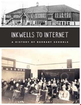
Inkwells to Internet: A History of Burnaby Schools
https://search.heritageburnaby.ca/link/museumlibrary7551
- Repository
- Burnaby Village Museum
- Publication Date
- 2020
- Call Number
- 371 CAR
School”. The building still exists
today as a private home on the south- east
corner of 19th Avenue and Canada Way.
School started January 22, 1894 with
teacher Miss Ethel Le Page in charge of a class
of twenty-eight students, which grew to forty-
one within a few days. Some of these students
were quite
- Repository
- Burnaby Village Museum
- Collection
- Reference Collection
- Digital Reference Collection
- Material Type
- Book
- ISBN
- 978-0-9781979-2-6
- Call Number
- 371 CAR
- Place of Publication
- Burnaby
- Publisher
- City of Burnaby
- Publication Date
- 2020
- Physical Description
- vii, 35 p. : ill. ; 29 cm.
- Library Subject (LOC)
- Burnaby (B.C.)--History
- Schools--British Columbia--Burnaby
- Subjects
- Education
- Notes
- "Includes index"
- A history of the Burnaby school district and individual school buildings in Burnaby, BC, between 1893 and 2013.
- The “First Nations cemetery” described on page 109 in Mary Johnson’s recollections was originally written as “Indian” and may refer to the Khalsa Diwan Society’s Sikh cremations at the Vancouver Cemetery.
Images
Digital Books
St. Albans the Martyr
https://search.heritageburnaby.ca/link/museumdescription11926
- Repository
- Burnaby Village Museum
- Date
- [ca.1910]
- Collection/Fonds
- Ronald G. Scobbie collection
- Description Level
- Item
- Physical Description
- 1 plan : black ink and watercol. on paper ; 30.45 x 30.5 cm
- Scope and Content
- Item consists of building insurance plan of "St. Albans the Martyr / Lots 45 & 46 North Part DL 28 / GP1 N.W.D." Edmonds Street is to the north, Douglas Road to the west and 19th Avenue to the south.
- Repository
- Burnaby Village Museum
- Collection/Fonds
- Ronald G. Scobbie collection
- Description Level
- Item
- Physical Description
- 1 plan : black ink and watercol. on paper ; 30.45 x 30.5 cm
- Material Details
- Scale 1 inch = 40 feet
- Scope and Content
- Item consists of building insurance plan of "St. Albans the Martyr / Lots 45 & 46 North Part DL 28 / GP1 N.W.D." Edmonds Street is to the north, Douglas Road to the west and 19th Avenue to the south.
- Subjects
- Buildings - Religious - Churches
- Accession Code
- BV003.83.48
- Access Restriction
- No restrictions
- Reproduction Restriction
- No known restrictions
- Date
- [ca.1910]
- Media Type
- Cartographic Material
- Scan Resolution
- 600
- Scan Date
- 15-Jan-2021
- Scale
- 100
- Notes
- Transcribed title
- Note in pencil on verso reads: "St. Albans the Martyr / Lots 45 & 46 North Part DL 28 / 1" = 40' "
- Note in balck in on verso reads: "3704"

![St. Albans the Martyr, [ca.1910] thumbnail](/media/hpo/_Data/_BVM_Cartographic_Material/2003/2003_0083_0048_001.jpg?width=280)