Narrow Results By
Creator
- Bartholomew, John, 1831-1893 1
- Bisiker, W. (William) 1
- Burnaby Village Museum 1
- Cornish, George A. (George Augustus), 1872- 3
- Denton, V. L. (Vernon Llewllyn), 1881-1944 1
- Farley, A. L. (Albert L.), 1920- 1
- Funk & Wagnalls Company 1
- Geographical Publishing Co. 1
- Hayes, Derek, 1947- 3
- Inch, R. Spencer, 1923- 1
- John C. Winston Company 1
- Orrin, H. C. (Herbert Charles), 1878-1963 1
The American library atlas of the world : containing about 100 maps, specially drawn and engraved for this work, from the latest federal, state andtransporation surveys; over 100,000 indexed place names, with their populations, and much valuable statistical information; making a complete compendium of geography with ample text and half-tone illustrations, all fully indexed
https://search.heritageburnaby.ca/link/museumlibrary1718
- Repository
- Burnaby Village Museum
- Author
- Geographical Publishing Co.
- Edition
- New census ed.
- Publication Date
- c1911
- Call Number
- 910 GEO OS
- Repository
- Burnaby Village Museum
- Collection
- Special Collection
- Material Type
- Book
- Accession Code
- HV984.21.31
- Call Number
- 910 GEO OS
- Edition
- New census ed.
- Author
- Geographical Publishing Co.
- Place of Publication
- Chicago
- Publisher
- Geographical
- Publication Date
- c1911
- Physical Description
- 192 p. : ill. (some col.), col. maps ; 38 cm.
- Library Subject (LOC)
- Atlases
- United States--Maps
- Notes
- "Engraved and published by The Geographical Publishing Company"--t.p.

Atlas of British Columbia : people, environment, and resource use
https://search.heritageburnaby.ca/link/museumlibrary1091
- Repository
- Burnaby Village Museum
- Collection
- Reference Collection
- Material Type
- Book
- ISBN
- 0774800925
- 9780774800921
- Call Number
- 912.711 FAR
- Place of Publication
- Vancouver
- Publisher
- University of British Columbia Press
- Publication Date
- 1979
- Physical Description
- viii, 135 p. : ill. (some col.) ; 29 x 36 cm.
- Library Subject (LOC)
- British Columbia--Maps
- British Columbia--Population--Maps
The British Empire (and Japan) : its features resources, commerce, industries and scenery, together with the physical and economic conditions of the world ; a modern atlas ...
https://search.heritageburnaby.ca/link/museumlibrary657
- Repository
- Burnaby Village Museum
- Author
- Bisiker, W. (William)
- Publication Date
- 1909
- Call Number
- 912 BIS OS
- Repository
- Burnaby Village Museum
- Collection
- Special Collection
- Material Type
- Book
- Accession Code
- BV985.5826.1
- Call Number
- 912 BIS OS
- Author
- Bisiker, W. (William)
- Place of Publication
- London
- Publisher
- Geographical
- Publication Date
- 1909
- Physical Description
- 81 p. : ill., maps (chiefly col.) ; 44 cm.
- Library Subject (LOC)
- Great Britain--Colonies--Maps
- Japan--Maps
- Notes
- "The British Empire (and Japan) : its features resources, commerce, industries and scenery, together with the physical and economic conditions of the world ; a modern atlas having 213 maps and 272 illustrations, numerous tables and diagrams with text concerning the illustrations, commercial products, statistics, histories, etc." --title page.
- Author's given name: Bisiker, W. (William)
The Canadian Oxford school atlas
https://search.heritageburnaby.ca/link/museumlibrary3827
- Repository
- Burnaby Village Museum
- Author
- Pleva, E. G. (Edward G.)
- Publication Date
- 1957
- Call Number
- 912 PLE
- Repository
- Burnaby Village Museum
- Collection
- Special Collection
- Material Type
- Book
- Accession Code
- BV004.20.6
- Call Number
- 912 PLE
- Author
- Pleva, E. G. (Edward G.)
- Place of Publication
- Toronto
- Publisher
- Oxford University Press
- Publication Date
- 1957
- Printer
- McCorquodale and Blades (Printers) Limited
- Physical Description
- iv, 136 p. : maps ; 26 cm.
- Library Subject (LOC)
- Atlases--Canadian
- Canada--Maps--Historical texts
- Canada--Statistics--Historical texts
- Notes
- "Advisory Editor E.G. Pleva, assisted by Spencer Inch"--front cover
- "The atlas has been prepared by the Cartographic Department of the Oxford University Press"--paste down
- "Authorized for use in the Schools of Alberta"--paste down
- "Approved for use in the Schools of Ontario"--paste down
- "Authorized for use in the Protestant Schools of Quebec"--paste down
- "Authorized for use in the Schools of Prince Edward Island"--paste down
- "Recommended for use in the Schools of Saskatchewan & Manitoba"--paste down
- "Prescribed for the Senior High Schools of British Columbia"--paste down
- Editor's given name and dates: Pleva, E. G. (Edward G.), 1912-2008
- Assistant's given name and dates: Inch, R. Spencer (Robert Spencer), 1923-
The Canadian school atlas : containing seventy-three maps (including seven classical maps) and complete index
https://search.heritageburnaby.ca/link/museumlibrary1710
- Repository
- Burnaby Village Museum
- Edition
- Rev. and enl. ed.
- Publication Date
- 1926
- Call Number
- 912 CAN Copy 1
- Repository
- Burnaby Village Museum
- Collection
- Special Collection
- Material Type
- Book
- Accession Code
- HV984.21.23
- Call Number
- 912 CAN Copy 1
- Edition
- Rev. and enl. ed.
- Contributor
- Cornish, George A. (George Augustus), 1872-
- Place of Publication
- Toronto
- Publisher
- J. M. Dent & Sons Limited
- Publication Date
- 1926
- Printer
- Temple Press
- Physical Description
- [58], 32 p. : col. maps ; 29 cm.
- Inscription
- "Vera Morrow '36" [handwritten in black ink on front pastedown] "Vera Morrow" [handwritten twice in pencil on front pastedown] "716" [stamped in faded ink on front pastedown] "V.Z.M." [stamped in black ink on front and back endpaper] "Vera Morrow Geography Book Atlas" [handwritten three times in red and blue ink and pencil on front endpaper] "716" [stamped in black ink on front endpaper] Two hand drawn sketches of women in pencil on front endpaper. Clipping from Wed. April 1, 1959 Vancouver Sun showing "New route to border opening about May 15" found next to title page. enclosed in polyester film sleeve Hand drawn sketch of advertisement for Cunard Steamship Lines trip from New York to Havana. Found between p. 20-21 of index. "Vera Morrow Canadian School Atlas J.M. Dent + Sons" [handwritten twice in red ink and pencil on page after p. 32 of index] Three hand drawn sketches of women in pencil on page after p. 32 of index. "Vera Morrow" [handwritten in dark ink on back endpaper] Folded map of British Isles found inside back cover printed by F. P. Lloyd, Toronto, Canada
- Library Subject (LOC)
- Atlases--Canadian
- Historical geography--Maps
- Canada--History--Study and teaching
- Atlases
- Notes
- "Recommended for use in the High Schools of Ontario" --Title page.
- "Authorised for use in the schools of Nova Scotia, Quebec, Saskatchewan and British Columbia" --Title page.
- "Prepared at the Edinburgh Geographical Institute" --Half-title verso.
- "Under the editorship of George A. Cornish" --Half-title verso.
- "Companion to the 'Canadian school geography'" --Half-title verso.
- Copy 1 of 2.
- Editor's given name and dates: Cornish, George A. (George Augustus), 1872-1960
The Canadian school atlas : containing seventy-three maps with complete index
https://search.heritageburnaby.ca/link/museumlibrary189
- Repository
- Burnaby Village Museum
- Edition
- Rev. and enl. ed.
- Publication Date
- 1925
- Call Number
- 912 COR
- Repository
- Burnaby Village Museum
- Collection
- Special Collection
- Material Type
- Book
- Accession Code
- HV971.120.25
- Call Number
- 912 COR
- Edition
- Rev. and enl. ed.
- Contributor
- Cornish, George A. (George Augustus), 1872-
- Place of Publication
- Toronto
- Publisher
- J. M. Dent & Sons, Ltd.
- Publication Date
- 1925
- Printer
- The Temple Press
- Physical Description
- 1 v. (multiple pagings) : col. ill. (maps) : 29 cm.
- Inscription
- "This Book Cover is presented with the / compliments of / The Royal Bank of Canada", printed on front of jacket. Atlas / Peggy McKay / Florence Nightingale School / Vancouver BC" hand written on front of dust jacket. "Peggy McKay" [Handwritten in black ink on outside envelope] "Billy McKay 409-15th Av. East Vancouver B.C. Canada" [Handwritten in pencil on front endpaper] "Jack McLennan" [Handwritten in pencil on front endpaper] "Oh dear Baby face Drawn by Peggy McKay" [Handwritten in pencil around drawing of a woman's face on front endpaper] "Peggy McKay Florence Nightingale Vancouver B.C. Canada" [Handwritten in blue ink on front flyleaf] "Along came you, sweet little you, Just like a flower you came. You came into my heart never to leave me + never to part." [Handwritten in pencil on title page] "Liar" [Handwritten in pencil on title page] "867-5309" [Handwritten in pencil on contents verso] "Jenny's number... 867-5309, 867-5309 I got it, I got it, I got you number on the wa-ll I got, I got it, for a good time for a good time CALL" [Handwritten on contents verso] Handwritten story from front flyleaf to pre-title page verso (4 pages) Drawing of woman's face on front flyleaf. Song lyrics handwritten in blue ink on title page verso and opposite contents. List of names under the index, page 32.
- Library Subject (LOC)
- Atlases--Canadian
- Historical geography--Maps
- Canada--History--Study and teaching
- Atlases
- Notes
- Includes index.
- "Under the editorship of George A. Cornish" -- Pre Title-Page Verso
- "Prepared at the Edinburgh Geographical Institute to form a companion to the 'Canadian School Geography'" -- Pre Title-Page Verso
- "Authorized for use in the schools of the provinces of Nova Scotia, Quebec, Saskatchewan and British Columbia" -- Cover
- Contributor's full name and date as follows:George A Cornish (George Augustus), 1872-1960
The Canadian school atlas : containing sixty-six maps with complete index
https://search.heritageburnaby.ca/link/museumlibrary6360
- Repository
- Burnaby Village Museum
- Collection
- Special Collection
- Material Type
- Book
- Accession Code
- X3894
- Call Number
- 912 CAN Copy 1
- Place of Publication
- Toronto
- Publisher
- J. M. Dent & Sons Limited
- Publication Date
- 1924
- Physical Description
- 1 vol. : ill., maps (mostly col.) ; 29 cm.
- Inscription
- "Alex Virostko" [handwritten in pencil on front pastedown] doodle on first endpaper
- Library Subject (LOC)
- Atlases--Canadian
- Historical geography--Maps
- Canada--History--Study and teaching
- Atlases
- Notes
- "Authorised for use in the schools of Nova Scotia, Quebec, Saskatchewan and British Columbia" --Title page.
- "Prepared at the Edinburgh Geographical Institute" --Half-title verso.
- "Under the editorship of George A. Cornish" --Half-title verso.
- Editor's given name and dates: Cornish, George A. (George Augustus), 1872-1960
- Includes index
- Copy 1 of 2
Conklin's handy manual of useful information and atlas of the world
https://search.heritageburnaby.ca/link/museumlibrary2529
- Repository
- Burnaby Village Museum
- Collection
- Special Collection
- Material Type
- Book
- Accession Code
- HV975.61.27
- Call Number
- 030 CON
- Place of Publication
- [S.l]
- Publisher
- [s.n.]
- Publication Date
- 1892
- Physical Description
- 442 p. : ill.(some col.), maps. ; 14 cm.
- Inscription
- "with 3 f. -- / depth 18 ins. / length 8 f" -- handwritten in pencil on endpaper (back).
- Library Subject (LOC)
- Encyclopedias and dictionaries
- Notes
- Includes index.
- "A Million Facts" -- cover
- "50 full page maps" -- cover
Dent's Canadian school atlas
https://search.heritageburnaby.ca/link/museumlibrary5038
- Repository
- Burnaby Village Museum
- Collection
- Special Collection
- Material Type
- Book
- Accession Code
- X3191
- Call Number
- 912 DEN
- Edition
- Rev. ed.
- Contributor
- Denton, V. L. (Vernon Llewllyn), 1881-1944
- Place of Publication
- Toronto
- Publisher
- J. M. Dent & Sons (Canada) Ltd.
- Publication Date
- 1947
- Printer
- The Temple Press
- Physical Description
- 62 p. : ill., maps (chiefly col.) ; 29 cm.
- Inscription
- face drawn in pen on last page "Joe Blow" [written in pencil on bottom left corner of cover]
- Library Subject (LOC)
- Atlases--Canadian
- Historical geography--Maps
- Canada--History--Study and teaching
- Atlases
- Notes
- "Authorised for use in the schools of British Columbia and Quebec" --Title page.
- "Recommended for use in the Schools of Alberta, Ontario and Saskatchewan" --Title page.
- Includes index
- Author's given name and dates: Denton, V.L. (Vernon Llewllyn), 1881-1944
First aid X-ray atlas of the arteries
https://search.heritageburnaby.ca/link/museumlibrary3677
- Repository
- Burnaby Village Museum
- Collection
- Special Collection
- Material Type
- Book
- Accession Code
- BV000.30.44
- Call Number
- 616.0757 ORR
- Place of Publication
- London
- Publisher
- Bailliere, Tindall & Cox
- Publication Date
- 1922
- Printer
- Billing and Sons
- Physical Description
- vii, 46 p. : ill.; 17 cm.
- Inscription
- inside front page: "Amy Leigh" [handwritten in pencil]
- Library Subject (LOC)
- Radiography
- Notes
- Includes index.
- Author's given name and dates : Orrin, (H.C.) Herbert Charles, 1878-1963.
Hammond's home and office atlas of the world
https://search.heritageburnaby.ca/link/museumlibrary649
- Repository
- Burnaby Village Museum
- Collection
- Special Collection
- Material Type
- Book
- Accession Code
- BV985.1773.1
- Call Number
- 912 HAM OS
- Place of Publication
- New York
- Publisher
- C. S. Hammond & Company
- Publication Date
- 1913
- Physical Description
- 224, [8], 15 p. : ill., col. maps ; 35 cm.
- Library Subject (LOC)
- Atlases
- Historical geography--Maps
- Panama--Panama Canal
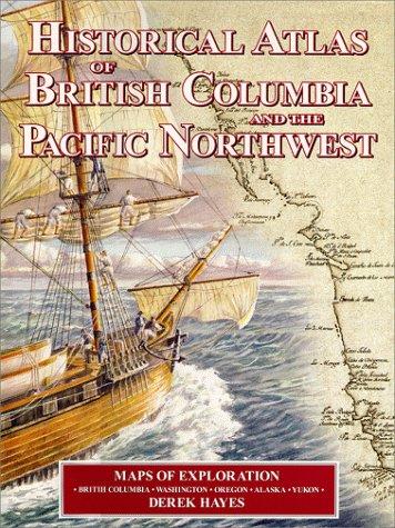
Historical atlas of British Columbia and the Pacific Northwest : maps of exploration, British Columbia, Washington, Oregon, Alaska, Yukon
https://search.heritageburnaby.ca/link/museumlibrary830
- Repository
- Burnaby Village Museum
- Author
- Hayes, Derek, 1947-
- Publication Date
- c1999
- Call Number
- 911 HAY
- Repository
- Burnaby Village Museum
- Collection
- Reference Collection
- Material Type
- Book
- ISBN
- 1552899004
- Call Number
- 911 HAY
- Author
- Hayes, Derek, 1947-
- Place of Publication
- Vancouver
- Publisher
- Cavendish Books
- Publication Date
- c1999
- Physical Description
- 208 p. : ill. (some col.), maps (some col.) ; 32 cm.
- Library Subject (LOC)
- British Columbia--Discovery and exploration--Maps
- British Columbia--Historical geography--Maps
- Northwest , Pacific--Discovery and exploration--Maps
- Northwest , Pacific--Historical geography--Maps
- Alaska
- Yukon Territory--Discovery and exploration--Maps
- Yukon territory--Historical geography--Maps
- Notes
- Includes bibliographical references (p. 193-196) and index.

Historical atlas of Canada : Canada's history illustrated with original maps
https://search.heritageburnaby.ca/link/museumlibrary1455
- Repository
- Burnaby Village Museum
- Author
- Hayes, Derek, 1947-
- Publication Date
- c2002
- Call Number
- 911.71 HAY
- Repository
- Burnaby Village Museum
- Collection
- Reference Collection
- Material Type
- Book
- ISBN
- 1553650778
- 9781550549188
- 1550549189
- 9781553650775
- Call Number
- 911.71 HAY
- Author
- Hayes, Derek, 1947-
- Place of Publication
- Vancouver
- Publisher
- Douglas & McIntyre
- Publication Date
- c2002
- Physical Description
- 272 p. : ill. (some col.), maps (some col.) ; 35 cm.
- Library Subject (LOC)
- Canada--Historical geography--Maps
- Canada--Discovery and exploration--Maps
- Notes
- Includes bibliographical references (p. 265-267) and index.
- Oversized book
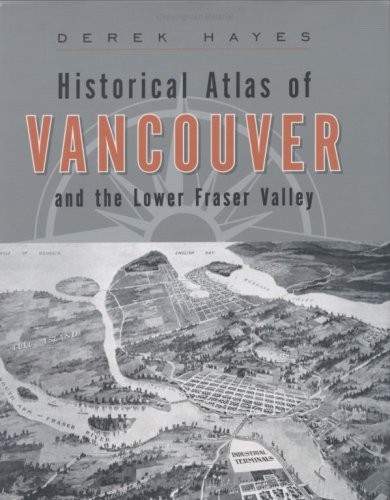
Historical atlas of Vancouver and the lower Fraser Valley
https://search.heritageburnaby.ca/link/museumlibrary1424
- Repository
- Burnaby Village Museum
- Author
- Hayes, Derek, 1947-
- Edition
- 1st paperback ed.
- Publication Date
- 2007
- c2005
- Call Number
- 911.71133 HAY
- Repository
- Burnaby Village Museum
- Collection
- Reference Collection
- Material Type
- Book
- ISBN
- 9781553652830
- 1553652835
- 1553651073
- Call Number
- 911.71133 HAY
- Edition
- 1st paperback ed.
- Author
- Hayes, Derek, 1947-
- Place of Publication
- Vancouver
- Publisher
- Douglas & McIntyre
- Publication Date
- 2007
- c2005
- Physical Description
- 192 p. : ill. (chiefly col.), maps, ports. ; 31 cm.
- Library Subject (LOC)
- Vancouver (B.C.)--Historical geography--Maps
- Lower Mainland (B.C.)--Historical geography--Maps
- Lower Mainland (B.C.)--Discovery and exploration--Maps
- Notes
- Maps on end papers.
- Includes bibliographical references (p. 186-187) and index.
- "Winner of the Lieutenant-Governor's Award for Historical Writing"
The Literary digest atlas of the world and gazetteer
https://search.heritageburnaby.ca/link/museumlibrary1694
- Repository
- Burnaby Village Museum
- Author
- Funk & Wagnalls Company
- Publication Date
- 1927
- Call Number
- 912 FUN
- Repository
- Burnaby Village Museum
- Collection
- Special Collection
- Material Type
- Book
- Accession Code
- BV985.5211.1
- Call Number
- 912 FUN
- Author
- Funk & Wagnalls Company
- Place of Publication
- New York
- Publisher
- Funk & Wagnalls Company
- Publication Date
- 1927
- Physical Description
- 192 p. : col. maps ; 25 cm.
- Library Subject (LOC)
- Atlases
- Notes
- "Containing new maps of the principal countries of the world and separate maps of each Amercian state and territory, the Canadian provinces, etc., etc.; accompanied by individual indexes of each state, province, etc., and a descriptive gazetteer of the principal countries of the world" --title page.
- Maps by C.S. Hammond Co.
Modern school geography and atlas
https://search.heritageburnaby.ca/link/museumlibrary1566
- Repository
- Burnaby Village Museum
- Collection
- Special Collection
- Material Type
- Book
- Accession Code
- BV985.3865.1
- Call Number
- 912 MOD
- Edition
- [6th ed.]
- Place of Publication
- Toronto
- Publisher
- Canada Publishing Company, Limited.
- Publication Date
- c1883
- Physical Description
- 96 p. : ill., maps (some col.) ; 23 cm.
- Inscription
- "Measurements B.C. Base 3" [handwritten in pencil along with drawing of B.C. on back of map of the world(p.96) Hand drawing in pencil of North America on back endpaper. Hand drawing in pencil on back pastedown
- Library Subject (LOC)
- Atlases--Canadian
- Geography
- Notes
- "New edition, revised and corrected" --cover
- "Prepared for the use of schools in the Dominion of Canada" --cover
- "Authorized by the Minister of Education for use in the schools of Ontario, and by the Councils of Public Instruction for use in the provinces of Quebec, New Brunswick and Prince Edward Island" --T.p.
The national atlas : consisting of forty maps of modern geography
https://search.heritageburnaby.ca/link/museumlibrary1685
- Repository
- Burnaby Village Museum
- Author
- Bartholomew, John, 1831-1893
- Publication Date
- 1800
- Call Number
- 910 BAR
- Repository
- Burnaby Village Museum
- Collection
- Special Collection
- Material Type
- Book
- Accession Code
- BV985.5136.1
- Call Number
- 910 BAR
- Author
- Bartholomew, John, 1831-1893
- Place of Publication
- London
- Publisher
- William Collins, Sons, & Co. Ltd.
- Publication Date
- 1800
- Physical Description
- 1 v. : col. maps ; 23 cm.
- Inscription
- "Douglas Lunn" [handwritten in pencil on front cover] "Douglas Lunn 1 Junction road England" [handwritten in pencil on front paste down] "Ethel + Mabel Morris April 9/1889" [handwritten in black ink on title page]
- Library Subject (LOC)
- Atlases
- Political geography
- Notes
- "Constructed and engraved by John Bartholomew"--title page
- "with a copious index"--title page
The new encyclopedic atlas and gazetteer of the world
https://search.heritageburnaby.ca/link/museumlibrary1677
- Repository
- Burnaby Village Museum
- Edition
- Panama-Pacific ed.
- Publication Date
- c1914
- Call Number
- 912 COL OS
- Repository
- Burnaby Village Museum
- Collection
- Special Collection
- Material Type
- Book
- Accession Code
- BV985.4069.1
- Call Number
- 912 COL OS
- Edition
- Panama-Pacific ed.
- Contributor
- Reynolds, Francis J. (Francis Joseph), 1867-1937
- Place of Publication
- New York
- Publisher
- P. F. Collier & Son
- Publication Date
- c1914
- Physical Description
- 264 p. : ill., maps (some col.) ; 39 cm.
- Inscription
- "Mr. + Mrs _ Fitzpatrick" [handwritten in red pencil on front endpaper] Initials J.D. and J.F. each followed by list of 11 numbers handwritten in pencil located between drawing of dots connected by lines in shape of triangle (game?) Scale drawing of blimp in pencil on back endpaper
- Library Subject (LOC)
- Geography--Dictionaries
- Atlases
- Notes
- "With latest war maps. Containing an entirely new series of colored maps and index gazetteer of the world, a physical and commercial analysis of the United States and Canada & up-to-date information about the Panama Canal and the exposition"--cover
- "World maps revised to 1914 - showing new boundaries of all foreign states and their dependencies - newly organized counties and other state changes with the United States - new Canadian maps - latest population statistics of all countries and cities of the world - the Panama Canal and the Panama-Pacific exposition"--title page
- "Latest maps of war zones"--title page
- "Profusely illustrated"--title page
- "Edited and revised by Francis J. Reynolds"--title page
- Editor's given name and dates: Reynolds, Francis J. (Francis Joseph), 1867-1937
The new student's atlas
https://search.heritageburnaby.ca/link/museumlibrary2427
- Repository
- Burnaby Village Museum
- Collection
- Special Collection
- Material Type
- Book
- Accession Code
- HV975.5.502
- Call Number
- 912 COL
- Place of Publication
- London
- Publisher
- William Collins, Sons, & Co. Ltd.
- Publication Date
- [1899]
- Physical Description
- 1 atlas : col. maps ; 27 cm.
- Library Subject (LOC)
- Atlases
- Object History
- This item originates from the Chinese Herbalist Store “Way Sang Yuen Wat Kee & Co.”, Victoria B.C.
- Notes
- Includes index
The new world atlas and gazetteer
https://search.heritageburnaby.ca/link/museumlibrary169
- Repository
- Burnaby Village Museum
- Edition
- 1922 ed.
- Publication Date
- c1922
- Call Number
- 912 COL 1922 OS
- Repository
- Burnaby Village Museum
- Collection
- Special Collection
- Material Type
- Book
- Accession Code
- HV971.120.16
- Call Number
- 912 COL 1922 OS
- Edition
- 1922 ed.
- Place of Publication
- New York
- Publisher
- P. F. Collier & Son
- Publication Date
- c1922
- Physical Description
- 272 p. : ill., maps (some col.) ; 39 cm.
- Inscription
- "W15" [phrase crossed out and written in black ink on front endpaper]
- Library Subject (LOC)
- Geography--Dictionaries
- Atlases
- Notes
- "New population statistics of federal census of 1920 of all states and territories, of all cities and towns of the United States"--title page
- "World maps revised to 1922--new maps showing new boundaries of all foreign states and their dependencies--new maps of each state of the United States, including their newly organized counties and other boundary changes to 1922--new Canadian maps--physical and commercial analysis of United States and Canada--analysis of all countries of the world--illustrated gazetteer of cities and towns of the world"--t.p.
- "Profusely illustrated"--title page
- "Edited by Francis J. Reynolds"--title page
- "Revised to date by Adam Ward"--title page
- Editor's given name and dates: Reynolds, Francis J. (Francis Joseph), 1867-1937