Narrow Results By
Subject
- Accidents 1
- Accidents - Automobile Accidents 1
- Advertising Medium 3
- Advertising Medium - Signs and Signboards 69
- Aerial Photographs
- Agricultural Tools and Equipment - Gardening Equipment 1
- Agricultural Tools and Equipment - Plows 1
- Agriculture - Crops 4
- Agriculture - Farms 11
- Agriculture - Fruit and Berries 4
- Agriculture - Orchards 1
- Agriculture - Poultry 3
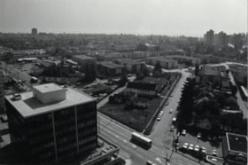
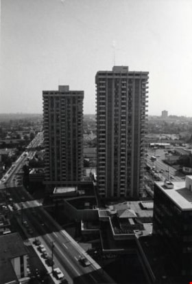
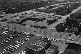
Aerial view looking east on Kingsway
https://search.heritageburnaby.ca/link/archivedescription78857
- Repository
- City of Burnaby Archives
- Date
- September 15, 1976
- Collection/Fonds
- Burnaby Public Library Contemporary Visual Archive Project
- Description Level
- Item
- Physical Description
- 1 photograph : b&w ; 11 x 16 cm mounted on cardboard
- Scope and Content
- Photograph is an aerial view looking east on Kingsway, taken from the twenty-first floor of the Panorama Towers on Grange Street, with Sears and Kelly Douglas in the background.
- Repository
- City of Burnaby Archives
- Date
- September 15, 1976
- Collection/Fonds
- Burnaby Public Library Contemporary Visual Archive Project
- Physical Description
- 1 photograph : b&w ; 11 x 16 cm mounted on cardboard
- Description Level
- Item
- Record No.
- 556-004
- Access Restriction
- No restrictions
- Reproduction Restriction
- Reproduce for fair dealing purposes only
- Accession Number
- 2013-13
- Scope and Content
- Photograph is an aerial view looking east on Kingsway, taken from the twenty-first floor of the Panorama Towers on Grange Street, with Sears and Kelly Douglas in the background.
- Subjects
- Aerial Photographs
- Media Type
- Photograph
- Photographer
- McCarron, John
- Notes
- Scope note taken directly from BPL photograph description.
- 1 b&w copy negative : 10 x 12.5 cm accompanying
- Geographic Access
- Kingsway
- Grange Street
- Historic Neighbourhood
- Central Park (Historic Neighbourhood)
- Planning Study Area
- Maywood Area
- Garden Village Area
Images
Aerial view of Kingsway and Barker
https://search.heritageburnaby.ca/link/archivedescription78859
- Repository
- City of Burnaby Archives
- Date
- September 27, 1976
- Collection/Fonds
- Burnaby Public Library Contemporary Visual Archive Project
- Description Level
- Item
- Physical Description
- 1 photograph : b&w ; 11 x 16 cm mounted on cardboard
- Scope and Content
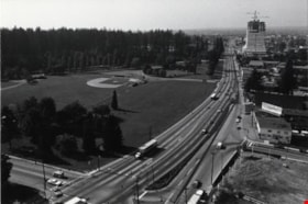
- Photograph is an aerial view of Kingsway and Barker Avenue, looking southeast from Central Park Place.
- Repository
- City of Burnaby Archives
- Date
- September 27, 1976
- Collection/Fonds
- Burnaby Public Library Contemporary Visual Archive Project
- Physical Description
- 1 photograph : b&w ; 11 x 16 cm mounted on cardboard
- Description Level
- Item
- Record No.
- 556-005
- Access Restriction
- No restrictions
- Reproduction Restriction
- Reproduce for fair dealing purposes only
- Accession Number
- 2013-13
- Scope and Content
- Photograph is an aerial view of Kingsway and Barker Avenue, looking southeast from Central Park Place.
- Subjects
- Aerial Photographs
- Media Type
- Photograph
- Photographer
- Norton, Paul
- Notes
- Scope note taken directly from BPL photograph description.
- 1 b&w copy negative : 10 x 12.5 cm accompanying
- Geographic Access
- Kingsway
- Barker Avenue
- Historic Neighbourhood
- Central Park (Historic Neighbourhood)
- Planning Study Area
- Maywood Area
- Garden Village Area
Images
Alfred Hickman
https://search.heritageburnaby.ca/link/archivedescription35054
- Repository
- City of Burnaby Archives
- Date
- [195-] (date of original), copied 1986
- Collection/Fonds
- Burnaby Historical Society fonds
- Description Level
- Item
- Physical Description
- 1 photograph : b&w ; 7.5 x 11 cm print
- Scope and Content
- Photograph of two men standing outside Hickman's Grocery on Patterson Avenue near the railroad tracks. One of the men is Alfred Hickman, the store's owner. Signs on the store read, "Hickmans / Groceries / Produce" and "Groceries / Hickmans / Meats." Signs in the window advertise wieners and "Mea…
- Repository
- City of Burnaby Archives
- Date
- [195-] (date of original), copied 1986
- Collection/Fonds
- Burnaby Historical Society fonds
- Subseries
- Alfred Hickman subseries
- Physical Description
- 1 photograph : b&w ; 7.5 x 11 cm print
- Description Level
- Item
- Record No.
- 183-002
- Access Restriction
- No restrictions
- Reproduction Restriction
- Reproduce for fair dealing purposes only
- Accession Number
- BHS1986-31
- Scope and Content
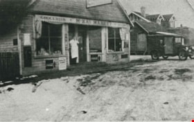
- Photograph of two men standing outside Hickman's Grocery on Patterson Avenue near the railroad tracks. One of the men is Alfred Hickman, the store's owner. Signs on the store read, "Hickmans / Groceries / Produce" and "Groceries / Hickmans / Meats." Signs in the window advertise wieners and "Meat Makes the Meal."
- Subjects
- Buildings - Commercial - Grocery Stores
- Occupations - Grocers
- Advertising Medium - Signs and Signboards
- Media Type
- Photograph
- Notes
- Title based on contents of photograph
- Street address for the grocery store later numbered 5932 Patterson Avenue
- Geographic Access
- Patterson Avenue
- Street Address
- 5932 Patterson Avenue
- Historic Neighbourhood
- Central Park (Historic Neighbourhood)
- Planning Study Area
- Maywood Area
Images
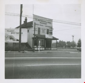
A. Matheson and Sons Market
https://search.heritageburnaby.ca/link/archivedescription34063
- Repository
- City of Burnaby Archives
- Date
- 1957
- Collection/Fonds
- Burnaby Historical Society fonds
- Description Level
- Item
- Physical Description
- 1 photograph : b&w ; 8.9 x 9.0 cm
- Scope and Content
- Photograph of the A. Matheson & Sons store building located at 3576 Kingsway (later renumbered 4920 Kingsway) and Nelson Avenue. Signs on the store read, "A. Matheson & Sons Market / Fresh Meats - Groceries / Quality and Service / Dexter 1372, 1373 / Free Delivery." Additional signs and billboard…
- Repository
- City of Burnaby Archives
- Date
- 1957
- Collection/Fonds
- Burnaby Historical Society fonds
- Subseries
- Photographs subseries
- Physical Description
- 1 photograph : b&w ; 8.9 x 9.0 cm
- Description Level
- Item
- Record No.
- 006-002
- Access Restriction
- No restrictions
- Reproduction Restriction
- Reproduce for fair dealing purposes only
- Accession Number
- BHS2007-04
- Scope and Content
- Photograph of the A. Matheson & Sons store building located at 3576 Kingsway (later renumbered 4920 Kingsway) and Nelson Avenue. Signs on the store read, "A. Matheson & Sons Market / Fresh Meats - Groceries / Quality and Service / Dexter 1372, 1373 / Free Delivery." Additional signs and billboards include "Burnaby Liberal Committee Rooms" and a cigarette billboard. This store was previously owned and operated by Alexander MacKenzie.
- Media Type
- Photograph
- Notes
- Title based on contents of photograph
- Geographic Access
- Kingsway
- Street Address
- 4920 Kingsway
- Historic Neighbourhood
- Central Park (Historic Neighbourhood)
- Planning Study Area
- Marlborough Area
Images
Boundary Road
https://search.heritageburnaby.ca/link/archivedescription79966
- Repository
- City of Burnaby Archives
- Date
- September 27, 1976
- Collection/Fonds
- Burnaby Public Library Contemporary Visual Archive Project
- Description Level
- Item
- Physical Description
- 1 photograph : b&w ; 11 x 16 cm mounted on cardboard
- Scope and Content
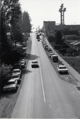
- Photograph shows a view of Boundary Road looking south from the railway trestle just north of Kingsway.
- Repository
- City of Burnaby Archives
- Date
- September 27, 1976
- Collection/Fonds
- Burnaby Public Library Contemporary Visual Archive Project
- Physical Description
- 1 photograph : b&w ; 11 x 16 cm mounted on cardboard
- Description Level
- Item
- Record No.
- 556-529
- Access Restriction
- No restrictions
- Reproduction Restriction
- Reproduce for fair dealing purposes only
- Accession Number
- 2013-13
- Scope and Content
- Photograph shows a view of Boundary Road looking south from the railway trestle just north of Kingsway.
- Subjects
- Aerial Photographs
- Media Type
- Photograph
- Photographer
- Norton, Paul
- Notes
- Scope note taken directly from BPL photograph description.
- 1 b&w copy negative : 10 x 12.5 cm accompanying
- Geographic Access
- Boundary Road
- Historic Neighbourhood
- Central Park (Historic Neighbourhood)
- Planning Study Area
- Garden Village Area
Images
Boundary Road
https://search.heritageburnaby.ca/link/archivedescription79967
- Repository
- City of Burnaby Archives
- Date
- September 27, 1976
- Collection/Fonds
- Burnaby Public Library Contemporary Visual Archive Project
- Description Level
- Item
- Physical Description
- 1 photograph : b&w ; 11 x 16 cm mounted on cardboard
- Scope and Content
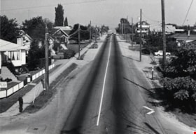
- Photograph shows a view of Boundary Road looking north from the railway trestle just north of Kingsway.
- Repository
- City of Burnaby Archives
- Date
- September 27, 1976
- Collection/Fonds
- Burnaby Public Library Contemporary Visual Archive Project
- Physical Description
- 1 photograph : b&w ; 11 x 16 cm mounted on cardboard
- Description Level
- Item
- Record No.
- 556-530
- Access Restriction
- No restrictions
- Reproduction Restriction
- Reproduce for fair dealing purposes only
- Accession Number
- 2013-13
- Scope and Content
- Photograph shows a view of Boundary Road looking north from the railway trestle just north of Kingsway.
- Subjects
- Aerial Photographs
- Media Type
- Photograph
- Photographer
- Norton, Paul
- Notes
- Scope note taken directly from BPL photograph description.
- 1 b&w copy negative : 10 x 12.5 cm accompanying
- Geographic Access
- Boundary Road
- Historic Neighbourhood
- Central Park (Historic Neighbourhood)
- Planning Study Area
- Garden Village Area
Images
Burnaby Centre
https://search.heritageburnaby.ca/link/archivedescription79941
- Repository
- City of Burnaby Archives
- Date
- September 27, 1976
- Collection/Fonds
- Burnaby Public Library Contemporary Visual Archive Project
- Description Level
- Item
- Physical Description
- 1 photograph : b&w ; 11 x 16 cm mounted on cardboard
- Scope and Content
- Photograph shows an aerial view of Burnaby Centre looking east from Central Park Place. Kingsway is on the right and Grange Street is on the left.
- Repository
- City of Burnaby Archives
- Date
- September 27, 1976
- Collection/Fonds
- Burnaby Public Library Contemporary Visual Archive Project
- Physical Description
- 1 photograph : b&w ; 11 x 16 cm mounted on cardboard
- Description Level
- Item
- Record No.
- 556-512
- Access Restriction
- No restrictions
- Reproduction Restriction
- Reproduce for fair dealing purposes only
- Accession Number
- 2013-13
- Scope and Content
- Photograph shows an aerial view of Burnaby Centre looking east from Central Park Place. Kingsway is on the right and Grange Street is on the left.
- Media Type
- Photograph
- Photographer
- Norton, Paul
- Notes
- Scope note taken directly from BPL photograph description.
- 1 b&w copy negative : 10 x 12.5 cm accompanying
- Geographic Access
- Kingsway
- Grange Street
- Historic Neighbourhood
- Central Park (Historic Neighbourhood)
- Planning Study Area
- Maywood Area
Images
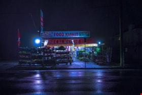
Canadian Food Market
https://search.heritageburnaby.ca/link/archivedescription98666
- Repository
- City of Burnaby Archives
- Date
- 2022
- Collection/Fonds
- Disappearing Burnaby collection
- Description Level
- Item
- Physical Description
- 1 photograph (jpeg) : col.
- Scope and Content
- Photograph of the exterior of the Canadian Food Market, taken from across Imperial Street at night. The grocery store is located at 4378 Imperial Street and the building was constructed in 1962. A large display of plants and flowers stands in front of the store and is illuminated by bright lights.
- Repository
- City of Burnaby Archives
- Date
- 2022
- Collection/Fonds
- Disappearing Burnaby collection
- Physical Description
- 1 photograph (jpeg) : col.
- Description Level
- Item
- Record No.
- 634-013
- Access Restriction
- No restrictions
- Reproduction Restriction
- No restrictions
- Accession Number
- 2022-14
- Scope and Content
- Photograph of the exterior of the Canadian Food Market, taken from across Imperial Street at night. The grocery store is located at 4378 Imperial Street and the building was constructed in 1962. A large display of plants and flowers stands in front of the store and is illuminated by bright lights.
- Media Type
- Photograph
- Photographer
- Cheung, Nakita
- Notes
- Title taken from the associated blog post
- Associated blog post: https://disappearingburnaby.wordpress.com/2022/02/20/imperial-manor-2/
- Geographic Access
- Imperial Street
- Street Address
- 4378 Imperial Street
- Historic Neighbourhood
- Central Park (Historic Neighbourhood)
- Planning Study Area
- Sussex-Nelson Area
Images
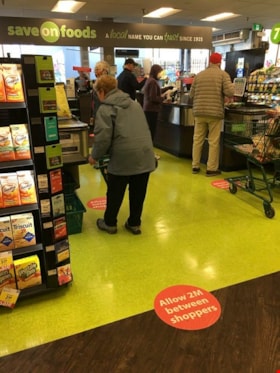
Cash till line up
https://search.heritageburnaby.ca/link/archivedescription95107
- Repository
- City of Burnaby Archives
- Date
- April 27, 2020
- Collection/Fonds
- Burnaby Photographic Society fonds
- Description Level
- Item
- Physical Description
- 1 photograph (tiff)
- Scope and Content
- Photograph of shoppers in the checkout lines at Save-On-Foods grocery store at the Old Orchard Shopping Centre. On the floor are red decals indicating where shoppers should stand to maintain distance from one another. The decals read: "Allow 2M between shoppers".
- Repository
- City of Burnaby Archives
- Date
- April 27, 2020
- Collection/Fonds
- Burnaby Photographic Society fonds
- Physical Description
- 1 photograph (tiff)
- Description Level
- Item
- Record No.
- 623-025
- Access Restriction
- No restrictions
- Reproduction Restriction
- No restrictions
- Accession Number
- 2020-10
- Scope and Content
- Photograph of shoppers in the checkout lines at Save-On-Foods grocery store at the Old Orchard Shopping Centre. On the floor are red decals indicating where shoppers should stand to maintain distance from one another. The decals read: "Allow 2M between shoppers".
- Media Type
- Photograph
- Photographer
- Snowdon, Nick
- Notes
- Transcribed title
- Photographer's caption: "Physical distancing signs become common in most stores"
- Geographic Access
- Kingsway
- Street Address
- 4429 Kingsway
- Historic Neighbourhood
- Central Park (Historic Neighbourhood)
- Planning Study Area
- Garden Village Area
Images
Daniel Igali in Save-On-Foods
https://search.heritageburnaby.ca/link/archivedescription97111
- Repository
- City of Burnaby Archives
- Date
- [2000]
- Collection/Fonds
- Burnaby NewsLeader photograph collection
- Description Level
- Item
- Physical Description
- 1 photograph (tiff) : col.
- Scope and Content
- Photograph of Canadian Olympic wrestler Daniel Igali shopping for cereal in the Metrotown Save-On-Foods grocery store as promotion for a fundraising event for the Greater Vancouver Food Bank, sponsored by General Mills and Save-On-Foods.
- Repository
- City of Burnaby Archives
- Date
- [2000]
- Collection/Fonds
- Burnaby NewsLeader photograph collection
- Physical Description
- 1 photograph (tiff) : col.
- Description Level
- Item
- Record No.
- 535-2638
- Access Restriction
- No restrictions
- Reproduction Restriction
- No restrictions
- Accession Number
- 2018-12
- Scope and Content
- Photograph of Canadian Olympic wrestler Daniel Igali shopping for cereal in the Metrotown Save-On-Foods grocery store as promotion for a fundraising event for the Greater Vancouver Food Bank, sponsored by General Mills and Save-On-Foods.
- Media Type
- Photograph
- Photographer
- Bartel, Mario
- Notes
- Title based on caption
- Collected by editorial for use in an August 2000 issue of the Burnaby NewsLeader
- Caption from metadata: "Canadian Olympic wrestler Daniel Igali isn't just shopping for his breakfast cereal at Save-On Foods Metrotown. He, his sponsor, General Mills, and the grocery store are hoping people will contribute non-perishable goods to the Greater Vancouver Food Bank. All donations will be matched by General Mills."
- Geographic Access
- Kingsway
- Street Address
- 4469 Kingsway
- Historic Neighbourhood
- Central Park (Historic Neighbourhood)
- Planning Study Area
- Maywood Area
Images
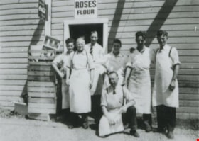
Employees outside Matheson & Sons Market
https://search.heritageburnaby.ca/link/archivedescription37656
- Repository
- City of Burnaby Archives
- Date
- 1945 (date of original), copied 1991
- Collection/Fonds
- Burnaby Historical Society fonds
- Description Level
- Item
- Physical Description
- 1 photograph : b&w ; 3.2 x 4.5 cm print on contact sheet 20.2 x 25.3 cm
- Scope and Content
- Photograph of a group of employees in front of Matheson & Sons Market at 3576 Kingsway and Nelson Avenue (later renumbered 4920 Kingsway). Left to right: Barry Burns, Angus Matheson, Dan Matheson, Ed Matheson, Lex Henderson, John Matheson, and Gil Summers (kneeling). There are Coca Cola and Roses…
- Repository
- City of Burnaby Archives
- Date
- 1945 (date of original), copied 1991
- Collection/Fonds
- Burnaby Historical Society fonds
- Subseries
- Burnaby Image Bank subseries
- Physical Description
- 1 photograph : b&w ; 3.2 x 4.5 cm print on contact sheet 20.2 x 25.3 cm
- Description Level
- Item
- Record No.
- 370-244
- Access Restriction
- No restrictions
- Reproduction Restriction
- No known restrictions
- Accession Number
- BHS1999-03
- Scope and Content
- Photograph of a group of employees in front of Matheson & Sons Market at 3576 Kingsway and Nelson Avenue (later renumbered 4920 Kingsway). Left to right: Barry Burns, Angus Matheson, Dan Matheson, Ed Matheson, Lex Henderson, John Matheson, and Gil Summers (kneeling). There are Coca Cola and Roses Flour signs over the door. This store was previously owned and operated by Alexander MacKenzie.
- Names
- Burns, Barry
- Henderson, Lex
- Matheson, Angus
- Matheson, Dan
- Matheson, Ed
- Matheson, John
- Matheson and Sons Market
- Summers, Gil
- A. MacKenzie and Company Jubilee Store
- Media Type
- Photograph
- Notes
- Title based on contents of photograph
- 1 b&w copy negative accompanying
- Negative has a pink cast
- Geographic Access
- Kingsway
- Street Address
- 4920 Kingsway
- Historic Neighbourhood
- Central Park (Historic Neighbourhood)
- Planning Study Area
- Marlborough Area
Images
Henry's Foodland
https://search.heritageburnaby.ca/link/archivedescription79102
- Repository
- City of Burnaby Archives
- Date
- September 15, 1976
- Collection/Fonds
- Burnaby Public Library Contemporary Visual Archive Project
- Description Level
- Item
- Physical Description
- 1 photograph : b&w ; 11 x 16 cm mounted on cardboard
- Scope and Content
- Photograph shows the interior of Henry's Foodland at 4530 Kingsway, near Cassie Avenue. The building was constructed around 1925 with residences upstairs. The man in the photograph is unidentified.
- Repository
- City of Burnaby Archives
- Date
- September 15, 1976
- Collection/Fonds
- Burnaby Public Library Contemporary Visual Archive Project
- Physical Description
- 1 photograph : b&w ; 11 x 16 cm mounted on cardboard
- Description Level
- Item
- Record No.
- 556-153
- Access Restriction
- No restrictions
- Reproduction Restriction
- Reproduce for fair dealing purposes only
- Accession Number
- 2013-13
- Scope and Content
- Photograph shows the interior of Henry's Foodland at 4530 Kingsway, near Cassie Avenue. The building was constructed around 1925 with residences upstairs. The man in the photograph is unidentified.
- Names
- Henry's Foodland
- Media Type
- Photograph
- Photographer
- McCarron, John
- Notes
- Scope note taken directly from BPL photograph description.
- 1 b&w copy negative : 10 x 12.5 cm accompanying
- Geographic Access
- Kingsway
- Street Address
- 4530 Kingsway
- Historic Neighbourhood
- Central Park (Historic Neighbourhood)
- Planning Study Area
- Maywood Area
Images
Hickman Family Store
https://search.heritageburnaby.ca/link/archivedescription35386
- Repository
- City of Burnaby Archives
- Date
- [1940] (date of original), copied 1986
- Collection/Fonds
- Burnaby Historical Society fonds
- Description Level
- Item
- Physical Description
- 1 photograph : b&w ; 12.7 x 17.8 cm print
- Scope and Content
- Photograph of the exterior of Hickmans Market. This store was owned and operated by Alf Hickman and was located on Patterson Avenue (later numbered 5932 Patterson Avenue).
- Repository
- City of Burnaby Archives
- Date
- [1940] (date of original), copied 1986
- Collection/Fonds
- Burnaby Historical Society fonds
- Subseries
- Pioneer Tales subseries
- Physical Description
- 1 photograph : b&w ; 12.7 x 17.8 cm print
- Description Level
- Item
- Record No.
- 204-243
- Access Restriction
- No restrictions
- Reproduction Restriction
- No known restrictions
- Accession Number
- BHS1988-03
- Scope and Content
- Photograph of the exterior of Hickmans Market. This store was owned and operated by Alf Hickman and was located on Patterson Avenue (later numbered 5932 Patterson Avenue).
- Names
- Hickman and Son Market
- Media Type
- Photograph
- Notes
- Title based on contents of photograph
- Geographic Access
- Patterson Avenue
- Street Address
- 5932 Patterson Avenue
- Historic Neighbourhood
- Central Park (Historic Neighbourhood)
- Planning Study Area
- Maywood Area
Images
IGA Marketplace fundraiser cookie
https://search.heritageburnaby.ca/link/archivedescription96242
- Repository
- City of Burnaby Archives
- Date
- [2005]
- Collection/Fonds
- Burnaby NewsLeader photograph collection
- Description Level
- Item
- Physical Description
- 1 photograph (tiff) : col.
- Scope and Content
- Photograph of baker Dave Allison in the bakery section of the IGA Marketplace on Kingsway. Allison is posing with a heart-shaped cookie that is for sale as part of the Heart to Heart fundraising campaign for Variety Children's Charity.
- Repository
- City of Burnaby Archives
- Date
- [2005]
- Collection/Fonds
- Burnaby NewsLeader photograph collection
- Physical Description
- 1 photograph (tiff) : col.
- Description Level
- Item
- Record No.
- 535-1926
- Access Restriction
- No restrictions
- Reproduction Restriction
- No restrictions
- Accession Number
- 2018-12
- Scope and Content
- Photograph of baker Dave Allison in the bakery section of the IGA Marketplace on Kingsway. Allison is posing with a heart-shaped cookie that is for sale as part of the Heart to Heart fundraising campaign for Variety Children's Charity.
- Media Type
- Photograph
- Photographer
- Medig, Kari
- Notes
- Title based on caption
- Collected by editorial for use in a February 2005 issue of the Burnaby NewsLeader
- Caption from metadata: "Baker Dave Allison prepares to sample a heart-shaped doughnut at [I]GA Marketplace's Kingsway store Monday afternoon. The Valentine's Day treats are on sale to raise money for the Heart to Heart Campaign, a Variety Children's charity."
- Geographic Access
- Kingsway
- Historic Neighbourhood
- Central Park (Historic Neighbourhood)
- Planning Study Area
- Maywood Area
Images
Kingsway
https://search.heritageburnaby.ca/link/archivedescription79943
- Repository
- City of Burnaby Archives
- Date
- September 15, 1976
- Collection/Fonds
- Burnaby Public Library Contemporary Visual Archive Project
- Description Level
- Item
- Physical Description
- 1 photograph : b&w ; 11 x 16 cm mounted on cardboard
- Scope and Content
- Photograph shows a view of Kingsway looking southeast from the 21st floor of the Panorama Towers in Grange Street. The Esso Car Clinic is in the centre of the photo.
- Repository
- City of Burnaby Archives
- Date
- September 15, 1976
- Collection/Fonds
- Burnaby Public Library Contemporary Visual Archive Project
- Physical Description
- 1 photograph : b&w ; 11 x 16 cm mounted on cardboard
- Description Level
- Item
- Record No.
- 556-514
- Access Restriction
- No restrictions
- Reproduction Restriction
- Reproduce for fair dealing purposes only
- Accession Number
- 2013-13
- Scope and Content
- Photograph shows a view of Kingsway looking southeast from the 21st floor of the Panorama Towers in Grange Street. The Esso Car Clinic is in the centre of the photo.
- Subjects
- Aerial Photographs
- Media Type
- Photograph
- Photographer
- McCarron, John
- Notes
- Scope note taken directly from BPL photograph description.
- 1 b&w copy negative : 10 x 12.5 cm accompanying
- Geographic Access
- Kingsway
- Historic Neighbourhood
- Central Park (Historic Neighbourhood)
- Planning Study Area
- Maywood Area
Images
Kingsway and Central Park
https://search.heritageburnaby.ca/link/archivedescription79964
- Repository
- City of Burnaby Archives
- Date
- October 27, 1976
- Collection/Fonds
- Burnaby Public Library Contemporary Visual Archive Project
- Description Level
- Item
- Physical Description
- 1 photograph : b&w ; 11 x 16 cm mounted on cardboard
- Scope and Content
- Photograph shows a view of Kingsway looking west from Central Park Place.
- Repository
- City of Burnaby Archives
- Date
- October 27, 1976
- Collection/Fonds
- Burnaby Public Library Contemporary Visual Archive Project
- Physical Description
- 1 photograph : b&w ; 11 x 16 cm mounted on cardboard
- Description Level
- Item
- Record No.
- 556-527
- Access Restriction
- No restrictions
- Reproduction Restriction
- Reproduce for fair dealing purposes only
- Accession Number
- 2013-13
- Scope and Content
- Photograph shows a view of Kingsway looking west from Central Park Place.
- Subjects
- Aerial Photographs
- Media Type
- Photograph
- Photographer
- Norton, Paul
- Notes
- Scope note taken directly from BPL photograph description.
- 1 b&w copy negative : 10 x 12.5 cm accompanying
- Geographic Access
- Kingsway
- Historic Neighbourhood
- Central Park (Historic Neighbourhood)
- Planning Study Area
- Maywood Area
Images
Kingsway and Central Park
https://search.heritageburnaby.ca/link/archivedescription34658
- Repository
- City of Burnaby Archives
- Date
- [196-]
- Collection/Fonds
- Burnaby Historical Society fonds
- Description Level
- Item
- Physical Description
- 1 photograph : b&w ; 14.5 x 19.4 cm
- Scope and Content
- Aerial photograph of Kingsway and Central Park.
- Repository
- City of Burnaby Archives
- Date
- [196-]
- Collection/Fonds
- Burnaby Historical Society fonds
- Subseries
- Photographs subseries
- Physical Description
- 1 photograph : b&w ; 14.5 x 19.4 cm
- Description Level
- Item
- Record No.
- 083-001
- Access Restriction
- No restrictions
- Reproduction Restriction
- Reproduce for fair dealing purposes only
- Accession Number
- BHS2007-04
- Scope and Content
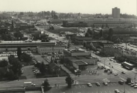
- Aerial photograph of Kingsway and Central Park.
- Media Type
- Photograph
- Notes
- Title based on contents of photograph
- Geographic Access
- Kingsway
- Central Park
- Historic Neighbourhood
- Central Park (Historic Neighbourhood)
- Planning Study Area
- Maywood Area
Images
Matheson and Sons Market
https://search.heritageburnaby.ca/link/archivedescription35041
- Repository
- City of Burnaby Archives
- Date
- 1949 (date of original), copied 1986
- Collection/Fonds
- Burnaby Historical Society fonds
- Description Level
- Item
- Physical Description
- 1 photograph : col. ; 8.6 x 12.7 cm print
- Scope and Content
- Photograph of the exterior of A. Matheson and Sons Market at 3576 Kingsway (later renumbered 4920 Kingsway) and Nelson Avenue. Signs on the building read, "A. Matheson & Sons Market," "Fresh Meats - Groceries," "Quality and Service," "Dexter 1372 1373," and "Free Delivery." Signs advertising pric…
- Repository
- City of Burnaby Archives
- Date
- 1949 (date of original), copied 1986
- Collection/Fonds
- Burnaby Historical Society fonds
- Subseries
- Chamberlain family subseries
- Physical Description
- 1 photograph : col. ; 8.6 x 12.7 cm print
- Description Level
- Item
- Record No.
- 179-012
- Access Restriction
- No restrictions
- Reproduction Restriction
- Reproduce for fair dealing purposes only
- Accession Number
- BHS1986-27
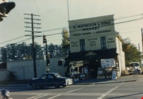
- Scope and Content
- Photograph of the exterior of A. Matheson and Sons Market at 3576 Kingsway (later renumbered 4920 Kingsway) and Nelson Avenue. Signs on the building read, "A. Matheson & Sons Market," "Fresh Meats - Groceries," "Quality and Service," "Dexter 1372 1373," and "Free Delivery." Signs advertising prices are outside the store. A sign by the street lights reads, "Signals set for 29 mph." Cars can be seen. This store was previously owned and operated by Alexander MacKenzie.
- Media Type
- Photograph
- Notes
- Title based on contents of photograph
- Print made from col. slide
- Geographic Access
- Kingsway
- Street Address
- 4920 Kingsway
- Historic Neighbourhood
- Central Park (Historic Neighbourhood)
- Planning Study Area
- Marlborough Area
Images
Matheson and Sons Market
https://search.heritageburnaby.ca/link/archivedescription35042
- Repository
- City of Burnaby Archives
- Date
- 1949 (date of original), copied 1986
- Collection/Fonds
- Burnaby Historical Society fonds
- Description Level
- Item
- Physical Description
- 1 photograph : col. ; 8.8 x 12.6 cm print
- Scope and Content
- Photograph of the exterior of A. Matheson and Sons Market at 3576 Kingsway (later renumbered 4920 Kingsway) and Nelson Avenue. Signs on the building read, "A. Matheson & Sons Market," "Fresh Meats - Groceries," "Quality and Service," "Dexter 1372 1373," and "Free Delivery." Signs advertising pric…
- Repository
- City of Burnaby Archives
- Date
- 1949 (date of original), copied 1986
- Collection/Fonds
- Burnaby Historical Society fonds
- Subseries
- Chamberlain family subseries
- Physical Description
- 1 photograph : col. ; 8.8 x 12.6 cm print
- Description Level
- Item
- Record No.
- 179-013
- Access Restriction
- No restrictions
- Reproduction Restriction
- Reproduce for fair dealing purposes only
- Accession Number
- BHS1986-27
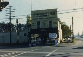
- Scope and Content
- Photograph of the exterior of A. Matheson and Sons Market at 3576 Kingsway (later renumbered 4920 Kingsway) and Nelson Avenue. Signs on the building read, "A. Matheson & Sons Market," "Fresh Meats - Groceries," "Quality and Service," "Dexter 1372 1373," and "Free Delivery." Signs advertising prices are outside the store. A sign by the street lights reads, "Signals set for 29 mph." This store was previously owned and operated by Alexander MacKenzie.
- Media Type
- Photograph
- Notes
- Title based on contents of photograph
- Print made from col. slide
- Geographic Access
- Kingsway
- Street Address
- 4920 Kingsway
- Historic Neighbourhood
- Central Park (Historic Neighbourhood)
- Planning Study Area
- Marlborough Area
Images
McKay Market
https://search.heritageburnaby.ca/link/archivedescription35746
- Repository
- City of Burnaby Archives
- Date
- 1926 (date of original), copied 1986
- Collection/Fonds
- Burnaby Historical Society fonds
- Description Level
- Item
- Physical Description
- 1 photograph : b&w ; 12.7 x 17.8 cm print
- Scope and Content
- Photograph of McKay Market at 2624 McKay Avenue (later renumbered 6555 McKay Avenue). Identified: (back) Ed Morash, driver of delivery truck (brother of Murial Morash Crosby); (in doorway) William Tate Wilson, store owner and later Reeve of Burnaby, 1943-44.
- Repository
- City of Burnaby Archives
- Date
- 1926 (date of original), copied 1986
- Collection/Fonds
- Burnaby Historical Society fonds
- Subseries
- Pioneer Tales subseries
- Physical Description
- 1 photograph : b&w ; 12.7 x 17.8 cm print
- Description Level
- Item
- Record No.
- 204-604
- Access Restriction
- No restrictions
- Reproduction Restriction
- No known restrictions
- Accession Number
- BHS1988-03
- Scope and Content
- Photograph of McKay Market at 2624 McKay Avenue (later renumbered 6555 McKay Avenue). Identified: (back) Ed Morash, driver of delivery truck (brother of Murial Morash Crosby); (in doorway) William Tate Wilson, store owner and later Reeve of Burnaby, 1943-44.
- Subjects
- Buildings - Commercial - Grocery Stores
- Occupations - Truck Drivers
- Occupations - Grocers
- Officials - Mayors and Reeves
- Media Type
- Photograph
- Notes
- Title based on contents of photograph
- Geographic Access
- McKay Avenue
- Street Address
- 6555 McKay Avenue
- Historic Neighbourhood
- Central Park (Historic Neighbourhood)
- Planning Study Area
- Maywood Area
![Alfred Hickman, [195-] (date of original), copied 1986 thumbnail](/media/hpo/_Data/_Archives_Images/_Unrestricted/126/183-002.jpg?width=280)
![Daniel Igali in Save-On-Foods, [2000] thumbnail](/media/hpo/_Data/_Archives_Images/_Unrestricted/535/535-2638.jpg?width=280)

![Hickman Family Store, [1940] (date of original), copied 1986 thumbnail](/media/hpo/_Data/_Archives_Images/_Unrestricted/204/204-243.jpg?width=280)
![IGA Marketplace fundraiser cookie, [2005] thumbnail](/media/hpo/_Data/_Archives_Images/_Unrestricted/535/535-1926.jpg?width=280)
![Kingsway and Central Park, [196-] thumbnail](/media/hpo/_Data/_Archives_Images/_Unrestricted/001/083-001.jpg?width=280)
