Narrow Results By

Aerial view looking east on Kingsway
https://search.heritageburnaby.ca/link/archivedescription78857
- Repository
- City of Burnaby Archives
- Date
- September 15, 1976
- Collection/Fonds
- Burnaby Public Library Contemporary Visual Archive Project
- Description Level
- Item
- Physical Description
- 1 photograph : b&w ; 11 x 16 cm mounted on cardboard
- Scope and Content
- Photograph is an aerial view looking east on Kingsway, taken from the twenty-first floor of the Panorama Towers on Grange Street, with Sears and Kelly Douglas in the background.
- Repository
- City of Burnaby Archives
- Date
- September 15, 1976
- Collection/Fonds
- Burnaby Public Library Contemporary Visual Archive Project
- Physical Description
- 1 photograph : b&w ; 11 x 16 cm mounted on cardboard
- Description Level
- Item
- Record No.
- 556-004
- Access Restriction
- No restrictions
- Reproduction Restriction
- Reproduce for fair dealing purposes only
- Accession Number
- 2013-13
- Scope and Content
- Photograph is an aerial view looking east on Kingsway, taken from the twenty-first floor of the Panorama Towers on Grange Street, with Sears and Kelly Douglas in the background.
- Subjects
- Aerial Photographs
- Media Type
- Photograph
- Photographer
- McCarron, John
- Notes
- Scope note taken directly from BPL photograph description.
- 1 b&w copy negative : 10 x 12.5 cm accompanying
- Geographic Access
- Kingsway
- Grange Street
- Historic Neighbourhood
- Central Park (Historic Neighbourhood)
- Planning Study Area
- Maywood Area
- Garden Village Area
Images


Aerial view of Kingsway and Barker
https://search.heritageburnaby.ca/link/archivedescription78859
- Repository
- City of Burnaby Archives
- Date
- September 27, 1976
- Collection/Fonds
- Burnaby Public Library Contemporary Visual Archive Project
- Description Level
- Item
- Physical Description
- 1 photograph : b&w ; 11 x 16 cm mounted on cardboard
- Scope and Content
- Photograph is an aerial view of Kingsway and Barker Avenue, looking southeast from Central Park Place.
- Repository
- City of Burnaby Archives
- Date
- September 27, 1976
- Collection/Fonds
- Burnaby Public Library Contemporary Visual Archive Project
- Physical Description
- 1 photograph : b&w ; 11 x 16 cm mounted on cardboard
- Description Level
- Item
- Record No.
- 556-005
- Access Restriction
- No restrictions
- Reproduction Restriction
- Reproduce for fair dealing purposes only
- Accession Number
- 2013-13
- Scope and Content
- Photograph is an aerial view of Kingsway and Barker Avenue, looking southeast from Central Park Place.
- Subjects
- Aerial Photographs
- Media Type
- Photograph
- Photographer
- Norton, Paul
- Notes
- Scope note taken directly from BPL photograph description.
- 1 b&w copy negative : 10 x 12.5 cm accompanying
- Geographic Access
- Kingsway
- Barker Avenue
- Historic Neighbourhood
- Central Park (Historic Neighbourhood)
- Planning Study Area
- Maywood Area
- Garden Village Area
Images


Andy Johnson's "Glenedward"
https://search.heritageburnaby.ca/link/archivedescription35046
- Repository
- City of Burnaby Archives
- Date
- 1912 (date of original), copied 1986
- Collection/Fonds
- Burnaby Historical Society fonds
- Description Level
- Item
- Physical Description
- 1 photograph : b&w copy print ; 8.7 x 12.7 cm + copy negative
- Scope and Content
- Photograph of the exterior of Andrew M. Johnson's house "Glenedward," at 5152 Kingsway. Two men and two boys are outside the house, with the youngest boy is seated in a toy car. A low stone wall is surrounding the yard.
- Repository
- City of Burnaby Archives
- Date
- 1912 (date of original), copied 1986
- Collection/Fonds
- Burnaby Historical Society fonds
- Subseries
- Photographs subseries
- Physical Description
- 1 photograph : b&w copy print ; 8.7 x 12.7 cm + copy negative
- Description Level
- Item
- Record No.
- 181-001
- Access Restriction
- No restrictions
- Reproduction Restriction
- No known restrictions
- Accession Number
- BHS1986-29
- Scope and Content
- Photograph of the exterior of Andrew M. Johnson's house "Glenedward," at 5152 Kingsway. Two men and two boys are outside the house, with the youngest boy is seated in a toy car. A low stone wall is surrounding the yard.
- Media Type
- Photograph
- Notes
- Title based on contents of photograph
- Geographic Access
- Kingsway
- Street Address
- 5152 Kingsway
- Historic Neighbourhood
- Central Park (Historic Neighbourhood)
- Planning Study Area
- Marlborough Area
Images


Burnaby Centre
https://search.heritageburnaby.ca/link/archivedescription79941
- Repository
- City of Burnaby Archives
- Date
- September 27, 1976
- Collection/Fonds
- Burnaby Public Library Contemporary Visual Archive Project
- Description Level
- Item
- Physical Description
- 1 photograph : b&w ; 11 x 16 cm mounted on cardboard
- Scope and Content
- Photograph shows an aerial view of Burnaby Centre looking east from Central Park Place. Kingsway is on the right and Grange Street is on the left.
- Repository
- City of Burnaby Archives
- Date
- September 27, 1976
- Collection/Fonds
- Burnaby Public Library Contemporary Visual Archive Project
- Physical Description
- 1 photograph : b&w ; 11 x 16 cm mounted on cardboard
- Description Level
- Item
- Record No.
- 556-512
- Access Restriction
- No restrictions
- Reproduction Restriction
- Reproduce for fair dealing purposes only
- Accession Number
- 2013-13
- Scope and Content
- Photograph shows an aerial view of Burnaby Centre looking east from Central Park Place. Kingsway is on the right and Grange Street is on the left.
- Media Type
- Photograph
- Photographer
- Norton, Paul
- Notes
- Scope note taken directly from BPL photograph description.
- 1 b&w copy negative : 10 x 12.5 cm accompanying
- Geographic Access
- Kingsway
- Grange Street
- Historic Neighbourhood
- Central Park (Historic Neighbourhood)
- Planning Study Area
- Maywood Area
Images

![Hotel Burnaby, [1953] thumbnail](/media/hpo/_Data/_Archives_Images/_Unrestricted/371/410-001.jpg?width=280)
Hotel Burnaby
https://search.heritageburnaby.ca/link/archivedescription38341
- Repository
- City of Burnaby Archives
- Date
- [1953]
- Collection/Fonds
- Burnaby Historical Society fonds
- Description Level
- Item
- Physical Description
- 1 photograph : b&w postcard ; 8.7 x 13.1 cm
- Scope and Content
- Photographic postcard advertising the Hotel Burnaby at 1385 Kingsway (old street numbering). A caption on the reverse of the postcard reads: Hotel Burnaby / :Located between new Simpsons-Sears and new Woodwards shopping centres / You will remember Hotel Burnaby for the REST of your life."
- Repository
- City of Burnaby Archives
- Date
- [1953]
- Collection/Fonds
- Burnaby Historical Society fonds
- Subseries
- Jim Wolf subseries
- Physical Description
- 1 photograph : b&w postcard ; 8.7 x 13.1 cm
- Description Level
- Item
- Record No.
- 410-001
- Access Restriction
- No restrictions
- Reproduction Restriction
- Reproduce for fair dealing purposes only
- Accession Number
- BHS2000-11
- Scope and Content
- Photographic postcard advertising the Hotel Burnaby at 1385 Kingsway (old street numbering). A caption on the reverse of the postcard reads: Hotel Burnaby / :Located between new Simpsons-Sears and new Woodwards shopping centres / You will remember Hotel Burnaby for the REST of your life."
- Subjects
- Advertising Medium
- Documentary Artifacts - Postcards
- Buildings - Commercial - Hotels and Motels
- Names
- Hotel Burnaby Limited
- Media Type
- Photograph
- Notes
- Title based on contents of photograph
- Geographic Access
- Kingsway
- Historic Neighbourhood
- Edmonds (Historic Neighbourhood)
- Planning Study Area
- Stride Avenue Area
Images
![Hotel Burnaby, [1953] thumbnail](/media/hpo/_Data/_Archives_Images/_Unrestricted/371/410-001.jpg)
![Hotel Burnaby Ltd., [1955] thumbnail](/media/hpo/_Data/_Archives_Images/_Unrestricted/371/474-001.jpg?width=280)
Hotel Burnaby Ltd.
https://search.heritageburnaby.ca/link/archivedescription38656
- Repository
- City of Burnaby Archives
- Date
- [1955]
- Collection/Fonds
- Burnaby Historical Society fonds
- Description Level
- Item
- Physical Description
- 1 photograph : col. postcard ; 9 x 14 cm
- Scope and Content
- Photographic postcard of Burnaby Hotel located at 1385 Kingsway (old street numbering system). Printed at the bottom of the postcard is the following: Hotel Burnaby Ltd. / 1385 Kingsway at 14th Avenue / Burnaby 3, New Westminster, B.C., Telephone LA 1-8891. On the reverse is written: "Hotel Burna…
- Repository
- City of Burnaby Archives
- Date
- [1955]
- Collection/Fonds
- Burnaby Historical Society fonds
- Subseries
- Jim Wolf subseries
- Physical Description
- 1 photograph : col. postcard ; 9 x 14 cm
- Description Level
- Item
- Record No.
- 474-001
- Access Restriction
- No restrictions
- Reproduction Restriction
- Reproduce for fair dealing purposes only
- Accession Number
- BHS2005-6
- Scope and Content
- Photographic postcard of Burnaby Hotel located at 1385 Kingsway (old street numbering system). Printed at the bottom of the postcard is the following: Hotel Burnaby Ltd. / 1385 Kingsway at 14th Avenue / Burnaby 3, New Westminster, B.C., Telephone LA 1-8891. On the reverse is written: "Hotel Burnaby: Located between new Simpson-Sears and new Woodwards shopping centres. You will remember Hotel Burnaby for the rest of your life."
- Subjects
- Buildings - Commercial - Hotels and Motels
- Documentary Artifacts - Postcards
- Advertising Medium
- Names
- Hotel Burnaby Limited
- Media Type
- Photograph
- Photographer
- Grant-Mann Lithographers Limited
- Notes
- Title based on caption of postcard
- Made by Grant-Mann Lithographers Ltd. "Colour Card" Division, Vancouver British Columbia
- Geographic Access
- Kingsway
- Historic Neighbourhood
- Edmonds (Historic Neighbourhood)
- Planning Study Area
- Stride Avenue Area
Images
![Hotel Burnaby Ltd., [1955] thumbnail](/media/hpo/_Data/_Archives_Images/_Unrestricted/371/474-001.jpg)

Kingsway
https://search.heritageburnaby.ca/link/archivedescription79943
- Repository
- City of Burnaby Archives
- Date
- September 15, 1976
- Collection/Fonds
- Burnaby Public Library Contemporary Visual Archive Project
- Description Level
- Item
- Physical Description
- 1 photograph : b&w ; 11 x 16 cm mounted on cardboard
- Scope and Content
- Photograph shows a view of Kingsway looking southeast from the 21st floor of the Panorama Towers in Grange Street. The Esso Car Clinic is in the centre of the photo.
- Repository
- City of Burnaby Archives
- Date
- September 15, 1976
- Collection/Fonds
- Burnaby Public Library Contemporary Visual Archive Project
- Physical Description
- 1 photograph : b&w ; 11 x 16 cm mounted on cardboard
- Description Level
- Item
- Record No.
- 556-514
- Access Restriction
- No restrictions
- Reproduction Restriction
- Reproduce for fair dealing purposes only
- Accession Number
- 2013-13
- Scope and Content
- Photograph shows a view of Kingsway looking southeast from the 21st floor of the Panorama Towers in Grange Street. The Esso Car Clinic is in the centre of the photo.
- Subjects
- Aerial Photographs
- Media Type
- Photograph
- Photographer
- McCarron, John
- Notes
- Scope note taken directly from BPL photograph description.
- 1 b&w copy negative : 10 x 12.5 cm accompanying
- Geographic Access
- Kingsway
- Historic Neighbourhood
- Central Park (Historic Neighbourhood)
- Planning Study Area
- Maywood Area
Images


Kingsway
https://search.heritageburnaby.ca/link/archivedescription79944
- Repository
- City of Burnaby Archives
- Date
- October 20, 1976
- Collection/Fonds
- Burnaby Public Library Contemporary Visual Archive Project
- Description Level
- Item
- Physical Description
- 1 photograph : b&w ; 11 x 16 cm mounted on cardboard
- Scope and Content
- Photograph shows a view of Kingsway looking northwest, taken from the Hall Towers at Edmonds Street and Kingsway.
- Repository
- City of Burnaby Archives
- Date
- October 20, 1976
- Collection/Fonds
- Burnaby Public Library Contemporary Visual Archive Project
- Physical Description
- 1 photograph : b&w ; 11 x 16 cm mounted on cardboard
- Description Level
- Item
- Record No.
- 556-515
- Access Restriction
- No restrictions
- Reproduction Restriction
- Reproduce for fair dealing purposes only
- Accession Number
- 2013-13
- Scope and Content
- Photograph shows a view of Kingsway looking northwest, taken from the Hall Towers at Edmonds Street and Kingsway.
- Subjects
- Aerial Photographs
- Media Type
- Photograph
- Photographer
- Ross, Martha
- Notes
- Scope note taken directly from BPL photograph description.
- 1 b&w copy negative : 10 x 12.5 cm accompanying
- Geographic Access
- Kingsway
- Historic Neighbourhood
- Edmonds (Historic Neighbourhood)
Images

![Kingsway and Central Park, [196-] thumbnail](/media/hpo/_Data/_Archives_Images/_Unrestricted/001/083-001.jpg?width=280)
Kingsway and Central Park
https://search.heritageburnaby.ca/link/archivedescription34658
- Repository
- City of Burnaby Archives
- Date
- [196-]
- Collection/Fonds
- Burnaby Historical Society fonds
- Description Level
- Item
- Physical Description
- 1 photograph : b&w ; 14.5 x 19.4 cm
- Scope and Content
- Aerial photograph of Kingsway and Central Park.
- Repository
- City of Burnaby Archives
- Date
- [196-]
- Collection/Fonds
- Burnaby Historical Society fonds
- Subseries
- Photographs subseries
- Physical Description
- 1 photograph : b&w ; 14.5 x 19.4 cm
- Description Level
- Item
- Record No.
- 083-001
- Access Restriction
- No restrictions
- Reproduction Restriction
- Reproduce for fair dealing purposes only
- Accession Number
- BHS2007-04
- Scope and Content
- Aerial photograph of Kingsway and Central Park.
- Media Type
- Photograph
- Notes
- Title based on contents of photograph
- Geographic Access
- Kingsway
- Central Park
- Historic Neighbourhood
- Central Park (Historic Neighbourhood)
- Planning Study Area
- Maywood Area
Images
![Kingsway and Central Park, [196-] thumbnail](/media/hpo/_Data/_Archives_Images/_Unrestricted/001/083-001.jpg)

Kingsway and Central Park
https://search.heritageburnaby.ca/link/archivedescription79964
- Repository
- City of Burnaby Archives
- Date
- October 27, 1976
- Collection/Fonds
- Burnaby Public Library Contemporary Visual Archive Project
- Description Level
- Item
- Physical Description
- 1 photograph : b&w ; 11 x 16 cm mounted on cardboard
- Scope and Content
- Photograph shows a view of Kingsway looking west from Central Park Place.
- Repository
- City of Burnaby Archives
- Date
- October 27, 1976
- Collection/Fonds
- Burnaby Public Library Contemporary Visual Archive Project
- Physical Description
- 1 photograph : b&w ; 11 x 16 cm mounted on cardboard
- Description Level
- Item
- Record No.
- 556-527
- Access Restriction
- No restrictions
- Reproduction Restriction
- Reproduce for fair dealing purposes only
- Accession Number
- 2013-13
- Scope and Content
- Photograph shows a view of Kingsway looking west from Central Park Place.
- Subjects
- Aerial Photographs
- Media Type
- Photograph
- Photographer
- Norton, Paul
- Notes
- Scope note taken directly from BPL photograph description.
- 1 b&w copy negative : 10 x 12.5 cm accompanying
- Geographic Access
- Kingsway
- Historic Neighbourhood
- Central Park (Historic Neighbourhood)
- Planning Study Area
- Maywood Area
Images

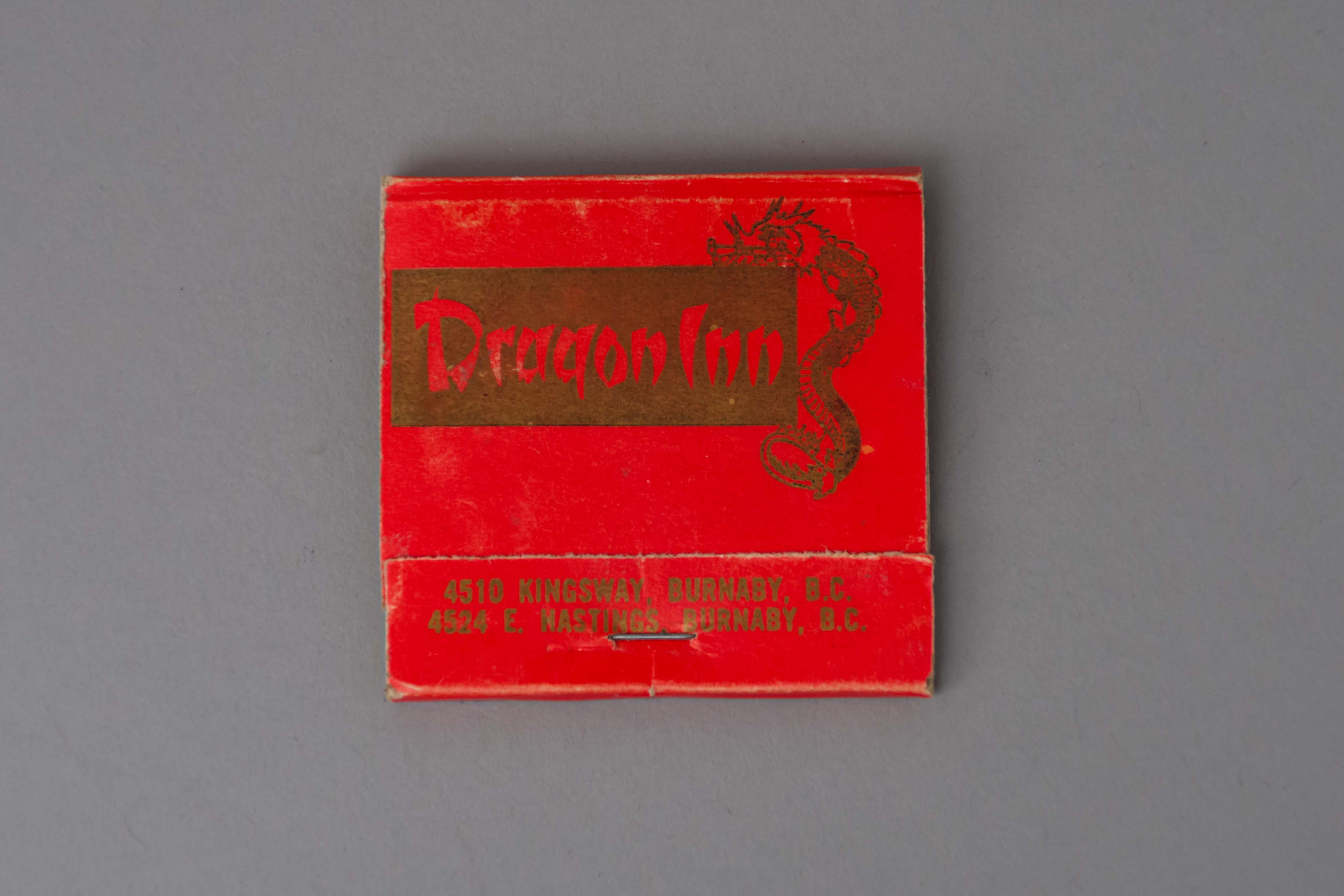
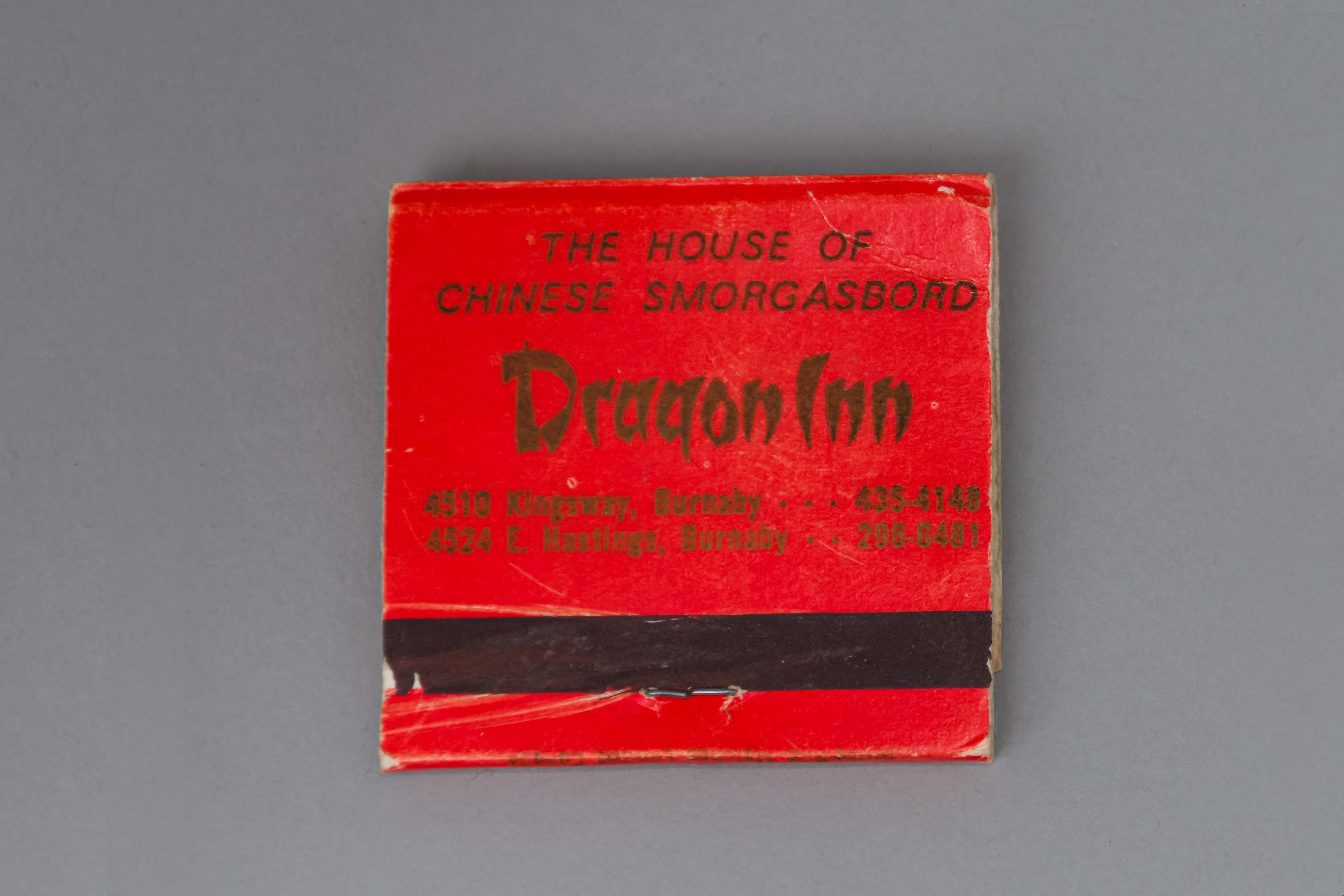
matchbook
https://search.heritageburnaby.ca/link/museumartifact89161
- Repository
- Burnaby Village Museum
- Accession Code
- BV017.37.8
- Description
- matchbook; red folded paper with gold ink text and illustration of a dragon; "Dragon Inn / 4510 KINGSWAY, BURNABY, B.C. / 4524 E. HASTINGS, BURNABY B.C." printed on face; "THE HOUSE OF / CHINESE SMORGASBORD / Dragon Inn / 4510 Kingsway, Burnaby . . . 435-4148 / 4524 E. Hastings . . . 298-6481". There are pink-tipped matches in the book.
- Object History
- Dragon Inn belonged to the Lee family. The Dragon Inn restaurant was located at at 4510 Kingsway, on the corner of Kingsway and Willingdon Avenue (opened in the 1970s) and later at Hastings Street near Willingdon (opened in the 1990s). The Dragon Inn was known for its exterior neon sign which was removed in 1997.
- Category
- 02. Furnishings
- Classification
- Temperature Control Equipment - - Firemaking Equipment
- Object Term
- Matchbook
- Names
- Dragon Inn
- Geographic Access
- Kingsway
- Street Address
- 4510 Kingsway
- Historic Neighbourhood
- Central Park (Historic Neighbourhood)
- Planning Study Area
- Maywood Area
Images
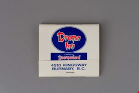
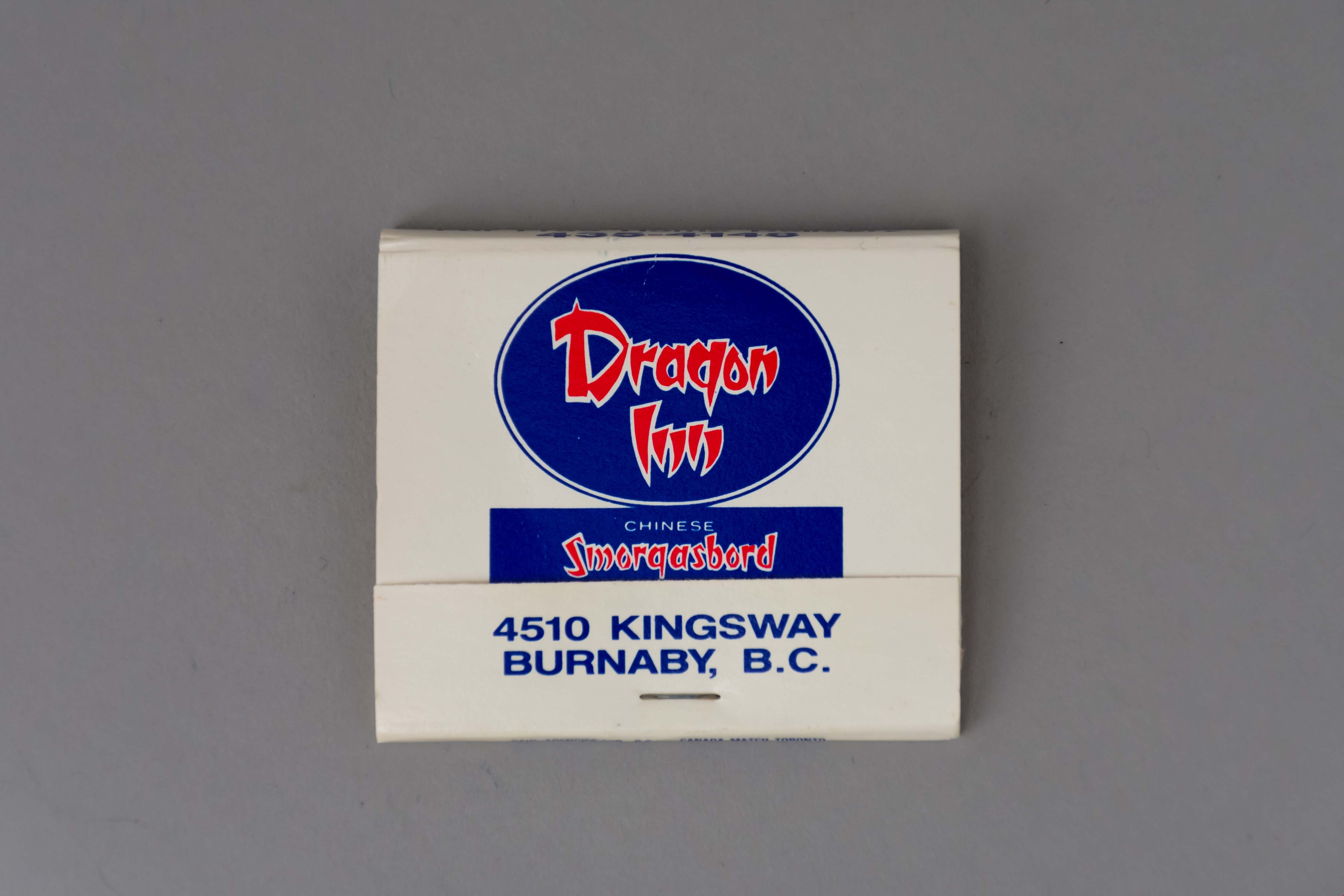
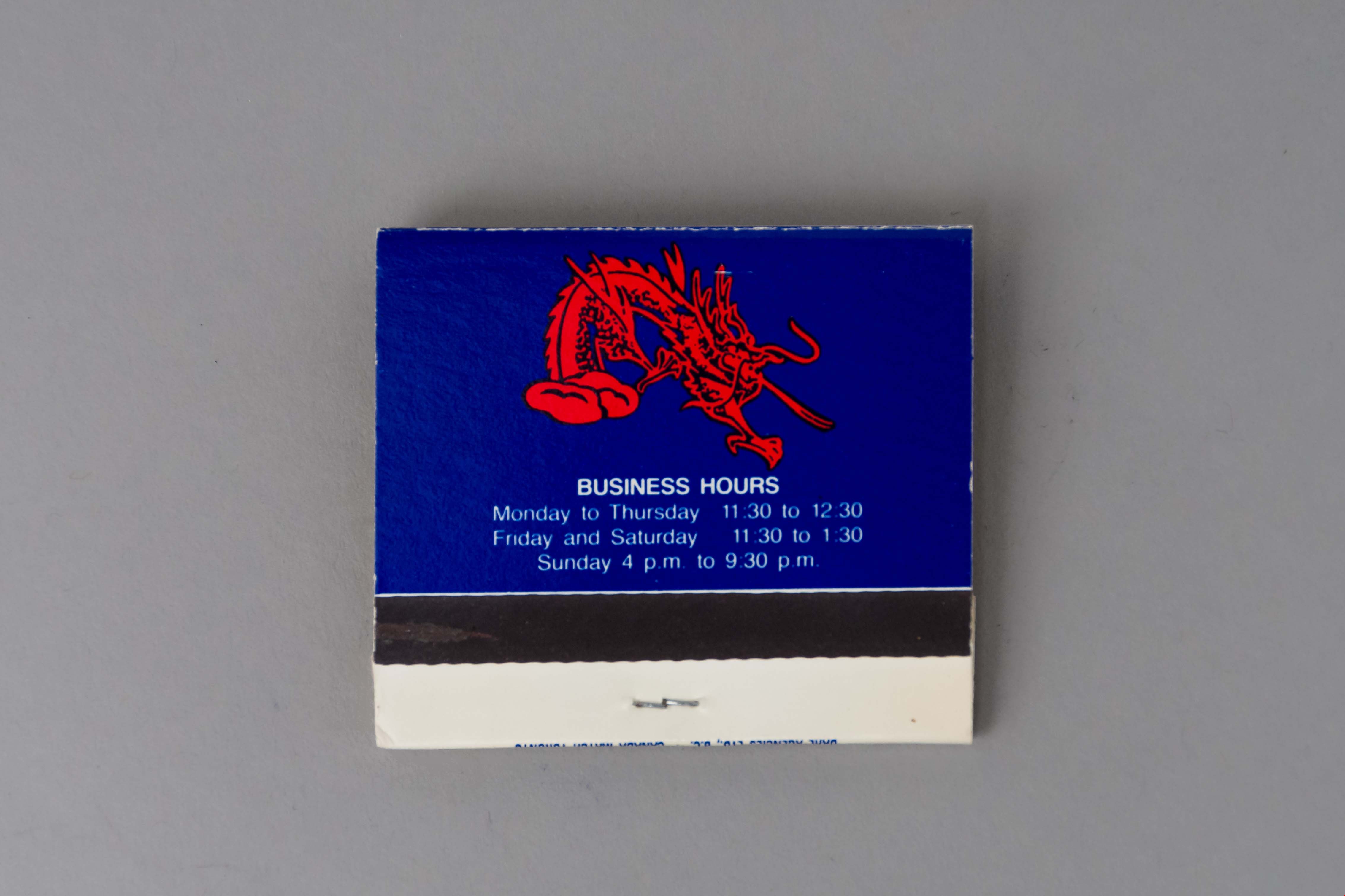
matchbook
https://search.heritageburnaby.ca/link/museumartifact89162
- Repository
- Burnaby Village Museum
- Accession Code
- BV017.37.9
- Description
- matchbook; white folded paper with blue and red ink text and illustration of a dragon; "Dragon / Inn / CHINESE / Smorgasbord / EVERY DAY / 4510 KINGSWAY / BURNABY, B.C." printed on face; business hours printed on back. There are blue-tipped matches in the book; manufactured by "DAHL AGENCIES LTD, B.C. * CANADA MATCH TORONTO".
- Object History
- Dragon Inn belonged to the Lee family. The Dragon Inn restaurant was located at at 4510 Kingsway, on the corner of Kingsway and Willingdon Avenue (opened in the 1970s) and later at Hastings Street near Willingdon (opened in the 1990s). The Dragon Inn was known for its exterior neon sign which was removed in 1997.
- Category
- 02. Furnishings
- Classification
- Temperature Control Equipment - - Firemaking Equipment
- Object Term
- Matchbook
- Names
- Dragon Inn
- Geographic Access
- Kingsway
- Street Address
- 4510 Kingsway
- Historic Neighbourhood
- Central Park (Historic Neighbourhood)
- Planning Study Area
- Maywood Area
Images

Middlegate
https://search.heritageburnaby.ca/link/archivedescription79965
- Repository
- City of Burnaby Archives
- Date
- October 20, 1976
- Collection/Fonds
- Burnaby Public Library Contemporary Visual Archive Project
- Description Level
- Item
- Physical Description
- 1 photograph : b&w ; 11 x 16 cm mounted on cardboard
- Scope and Content
- Photograph shows a view of Kingsway near the Middlegate Shopping Centre, looking northwest from Hall Towers.
- Repository
- City of Burnaby Archives
- Date
- October 20, 1976
- Collection/Fonds
- Burnaby Public Library Contemporary Visual Archive Project
- Physical Description
- 1 photograph : b&w ; 11 x 16 cm mounted on cardboard
- Description Level
- Item
- Record No.
- 556-528
- Access Restriction
- No restrictions
- Reproduction Restriction
- Reproduce for fair dealing purposes only
- Accession Number
- 2013-13
- Scope and Content
- Photograph shows a view of Kingsway near the Middlegate Shopping Centre, looking northwest from Hall Towers.
- Subjects
- Aerial Photographs
- Media Type
- Photograph
- Photographer
- Ross, Martha
- Notes
- Scope note taken directly from BPL photograph description.
- 1 b&w copy negative : 10 x 12.5 cm accompanying
- Geographic Access
- Kingsway
- Historic Neighbourhood
- Edmonds (Historic Neighbourhood)
- Planning Study Area
- Stride Avenue Area
Images

![Orchard Shopping Centre, [196-] thumbnail](/media/hpo/_Data/_Archives_Images/_Unrestricted/001/069-002.jpg?width=280)
Orchard Shopping Centre
https://search.heritageburnaby.ca/link/archivedescription34634
- Repository
- City of Burnaby Archives
- Date
- [196-]
- Collection/Fonds
- Burnaby Historical Society fonds
- Description Level
- Item
- Physical Description
- 1 photograph : b&w ; 12.6 x 20.4 cm
- Scope and Content
- Aerial photograph of the Old Orchard Shopping Centre on Kingsway.
- Repository
- City of Burnaby Archives
- Date
- [196-]
- Collection/Fonds
- Burnaby Historical Society fonds
- Subseries
- Photographs subseries
- Physical Description
- 1 photograph : b&w ; 12.6 x 20.4 cm
- Description Level
- Item
- Record No.
- 069-002
- Access Restriction
- No restrictions
- Reproduction Restriction
- Reproduce for fair dealing purposes only
- Accession Number
- BHS2007-04
- Scope and Content
- Aerial photograph of the Old Orchard Shopping Centre on Kingsway.
- Media Type
- Photograph
- Notes
- Title based on contents of photograph
- Geographic Access
- Kingsway
- Street Address
- 4469 Kingsway
- Historic Neighbourhood
- Central Park (Historic Neighbourhood)
- Planning Study Area
- Maywood Area
Images
![Orchard Shopping Centre, [196-] thumbnail](/media/hpo/_Data/_Archives_Images/_Unrestricted/001/069-002.jpg)

Safeway Disco Centre
https://search.heritageburnaby.ca/link/archivedescription79963
- Repository
- City of Burnaby Archives
- Date
- October 20, 1976
- Collection/Fonds
- Burnaby Public Library Contemporary Visual Archive Project
- Description Level
- Item
- Physical Description
- 1 photograph : b&w ; 11 x 16 cm mounted on cardboard
- Scope and Content
- Photograph shows a view of the Safeway Disco Centre at Kingsway and Edmonds Street looking southeast from Hall Towers.
- Repository
- City of Burnaby Archives
- Date
- October 20, 1976
- Collection/Fonds
- Burnaby Public Library Contemporary Visual Archive Project
- Physical Description
- 1 photograph : b&w ; 11 x 16 cm mounted on cardboard
- Description Level
- Item
- Record No.
- 556-526
- Access Restriction
- No restrictions
- Reproduction Restriction
- Reproduce for fair dealing purposes only
- Accession Number
- 2013-13
- Scope and Content
- Photograph shows a view of the Safeway Disco Centre at Kingsway and Edmonds Street looking southeast from Hall Towers.
- Subjects
- Aerial Photographs
- Names
- Safeway Disco Centre
- Media Type
- Photograph
- Photographer
- Ross, Martha
- Notes
- Scope note taken directly from BPL photograph description.
- 1 b&w copy negative : 10 x 12.5 cm accompanying
- Geographic Access
- Kingsway
- Edmonds Street
- Historic Neighbourhood
- Edmonds (Historic Neighbourhood)
- Planning Study Area
- Stride Avenue Area
Images
