Narrow Results By
Subject
- Accidents 1
- Accidents - Automobile Accidents 1
- Advertising Medium
- Advertising Medium - Signs and Signboards 68
- Aerial Photographs 10
- Agricultural Tools and Equipment - Gardening Equipment 1
- Agricultural Tools and Equipment - Plows 1
- Agriculture - Crops 4
- Agriculture - Farms
- Agriculture - Fruit and Berries 4
- Agriculture - Orchards 1
- Agriculture - Poultry 3
![Cassidy Family on their Dairy Farm, [1912] (date of original), copied 1986 thumbnail](/media/hpo/_Data/_Archives_Images/_Unrestricted/204/204-074.jpg?width=280)
Cassidy Family on their Dairy Farm
https://search.heritageburnaby.ca/link/archivedescription35217
- Repository
- City of Burnaby Archives
- Date
- [1912] (date of original), copied 1986
- Collection/Fonds
- Burnaby Historical Society fonds
- Description Level
- Item
- Physical Description
- 1 photograph : b&w ; 12.7 x 20.3 cm print
- Scope and Content
- Photograph of the Cassidy family. Willie Cassidy (back), Mary Cassidy (left) and Mrs. Katherine Cassidy (foreground) are tending the dairy herd on the Cassidy farm at Darwin and Moscrop Streets. John Cassidy delivered milk.
- Repository
- City of Burnaby Archives
- Date
- [1912] (date of original), copied 1986
- Collection/Fonds
- Burnaby Historical Society fonds
- Subseries
- Pioneer Tales subseries
- Physical Description
- 1 photograph : b&w ; 12.7 x 20.3 cm print
- Description Level
- Item
- Record No.
- 204-074
- Access Restriction
- No restrictions
- Reproduction Restriction
- No known restrictions
- Accession Number
- BHS1988-03
- Scope and Content
- Photograph of the Cassidy family. Willie Cassidy (back), Mary Cassidy (left) and Mrs. Katherine Cassidy (foreground) are tending the dairy herd on the Cassidy farm at Darwin and Moscrop Streets. John Cassidy delivered milk.
- Subjects
- Animals - Cows
- Agriculture - Farms
- Media Type
- Photograph
- Notes
- Title based on contents of photograph
- Geographic Access
- Darwin Avenue
- Moscrop Street
- Historic Neighbourhood
- Central Park (Historic Neighbourhood)
- Planning Study Area
- Garden Village Area
Images
![Cassidy Family on their Dairy Farm, [1912] (date of original), copied 1986 thumbnail](/media/hpo/_Data/_Archives_Images/_Unrestricted/204/204-074.jpg)

Cram family fruit stand
https://search.heritageburnaby.ca/link/archivedescription35703
- Repository
- City of Burnaby Archives
- Date
- 1920 (date of original), copied 1986
- Collection/Fonds
- Burnaby Historical Society fonds
- Description Level
- Item
- Physical Description
- 1 photograph : b&w ; 12.7 x 17.8 cm print
- Scope and Content
- Photograph of the Cram roadside fruit stand on Kingsway with Mary Cram in front. The Cram family sold fruit, produce, honey, and cottage cheese from their farm at Kingsway and what is now 6515 Denbigh Avenue. The stand was located directly in front of the Cram-Tidball family home.
- Repository
- City of Burnaby Archives
- Date
- 1920 (date of original), copied 1986
- Collection/Fonds
- Burnaby Historical Society fonds
- Subseries
- Pioneer Tales subseries
- Physical Description
- 1 photograph : b&w ; 12.7 x 17.8 cm print
- Description Level
- Item
- Record No.
- 204-561
- Access Restriction
- No restrictions
- Reproduction Restriction
- No known restrictions
- Accession Number
- BHS1988-03
- Scope and Content
- Photograph of the Cram roadside fruit stand on Kingsway with Mary Cram in front. The Cram family sold fruit, produce, honey, and cottage cheese from their farm at Kingsway and what is now 6515 Denbigh Avenue. The stand was located directly in front of the Cram-Tidball family home.
- Names
- Vogt, Mary Cram
- Media Type
- Photograph
- Notes
- Title based on contents of photograph
- Geographic Access
- Denbigh Avenue
- Street Address
- 6515 Denbigh Avenue
- Historic Neighbourhood
- Central Park (Historic Neighbourhood)
- Planning Study Area
- Windsor Area
Images

![Elgin Avenue farmhouse, [between 1920 and 1925] (date of original), copied 1986 thumbnail](/media/hpo/_Data/_Archives_Images/_Unrestricted/126/179-005.jpg?width=280)
Elgin Avenue farmhouse
https://search.heritageburnaby.ca/link/archivedescription35034
- Repository
- City of Burnaby Archives
- Date
- [between 1920 and 1925] (date of original), copied 1986
- Collection/Fonds
- Burnaby Historical Society fonds
- Description Level
- Item
- Physical Description
- 1 photograph : b&w ; 8.7 x 12.7 cm print
- Scope and Content
- Photograph of the exterior of an Elgin Avenue farmhouse and surrounding property. The farmhouse is at the left side of the photograph, and a chicken barn is at the right side. This may be 6389 Elgin Avenue.
- Repository
- City of Burnaby Archives
- Date
- [between 1920 and 1925] (date of original), copied 1986
- Collection/Fonds
- Burnaby Historical Society fonds
- Subseries
- Chamberlain family subseries
- Physical Description
- 1 photograph : b&w ; 8.7 x 12.7 cm print
- Description Level
- Item
- Record No.
- 179-005
- Access Restriction
- No restrictions
- Reproduction Restriction
- No known restrictions
- Accession Number
- BHS1986-27
- Scope and Content
- Photograph of the exterior of an Elgin Avenue farmhouse and surrounding property. The farmhouse is at the left side of the photograph, and a chicken barn is at the right side. This may be 6389 Elgin Avenue.
- Media Type
- Photograph
- Notes
- Title based on contents of photograph
- Geographic Access
- Elgin Avenue
- Street Address
- 6389 Elgin Avenue
- Historic Neighbourhood
- Central Park (Historic Neighbourhood)
- Planning Study Area
- Windsor Area
Images
![Elgin Avenue farmhouse, [between 1920 and 1925] (date of original), copied 1986 thumbnail](/media/hpo/_Data/_Archives_Images/_Unrestricted/126/179-005.jpg)

Fernhurst Game Farm
https://search.heritageburnaby.ca/link/archivedescription35393
- Repository
- City of Burnaby Archives
- Date
- 1918 (date of original), copied 1986
- Collection/Fonds
- Burnaby Historical Society fonds
- Description Level
- Item
- Physical Description
- 1 photograph : b&w ; 12.7 x 17.8 cm print
- Scope and Content
- Photograph of a raccoon at the Fernhurst Game Farm, founded by Charles R. Gillmore near Imperial Street and Dow Avenue. This later became the site of Maywood Elementary School at 4567 Imperial Street.
- Repository
- City of Burnaby Archives
- Date
- 1918 (date of original), copied 1986
- Collection/Fonds
- Burnaby Historical Society fonds
- Subseries
- Pioneer Tales subseries
- Physical Description
- 1 photograph : b&w ; 12.7 x 17.8 cm print
- Description Level
- Item
- Record No.
- 204-250
- Access Restriction
- No restrictions
- Reproduction Restriction
- No known restrictions
- Accession Number
- BHS1988-03
- Scope and Content
- Photograph of a raccoon at the Fernhurst Game Farm, founded by Charles R. Gillmore near Imperial Street and Dow Avenue. This later became the site of Maywood Elementary School at 4567 Imperial Street.
- Subjects
- Animals
- Agriculture - Farms
- Names
- Fernhurst Game Farm
- Media Type
- Photograph
- Notes
- Title based on contents of photograph
- Geographic Access
- Imperial Street
- Street Address
- 4567 Imperial Street
- Historic Neighbourhood
- Central Park (Historic Neighbourhood)
- Planning Study Area
- Maywood Area
Images


Fernhurst Game Farm
https://search.heritageburnaby.ca/link/archivedescription35394
- Repository
- City of Burnaby Archives
- Date
- 1920 (date of original), copied 1986
- Collection/Fonds
- Burnaby Historical Society fonds
- Description Level
- Item
- Physical Description
- 1 photograph : b&w ; 12.7 x 17.8 cm print
- Scope and Content
- Photograph of Canada geese and goslings at the Fernhurst Game Farm. Fernhurst was operated by Charles R. Gillmore who later introduced Canada geese into New Zealand. This later became the site of Maywood Elementary School at 4567 Imperial Street.
- Repository
- City of Burnaby Archives
- Date
- 1920 (date of original), copied 1986
- Collection/Fonds
- Burnaby Historical Society fonds
- Subseries
- Pioneer Tales subseries
- Physical Description
- 1 photograph : b&w ; 12.7 x 17.8 cm print
- Description Level
- Item
- Record No.
- 204-251
- Access Restriction
- No restrictions
- Reproduction Restriction
- No known restrictions
- Accession Number
- BHS1988-03
- Scope and Content
- Photograph of Canada geese and goslings at the Fernhurst Game Farm. Fernhurst was operated by Charles R. Gillmore who later introduced Canada geese into New Zealand. This later became the site of Maywood Elementary School at 4567 Imperial Street.
- Subjects
- Animals - Poultry
- Agriculture - Farms
- Names
- Fernhurst Game Farm
- Media Type
- Photograph
- Notes
- Title based on contents of photograph
- Geographic Access
- Imperial Street
- Street Address
- 4567 Imperial Street
- Historic Neighbourhood
- Central Park (Historic Neighbourhood)
- Planning Study Area
- Maywood Area
Images

![Fernhurst Game Farm, [1920] (date of original), copied 1986 thumbnail](/media/hpo/_Data/_Archives_Images/_Unrestricted/204/204-253.jpg?width=280)
Fernhurst Game Farm
https://search.heritageburnaby.ca/link/archivedescription35396
- Repository
- City of Burnaby Archives
- Date
- [1920] (date of original), copied 1986
- Collection/Fonds
- Burnaby Historical Society fonds
- Description Level
- Item
- Physical Description
- 1 photograph : b&w ; 12.7 x 17.8 cm print
- Scope and Content
- Photograph of a large pond for ducks and geese at Fernhurst Game Farm, operated by Charles R. Gillmore near Imperial Street and Dow Avenue. This later became the site of Maywood Elementary School at 4567 Imperial Street.
- Repository
- City of Burnaby Archives
- Date
- [1920] (date of original), copied 1986
- Collection/Fonds
- Burnaby Historical Society fonds
- Subseries
- Pioneer Tales subseries
- Physical Description
- 1 photograph : b&w ; 12.7 x 17.8 cm print
- Description Level
- Item
- Record No.
- 204-253
- Access Restriction
- No restrictions
- Reproduction Restriction
- No known restrictions
- Accession Number
- BHS1988-03
- Scope and Content
- Photograph of a large pond for ducks and geese at Fernhurst Game Farm, operated by Charles R. Gillmore near Imperial Street and Dow Avenue. This later became the site of Maywood Elementary School at 4567 Imperial Street.
- Names
- Fernhurst Game Farm
- Media Type
- Photograph
- Notes
- Title based on contents of photograph
- Geographic Access
- Imperial Street
- Street Address
- 4567 Imperial Street
- Historic Neighbourhood
- Central Park (Historic Neighbourhood)
- Planning Study Area
- Maywood Area
Images
![Fernhurst Game Farm, [1920] (date of original), copied 1986 thumbnail](/media/hpo/_Data/_Archives_Images/_Unrestricted/204/204-253.jpg)

Gardner Family Chicken Farm
https://search.heritageburnaby.ca/link/archivedescription35614
- Repository
- City of Burnaby Archives
- Date
- 1927 (date of original), copied 1986
- Collection/Fonds
- Burnaby Historical Society fonds
- Description Level
- Item
- Physical Description
- 1 photograph : b&w ; 12.7 x 17.8 cm print
- Scope and Content
- Photograph of (left to right) Harry Gardner and Sarah Gardner in front of the property they rented for use as a chicken farm. 2604 Fern Avenue was located across from the family home, and for two years the family used it as a fryer chicken and egg farm. The Bonsor recreation centre was later buil…
- Repository
- City of Burnaby Archives
- Date
- 1927 (date of original), copied 1986
- Collection/Fonds
- Burnaby Historical Society fonds
- Subseries
- Pioneer Tales subseries
- Physical Description
- 1 photograph : b&w ; 12.7 x 17.8 cm print
- Description Level
- Item
- Record No.
- 204-472
- Access Restriction
- No restrictions
- Reproduction Restriction
- No known restrictions
- Accession Number
- BHS1988-03
- Scope and Content
- Photograph of (left to right) Harry Gardner and Sarah Gardner in front of the property they rented for use as a chicken farm. 2604 Fern Avenue was located across from the family home, and for two years the family used it as a fryer chicken and egg farm. The Bonsor recreation centre was later built there after it became the site of Bonsor Park at 6550 Bonsor Avenue.
- Subjects
- Agriculture - Farms
- Media Type
- Photograph
- Notes
- Title based on contents of photograph
- Geographic Access
- Fern Avenue
- Bonsor Avenue
- Street Address
- 6550 Bonsor Avenue
- Historic Neighbourhood
- Central Park (Historic Neighbourhood)
- Planning Study Area
- Marlborough Area
Images


Gardner family farm
https://search.heritageburnaby.ca/link/archivedescription35615
- Repository
- City of Burnaby Archives
- Date
- 1927 (date of original), copied 1986
- Collection/Fonds
- Burnaby Historical Society fonds
- Description Level
- Item
- Physical Description
- 1 photograph : b&w ; 12.7 x 17.8 cm print
- Scope and Content
- Photograph of Hazel Gardner and a pet goat at the family chicken farm. The centre house in the background is the family home across Fern Avenue. This area later became the site of Bonsor Park at 6550 Bonsor Avenue.
- Repository
- City of Burnaby Archives
- Date
- 1927 (date of original), copied 1986
- Collection/Fonds
- Burnaby Historical Society fonds
- Subseries
- Pioneer Tales subseries
- Physical Description
- 1 photograph : b&w ; 12.7 x 17.8 cm print
- Description Level
- Item
- Record No.
- 204-473
- Access Restriction
- No restrictions
- Reproduction Restriction
- No known restrictions
- Accession Number
- BHS1988-03
- Scope and Content
- Photograph of Hazel Gardner and a pet goat at the family chicken farm. The centre house in the background is the family home across Fern Avenue. This area later became the site of Bonsor Park at 6550 Bonsor Avenue.
- Subjects
- Animals - Goats
- Agriculture - Farms
- Names
- Willis, Hazel Gardner
- Media Type
- Photograph
- Notes
- Title based on contents of photograph
- Geographic Access
- Fern Avenue
- Bonsor Avenue
- Street Address
- 6550 Bonsor Avenue
- Historic Neighbourhood
- Central Park (Historic Neighbourhood)
- Planning Study Area
- Marlborough Area
Images


Gillmore Poultry Farm
https://search.heritageburnaby.ca/link/archivedescription35388
- Repository
- City of Burnaby Archives
- Date
- 1911 (date of original), copied 1986
- Collection/Fonds
- Burnaby Historical Society fonds
- Description Level
- Item
- Physical Description
- 1 photograph : b&w ; 12.7 x 17.8 cm print
- Scope and Content
- Photograph of (left to right) Jack Gillmore and his mother, Jean Gillmore, feeding some of the 2,000 chickens on Red Feather Poultry Ranch on Keefer Road (later becoming 6350 McKay Avenue). The ranch was founded by Charles Reginald Gillmore. Charles R. Gillmore was married to Jean Leslie Mills an…
- Repository
- City of Burnaby Archives
- Date
- 1911 (date of original), copied 1986
- Collection/Fonds
- Burnaby Historical Society fonds
- Subseries
- Pioneer Tales subseries
- Physical Description
- 1 photograph : b&w ; 12.7 x 17.8 cm print
- Description Level
- Item
- Record No.
- 204-245
- Access Restriction
- No restrictions
- Reproduction Restriction
- No known restrictions
- Accession Number
- BHS1988-03
- Scope and Content
- Photograph of (left to right) Jack Gillmore and his mother, Jean Gillmore, feeding some of the 2,000 chickens on Red Feather Poultry Ranch on Keefer Road (later becoming 6350 McKay Avenue). The ranch was founded by Charles Reginald Gillmore. Charles R. Gillmore was married to Jean Leslie Mills and was a principal in Gillmore, Mills & Co. of 170 Water Street in Vancouver.
- Subjects
- Animals - Poultry
- Agriculture - Farms
- Media Type
- Photograph
- Notes
- Title based on contents of photograph
- Geographic Access
- McKay Avenue
- Street Address
- 6350 McKay Avenue
- Historic Neighbourhood
- Central Park (Historic Neighbourhood)
- Planning Study Area
- Maywood Area
Images


Gillmore Poultry Farm
https://search.heritageburnaby.ca/link/archivedescription35389
- Repository
- City of Burnaby Archives
- Date
- 1911 (date of original), copied 1986
- Collection/Fonds
- Burnaby Historical Society fonds
- Description Level
- Item
- Physical Description
- 1 photograph : b&w ; 12.7 x 17.8 cm print
- Scope and Content
- Photograph of ducks on the Red Feather Poultry Ranch located on Keefer Road (later becoming 6350 McKay Avenue). The long ranch house is faintly discernable in the background. The farm was operated by Charles R. Gillmore.
- Repository
- City of Burnaby Archives
- Date
- 1911 (date of original), copied 1986
- Collection/Fonds
- Burnaby Historical Society fonds
- Subseries
- Pioneer Tales subseries
- Physical Description
- 1 photograph : b&w ; 12.7 x 17.8 cm print
- Description Level
- Item
- Record No.
- 204-246
- Access Restriction
- No restrictions
- Reproduction Restriction
- No known restrictions
- Accession Number
- BHS1988-03
- Scope and Content
- Photograph of ducks on the Red Feather Poultry Ranch located on Keefer Road (later becoming 6350 McKay Avenue). The long ranch house is faintly discernable in the background. The farm was operated by Charles R. Gillmore.
- Subjects
- Animals - Poultry
- Agriculture - Farms
- Media Type
- Photograph
- Notes
- Title based on contents of photograph
- Geographic Access
- McKay Avenue
- Street Address
- 6350 McKay Avenue
- Historic Neighbourhood
- Central Park (Historic Neighbourhood)
- Planning Study Area
- Maywood Area
Images


Jack Gillmore
https://search.heritageburnaby.ca/link/archivedescription35392
- Repository
- City of Burnaby Archives
- Date
- 1910 (date of original), copied 1986
- Collection/Fonds
- Burnaby Historical Society fonds
- Description Level
- Item
- Physical Description
- 1 photograph : b&w ; 12.7 x 17.8 cm print
- Scope and Content
- Photograph of Jack Gillmore holding a bantam. The long ranch home and chicken pens can be seen. Jack was the son of Charles R. Gillmore who operated the Red Feather Poultry Ranch on Keefer Road (later becoming 6350 McKay Avenue).
- Repository
- City of Burnaby Archives
- Date
- 1910 (date of original), copied 1986
- Collection/Fonds
- Burnaby Historical Society fonds
- Subseries
- Pioneer Tales subseries
- Physical Description
- 1 photograph : b&w ; 12.7 x 17.8 cm print
- Description Level
- Item
- Record No.
- 204-249
- Access Restriction
- No restrictions
- Reproduction Restriction
- No known restrictions
- Accession Number
- BHS1988-03
- Scope and Content
- Photograph of Jack Gillmore holding a bantam. The long ranch home and chicken pens can be seen. Jack was the son of Charles R. Gillmore who operated the Red Feather Poultry Ranch on Keefer Road (later becoming 6350 McKay Avenue).
- Subjects
- Animals - Poultry
- Agriculture - Farms
- Media Type
- Photograph
- Notes
- Title based on contents of photograph
- Geographic Access
- McKay Avenue
- Street Address
- 6350 McKay Avenue
- Historic Neighbourhood
- Central Park (Historic Neighbourhood)
- Planning Study Area
- Maywood Area
Images

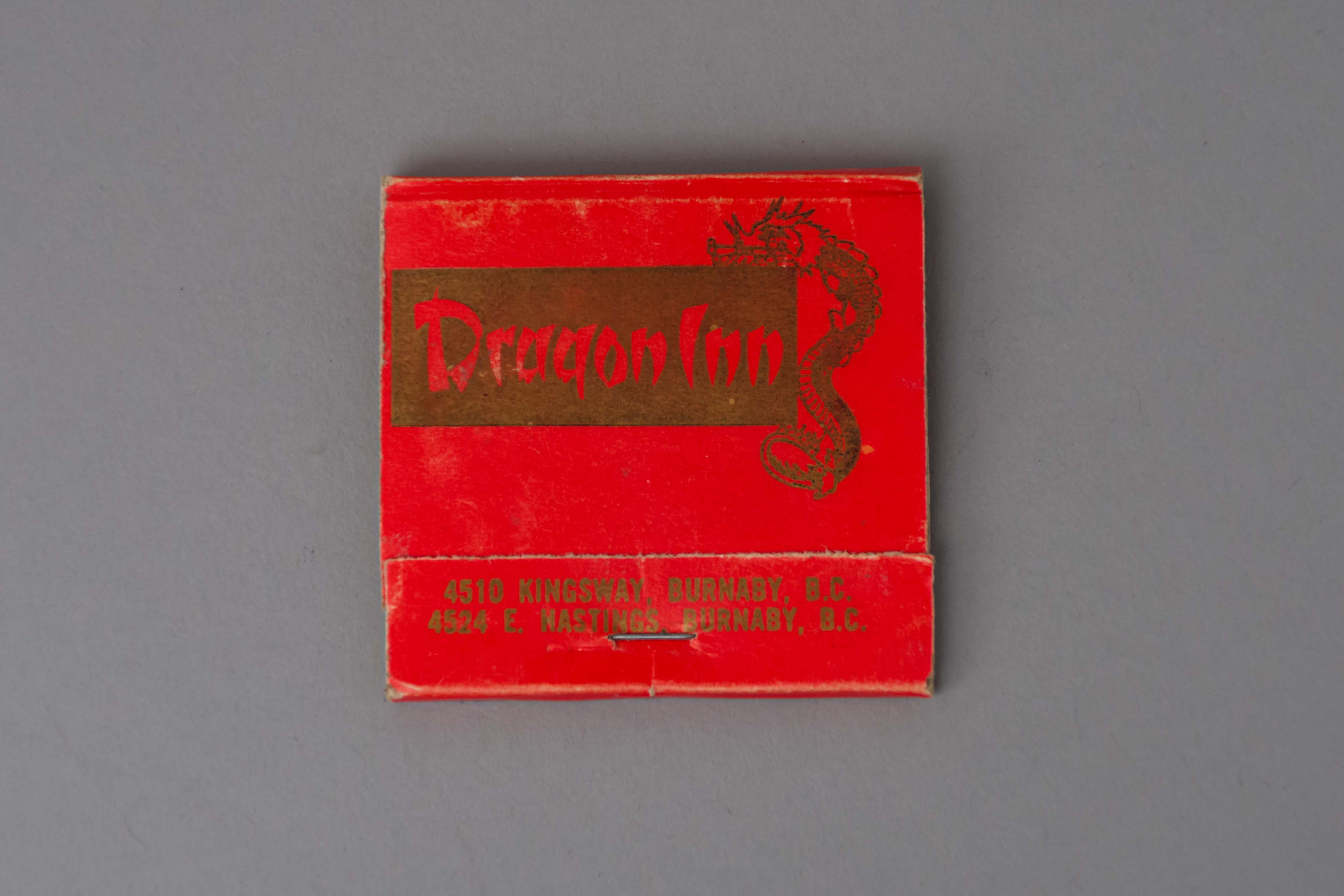
matchbook
https://search.heritageburnaby.ca/link/museumartifact89161
- Repository
- Burnaby Village Museum
- Accession Code
- BV017.37.8
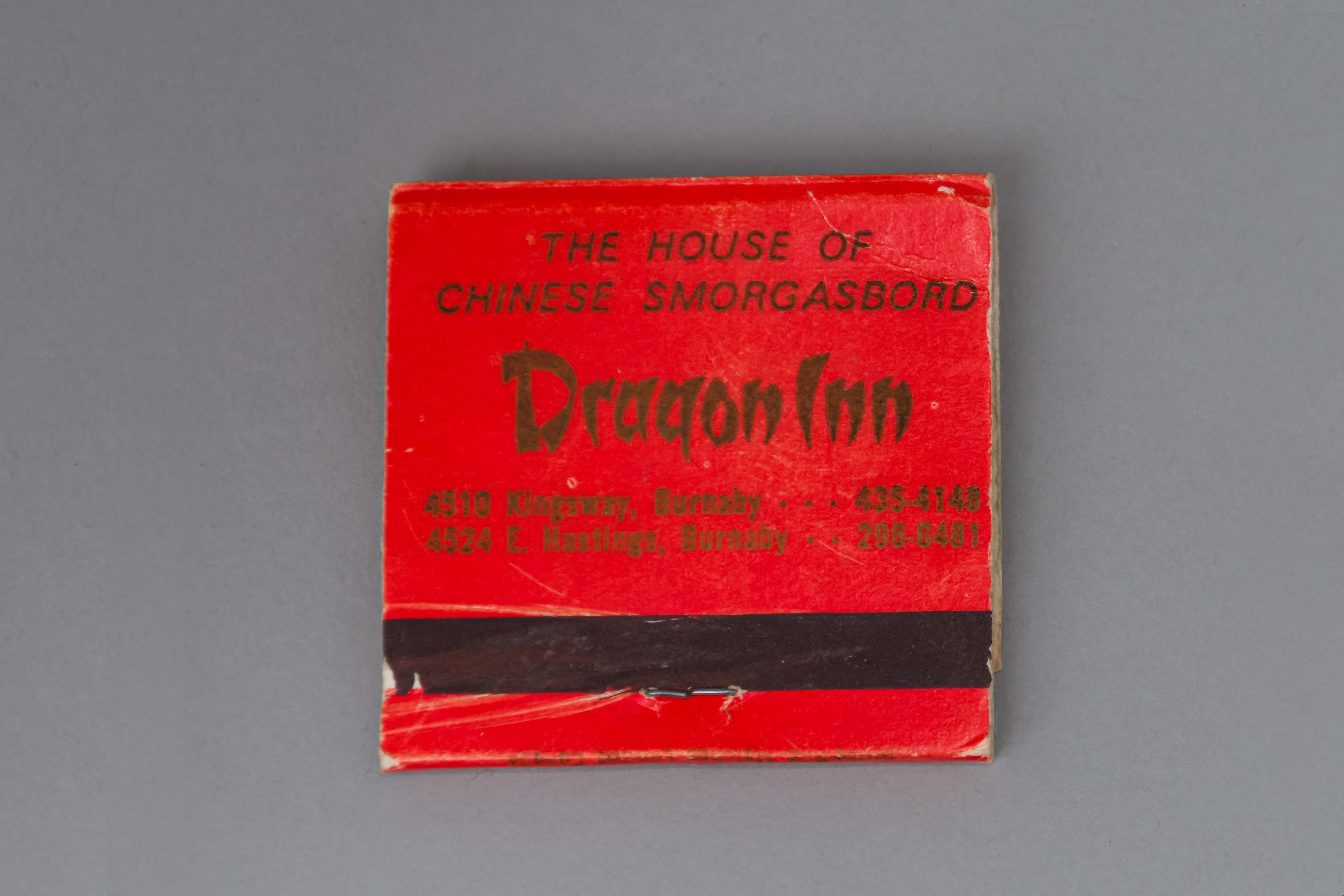
- Description
- matchbook; red folded paper with gold ink text and illustration of a dragon; "Dragon Inn / 4510 KINGSWAY, BURNABY, B.C. / 4524 E. HASTINGS, BURNABY B.C." printed on face; "THE HOUSE OF / CHINESE SMORGASBORD / Dragon Inn / 4510 Kingsway, Burnaby . . . 435-4148 / 4524 E. Hastings . . . 298-6481". There are pink-tipped matches in the book.
- Object History
- Dragon Inn belonged to the Lee family. The Dragon Inn restaurant was located at at 4510 Kingsway, on the corner of Kingsway and Willingdon Avenue (opened in the 1970s) and later at Hastings Street near Willingdon (opened in the 1990s). The Dragon Inn was known for its exterior neon sign which was removed in 1997.
- Category
- 02. Furnishings
- Classification
- Temperature Control Equipment - - Firemaking Equipment
- Object Term
- Matchbook
- Names
- Dragon Inn
- Geographic Access
- Kingsway
- Street Address
- 4510 Kingsway
- Historic Neighbourhood
- Central Park (Historic Neighbourhood)
- Planning Study Area
- Maywood Area
Images
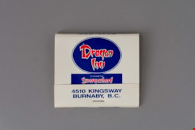
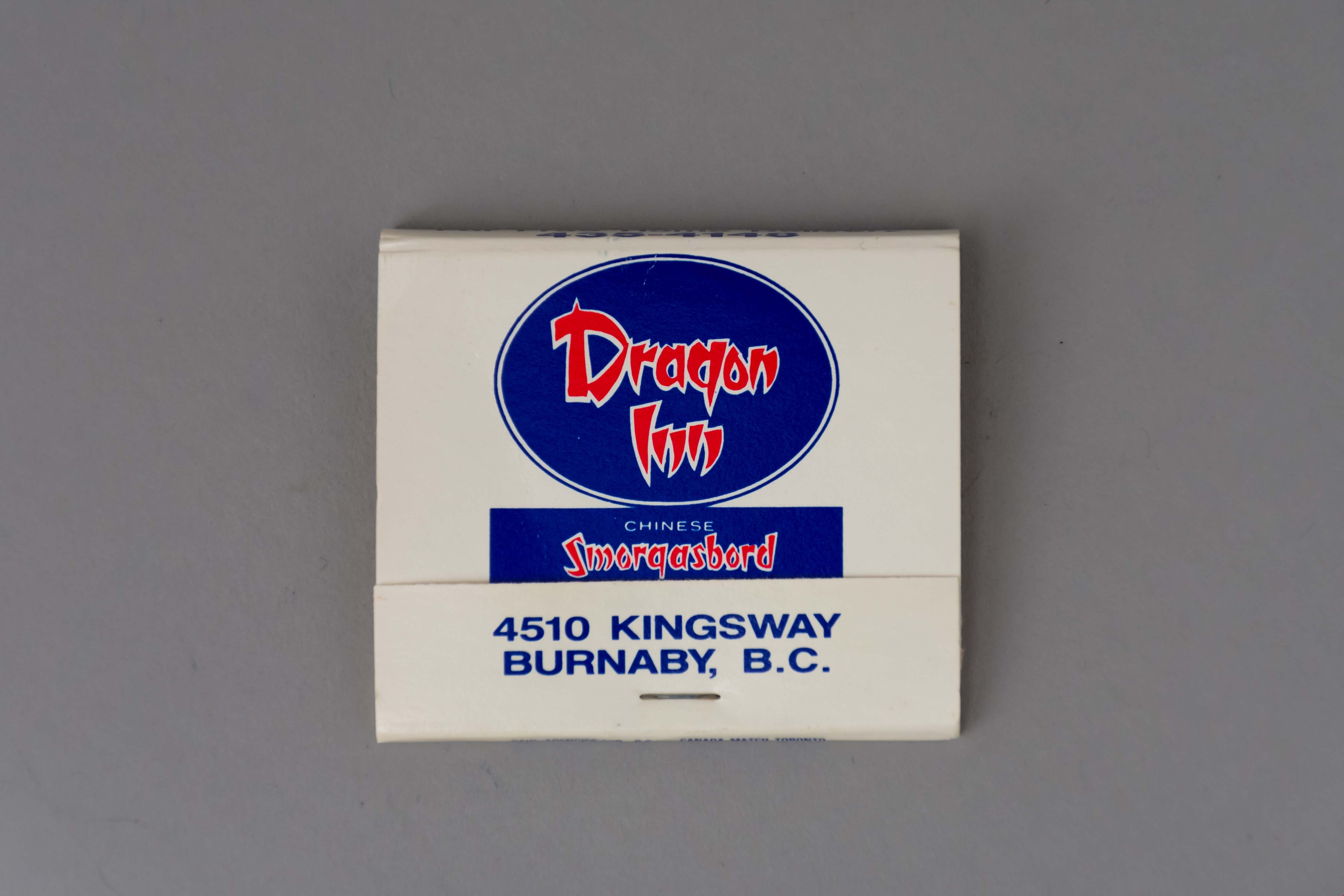
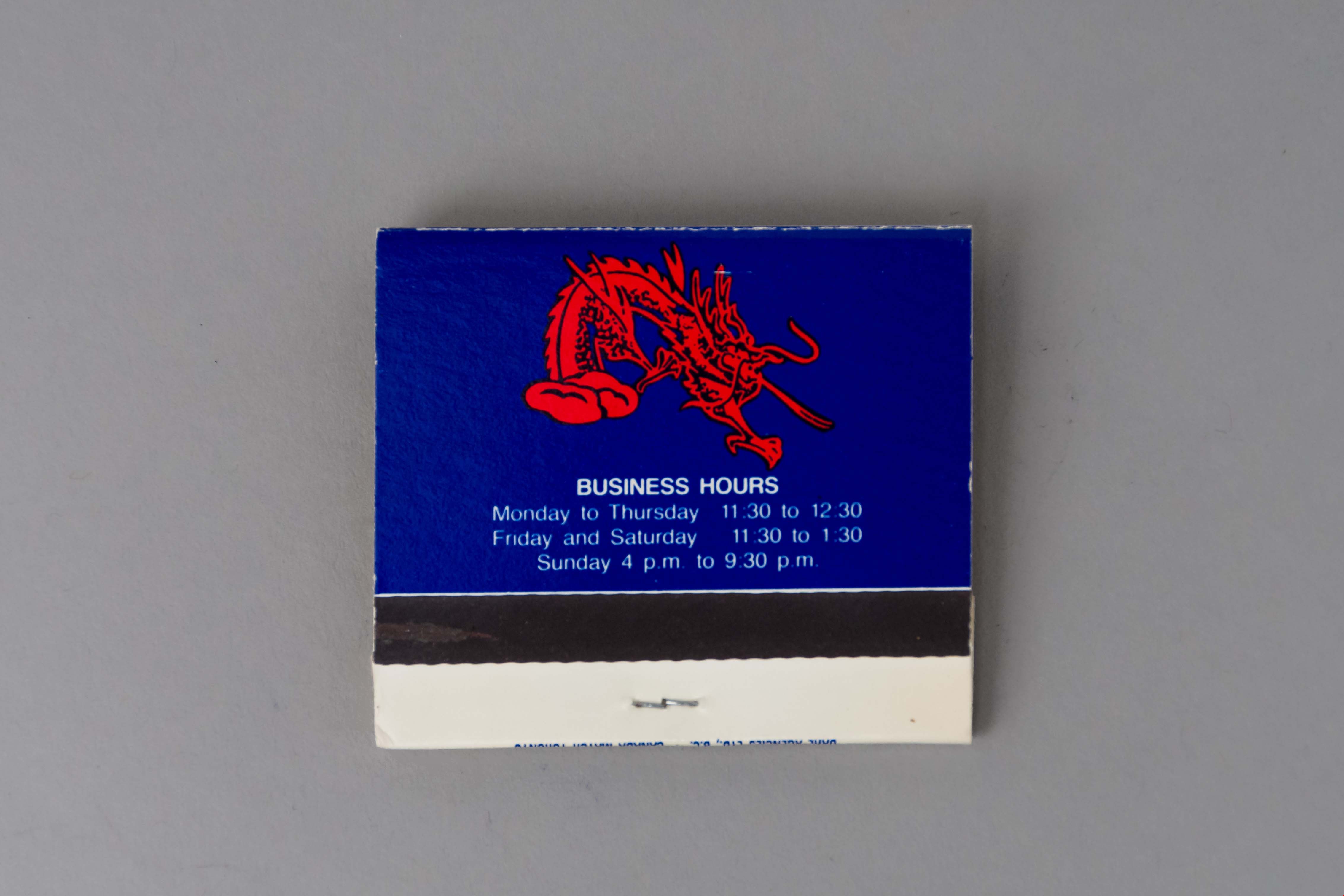
matchbook
https://search.heritageburnaby.ca/link/museumartifact89162
- Repository
- Burnaby Village Museum
- Accession Code
- BV017.37.9
- Description
- matchbook; white folded paper with blue and red ink text and illustration of a dragon; "Dragon / Inn / CHINESE / Smorgasbord / EVERY DAY / 4510 KINGSWAY / BURNABY, B.C." printed on face; business hours printed on back. There are blue-tipped matches in the book; manufactured by "DAHL AGENCIES LTD, B.C. * CANADA MATCH TORONTO".
- Object History
- Dragon Inn belonged to the Lee family. The Dragon Inn restaurant was located at at 4510 Kingsway, on the corner of Kingsway and Willingdon Avenue (opened in the 1970s) and later at Hastings Street near Willingdon (opened in the 1990s). The Dragon Inn was known for its exterior neon sign which was removed in 1997.
- Category
- 02. Furnishings
- Classification
- Temperature Control Equipment - - Firemaking Equipment
- Object Term
- Matchbook
- Names
- Dragon Inn
- Geographic Access
- Kingsway
- Street Address
- 4510 Kingsway
- Historic Neighbourhood
- Central Park (Historic Neighbourhood)
- Planning Study Area
- Maywood Area
Images

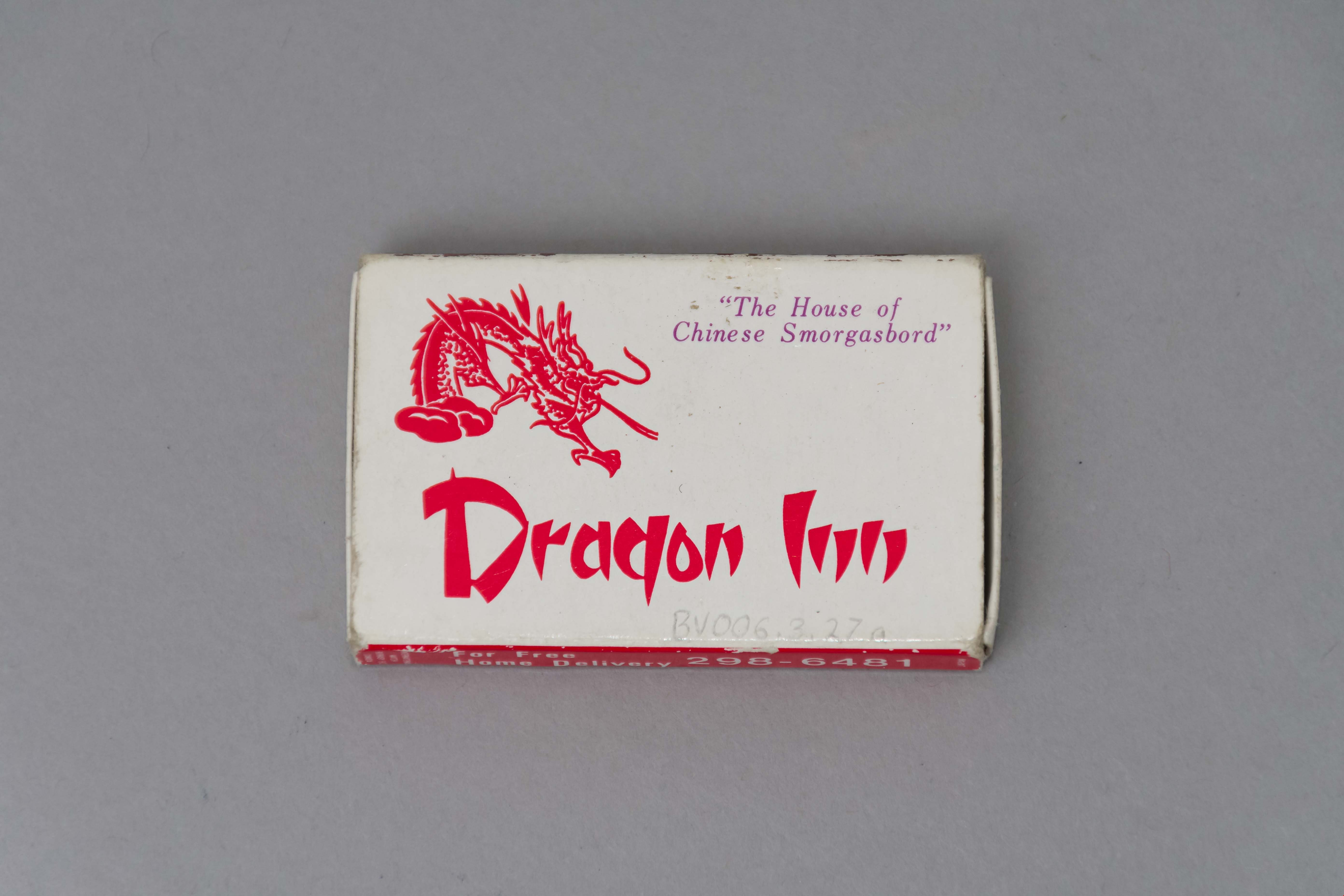
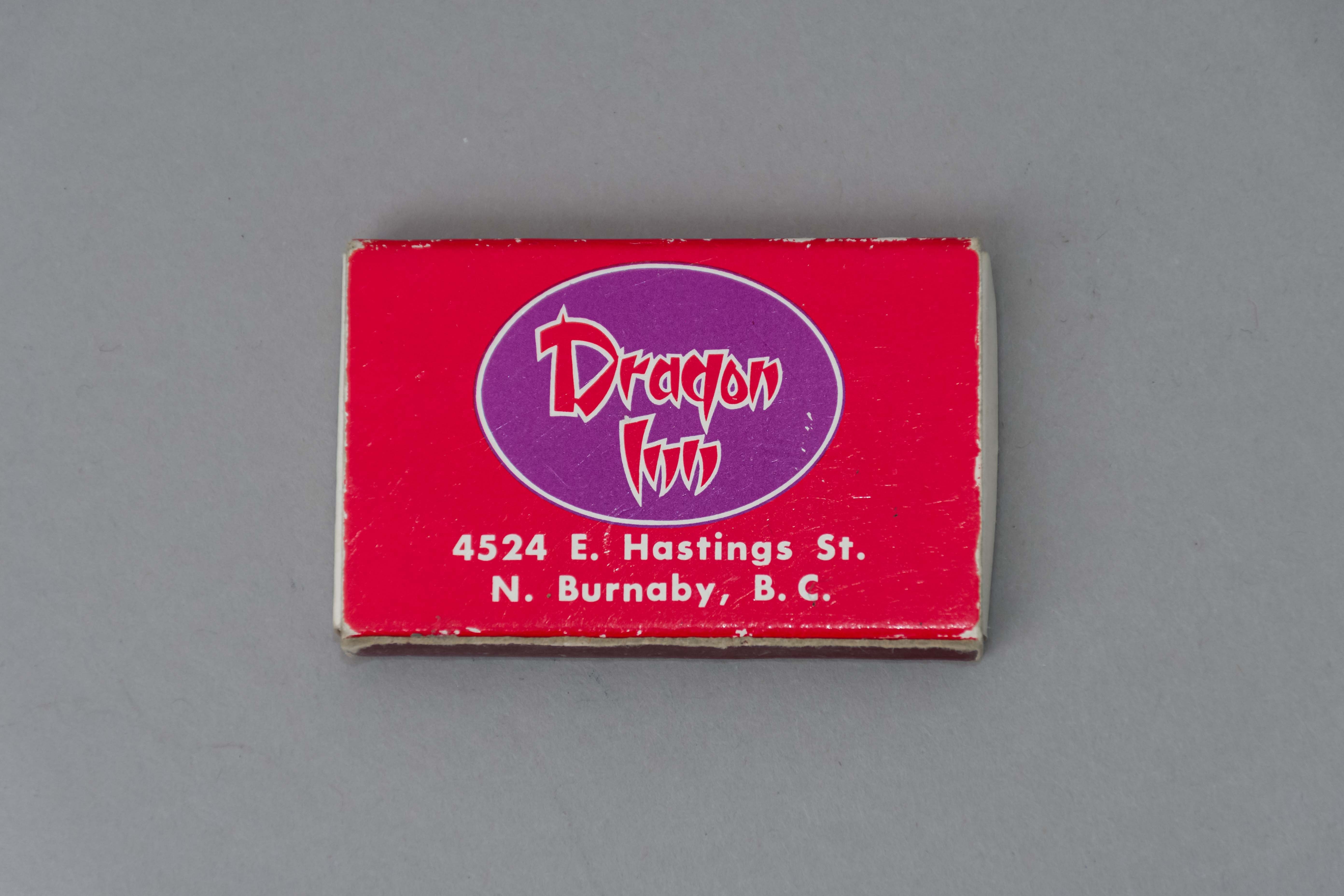
matchbox
https://search.heritageburnaby.ca/link/museumartifact50021
- Repository
- Burnaby Village Museum
- Accession Code
- BV006.3.27
- Description
- Red and white paper match box The tray slides out of the outer covering. Outer covering features a red dragon "The House of / Chinese Smorgasbord / Dragon Inn." One side of the outer covering features a strike area the other " For Free / Home Delivery / 298 - 6481..." The other side of the outer covering " ...4524 E. hastings St. / N. Burnaby, B.C.".
- Object History
- Dragon Inn belonged to the Lee family. The Dragon Inn restaurant was located at at 4510 Kingsway, on the corner of Kingsway and Willingdon Avenue (opened in the 1970s) and later at Hastings Street near Willingdon (opened in the 1990s). The Dragon Inn was known for its exterior neon sign which was removed in 1997.
- Category
- 02. Furnishings
- Classification
- Temperature Control Equipment - - Firemaking Equipment
- Object Term
- Matchbox
- Names
- Dragon Inn
- Historic Neighbourhood
- Central Park (Historic Neighbourhood)
- Planning Study Area
- Maywood Area
Images