Narrow Results By
Format
- Architectural Drawing 807
- Cartographic Material
- Council - Committee Report 17650
- Council - Manager's Report 33522
- Council - Mayor/Councillor/Staff Report 19160
- Council - Public Hearing Minutes 669
- Council - Regular Council Minutes 5270
- Graphic Material 32
- Moving Images
- Photograph 13326
- Sound Recording 647
- Technical Drawing 5
Creator
- Bancroft, Rose 1
- Brown, Donald N. "Don" 1
- Bureau of Post War Rehabilitation and Reconstruction Regional Planning Division 1
- Burnaby School Board 1
- City of Burnaby 3
- Digney, Andy 27
- Digney family 1
- Dominion Map and Blue Print Co. 1
- Easthope family 1
- Forsyth, Mary 1
- Gordon, Roth 1
- Henderson, Norman "Norm" 1
Person / Organization
- Apps, Ed 1
- Burnaby Advisory Planning Commission 1
- Burnaby School Board 1
- Burnaby Village Museum 1
- Digney, Alice 6
- Digney, Andy 21
- Digney, Bruce 1
- Digney, Dorothy 2
- Digney, Ernest Frank "Dig" 19
- Digney, Paul 3
- Digney Speedway 2
- Elizabeth, Queen, consort of George VI, King of Great Britain, 1900-2002 1
Oakalla Tour with Warren Mulligan
https://search.heritageburnaby.ca/link/archivedescription64771
- Repository
- City of Burnaby Archives
- Date
- September 7, 1991
- Collection/Fonds
- Burnaby Historical Society fonds
- Description Level
- Item
- Physical Description
- 1 videocassette ( unknown length)
- Scope and Content
- Item is a VHS tape entitled “Okalla [sic] Tour with Warren Mulligan” dated September 7, 1991.
- Repository
- City of Burnaby Archives
- Date
- September 7, 1991
- Collection/Fonds
- Burnaby Historical Society fonds
- Subseries
- Ephemera subseries
- Physical Description
- 1 videocassette ( unknown length)
- Material Details
- Video Home System (VHS) tape
- Description Level
- Item
- Record No.
- 598-003
- Access Restriction
- No restrictions
- Reproduction Restriction
- May be restricted by third party rights
- Accession Number
- BHS2007-04
- Scope and Content
- Item is a VHS tape entitled “Okalla [sic] Tour with Warren Mulligan” dated September 7, 1991.
- Media Type
- Moving Images
![Oak Theatre, [between 1937 and 1936] thumbnail](/media/Hpo/_Data/_Archives_Moving_Images/_Unrestricted/562-002-1.jpg?width=280)
Oak Theatre
https://search.heritageburnaby.ca/link/archivedescription85202
- Repository
- City of Burnaby Archives
- Date
- [between 1937 and 1936]
- Collection/Fonds
- Digney Family fonds
- Description Level
- Item
- Physical Description
- 1 film clip (9 min., 26 sec.) : digital, col., si.
- Scope and Content
- Item is a digitized copy of a silent colour film segment with footage of the construction of the Oak Theatre in 1936, the opening of the theatre held on August 4, 1937, the theatre with snow in the winter and the Digney family home and neighborhood . Andy Digney moved with his family from Manitoba …
- Repository
- City of Burnaby Archives
- Date
- [between 1937 and 1936]
- Collection/Fonds
- Digney Family fonds
- Physical Description
- 1 film clip (9 min., 26 sec.) : digital, col., si.
- Description Level
- Item
- Record No.
- 562-002-1
- Access Restriction
- No restrictions
- Reproduction Restriction
- May be restricted by third party rights
- Accession Number
- 2012-15
- Scope and Content
- Item is a digitized copy of a silent colour film segment with footage of the construction of the Oak Theatre in 1936, the opening of the theatre held on August 4, 1937, the theatre with snow in the winter and the Digney family home and neighborhood . Andy Digney moved with his family from Manitoba to Burnaby in 1936 and purchased 2 acres of land where he settled with his family and built the Oak Theatre which was located at 5000 Kingsway (Marlborough & Kingsway). The theatre was located on a 2 acre parcel of land and had a 350 seat capacity and offered valet parking. Construction crews with men and horses can be seen laying the foundation and erecting the walls of the theatre and crowds of people and cars are seen arriving outside the theatre on opening day.
- Subjects
- Events - Openings
- Buildings - Commercial - Theatres
- Recreational Activities - Theatre
- Animals - Horses
- Names
- Oak Theatre
- Digney, Andy
- Media Type
- Moving Images
- Photographer
- Digney, Andy
- Creator
- Digney, Andy
- Notes
- Title based on contents of film
- Film clip originates from digitized version of original 16 mm film footage (item 562-002). This segment was part of digitized portion titled 'Oak Theatre'
- Historic Neighbourhood
- Central Park (Historic Neighbourhood)
- Planning Study Area
- Sussex-Nelson Area
Images
![Oak Theatre, [between 1937 and 1936] thumbnail](/media/Hpo/_Data/_Archives_Moving_Images/_Unrestricted/562-002-1.jpg)
Video
Oak Theatre, [between 1937 and 1936]
Oak Theatre, [between 1937 and 1936]
https://search.heritageburnaby.ca/media/hpo/_Data/_Archives_Moving_Images/_Unrestricted/562-002-1.m4v
Operation Mink Farm
https://search.heritageburnaby.ca/link/archivedescription72207
- Repository
- City of Burnaby Archives
- Date
- April 24, 1955
- Collection/Fonds
- Planning Department fonds
- Description Level
- Item
- Physical Description
- 1 film reel ( 6 min., 8 sec.) : col. , si. ; 16 mm
- Scope and Content
- Item consists of a silent motion picture civil defense film entitled, "Operation Mink Farm" produced by the Corporation of the District of Burnaby. The film footage was shot in Burnaby, B.C. on April 24th, 1955. A resolution was passed in February 1955 by the Corporation of the District of Burnaby …
- Repository
- City of Burnaby Archives
- Date
- April 24, 1955
- Collection/Fonds
- Planning Department fonds
- Physical Description
- 1 film reel ( 6 min., 8 sec.) : col. , si. ; 16 mm
- Description Level
- Item
- Record No.
- 566-001
- Access Restriction
- No restrictions
- Reproduction Restriction
- No known restrictions
- Accession Number
- 2009-08
- Scope and Content
- Item consists of a silent motion picture civil defense film entitled, "Operation Mink Farm" produced by the Corporation of the District of Burnaby. The film footage was shot in Burnaby, B.C. on April 24th, 1955. A resolution was passed in February 1955 by the Corporation of the District of Burnaby to create a Civil Defense Board comprised of council members and appointees, whereby the Reeve would act as the chair of the board. Several municipal employees and council members went through Civil Defense training in preparation for an attack or catastrophe. The first portion of the film takes place at the old City Hall (the stone building) with uniformed Air Raid Precaution (A.R.P.) members performing civil defense exercises in the case of a nuclear war and how to care for and rescue injured civilians. Volunteers pose as the injured as they are cared for and transported on stretchers. In the second portion of the film, the local fire department and civil defense members endeavor to get a fire under control with water hoses. The film takes place at a former mink farm in North Burnaby as referred to in the title.
- Media Type
- Moving Images
- Photographer
- Scott, A.F.
- Notes
- Transcribed title
Images

Video
Operation Mink Farm, April 24, 1955
Operation Mink Farm, April 24, 1955
https://search.heritageburnaby.ca/media/hpo/_Data/_Archives_Moving_Images/_Unrestricted/566-001.m4vOrders of Board of Railway Commission - Gilmore Avenue crossing
https://search.heritageburnaby.ca/link/archivedescription1485
- Repository
- City of Burnaby Archives
- Date
- 1928-1958
- Collection/Fonds
- City Council and Office of the City Clerk fonds
- Description Level
- File
- Physical Description
- 2 folders textual records and cartographic material
- Scope and Content
- Files contains white linen plan that accompanies railway application for highway crossing at Gilmore Avenue (1929) and 2 blueprint plans - one of the railway highway crossing protection at Bell and Sperling Avenue (1952) and the other at Bell and Douglas Avenue (1947).
- Repository
- City of Burnaby Archives
- Date
- 1928-1958
- Collection/Fonds
- City Council and Office of the City Clerk fonds
- Physical Description
- 2 folders textual records and cartographic material
- Description Level
- File
- Record No.
- 3296
- Accession Number
- 2001-02
- Scope and Content
- Files contains white linen plan that accompanies railway application for highway crossing at Gilmore Avenue (1929) and 2 blueprint plans - one of the railway highway crossing protection at Bell and Sperling Avenue (1952) and the other at Bell and Douglas Avenue (1947).
- Media Type
- Textual Record
- Cartographic Material
- Notes
- Plans/maps are located in file and have not been moved to map case.
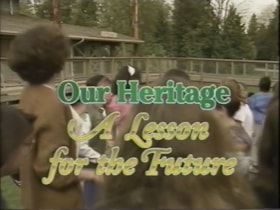
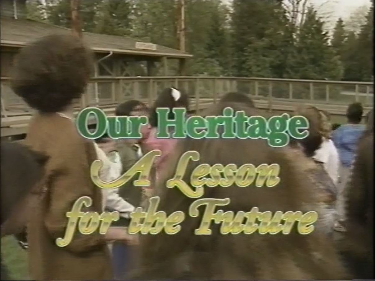
Our Heritage: A Lesson for the Future
https://search.heritageburnaby.ca/link/archivedescription64776
- Repository
- City of Burnaby Archives
- Date
- 1992
- Collection/Fonds
- Burnaby Historical Society fonds
- Description Level
- Item
- Physical Description
- 1 video cassette (22 min., 5 sec.) : VHS
- Scope and Content
- File consists of a VHS tape entitled “Our Heritage: A Lesson for the Future", a Burnaby Heritage Advisory Centennial project funded by the City of Burnaby that describes a school field trip to Burnaby Village Museum.
- Repository
- City of Burnaby Archives
- Date
- 1992
- Collection/Fonds
- Burnaby Historical Society fonds
- Subseries
- Municipal record subseries
- Physical Description
- 1 video cassette (22 min., 5 sec.) : VHS
- Description Level
- Item
- Record No.
- 597-002
- Access Restriction
- No restrictions
- Reproduction Restriction
- May be restricted by third party rights
- Accession Number
- BHS2004-13
- Scope and Content
- File consists of a VHS tape entitled “Our Heritage: A Lesson for the Future", a Burnaby Heritage Advisory Centennial project funded by the City of Burnaby that describes a school field trip to Burnaby Village Museum.
- Names
- Burnaby Village Museum
- Media Type
- Moving Images
- Notes
- Title based on contents of video
- Label on video cassette reads: "Burnaby Heritage "A Lesson For The Future" Length: 22:05"
- Video cassette cover available in accession file
- Street Address
- 6501 Deer Lake Avenue
- Historic Neighbourhood
- Burnaby Lake (Historic Neighbourhood)
- Planning Study Area
- Morley-Buckingham Area
Images
Video
Our Heritage: A Lesson for the Future, 1992
Our Heritage: A Lesson for the Future, 1992
https://search.heritageburnaby.ca/media/Hpo/_Data/_Archives_Moving_Images/_Unrestricted/597-002.m4v![Parades, [between 1936 and 1948] thumbnail](/media/Hpo/_Data/_Archives_Moving_Images/_Unrestricted/562-003-11.jpg?width=280)
Parades
https://search.heritageburnaby.ca/link/archivedescription85248
- Repository
- City of Burnaby Archives
- Date
- [between 1936 and 1948]
- Collection/Fonds
- Digney Family fonds
- Description Level
- Item
- Physical Description
- 1 film clip (11 min., 17sec.) :digital, b&w, col., si.
- Scope and Content
- Item is a digitized silent colour film segment identified as Reel 11. Film opens with colour footage of the Tacoma Daffodil Parade and switches to some black and white and colour footage of the Vancouver Diamond Jubilee Parade starting from the Toronto Dominion Bank located at Hastings Street and C…
- Repository
- City of Burnaby Archives
- Date
- [between 1936 and 1948]
- Collection/Fonds
- Digney Family fonds
- Physical Description
- 1 film clip (11 min., 17sec.) :digital, b&w, col., si.
- Description Level
- Item
- Record No.
- 562-003-11
- Access Restriction
- No restrictions
- Reproduction Restriction
- May be restricted by third party rights
- Accession Number
- 2014-04
- Scope and Content
- Item is a digitized silent colour film segment identified as Reel 11. Film opens with colour footage of the Tacoma Daffodil Parade and switches to some black and white and colour footage of the Vancouver Diamond Jubilee Parade starting from the Toronto Dominion Bank located at Hastings Street and Cambie Street. The Queen appears in a calvicade at the beginning of the parade. The footage soon switches to the Vancouver PNC Parade in 1946 celebrating 50 years of progress.
- Subjects
- Events - Parades
- Media Type
- Moving Images
- Photographer
- Digney, Andy
- Creator
- Digney, Andy
- Notes
- Title based on contents of film
Images
![Parades, [between 1936 and 1948] thumbnail](/media/Hpo/_Data/_Archives_Moving_Images/_Unrestricted/562-003-11.jpg)
Video
Parades, [between 1936 and 1948]
Parades, [between 1936 and 1948]
https://search.heritageburnaby.ca/media/hpo/_Data/_Archives_Moving_Images/_Unrestricted/562-003-11.m4vParks
https://search.heritageburnaby.ca/link/archivedescription390
- Repository
- City of Burnaby Archives
- Date
- 1910-1913
- Collection/Fonds
- City Council and Office of the City Clerk fonds
- Description Level
- File
- Physical Description
- Textual record and cartographic material
- Scope and Content
- File includes a plan of a Subdivision of the Southwestern portion Holmes Estate, Lot 1, Group 1 (Brunette Creek), a blueprint plan of proposed subdivision of part of DL 79, hand drawn sketch plan of portion of east 1/2 of southwest 1/4 DL 159, and a hand drawn sketch plan of southwest portion of DL…
- Repository
- City of Burnaby Archives
- Date
- 1910-1913
- Collection/Fonds
- City Council and Office of the City Clerk fonds
- Physical Description
- Textual record and cartographic material
- Description Level
- File
- Record No.
- 2083
- Accession Number
- 2001-02
- Scope and Content
- File includes a plan of a Subdivision of the Southwestern portion Holmes Estate, Lot 1, Group 1 (Brunette Creek), a blueprint plan of proposed subdivision of part of DL 79, hand drawn sketch plan of portion of east 1/2 of southwest 1/4 DL 159, and a hand drawn sketch plan of southwest portion of DL 158. The plans were used during the purchase of land for proposed parks.
- Media Type
- Textual Record
- Cartographic Material
- Notes
- Plans/maps are located in file and have not been moved to map case.
![Paul Digney and family, [between 1948 and 1949] thumbnail](/media/Hpo/_Data/_Archives_Moving_Images/_Unrestricted/562-003-13.jpg?width=280)
Paul Digney and family
https://search.heritageburnaby.ca/link/archivedescription85250
- Repository
- City of Burnaby Archives
- Date
- [between 1948 and 1949]
- Collection/Fonds
- Digney Family fonds
- Description Level
- Item
- Physical Description
- 1 film clip (10 min., 21 sec.) : digital, col., si.
- Scope and Content
- Item is a digitized silent colour film segment identified as Reel 13. Film provides footage of Paul Digney as a young child as he interacts with family members and pet dogs at the Digney family home on Bonsor Avenue in Burnaby. The film contains views of the Digney family home, yard and neighborhoo…
- Repository
- City of Burnaby Archives
- Date
- [between 1948 and 1949]
- Collection/Fonds
- Digney Family fonds
- Physical Description
- 1 film clip (10 min., 21 sec.) : digital, col., si.
- Description Level
- Item
- Record No.
- 562-003-13
- Access Restriction
- No restrictions
- Reproduction Restriction
- May be restricted by third party rights
- Accession Number
- 2014-04
- Scope and Content
- Item is a digitized silent colour film segment identified as Reel 13. Film provides footage of Paul Digney as a young child as he interacts with family members and pet dogs at the Digney family home on Bonsor Avenue in Burnaby. The film contains views of the Digney family home, yard and neighborhood in summer and winter time. Some of the footage shows some wear.
- Media Type
- Moving Images
- Photographer
- Digney, Andy
- Creator
- Digney, Andy
- Notes
- Title based on contents of film
- Geographic Access
- Bonsor Avenue
- Historic Neighbourhood
- Central Park (Historic Neighbourhood)
- Planning Study Area
- Maywood Area
Images
![Paul Digney and family, [between 1948 and 1949] thumbnail](/media/Hpo/_Data/_Archives_Moving_Images/_Unrestricted/562-003-13.jpg)
Video
Paul Digney and family, [between 1948 and 1949]
Paul Digney and family, [between 1948 and 1949]
https://search.heritageburnaby.ca/media/hpo/_Data/_Archives_Moving_Images/_Unrestricted/562-003-13.m4vPeople of Faith
https://search.heritageburnaby.ca/link/archivedescription62886
- Repository
- City of Burnaby Archives
- Date
- May 1992
- Collection/Fonds
- Burnaby Historical Society fonds
- Description Level
- File
- Physical Description
- 1 videocassette : VHS
- Scope and Content
- Item is a Video Home System (VHS) tape entitled "People of Faith # 13."
- Repository
- City of Burnaby Archives
- Date
- May 1992
- Collection/Fonds
- Burnaby Historical Society fonds
- Subseries
- Donald N. Brown subseries
- Physical Description
- 1 videocassette : VHS
- Material Details
- Video Home System (VHS) tape
- Description Level
- File
- Record No.
- 604-001
- Access Restriction
- No restrictions
- Reproduction Restriction
- May be restricted by third party rights
- Accession Number
- BHS2004-01
- Scope and Content
- Item is a Video Home System (VHS) tape entitled "People of Faith # 13."
- Media Type
- Moving Images
- Notes
- Transcribed title
- Notes on cardboard cover of VHS tape read: "1992 Cenntenial / May / 'People of Faith'"
Petition (Lefurgey) - Cancellation of plans, map 1521
https://search.heritageburnaby.ca/link/archivedescription727
- Repository
- City of Burnaby Archives
- Date
- [ between 1909 - 1912 ]
- Collection/Fonds
- City Council and Office of the City Clerk fonds
- Description Level
- File
- Physical Description
- Textual record and cartographic material
- Scope and Content
- File contains correspondence and Council minutes regarding the petition made by Alfred Lefurgey to have Map No. 1521 cancelled. File also includes the petition made by Lefurgey to the County Court of Westminster and two oversized blueprint plans for DL 10 (1909) and for the NE portion of DL 10 (19…
- Repository
- City of Burnaby Archives
- Date
- [ between 1909 - 1912 ]
- Collection/Fonds
- City Council and Office of the City Clerk fonds
- Physical Description
- Textual record and cartographic material
- Description Level
- File
- Record No.
- 2454
- Accession Number
- 2001-02
- Scope and Content
- File contains correspondence and Council minutes regarding the petition made by Alfred Lefurgey to have Map No. 1521 cancelled. File also includes the petition made by Lefurgey to the County Court of Westminster and two oversized blueprint plans for DL 10 (1909) and for the NE portion of DL 10 (1911).
- Media Type
- Textual Record
- Cartographic Material
- Notes
- 2 plans of subdivision of NE Portion of DL 10, group 1, NWD : M9-A-8-14; M9-A-8-15
Plan - Block 6, DL 91 (Mark and Tigar)
https://search.heritageburnaby.ca/link/archivedescription603
- Repository
- City of Burnaby Archives
- Date
- 1912-1913
- Collection/Fonds
- City Council and Office of the City Clerk fonds
- Description Level
- File
- Physical Description
- Textual record and cartographic material
- Scope and Content
- File contains correspondence and a declaration regarding expropriation and subdivision of Block 6, DL 91, owned by Mr. Mark and Mr. Tigar. File also includes 1 white linen plan of the land to be expropriated.
- Repository
- City of Burnaby Archives
- Date
- 1912-1913
- Collection/Fonds
- City Council and Office of the City Clerk fonds
- Physical Description
- Textual record and cartographic material
- Description Level
- File
- Record No.
- 2316
- Accession Number
- 2001-02
- Scope and Content
- File contains correspondence and a declaration regarding expropriation and subdivision of Block 6, DL 91, owned by Mr. Mark and Mr. Tigar. File also includes 1 white linen plan of the land to be expropriated.
- Media Type
- Textual Record
- Cartographic Material
- Notes
- Plans/maps are located in file and have not been moved to map case.
Planning Department fonds
https://search.heritageburnaby.ca/link/archivedescription102
- Repository
- City of Burnaby Archives
- Date
- 1940-2016
- Collection/Fonds
- Planning Department fonds
- Description Level
- Fonds
- Physical Description
- 80 m of textual records and other material
- Scope and Content
- Fonds consists of those records created during the regular conduct of business by the Planning Department and its predecessor agencies according to their mandate of providing professional and technical advice to Council on the current and future uses of City land and resources.
- Repository
- City of Burnaby Archives
- Date
- 1940-2016
- Collection/Fonds
- Planning Department fonds
- Physical Description
- 80 m of textual records and other material
- Description Level
- Fonds
- File Class
- 71000 10 (add. 2020)
- 71000 20 (add. 2020)
- 71000 30 (add. 2020)
- 71000 40 (add. 2020)
- Access Restriction
- Subject to FOIPPA
- Reproduction Restriction
- Reproductions subject to FOIPPA.
- Scope and Content
- Fonds consists of those records created during the regular conduct of business by the Planning Department and its predecessor agencies according to their mandate of providing professional and technical advice to Council on the current and future uses of City land and resources.
- History
- The City of Burnaby Planning Department was established on October 9, 1956, when the City Council unanimously carried the motion to create a distinct department to deal with planning issues within the City and appointed Mr. William John Blakely as its head. This decision followed a report and recommendation made by the City’s Chief Administrative Officer which indicated that the role of the Planning Engineer and his staff had quickly expanded to become a separate division within the Engineering Department and that they were functioning as an independent unit in all but name. The proposed separation of the Engineering and Planning departments had been in the works since the early part of 1956 when staff changes and restructuring within the Engineering Department’s Planning Division illustrated the undermanned condition of the Planning Engineer’s office. As a result, Council asked the Chief Administrative Officer to undertake a study examining the feasibility of creating a distinct Planning Department. This report was delivered to Council on July 3, 1956, but was laid over until a Committee of the Council had the opportunity to study the functions of the Planning department to determine the necessity of the proposal. The Committee’s findings were in line with the initial report and the Planning Department was established with a staff of nine (the head Planning Engineer, an Administrative Planner, three Research Planning Assistants, a Draughtsman, a Subdivision Control Clerk, a department Clerk and a Clerk Stenographer). This new department was to offer advice and carry out the work intensive in matters such as zoning and rezoning applications, subdivision control, traffic and transportation planning, and general City planning schemes. Prior to the creation of the Planning Department, a number of bodies within the City had been responsible for fulfilling the functions carried out by this new unit. In the earliest years of the City, the members of Council were responsible for matters of planning and were assisted in their job by the City’s Engineer or any number of hired consultants (e.g. surveyors, cartographers). By 1906, however, the provincial laws surrounding the subdivision process had changed, and local governments were charged with the task of approving all private subdivision plans in their respective Municipalities. In Burnaby, the City Council passed a bylaw decreeing that all subdivision plans were to be submitted to Council for review and the City Engineer was responsible for ensuring compliance with the law. After the first Town Planning Bylaw in 1924 which restricted the type and size of construction that could occur in certain City areas, the Engineering and Building departments were to work together to oversee the enforcement of the Bylaw and the development of City plans. The scope and competence required to carry out this work grew as Burnaby’s population expanded, and in 1930 Council passed the Town Planning Commission Bylaw (No. 1028) that saw the creation of a permanent body – the Town Planning Commission – which was to serve as an advisory body to help direct the planning activities in the City while the actual work continued to be carried out by the Engineering Department. This body was comprised of the Reeve, the Chairman of the School Board, the Chairman of the Park Committee (later, the Board of Parks Commissioners), and six appointed citizens who served three-year terms. Council referred all matters of subdivisions, transportation planning, and rezoning to this Commission, which was later supported in its work by several other special or standing committees such as the Subdivision Committee, the Apartment Committee, the Transportation Committee or the Town Planning Board of Appeal. By 1953, it had become apparent that the advisory committees that were dedicated to these planning issues needed a permanent staff to carry out the work intensive, so a restructuring of the Engineering department resulted in a permanent Planning Engineer’s office being created. The Town Planning Commission continued in its advisory capacity even after the determination came in 1956 to create a separate Planning Department. When Bylaw No. 4473 was passed in 1963, the Town Planning Commission was disbanded in favour of a new Advisory Planning Commission that would turn over all routine matters such as subdivision and rezoning applications to the Planning Department but would offer advice and community input into the more complex planning schemes within the City and act as an intermediary in cases where Council and Planning staff were in disagreement. A new Advisory Planning Commission Bylaw (No. 7600) was adopted in 1980 which allowed for even greater community participation in the planning process. The Planning Department was initially responsible to report directly to Council, but in 1957, the administrative structure of Municipal staff changed with the introduction of the Burnaby Municipal Manager Bylaw (No. 3859) and from that point on, the head of the Planning Department held a direct reporting relationship to the Municipal Manager, who in turn was responsible for reporting the activities of the Department to the City Council. Over the years, the internal structure and the scope of responsibilities of the Department have changed during periods of staff reorganizations. Under the larger umbrella of the Planning and Building Department, Planning has come to be comprised of two divisions: the Current Planning Division and the Long Range Planning Division. The functions of the Current Planning Division include rezoning, subdivision, development plan areas, preliminary plan approvals, urban design, heritage planning, and urban trails and bicycle routes. The Long Range Planning Division is responsible for environmental planning concerns, transportation planning, housing, neighbourhood area planning, social planning and planning information services. In 2022, the Planning and Building Department was reorganized to better align functions with delivery of services. The Climate Action and Engery Division moved from Corporate Services to the Planning and Building Department, while Indigenous Relations and Facilities Management moved to Corporate Services and Lands and Facilities, respectively. The position of Director of Planning and Building was changed to General Manager, Planning and Development. The following individuals have served as Planning Engineer and/or Director of the Planning Department and/or General Manager, Planning and Development for the City of Burnaby: William John Blakely 1954-1956 (as Planning Engineer) 1956-1963 (as Head of the Department) Anthony P. Parr 1964-1993 Don G. Stenson 1993-2001 Jack S. Belhouse 2001-2006 Basil Luksun 2006-2012 Lou Pelletier 2012-2019 Edward Kozak 2019-present
- Formats
- Microforms exist for some records. See series descriptions.
- Media Type
- Textual Record
- Photograph
- Moving Images
- Creator
- City of Burnaby
- Notes
- Title based on contents of fonds
Plan Shewing [sic] Position of New Wagon Road through DL's 214 and 213
https://search.heritageburnaby.ca/link/archivedescription8037
- Repository
- City of Burnaby Archives
- Date
- 1908
- Collection/Fonds
- City Council and Office of the City Clerk fonds
- Description Level
- Item
- Physical Description
- 1 map
- Scope and Content
- White linen plan showing DL's 212, 213, 214, and 215 with Burrard Inlet to the north and the proposed road done in red.
- Repository
- City of Burnaby Archives
- Date
- 1908
- Collection/Fonds
- City Council and Office of the City Clerk fonds
- Physical Description
- 1 map
- Description Level
- Item
- Record No.
- 10992
- Accession Number
- 2001-02
- Scope and Content
- White linen plan showing DL's 212, 213, 214, and 215 with Burrard Inlet to the north and the proposed road done in red.
- Media Type
- Cartographic Material
- Notes
- Located in map case.
Plan Showing Proposed Road DL 212
https://search.heritageburnaby.ca/link/archivedescription8036
- Repository
- City of Burnaby Archives
- Date
- [191-?]
- Collection/Fonds
- City Council and Office of the City Clerk fonds
- Description Level
- Item
- Physical Description
- 1 map
- Scope and Content
- White linen plan with Burrard Inlet to the north and Barnet Road to the South. A proposed crossing for the Canadian Pacific Railway is outlined in red and the Bestwood Shingle Mill and Nichol's Chemical operation are identified in black.
- Repository
- City of Burnaby Archives
- Date
- [191-?]
- Collection/Fonds
- City Council and Office of the City Clerk fonds
- Physical Description
- 1 map
- Description Level
- Item
- Record No.
- 10990
- Accession Number
- 2001-02
- Scope and Content
- White linen plan with Burrard Inlet to the north and Barnet Road to the South. A proposed crossing for the Canadian Pacific Railway is outlined in red and the Bestwood Shingle Mill and Nichol's Chemical operation are identified in black.
- Media Type
- Cartographic Material
- Notes
- Located in map case.
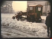
Ploughing snow at the Oak Theatre
https://search.heritageburnaby.ca/link/archivedescription85471
- Repository
- City of Burnaby Archives
- Date
- 1939
- Collection/Fonds
- Digney Family fonds
- Description Level
- Item
- Physical Description
- 1 film clip (45 sec.) : digital, col. ; si.
- Scope and Content
- Item is a digitized copy of a silent colour film segment of a snow plough ploughing snow in the parking lot outside the Oak Theatre.
- Repository
- City of Burnaby Archives
- Date
- 1939
- Collection/Fonds
- Digney Family fonds
- Physical Description
- 1 film clip (45 sec.) : digital, col. ; si.
- Description Level
- Item
- Record No.
- 562-002-7
- Access Restriction
- No restrictions
- Reproduction Restriction
- No known restrictions
- Accession Number
- 2012-15
- Scope and Content
- Item is a digitized copy of a silent colour film segment of a snow plough ploughing snow in the parking lot outside the Oak Theatre.
- Subjects
- Natural Phenomena - Snow
- Media Type
- Moving Images
- Photographer
- Digney, Andy
- Creator
- Digney, Andy
- Notes
- Title based on contents of film
- Film clip originates from digitized version of original 16 mm film footage (item 562-002). This segment was part of digitized portion titled 'Royal Visit'
- Geographic Access
- Central Park
- Kingsway
- Historic Neighbourhood
- Central Park (Historic Neighbourhood)
- Planning Study Area
- Sussex-Nelson Area
Images
Video
Ploughing snow at the Oak Theatre, 1939
Ploughing snow at the Oak Theatre, 1939
https://search.heritageburnaby.ca/media/hpo/_Data/_Archives_Moving_Images/_Unrestricted/562-002-7.m4vProposed Tramline North of Burnaby Lake
https://search.heritageburnaby.ca/link/archivedescription659
- Repository
- City of Burnaby Archives
- Date
- [190-?]
- Collection/Fonds
- City Council and Office of the City Clerk fonds
- Description Level
- File
- Physical Description
- Textual record and cartographic material
- Scope and Content
- File contains one blueprint plan [190?] of the proposed site.
- Repository
- City of Burnaby Archives
- Date
- [190-?]
- Collection/Fonds
- City Council and Office of the City Clerk fonds
- Physical Description
- Textual record and cartographic material
- Description Level
- File
- Record No.
- 2384
- Accession Number
- 2001-02
- Scope and Content
- File contains one blueprint plan [190?] of the proposed site.
- Media Type
- Textual Record
- Cartographic Material
- Notes
- Plans/maps are located in file and have not been moved to map case.
Provincial Prison Farm - Oakalla - Plan Showing Central Areas of the Property / Planning Department
https://search.heritageburnaby.ca/link/archivedescription6015
- Repository
- City of Burnaby Archives
- Date
- 1954
- Collection/Fonds
- Planning Department fonds
- Description Level
- Item
- Physical Description
- 1 plan : b&w ink on paper ; 148 x 92 cm folded to 39 x 23 cm
- Scope and Content
- One large plan of Oakalla and the surrounding areas, Plan no. 4436-1.
- Repository
- City of Burnaby Archives
- Date
- 1954
- Collection/Fonds
- Planning Department fonds
- Series
- Facilities series
- Physical Description
- 1 plan : b&w ink on paper ; 148 x 92 cm folded to 39 x 23 cm
- Material Details
- Scale : 1 inch = 50 feet
- Description Level
- Item
- Record No.
- 8966
- Accession Number
- 2001-02
- Scope and Content
- One large plan of Oakalla and the surrounding areas, Plan no. 4436-1.
- Media Type
- Cartographic Material
Queen's Avenue wharf
https://search.heritageburnaby.ca/link/archivedescription599
- Repository
- City of Burnaby Archives
- Date
- 1912-1925
- Collection/Fonds
- City Council and Office of the City Clerk fonds
- Description Level
- File
- Physical Description
- 3 folders textual records and cartographic material
- Scope and Content
- File contains petition, correspondence, and agreements with the Burrard Lumber Co. Ltd., the Bowness Lumber Co., Ltd., and the Pacific Lumber & Trading Co., Ltd., regarding the maintenance and construction of Queen's Avenue and Queen's Avenue Wharf. File also includes 2 white linen plans: "works o…
- Repository
- City of Burnaby Archives
- Date
- 1912-1925
- Collection/Fonds
- City Council and Office of the City Clerk fonds
- Physical Description
- 3 folders textual records and cartographic material
- Description Level
- File
- Record No.
- 2310
- Accession Number
- 2001-02
- Scope and Content
- File contains petition, correspondence, and agreements with the Burrard Lumber Co. Ltd., the Bowness Lumber Co., Ltd., and the Pacific Lumber & Trading Co., Ltd., regarding the maintenance and construction of Queen's Avenue and Queen's Avenue Wharf. File also includes 2 white linen plans: "works on Foreshore adjoining the North end of Queen's Avenue, Burnaby, "
- Media Type
- Textual Record
- Cartographic Material
- Notes
- Plans/maps are located in file and have not been moved to map case.
Railways
https://search.heritageburnaby.ca/link/archivedescription98236
- Repository
- City of Burnaby Archives
- Date
- [date unknown]
- Collection/Fonds
- Burnaby Historical Society fonds
- Description Level
- File
- Physical Description
- 2 maps : col. ; 89 cm x 76 cm
- Scope and Content
- File contains sheet 7 and 8 of a map of Canadian railways. Sheets depict British Columbia, Yukon, and the eastern portions of Albert and Northwest Territories. Sheet 7 includes an index of railways.
- Repository
- City of Burnaby Archives
- Date
- [date unknown]
- Collection/Fonds
- Burnaby Historical Society fonds
- Subseries
- Ephemera subseries
- Physical Description
- 2 maps : col. ; 89 cm x 76 cm
- Description Level
- File
- Record No.
- 64999
- Accession Number
- BHS2007-04
- Scope and Content
- File contains sheet 7 and 8 of a map of Canadian railways. Sheets depict British Columbia, Yukon, and the eastern portions of Albert and Northwest Territories. Sheet 7 includes an index of railways.
- Media Type
- Cartographic Material
- Notes
- Title based on contents of files
Re-plotting Plan of DL 189
https://search.heritageburnaby.ca/link/archivedescription65822
- Repository
- City of Burnaby Archives
- Date
- December 1929
- Collection/Fonds
- Burnaby Historical Society fonds
- Description Level
- Item
- Physical Description
- 1 map : b&w on paper ; 36 x 58 cm folded to 22 x 29 cm
- Scope and Content
- Item is the "Re-plotting of DL 189 and Portions of DL's 122, 127, 188, 205 & 218 Plan Showing Areas Disturbed / Tentative Plan of Re-plotting of DL 189 and Portions of DL's 122, 127, 188, 205 & 218."
- Repository
- City of Burnaby Archives
- Date
- December 1929
- Collection/Fonds
- Burnaby Historical Society fonds
- Subseries
- Municipal record subseries
- Physical Description
- 1 map : b&w on paper ; 36 x 58 cm folded to 22 x 29 cm
- Material Details
- Scale not indicated
- Description Level
- Item
- Record No.
- 42683
- Accession Number
- BHS1997-23
- Scope and Content
- Item is the "Re-plotting of DL 189 and Portions of DL's 122, 127, 188, 205 & 218 Plan Showing Areas Disturbed / Tentative Plan of Re-plotting of DL 189 and Portions of DL's 122, 127, 188, 205 & 218."
- Media Type
- Cartographic Material
- Notes
- Title based on contents of item
- Note with plan reads: "Further information in Burnaby Municipal Minutes Dec. 16, 1929. Minute Book # 17 pp 288+"
Resurvey of the Municipality of Burnaby - Correspondence (H-L)
https://search.heritageburnaby.ca/link/archivedescription741
- Repository
- City of Burnaby Archives
- Date
- 1914-1942
- Collection/Fonds
- City Council and Office of the City Clerk fonds
- Description Level
- File
- Physical Description
- 2 folders textual records and cartographic material
- Scope and Content
- File contains correspondence regarding the re-survey of the Municipality of Burnaby. File also contains blueprint plan of lots 1-3 and 34 of lots 61 and 62, DL 30.
- Repository
- City of Burnaby Archives
- Date
- 1914-1942
- Collection/Fonds
- City Council and Office of the City Clerk fonds
- Physical Description
- 2 folders textual records and cartographic material
- Description Level
- File
- Record No.
- 2470
- Accession Number
- 2001-02
- Scope and Content
- File contains correspondence regarding the re-survey of the Municipality of Burnaby. File also contains blueprint plan of lots 1-3 and 34 of lots 61 and 62, DL 30.
- Media Type
- Textual Record
- Cartographic Material
- Notes
- For related records see also 7-2-4-14 and 7-2-5-1 to 7-2-5-3. Plans/maps are located in file and have not been moved to map case.
Resurvey of the Municipality of Burnaby - Miscellaneous
https://search.heritageburnaby.ca/link/archivedescription743
- Repository
- City of Burnaby Archives
- Date
- 1913-1926
- Collection/Fonds
- City Council and Office of the City Clerk fonds
- Description Level
- File
- Physical Description
- 4 folders textual records and cartographic material
- Scope and Content
- File contains correspondence regarding the re-survey of the Municipality of Burnaby. As well, file includes "Report on the Special Survey of Burnaby up to June 1, 1915" which includes a linen plan of "Complete Special Survey" and "Block Outline Special Survey." Also included are lists of property…
- Repository
- City of Burnaby Archives
- Date
- 1913-1926
- Collection/Fonds
- City Council and Office of the City Clerk fonds
- Physical Description
- 4 folders textual records and cartographic material
- Description Level
- File
- Record No.
- 2476
- Accession Number
- 2001-02
- Scope and Content
- File contains correspondence regarding the re-survey of the Municipality of Burnaby. As well, file includes "Report on the Special Survey of Burnaby up to June 1, 1915" which includes a linen plan of "Complete Special Survey" and "Block Outline Special Survey." Also included are lists of property owners.
- Media Type
- Textual Record
- Cartographic Material
- Notes
- For related records see also 7-2-4-14 and 7-2-4-15, and 7-2-5-1 and 7-2-5-3. Plans/maps are located in file and have not been moved to map case.
Road allowance - Block 13, DL 91 (Allan Bros.)
https://search.heritageburnaby.ca/link/archivedescription602
- Repository
- City of Burnaby Archives
- Date
- 1911-1912
- Collection/Fonds
- City Council and Office of the City Clerk fonds
- Description Level
- File
- Physical Description
- Textual record and cartographic material
- Scope and Content
- File contains agreements and correspondence regarding road allowance agreement with Joseph Dodd Allan and John George Allan for Block 13, DL 91. File also includes 2 indentures, one containing 2 white linen plans of "Portion of lot 13, Central Portion of DL 91, group 1, NWD."
- Repository
- City of Burnaby Archives
- Date
- 1911-1912
- Collection/Fonds
- City Council and Office of the City Clerk fonds
- Physical Description
- Textual record and cartographic material
- Description Level
- File
- Record No.
- 2315
- Accession Number
- 2001-02
- Scope and Content
- File contains agreements and correspondence regarding road allowance agreement with Joseph Dodd Allan and John George Allan for Block 13, DL 91. File also includes 2 indentures, one containing 2 white linen plans of "Portion of lot 13, Central Portion of DL 91, group 1, NWD."
- Media Type
- Textual Record
- Cartographic Material
- Notes
- Plans/maps are located in file and have not been moved to map case.
Road allowances - Holdom Avenue
https://search.heritageburnaby.ca/link/archivedescription1230
- Repository
- City of Burnaby Archives
- Date
- 1921-1923
- Collection/Fonds
- City Council and Office of the City Clerk fonds
- Description Level
- File
- Physical Description
- Textual record and cartographic material
- Scope and Content
- File includes transparent paper map and sketch; file includes bylaw #1125
- Repository
- City of Burnaby Archives
- Date
- 1921-1923
- Collection/Fonds
- City Council and Office of the City Clerk fonds
- Physical Description
- Textual record and cartographic material
- Description Level
- File
- Record No.
- 3028
- Accession Number
- 2001-02
- Scope and Content
- File includes transparent paper map and sketch; file includes bylaw #1125
- Media Type
- Textual Record
- Cartographic Material
- Notes
- For related records see also file 8-4-3-8. Plans/maps are located in file and have not been moved to map case.
Road allowances - Patterson Avenue
https://search.heritageburnaby.ca/link/archivedescription1197
- Repository
- City of Burnaby Archives
- Date
- 1919-1920
- Collection/Fonds
- City Council and Office of the City Clerk fonds
- Description Level
- File
- Physical Description
- Textual records and cartographic material.
- Repository
- City of Burnaby Archives
- Date
- 1919-1920
- Collection/Fonds
- City Council and Office of the City Clerk fonds
- Physical Description
- Textual records and cartographic material.
- Description Level
- File
- Record No.
- 2993
- Accession Number
- 2001-02
- Media Type
- Textual Record
- Cartographic Material
- Notes
- See folder for a more detailed file inventory. Blueprint showing Patterson Avenue : M9-A-3-18.
Road allowance - Sussex Avenue
https://search.heritageburnaby.ca/link/archivedescription1157
- Repository
- City of Burnaby Archives
- Date
- 1921
- Collection/Fonds
- City Council and Office of the City Clerk fonds
- Description Level
- File
- Physical Description
- Textual record and cartographic material
- Scope and Content
- File includes blueprint "Plan of 0.16 Acre Parcel of Block 11 DL 32, Group 1, New Westminster District", 1921.
- Repository
- City of Burnaby Archives
- Date
- 1921
- Collection/Fonds
- City Council and Office of the City Clerk fonds
- Physical Description
- Textual record and cartographic material
- Description Level
- File
- Record No.
- 2950
- Accession Number
- 2001-02
- Scope and Content
- File includes blueprint "Plan of 0.16 Acre Parcel of Block 11 DL 32, Group 1, New Westminster District", 1921.
- Media Type
- Textual Record
- Cartographic Material
- Notes
- Plans/maps are located in file and have not been moved to map case.
Roads - DL 25
https://search.heritageburnaby.ca/link/archivedescription408
- Repository
- City of Burnaby Archives
- Date
- 1911
- Collection/Fonds
- City Council and Office of the City Clerk fonds
- Description Level
- File
- Physical Description
- Textual record and cartographic material
- Scope and Content
- File contains correspondence related to the opening of a road in DL 25. File also includes "sketch showing positions of 4th Avenue and Armstrong Road"
- Repository
- City of Burnaby Archives
- Date
- 1911
- Collection/Fonds
- City Council and Office of the City Clerk fonds
- Physical Description
- Textual record and cartographic material
- Description Level
- File
- Record No.
- 2108
- Accession Number
- 2001-02
- Scope and Content
- File contains correspondence related to the opening of a road in DL 25. File also includes "sketch showing positions of 4th Avenue and Armstrong Road"
- Media Type
- Textual Record
- Cartographic Material
- Notes
- Plans/maps are located in file and have not been moved to map case.
Roads - DL 88
https://search.heritageburnaby.ca/link/archivedescription490
- Repository
- City of Burnaby Archives
- Date
- 1911
- Collection/Fonds
- City Council and Office of the City Clerk fonds
- Description Level
- File
- Physical Description
- Textual record and cartographic material
- Scope and Content
- File contains correspondence pertaining to the construction of a road in DL 88 and includes a sketch of Grassmere Road.
- Repository
- City of Burnaby Archives
- Date
- 1911
- Collection/Fonds
- City Council and Office of the City Clerk fonds
- Physical Description
- Textual record and cartographic material
- Description Level
- File
- Record No.
- 2197
- Accession Number
- 2001-02
- Scope and Content
- File contains correspondence pertaining to the construction of a road in DL 88 and includes a sketch of Grassmere Road.
- Media Type
- Textual Record
- Cartographic Material
- Notes
- Plans/maps are located in file and have not been moved to map case.
Roads - DL 88 (Lakeside Terrace)
https://search.heritageburnaby.ca/link/archivedescription502
- Repository
- City of Burnaby Archives
- Date
- [1911]
- Collection/Fonds
- City Council and Office of the City Clerk fonds
- Description Level
- File
- Physical Description
- Textual record and cartographic material
- Scope and Content
- File contains correspondence for the opening of roads through DL 88 (Lakeside Terrace) as per the request of Financial Agents Passage and Tomlin and an oversized blueprint plan of Subdivision Blocks 3-8, DL 88, Lakeside Terrace [1911].
- Repository
- City of Burnaby Archives
- Date
- [1911]
- Collection/Fonds
- City Council and Office of the City Clerk fonds
- Physical Description
- Textual record and cartographic material
- Description Level
- File
- Record No.
- 2209
- Accession Number
- 2001-02
- Scope and Content
- File contains correspondence for the opening of roads through DL 88 (Lakeside Terrace) as per the request of Financial Agents Passage and Tomlin and an oversized blueprint plan of Subdivision Blocks 3-8, DL 88, Lakeside Terrace [1911].
- Media Type
- Cartographic Material
- Textual Record
- Notes
- Plan of subdivision of Blocks 3 - 8, DL 88, Lakeside Terrace : M9-B-1-3
Roads - DL 95
https://search.heritageburnaby.ca/link/archivedescription397
- Repository
- City of Burnaby Archives
- Date
- 1911
- Collection/Fonds
- City Council and Office of the City Clerk fonds
- Description Level
- File
- Physical Description
- Textual record and cartographic material
- Scope and Content
- File contains correspondence related to the management of roads in DL 95. Also included is a sketch of Elwell Road, Beale Road, Dykes Road, and New Westminster Road.
- Repository
- City of Burnaby Archives
- Date
- 1911
- Collection/Fonds
- City Council and Office of the City Clerk fonds
- Physical Description
- Textual record and cartographic material
- Description Level
- File
- Record No.
- 2097
- Accession Number
- 2001-02
- Scope and Content
- File contains correspondence related to the management of roads in DL 95. Also included is a sketch of Elwell Road, Beale Road, Dykes Road, and New Westminster Road.
- Media Type
- Textual Record
- Cartographic Material
- Notes
- Plans/maps are located in file and have not been moved to map case.
Roads - DL 96
https://search.heritageburnaby.ca/link/archivedescription481
- Repository
- City of Burnaby Archives
- Date
- 1911
- Collection/Fonds
- City Council and Office of the City Clerk fonds
- Description Level
- File
- Physical Description
- Textual record and cartographic material
- Scope and Content
- File contains correspondence pertaining to the construction of roads in DL 96. File also includes advertisements and plans for new "Newman Heights" and "Gilley Park" subdivisions (DL 96) 1911.
- Repository
- City of Burnaby Archives
- Date
- 1911
- Collection/Fonds
- City Council and Office of the City Clerk fonds
- Physical Description
- Textual record and cartographic material
- Description Level
- File
- Record No.
- 2188
- Accession Number
- 2001-02
- Scope and Content
- File contains correspondence pertaining to the construction of roads in DL 96. File also includes advertisements and plans for new "Newman Heights" and "Gilley Park" subdivisions (DL 96) 1911.
- Media Type
- Textual Record
- Cartographic Material
- Notes
- Plans/maps are located in file and have not been moved to map case.
Royal Oak well
https://search.heritageburnaby.ca/link/archivedescription370
- Repository
- City of Burnaby Archives
- Date
- 1911
- Collection/Fonds
- City Council and Office of the City Clerk fonds
- Description Level
- File
- Physical Description
- Textual record and cartographic material
- Scope and Content
- File contains correspondence and a sketched plan that relate to the location of a drilled well and tank site on Royal Oak Road.
- Repository
- City of Burnaby Archives
- Date
- 1911
- Collection/Fonds
- City Council and Office of the City Clerk fonds
- Physical Description
- Textual record and cartographic material
- Description Level
- File
- Record No.
- 2063
- Accession Number
- 2001-02
- Scope and Content
- File contains correspondence and a sketched plan that relate to the location of a drilled well and tank site on Royal Oak Road.
- Media Type
- Textual Record
- Cartographic Material
- Notes
- Plans/maps are located in file and have not been moved to map case.
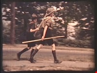
Royal Visit
https://search.heritageburnaby.ca/link/archivedescription85203
- Repository
- City of Burnaby Archives
- Date
- 1939
- Collection/Fonds
- Digney Family fonds
- Description Level
- Item
- Physical Description
- 1 film clip (1 min., 52 sec.) : digital, col., si.
- Scope and Content
- Item is a digitized copy of a silent colour film segment with footage of the Royal Visit from King George VI and Queen consort, Elizabeth. Boy Scouts and members of the community can be seen preparing for a roadside view of the motorcade and Mr. Digney can be seen pacing in his gardens at the Oak T…
- Repository
- City of Burnaby Archives
- Date
- 1939
- Collection/Fonds
- Digney Family fonds
- Physical Description
- 1 film clip (1 min., 52 sec.) : digital, col., si.
- Description Level
- Item
- Record No.
- 562-002-2
- Access Restriction
- No restrictions
- Reproduction Restriction
- No known restrictions
- Accession Number
- 2012-15
- Scope and Content
- Item is a digitized copy of a silent colour film segment with footage of the Royal Visit from King George VI and Queen consort, Elizabeth. Boy Scouts and members of the community can be seen preparing for a roadside view of the motorcade and Mr. Digney can be seen pacing in his gardens at the Oak Theatre. As the royal couple (King George VI and Queen Elizabeth) drive by the crowd on Kingsway, they can be seen in a automobile identified as a McLaughlin model 45 Extra Special series, with Queen Elizabeth holding a white umbrella. RCMP officers are seen on a motorcycle with a side car, while dignitaries and officials in automobiles accompany the royal couple as the crowd waves red flags and looks on as the cars drive off.
- Subjects
- Events - May Day
- Events - Royal Visits
- Buildings - Commercial - Theatres
- Recreational Activities - Theatre
- Names
- Oak Theatre
- Digney, Andy
- Elizabeth, Queen, consort of George VI, King of Great Britain, 1900-2002
- George VI, King of Great Britain, 1895-1952
- Media Type
- Moving Images
- Photographer
- Digney, Andy
- Creator
- Digney, Andy
- Notes
- Title based on contents of film
- Film clip originates from digitized version of original 16 mm film footage (item 562-002). This segment was part of digitized portion titled 'Royal Visit'
- Geographic Access
- Kingsway
- Central Park
- Historic Neighbourhood
- Central Park (Historic Neighbourhood)
- Planning Study Area
- Sussex-Nelson Area
Images

Video
Royal Visit, 1939
![San Francisco Trip, [between 1935 and 1952] thumbnail](/media/Hpo/_Data/_Archives_Moving_Images/_Unrestricted/562-003-18.jpg?width=280)
San Francisco Trip
https://search.heritageburnaby.ca/link/archivedescription85312
- Repository
- City of Burnaby Archives
- Date
- [between 1935 and 1952]
- Collection/Fonds
- Digney Family fonds
- Description Level
- Item
- Physical Description
- 1 film clip ( 9 min., 43 sec.) : digital, b&w, col., si.
- Scope and Content
- Item is a digitized silent film segment identified as Reel 18 and contains footage interchanging between colour and black and white, showing the Digney family trip to San Francisco and California. The footage starts off rather poor. It provides views of; the islands surrounding San Francisco; cactu…
- Repository
- City of Burnaby Archives
- Date
- [between 1935 and 1952]
- Collection/Fonds
- Digney Family fonds
- Physical Description
- 1 film clip ( 9 min., 43 sec.) : digital, b&w, col., si.
- Description Level
- Item
- Record No.
- 562-003-18
- Access Restriction
- No restrictions
- Reproduction Restriction
- May be restricted by third party rights
- Accession Number
- 2014-04
- Scope and Content
- Item is a digitized silent film segment identified as Reel 18 and contains footage interchanging between colour and black and white, showing the Digney family trip to San Francisco and California. The footage starts off rather poor. It provides views of; the islands surrounding San Francisco; cactus gardens; the Pismo Beach zoo; a Circus; the Aurora Speedway in Seattle; a beach; garden sculptures; views from Telegraph Hill; clearing a California hwy and closes with Paul, Joyce and Dot Digney.
- Media Type
- Moving Images
- Photographer
- Digney, Andy
- Creator
- Digney, Andy
- Notes
- Title based on contents of film
Images
![San Francisco Trip, [between 1935 and 1952] thumbnail](/media/Hpo/_Data/_Archives_Moving_Images/_Unrestricted/562-003-18.jpg)
Video
San Francisco Trip, [between 1935 and 1952]
San Francisco Trip, [between 1935 and 1952]
https://search.heritageburnaby.ca/media/hpo/_Data/_Archives_Moving_Images/_Unrestricted/562-003-18.m4vSapperton sewage
https://search.heritageburnaby.ca/link/archivedescription393
- Repository
- City of Burnaby Archives
- Date
- 1912-1913
- Collection/Fonds
- City Council and Office of the City Clerk fonds
- Description Level
- File
- Physical Description
- Textual record and cartographic material
- Scope and Content
- File contains correspondence, memos, reports, meeting minutes and cost estimates related to the operation of the joint Sapperton sewerage system (Burnaby and New Westminster). Also included is a blueprint of the Sapperton sewerage area.
- Repository
- City of Burnaby Archives
- Date
- 1912-1913
- Collection/Fonds
- City Council and Office of the City Clerk fonds
- Physical Description
- Textual record and cartographic material
- Description Level
- File
- Record No.
- 2089
- Accession Number
- 2001-02
- Scope and Content
- File contains correspondence, memos, reports, meeting minutes and cost estimates related to the operation of the joint Sapperton sewerage system (Burnaby and New Westminster). Also included is a blueprint of the Sapperton sewerage area.
- Media Type
- Textual Record
- Cartographic Material
- Notes
- Plans/maps are located in file and have not been moved to map case.

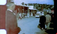
Seattle World's fair and McLean family
https://search.heritageburnaby.ca/link/archivedescription85416
- Repository
- City of Burnaby Archives
- Date
- 1961
- Collection/Fonds
- George H.F. McLean fonds
- Description Level
- Item
- Physical Description
- 1 digital file ( 4 min., 23 sec ) : digital , col., si.
- Scope and Content
- Item consists of one silent, colour film segment providing glimpses of the Seattle Worlds Fair in 1961. The footage provides views of the McLean family touring the sites of the fair including the metropolitan area, the monorail, gondola, rides and architecture. The film closes with Teresa McLean …
- Repository
- City of Burnaby Archives
- Date
- 1961
- Collection/Fonds
- George H.F. McLean fonds
- Physical Description
- 1 digital file ( 4 min., 23 sec ) : digital , col., si.
- Description Level
- Item
- Record No.
- 567-001-1
- Access Restriction
- No restrictions
- Reproduction Restriction
- May be restricted by third party rights
- Accession Number
- 2014-03
- Scope and Content
- Item consists of one silent, colour film segment providing glimpses of the Seattle Worlds Fair in 1961. The footage provides views of the McLean family touring the sites of the fair including the metropolitan area, the monorail, gondola, rides and architecture. The film closes with Teresa McLean as an infant.
- Media Type
- Moving Images
- Photographer
- McLean, George H.F.
- Notes
- Title based on content of film
- Films originated in an 8mm format and were digitized by George McLean before being donated to the CBA
Images
Video
Seattle World's fair and McLean family, 1961
Seattle World's fair and McLean family, 1961
https://search.heritageburnaby.ca/media/hpo/_Data/_Archives_Moving_Images/_Unrestricted/567-001-1.m4vSFU/Burnaby Centennial Committee fonds
https://search.heritageburnaby.ca/link/archivedescription97236
- Repository
- City of Burnaby Archives
- Date
- [191-?] (date of original) -2015
- Collection/Fonds
- SFU/Burnaby Centennial Committee fonds
- Description Level
- Fonds
- Physical Description
- 10 cm. of textual records and other material.
- Scope and Content
- Records consist of material created and collected by the SFU/Burnaby Centennial Committee in celebration of Burnaby's Centennial in 1992. Celebration projects undertaken by the Committee include: Image Bank project; Centennial Oral History project; Burnaby at 100 video series; and two publications:…
- Repository
- City of Burnaby Archives
- Date
- [191-?] (date of original) -2015
- Collection/Fonds
- SFU/Burnaby Centennial Committee fonds
- Physical Description
- 10 cm. of textual records and other material.
- Description Level
- Fonds
- Accession Number
- 2015-03
- 2014-28
- Scope and Content
- Records consist of material created and collected by the SFU/Burnaby Centennial Committee in celebration of Burnaby's Centennial in 1992. Celebration projects undertaken by the Committee include: Image Bank project; Centennial Oral History project; Burnaby at 100 video series; and two publications: "Burnaby: A Cultural Inventory and Resource Guide" and "Suburb of Happy Homes: Burnaby Centennial Themes".
- History
- The SFU (Simon Fraser University)/Burnaby Centennial Committee was established in 1990 and obtained initial funding from the President of Simon Fraser University, which was matched by a grant authorized by the Mayor and Council of the Municipality of Burnaby. Further funding came from the Burnaby (civic) Centennial Committee after the projects had been accepted as part of the recognition for Burnaby's Centennial celebrations in 1992. The suggestion for this committee originated with Professor Robert Anderson from the School of Communications and he was joined by Professors Veronica Strong-Boag from the Department of History and Leonard J. Evenden from the Department of Geography. Primary responsibilities ended up falling jointly to Professor Evenden and Susan Jamieson-McLarnon. The Committee was made up of the following members who helped to carry out the projects to completion: Rodney Fowler (SFU Department of Geography), Terry Fowler (Adler School of Professional Psychology, Chicago), Edward Gibson (SFU Department of Geography and Director of the Simon Fraser Gallery), James Ross (SFU Archivist), Allen Seager (Department of History), Grant Strate (SFU Fine and Performing Arts), and Arthur Wirick (representing Burnaby Municipal Centennial Committee). Other members of the university community contributed their expertise in a variety of ways, including: Jack Corse (SFU Librarian), Stephen Duguid (Institute of Humanities), Christine Hearn (Continuing Studies), Ken Mennel (Media and Public Relations), Jane Parkinson (Historian and Researcher), Stanley Shapiro (Business Administration) and Jerry Zaslove (Institute for the Humanities). Rodney Fowler also filled the position of committee coordinator. The committee's first undertaking was to explore the extent and availability of historical resources in the community of Burnaby. Two graduate students were hired to help carry out this work in the summer of 1991, which took two forms: a document-based study and an oral history project. The document-based history resulted in an inventory of 'archival' resources titled "Burnaby: A Cultural Inventory and Resource Guide," and the Oral History Project consisted of interviews with 11 Burnaby citizens. With the culmination of these two projects, a day-long workshop was held with both the SFU and the Burnaby municipal committees and other members of the Burnaby community who were pursuing various centennial projects of their own. Following the workshop and several meetings, the committee proposed other projects in addition to the Cultural Inventory and Oral History Project. The other completed projects consisted of: "The Burnaby Image Bank" which included an exhibition titled, "Images of Burnaby"; a finding aid video titled, "Burnaby's Photographic Family Album / Burnaby Image Bank Collection / Volume 1 / 1992"; a video titled "Burnaby at 100: Images and Voices"; a book of essays titled, "Suburb of Happy Homes: Burnaby Centennial Themes"; and a dance festival sponsored by The Centre for the Arts. "Suburb of Happy Homes: Burnaby Centennial Themes", dedicated to the citizens and students of Burnaby, and to the students of Simon Fraser University, was published in 1995. For this project, Leonard Evenden received the City of Burnaby Heritage Award in 1997. A companion project to the book of essays consisted of a map project which illustrated the development of settlement within the city, but it never came to fruition due to funding constraints.
- Media Type
- Textual Record
- Photograph
- Sound Recording
- Moving Images
- Notes
- Title based on contents of fonds
- PC 576, MI 579, MSS 187
South Burnaby Nursery School 4 year olds
https://search.heritageburnaby.ca/link/archivedescription85047
- Repository
- City of Burnaby Archives
- Date
- 1972
- Collection/Fonds
- South Burnaby Parent Participation Preschool fonds
- Description Level
- Item
- Physical Description
- 1 film reel (100 ft.) : kodak kodachrome, col., [sd.] ; 8mm
- Scope and Content
- Item is a film identified as South Burnaby Nursery school four year olds, (later named South Burnaby Parent Participation Preschool), January 1972.
- Repository
- City of Burnaby Archives
- Date
- 1972
- Collection/Fonds
- South Burnaby Parent Participation Preschool fonds
- Physical Description
- 1 film reel (100 ft.) : kodak kodachrome, col., [sd.] ; 8mm
- Description Level
- Item
- Record No.
- 563-002
- Access Restriction
- In Archives only
- Reproduction Restriction
- May be restricted by third party rights
- Accession Number
- 2014-06
- Scope and Content
- Item is a film identified as South Burnaby Nursery school four year olds, (later named South Burnaby Parent Participation Preschool), January 1972.
- Media Type
- Moving Images
- Notes
- Transcribed title
- Geographic Access
- Gray Avenue
- Historic Neighbourhood
- Alta-Vista (Historic Neighbourhood)
South Burnaby Parent Participation Preschool fonds
https://search.heritageburnaby.ca/link/archivedescription84942
- Repository
- City of Burnaby Archives
- Date
- 1957-2001
- Collection/Fonds
- South Burnaby Parent Participation Preschool fonds
- Description Level
- Fonds
- Physical Description
- 52 cm. of textual records + 129 photographs (113 photographs : col. negatives, 35 mm ; 12 photographs : col. negatives, 15 mm ; 5 photograph : col., 15 x 10 cm) + 3 moving images (2 film reel (100 ft.) : kodak kodachrome, col., [sd.], 8mm ; 1 film reel (50 ft.) : kodak kodachrome, col., no sound ; 8mm).
- Scope and Content
- Fonds consists of all records generated by the South Burnaby Parent Participation Preschool between 1957-2001 during their operational functions under the Societies Act.
- Repository
- City of Burnaby Archives
- Date
- 1957-2001
- Collection/Fonds
- South Burnaby Parent Participation Preschool fonds
- Physical Description
- 52 cm. of textual records + 129 photographs (113 photographs : col. negatives, 35 mm ; 12 photographs : col. negatives, 15 mm ; 5 photograph : col., 15 x 10 cm) + 3 moving images (2 film reel (100 ft.) : kodak kodachrome, col., [sd.], 8mm ; 1 film reel (50 ft.) : kodak kodachrome, col., no sound ; 8mm).
- Description Level
- Fonds
- Access Restriction
- In Archives only
- Reproduction Restriction
- May be restricted by third party rights
- Accession Number
- 2014-06
- Scope and Content
- Fonds consists of all records generated by the South Burnaby Parent Participation Preschool between 1957-2001 during their operational functions under the Societies Act.
- History
- The South Burnaby United Church Cooperative Play group was formed as a society under the Societies Act in September 1954 when a group of parents in Burnaby decided to create a parent participation and cooperative preschool for children age three to five. The preschool was located at the South Burnaby United Church, 7551 Gray Avenue in Burnaby. The society hired early childhood educators, offering preschool classes in the mornings. In 1961, the preschool expanded in offering classes in both mornings and afternoons. In 1959, they changed their name to South Burnaby Cooperative Preschool Group. In the 1970s, they were also known as the South Burnaby Nursery School and The South Burnaby Cooperative Nursery School Group. They later rebranded in the 1980s as the South Burnaby Parent Participation Preschool and were also known as the South Burnaby Preschool. The preschool was based on the following principles in their constitution: a) To promote principles of preschool education in which children through play develop socially, physically, emotionally and intellectually; b) To provide a high standard of preschool education in which children through play develop socially, physically, emotionally and intellectually; c) To encourage and facilitate opportunities for parents to observe and learn about the development, needs and behavior of children; and d) To do everything incidental and necessary to promote and attain the foregoing objects. Presidents of the Society included: Helen Gray (1957-1958); Dorothy Lyeler (1958-1959); G.L. Bancroft; Helen Stone (1959-1960); Carol Jane Gray (1969-1970); Nancy Gordon (1970-1971); Barbara Spitz (1971-1972); Debby Fry (1976-1977); Jill Johneox (1977-1978); Nancy Lewis (1980-1981); Nancy Lewis (1983-1984); Lynda Walsh (1984-1985); Margaret Stevens (1985-1986); Nina Crowe (1987-1988); Carol McRae and Cathy Lauzon (1988-1989); Tracy Sawatzky (1996-1997); Shelley Molarni and Charmaine Calbick (1997-1998); Kathie Owen (1999-2000); and Susie Jackson (2001-2002). The first supervisor was Rhoda Darnbrough (1954-1981). All parents who had children enrolled in the preschool were responsible for the administration and staffing of the preschool under the guidance of a qualified preschool teacher. Parents occupied positions on the executive, assisting in the general administration and helping out in the classroom under the guidance of the supervising teacher. The society was an active member of the Council of Parent Participation Preschools in B.C., which was established in 1960 as The Association of Cooperative Pre School Groups, and adhered to the Council's statements of standards and common practices. Members from the preschool executive sat on the South Burnaby executive of the CPPPBC. Salaries were paid to educators in accordance with the Parent Participation Preschool Teachers' Association. In 1958, the preschool was chosen by the Play Groups Association of BC as an Observation Centre and was selected for many years following. The preschool participated in fundraising activities and was granted Gaming/Casino funding to help purchase supplies and furnishings for their facility. The preschool closed in 2001.
- Media Type
- Photograph
- Textual Record
- Moving Images
- Notes
- Title based on contents of fonds
- MSS181, photo/MI catalogue 563
South Burnaby Parent Participation Preschool puppet show
https://search.heritageburnaby.ca/link/archivedescription85046
- Repository
- City of Burnaby Archives
- Date
- 1975
- Collection/Fonds
- South Burnaby Parent Participation Preschool fonds
- Description Level
- Item
- Physical Description
- 1 film reel (50 ft.) : kodak kodachrome, col., no sound ; 8mm
- Scope and Content
- Item is a film of a puppet show from the South Burnaby Parent Participation Preschool. Identification on outside label includeds the name, Darnbrough and the date, Mar 27, 1975.
- Repository
- City of Burnaby Archives
- Date
- 1975
- Collection/Fonds
- South Burnaby Parent Participation Preschool fonds
- Physical Description
- 1 film reel (50 ft.) : kodak kodachrome, col., no sound ; 8mm
- Description Level
- Item
- Record No.
- 563-001
- Access Restriction
- In Archives only
- Reproduction Restriction
- May be restricted by third party rights
- Accession Number
- 2014-06
- Scope and Content
- Item is a film of a puppet show from the South Burnaby Parent Participation Preschool. Identification on outside label includeds the name, Darnbrough and the date, Mar 27, 1975.
- Subjects
- Recreational Activities - Theatre
- Media Type
- Moving Images
- Notes
- Transcribed title
South Burnaby Parent Participation Preschool School 3 year olds
https://search.heritageburnaby.ca/link/archivedescription85048
- Repository
- City of Burnaby Archives
- Date
- 1971
- Collection/Fonds
- South Burnaby Parent Participation Preschool fonds
- Description Level
- Item
- Physical Description
- 1 film reel (100 ft.) : kodak kodachrome, col., [sd.] ; 8mm
- Scope and Content
- Item is a film identified as three year olds, (from the South Burnaby Parent Participation Preschool), December 1971.
- Repository
- City of Burnaby Archives
- Date
- 1971
- Collection/Fonds
- South Burnaby Parent Participation Preschool fonds
- Physical Description
- 1 film reel (100 ft.) : kodak kodachrome, col., [sd.] ; 8mm
- Description Level
- Item
- Record No.
- 563-003
- Access Restriction
- In Archives only
- Reproduction Restriction
- May be restricted by third party rights
- Accession Number
- 2014-06
- Scope and Content
- Item is a film identified as three year olds, (from the South Burnaby Parent Participation Preschool), December 1971.
- Media Type
- Moving Images
- Notes
- Transcribed title
- Geographic Access
- Gray Avenue
- Historic Neighbourhood
- Alta-Vista (Historic Neighbourhood)
Sprott Road to Douglas Road (Harvey, Loewen, Humble)
https://search.heritageburnaby.ca/link/archivedescription371
- Repository
- City of Burnaby Archives
- Date
- [1911]
- Collection/Fonds
- City Council and Office of the City Clerk fonds
- Description Level
- File
- Physical Description
- Textual record and cartographic material
- Scope and Content
- File contains subdivision plans for Blocks 9 and 10, DL 80; subdivision of south 1/4 DL 74; subdivision of north 1/2 DL 80. These plans were drawn up by Loewen, Harvey & Humble.
- Repository
- City of Burnaby Archives
- Date
- [1911]
- Collection/Fonds
- City Council and Office of the City Clerk fonds
- Physical Description
- Textual record and cartographic material
- Description Level
- File
- Record No.
- 2064
- Accession Number
- 2001-02
- Scope and Content
- File contains subdivision plans for Blocks 9 and 10, DL 80; subdivision of south 1/4 DL 74; subdivision of north 1/2 DL 80. These plans were drawn up by Loewen, Harvey & Humble.
- Media Type
- Textual Record
- Cartographic Material
- Notes
- Plans/maps are located in file and have not been moved to map case.
Spur - Hall grounds
https://search.heritageburnaby.ca/link/archivedescription798
- Repository
- City of Burnaby Archives
- Date
- 1912-1915
- Collection/Fonds
- City Council and Office of the City Clerk fonds
- Description Level
- File
- Physical Description
- Textual record and cartographic material
- Scope and Content
- File contains correspondence and reports regarding road allowances and widening of lane in DL 95 to improve access to Municipal Hall. File also includes blueprint of Plan and Profile of Spur to serve Burnaby Municipal Hall at Edmonds, 1912.
- Repository
- City of Burnaby Archives
- Date
- 1912-1915
- Collection/Fonds
- City Council and Office of the City Clerk fonds
- Physical Description
- Textual record and cartographic material
- Description Level
- File
- Record No.
- 2549
- Accession Number
- 2001-02
- Scope and Content
- File contains correspondence and reports regarding road allowances and widening of lane in DL 95 to improve access to Municipal Hall. File also includes blueprint of Plan and Profile of Spur to serve Burnaby Municipal Hall at Edmonds, 1912.
- Media Type
- Textual Record
- Cartographic Material
- Notes
- Plans/maps are located in file and have not been moved to map case.
Spur - James Drake
https://search.heritageburnaby.ca/link/archivedescription875
- Repository
- City of Burnaby Archives
- Date
- 1913-1914
- Collection/Fonds
- City Council and Office of the City Clerk fonds
- Description Level
- File
- Physical Description
- Textual record and cartographic material
- Scope and Content
- File contains agreement made between the Corporation of the District of Burnaby and James Drake for the construction and operation of a spur from the B.C. Electric Railway Co.'s track in DL 70. File includes blueprint "plan of spur to serve the James Drake Shingle Co., Ardley, Burnaby Lake, 1913"…
- Repository
- City of Burnaby Archives
- Date
- 1913-1914
- Collection/Fonds
- City Council and Office of the City Clerk fonds
- Physical Description
- Textual record and cartographic material
- Description Level
- File
- Record No.
- 2639
- Accession Number
- 2001-02
- Scope and Content
- File contains agreement made between the Corporation of the District of Burnaby and James Drake for the construction and operation of a spur from the B.C. Electric Railway Co.'s track in DL 70. File includes blueprint "plan of spur to serve the James Drake Shingle Co., Ardley, Burnaby Lake, 1913" as well as white linen map "Subdivision of North 11.06 acres of E.1/2 DL 70 Group 1 New Westminster District, Burnaby Municipality."
- Media Type
- Textual Record
- Cartographic Material
- Notes
- Plans/maps are located in file and have not been moved to map case.
Street lighting
https://search.heritageburnaby.ca/link/archivedescription436
- Repository
- City of Burnaby Archives
- Date
- 1909-1922
- Collection/Fonds
- City Council and Office of the City Clerk fonds
- Description Level
- File
- Physical Description
- 4 folders textual records and cartographic material
- Scope and Content
- File contains agreements, statements, correspondence and reports pertaining to the installation and maintenance of street lights.
- Repository
- City of Burnaby Archives
- Date
- 1909-1922
- Collection/Fonds
- City Council and Office of the City Clerk fonds
- Physical Description
- 4 folders textual records and cartographic material
- Description Level
- File
- Record No.
- 2138
- Accession Number
- 2001-02
- Scope and Content
- File contains agreements, statements, correspondence and reports pertaining to the installation and maintenance of street lights.
- Media Type
- Textual Record
- Cartographic Material
- Notes
- A map of Burnaby with proposed street lamps marked (1912?) : M9-B-2-12
Studies, reports, and conferences series
https://search.heritageburnaby.ca/link/archivedescription186
- Repository
- City of Burnaby Archives
- Date
- 1930-2010
- Collection/Fonds
- Planning Department fonds
- Description Level
- Series
- Scope and Content
- Series consists of the various published and draft reports and studies produced by the Planning Department covering all facets of their operations. During the course of their research and reporting on all planning issues within the City, the Planning Department published or made available studies …
- Repository
- City of Burnaby Archives
- Date
- 1930-2010
- Collection/Fonds
- Planning Department fonds
- Description Level
- Series
- Scope and Content
- Series consists of the various published and draft reports and studies produced by the Planning Department covering all facets of their operations. During the course of their research and reporting on all planning issues within the City, the Planning Department published or made available studies that outlined the findings or proposals that arose from their work and this type of material was all grouped together within this series. These reports and studies ranged from topics such as Burnaby regional studies, transportation and apartment reports, and park and school site needs to Official Community Plans and development schemes related to residential, commercial, and industrial sites. Also found within this series were the records that were created dealing with conferences, workshops, and seminars attended or held by the Burnaby Planning Department staff.
- Media Type
- Textual Record
- Moving Images
Survey maps - Sundries
https://search.heritageburnaby.ca/link/archivedescription664
- Repository
- City of Burnaby Archives
- Date
- 1902-1910
- Collection/Fonds
- City Council and Office of the City Clerk fonds
- Description Level
- File
- Physical Description
- Textual record and cartographic material
- Scope and Content
- File contains various maps - 1 ink on paper and 5 linen plans by Albert J. Hill as well as survey descriptions (textual).
- Repository
- City of Burnaby Archives
- Date
- 1902-1910
- Collection/Fonds
- City Council and Office of the City Clerk fonds
- Physical Description
- Textual record and cartographic material
- Description Level
- File
- Record No.
- 2389
- Accession Number
- 2001-02
- Scope and Content
- File contains various maps - 1 ink on paper and 5 linen plans by Albert J. Hill as well as survey descriptions (textual).
- Media Type
- Textual Record
- Cartographic Material
- Notes
- Plans/maps are located in file and have not been moved to map case.
Survey - Roberts Road and Power House Road
https://search.heritageburnaby.ca/link/archivedescription8038
- Repository
- City of Burnaby Archives
- Date
- [191-?]
- Collection/Fonds
- City Council and Office of the City Clerk fonds
- Description Level
- Item
- Physical Description
- 1 map
- Scope and Content
- One white linen plan with Vancouver Road to the north and North Arm Road to the south.
- Repository
- City of Burnaby Archives
- Date
- [191-?]
- Collection/Fonds
- City Council and Office of the City Clerk fonds
- Physical Description
- 1 map
- Description Level
- Item
- Record No.
- 10993
- Accession Number
- 2001-02
- Scope and Content
- One white linen plan with Vancouver Road to the north and North Arm Road to the south.
- Media Type
- Cartographic Material
- Notes
- Located in map case.
Tank Site - Central Park
https://search.heritageburnaby.ca/link/archivedescription577
- Repository
- City of Burnaby Archives
- Date
- 1911-1912
- Collection/Fonds
- City Council and Office of the City Clerk fonds
- Description Level
- File
- Physical Description
- Textual record and cartographic material
- Scope and Content
- File contains agreement and correspondence between the Corporation of the District of Burnaby and the Central Park Agricultural Association and Farmers Institute regarding the water tank site. File also contains 3 blueprint plans of the tank site.
- Repository
- City of Burnaby Archives
- Date
- 1911-1912
- Collection/Fonds
- City Council and Office of the City Clerk fonds
- Physical Description
- Textual record and cartographic material
- Description Level
- File
- Record No.
- 2287
- Accession Number
- 2001-02
- Scope and Content
- File contains agreement and correspondence between the Corporation of the District of Burnaby and the Central Park Agricultural Association and Farmers Institute regarding the water tank site. File also contains 3 blueprint plans of the tank site.
- Media Type
- Textual Record
- Cartographic Material
- Notes
- A plan of site for water tank in Central Park : M9-B-3-6
Traffic Flow Map of Greater Vancouver
https://search.heritageburnaby.ca/link/archivedescription90140
- Repository
- City of Burnaby Archives
- Date
- 1959
- Collection/Fonds
- Planning Department fonds
- Description Level
- Item
- Physical Description
- 1 map : col ; 53 x 82.5 cm on sheet 47 x 86 cm
- Scope and Content
- Map laying out traffic flow of Greater Vancouver Regional District which includes Burnaby.
- Repository
- City of Burnaby Archives
- Date
- 1959
- Collection/Fonds
- Planning Department fonds
- Series
- Planning General series
- Physical Description
- 1 map : col ; 53 x 82.5 cm on sheet 47 x 86 cm
- Material Details
- Scale : 1 inch = .57 miles
- Description Level
- Item
- Record No.
- 59930
- Access Restriction
- Open access
- Accession Number
- 2016-09
- Scope and Content
- Map laying out traffic flow of Greater Vancouver Regional District which includes Burnaby.
- Media Type
- Cartographic Material
- Publisher
- Prepared for Neon Products of Canada Ltd.
- Notes
- Transcribed title