Narrow Results By
Subject
- Agriculture 1
- Agriculture - Farms 1
- Buildings 1
- Buildings - Agricultural 1
- Buildings - Heritage 3
- Buildings - Public - Detention Facilities 2
- Buildings - Residential 1
- Buildings - Residential - Houses 1
- Documentary Artifacts 2
- Documentary Artifacts - Books 2
- Education 1
- Government - Colonial Government 1
Creator
- Albert F. Arnold 1
- Alphonse J. Toebaert 1
- Angus, H. F. (Henry Forbes), 1891-1991 1
- Barrett, Dave, 1930-2018 1
- Benson, Arthur Christopher, 1862-1925 1
- Bowman and Cullerne 1
- Burnaby Centennial '71 Committee 1
- Burnaby Community Heritage Commission 1
- Burnaby Monumental Works 1
- Burnaby, Robert, 1828-1878 1
- Burnaby Village Museum 8
- Caldwell, Otis W. (Otis William), 1869-1947 1

Government Road Neighbourhood
https://search.heritageburnaby.ca/link/landmark822
- Repository
- Burnaby Heritage Planning
- Associated Dates
- 1955-2008
- Heritage Value
- After the building boom of the 1950s, the Government Road Neighbourhood became characterised as a stable, single-family residential area. In addition to the residential component, the neighbourhood also has a significant industrial sector, along the north side of Burnaby Lake, and a commercial zone to the north along the Lougheed Highway.
- Historic Neighbourhood
- Lozells (Historic Neighbourhood)
- Planning Study Area
- Government Road Area
Images


Lozells Neighbourhood
https://search.heritageburnaby.ca/link/landmark701
- Repository
- Burnaby Heritage Planning
- Associated Dates
- 1925-1954
- Heritage Value
- Like a lot of residential neighbourhoods in Burnaby during the post-War boom, the Lozells area during the 1925-1954 period was one of new construction and subdivisions. Although more homes were being built, the neighbourhood still retained a somewhat rural characteristic well into the 1950s.
- Historic Neighbourhood
- Lozells (Historic Neighbourhood)
- Planning Study Area
- Government Road Area
Images


Lozells Neighbourhood
https://search.heritageburnaby.ca/link/landmark756
- Repository
- Burnaby Heritage Planning
- Associated Dates
- 1905-1924
- Heritage Value
- In 1906 C.T. Piper and Alfred Wiggs built a sawmill at the foot of what is now Piper Avenue along the north shore of Burnaby Lake. These operations and the proximity of the Great Northern Railway encourage settlers to move into this area and among them were Colonel and Mrs. James Ward. They were authorized to open a post office here and Mrs. Ward named it 'Lozells' after the Anglican parish to which she had been a member in Birmingham, England.
- Historic Neighbourhood
- Lozells (Historic Neighbourhood)
- Planning Study Area
- Government Road Area
Images


Central Park Neighbourhood
https://search.heritageburnaby.ca/link/landmark723
- Repository
- Burnaby Heritage Planning
- Associated Dates
- 1891-1904
- Heritage Value
- Central Park was one of the first and fastest-growing communities in Burnaby. Located along the electric tram line and the Vancouver Road (Kingsway), it was also chosen for a government settlement project referred to as the Central Park Small Holdings. The lands held by the Provincial Government were subdivided and sold around 1894 and by 1899 the settlement was large enough to warrant the construction of an Anglican Church there.
- Historic Neighbourhood
- Central Park (Historic Neighbourhood)
- Planning Study Area
- Maywood Area
Images

Gaskell's compendium of forms : educational, social, legal and commercial : embracing a complete self-teaching course in penmanship and bookkeeping, and aid to English composition : together with the laws and by-laws of social etiquette and busniess laws and commercial forms : a political dictionary, a biographical dictionary, the government of the U. S., the states and territorial governments, colored charts, etc. etc., also a manual of agricultural, mechanics and mining, and a complete guide to parliamentary practice, the whole forming a complete encyclopedia of reference : elegantly illustrated
https://search.heritageburnaby.ca/link/museumlibrary3491
- Repository
- Burnaby Village Museum
- Collection
- Special Collection
- Material Type
- Book
- Accession Code
- BV985.5288.1
- Call Number
- 031 GAS
- Place of Publication
- Chicago
- Publisher
- Fairbanks & Palmer Pub. Co.
- Publication Date
- c1884
- Printer
- Blakely, Marsh & Co.
- Physical Description
- 920 p. : ill. ; 28 cm.
- Library Subject (LOC)
- Encyclopedias and dictionaries
- Bookkeeping
- Penmanship
- Letter writing
- Etiquette
- Parliamentary practice
- Notes
- Includes index.
- Author's full name and date: Gaskell, G. A. (George A.), 1844-
Our government : a book for Canadians
https://search.heritageburnaby.ca/link/museumlibrary3117
- Repository
- Burnaby Village Museum
- Author
- Stevenson, Mabel McLuhan
- Edition
- Ontrario ed.
- Publication Date
- c1917
- Call Number
- 354.71 STE
- Repository
- Burnaby Village Museum
- Collection
- Special Collection
- Material Type
- Book
- Accession Code
- HV972.165.85
- Call Number
- 354.71 STE
- Edition
- Ontrario ed.
- Author
- Stevenson, Mabel McLuhan
- Place of Publication
- Toronto
- Publisher
- George J. McLeod Ltd.
- Publication Date
- c1917
- Physical Description
- 178 p. ; 19 cm.
- Inscription
- "W 72" -- handwritten and crossed-out on endpaper (front). "Mrs. R.M. Bradshaw / 3 Joon Rae"? -- handwritten in ink on flyleaf.
- Library Subject (LOC)
- Political science
- Canada--Politics and government
- Civics, Canadian
- Notes
- Includes index.

The school record : a guide to government archives relating to public education in British Columbia, 1852-1946
https://search.heritageburnaby.ca/link/museumlibrary5205
- Repository
- Burnaby Village Museum
- Collection
- Reference Collection
- Material Type
- Book
- ISBN
- 0771891547
- Call Number
- 016.37 DUN
- Place of Publication
- [Victoria, BC]
- Publisher
- Ministry of Government Services, British Columbia Archives and Record Services
- Publication Date
- 1992
- Physical Description
- x, 154 p. : ill. ; 27 cm.
- Inscription
- "Eric Damer / Donated to BVM- / Seaforth School", handwritten in ink on title page.
- Library Subject (LOC)
- Archives
- Public schools
- Catalogs
- Education
- Notes
- Includes bibliographical references.
- Author full name: Dunae, Patrick A. (Patrick Alexander), 1950-.
Studies in the scriptures : series 1 : the plan of the ages : a vindication of the divine character and government: showing, by a recognition and harmonizing of all the scriptures, that the permission of evil, past and present, is educational and preparatory to the userhing of mankind into the golden age of prophecy in which all the families of the earth will be blessed with a full knowledge of God and a full opportunity for attaining everlasing life through the redeemer, who then will be the great restorer and life-giver.
https://search.heritageburnaby.ca/link/museumlibrary3697
- Repository
- Burnaby Village Museum
- Collection
- Special Collection
- Material Type
- Book
- Accession Code
- BV001.1.32
- Call Number
- 230.9 WAT
- Place of Publication
- London
- Publisher
- Watch Tower Bible & Tract Society
- Publication Date
- 1910
- c1886
- Physical Description
- 356, 14 p. : 1 folded chart ; 19 cm.
- Library Subject (LOC)
- Jehovah's Witnesses
- Bible
- Notes
- Includes "A criticism of millennial hopes examined"
- Includes index.
The winning of popular government : a chronicle of the union of 1841, v.27
https://search.heritageburnaby.ca/link/museumlibrary5122
- Repository
- Burnaby Village Museum
- Collection
- Special Collection
- Material Type
- Book
- Accession Code
- BV004.106.14
- Call Number
- 971 CHR v.27
- Place of Publication
- Toronto
- Publisher
- Glasgow, Brook & Company
- Publication Date
- 1916
- Series
- Chronicles of Canada, 27
- Printer
- T. and A. Constable
- Physical Description
- xi, 172 p., [7] leaves of plates : ill. (some col.), ports. ; 19 cm.
- Library Subject (LOC)
- Canada--History
- Notes
- "Edited by George M. Wrong and H.H. Langton"
- "In thirty-two volumes"
- "Part VII The Struggle for Political Freedom"
- Includes bibliographic references and index.
- Author's given names and dates: MacMechan Archibald McKellar, 1862-1933
- Editor's given names and dates: Wrong, George McKinnon, 1860-1948
- Editor's given names and dates: Langton, H.H. (Hugh Hornby), 1862-1953
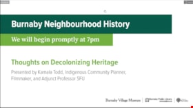
Thoughts on decolonizing heritage
https://search.heritageburnaby.ca/link/museumdescription14757
- Repository
- Burnaby Village Museum
- Date
- 1 Oct. 2020
- Collection/Fonds
- Burnaby Village Museum fonds
- Description Level
- Item
- Physical Description
- 1 video recording (mp4) (88 min., 3 sec.) : digital, col., sd., stereo ; 29 fps
- Scope and Content
- Item consists of a video recording of a live Zoom webinar hosted by Burnaby Village Museum's Kate Petrusa. The webinar is titled "Thoughts on Decolonizing Heritage" and is presented by Kamala Todd - Indigenous Community Planner, Filmmaker, and Adjunct Professor SFU. The zoom webinar is the second i…
- Repository
- Burnaby Village Museum
- Collection/Fonds
- Burnaby Village Museum fonds
- Description Level
- Item
- Physical Description
- 1 video recording (mp4) (88 min., 3 sec.) : digital, col., sd., stereo ; 29 fps
- Material Details
- Presenter: Kamala Todd
- Host: Kate Petrusa
- Date of Presentation: October 1, 7:00 pm - 8:30 pm
- Total Number of tracks: 1
- Total Length of all tracks: 88 min., 3 sec.
- Recording Device: Zoom video communication platform
- Scope and Content
- Item consists of a video recording of a live Zoom webinar hosted by Burnaby Village Museum's Kate Petrusa. The webinar is titled "Thoughts on Decolonizing Heritage" and is presented by Kamala Todd - Indigenous Community Planner, Filmmaker, and Adjunct Professor SFU. The zoom webinar is the second in a collection of seven "Neighbourhood Speaker series" webinars that were presented and made available to the public between September 29 and October 27, 2020. The live webinar and recording was also made available on the Burnaby Village Museum's facebook page. In this webinar, Kamala Todd speaks about how narratives and sense of place shape our connection to the lands we live upon. Kamala highlights how dominant colonial narratives are embedded into the built environment, place names, heritage landscapes, and the very planning of our cities contributing to exclusion and erasure of the hən̓q̓əmin̓əm and Sḵwx̱wú7mesh speaking people, who have lived on their unceded territories since time immemorial.Todd provides her perspectives by asking the questions; How has “Heritage” contributed to colonial harms and erasures? And what will it take to decolonize and re-Indigenize the stories, landscapes, and understandings of the places we call home? The presentation is supported with contemporary and historic photographs. Kamala takes questions from webinar participants and reads from writings of different authors including Stó:lō author, Lee Maracle and Salish poet, Will George.
- Creator
- Burnaby Village Museum
- Subjects
- Indigenous peoples - British Columbia
- Indigenous peoples - Canada - Government relations
- Indigenous peoples - Canada - , Treatment of
- Persons - Pioneers
- Government - Colonial Government
- Monuments
- Responsibility
- Petrusa, Kate
- Geographic Access
- Vancouver
- Accession Code
- BV020.29.2
- Access Restriction
- No restrictions
- Reproduction Restriction
- No known restrictions
- Date
- 1 Oct. 2020
- Media Type
- Moving Images
- Notes
- Title based on contents of video recording
- Video recording was edited for publication on Heritage Burnaby. Original mp4 video recording (BV020.29.2.1) is 103 min., 49 sec.
Images

Video
Thoughts on decolonizing heritage, 1 Oct. 2020
Thoughts on decolonizing heritage, 1 Oct. 2020
https://search.heritageburnaby.ca/media/hpo/_Data/_BVM_Moving_Images/2020_0029_0002_002.mp4
Broadview Neighbourhood
https://search.heritageburnaby.ca/link/landmark750
- Repository
- Burnaby Heritage Planning
- Associated Dates
- 1905-1924
- Heritage Value
- Between 1905 and 1924, the Broadview neighbourhood in Burnaby was settled by almost 100 families who saw the advantage of living in an area that was served by two railway lines - the B.C. Electric Railway and the Great Northern Railway. Touted as being only a 20 minute car ride to the city centre, this neighbourhood expanded during the early 1920s with the promise of a new direct access road to the city being built by the Great Northern Railway company and new blocks being opened up on two government reserves adjoining it.
- Historic Neighbourhood
- Broadview (Historic Neighbourhood)
- Planning Study Area
- Cascade-Schou Area
Images


Burnaby Civic Employees Union Memorial Fountain
https://search.heritageburnaby.ca/link/landmark539
- Repository
- Burnaby Heritage Planning
- Description
- This memorial granite drinking fountain is a monument to Burnaby’s municipal employees who lost their lives in the First World War. It has been relocated from its original setting to a shaded arterial pathway within the Burnaby Village Museum.
- Associated Dates
- 1923
- Formal Recognition
- Heritage Designation, Community Heritage Register
- Repository
- Burnaby Heritage Planning
- Geographic Access
- Deer Lake Avenue
- Associated Dates
- 1923
- Formal Recognition
- Heritage Designation, Community Heritage Register
- Enactment Type
- Bylaw No. 9807
- Enactment Date
- 23/11/1992
- Description
- This memorial granite drinking fountain is a monument to Burnaby’s municipal employees who lost their lives in the First World War. It has been relocated from its original setting to a shaded arterial pathway within the Burnaby Village Museum.
- Heritage Value
- The fountain is an early civic monument with superior massing and detail, constructed of local materials by local stonemason William Williamson. It was erected by the Burnaby Civic Employees Union (now CUPE Local 23) in 1923, on Burnaby’s original Municipal Hall grounds located at Kingsway and Edmonds Street, to honour their members who lost their lives in the First World War, commemorated by an engraved memorial at the top of the fountain. It signifies an important connection with the early strength and prominence of the civic labour union in Burnaby, as this was a memorial erected by the union members themselves, rather than by the civic government. Many war memorials were constructed across Canada after the end of the First World War, however, most are static, inviting passive contemplation. This memorial is unusual in its combination of functions; its use as a drinking fountain invites active participation. The memorial also includes a stone drinking bowl for dogs at the bottom left of the memorial, further illustrating the daily functional use of the fountain. The heritage value for this fountain also lies in its interpretive value within the Burnaby Village Museum. The site is an important cultural feature for the interpretation of Burnaby’s heritage to the public. The fountain was moved to the Burnaby Village Museum in 1974.
- Defining Elements
- The character defining features of the Burnaby Civic Employees Union Memorial Fountain include its: - distinctive form with central water fountain - construction of rough-dressed local B.C. granite - engraved memorial at the top - carved emblematic maple leaf - drinking fountain function - dog drinking bowl
- Locality
- Deer Lake Park
- Historic Neighbourhood
- Burnaby Lake (Historic Neighbourhood)
- Planning Study Area
- Morley-Buckingham Area
- Builder
- William Williamson
- Function
- Primary Current--Monument
- Primary Historic--Monument
- Secondary Current--Museum
- Community
- Burnaby
- Cadastral Identifier
- P.I.D. No. 011-030-356 Legal Description: Parcel 1, District Lot 79 and District Lot 85, Group 1, New Westminster District, Reference Plan 77594
- Boundaries
- Burnaby Village Museum is comprised of a single municipally-owned property located at 6501 Deer Lake Avenue, Burnaby.
- Area
- 38,488.63
- Contributing Resource
- Building
- Structure
- Landscape Feature
- Ownership
- Public (local)
- Documentation
- Heritage Site Files: PC77000 20. City of Burnaby Planning and Building Department, 4949 Canada Way, Burnaby, B.C., V5G 1M2
- Street Address
- 6501 Deer Lake Avenue
Images


Burnaby Mountain Neighbourhood
https://search.heritageburnaby.ca/link/landmark792
- Repository
- Burnaby Heritage Planning
- Associated Dates
- 1955-2008
- Heritage Value
- Burnaby Mountain had been dedicated as park in 1942, however the original park boundaries were reconsidered in 1952 with the development of the Trans Mountain Pipeline. Although the boundaries were adjusted to accommodate this project, significant conservation and park lands were left untouched. When, in 1962, the government of British Columbia determined the need for additional post-secondary facilities, Burnaby Mountain was chosen as the site for the new Simon Fraser University which opened in 1965. As early as 1964, the idea of establishing a townsite around the university had been discussed by Burnaby, but it was not until the mid-1990s that the idea came to fruition and by the early 2000s, a new housing development know as the UniverCity took shape on the mountain adjacent to the university.
- Historic Neighbourhood
- Barnet (Historic Neighbourhood)
- Planning Study Area
- Burnaby Mountain Area
Images


Central Park
https://search.heritageburnaby.ca/link/landmark728
- Repository
- Burnaby Heritage Planning
- Geographic Access
- Imperial Street
- Associated Dates
- 1891
- Heritage Value
- In 1860, as the Royal Engineers constructed the road from New Westminster to Vancouver (now Kingsway), a military reserve was set aside at the trail's highest point along the ridge. This reserve provided a particularly good scenic look-out since the original forest had burned down prior to 1860, the remaining stumps offered unobstructed views. By the 1880s, the city council of both New Westminster and Vancouver eyed the reserve as potential recreation ground. As construction of the tram line was underway, the Provincial Government moved to designate the whole reserve as a park. On January 14, 1891, the Lieutenant Governor of British Columbia proclaimed it as a public recreation ground.
- Historic Neighbourhood
- Central Park (Historic Neighbourhood)
- Planning Study Area
- Maywood Area
- Street Address
- 3883 Imperial Street
- Street View URL
- Google Maps Street View
Images


Duncan & Margaret McGregor Estate 'Glen-Lyon' Mansion
https://search.heritageburnaby.ca/link/landmark518
- Repository
- Burnaby Heritage Planning
- Description
- Overlooking the rich farmland of the Fraser River floodplain, 'Glen-Lyon' is an Edwardian era rural estate, with a tall, two and one-half storey plus basement wood-frame mansion, set in a pastoral and formal landscape with an associated barn and early log pond, located near a ravine and forested ar…
- Associated Dates
- 1902
- Formal Recognition
- Heritage Designation, Community Heritage Register
- Street View URL
- Google Maps Street View
- Repository
- Burnaby Heritage Planning
- Geographic Access
- Marine Drive
- Associated Dates
- 1902
- Formal Recognition
- Heritage Designation, Community Heritage Register
- Enactment Type
- Bylaw No. 12183
- Enactment Date
- 11/12/2006
- Description
- Overlooking the rich farmland of the Fraser River floodplain, 'Glen-Lyon' is an Edwardian era rural estate, with a tall, two and one-half storey plus basement wood-frame mansion, set in a pastoral and formal landscape with an associated barn and early log pond, located near a ravine and forested area adjacent to Marine Drive in South Burnaby.
- Heritage Value
- ‘Glen-Lyon’ is valued as an excellent example of a privately-owned Edwardian era country estate built at the turn of the nineteenth century. The property retains significant heritage features including the Edwardian era mansion with rustic Arts and Crafts features, and elements of a working agricultural landscape. The property was originally the Royal City Mills logging camp, and in 1900 was purchased by Duncan Campbell McGregor (1853-1929) and Margaret Jane McGregor (1875-1960), who named their estate ‘Glen-Lyon’ after Duncan McGregor’s birthplace in Perthshire, Scotland. The McGregors were active in municipal affairs and social activities, and played a significant role in the early development of Burnaby. Duncan McGregor served as a city councillor from 1909 to 1912 and was elected reeve of Burnaby in 1913. Margaret McGregor was instrumental in the formation and fundraising activities of the Victoria Order of Nurses in Burnaby. Additionally, the site is historically significant for its association with early social welfare and correctional reform. The estate was sold in 1926 to an inter-denominational religious organization called the Home of the Friendless, which used it as their B.C. headquarters. The organization was charged with several cases of abuse and neglect in 1937, after which a Royal Commission was formed that led to new legislation to regulate and license all private welfare institutions. 'Glen-Lyon' was sold to the provincial government, and was dedicated in 1939 by the Lt.-Gov. E.W. Hamber for use as the New Haven Borstal Home for Boys and Youthful Offenders (later renamed the New Haven Correction Centre). The Borstal movement originated in England in the late nineteenth century, as an alternative to sending young offenders and runaways to prisons by providing reformatories that focused on discipline and vocational skill. This site’s role as the first North American institution devoted to the Borstal School philosophy was historic, and influenced corrections programs across Canada. The site retains significant features from its development in 1939 as the Borstal School, including a large gambrel-roofed barn designed by Chief Provincial Architect Henry Whittaker of the Department of Public Works that is the only remaining structure of its kind in Burnaby. Between 1941 and 1945 the mansion housed the Provincial School for the Deaf and Blind when the Borstal School was closed temporarily as a war measure during the Second World War.
- Defining Elements
- Key elements that define the heritage character of 'Glen-Lyon' Mansion include its: - location on a sloping site with expansive southern exposure, adjacent to Marine Drive - residential form, scale and massing of the house as exemplified by its two and one-half storey height, above-ground basement and rectangular plan - Arts and Crafts elements of the house such as its stone foundation, multi-gabled roof line with steep central hipped roof, symmetrical cross-gables, side shed dormers, bellcast upper walls sheathed in cedar shingles and lower walls sheathed in narrow clapboard - original exterior features of the house such as the full width front verandah with square columns, central staircase on the southern elevation, original doors and stained glass windows; and the irregular fenestration such as double-hung 1-over-1 wooden-sash windows, bay windows, and projecting windows in the gable ends - original interior features of the house such as the U-shaped main stair designed around two symmetrically placed Ionic columns, and interior trim on the main floor including boxed beams and fireplaces - gambrel-roofed barn with roof vent with finial, sliding hay loft and access doors, small multi-pane windows, and lapped wooden siding - associated landscape features such as the original garden plantings with some exotic and many native specimen trees; the original log pond and its concrete Marine Drive causeway and culvert; rockeries and a rose garden
- Historic Neighbourhood
- Fraser Arm (Historic Neighbourhood)
- Planning Study Area
- Big Bend Area
- Architect
- Henry Whittaker
- Function
- Primary Historic--Estate
- Community
- Burnaby
- Cadastral Identifier
- 003-004-661
- Boundaries
- 'Glen-Lyon' is comprised of a single residential lot located at 4250 Marine Drive, Burnaby.
- Area
- 230873.18
- Contributing Resource
- Building
- Ownership
- Private
- Names
- McGregor, Duncan C. (1853-1929)
- Whittaker, Henry
- Home of the Friendless
- Borstal School
- New Haven Correction Centre
- Subjects
- Buildings - Heritage
- Buildings - Residential - Houses
- Buildings - Public - Detention Facilities
- Buildings - Residential
- Street Address
- 4250 Marine Drive
- Street View URL
- Google Maps Street View
Images


Duncan & Margaret McGregor Estate 'Glen-Lyon' New Haven Barn
https://search.heritageburnaby.ca/link/landmark852
- Repository
- Burnaby Heritage Planning
- Description
- Designed in a vernacular architectural style, the New Haven Barn is a large gambrel-roofed barn located on the Edwardian era McGregor Estate 'Glen-Lyon,' overlooking the rich farmland of the Fraser River floodplain and near a ravine and forested area adjacent to Marine Drive in South Burnaby.
- Associated Dates
- 1939
- Formal Recognition
- Heritage Designation, Community Heritage Register
- Other Names
- Home of the Friendless, New Haven Borstal Home for Boys and Youthful Offenders, New Haven Correction Centre
- Street View URL
- Google Maps Street View
- Repository
- Burnaby Heritage Planning
- Other Names
- Home of the Friendless, New Haven Borstal Home for Boys and Youthful Offenders, New Haven Correction Centre
- Geographic Access
- Marine Drive
- Associated Dates
- 1939
- Formal Recognition
- Heritage Designation, Community Heritage Register
- Enactment Type
- Bylaw No. 12183
- Enactment Date
- 11/12/2006
- Description
- Designed in a vernacular architectural style, the New Haven Barn is a large gambrel-roofed barn located on the Edwardian era McGregor Estate 'Glen-Lyon,' overlooking the rich farmland of the Fraser River floodplain and near a ravine and forested area adjacent to Marine Drive in South Burnaby.
- Heritage Value
- The site is historically significant for its association with early social welfare and correctional reform. The estate was sold in 1926 to an inter-denominational religious organization called the Home of the Friendless, which used it as their B.C. headquarters. The organization was charged with several cases of abuse and neglect in 1937, after which a Royal Commission was formed that led to new legislation to regulate and license all private welfare institutions. 'Glen-Lyon' was sold to the provincial government, and was dedicated in 1939 by the Lt.-Gov. E.W. Hamber for use as the New Haven Borstal Home for Boys and Youthful Offenders (later renamed the New Haven Correction Centre). The Borstal movement originated in England in the late nineteenth century, as an alternative to sending young offenders and runaways to prisons by providing reformatories that focused on discipline and vocational skill. This site’s role as the first North American institution devoted to the Borstal School philosophy was historic, and influenced corrections programs across Canada. The New Haven Barn is a significant feature from its development in 1939 as the Borstal School, designed by Chief Provincial Architect Henry Whittaker of the Department of Public Works, and is the only remaining structure of its kind in Burnaby.
- Defining Elements
- Key elements that define the heritage character of the New Haven Barn include its: - gambrel-roofed barn with roof vent with finial, sliding hay loft and access doors, small multi-pane windows, and lapped wooden siding
- Historic Neighbourhood
- Fraser Arm (Historic Neighbourhood)
- Planning Study Area
- Big Bend Area
- Architect
- Henry Whittaker
- Function
- Primary Historic--Estate
- Community
- Burnaby
- Cadastral Identifier
- 003-004-661
- Boundaries
- 'Glen-Lyon' is comprised of a single residential lot located at 4250 Marine Drive, Burnaby.
- Area
- 230873.18
- Contributing Resource
- Building
- Ownership
- Private
- Names
- Whittaker, George
- New Haven Borstal Home for Boys and Youthful Offenders
- New Haven Correction Centre
- Borstal School
- Street Address
- 4250 Marine Drive
- Street View URL
- Google Maps Street View
Images


East Burnaby School (Edmonds Street School)
https://search.heritageburnaby.ca/link/landmark735
- Repository
- Burnaby Heritage Planning
- Geographic Access
- Canada Way
- Associated Dates
- 1894
- Heritage Value
- One of the first tasks of Burnaby's Municipal Government upon its incorporation was to lobby for a public school in Burnaby. By 1893, land on Douglas Road near Edmonds was donated and the new school was built in 1893. The one-room school opened on January 22, 1894 with 29 students under the charge of teacher, Ethel LePage. The School has been known as the Burnaby School (until1896), and then East Burnaby School from 1896 to 1907 and finally, Edmonds Street School.
- Historic Neighbourhood
- Edmonds (Historic Neighbourhood)
- Planning Study Area
- Edmonds Area
- Street Address
- 7376 Canada Way
- Street View URL
- Google Maps Street View
Images


Hastings Barnet Road
https://search.heritageburnaby.ca/link/landmark715
- Repository
- Burnaby Heritage Planning
- Associated Dates
- 1903
- Heritage Value
- Prior to 1900, Hastings Street in Vancouver (named after Rear Admiral George Fowler Hastings, commander of Her Majesty's Pacific Coast Squadron) only extended eastward as far as Renfrew Street. By 1903, however, with operations at the Barnet Mill expanding, a direct route into Vancouver was deemed necessary and the Provincial Government ordered that Hastings be extended to connect with the rough trail known as the Barnet Road.
- Historic Neighbourhood
- Vancouver Heights (Historic Neighbourhood)
- Planning Study Area
- Burnaby Heights Area
Images


Jubilee Grove Arch
https://search.heritageburnaby.ca/link/landmark533
- Repository
- Burnaby Heritage Planning
- Description
- The Jubilee Grove Arch sits at the corner of Kingsway and Patterson Avenue. Located within Central Park, the ceremonial arch and its decorative plantings provide a visual anchor to the northeast corner and entry point to the park.
- Associated Dates
- 1939
- Formal Recognition
- Heritage Designation, Community Heritage Register
- Street View URL
- Google Maps Street View
- Repository
- Burnaby Heritage Planning
- Geographic Access
- Imperial Street
- Associated Dates
- 1939
- Formal Recognition
- Heritage Designation, Community Heritage Register
- Enactment Type
- Bylaw No. 9807
- Enactment Date
- 23/11/1992
- Description
- The Jubilee Grove Arch sits at the corner of Kingsway and Patterson Avenue. Located within Central Park, the ceremonial arch and its decorative plantings provide a visual anchor to the northeast corner and entry point to the park.
- Heritage Value
- Jubilee Grove Arch was dedicated as part of the municipality’s celebration of the Jubilee of the coronation of King George V and was dedicated during Burnaby’s annual May Day celebrations in 1935. Much of the construction work was carried out by local citizens under the direction of the Burnaby Engineering Department through a Depression era work relief program that provided a way for local residents to pay their taxes. The garden was also chosen as the site for the ceremonial planting of an oak tree from the Royal Forest at Windsor, in honor of the Coronation of King George VI and Queen Elizabeth in 1937. The original bronze garden dedication plaque and oak tree remain at the site today. The decorative stone arch was erected in 1939 as a symbol of Burnaby's, and the Lower Mainland of British Columbia’s, strong ties to the English monarchy at the time, and the arch’s unveiling during May Day ceremonies shows the social role that such a commemorative feature played both to the local government and people of Burnaby. It was erected just prior to the Royal Visit of 1939, the first time that reigning British monarchs had travelled to Canada. Built of Haddington Island sandstone, the arch itself was reconstructed from a salvaged architectural element of a historic Vancouver landmark. The arch originally framed the entrance door to the Vancouver Club building in Vancouver, built in 1893-94 on West Hastings Street and designed by architect C.O. Wickenden. The building was demolished in 1930, however the arch was stored and rebuilt as the focal point of the Jubilee Grove after being bought by the Municipality of Burnaby. The work was undertaken by Italian-born stone mason Rizieri Stefanini (1879-1954), the owner of Burnaby Monumental Works. The re-use of the arch symbolizes the close tie between Vancouver and Burnaby and the joint evolution of the neighbouring cities.
- Defining Elements
- The Jubilee Grove Arch has character-defining elements that recognize it both as a remnant of a past building and as a new and individual structure. These include its: - axial diagonal placement and prominent corner location marking one of the entries to Central Park - visibility and accessibility as a public monument - hand carved stone blocks of Haddington Island sandstone - decorative twisted-rope motif carved to outline the arch - supporting rusticated sidewalls with planting urns - original bronze dedication plaque - flanking ornamental gardens - Royal Oak tree and plaque
- Historic Neighbourhood
- Central Park (Historic Neighbourhood)
- Planning Study Area
- Maywood Area
- Organization
- City of Burnaby
- Architect
- C.O. Wickenden
- Function
- Primary Current--Park Fixture
- Primary Historic--Park Fixture
- Community
- Burnaby
- Cadastral Identifier
- P.I.D. No. 017-767-172 Legal Description: Block B of Lot 2 Except Firstly: Part on Plan 8669 and Secondly: Part on Plan LMP4689 District Lot 151, Group 1, New Westminster District, Plan 3443
- Boundaries
- The property (Central Park) is a municipally-owned park that lies at the western edge of Burnaby, between 49th Avenue to the south, Kingsway to the north, Boundary Road to the west and Patterson Avenue to the east.
- Area
- 853,403.82
- Contributing Resource
- Structure
- Landscape Feature
- Ownership
- Public (local)
- Documentation
- Heritage Site Files: PC77000 20. City of Burnaby Planning and Building Department, 4949 Canada Way, Burnaby, B.C., V5G 1M2
- Names
- Burnaby Monumental Works
- Street Address
- 3883 Imperial Street
- Street View URL
- Google Maps Street View
Images


Oakalla Prison
https://search.heritageburnaby.ca/link/landmark752
- Repository
- Burnaby Heritage Planning
- Geographic Access
- Royal Oak Avenue
- Associated Dates
- 1912
- Heritage Value
- The Oakalla Prison Farm opened in 1912 and was hailed as the most modern facility of its kind. Initially designed to hold 150 men and 50 women, by the 1950s, the population was well over 1000. A working farm, the prison had its own dairy, vegetable gardens and livestock. From the beginning, the location of Oakalla on 185 acres of scenic land next to Burnaby's Deer Lake was the source of contention with residents petitioning the government to relocate the prison and by 1979 it was decided to close the farm and 64 acres of land were transferred to Burnaby for inclusion on the Deer Lake Park. In 1991, Oakalla closed forever and the buildings were demolished to make way for a new residential housing development and an expansion of the park.
- Historic Neighbourhood
- Burnaby Lake (Historic Neighbourhood)
- Planning Study Area
- Oakalla Area
Images
