Narrow Results By
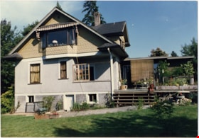
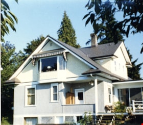
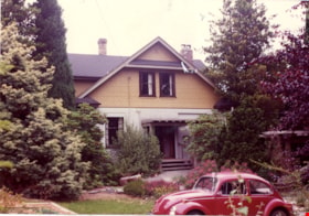
Back of Mawhinney house
https://search.heritageburnaby.ca/link/museumdescription15558
- Repository
- Burnaby Village Museum
- Date
- 1987
- Collection/Fonds
- Reverend Edward S. Gale fonds
- Description Level
- Item
- Physical Description
- 1 photograph : col. ; 9 x 12.5 cm
- Scope and Content
- Photograph of the back of the Mawhinney house located at 7667 Burris Street in Burnaby. A large back porch (deck) is attached to the right side of the house.
- Repository
- Burnaby Village Museum
- Collection/Fonds
- Reverend Edward S. Gale fonds
- Description Level
- Item
- Physical Description
- 1 photograph : col. ; 9 x 12.5 cm
- Scope and Content
- Photograph of the back of the Mawhinney house located at 7667 Burris Street in Burnaby. A large back porch (deck) is attached to the right side of the house.
- Geographic Access
- Burris Street
- Street Address
- 7667 Burris Street
- Accession Code
- BV018.9.44
- Access Restriction
- No restrictions
- Reproduction Restriction
- May be restricted by third party rights
- Date
- 1987
- Media Type
- Photograph
- Planning Study Area
- Morley-Buckingham Area
- Scan Resolution
- 600
- Scan Date
- April 15, 2021
- Scale
- 100
- Notes
- Title based on contents of photograph
Images

Back of Mawhinney house
https://search.heritageburnaby.ca/link/museumdescription15560
- Repository
- Burnaby Village Museum
- Date
- 1988
- Collection/Fonds
- Reverend Edward S. Gale fonds
- Description Level
- Item
- Physical Description
- 1 photograph : col. ; 9 x 12.5 cm
- Scope and Content
- Photograph of the back of the Mawhinney house located at 7667 Burris Street in Burnaby. A large back porch (deck) is attached to the right side of the house. Photograph was taken after the house was painted.
- Repository
- Burnaby Village Museum
- Collection/Fonds
- Reverend Edward S. Gale fonds
- Description Level
- Item
- Physical Description
- 1 photograph : col. ; 9 x 12.5 cm
- Scope and Content
- Photograph of the back of the Mawhinney house located at 7667 Burris Street in Burnaby. A large back porch (deck) is attached to the right side of the house. Photograph was taken after the house was painted.
- Geographic Access
- Burris Street
- Street Address
- 7667 Burris Street
- Accession Code
- BV018.9.26
- Access Restriction
- No restrictions
- Reproduction Restriction
- May be restricted by third party rights
- Date
- 1988
- Media Type
- Photograph
- Planning Study Area
- Morley-Buckingham Area
- Related Material
- See also BV018.9.44
- Scan Resolution
- 600
- Scan Date
- April 20, 2021
- Scale
- 100
- Notes
- Title based on contents of photograph
Images

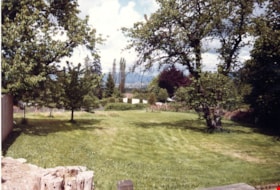
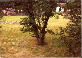
Back yard of Mawhinney house
https://search.heritageburnaby.ca/link/museumdescription15561
- Repository
- Burnaby Village Museum
- Date
- August 1984
- Collection/Fonds
- Reverend Edward S. Gale fonds
- Description Level
- Item
- Physical Description
- 1 photograph : col. ; 10 x 15 cm
- Scope and Content
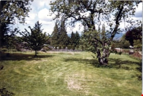
- Photograph of the back yard of the Mervin Mawhinney house looking north from the back deck before any of the subsequent landscaping was done by Reverend Gale. Tree on the right is a cherry tree. The house is located at 7667 Burris Street.
- Repository
- Burnaby Village Museum
- Collection/Fonds
- Reverend Edward S. Gale fonds
- Description Level
- Item
- Physical Description
- 1 photograph : col. ; 10 x 15 cm
- Scope and Content
- Photograph of the back yard of the Mervin Mawhinney house looking north from the back deck before any of the subsequent landscaping was done by Reverend Gale. Tree on the right is a cherry tree. The house is located at 7667 Burris Street.
- Geographic Access
- Burris Street
- Street Address
- 7667 Burris Street
- Accession Code
- BV018.9.27
- Access Restriction
- No restrictions
- Reproduction Restriction
- May be restricted by third party rights
- Date
- August 1984
- Media Type
- Photograph
- Planning Study Area
- Morley-Buckingham Area
- Scan Resolution
- 600
- Scan Date
- April 20, 2021
- Scale
- 100
- Notes
- Title based on contents of photograph
- Note in black ink on verso of photograph reads: "August '84"
Images

Back yard of Mawhinney house
https://search.heritageburnaby.ca/link/museumdescription15562
- Repository
- Burnaby Village Museum
- Date
- 1990
- Collection/Fonds
- Reverend Edward S. Gale fonds
- Description Level
- Item
- Physical Description
- 1 photograph : col. ; 10 x 15 cm
- Scope and Content
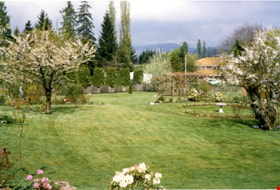
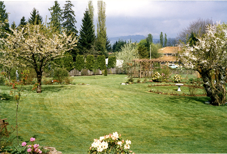
- Photograph of the back yard of the Mervin Mawhinney house looking north from the back deck after landscaping was done by owner Reverend Gale. Cherry trees, rhododendrons and gardens are visible. The house is located at 7667 Burris Street.
- Repository
- Burnaby Village Museum
- Collection/Fonds
- Reverend Edward S. Gale fonds
- Description Level
- Item
- Physical Description
- 1 photograph : col. ; 10 x 15 cm
- Scope and Content
- Photograph of the back yard of the Mervin Mawhinney house looking north from the back deck after landscaping was done by owner Reverend Gale. Cherry trees, rhododendrons and gardens are visible. The house is located at 7667 Burris Street.
- Geographic Access
- Burris Street
- Street Address
- 7667 Burris Street
- Accession Code
- BV018.9.28
- Access Restriction
- No restrictions
- Reproduction Restriction
- May be restricted by third party rights
- Date
- 1990
- Media Type
- Photograph
- Planning Study Area
- Morley-Buckingham Area
- Scan Resolution
- 600
- Scan Date
- April 20, 2021
- Scale
- 100
- Notes
- Title based on contents of photograph
Images
Back yard of Mawhinney house
https://search.heritageburnaby.ca/link/museumdescription15563
- Repository
- Burnaby Village Museum
- Date
- August 1984
- Collection/Fonds
- Reverend Edward S. Gale fonds
- Description Level
- Item
- Physical Description
- 1 photograph : col. ; 10 x 15 cm
- Scope and Content
- Photograph of the back yard of the Mervin Mawhinney house looking north from the back deck before any of the subsequent landscaping was done by Reverend Gale. Tree on the right is a cherry tree. The house is located at 7667 Burris Street.
- Repository
- Burnaby Village Museum
- Collection/Fonds
- Reverend Edward S. Gale fonds
- Description Level
- Item
- Physical Description
- 1 photograph : col. ; 10 x 15 cm
- Scope and Content
- Photograph of the back yard of the Mervin Mawhinney house looking north from the back deck before any of the subsequent landscaping was done by Reverend Gale. Tree on the right is a cherry tree. The house is located at 7667 Burris Street.
- Geographic Access
- Burris Street
- Street Address
- 7667 Burris Street
- Accession Code
- BV018.9.29
- Access Restriction
- No restrictions
- Reproduction Restriction
- May be restricted by third party rights
- Date
- August 1984
- Media Type
- Photograph
- Planning Study Area
- Morley-Buckingham Area
- Scan Resolution
- 600
- Scan Date
- April 20, 2021
- Scale
- 100
- Notes
- Title based on contents of photograph
Images
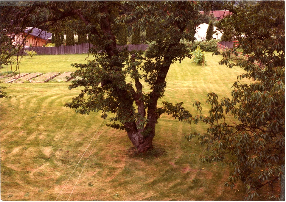
Back yard of Mawhinney house
https://search.heritageburnaby.ca/link/museumdescription15565
- Repository
- Burnaby Village Museum
- Date
- August 1984
- Collection/Fonds
- Reverend Edward S. Gale fonds
- Description Level
- Item
- Physical Description
- 1 photograph : col. ; 10 x 15 cm
- Scope and Content
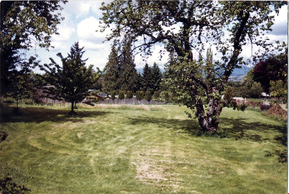
- Photograph of the back yard of the Mervin Mawhinney house located at 7667 Burris Street in Burnaby. A large cherry tree is in the centre of the photograph and a row of rectangular garden beds are visible in the background along with a wooden fence and neighbouring house.
- Repository
- Burnaby Village Museum
- Collection/Fonds
- Reverend Edward S. Gale fonds
- Description Level
- Item
- Physical Description
- 1 photograph : col. ; 10 x 15 cm
- Scope and Content
- Photograph of the back yard of the Mervin Mawhinney house located at 7667 Burris Street in Burnaby. A large cherry tree is in the centre of the photograph and a row of rectangular garden beds are visible in the background along with a wooden fence and neighbouring house.
- Geographic Access
- Burris Street
- Street Address
- 7667 Burris Street
- Accession Code
- BV018.9.31
- Access Restriction
- No restrictions
- Reproduction Restriction
- May be restricted by third party rights
- Date
- August 1984
- Media Type
- Photograph
- Planning Study Area
- Morley-Buckingham Area
- Scan Resolution
- 600
- Scan Date
- April 15, 2021
- Scale
- 100
- Notes
- Title based on contents of photograph
Images
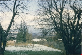
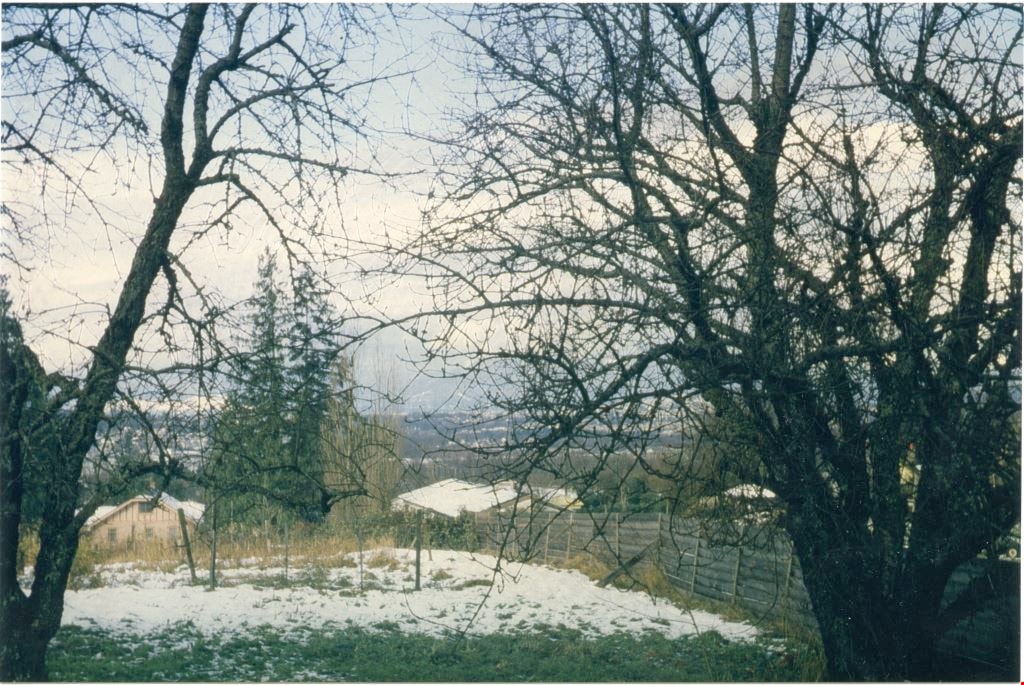
Back yard of the Mervin Mawhinney house looking north west
https://search.heritageburnaby.ca/link/museumdescription5208
- Repository
- Burnaby Village Museum
- Date
- 1962
- Collection/Fonds
- Reverend Edward S. Gale fonds
- Description Level
- Item
- Physical Description
- 1 photograph : col. ; 10 x 15.2 cm print
- Scope and Content
- Photograph of the back yard of the Mervin Mawhinney house looking north west. The ground is covered with snow. Two bare deciduous trees in foreground. The address of the house was 7661 Burris Street and was changed to 7667 Burris Street in 1984.
- Repository
- Burnaby Village Museum
- Collection/Fonds
- Reverend Edward S. Gale fonds
- Description Level
- Item
- Physical Description
- 1 photograph : col. ; 10 x 15.2 cm print
- Scope and Content
- Photograph of the back yard of the Mervin Mawhinney house looking north west. The ground is covered with snow. Two bare deciduous trees in foreground. The address of the house was 7661 Burris Street and was changed to 7667 Burris Street in 1984.
- Subjects
- Natural Phenomena - Snow
- Geographic Access
- Burris Street
- Street Address
- 7667 Burris Street
- Accession Code
- BV018.9.8
- Access Restriction
- No restrictions
- Reproduction Restriction
- May be restricted by third party rights
- Date
- 1962
- Media Type
- Photograph
- Planning Study Area
- Morley-Buckingham Area
- Scan Resolution
- 600
- Scan Date
- 07-05-2018
- Photographer
- Weller, Michael
- Notes
- Title based on contents of photograph
- "Dec. '62 / looking N. west" written in pen on verso.
Images

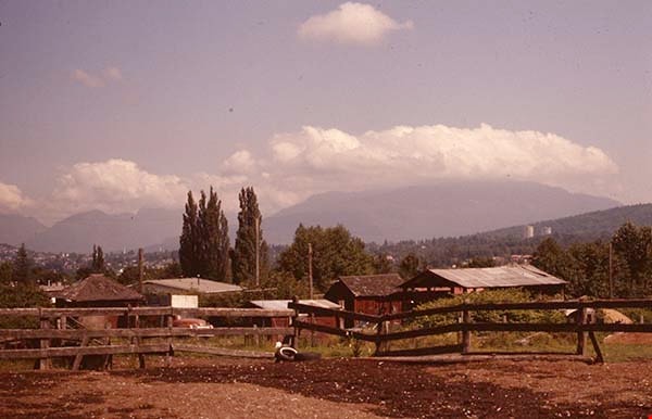
Barn, paddock and out buildings
https://search.heritageburnaby.ca/link/museumdescription12818
- Repository
- Burnaby Village Museum
- Date
- 1977
- Collection/Fonds
- Century Park Museum Association fonds
- Description Level
- Item
- Physical Description
- 1 photograph : col. slide ; 35 mm
- Scope and Content
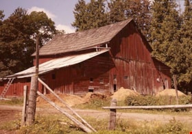
- Photograph of the barn, fenced paddocks and out buildings on the Lubbock family farm located at 7803 Burris Street.
- Repository
- Burnaby Village Museum
- Collection/Fonds
- Century Park Museum Association fonds
- Description Level
- Item
- Physical Description
- 1 photograph : col. slide ; 35 mm
- Scope and Content
- Photograph of the barn, fenced paddocks and out buildings on the Lubbock family farm located at 7803 Burris Street.
- History
- In 1977, Century Park Museum was granted access to the Sprott-Lubbock farm to appraise the heritage buildings for preservation. Buildings that were saved included the old farrier shed (BV985.1240.2) which was also used as a blacksmith shop and the Vorce tram station building (BV985.1240.3) from the old Burnaby Lake Interurban line which was used as a grain storage shed on the property. Segments of the original farmhouse and other out buildings were retained. Other buildings on the site were demolished to make way for a new housing development.
- Subjects
- Agriculture - Farms
- Names
- Lubbock farm
- Geographic Access
- Grandview Highway
- Burris Street
- Street Address
- 7803 Burris Street
- Accession Code
- BV020.5.485
- Access Restriction
- No restrictions
- Reproduction Restriction
- No known restrictions
- Date
- 1977
- Media Type
- Photograph
- Historic Neighbourhood
- Burnaby Lake (Historic Neighbourhood)
- Planning Study Area
- Morley-Buckingham Area
- Scan Resolution
- 2400
- Scan Date
- 13-Mar-20
- Scale
- 100
- Notes
- Title based on contents of photograph
Images

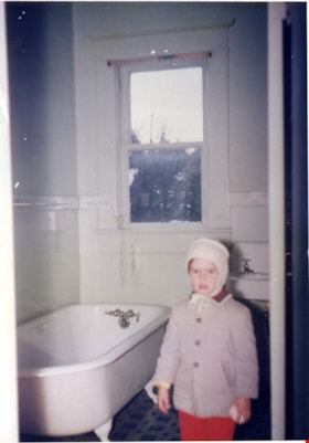
Bathroom of Mawhinney house
https://search.heritageburnaby.ca/link/museumdescription15568
- Repository
- Burnaby Village Museum
- Date
- 1962
- Collection/Fonds
- Reverend Edward S. Gale fonds
- Description Level
- Item
- Physical Description
- 1 photograph : col. negative ; 35 mm
- Scope and Content
- Photograph of the second floor bathroom inside of the Mervin Mawhinney house. Michael Weller's daughter is standing inside the bathroom with the bathtub to the left and the sink behind him. A pane glass window is on the wall above the bathtub. The address of the house was 7661 Burris Street and was…
- Repository
- Burnaby Village Museum
- Collection/Fonds
- Reverend Edward S. Gale fonds
- Description Level
- Item
- Physical Description
- 1 photograph : col. negative ; 35 mm
- Scope and Content
- Photograph of the second floor bathroom inside of the Mervin Mawhinney house. Michael Weller's daughter is standing inside the bathroom with the bathtub to the left and the sink behind him. A pane glass window is on the wall above the bathtub. The address of the house was 7661 Burris Street and was changed to 7667 Burris Street in 1984.
- Geographic Access
- Burris Street
- Street Address
- 7667 Burris Street
- Accession Code
- BV018.9.34
- Access Restriction
- No restrictions
- Reproduction Restriction
- May be restricted by third party rights
- Date
- 1962
- Media Type
- Photograph
- Planning Study Area
- Morley-Buckingham Area
- Scan Resolution
- 600
- Scan Date
- April 15, 2021
- Scale
- 100
- Photographer
- Weller, Michael
- Notes
- Title based on contents of photograph
- 1 col. print 12.5 x 9 cm accompanying
Images


Buildings on Lubbock farm
https://search.heritageburnaby.ca/link/museumdescription12783
- Repository
- Burnaby Village Museum
- Date
- 1977
- Collection/Fonds
- Century Park Museum Association fonds
- Description Level
- Item
- Physical Description
- 1 photograph : col. slide ; 35 mm
- Scope and Content
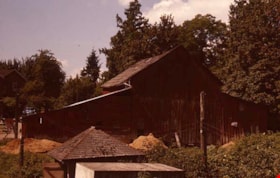
- Photograph of the cedar shingled rooftops of the Lubbock barn and out buildings that were located at at 7803 Burris Street near Burnaby Lake. Bushes, trees and tall grasses surround the buildings.
- Repository
- Burnaby Village Museum
- Collection/Fonds
- Century Park Museum Association fonds
- Description Level
- Item
- Physical Description
- 1 photograph : col. slide ; 35 mm
- Scope and Content
- Photograph of the cedar shingled rooftops of the Lubbock barn and out buildings that were located at at 7803 Burris Street near Burnaby Lake. Bushes, trees and tall grasses surround the buildings.
- History
- In 1977, Century Park Museum was granted access to the Sprott-Lubbock farm to appraise the heritage buildings for preservation. Buildings that were saved included the old farrier shed (BV985.1240.2) which was also used as a blacksmith shop and the Vorce tram station building (BV985.1240.3) from the old Burnaby Lake Interurban line which was used as a grain storage shed on the property. Segments of the original farmhouse and other out buildings were retained. Other buildings on the site were demolished to make way for a new housing development.
- Subjects
- Agriculture - Farms
- Names
- Lubbock farm
- Geographic Access
- Grandview Highway
- Burris Street
- Street Address
- 7803 Burris Street
- Accession Code
- BV020.5.460
- Access Restriction
- No restrictions
- Reproduction Restriction
- No known restrictions
- Date
- 1977
- Media Type
- Photograph
- Historic Neighbourhood
- Burnaby Lake (Historic Neighbourhood)
- Planning Study Area
- Morley-Buckingham Area
- Scan Resolution
- 2400
- Scan Date
- 13-Mar-20
- Scale
- 100
- Notes
- Title based on contents of photograph
Images

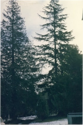
Cedar and hemlock trees
https://search.heritageburnaby.ca/link/museumdescription5214
- Repository
- Burnaby Village Museum
- Date
- Dec. 1962
- Collection/Fonds
- Reverend Edward S. Gale fonds
- Description Level
- Item
- Physical Description
- 1 photograph : col. ; 15.2 x 10.1 cm print
- Scope and Content
- Photograph of two large coniferous trees in the yard of the Mervin Mawhinney house. Some snowy ground in foreground. Overcast sky in background. The address of the house was 7661 Burris Street and was changed to 7667 Burris Street in 1984.
- Repository
- Burnaby Village Museum
- Collection/Fonds
- Reverend Edward S. Gale fonds
- Description Level
- Item
- Physical Description
- 1 photograph : col. ; 15.2 x 10.1 cm print
- Scope and Content
- Photograph of two large coniferous trees in the yard of the Mervin Mawhinney house. Some snowy ground in foreground. Overcast sky in background. The address of the house was 7661 Burris Street and was changed to 7667 Burris Street in 1984.
- Geographic Access
- Burris Street
- Street Address
- 7667 Burris Street
- Accession Code
- BV018.9.14
- Access Restriction
- No restrictions
- Reproduction Restriction
- May be restricted by third party rights
- Date
- Dec. 1962
- Media Type
- Photograph
- Planning Study Area
- Morley-Buckingham Area
- Scan Resolution
- 600
- Scan Date
- 07-05-2018
- Photographer
- Weller, Michael
- Notes
- Title based on contents of photograph
- "Dec. '62 / large cedar + hemlock at entrance" written in pen on verso.
Images


Chicken coop building
https://search.heritageburnaby.ca/link/museumdescription12796
- Repository
- Burnaby Village Museum
- Date
- 1977
- Collection/Fonds
- Century Park Museum Association fonds
- Description Level
- Item
- Physical Description
- 1 photograph : col. slide ; 35 mm
- Scope and Content
- Photograph of a building that was used as a chicken coop on the Lubbock farm located at 7803 Burris Street near Burnaby Lake.
- Repository
- Burnaby Village Museum
- Collection/Fonds
- Century Park Museum Association fonds
- Description Level
- Item
- Physical Description
- 1 photograph : col. slide ; 35 mm
- Scope and Content
- Photograph of a building that was used as a chicken coop on the Lubbock farm located at 7803 Burris Street near Burnaby Lake.
- History
- In 1977, Century Park Museum was granted access to the Sprott-Lubbock farm to appraise the heritage buildings for preservation. Buildings that were saved included the old farrier shed (BV985.1240.2) which was also used as a blacksmith shop and the Vorce tram station building (BV985.1240.3) from the old Burnaby Lake Interurban line which was used as a grain storage shed on the property. Segments of the original farmhouse and other out buildings were retained. Other buildings on the site were demolished to make way for a new housing development.
- Subjects
- Agriculture - Farms
- Names
- Lubbock farm
- Geographic Access
- Grandview Highway
- Burris Street
- Street Address
- 7803 Burris Street
- Accession Code
- BV020.5.473
- Access Restriction
- No restrictions
- Reproduction Restriction
- No known restrictions
- Date
- 1977
- Media Type
- Photograph
- Historic Neighbourhood
- Burnaby Lake (Historic Neighbourhood)
- Planning Study Area
- Morley-Buckingham Area
- Scan Resolution
- 2400
- Scan Date
- 13-Mar-20
- Scale
- 100
- Notes
- Title based on contents of photograph
Images

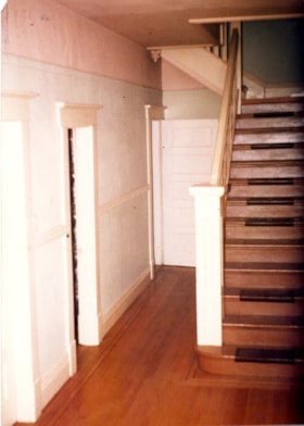
Entrance hall and stairway inside Mawhinney house
https://search.heritageburnaby.ca/link/museumdescription15574
- Repository
- Burnaby Village Museum
- Date
- 1962
- Collection/Fonds
- Reverend Edward S. Gale fonds
- Description Level
- Item
- Physical Description
- 1 photograph : col. ; 17.5 x 12.5 cm
- Scope and Content
- Photograph of the front entrance hall and stairway inside of the Mervin Mawhinney house. The address of the house was 7661 Burris Street and was changed to 7667 Burris Street in 1984.
- Repository
- Burnaby Village Museum
- Collection/Fonds
- Reverend Edward S. Gale fonds
- Description Level
- Item
- Physical Description
- 1 photograph : col. ; 17.5 x 12.5 cm
- Scope and Content
- Photograph of the front entrance hall and stairway inside of the Mervin Mawhinney house. The address of the house was 7661 Burris Street and was changed to 7667 Burris Street in 1984.
- Geographic Access
- Burris Street
- Street Address
- 7667 Burris Street
- Accession Code
- BV018.9.39
- Access Restriction
- No restrictions
- Reproduction Restriction
- May be restricted by third party rights
- Date
- 1962
- Media Type
- Photograph
- Planning Study Area
- Morley-Buckingham Area
- Scan Resolution
- 600
- Scan Date
- April 15, 2021
- Scale
- 100
- Photographer
- Weller, Michael
- Notes
- Title based on contents of photograph
Images

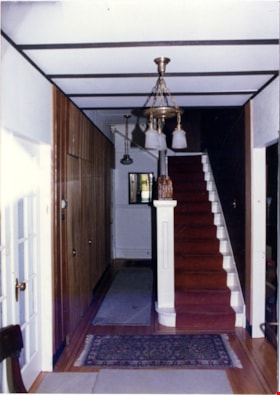
Entrance hall and stairway inside Mawhinney house
https://search.heritageburnaby.ca/link/museumdescription15575
- Repository
- Burnaby Village Museum
- Date
- 1987
- Collection/Fonds
- Reverend Edward S. Gale fonds
- Description Level
- Item
- Physical Description
- 1 photograph : col. ; 12.5 x 9 cm
- Scope and Content
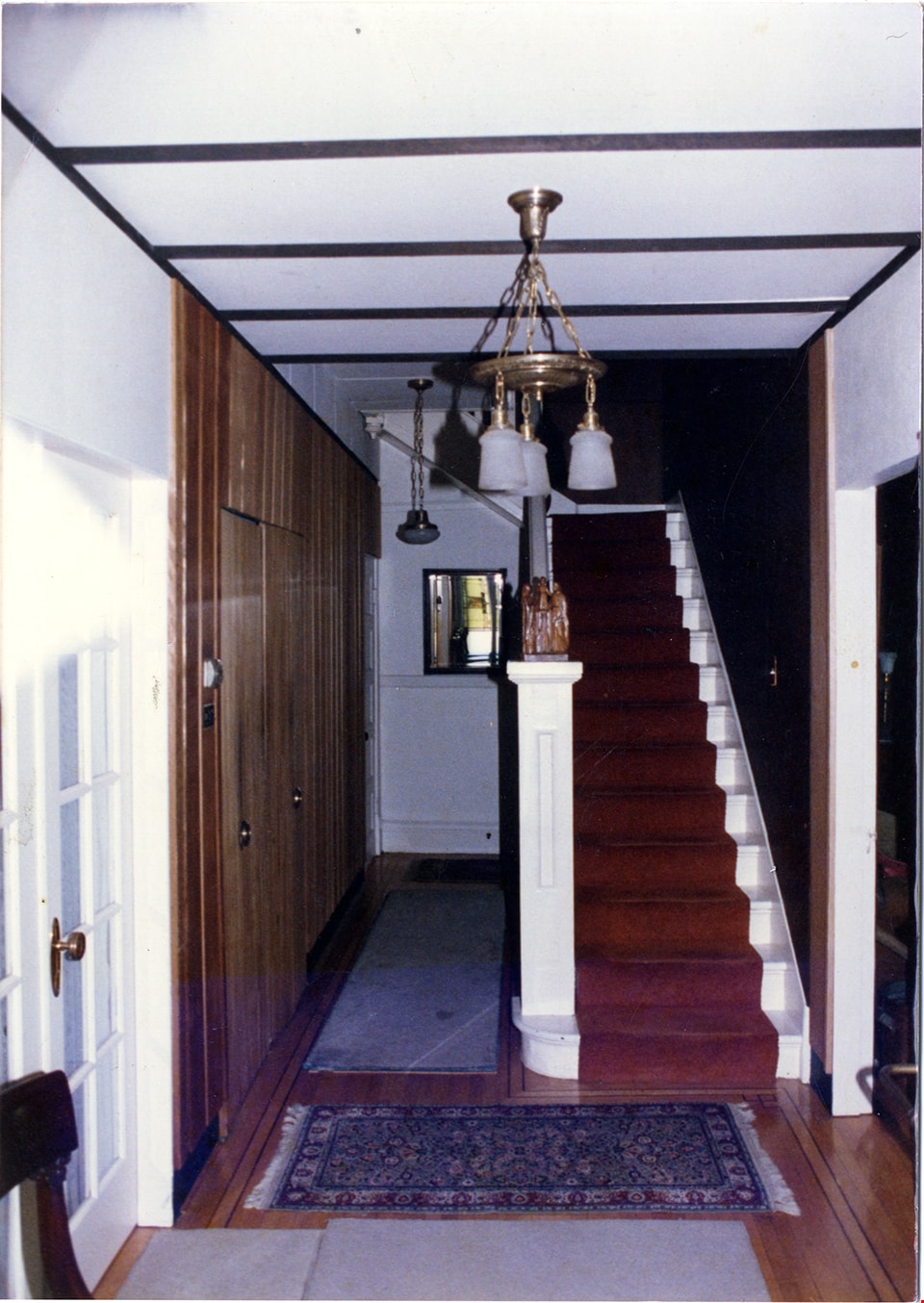
- Photograph of the front entrance hall and stairway inside of the Mervin Mawhinney house located at 7667 Burris Street in Burnaby. Photograph was taken after renovations by Reverend Gale whereby the wood panelling and dropped ceiling were added. Two lighting fixtures are hanging from the ceiling and…
- Repository
- Burnaby Village Museum
- Collection/Fonds
- Reverend Edward S. Gale fonds
- Description Level
- Item
- Physical Description
- 1 photograph : col. ; 12.5 x 9 cm
- Scope and Content
- Photograph of the front entrance hall and stairway inside of the Mervin Mawhinney house located at 7667 Burris Street in Burnaby. Photograph was taken after renovations by Reverend Gale whereby the wood panelling and dropped ceiling were added. Two lighting fixtures are hanging from the ceiling and an oriental style carpet sits at the base of the staircase. Two french doors are visible on the left and a mirror is hanging on the wall at the end of the hallway next to the stairwell.
- Geographic Access
- Burris Street
- Street Address
- 7667 Burris Street
- Accession Code
- BV018.9.40
- Access Restriction
- No restrictions
- Reproduction Restriction
- May be restricted by third party rights
- Date
- 1987
- Media Type
- Photograph
- Planning Study Area
- Morley-Buckingham Area
- Scan Resolution
- 600
- Scan Date
- April 20, 2021
- Scale
- 100
- Notes
- Title based on contents of photograph
Images

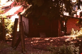
Farm building covered with brambles
https://search.heritageburnaby.ca/link/museumdescription12811
- Repository
- Burnaby Village Museum
- Date
- 1977
- Collection/Fonds
- Century Park Museum Association fonds
- Description Level
- Item
- Physical Description
- 1 photograph : col. slide ; 35 mm
- Scope and Content
- Photograph of a wooden building on the Lubbock farm. The building is overgrown with blackberry bushes.
- Repository
- Burnaby Village Museum
- Collection/Fonds
- Century Park Museum Association fonds
- Description Level
- Item
- Physical Description
- 1 photograph : col. slide ; 35 mm
- Scope and Content
- Photograph of a wooden building on the Lubbock farm. The building is overgrown with blackberry bushes.
- History
- In 1977, Century Park Museum was granted access to the Sprott-Lubbock farm to appraise the heritage buildings for preservation. Buildings that were saved included the old farrier shed (BV985.1240.2) which was also used as a blacksmith shop and the Vorce tram station building (BV985.1240.3) from the old Burnaby Lake Interurban line which was used as a grain storage shed on the property. Segments of the original farmhouse and other out buildings were retained. Other buildings on the site were demolished to make way for a new housing development.
- Subjects
- Agriculture - Farms
- Names
- Lubbock farm
- Geographic Access
- Grandview Highway
- Burris Street
- Street Address
- 7803 Burris Street
- Accession Code
- BV020.5.478
- Access Restriction
- No restrictions
- Reproduction Restriction
- No known restrictions
- Date
- 1977
- Media Type
- Photograph
- Historic Neighbourhood
- Burnaby Lake (Historic Neighbourhood)
- Planning Study Area
- Morley-Buckingham Area
- Scan Resolution
- 2400
- Scan Date
- 13-Mar-20
- Scale
- 100
- Notes
- Title based on contents of photograph
Images


Farrier shed on Lubbock farm
https://search.heritageburnaby.ca/link/museumdescription12816
- Repository
- Burnaby Village Museum
- Date
- 1977
- Collection/Fonds
- Century Park Museum Association fonds
- Description Level
- Item
- Physical Description
- 1 photograph : col. slide ; 35 mm
- Scope and Content
- Photograph of the farrier shed on Lubbock family farm. The farrier shed was moved to Heritage Village in 1977 and converted to a Tinsmith shop.
- Repository
- Burnaby Village Museum
- Collection/Fonds
- Century Park Museum Association fonds
- Description Level
- Item
- Physical Description
- 1 photograph : col. slide ; 35 mm
- Scope and Content
- Photograph of the farrier shed on Lubbock family farm. The farrier shed was moved to Heritage Village in 1977 and converted to a Tinsmith shop.
- History
- In 1977, Century Park Museum was granted access to the Sprott-Lubbock farm to appraise the heritage buildings for preservation. Buildings that were saved included the old farrier shed (BV985.1240.2) which was also used as a blacksmith shop and the Vorce tram station building (BV985.1240.3) from the old Burnaby Lake Interurban line which was used as a grain storage shed on the property. Segments of the original farmhouse and other out buildings were retained. Other buildings on the site were demolished to make way for a new housing development.
- Subjects
- Agriculture - Farms
- Names
- Lubbock farm
- Geographic Access
- Grandview Highway
- Burris Street
- Street Address
- 7803 Burris Street
- Accession Code
- BV020.5.483
- Access Restriction
- No restrictions
- Reproduction Restriction
- No known restrictions
- Date
- 1977
- Media Type
- Photograph
- Historic Neighbourhood
- Burnaby Lake (Historic Neighbourhood)
- Planning Study Area
- Morley-Buckingham Area
- Scan Resolution
- 2400
- Scan Date
- 13-Mar-20
- Scale
- 100
- Notes
- Title based on contents of photograph
Images


Farrier shed on Lubbock farm
https://search.heritageburnaby.ca/link/museumdescription12817
- Repository
- Burnaby Village Museum
- Date
- 1977
- Collection/Fonds
- Century Park Museum Association fonds
- Description Level
- Item
- Physical Description
- 1 photograph : col. slide ; 35 mm
- Scope and Content
- Photograph of the farrier shed on Lubbock family farm. The farrier shed was moved to Heritage Village in 1977 and converted to a Tinsmith shop.
- Repository
- Burnaby Village Museum
- Collection/Fonds
- Century Park Museum Association fonds
- Description Level
- Item
- Physical Description
- 1 photograph : col. slide ; 35 mm
- Scope and Content
- Photograph of the farrier shed on Lubbock family farm. The farrier shed was moved to Heritage Village in 1977 and converted to a Tinsmith shop.
- History
- In 1977, Century Park Museum was granted access to the Sprott-Lubbock farm to appraise the heritage buildings for preservation. Buildings that were saved included the old farrier shed (BV985.1240.2) which was also used as a blacksmith shop and the Vorce tram station building (BV985.1240.3) from the old Burnaby Lake Interurban line which was used as a grain storage shed on the property. Segments of the original farmhouse and other out buildings were retained. Other buildings on the site were demolished to make way for a new housing development.
- Subjects
- Agriculture - Farms
- Names
- Lubbock farm
- Geographic Access
- Grandview Highway
- Burris Street
- Street Address
- 7803 Burris Street
- Accession Code
- BV020.5.484
- Access Restriction
- No restrictions
- Reproduction Restriction
- No known restrictions
- Date
- 1977
- Media Type
- Photograph
- Historic Neighbourhood
- Burnaby Lake (Historic Neighbourhood)
- Planning Study Area
- Morley-Buckingham Area
- Scan Resolution
- 2400
- Scan Date
- 13-Mar-20
- Scale
- 100
- Notes
- Title based on contents of photograph
Images


Fence and field
https://search.heritageburnaby.ca/link/museumdescription12788
- Repository
- Burnaby Village Museum
- Date
- 1977
- Collection/Fonds
- Century Park Museum Association fonds
- Description Level
- Item
- Physical Description
- 1 photograph : col. slide ; 35 mm
- Scope and Content
- Photograph of a rail fence on the Lubbock farm at 7803 Burris Street near Burnaby Lake. The fence divides a road and field.
- Repository
- Burnaby Village Museum
- Collection/Fonds
- Century Park Museum Association fonds
- Description Level
- Item
- Physical Description
- 1 photograph : col. slide ; 35 mm
- Scope and Content
- Photograph of a rail fence on the Lubbock farm at 7803 Burris Street near Burnaby Lake. The fence divides a road and field.
- History
- In 1977, Century Park Museum was granted access to the Sprott-Lubbock farm to appraise the heritage buildings for preservation. Buildings that were saved included the old farrier shed (BV985.1240.2) which was also used as a blacksmith shop and the Vorce tram station building (BV985.1240.3) from the old Burnaby Lake Interurban line which was used as a grain storage shed on the property. Segments of the original farmhouse and other out buildings were retained. Other buildings on the site were demolished to make way for a new housing development.
- Subjects
- Agriculture - Farms
- Names
- Lubbock farm
- Geographic Access
- Grandview Highway
- Burris Street
- Street Address
- 7803 Burris Street
- Accession Code
- BV020.5.465
- Access Restriction
- No restrictions
- Reproduction Restriction
- No known restrictions
- Date
- 1977
- Media Type
- Photograph
- Historic Neighbourhood
- Burnaby Lake (Historic Neighbourhood)
- Planning Study Area
- Morley-Buckingham Area
- Scan Resolution
- 2400
- Scan Date
- 13-Mar-20
- Scale
- 100
- Notes
- Title based on contents of photograph
Images

Front of Mawhinney house
https://search.heritageburnaby.ca/link/museumdescription15550
- Repository
- Burnaby Village Museum
- Date
- September 1988
- Collection/Fonds
- Reverend Edward S. Gale fonds
- Description Level
- Item
- Physical Description
- 1 photograph : col. ; 11.5 x 12.5 cm
- Scope and Content
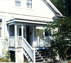
- Photograph of the front entrance and porch of the Mawhinney house located at 7667 Burris Street in Burnaby. In 1988, the front path of the house was excavated to its original level and the porch was enlarged and altered to suit the style of the rest of the house; alterations were made to the carp…
- Repository
- Burnaby Village Museum
- Collection/Fonds
- Reverend Edward S. Gale fonds
- Description Level
- Item
- Physical Description
- 1 photograph : col. ; 11.5 x 12.5 cm
- Scope and Content
- Photograph of the front entrance and porch of the Mawhinney house located at 7667 Burris Street in Burnaby. In 1988, the front path of the house was excavated to its original level and the porch was enlarged and altered to suit the style of the rest of the house; alterations were made to the carport for the same reason. The house roof was replaced, and the exterior of the house was painted.
- Geographic Access
- Burris Street
- Street Address
- 7667 Burris Street
- Accession Code
- BV018.9.18
- Access Restriction
- No restrictions
- Reproduction Restriction
- May be restricted by third party rights
- Date
- September 1988
- Media Type
- Photograph
- Planning Study Area
- Morley-Buckingham Area
- Scan Resolution
- 600
- Scan Date
- April 15, 2021
- Scale
- 100
- Notes
- Title based on contents of photograph
- Note in black ink on verso of photograph reads: "Sept '88"
Images

![Front of Mawhinney house, [1988] thumbnail](/media/hpo/_Data/_BVM_Images/2018/2018_0009_0019_001.jpg?width=280)
Front of Mawhinney house
https://search.heritageburnaby.ca/link/museumdescription15551
- Repository
- Burnaby Village Museum
- Date
- [1988]
- Collection/Fonds
- Reverend Edward S. Gale fonds
- Description Level
- Item
- Physical Description
- 1 photograph : col. ; 11.5 x 12.5 cm
- Scope and Content
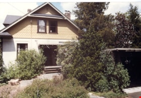
- Photograph of the Mawhinney house located at 7667 Burris Street in Burnaby. The front porch, entrance and part of the carport is visible. In 1988 the front path of the house was excavated to its original level and the porch was enlarged and altered to suit the style of the rest of the house; altera…
- Repository
- Burnaby Village Museum
- Collection/Fonds
- Reverend Edward S. Gale fonds
- Description Level
- Item
- Physical Description
- 1 photograph : col. ; 11.5 x 12.5 cm
- Scope and Content
- Photograph of the Mawhinney house located at 7667 Burris Street in Burnaby. The front porch, entrance and part of the carport is visible. In 1988 the front path of the house was excavated to its original level and the porch was enlarged and altered to suit the style of the rest of the house; alterations were made to the carport for the same reason. The house roof was replaced, and the exterior of the house was painted.
- Geographic Access
- Burris Street
- Street Address
- 7667 Burris Street
- Accession Code
- BV018.9.19
- Access Restriction
- No restrictions
- Reproduction Restriction
- May be restricted by third party rights
- Date
- [1988]
- Media Type
- Photograph
- Planning Study Area
- Morley-Buckingham Area
- Scan Resolution
- 600
- Scan Date
- April 15, 2021
- Scale
- 100
- Notes
- Title based on contents of photograph
Images
![Front of Mawhinney house, [1988] thumbnail](/media/hpo/_Data/_BVM_Images/2018/2018_0009_0019_001.jpg)
Front of Mawhinney house
https://search.heritageburnaby.ca/link/museumdescription15552
- Repository
- Burnaby Village Museum
- Date
- August 1984
- Collection/Fonds
- Reverend Edward S. Gale fonds
- Description Level
- Item
- Physical Description
- 1 photograph : col. ; 11.5 x 12.5 cm
- Scope and Content
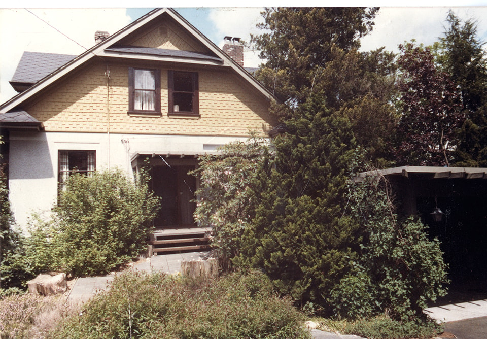
- Photograph of the front of the Mawhinney house located at 7667 Burris Street in Burnaby. The carport structure is visible to the right. Trees and bushes are growing alongside the house and carport.
- Repository
- Burnaby Village Museum
- Collection/Fonds
- Reverend Edward S. Gale fonds
- Description Level
- Item
- Physical Description
- 1 photograph : col. ; 11.5 x 12.5 cm
- Scope and Content
- Photograph of the front of the Mawhinney house located at 7667 Burris Street in Burnaby. The carport structure is visible to the right. Trees and bushes are growing alongside the house and carport.
- Geographic Access
- Burris Street
- Street Address
- 7667 Burris Street
- Accession Code
- BV018.9.20
- Access Restriction
- No restrictions
- Reproduction Restriction
- May be restricted by third party rights
- Date
- August 1984
- Media Type
- Photograph
- Planning Study Area
- Morley-Buckingham Area
- Scan Resolution
- 600
- Scan Date
- April 15, 2021
- Scale
- 100
- Photographer
- Weller, Michael
- Notes
- Title based on contents of photograph
Images
Front of Mawhinney house
https://search.heritageburnaby.ca/link/museumdescription15553
- Repository
- Burnaby Village Museum
- Date
- August 1984
- Collection/Fonds
- Reverend Edward S. Gale fonds
- Description Level
- Item
- Physical Description
- 1 photograph : col. ; 11.5 x 12.5 cm
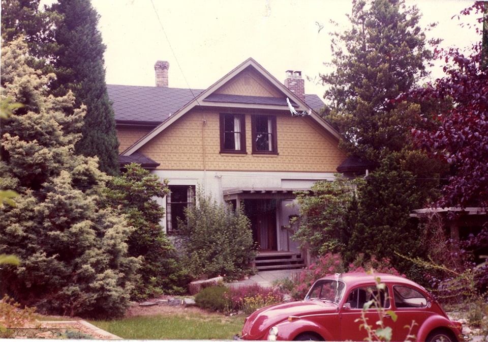
- Scope and Content
- Photograph of the front of the Mawhinney house located at 7667 Burris Street in Burnaby. The carport structure is visible to the right. Trees and bushes are growing alongside the house and carport. A red Volkswagon beetle car is parked in front.
- Repository
- Burnaby Village Museum
- Collection/Fonds
- Reverend Edward S. Gale fonds
- Description Level
- Item
- Physical Description
- 1 photograph : col. ; 11.5 x 12.5 cm
- Scope and Content
- Photograph of the front of the Mawhinney house located at 7667 Burris Street in Burnaby. The carport structure is visible to the right. Trees and bushes are growing alongside the house and carport. A red Volkswagon beetle car is parked in front.
- Geographic Access
- Burris Street
- Street Address
- 7667 Burris Street
- Accession Code
- BV018.9.21
- Access Restriction
- No restrictions
- Reproduction Restriction
- May be restricted by third party rights
- Date
- August 1984
- Media Type
- Photograph
- Planning Study Area
- Morley-Buckingham Area
- Scan Resolution
- 600
- Scan Date
- April 15, 2021
- Scale
- 100
- Photographer
- Weller, Michael
- Notes
- Title based on contents of photograph
Images
Front of Mawhinney house
https://search.heritageburnaby.ca/link/museumdescription15554
- Repository
- Burnaby Village Museum
- Date
- August 1984
- Collection/Fonds
- Reverend Edward S. Gale fonds
- Description Level
- Item
- Physical Description
- 1 photograph : col. ; 11.5 x 12.5 cm
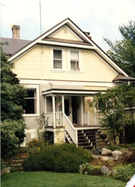
- Scope and Content
- Photograph of the front of the Mawhinney house located at 7667 Burris Street in Burnaby. The front porch and entrance are visible. The front yard and pathway to entrance are landscaped with flowers, bushes and trees.
- Repository
- Burnaby Village Museum
- Collection/Fonds
- Reverend Edward S. Gale fonds
- Description Level
- Item
- Physical Description
- 1 photograph : col. ; 11.5 x 12.5 cm
- Scope and Content
- Photograph of the front of the Mawhinney house located at 7667 Burris Street in Burnaby. The front porch and entrance are visible. The front yard and pathway to entrance are landscaped with flowers, bushes and trees.
- Geographic Access
- Burris Street
- Street Address
- 7667 Burris Street
- Accession Code
- BV018.9.22
- Access Restriction
- No restrictions
- Reproduction Restriction
- May be restricted by third party rights
- Date
- August 1984
- Media Type
- Photograph
- Planning Study Area
- Morley-Buckingham Area
- Scan Resolution
- 600
- Scan Date
- April 15, 2021
- Scale
- 100
- Notes
- Title based on contents of photograph
Images

![Front of Mawhinney house with carport, [199-] thumbnail](/media/hpo/_Data/_BVM_Images/2018/2018_0009_0046_001.jpg?width=280)
Front of Mawhinney house with carport
https://search.heritageburnaby.ca/link/museumdescription15579
- Repository
- Burnaby Village Museum
- Date
- [199-]
- Collection/Fonds
- Reverend Edward S. Gale fonds
- Description Level
- Item
- Physical Description
- 1 photograph : col. ; 10 x 14 cm
- Scope and Content
- Photograph of the front of the Mervin Mawhinney house with carport located at 7667 Burris Street in Burnaby. A car is parked inside of the carport and a large rhodendron bush stands to the left of the carport near the front stair case. The sidewalk in the front yard is bordered by flower beds. The …
- Repository
- Burnaby Village Museum
- Collection/Fonds
- Reverend Edward S. Gale fonds
- Description Level
- Item
- Physical Description
- 1 photograph : col. ; 10 x 14 cm
- Scope and Content
- Photograph of the front of the Mervin Mawhinney house with carport located at 7667 Burris Street in Burnaby. A car is parked inside of the carport and a large rhodendron bush stands to the left of the carport near the front stair case. The sidewalk in the front yard is bordered by flower beds. The sun is shining on the upper portion of the front of the house.
- Geographic Access
- Burris Street
- Street Address
- 7667 Burris Street
- Accession Code
- BV018.9.46
- Access Restriction
- No restrictions
- Reproduction Restriction
- May be restricted by third party rights
- Date
- [199-]
- Media Type
- Photograph
- Planning Study Area
- Morley-Buckingham Area
- Scan Resolution
- 600
- Scan Date
- April 22, 2021
- Scale
- 100
- Notes
- Title based on contents of photograph
Images
![Front of Mawhinney house with carport, [199-] thumbnail](/media/hpo/_Data/_BVM_Images/2018/2018_0009_0046_001.jpg)
![Front of Mawhinney house with carport, [199-] thumbnail](/media/hpo/_Data/_BVM_Images/2018/2018_0009_0045_001.jpg?width=280)
Front of Mawhinney house with carport
https://search.heritageburnaby.ca/link/museumdescription15580
- Repository
- Burnaby Village Museum
- Date
- [199-]
- Collection/Fonds
- Reverend Edward S. Gale fonds
- Description Level
- Item
- Physical Description
- 1 photograph : col. ; 10 x 15 cm
- Scope and Content
- Photograph of the front of the Mervin Mawhinney house with carport located at 7667 Burris Street in Burnaby. A car is parked inside of the carport and a large rhodendron bush stands to the left of the carport near the front stair case. The sidewalk in the front yard is bordered by flower beds.
- Repository
- Burnaby Village Museum
- Collection/Fonds
- Reverend Edward S. Gale fonds
- Description Level
- Item
- Physical Description
- 1 photograph : col. ; 10 x 15 cm
- Scope and Content
- Photograph of the front of the Mervin Mawhinney house with carport located at 7667 Burris Street in Burnaby. A car is parked inside of the carport and a large rhodendron bush stands to the left of the carport near the front stair case. The sidewalk in the front yard is bordered by flower beds.
- Geographic Access
- Burris Street
- Street Address
- 7667 Burris Street
- Accession Code
- BV018.9.45
- Access Restriction
- No restrictions
- Reproduction Restriction
- May be restricted by third party rights
- Date
- [199-]
- Media Type
- Photograph
- Planning Study Area
- Morley-Buckingham Area
- Scan Resolution
- 600
- Scan Date
- April 22, 2021
- Scale
- 100
- Notes
- Title based on contents of photograph
Images
![Front of Mawhinney house with carport, [199-] thumbnail](/media/hpo/_Data/_BVM_Images/2018/2018_0009_0045_001.jpg)
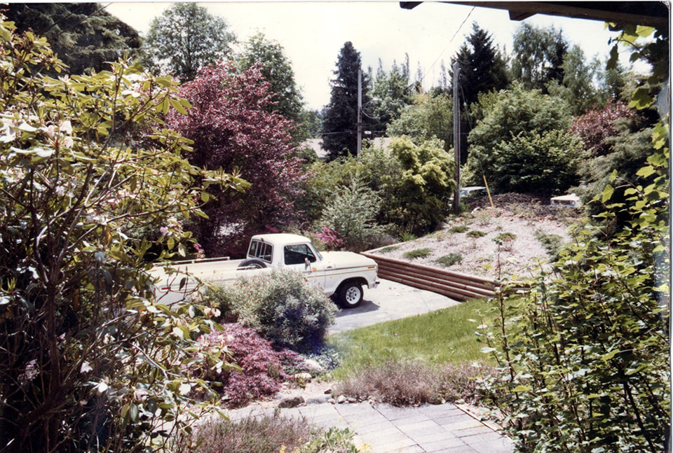
Front yard of Mawhinney house
https://search.heritageburnaby.ca/link/museumdescription15564
- Repository
- Burnaby Village Museum
- Date
- 1984
- Collection/Fonds
- Reverend Edward S. Gale fonds
- Description Level
- Item
- Physical Description
- 1 photograph : col. ; 10 x 15 cm
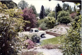
- Scope and Content
- Photograph of the front yard of the Mervin Mawhinney house looking from the front porch. The photograph was taken after subsequent landscaping was done by Reverend Gale. a white truck is parked in the driveway. The view of the yard includes gardens of trees and bushes, some in bloom. The house is l…
- Repository
- Burnaby Village Museum
- Collection/Fonds
- Reverend Edward S. Gale fonds
- Description Level
- Item
- Physical Description
- 1 photograph : col. ; 10 x 15 cm
- Scope and Content
- Photograph of the front yard of the Mervin Mawhinney house looking from the front porch. The photograph was taken after subsequent landscaping was done by Reverend Gale. a white truck is parked in the driveway. The view of the yard includes gardens of trees and bushes, some in bloom. The house is located at 7667 Burris Street.
- Geographic Access
- Burris Street
- Street Address
- 7667 Burris Street
- Accession Code
- BV018.9.30
- Access Restriction
- No restrictions
- Reproduction Restriction
- May be restricted by third party rights
- Date
- 1984
- Media Type
- Photograph
- Planning Study Area
- Morley-Buckingham Area
- Scan Resolution
- 600
- Scan Date
- April 20, 2021
- Scale
- 100
- Notes
- Title based on contents of photograph
Images
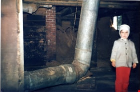
Heating pipe in basement of Mawhinney house
https://search.heritageburnaby.ca/link/museumdescription15576
- Repository
- Burnaby Village Museum
- Date
- 1962
- Collection/Fonds
- Reverend Edward S. Gale fonds
- Description Level
- Item
- Physical Description
- 1 photograph : col. negative ; 35 mm
- Scope and Content
- Photograph of Micheal Weller's daughter standing next to a heating pipe inside the basement of the Mervin Mawhinney house. The original coal burning furnace was converted to the sawdust-burner by the nuns and then converted to gas by owner Michael Weller. A brick chimney and crawl space are visib…
- Repository
- Burnaby Village Museum
- Collection/Fonds
- Reverend Edward S. Gale fonds
- Description Level
- Item
- Physical Description
- 1 photograph : col. negative ; 35 mm
- Scope and Content
- Photograph of Micheal Weller's daughter standing next to a heating pipe inside the basement of the Mervin Mawhinney house. The original coal burning furnace was converted to the sawdust-burner by the nuns and then converted to gas by owner Michael Weller. A brick chimney and crawl space are visible behind. The address of the house was 7661 Burris Street and was changed to 7667 Burris Street in 1984.
- Geographic Access
- Burris Street
- Street Address
- 7667 Burris Street
- Accession Code
- BV018.9.41
- Access Restriction
- No restrictions
- Reproduction Restriction
- May be restricted by third party rights
- Date
- 1962
- Media Type
- Photograph
- Planning Study Area
- Morley-Buckingham Area
- Scan Resolution
- 600
- Scan Date
- April 20, 2021
- Scale
- 100
- Photographer
- Weller, Michael
- Notes
- Title based on contents of photograph
- 1 b&w copy print ; 10 x 15 cm accompanying
Images


Horse paddock
https://search.heritageburnaby.ca/link/museumdescription12776
- Repository
- Burnaby Village Museum
- Date
- 1977
- Collection/Fonds
- Century Park Museum Association fonds
- Description Level
- Item
- Physical Description
- 1 photograph : col. slide ; 35 mm
- Scope and Content
- Photograph of the fenced horse paddock and out buildings on the Lubbock farm.
- Repository
- Burnaby Village Museum
- Collection/Fonds
- Century Park Museum Association fonds
- Description Level
- Item
- Physical Description
- 1 photograph : col. slide ; 35 mm
- Scope and Content
- Photograph of the fenced horse paddock and out buildings on the Lubbock farm.
- History
- In 1977, Century Park Museum was granted access to the Sprott-Lubbock farm to appraise the heritage buildings for preservation. Buildings that were saved included the old farrier shed (BV985.1240.2) which was also used as a blacksmith shop and the Vorce tram station building (BV985.1240.3) from the old Burnaby Lake Interurban line which was used as a grain storage shed on the property. Segments of the original farmhouse and other out buildings were retained. Other buildings on the site were demolished to make way for a new housing development.
- Subjects
- Agriculture - Farms
- Names
- Lubbock farm
- Geographic Access
- Grandview Highway
- Burris Street
- Street Address
- 7803 Burris Street
- Accession Code
- BV020.5.453
- Access Restriction
- No restrictions
- Reproduction Restriction
- No known restrictions
- Date
- 1977
- Media Type
- Photograph
- Historic Neighbourhood
- Burnaby Lake (Historic Neighbourhood)
- Planning Study Area
- Morley-Buckingham Area
- Scan Resolution
- 2400
- Scan Date
- 13-Mar-20
- Scale
- 100
- Notes
- Title based on contents of photograph
Images


Horse paddock
https://search.heritageburnaby.ca/link/museumdescription12777
- Repository
- Burnaby Village Museum
- Date
- 1977
- Collection/Fonds
- Century Park Museum Association fonds
- Description Level
- Item
- Physical Description
- 1 photograph : col. slide ; 35 mm
- Scope and Content
- Photograph of the fenced horse paddock and out buildings on the Lubbock farm. Burnaby mountain can be seen in the distance.
- Repository
- Burnaby Village Museum
- Collection/Fonds
- Century Park Museum Association fonds
- Description Level
- Item
- Physical Description
- 1 photograph : col. slide ; 35 mm
- Scope and Content
- Photograph of the fenced horse paddock and out buildings on the Lubbock farm. Burnaby mountain can be seen in the distance.
- History
- In 1977, Century Park Museum was granted access to the Sprott-Lubbock farm to appraise the heritage buildings for preservation. Buildings that were saved included the old farrier shed (BV985.1240.2) which was also used as a blacksmith shop and the Vorce tram station building (BV985.1240.3) from the old Burnaby Lake Interurban line which was used as a grain storage shed on the property. Segments of the original farmhouse and other out buildings were retained. Other buildings on the site were demolished to make way for a new housing development.
- Subjects
- Agriculture - Farms
- Names
- Lubbock farm
- Geographic Access
- Grandview Highway
- Burris Street
- Street Address
- 7803 Burris Street
- Accession Code
- BV020.5.454
- Access Restriction
- No restrictions
- Reproduction Restriction
- No known restrictions
- Date
- 1977
- Media Type
- Photograph
- Historic Neighbourhood
- Burnaby Lake (Historic Neighbourhood)
- Planning Study Area
- Morley-Buckingham Area
- Scan Resolution
- 2400
- Scan Date
- 13-Mar-20
- Scale
- 100
- Notes
- Title based on contents of photograph
Images


Horse paddocks and farm buildings
https://search.heritageburnaby.ca/link/museumdescription12778
- Repository
- Burnaby Village Museum
- Date
- 1977
- Collection/Fonds
- Century Park Museum Association fonds
- Description Level
- Item
- Physical Description
- 1 photograph : col. slide ; 35 mm
- Scope and Content
- Photograph of the fenced horse paddocks and out buildings on the Lubbock farm. Burnaby mountain can be seen in the distance.
- Repository
- Burnaby Village Museum
- Collection/Fonds
- Century Park Museum Association fonds
- Description Level
- Item
- Physical Description
- 1 photograph : col. slide ; 35 mm
- Scope and Content
- Photograph of the fenced horse paddocks and out buildings on the Lubbock farm. Burnaby mountain can be seen in the distance.
- History
- In 1977, Century Park Museum was granted access to the Sprott-Lubbock farm to appraise the heritage buildings for preservation. Buildings that were saved included the old farrier shed (BV985.1240.2) which was also used as a blacksmith shop and the Vorce tram station building (BV985.1240.3) from the old Burnaby Lake Interurban line which was used as a grain storage shed on the property. Segments of the original farmhouse and other out buildings were retained. Other buildings on the site were demolished to make way for a new housing development.
- Subjects
- Agriculture - Farms
- Names
- Lubbock farm
- Geographic Access
- Grandview Highway
- Burris Street
- Street Address
- 7803 Burris Street
- Accession Code
- BV020.5.455
- Access Restriction
- No restrictions
- Reproduction Restriction
- No known restrictions
- Date
- 1977
- Media Type
- Photograph
- Historic Neighbourhood
- Burnaby Lake (Historic Neighbourhood)
- Planning Study Area
- Morley-Buckingham Area
- Scan Resolution
- 2400
- Scan Date
- 13-Mar-20
- Scale
- 100
- Notes
- Title based on contents of photograph
Images

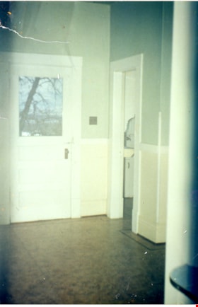
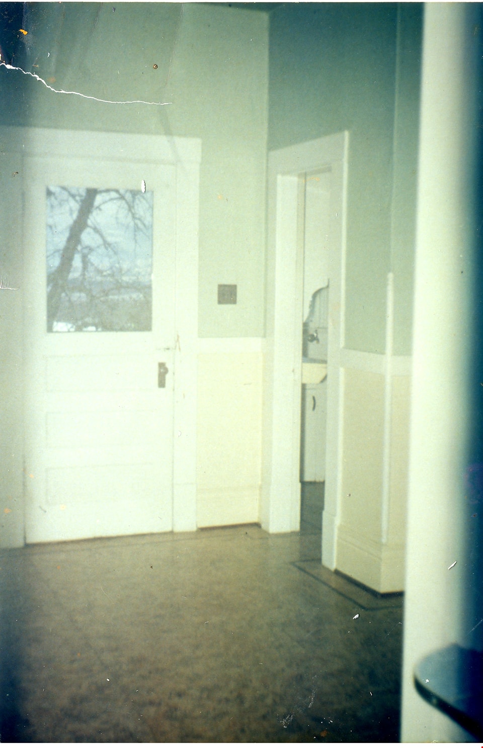
Kitchen inside Mawhinney house
https://search.heritageburnaby.ca/link/museumdescription15573
- Repository
- Burnaby Village Museum
- Date
- 1962
- Collection/Fonds
- Reverend Edward S. Gale fonds
- Description Level
- Item
- Physical Description
- 1 photograph : col. negative ; 35 mm
- Scope and Content
- Photograph of the inside kitchen of the Mervin Mawhinney house. Photograph is looking towards the back door with the pantry doorway on the right, which led to the dining room. A tree is visible through the window of the back door. The address of the house was 7661 Burris Street and was changed to 7…
- Repository
- Burnaby Village Museum
- Collection/Fonds
- Reverend Edward S. Gale fonds
- Description Level
- Item
- Physical Description
- 1 photograph : col. negative ; 35 mm
- Scope and Content
- Photograph of the inside kitchen of the Mervin Mawhinney house. Photograph is looking towards the back door with the pantry doorway on the right, which led to the dining room. A tree is visible through the window of the back door. The address of the house was 7661 Burris Street and was changed to 7667 Burris Street in 1984.
- Geographic Access
- Burris Street
- Street Address
- 7667 Burris Street
- Accession Code
- BV018.9.38
- Access Restriction
- No restrictions
- Reproduction Restriction
- May be restricted by third party rights
- Date
- 1962
- Media Type
- Photograph
- Planning Study Area
- Morley-Buckingham Area
- Scan Resolution
- 600
- Scan Date
- April 15, 2021
- Scale
- 100
- Photographer
- Weller, Michael
- Notes
- Title based on contents of photograph
- 1 col. print 15 x 10 cm accompanying
Images
![Landscape plan for front yard of Mawhinney house, [between 1988 and 1990] thumbnail](/media/hpo/_Data/_BVM_Architectural_Drawings/2018_0009_0048_001.jpg?width=280)
Landscape plan for front yard of Mawhinney house
https://search.heritageburnaby.ca/link/museumdescription15582
- Repository
- Burnaby Village Museum
- Date
- [between 1988 and 1990]
- Collection/Fonds
- Reverend Edward S. Gale fonds
- Description Level
- Item
- Physical Description
- 1 architectural drawing : pencil on parchment ; 30 x 56 cm
- Scope and Content
- Item consists of a landscape drawing identifying the layout and types of trees and bushes to be planted on the property of the Mervin Mawhinney house located at 7667 Burris Street in Burnaby while it was owned by Reverend Edward S. Gale. Grounds on the site were re-landscaped by Reverend Edward S. …
- Repository
- Burnaby Village Museum
- Collection/Fonds
- Reverend Edward S. Gale fonds
- Description Level
- Item
- Physical Description
- 1 architectural drawing : pencil on parchment ; 30 x 56 cm
- Scope and Content
- Item consists of a landscape drawing identifying the layout and types of trees and bushes to be planted on the property of the Mervin Mawhinney house located at 7667 Burris Street in Burnaby while it was owned by Reverend Edward S. Gale. Grounds on the site were re-landscaped by Reverend Edward S. Gale between 1988 and 1990..
- Geographic Access
- Burris Street
- Street Address
- 7667 Burris Street
- Accession Code
- BV018.9.48
- Access Restriction
- No restrictions
- Reproduction Restriction
- May be restricted by third party rights
- Date
- [between 1988 and 1990]
- Media Type
- Architectural Drawing
- Planning Study Area
- Morley-Buckingham Area
- Scan Resolution
- 600
- Scan Date
- May 3, 2021
- Scale
- 100
- Notes
- Title based on contents of photograph
Images
![Landscape plan for front yard of Mawhinney house, [between 1988 and 1990] thumbnail](/media/hpo/_Data/_BVM_Architectural_Drawings/2018_0009_0048_001.jpg)
![Landscape plan for front yard of Mawhinney house, [between 1988 and 1990] thumbnail](/media/hpo/_Data/_BVM_Architectural_Drawings/2018_0009_0049_001.jpg?width=280)
Landscape plan for front yard of Mawhinney house
https://search.heritageburnaby.ca/link/museumdescription15583
- Repository
- Burnaby Village Museum
- Date
- [between 1988 and 1990]
- Collection/Fonds
- Reverend Edward S. Gale fonds
- Description Level
- Item
- Physical Description
- 1 architectural drawing : blueline print with pencil ; 42.5 x 59.5 cm
- Scope and Content
- Item consists of an architectural landscape plan identifying the layout and types of trees and bushes to be planted in the front yard of the Mervin Mawhinney house located at 7667 Burris Street in Burnaby while it was owned by Reverend Edward S. Gale. Plantings identified include; Juniper, Rhodendr…
- Repository
- Burnaby Village Museum
- Collection/Fonds
- Reverend Edward S. Gale fonds
- Description Level
- Item
- Physical Description
- 1 architectural drawing : blueline print with pencil ; 42.5 x 59.5 cm
- Scope and Content
- Item consists of an architectural landscape plan identifying the layout and types of trees and bushes to be planted in the front yard of the Mervin Mawhinney house located at 7667 Burris Street in Burnaby while it was owned by Reverend Edward S. Gale. Plantings identified include; Juniper, Rhodendron, Azaleas, abelia, Rosh Rogos. Grounds on the site were re-landscaped by Reverend Edward S. Gale between 1988 and 1990.
- Geographic Access
- Burris Street
- Street Address
- 7667 Burris Street
- Accession Code
- BV018.9.49
- Access Restriction
- No restrictions
- Reproduction Restriction
- May be restricted by third party rights
- Date
- [between 1988 and 1990]
- Media Type
- Architectural Drawing
- Planning Study Area
- Morley-Buckingham Area
- Related Material
- See also BV018.9.30
- Scan Resolution
- 600
- Scan Date
- May 3, 2021
- Scale
- 100
- Notes
- Title based on contents of photograph
Images
![Landscape plan for front yard of Mawhinney house, [between 1988 and 1990] thumbnail](/media/hpo/_Data/_BVM_Architectural_Drawings/2018_0009_0049_001.jpg)
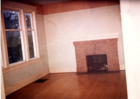
Living room of Mawhinney house
https://search.heritageburnaby.ca/link/museumdescription15578
- Repository
- Burnaby Village Museum
- Date
- 1962
- Collection/Fonds
- Reverend Edward S. Gale fonds
- Description Level
- Item
- Physical Description
- 1 photograph : col. ; 12.5 x 17.5 cm
- Scope and Content
- Photograph of the living room inside of the Mervin Mawhinney house. A brick fireplace , wood floor and front window are visible. Photograph was taken looking through the archway of the dining room. The address of the house was 7661 Burris Street and was changed to 7667 Burris Street in 1984.
- Repository
- Burnaby Village Museum
- Collection/Fonds
- Reverend Edward S. Gale fonds
- Description Level
- Item
- Physical Description
- 1 photograph : col. ; 12.5 x 17.5 cm
- Scope and Content
- Photograph of the living room inside of the Mervin Mawhinney house. A brick fireplace , wood floor and front window are visible. Photograph was taken looking through the archway of the dining room. The address of the house was 7661 Burris Street and was changed to 7667 Burris Street in 1984.
- Geographic Access
- Burris Street
- Street Address
- 7667 Burris Street
- Accession Code
- BV018.9.42
- Access Restriction
- No restrictions
- Reproduction Restriction
- May be restricted by third party rights
- Date
- 1962
- Media Type
- Photograph
- Planning Study Area
- Morley-Buckingham Area
- Scan Resolution
- 600
- Scan Date
- April 20, 2021
- Scale
- 100
- Photographer
- Weller, Michael
- Notes
- Title based on contents of photograph
Images


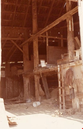
Lubbock barn
https://search.heritageburnaby.ca/link/museumdescription12768
- Repository
- Burnaby Village Museum
- Date
- 1977
- Collection/Fonds
- Century Park Museum Association fonds
- Description Level
- Item
- Physical Description
- 1 photograph : col. slide ; 35 mm
- Scope and Content
- Photograph of the interior of the Lubbock barn. The barn was located at 7803 Burris Street near Burnaby Lake.
- Repository
- Burnaby Village Museum
- Collection/Fonds
- Century Park Museum Association fonds
- Description Level
- Item
- Physical Description
- 1 photograph : col. slide ; 35 mm
- Scope and Content
- Photograph of the interior of the Lubbock barn. The barn was located at 7803 Burris Street near Burnaby Lake.
- History
- In 1977, Century Park Museum was granted access to the Sprott-Lubbock farm to appraise the heritage buildings for preservation. Buildings that were saved included the old farrier shed (BV985.1240.2) which was also used as a blacksmith shop and the Vorce tram station building (BV985.1240.3) from the old Burnaby Lake Interurban line which was used as a grain storage shed on the property. Segments of the original farmhouse and other out buildings were retained. Other buildings on the site were demolished to make way for a new housing development.
- Subjects
- Agriculture - Farms
- Names
- Lubbock farm
- Geographic Access
- Grandview Highway
- Burris Street
- Street Address
- 7803 Burris Street
- Accession Code
- BV020.5.445
- Access Restriction
- No restrictions
- Reproduction Restriction
- No known restrictions
- Date
- 1977
- Media Type
- Photograph
- Historic Neighbourhood
- Burnaby Lake (Historic Neighbourhood)
- Planning Study Area
- Morley-Buckingham Area
- Scan Resolution
- 2400
- Scan Date
- 13-Mar-20
- Scale
- 100
- Notes
- Title based on contents of photograph
Images

Lubbock barn
https://search.heritageburnaby.ca/link/museumdescription12771
- Repository
- Burnaby Village Museum
- Date
- 1977
- Collection/Fonds
- Century Park Museum Association fonds
- Description Level
- Item
- Physical Description
- 1 photograph : col. slide ; 35 mm
- Scope and Content
- Photograph of the interior of the Lubbock barn. The barn was located at 7803 Burris Street near Burnaby Lake.
- Repository
- Burnaby Village Museum
- Collection/Fonds
- Century Park Museum Association fonds
- Description Level
- Item
- Physical Description
- 1 photograph : col. slide ; 35 mm
- Scope and Content
- Photograph of the interior of the Lubbock barn. The barn was located at 7803 Burris Street near Burnaby Lake.
- History
- In 1977, Century Park Museum was granted access to the Sprott-Lubbock farm to appraise the heritage buildings for preservation. Buildings that were saved included the old farrier shed (BV985.1240.2) which was also used as a blacksmith shop and the Vorce tram station building (BV985.1240.3) from the old Burnaby Lake Interurban line which was used as a grain storage shed on the property. Segments of the original farmhouse and other out buildings were retained. Other buildings on the site were demolished to make way for a new housing development.
- Subjects
- Agriculture - Farms
- Names
- Lubbock farm
- Geographic Access
- Grandview Highway
- Burris Street
- Street Address
- 7803 Burris Street
- Accession Code
- BV020.5.448
- Access Restriction
- No restrictions
- Reproduction Restriction
- No known restrictions
- Date
- 1977
- Media Type
- Photograph
- Historic Neighbourhood
- Burnaby Lake (Historic Neighbourhood)
- Planning Study Area
- Morley-Buckingham Area
- Scan Resolution
- 2400
- Scan Date
- 13-Mar-20
- Scale
- 100
- Notes
- Title based on contents of photograph
Images

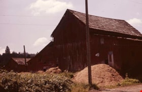
Lubbock barn
https://search.heritageburnaby.ca/link/museumdescription12781
- Repository
- Burnaby Village Museum
- Date
- 1977
- Collection/Fonds
- Century Park Museum Association fonds
- Description Level
- Item
- Physical Description
- 1 photograph : col. slide ; 35 mm
- Scope and Content
- Photograph of the Lubbock barn that was located at 7803 Burris Street near Burnaby Lake. Blackberry bushes and a pile of hay or sileage are visible in the foreground.
- Repository
- Burnaby Village Museum
- Collection/Fonds
- Century Park Museum Association fonds
- Description Level
- Item
- Physical Description
- 1 photograph : col. slide ; 35 mm
- Scope and Content
- Photograph of the Lubbock barn that was located at 7803 Burris Street near Burnaby Lake. Blackberry bushes and a pile of hay or sileage are visible in the foreground.
- History
- In 1977, Century Park Museum was granted access to the Sprott-Lubbock farm to appraise the heritage buildings for preservation. Buildings that were saved included the old farrier shed (BV985.1240.2) which was also used as a blacksmith shop and the Vorce tram station building (BV985.1240.3) from the old Burnaby Lake Interurban line which was used as a grain storage shed on the property. Segments of the original farmhouse and other out buildings were retained. Other buildings on the site were demolished to make way for a new housing development.
- Subjects
- Agriculture - Farms
- Names
- Lubbock farm
- Geographic Access
- Grandview Highway
- Burris Street
- Street Address
- 7803 Burris Street
- Accession Code
- BV020.5.458
- Access Restriction
- No restrictions
- Reproduction Restriction
- No known restrictions
- Date
- 1977
- Media Type
- Photograph
- Historic Neighbourhood
- Burnaby Lake (Historic Neighbourhood)
- Planning Study Area
- Morley-Buckingham Area
- Scan Resolution
- 2400
- Scan Date
- 13-Mar-20
- Scale
- 100
- Notes
- Title based on contents of photograph
Images

Lubbock barn
https://search.heritageburnaby.ca/link/museumdescription12784
- Repository
- Burnaby Village Museum
- Date
- 1977
- Collection/Fonds
- Century Park Museum Association fonds
- Description Level
- Item
- Physical Description
- 1 photograph : col. slide ; 35 mm
- Scope and Content
- Photograph of the Lubbock barn and out buildings on the Lubbock farm. The farm was located at 7803 Burris Street near Burnaby Lake. Bushes, trees and tall grasses surround the buildings.
- Repository
- Burnaby Village Museum
- Collection/Fonds
- Century Park Museum Association fonds
- Description Level
- Item
- Physical Description
- 1 photograph : col. slide ; 35 mm
- Scope and Content
- Photograph of the Lubbock barn and out buildings on the Lubbock farm. The farm was located at 7803 Burris Street near Burnaby Lake. Bushes, trees and tall grasses surround the buildings.
- History
- In 1977, Century Park Museum was granted access to the Sprott-Lubbock farm to appraise the heritage buildings for preservation. Buildings that were saved included the old farrier shed (BV985.1240.2) which was also used as a blacksmith shop and the Vorce tram station building (BV985.1240.3) from the old Burnaby Lake Interurban line which was used as a grain storage shed on the property. Segments of the original farmhouse and other out buildings were retained. Other buildings on the site were demolished to make way for a new housing development.
- Subjects
- Agriculture - Farms
- Names
- Lubbock farm
- Geographic Access
- Grandview Highway
- Burris Street
- Street Address
- 7803 Burris Street
- Accession Code
- BV020.5.461
- Access Restriction
- No restrictions
- Reproduction Restriction
- No known restrictions
- Date
- 1977
- Media Type
- Photograph
- Historic Neighbourhood
- Burnaby Lake (Historic Neighbourhood)
- Planning Study Area
- Morley-Buckingham Area
- Scan Resolution
- 2400
- Scan Date
- 13-Mar-20
- Scale
- 100
- Notes
- Title based on contents of photograph
Images

Lubbock barn
https://search.heritageburnaby.ca/link/museumdescription12786
- Repository
- Burnaby Village Museum
- Date
- 1977
- Collection/Fonds
- Century Park Museum Association fonds
- Description Level
- Item
- Physical Description
- 1 photograph : col. slide ; 35 mm
- Scope and Content
- Photograph of the Lubbock barn located at 7803 Burris Street near Burnaby Lake. Piles of sileage surround the outside of the building.
- Repository
- Burnaby Village Museum
- Collection/Fonds
- Century Park Museum Association fonds
- Description Level
- Item
- Physical Description
- 1 photograph : col. slide ; 35 mm
- Scope and Content
- Photograph of the Lubbock barn located at 7803 Burris Street near Burnaby Lake. Piles of sileage surround the outside of the building.
- History
- In 1977, Century Park Museum was granted access to the Sprott-Lubbock farm to appraise the heritage buildings for preservation. Buildings that were saved included the old farrier shed (BV985.1240.2) which was also used as a blacksmith shop and the Vorce tram station building (BV985.1240.3) from the old Burnaby Lake Interurban line which was used as a grain storage shed on the property. Segments of the original farmhouse and other out buildings were retained. Other buildings on the site were demolished to make way for a new housing development.
- Subjects
- Agriculture - Farms
- Names
- Lubbock farm
- Geographic Access
- Grandview Highway
- Burris Street
- Street Address
- 7803 Burris Street
- Accession Code
- BV020.5.463
- Access Restriction
- No restrictions
- Reproduction Restriction
- No known restrictions
- Date
- 1977
- Media Type
- Photograph
- Historic Neighbourhood
- Burnaby Lake (Historic Neighbourhood)
- Planning Study Area
- Morley-Buckingham Area
- Scan Resolution
- 2400
- Scan Date
- 13-Mar-20
- Scale
- 100
- Notes
- Title based on contents of photograph
Images

Lubbock barn
https://search.heritageburnaby.ca/link/museumdescription12812
- Repository
- Burnaby Village Museum
- Date
- 1977
- Collection/Fonds
- Century Park Museum Association fonds
- Description Level
- Item
- Physical Description
- 1 photograph : col. slide ; 35 mm
- Scope and Content
- Photograph of the barn on the Lubbock family farm. A few out buildings are visible in the foreground and the house is visible in the background.
- Repository
- Burnaby Village Museum
- Collection/Fonds
- Century Park Museum Association fonds
- Description Level
- Item
- Physical Description
- 1 photograph : col. slide ; 35 mm
- Scope and Content
- Photograph of the barn on the Lubbock family farm. A few out buildings are visible in the foreground and the house is visible in the background.
- History
- In 1977, Century Park Museum was granted access to the Sprott-Lubbock farm to appraise the heritage buildings for preservation. Buildings that were saved included the old farrier shed (BV985.1240.2) which was also used as a blacksmith shop and the Vorce tram station building (BV985.1240.3) from the old Burnaby Lake Interurban line which was used as a grain storage shed on the property. Segments of the original farmhouse and other out buildings were retained. Other buildings on the site were demolished to make way for a new housing development.
- Subjects
- Agriculture - Farms
- Names
- Lubbock farm
- Geographic Access
- Grandview Highway
- Burris Street
- Street Address
- 7803 Burris Street
- Accession Code
- BV020.5.479
- Access Restriction
- No restrictions
- Reproduction Restriction
- No known restrictions
- Date
- 1977
- Media Type
- Photograph
- Historic Neighbourhood
- Burnaby Lake (Historic Neighbourhood)
- Planning Study Area
- Morley-Buckingham Area
- Scan Resolution
- 2400
- Scan Date
- 13-Mar-20
- Scale
- 100
- Notes
- Title based on contents of photograph
Images
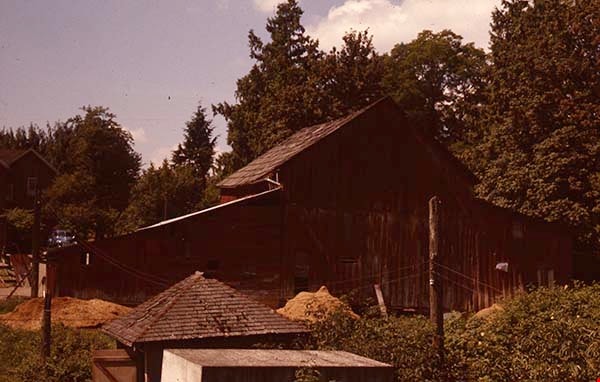
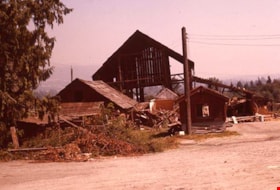
Lubbock barn and out buildings
https://search.heritageburnaby.ca/link/museumdescription12774
- Repository
- Burnaby Village Museum
- Date
- 1977
- Collection/Fonds
- Century Park Museum Association fonds
- Description Level
- Item
- Physical Description
- 1 photograph : col. slide ; 35 mm
- Scope and Content
- Photograph of the Lubbock barn and out buildings on the Lubbock farm. The farm was located at 7803 Burris Street near Burnaby Lake.
- Repository
- Burnaby Village Museum
- Collection/Fonds
- Century Park Museum Association fonds
- Description Level
- Item
- Physical Description
- 1 photograph : col. slide ; 35 mm
- Scope and Content
- Photograph of the Lubbock barn and out buildings on the Lubbock farm. The farm was located at 7803 Burris Street near Burnaby Lake.
- History
- In 1977, Century Park Museum was granted access to the Sprott-Lubbock farm to appraise the heritage buildings for preservation. Buildings that were saved included the old farrier shed (BV985.1240.2) which was also used as a blacksmith shop and the Vorce tram station building (BV985.1240.3) from the old Burnaby Lake Interurban line which was used as a grain storage shed on the property. Segments of the original farmhouse and other out buildings were retained. Other buildings on the site were demolished to make way for a new housing development.
- Subjects
- Agriculture - Farms
- Names
- Lubbock farm
- Geographic Access
- Grandview Highway
- Burris Street
- Street Address
- 7803 Burris Street
- Accession Code
- BV020.5.451
- Access Restriction
- No restrictions
- Reproduction Restriction
- No known restrictions
- Date
- 1977
- Media Type
- Photograph
- Historic Neighbourhood
- Burnaby Lake (Historic Neighbourhood)
- Planning Study Area
- Morley-Buckingham Area
- Scan Resolution
- 2400
- Scan Date
- 13-Mar-20
- Scale
- 100
- Notes
- Title based on contents of photograph
Images

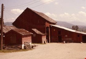
Lubbock barn and out buildings
https://search.heritageburnaby.ca/link/museumdescription12795
- Repository
- Burnaby Village Museum
- Date
- 1977
- Collection/Fonds
- Century Park Museum Association fonds
- Description Level
- Item
- Physical Description
- 1 photograph : col. slide ; 35 mm
- Scope and Content
- Photograph of the Lubbock barn and out buildings located at 7803 Burris Street near Burnaby Lake.
- Repository
- Burnaby Village Museum
- Collection/Fonds
- Century Park Museum Association fonds
- Description Level
- Item
- Physical Description
- 1 photograph : col. slide ; 35 mm
- Scope and Content
- Photograph of the Lubbock barn and out buildings located at 7803 Burris Street near Burnaby Lake.
- History
- In 1977, Century Park Museum was granted access to the Sprott-Lubbock farm to appraise the heritage buildings for preservation. Buildings that were saved included the old farrier shed (BV985.1240.2) which was also used as a blacksmith shop and the Vorce tram station building (BV985.1240.3) from the old Burnaby Lake Interurban line which was used as a grain storage shed on the property. Segments of the original farmhouse and other out buildings were retained. Other buildings on the site were demolished to make way for a new housing development.
- Subjects
- Agriculture - Farms
- Names
- Lubbock farm
- Geographic Access
- Grandview Highway
- Burris Street
- Street Address
- 7803 Burris Street
- Accession Code
- BV020.5.472
- Access Restriction
- No restrictions
- Reproduction Restriction
- No known restrictions
- Date
- 1977
- Media Type
- Photograph
- Historic Neighbourhood
- Burnaby Lake (Historic Neighbourhood)
- Planning Study Area
- Morley-Buckingham Area
- Scan Resolution
- 2400
- Scan Date
- 13-Mar-20
- Scale
- 100
- Notes
- Title based on contents of photograph
Images

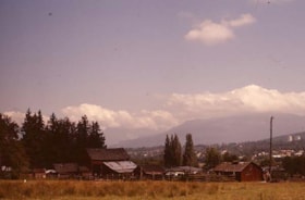
Lubbock farm
https://search.heritageburnaby.ca/link/museumdescription12756
- Repository
- Burnaby Village Museum
- Date
- 1977
- Collection/Fonds
- Century Park Museum Association fonds
- Description Level
- Item
- Physical Description
- 1 photograph : col. slide ; 35 mm
- Scope and Content
- Photograph of the Lubbock farm with barn and out buildings located at 7803 Burris Street.
- Repository
- Burnaby Village Museum
- Collection/Fonds
- Century Park Museum Association fonds
- Description Level
- Item
- Physical Description
- 1 photograph : col. slide ; 35 mm
- Scope and Content
- Photograph of the Lubbock farm with barn and out buildings located at 7803 Burris Street.
- History
- In 1977, Century Park Museum was granted access to the Sprott-Lubbock farm to appraise the heritage buildings for preservation. Buildings that were saved included the old farrier shed (BV985.1240.2) which was also used as a blacksmith shop and the Vorce tram station building (BV985.1240.3) from the old Burnaby Lake Interurban line which was used as a grain storage shed on the property. Segments of the original farmhouse and other out buildings were retained. Other buildings on the site were demolished to make way for a new housing development.
- Subjects
- Agriculture - Farms
- Names
- Lubbock farm
- Geographic Access
- Grandview Highway
- Burris Street
- Street Address
- 7803 Burris Street
- Accession Code
- BV020.5.433
- Access Restriction
- No restrictions
- Reproduction Restriction
- No known restrictions
- Date
- 1977
- Media Type
- Photograph
- Historic Neighbourhood
- Burnaby Lake (Historic Neighbourhood)
- Planning Study Area
- Morley-Buckingham Area
- Scan Resolution
- 2400
- Scan Date
- 13-Mar-20
- Scale
- 100
- Notes
- Title based on contents of photograph
Images

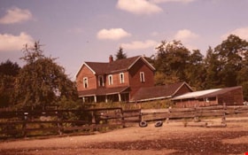
Lubbock farm
https://search.heritageburnaby.ca/link/museumdescription12773
- Repository
- Burnaby Village Museum
- Date
- 1977
- Collection/Fonds
- Century Park Museum Association fonds
- Description Level
- Item
- Physical Description
- 1 photograph : col. slide ; 35 mm
- Scope and Content
- Photograph of the Lubbock farmhouse, garage and horse paddocks. The house was located at 7803 Burris Street near Burnaby Lake.
- Repository
- Burnaby Village Museum
- Collection/Fonds
- Century Park Museum Association fonds
- Description Level
- Item
- Physical Description
- 1 photograph : col. slide ; 35 mm
- Scope and Content
- Photograph of the Lubbock farmhouse, garage and horse paddocks. The house was located at 7803 Burris Street near Burnaby Lake.
- History
- In 1977, Century Park Museum was granted access to the Sprott-Lubbock farm to appraise the heritage buildings for preservation. Buildings that were saved included the old farrier shed (BV985.1240.2) which was also used as a blacksmith shop and the Vorce tram station building (BV985.1240.3) from the old Burnaby Lake Interurban line which was used as a grain storage shed on the property. Segments of the original farmhouse and other out buildings were retained. Other buildings on the site were demolished to make way for a new housing development.
- Subjects
- Agriculture - Farms
- Names
- Lubbock farm
- Geographic Access
- Grandview Highway
- Burris Street
- Street Address
- 7803 Burris Street
- Accession Code
- BV020.5.450
- Access Restriction
- No restrictions
- Reproduction Restriction
- No known restrictions
- Date
- 1977
- Media Type
- Photograph
- Historic Neighbourhood
- Burnaby Lake (Historic Neighbourhood)
- Planning Study Area
- Morley-Buckingham Area
- Scan Resolution
- 2400
- Scan Date
- 13-Mar-20
- Scale
- 100
- Notes
- Title based on contents of photograph
Images

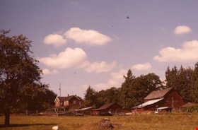
Lubbock farm
https://search.heritageburnaby.ca/link/museumdescription12790
- Repository
- Burnaby Village Museum
- Date
- 1977
- Collection/Fonds
- Century Park Museum Association fonds
- Description Level
- Item
- Physical Description
- 1 photograph : col. slide ; 35 mm
- Scope and Content
- Photograph of the Lubbock farm located at 7803 Burris Street near Burnaby Lake.
- Repository
- Burnaby Village Museum
- Collection/Fonds
- Century Park Museum Association fonds
- Description Level
- Item
- Physical Description
- 1 photograph : col. slide ; 35 mm
- Scope and Content
- Photograph of the Lubbock farm located at 7803 Burris Street near Burnaby Lake.
- History
- In 1977, Century Park Museum was granted access to the Sprott-Lubbock farm to appraise the heritage buildings for preservation. Buildings that were saved included the old farrier shed (BV985.1240.2) which was also used as a blacksmith shop and the Vorce tram station building (BV985.1240.3) from the old Burnaby Lake Interurban line which was used as a grain storage shed on the property. Segments of the original farmhouse and other out buildings were retained. Other buildings on the site were demolished to make way for a new housing development.
- Subjects
- Agriculture - Farms
- Names
- Lubbock farm
- Geographic Access
- Grandview Highway
- Burris Street
- Street Address
- 7803 Burris Street
- Accession Code
- BV020.5.467
- Access Restriction
- No restrictions
- Reproduction Restriction
- No known restrictions
- Date
- 1977
- Media Type
- Photograph
- Historic Neighbourhood
- Burnaby Lake (Historic Neighbourhood)
- Planning Study Area
- Morley-Buckingham Area
- Scan Resolution
- 2400
- Scan Date
- 13-Mar-20
- Scale
- 100
- Notes
- Title based on contents of photograph
Images

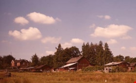
Lubbock farm
https://search.heritageburnaby.ca/link/museumdescription12791
- Repository
- Burnaby Village Museum
- Date
- 1977
- Collection/Fonds
- Century Park Museum Association fonds
- Description Level
- Item
- Physical Description
- 1 photograph : col. slide ; 35 mm
- Scope and Content
- Photograph of the Lubbock farm located at 7803 Burris Street near Burnaby Lake.
- Repository
- Burnaby Village Museum
- Collection/Fonds
- Century Park Museum Association fonds
- Description Level
- Item
- Physical Description
- 1 photograph : col. slide ; 35 mm
- Scope and Content
- Photograph of the Lubbock farm located at 7803 Burris Street near Burnaby Lake.
- History
- In 1977, Century Park Museum was granted access to the Sprott-Lubbock farm to appraise the heritage buildings for preservation. Buildings that were saved included the old farrier shed (BV985.1240.2) which was also used as a blacksmith shop and the Vorce tram station building (BV985.1240.3) from the old Burnaby Lake Interurban line which was used as a grain storage shed on the property. Segments of the original farmhouse and other out buildings were retained. Other buildings on the site were demolished to make way for a new housing development.
- Subjects
- Agriculture - Farms
- Names
- Lubbock farm
- Geographic Access
- Grandview Highway
- Burris Street
- Street Address
- 7803 Burris Street
- Accession Code
- BV020.5.468
- Access Restriction
- No restrictions
- Reproduction Restriction
- No known restrictions
- Date
- 1977
- Media Type
- Photograph
- Historic Neighbourhood
- Burnaby Lake (Historic Neighbourhood)
- Planning Study Area
- Morley-Buckingham Area
- Scan Resolution
- 2400
- Scan Date
- 13-Mar-20
- Scale
- 100
- Notes
- Title based on contents of photograph
Images

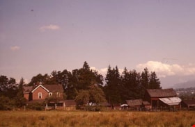
Lubbock farm
https://search.heritageburnaby.ca/link/museumdescription12792
- Repository
- Burnaby Village Museum
- Date
- 1977
- Collection/Fonds
- Century Park Museum Association fonds
- Description Level
- Item
- Physical Description
- 1 photograph : col. slide ; 35 mm
- Scope and Content
- Photograph of the Lubbock farm located at 7803 Burris Street near Burnaby Lake.
- Repository
- Burnaby Village Museum
- Collection/Fonds
- Century Park Museum Association fonds
- Description Level
- Item
- Physical Description
- 1 photograph : col. slide ; 35 mm
- Scope and Content
- Photograph of the Lubbock farm located at 7803 Burris Street near Burnaby Lake.
- History
- In 1977, Century Park Museum was granted access to the Sprott-Lubbock farm to appraise the heritage buildings for preservation. Buildings that were saved included the old farrier shed (BV985.1240.2) which was also used as a blacksmith shop and the Vorce tram station building (BV985.1240.3) from the old Burnaby Lake Interurban line which was used as a grain storage shed on the property. Segments of the original farmhouse and other out buildings were retained. Other buildings on the site were demolished to make way for a new housing development.
- Subjects
- Agriculture - Farms
- Names
- Lubbock farm
- Geographic Access
- Grandview Highway
- Burris Street
- Street Address
- 7803 Burris Street
- Accession Code
- BV020.5.469
- Access Restriction
- No restrictions
- Reproduction Restriction
- No known restrictions
- Date
- 1977
- Media Type
- Photograph
- Historic Neighbourhood
- Burnaby Lake (Historic Neighbourhood)
- Planning Study Area
- Morley-Buckingham Area
- Scan Resolution
- 2400
- Scan Date
- 13-Mar-20
- Scale
- 100
- Notes
- Title based on contents of photograph
Images

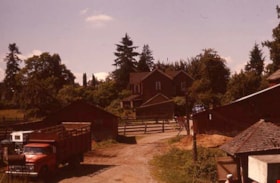
Lubbock farm
https://search.heritageburnaby.ca/link/museumdescription12813
- Repository
- Burnaby Village Museum
- Date
- 1977
- Collection/Fonds
- Century Park Museum Association fonds
- Description Level
- Item
- Physical Description
- 1 photograph : col. slide ; 35 mm
- Scope and Content
- Photograph of the Lubbock family farm. A few out buildings and vehicles are visible in the foreground and the house is visible in the background.
- Repository
- Burnaby Village Museum
- Collection/Fonds
- Century Park Museum Association fonds
- Description Level
- Item
- Physical Description
- 1 photograph : col. slide ; 35 mm
- Scope and Content
- Photograph of the Lubbock family farm. A few out buildings and vehicles are visible in the foreground and the house is visible in the background.
- History
- In 1977, Century Park Museum was granted access to the Sprott-Lubbock farm to appraise the heritage buildings for preservation. Buildings that were saved included the old farrier shed (BV985.1240.2) which was also used as a blacksmith shop and the Vorce tram station building (BV985.1240.3) from the old Burnaby Lake Interurban line which was used as a grain storage shed on the property. Segments of the original farmhouse and other out buildings were retained. Other buildings on the site were demolished to make way for a new housing development.
- Subjects
- Agriculture - Farms
- Names
- Lubbock farm
- Geographic Access
- Grandview Highway
- Burris Street
- Street Address
- 7803 Burris Street
- Accession Code
- BV020.5.480
- Access Restriction
- No restrictions
- Reproduction Restriction
- No known restrictions
- Date
- 1977
- Media Type
- Photograph
- Historic Neighbourhood
- Burnaby Lake (Historic Neighbourhood)
- Planning Study Area
- Morley-Buckingham Area
- Scan Resolution
- 2400
- Scan Date
- 13-Mar-20
- Scale
- 100
- Notes
- Title based on contents of photograph
Images

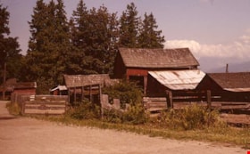
Lubbock farm
https://search.heritageburnaby.ca/link/museumdescription12815
- Repository
- Burnaby Village Museum
- Date
- 1977
- Collection/Fonds
- Century Park Museum Association fonds
- Description Level
- Item
- Physical Description
- 1 photograph : col. slide ; 35 mm
- Scope and Content
- Photograph of a barn and out buildings on the Lubbock family farm.
- Repository
- Burnaby Village Museum
- Collection/Fonds
- Century Park Museum Association fonds
- Description Level
- Item
- Physical Description
- 1 photograph : col. slide ; 35 mm
- Scope and Content
- Photograph of a barn and out buildings on the Lubbock family farm.
- History
- In 1977, Century Park Museum was granted access to the Sprott-Lubbock farm to appraise the heritage buildings for preservation. Buildings that were saved included the old farrier shed (BV985.1240.2) which was also used as a blacksmith shop and the Vorce tram station building (BV985.1240.3) from the old Burnaby Lake Interurban line which was used as a grain storage shed on the property. Segments of the original farmhouse and other out buildings were retained. Other buildings on the site were demolished to make way for a new housing development.
- Subjects
- Agriculture - Farms
- Names
- Lubbock farm
- Geographic Access
- Grandview Highway
- Burris Street
- Street Address
- 7803 Burris Street
- Accession Code
- BV020.5.482
- Access Restriction
- No restrictions
- Reproduction Restriction
- No known restrictions
- Date
- 1977
- Media Type
- Photograph
- Historic Neighbourhood
- Burnaby Lake (Historic Neighbourhood)
- Planning Study Area
- Morley-Buckingham Area
- Scan Resolution
- 2400
- Scan Date
- 13-Mar-20
- Scale
- 100
- Notes
- Title based on contents of photograph
Images

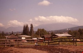
Lubbock farm
https://search.heritageburnaby.ca/link/museumdescription12819
- Repository
- Burnaby Village Museum
- Date
- 1977
- Collection/Fonds
- Century Park Museum Association fonds
- Description Level
- Item
- Physical Description
- 1 photograph : col. slide ; 35 mm
- Scope and Content
- Photograph of fenced paddock and buildings on the Lubbock family farm. Burnaby mountain is visible in the distance.
- Repository
- Burnaby Village Museum
- Collection/Fonds
- Century Park Museum Association fonds
- Description Level
- Item
- Physical Description
- 1 photograph : col. slide ; 35 mm
- Scope and Content
- Photograph of fenced paddock and buildings on the Lubbock family farm. Burnaby mountain is visible in the distance.
- History
- In 1977, Century Park Museum was granted access to the Sprott-Lubbock farm to appraise the heritage buildings for preservation. Buildings that were saved included the old farrier shed (BV985.1240.2) which was also used as a blacksmith shop and the Vorce tram station building (BV985.1240.3) from the old Burnaby Lake Interurban line which was used as a grain storage shed on the property. Segments of the original farmhouse and other out buildings were retained. Other buildings on the site were demolished to make way for a new housing development.
- Subjects
- Agriculture - Farms
- Names
- Lubbock farm
- Geographic Access
- Grandview Highway
- Burris Street
- Street Address
- 7803 Burris Street
- Accession Code
- BV020.5.486
- Access Restriction
- No restrictions
- Reproduction Restriction
- No known restrictions
- Date
- 1977
- Media Type
- Photograph
- Historic Neighbourhood
- Burnaby Lake (Historic Neighbourhood)
- Planning Study Area
- Morley-Buckingham Area
- Scan Resolution
- 2400
- Scan Date
- 13-Mar-20
- Scale
- 100
- Notes
- Title based on contents of photograph
Images