More like 'Opening of Lohn Gardens and Restored Jubilee Grove Arch'
Narrow Results By
Subject
- Accidents
- Accidents - Automobile Accidents 1
- Advertising Medium - Signs and Signboards 40
- Aerial Photographs 36
- Agricultural Tools and Equipment 5
- Agricultural Tools and Equipment - Gardening Equipment 6
- Agricultural Tools and Equipment - Plows
- Agriculture 9
- Agriculture - Crops 1
- Agriculture - Farms 17
- Agriculture - Fruit and Berries 3
- Animals 4
![John Yanko ploughing a field, [194-] (date of original), copied November 1976 thumbnail](/media/hpo/_Data/_Archives_Images/_Unrestricted/540/545-246.jpg?width=280)
John Yanko ploughing a field
https://search.heritageburnaby.ca/link/archivedescription80221
- Repository
- City of Burnaby Archives
- Date
- [194-] (date of original), copied November 1976
- Collection/Fonds
- Yanko family fonds
- Description Level
- Item
- Physical Description
- 1 photograph : b&w copy print ; 7.5 x 11.5 cm
- Scope and Content
- Photograph of John Ivan Yanko ploughing a field using a team of seven horses in Kelliher, Saskatchewan.
- Repository
- City of Burnaby Archives
- Date
- [194-] (date of original), copied November 1976
- Collection/Fonds
- Yanko family fonds
- Physical Description
- 1 photograph : b&w copy print ; 7.5 x 11.5 cm
- Description Level
- Item
- Record No.
- 545-246
- Access Restriction
- No restrictions
- Reproduction Restriction
- No restrictions
- Accession Number
- 2012-09
- Scope and Content
- Photograph of John Ivan Yanko ploughing a field using a team of seven horses in Kelliher, Saskatchewan.
- Subjects
- Geographic Features - Fields
- Agricultural Tools and Equipment - Plows
- Transportation - Horses
- Names
- Yanko, John Ivan
- Media Type
- Photograph
- Notes
- Title based on contents of photograph
- Photograph housed inside envelope on p. 14 of album
- Note in black ink on verso of photograph reads: "Dad + 7 horses"
Images
![John Yanko ploughing a field, [194-] (date of original), copied November 1976 thumbnail](/media/hpo/_Data/_Archives_Images/_Unrestricted/540/545-246.jpg)
![Mr. Manuel with a plough, [192-] (date of original), copied 1991 thumbnail](/media/hpo/_Data/_Archives_Images/_Unrestricted/370/370-100.jpg?width=280)
Mr. Manuel with a plough
https://search.heritageburnaby.ca/link/archivedescription37512
- Repository
- City of Burnaby Archives
- Date
- [192-] (date of original), copied 1991
- Collection/Fonds
- Burnaby Historical Society fonds
- Description Level
- Item
- Physical Description
- 1 photograph : b&w ; 3.1 x 5.3 cm print on contact sheet 20.3 x 25.3 cm
- Scope and Content
- Photograph of Mr. Manuel working a plough pulled by two horses at Cassie Avenue (later the location of Metrotown).
- Repository
- City of Burnaby Archives
- Date
- [192-] (date of original), copied 1991
- Collection/Fonds
- Burnaby Historical Society fonds
- Subseries
- Burnaby Image Bank subseries
- Physical Description
- 1 photograph : b&w ; 3.1 x 5.3 cm print on contact sheet 20.3 x 25.3 cm
- Description Level
- Item
- Record No.
- 370-100
- Access Restriction
- No restrictions
- Reproduction Restriction
- No known restrictions
- Accession Number
- BHS1999-03
- Scope and Content
- Photograph of Mr. Manuel working a plough pulled by two horses at Cassie Avenue (later the location of Metrotown).
- Subjects
- Geographic Features - Fields
- Transportation - Horses
- Agricultural Tools and Equipment - Plows
- Occupations - Farmers
- Media Type
- Photograph
- Notes
- Title based on contents of photograph
- 1 b&w copy negative accompanying
- Geographic Access
- Cassie Avenue
- Historic Neighbourhood
- Central Park (Historic Neighbourhood)
- Planning Study Area
- Maywood Area
Images
![Mr. Manuel with a plough, [192-] (date of original), copied 1991 thumbnail](/media/hpo/_Data/_Archives_Images/_Unrestricted/370/370-100.jpg)

Roof Collapse at Metrotown Save-on-Foods
https://search.heritageburnaby.ca/link/museumdescription1166
- Repository
- Burnaby Village Museum
- Date
- April 1988
- Collection/Fonds
- Burnaby Village Museum Photograph collection
- Description Level
- Item
- Physical Description
- 1 photograph : col. 19.5 x 24.5 cm
- Scope and Content
- Aerial photograph of the aftermath of the Save-on-Foods roof collapse at Metrotown on April 23, 1988. The rooftop parking lot has caved into the store along with the cars parked in that section. Workmen and police officers in uniforms are at the parking lot.
- Repository
- Burnaby Village Museum
- Collection/Fonds
- Burnaby Village Museum Photograph collection
- Description Level
- Item
- Physical Description
- 1 photograph : col. 19.5 x 24.5 cm
- Scope and Content
- Aerial photograph of the aftermath of the Save-on-Foods roof collapse at Metrotown on April 23, 1988. The rooftop parking lot has caved into the store along with the cars parked in that section. Workmen and police officers in uniforms are at the parking lot.
- Geographic Access
- Kingsway
- Street Address
- 4800 Kingsway
- Accession Code
- BV992.51.1
- Access Restriction
- Restricted access
- Reproduction Restriction
- May be restricted by third party rights
- Date
- April 1988
- Media Type
- Photograph
- Historic Neighbourhood
- Central Park (Historic Neighbourhood)
- Planning Study Area
- Maywood Area
- Scan Resolution
- 600
- Scan Date
- 01-Jun-09
- Scale
- 100
- Photographer
- Hodge, Craig
- Notes
- Title based on contents of photograph
Images


Original Second Narrows Bridge collapses
https://search.heritageburnaby.ca/link/museumdescription104
- Repository
- Burnaby Village Museum
- Date
- 1930
- Collection/Fonds
- Burnaby Village Museum Photograph collection
- Description Level
- Item
- Physical Description
- 1 photograph : sepia ; 6 x 10.5 cm
- Scope and Content
- Photograph of the aftermath of the Second Narrows Bridge being hit by the"Losmar" pictured on the right. Soon after being built in 1925, the Second Narrows Bridge was hit countless times by ships at the bascule portion installed at the south end of the bridge (unfortunately installed in a shallow w…
- Repository
- Burnaby Village Museum
- Collection/Fonds
- Burnaby Village Museum Photograph collection
- Description Level
- Item
- Physical Description
- 1 photograph : sepia ; 6 x 10.5 cm
- Scope and Content
- Photograph of the aftermath of the Second Narrows Bridge being hit by the"Losmar" pictured on the right. Soon after being built in 1925, the Second Narrows Bridge was hit countless times by ships at the bascule portion installed at the south end of the bridge (unfortunately installed in a shallow water area to avoid building expensive towers and a lift span). Each time it was hit the bridge was out of commission until it was repaired. The Second Narrows Bridge runs over Burrard Inlet and connects Vancouver to North Vancouver.
- Subjects
- Structures - Bridges
- Accidents
- Accession Code
- BV988.31.6
- Access Restriction
- No restrictions
- Date
- 1930
- Media Type
- Photograph
- Related Material
- For another photograph of the collapse of the Second Narrows Bridge, see BV988.31.7
- Scan Resolution
- 600
- Scan Date
- 2024-04-16
- Notes
- Title based on contents of photograph
- Note in blue pen on verso of photograph reads: "Collapse of original 2nd Narrows Bridge / year?"
Images

![Original Second Narrows Bridge collapses, [between 1925 and 1930] thumbnail](/media/hpo/_Data/_BVM_Images/1988/1988_0031_0007_001.jpg?width=280)
Original Second Narrows Bridge collapses
https://search.heritageburnaby.ca/link/museumdescription105
- Repository
- Burnaby Village Museum
- Date
- [between 1925 and 1930]
- Collection/Fonds
- Burnaby Village Museum Photograph collection
- Description Level
- Item
- Physical Description
- 1 photograph : sepia ; 6 x 10 cm
- Scope and Content
- Photograph of the aftermath of the Second Narrows Bridge being hit by a ship. The span girder is tipped into water on the left side of the photograph and the other girder is broken and in upright position. There is a large ship in the front with letters "CALMAR LINE" written on the side along with …
- Repository
- Burnaby Village Museum
- Collection/Fonds
- Burnaby Village Museum Photograph collection
- Description Level
- Item
- Physical Description
- 1 photograph : sepia ; 6 x 10 cm
- Scope and Content
- Photograph of the aftermath of the Second Narrows Bridge being hit by a ship. The span girder is tipped into water on the left side of the photograph and the other girder is broken and in upright position. There is a large ship in the front with letters "CALMAR LINE" written on the side along with several tug boats. Soon after being built in 1925, the Second Narrows Bridge was hit countless times by ships at the bascule portion installed at the south end of the bridge (unfortunately installed in a shallow water area to avoid building expensive towers and a lift span). Each time it was hit the bridge was out of commission until it was repaired. The Second Narrows Bridge runs over Burrard Inlet and connects Vancouver to North Vancouver.
- Subjects
- Structures - Bridges
- Accidents
- Accession Code
- BV988.31.7
- Access Restriction
- No restrictions
- Date
- [between 1925 and 1930]
- Media Type
- Photograph
- Related Material
- For another photograph of the collapse of the Second Narrows Bridge, see BV988.31.6
- Scan Resolution
- 600
- Scan Date
- 2024-04-16
- Notes
- Title based on contents of photograph
- Note in blue pen on verso of photograph reads: "Collapse of original 2nd Narrows Bridge / year?"
Images
![Original Second Narrows Bridge collapses, [between 1925 and 1930] thumbnail](/media/hpo/_Data/_BVM_Images/1988/1988_0031_0007_001.jpg)
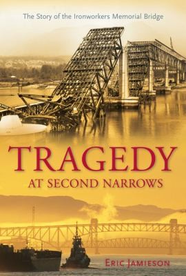
Tragedy at Second Narrows : the story of the Ironworkers Memorial Bridge
https://search.heritageburnaby.ca/link/museumlibrary1384
- Repository
- Burnaby Village Museum
- Author
- Jamieson, Eric, 1949-
- Publication Date
- c2008
- Call Number
- 624.2 JAM
- Repository
- Burnaby Village Museum
- Collection
- Reference Collection
- Material Type
- Book
- ISBN
- 9781550174519
- Call Number
- 624.2 JAM
- Author
- Jamieson, Eric, 1949-
- Place of Publication
- Maderia Park, BC
- Publisher
- Harbour
- Publication Date
- c2008
- Physical Description
- 301 p. : ill.
- Inscription
- "E.J.", Initials in black ink on subtitle page
- Library Subject (LOC)
- Bridges
- Subjects
- Structures - Bridges
- Accidents
- Geographic Access
- Vancouver
- Notes
- Includes bibliographical references and index
- Signed by author