More like 'Duncan & Margaret McGregor Estate 'Glen-Lyon' Mansion'
Exterior of Love farmhouse
https://search.heritageburnaby.ca/link/museumdescription1131
- Repository
- Burnaby Village Museum
- Date
- 1971 (date of original), copied 1990
- Collection/Fonds
- Love family fonds
- Description Level
- Item
- Physical Description
- 1 photograph : col. ; 10 x 15 cm print
- Scope and Content
- Photograph of the exterior of the Love farmhouse taken from the corner of Fourteenth Avenue and Cumberland Street while Elsie (nee Love) Hughes, her husband John and son Brent lived in the house. The house was located at 7651 Cumberland Street (Address pre 1960: 1390 Cumberland Road) and was moved …
- Repository
- Burnaby Village Museum
- Collection/Fonds
- Love family fonds
- Description Level
- Item
- Physical Description
- 1 photograph : col. ; 10 x 15 cm print
- Material Details
- Copy print was made from re-photographing an original colour slide
- Scope and Content
- Photograph of the exterior of the Love farmhouse taken from the corner of Fourteenth Avenue and Cumberland Street while Elsie (nee Love) Hughes, her husband John and son Brent lived in the house. The house was located at 7651 Cumberland Street (Address pre 1960: 1390 Cumberland Road) and was moved from its original site to the Burnaby Village Museum in 1988 and designated a Municipal Heritage Landmark in 1992.
- Geographic Access
- Cumberland Street
- 14th Avenue
- Street Address
- 7651 Cumberland Street
- Accession Code
- BV992.15.12
- Access Restriction
- Restricted access
- Reproduction Restriction
- May be restricted by third party rights
- Date
- 1971 (date of original), copied 1990
- Media Type
- Photograph
- Historic Neighbourhood
- East Burnaby (Historic Neighbourhood)
- Planning Study Area
- Cariboo-Armstrong Area
- Scan Resolution
- 600
- Scan Date
- 01-Jun-09
- Scale
- 100
- Photographer
- Parker, Albert "Bert"
- Notes
- Title based on contents of photograph
Images
Corner view of Love farmhouse
https://search.heritageburnaby.ca/link/museumdescription9919
- Repository
- Burnaby Village Museum
- Date
- [between 1966 and 1970]
- Collection/Fonds
- Love family fonds
- Description Level
- Item
- Physical Description
- 1 photograph : col. ; 10 x 15 cm print
- Scope and Content
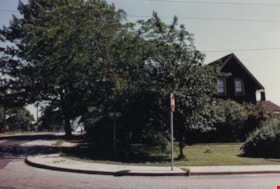
- Photograph of the exterior of the Love farmhouse taken at the corner of Fourteenth Avenue and Cumberland Street. The house is hidden behind large trees at it's orignal address of 7651 Cumberland Street (Address pre 1960: 1390 Cumberland Road). This photograph was taken while Elsie Hughes (nee Love)…
- Repository
- Burnaby Village Museum
- Collection/Fonds
- Love family fonds
- Description Level
- Item
- Physical Description
- 1 photograph : col. ; 10 x 15 cm print
- Material Details
- Copy print was made from re-photographing an original colour slide
- Scope and Content
- Photograph of the exterior of the Love farmhouse taken at the corner of Fourteenth Avenue and Cumberland Street. The house is hidden behind large trees at it's orignal address of 7651 Cumberland Street (Address pre 1960: 1390 Cumberland Road). This photograph was taken while Elsie Hughes (nee Love), her husband John Hughes and son Brent Hughes lived in the house. Elsie is the daughter of Sarah (nee Love) and William Parker. Sarah and William purchased the house in 1928, shortly after the death of Sarah's father, Jesse Love. Sarah and William Parker lived in the house with their three children, Albert, Bill and Elsie. William Parker died in 1961 and Sarah continued to live in the house until 1966 before selling it to her daughter Elsie and son in law John Hughes. Elsie and John lived in the house with their son Brent until 1971.
- Subjects
- Buildings - Heritage
- Geographic Access
- 14th Avenue
- Cumberland Street
- Street Address
- 7651 Cumberland Street
- Accession Code
- BV019.3.5
- Access Restriction
- No restrictions
- Reproduction Restriction
- No known restrictions
- Date
- [between 1966 and 1970]
- Media Type
- Photograph
- Historic Neighbourhood
- East Burnaby (Historic Neighbourhood)
- Planning Study Area
- Cariboo-Armstrong Area
- Scan Resolution
- 600
- Scan Date
- 31-Jan-2019
- Scale
- 96
- Photographer
- Parker, Albert "Bert"
- Notes
- Title based on contents of photograph
- See also BV992.15.12
Images
Corner view of Love farmhouse
https://search.heritageburnaby.ca/link/museumdescription9920
- Repository
- Burnaby Village Museum
- Date
- [between 1966 and 1970]
- Collection/Fonds
- Love family fonds
- Description Level
- Item
- Physical Description
- 1 photograph : col. ; 10 x 15 cm print
- Scope and Content
- Photograph of the exterior of the Love farmhouse taken at the corner of Fourteenth Avenue and Cumberland Street. The north side of the house and kitchen are in view with large trees covering the front of the house at it's orignal address of 7651 Cumberland Street (Address pre 1960: 1390 Cumberland …
- Repository
- Burnaby Village Museum
- Collection/Fonds
- Love family fonds
- Description Level
- Item
- Physical Description
- 1 photograph : col. ; 10 x 15 cm print
- Material Details
- Copy print was made from re-photographing an original colour slide
- Scope and Content
- Photograph of the exterior of the Love farmhouse taken at the corner of Fourteenth Avenue and Cumberland Street. The north side of the house and kitchen are in view with large trees covering the front of the house at it's orignal address of 7651 Cumberland Street (Address pre 1960: 1390 Cumberland Road). This photograph was taken while Elsie Hughes (nee Love), her husband John Hughes and son Brent Hughes lived in the house. Elsie is the daughter of Sarah (nee Love) and William Parker. Sarah and William purchased the house in 1928, shortly after the death of Sarah's father, Jesse Love. Sarah and William Parker lived in the house with their three children, Albert, Bill and Elsie. William Parker died in 1961 and Sarah continued to live in the house until 1966 before selling it to her daughter Elsie and son in law John Hughes. Elsie and John lived in the house with their son Brent until 1971.
- Subjects
- Buildings - Heritage
- Geographic Access
- 14th Avenue
- Cumberland Street
- Street Address
- 7651 Cumberland Street
- Accession Code
- BV019.3.6
- Access Restriction
- No restrictions
- Reproduction Restriction
- No known restrictions
- Date
- [between 1966 and 1970]
- Media Type
- Photograph
- Historic Neighbourhood
- East Burnaby (Historic Neighbourhood)
- Planning Study Area
- Cariboo-Armstrong Area
- Scan Resolution
- 600
- Scan Date
- 31-Jan-2019
- Scale
- 96
- Photographer
- Parker, Albert "Bert"
- Notes
- Title based on contents of photograph
- See also BV992.15.12
Images
Barnet School site
https://search.heritageburnaby.ca/link/museumdescription11140
- Repository
- Burnaby Village Museum
- Date
- May 27, 1915
- Collection/Fonds
- Ronald G. Scobbie collection
- Description Level
- Item
- Physical Description
- 1 survey plan : blueprint on paper ; 56 x 54 cm
- Scope and Content
- Survey plan of "Barnet School Site / Burnaby Municipality" "Being a portion of the west half of lot / 214, Group 1 / New Westminster District”.
- Repository
- Burnaby Village Museum
- Collection/Fonds
- Ronald G. Scobbie collection
- Description Level
- Item
- Physical Description
- 1 survey plan : blueprint on paper ; 56 x 54 cm
- Material Details
- Scale 40 feet = 1 inch
- Scope and Content
- Survey plan of "Barnet School Site / Burnaby Municipality" "Being a portion of the west half of lot / 214, Group 1 / New Westminster District”.
- Creator
- McGugan, Donald Johnston
- Subjects
- Buildings - Schools
- Names
- Barnet School
- Responsibility
- Burnett & McGugan, Engineers and Surveyors
- Geographic Access
- Barnet Road
- Street Address
- 7820 Barnet Road
- Accession Code
- BV003.83.19
- Access Restriction
- No restrictions
- Reproduction Restriction
- No known restrictions
- Date
- May 27, 1915
- Media Type
- Cartographic Material
- Historic Neighbourhood
- Barnet (Historic Neighbourhood)
- Planning Study Area
- Burnaby Mountain Area
- Scan Resolution
- 440
- Scan Date
- 22-Dec-2020
- Scale
- 100
- Notes
- Title based on contents of plan
- handwritten on back "Burnaby Schools" "23R" twice, "1783"
- Oath on plan reads: "I, D.J. McGugan...and did personally superintend the survey..." "completed on the 27th day of May 1915"; signed by D.J. McGugan, notarized by "Walter Edmonds" "sworn "...29th day of May 1915" "Burnett and McGugan" "B.C. Land Surveyors Etc. New Westminster, B.C.";
Zoomable Images
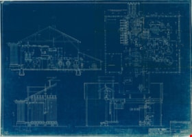
Nichols Chemical Co. Ltd. - D.D. Coolers Scrubbers and Settling Tanks with Pumps
https://search.heritageburnaby.ca/link/museumdescription11394
- Repository
- Burnaby Village Museum
- Date
- [1928]
- Collection/Fonds
- Nichols Chemical Company fonds
- Description Level
- Item
- Physical Description
- 1 technical drawing : blueprint ; 75.5 x 105 cm
- Scope and Content
- Item consists of technical drawing "D.D. Coolers Scrubbers and Settling Tanks with Pumps", "Nichols Chemical Co. LTD."; "Drawing No. 6314".
- Repository
- Burnaby Village Museum
- Collection/Fonds
- Nichols Chemical Company fonds
- Description Level
- Item
- Physical Description
- 1 technical drawing : blueprint ; 75.5 x 105 cm
- Material Details
- Scale 1:.25
- Scope and Content
- Item consists of technical drawing "D.D. Coolers Scrubbers and Settling Tanks with Pumps", "Nichols Chemical Co. LTD."; "Drawing No. 6314".
- Subjects
- Buildings - Industrial - Factories
- Responsibility
- General Chemical Company
- Geographic Access
- Barnet Road
- Street Address
- 8655 Barnet Road
- Accession Code
- BV998.23.16
- Access Restriction
- No restrictions
- Reproduction Restriction
- No known restrictions
- Date
- [1928]
- Media Type
- Technical Drawing
- Historic Neighbourhood
- Barnet (Historic Neighbourhood)
- Planning Study Area
- Burnaby Mountain Area
- Scan Resolution
- 300
- Scan Date
- 2022-05-10
- Notes
- Title based on contents of item
- "Scale 1/4" = 1'
- Stamp in lower left corner reads: "Private Design", "This Property Exclusively of General Chemical Company"
- Stamp on lower right reads: "Jul 12, 1946"
Images
Nichols Chemical Co. Ltd. - Drawing No. 6312
https://search.heritageburnaby.ca/link/museumdescription11388
- Repository
- Burnaby Village Museum
- Date
- [1928]
- Collection/Fonds
- Nichols Chemical Company fonds
- Description Level
- Item
- Physical Description
- 1 technical drawing : blueprint ; 73.5 x 104.5 cm
- Scope and Content
- Item consists of technical "Drawing No. 6312" "Nichols Chemical Co. Ltd.".
- Repository
- Burnaby Village Museum
- Collection/Fonds
- Nichols Chemical Company fonds
- Description Level
- Item
- Physical Description
- 1 technical drawing : blueprint ; 73.5 x 104.5 cm
- Material Details
- Scale 1:.25
- Scope and Content
- Item consists of technical "Drawing No. 6312" "Nichols Chemical Co. Ltd.".
- Subjects
- Buildings - Industrial - Factories
- Responsibility
- General Chemical Company
- Geographic Access
- Barnet Road
- Street Address
- 8655 Barnet Road
- Accession Code
- BV998.23.10
- Access Restriction
- No restrictions
- Reproduction Restriction
- No known restrictions
- Date
- [1928]
- Media Type
- Technical Drawing
- Historic Neighbourhood
- Barnet (Historic Neighbourhood)
- Planning Study Area
- Burnaby Mountain Area
- Scan Resolution
- 300
- Scan Date
- 2022-05-10
- Notes
- Title based on contents of item
- Hand-stamped horizontally is "MAR 12 1946"
- Stamp on back reads: "Private Design", "The Property Exclusively of General Chemical Company"
- "Scale 1/4" = 1'
Images
Nichols Chemical Co. Ltd. - Drawing No. 6318
https://search.heritageburnaby.ca/link/museumdescription11391
- Repository
- Burnaby Village Museum
- Date
- 1917
- Collection/Fonds
- Nichols Chemical Company fonds
- Description Level
- Item
- Physical Description
- 1 technical drawing : blueprint ; 75.5 x 105 cm
- Scope and Content
- Item consists of technical "Drawing No. 6318", Nichols Chemical Company Limited, Barnet Works B.C. Dated March 28, 1917, corrected June 1, 1918.
- Repository
- Burnaby Village Museum
- Collection/Fonds
- Nichols Chemical Company fonds
- Description Level
- Item
- Physical Description
- 1 technical drawing : blueprint ; 75.5 x 105 cm
- Material Details
- Scale 1:.25
- Scope and Content
- Item consists of technical "Drawing No. 6318", Nichols Chemical Company Limited, Barnet Works B.C. Dated March 28, 1917, corrected June 1, 1918.
- Subjects
- Buildings - Industrial - Factories
- Responsibility
- General Chemical Company
- Geographic Access
- Barnet Road
- Street Address
- 8655 Barnet Road
- Accession Code
- BV998.23.13
- Access Restriction
- No restrictions
- Reproduction Restriction
- No known restrictions
- Date
- 1917
- Media Type
- Technical Drawing
- Historic Neighbourhood
- Barnet (Historic Neighbourhood)
- Planning Study Area
- Burnaby Mountain Area
- Scan Resolution
- 300
- Scan Date
- 2022-05-10
- Notes
- Title based on contents of item
- "Scale 1/4" = 1'
- Date stamp: "JUN 27 1946"
Images
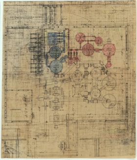
Nichols Chemical Co. Ltd. - Drawing No. 6381
https://search.heritageburnaby.ca/link/museumdescription11395
- Repository
- Burnaby Village Museum
- Date
- 27 Jun. 1946
- Collection/Fonds
- Nichols Chemical Company fonds
- Description Level
- Item
- Physical Description
- 1 technical drawing : blackline print with col. annotations ; 52.5 x 45 cm
- Scope and Content
- Item consists of technical "Drwg 6381" Nichols Chemical Company Limited, with details of equipment installation and dismantling.
- Repository
- Burnaby Village Museum
- Collection/Fonds
- Nichols Chemical Company fonds
- Description Level
- Item
- Physical Description
- 1 technical drawing : blackline print with col. annotations ; 52.5 x 45 cm
- Material Details
- Scale 1:.25
- Scope and Content
- Item consists of technical "Drwg 6381" Nichols Chemical Company Limited, with details of equipment installation and dismantling.
- Subjects
- Buildings - Industrial - Factories
- Responsibility
- General Chemical Company
- Geographic Access
- Barnet Road
- Street Address
- 8655 Barnet Road
- Accession Code
- BV998.23.17
- Access Restriction
- No restrictions
- Reproduction Restriction
- No known restrictions
- Date
- 27 Jun. 1946
- Media Type
- Technical Drawing
- Historic Neighbourhood
- Barnet (Historic Neighbourhood)
- Planning Study Area
- Burnaby Mountain Area
- Scan Resolution
- 300
- Scan Date
- 2022-05-10
- Notes
- Title based on contents of item
- "Scale 1/4" = 1'
- Stamp in lower left corner reads: "Private Design", "This Property Exclusively of General Chemical Company"
- 'Received' stamp on lower right corner, "Jul 9 1946"
Images
Nichols Chemical Co. Ltd. - Drawing No. 50785
https://search.heritageburnaby.ca/link/museumdescription11392
- Repository
- Burnaby Village Museum
- Date
- [1959]
- Collection/Fonds
- Nichols Chemical Company fonds
- Description Level
- Item
- Physical Description
- 1 technical drawing : blueline print ; 87.5 x 111 cm
- Scope and Content
- Item consists of technical drawing identified as No. 50785 with handwritten annotation reading "W.O.M. - 8560". Property Exclusively of General Chemical Company.
- Repository
- Burnaby Village Museum
- Collection/Fonds
- Nichols Chemical Company fonds
- Description Level
- Item
- Physical Description
- 1 technical drawing : blueline print ; 87.5 x 111 cm
- Material Details
- Scale 1:.25
- Scope and Content
- Item consists of technical drawing identified as No. 50785 with handwritten annotation reading "W.O.M. - 8560". Property Exclusively of General Chemical Company.
- Subjects
- Buildings - Industrial - Factories
- Responsibility
- General Chemical Company
- Geographic Access
- Barnet Road
- Street Address
- 8655 Barnet Road
- Accession Code
- BV998.23.14
- Access Restriction
- No restrictions
- Reproduction Restriction
- No known restrictions
- Date
- [1959]
- Media Type
- Technical Drawing
- Historic Neighbourhood
- Barnet (Historic Neighbourhood)
- Planning Study Area
- Burnaby Mountain Area
- Scan Resolution
- 300
- Scan Date
- 2022-05-10
- Notes
- Title based on contents of item
- Stamp on verso reads: "R.L. Johnston"
- "Scale 1/4" = 1'
- Date stampled "Oct. 19 1959"
- Annotation next to date stamp reads: "Dwg Rec'd 10-24-59"
- Stamp at bottom reads: "Property of / General Chemical Division / Allied Chemical & Dye Corporation"
Images
Nichols Chemical Co. Ltd. - Drawing No. 52499
https://search.heritageburnaby.ca/link/museumdescription11390
- Repository
- Burnaby Village Museum
- Date
- 28 Jan. 1947
- Collection/Fonds
- Nichols Chemical Company fonds
- Description Level
- Item
- Physical Description
- 1 technical drawing : blueprint ; 86 x 111 cm
- Scope and Content
- Item consists of technical drawing "Various Plans and Elevations", "Nichols Chemical Company"; drawing "No. 52499".
- Repository
- Burnaby Village Museum
- Collection/Fonds
- Nichols Chemical Company fonds
- Description Level
- Item
- Physical Description
- 1 technical drawing : blueprint ; 86 x 111 cm
- Material Details
- Scale 1:.25
- Scope and Content
- Item consists of technical drawing "Various Plans and Elevations", "Nichols Chemical Company"; drawing "No. 52499".
- Subjects
- Buildings - Industrial - Factories
- Responsibility
- General Chemical Company
- Geographic Access
- Barnet Road
- Street Address
- 8655 Barnet Road
- Accession Code
- BV998.23.12
- Access Restriction
- No restrictions
- Reproduction Restriction
- No known restrictions
- Date
- 28 Jan. 1947
- Media Type
- Technical Drawing
- Historic Neighbourhood
- Barnet (Historic Neighbourhood)
- Planning Study Area
- Burnaby Mountain Area
- Scan Resolution
- 300
- Scan Date
- 2022-05-10
- Notes
- Title based on contents of item
- Stamp on verso reads: "Private Design", "The Property Exclusively of General Chemical Company"; in upper left corner is red circular 'Received' stamp, dated Feb (?) 1947
- "Scale 1/4" = 1'
- "DRAWN_LEIBRICK / CHECKED_L.C.PRAY"
Images
Nichols Chemical Co. Ltd. - Drawing No. 511726
https://search.heritageburnaby.ca/link/museumdescription11393
- Repository
- Burnaby Village Museum
- Date
- 26 Jan. 1962
- Collection/Fonds
- Nichols Chemical Company fonds
- Description Level
- Item
- Physical Description
- 1 technical drawing : blueline print ; 87.5 x 111 cm
- Scope and Content
- Item consists of technical drawing titled "Assy. Det. No. 3 Ore Burner", "No. 511726" of Nichol's Chemical Plant. Includes "Parts Lists" index.
- Repository
- Burnaby Village Museum
- Collection/Fonds
- Nichols Chemical Company fonds
- Description Level
- Item
- Physical Description
- 1 technical drawing : blueline print ; 87.5 x 111 cm
- Material Details
- Scale 1:.25
- Scope and Content
- Item consists of technical drawing titled "Assy. Det. No. 3 Ore Burner", "No. 511726" of Nichol's Chemical Plant. Includes "Parts Lists" index.
- Subjects
- Buildings - Industrial - Factories
- Responsibility
- General Chemical Company
- Geographic Access
- Barnet Road
- Street Address
- 8655 Barnet Road
- Accession Code
- BV998.23.15
- Access Restriction
- No restrictions
- Reproduction Restriction
- No known restrictions
- Date
- 26 Jan. 1962
- Media Type
- Technical Drawing
- Historic Neighbourhood
- Barnet (Historic Neighbourhood)
- Planning Study Area
- Burnaby Mountain Area
- Scan Resolution
- 300
- Scan Date
- 2022-05-10
- Notes
- Title based on contents of item
- "Scale 1/4" = 1'
- Stamped with Print Date: "Jan 26 1962"
Images
Nichols Chemical Co. Ltd. - Sulphide Works
https://search.heritageburnaby.ca/link/museumdescription11387
- Repository
- Burnaby Village Museum
- Date
- 8 Sep. 1906
- Collection/Fonds
- Nichols Chemical Company fonds
- Description Level
- Item
- Physical Description
- 1 technical drawing : blueprint ; 75.5 x 102 cm
- Scope and Content
- Item consists of a technical drawing of "Nichols Chemical Co. of Can. Ltd. Sulphide Works". Index No. 450 Sheet V.
- Repository
- Burnaby Village Museum
- Collection/Fonds
- Nichols Chemical Company fonds
- Description Level
- Item
- Physical Description
- 1 technical drawing : blueprint ; 75.5 x 102 cm
- Material Details
- Scale 1:.25
- Scope and Content
- Item consists of a technical drawing of "Nichols Chemical Co. of Can. Ltd. Sulphide Works". Index No. 450 Sheet V.
- Subjects
- Buildings - Industrial - Factories
- Geographic Access
- Barnet Road
- Street Address
- 8655 Barnet Road
- Accession Code
- BV998.23.9
- Access Restriction
- No restrictions
- Reproduction Restriction
- No known restrictions
- Date
- 8 Sep. 1906
- Media Type
- Technical Drawing
- Historic Neighbourhood
- Barnet (Historic Neighbourhood)
- Planning Study Area
- Burnaby Mountain Area
- Notes
- Title based on contents of item
- "Scale 1/4" = 1'
Nichols Chemical Co. Ltd. - Sulphide Works
https://search.heritageburnaby.ca/link/museumdescription11389
- Repository
- Burnaby Village Museum
- Date
- 14 Sep. 1906
- Collection/Fonds
- Nichols Chemical Company fonds
- Description Level
- Item
- Physical Description
- 1 technical drawing : blueprint ; 75 x 68 cm
- Scope and Content
- Item consists of a technical drawing of "Nichols Chemical Co. of Can. Ltd. Sulphide Works". Index No. 450 Sheet V.
- Repository
- Burnaby Village Museum
- Collection/Fonds
- Nichols Chemical Company fonds
- Description Level
- Item
- Physical Description
- 1 technical drawing : blueprint ; 75 x 68 cm
- Material Details
- Scale 1:.25
- Scope and Content
- Item consists of a technical drawing of "Nichols Chemical Co. of Can. Ltd. Sulphide Works". Index No. 450 Sheet V.
- Subjects
- Buildings - Industrial - Factories
- Responsibility
- General Chemical Company
- Geographic Access
- Barnet Road
- Street Address
- 8655 Barnet Road
- Accession Code
- BV998.23.11
- Access Restriction
- No restrictions
- Reproduction Restriction
- No known restrictions
- Date
- 14 Sep. 1906
- Media Type
- Technical Drawing
- Historic Neighbourhood
- Barnet (Historic Neighbourhood)
- Planning Study Area
- Burnaby Mountain Area
- Scan Resolution
- 300
- Scan Date
- 2022-05-10
- Notes
- Title based on contents of item
- "Scale 1/4" = 1'
- "Note: Where possible lead pipe..."; in lower right corner, in box, "Index No. 450 Sheet V", "Sulphide Works 9 - 14 - 06";
![Corner view of Love farmhouse, [between 1966 and 1970] thumbnail](/media/hpo/_Data/_BVM_Images/2019/2019_0003_0005_001.jpg?width=280)
![Corner view of Love farmhouse, [between 1966 and 1970] thumbnail](/media/hpo/_Data/_BVM_Images/2019/2019_0003_0006_001.jpg?width=280)


![Nichols Chemical Co. Ltd. - D.D. Coolers Scrubbers and Settling Tanks with Pumps, [1928] thumbnail](/media/hpo/_Data/_BVM_Technical_Drawings/1998_0023_0016_002.jpg?width=280)
![Nichols Chemical Co. Ltd. - Drawing No. 6312, [1928] thumbnail](/media/hpo/_Data/_BVM_Technical_Drawings/1998_0023_0010_002.jpg?width=280)
![Nichols Chemical Co. Ltd. - Drawing No. 50785, [1959] thumbnail](/media/hpo/_Data/_BVM_Technical_Drawings/1998_0023_0014_002.jpg?width=280)
