Narrow Results By
Creator
- British Columbia Underwriters' Association 8
- Burnett, Geoffrey K. 1
- Donald R. Erb and Associates Architects 5
- Draper, William Nelson 1
- Garden, Hermon and Burwell 2
- Garden, Hermon & Burwell 1
- Gauvreau, Narcisse B. 1
- Government of Canada - Department of Mines - Geological Survey Branch 1
- Hill, Albert James 16
- Hill & Burnett 1
- Hopping Kovach Grinnell Design Consultants Limited 4
- Justice, Webb and Vincent Landscape Architects 1
Person / Organization
- British Columbia Electric Railway Company 1
- Brownlee, James Harrison 1
- Burnaby Advisory Planning Commission 1
- Burnaby Village Museum 12
- Choate, Bessie Perley 1
- Corsbie, Joseph Hardcastle-Cumberland "Joe" 1
- Grace, W. 1
- Great Northern Railway 1
- Hall, James Edward 1
- Hall, Joseph 1
- Harrison, John 1
- Hill, Louis Claude "Claude" 1
Survey and Subdivision plans in New Westminster District Group 2 - Surrey, ʷməθkʷəy̓əm (Musqueam) Indian Reserve
https://search.heritageburnaby.ca/link/museumdescription7062
- Repository
- Burnaby Village Museum
- Date
- [190-]
- Collection/Fonds
- Burnaby Village Museum Map collection
- Description Level
- File
- Physical Description
- 10 plans : blueprints on paper ; various sizes mounted on 2 sides of cardboard 76 x 102 cm
- Scope and Content
- File consists of a large board with ten plans (5 plans mounted on each side). All plans are located in New Westminster District, Group 2, covering geographic areas within Surrey. Side A: 1. Plan : blueprint on paper ; 57 x 33 cm. Title reads: "Plan / of the Subdivision of / Block 23 / in / Sec. 3…
- Repository
- Burnaby Village Museum
- Collection/Fonds
- Burnaby Village Museum Map collection
- Description Level
- File
- Physical Description
- 10 plans : blueprints on paper ; various sizes mounted on 2 sides of cardboard 76 x 102 cm
- Material Details
- Scales vary (One chain equals 792 inches)
- Indexed number on tape on edge of board reads "93"
- Scope and Content
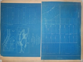
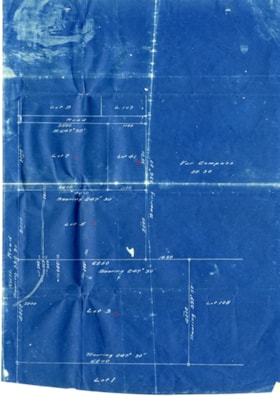
- File consists of a large board with ten plans (5 plans mounted on each side). All plans are located in New Westminster District, Group 2, covering geographic areas within Surrey. Side A: 1. Plan : blueprint on paper ; 57 x 33 cm. Title reads: "Plan / of the Subdivision of / Block 23 / in / Sec. 31 B5N R2W / N.W. Dist." Located in New Westminster District Group 2. Scale; 40 feet = 1 inch. Signed by Albert J. Hill, Provincial Land Surveyor. Subdivision plan covers land in Block 23 of Section 31 (New Westminster District, Group 2) south of Albert Street, north of Surrey Street and west of Fourth Avenue. (Geographic location: Surrey) 2. Plan : blueprint on paper ; 38.5 59.5 cm. Title reads: "Plan / of ʷməθkʷəy̓əm (Musqueam) Indian Reserve / And / Right-of-Way / for / Bridge Approach". Scale: 100 feet = 1 inch. Signed by Albert J. Hill, Provincial Land Surveyor, June 28, 1902. Plan covers the location of the ʷməθkʷəy̓əm (Musqueam) Indian Reserve in New Westminster District, Group 2, Lot 1 on the south shore of the Fraser River situated between lots owned by Herring (Lot B) and F. Clarke. Plan includes locations of buildings on F. Clarke's property and also includes the location of Roman Catholic Church located on ʷməθkʷəy̓əm (Musqueam) Indian Reserve. (Geographic location: Surrey) 3. Plan : blueprint on paper ; 26 x 35.5 cm. Title reads: "Section 35_B.5N._R.2W". Plan covers areas of land in Section 35 bordered by Section 36 and Section 26 in New Westminster District Group 2 (plan appears to be reversed with Section 26 to the north and Section 35 to the south). Yale Wagon Road is identified running through Section 35. 4. Plan : blueprint on paper ; 21 x 37.5 cm. Title reads: "Traverse of the Water Line / in front of / Lots 3 and 4 Group 2 / N.W.D. / with G.N. Railway Rt. of Way". Scale: 100 feet = 1 inch. Signed by Albert J. Hill, B.C. Land Surveyor. Plan covers the location of the water line with the Great Northern Railway Right of Way within New Westminster District, Group 2, Lots 3 and 4 on the south shore of the Fraser River. (Geographic location: Surrey) 5. Plan : blueprint on paper ; 75 x 52.5 cm. Title reads: "Plan / of Block 7 and 8 / of the / 5 W.1/4 Sec.6, TWP. 7 / N.W.D.". Scale: 1/12 chains = 1 inch. Annotation in red crayon reads "see Boards 85 & 207".Signed by Albert J. Hill, B.C. Land Surveyor. The plan is bordered by "O'Connell Street" to the north, "Columbia Avenue" to the west, "Westland Row" to the east and the International Boundary to the south. (Geographic location: Surrey) Side B: 1. Plan : blueprint on paper ; 60 x 39.5 cm. Title reads: "Plan / of Subdivision 'B' / of Section 20 / B5N R2W / New Westminster Distr." Scale: 2 chains = 1 inch. Signed by Albert J. Hill, B.C. Land Surveyor. Plan covers subdivision "B" in Section 20, New Westminster District, Group 2. (Geographic location: Surrey) 2. Plan : blueprint on paper ; 42 x 29.5 cm. Title reads: "Section 32, / Township 8, / New Westminster District". Scale 10 chains = 1 inch. Lot owners are identified as; Childs, Thompson, Gordon and Layfield bordered by Clover Valley Road to the west and Hall's Prairie Road to the east and Township Line Road and Lot 121 and Lot 99 to the north. Note in blue crayon reads: "also Board 80" (Geographic location: Surrey) 3. Plan : blueprint on paper ; 18 x 21 cm. Title reads: "N.E.1/4 Sec.21 / TP1". Ceritified by Albert J. Hill, B.C. Land Surveyor. Includes property identified as "Mr. Feedham". (Geographic location: Surrey) 4. Plan : blueprint on paper ; 27 x 19 cm. Title in blue crayon reads: "Sec 25 B5N. R3W / also see Board 91". Scale: 4 chaines = 1 inch. Signed by Albert J. Hill, B.C. Land Surveyor. Survey area includes land north of the intersection of Ladner Road and Scott Road. (Geographic location: Surrey) 5. Plan : blueprint on paper ; 53 x 34 cm. Title reads: "Plan of Subdivision / of / Section 27, / Block 5 North, Range 2 West, / New Westminster District". Scale: 4 chains - 1 inch. Signed by Albert J. Hill, Provincial Land Surveyor, [August 13, 1900]. Property in Section 27 bordered by Hjorth Road to the north, Quible Road to the east and Yale Road to the south. (Geographic location: Surrey)
- Creator
- Hill, Albert James
- Names
- ʷməθkʷəy̓əm (Musqueam)
- Accession Code
- HV977.93.93
- Access Restriction
- No restrictions
- Reproduction Restriction
- No known restrictions
- Date
- [190-]
- Media Type
- Cartographic Material
- Scan Resolution
- 600
- Scan Date
- 2023-06-26
- Notes
- Title based on contents of file
Zoomable Images
![Survey and Subdivision plans in New Westminster District Group 2 - Surrey, ʷməθkʷəy̓əm (Musqueam) Indian Reserve, [190-] thumbnail](/media/hpo/_Data/_BVM_Cartographic_Material/1977/1977_0093_0093_003_seadragon/1977_0093_0093_003.jpg?w=280)
Survey and Subdivision plans in New Westminster District Group 2 - Surrey, ʷməθkʷəy̓əm (Musqueam) Indian Reserve, [190-]
Zoom into ImageSurvey and Subdivision plans in New Westminster District, Group 2 - Surrey, ʷməθkʷəy̓əm (Musqueam) Indian Reserve
https://search.heritageburnaby.ca/link/museumdescription7068
- Repository
- Burnaby Village Museum
- Date
- [190-]
- Collection/Fonds
- Burnaby Village Museum Map collection
- Description Level
- File
- Physical Description
- 11 plans : graphite and ink on paper and linen + blueprint ; various sizes mounted on 2 sides of cardboard 76 x 102 cm
- Scope and Content
- File consists of a large board with eleven plans in New Westminster District (Group 2) mounted on one side and five plans in New Westminster District (Group 2) mounted on the other side. Side A: 1. Plan : black ink on linen ; 19.5 x 32 cm. Title reads: "Yale Road / Sec.9 & 10 / B5N R2W" (in blue …
- Repository
- Burnaby Village Museum
- Collection/Fonds
- Burnaby Village Museum Map collection
- Description Level
- File
- Physical Description
- 11 plans : graphite and ink on paper and linen + blueprint ; various sizes mounted on 2 sides of cardboard 76 x 102 cm
- Material Details
- Scales vary (One chain equals 792 inches)
- Indexed number on tape on edge of board reads "99"
- Scope and Content
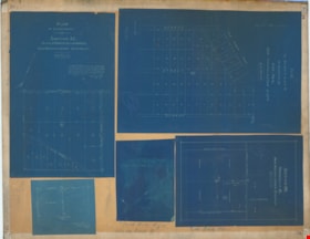
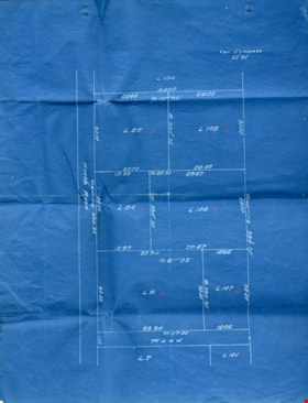
- File consists of a large board with eleven plans in New Westminster District (Group 2) mounted on one side and five plans in New Westminster District (Group 2) mounted on the other side. Side A: 1. Plan : black ink on linen ; 19.5 x 32 cm. Title reads: "Yale Road / Sec.9 & 10 / B5N R2W" (in blue crayon). Scale: 400 chains = 1 inch. Initals in blue crayon: "RB". Survey plan of Yale Road running through Sections 9 and 10 in New Westminster District, Group 2. (Geographic location: Surrey) 2. Plan : blueprint on paper ; 35.5 x 77.5 cm. Title reads: "Victoria Terminal Railway & Ferry Co. / Plan showing / Proposed Change of Wagon Road through White Rock, B.C" Scale: 400 feet = 1 inch. "H.C. Brice / Engineer in charge / New Westminster, B.C.". February 1906. Signed by "Walter Wilkie B.C.L.S.". Annotation in blue crayon reads: "Sub. of Parts of Sec. 10 & 11 / Tp. 1". Semiahmoo Indian Reserve, Washington Ave., Feb. 1906; 2. Yale Road, Sec.9, 10, B5N R2W, River Rd.; (Geographic location: White Rock) 3. Plan : graphite on paper ; 34 x 94 cm. Title reads: "Tp 7 / NW District" (in graphite) and "Campbell River / in Twp. 7" (in blue crayon). TP7, New Westminster District, Campbell R. in TP4, Coast Meridian, Bamford; (Geographic location: Surrey) Side B: 1. Plan : black ink and col. ink on paper ; 28 x 38.5 cm. Title reads: "G.N.R. / South approach to Wests bridge" (in blue crayon). Scale: 2 chains = 1 inch. Signed by Albert J. Hill, B.C.L.S. Plan covers land in Lot 2, Group 2 and ʷməθkʷəy̓əm (Musqueam) Indian Reserve with approach to bridge running through. (Geographic location: Surrey) 2. Plan : black ink and col. ink on paper ; 26.5 x 44.5 cm. Title reads: "Plan / of / River Frontage / across / Lot 1 BI.N.R.2W. and Lot 6, B.I.N.R.I.W. / N.W.D." Scale: 6 chains = 1 inch. Stamp in red ink reads: "Albert J. Hill, M.A., / Civil Engineer / and / Provincial Land Surveyor, / New Westminster, / B.C." (Geographic location: Surrey) 3. Plan : graphite and ink on paper ; 27 x 44.5 cm. (no formal title) Plan covers area between Yale Road, (north), Quible Road (west) and Townline Road (south). Scale: 4 chains = 1 inch. Signed by Albert J. Hill, B.C.L.S. Annotations in blue crayon read: "also Board 83 / Cancelled" (Geographic location: Surrey) 4. Plan : graphite on paper ; 35.5 x 21.5 cm. Title reads: "Sec 33 B.5N. R2W / see finished drawing Board 125". Initials in blue crayon "RB". Plan certifified by B.C. Provincial Land Surveyor in blue ink "Albert J. Hill". 5. Plan : black ink and col. ink on linen ; 15.5 x 22 cm. Title reads: " Lot 167 Gr. 2" (blue crayon). Scale: 200 feet = 1 inch. Signed by Albert J. Hill, Provincial Land Surveyor. Survey of aarea north of Cloverdale & Guichon Railway with area identified as "Gravel Pit". "Cancelled" in upper left corner of plan. (Geographic location: Surrey) 6. Plan : graphite on paper ; 27 x 27.5 cm. Title reads: "South Half / of / S.W.1/4 Sec.31 TP7 / N.W.D.". Scale: 5 chains = 1 inch. Other title at top of plan reads; "Edward Parr [sic] / Cloverdale". Covers area east of Coast Meridian Road in Section 36. (Geographic location: Surrey) 7. Plan : graphite on paper ; 20.5 x 16 cm. Title reads: "Survey of [sic] Sec. 16, Tp 1[sic] / ..." Other title in blue crayon reads: "N.E. 1/4 Sec. 16 / Twp. 1". (Geographic location: Surrey) 8. Plan : graphite on paper. ; 26.5 x 35 cm. (title is illegible) Plan covers are in New Westminster District, Group 2 along the south shore of the Fraser River. (Geographic location: Surrey)
- Creator
- Hill, Albert James
- Accession Code
- HV977.93.99
- Access Restriction
- No restrictions
- Reproduction Restriction
- No known restrictions
- Date
- [190-]
- Media Type
- Cartographic Material
- Scan Resolution
- 600
- Scan Date
- 2023-06-26
- Notes
- Title based on contents of file
Zoomable Images
![Survey and Subdivision plans in New Westminster District, Group 2 - Surrey, ʷməθkʷəy̓əm (Musqueam) Indian Reserve, [190-] thumbnail](/media/hpo/_Data/_BVM_Cartographic_Material/1977/1977_0093_0099_003_seadragon/1977_0093_0099_003.jpg?w=280)
Survey and Subdivision plans in New Westminster District, Group 2 - Surrey, ʷməθkʷəy̓əm (Musqueam) Indian Reserve, [190-]
Zoom into ImageSurvey maps - Sundries
https://search.heritageburnaby.ca/link/archivedescription664
- Repository
- City of Burnaby Archives
- Date
- 1902-1910
- Collection/Fonds
- City Council and Office of the City Clerk fonds
- Description Level
- File
- Physical Description
- Textual record and cartographic material
- Scope and Content
- File contains various maps - 1 ink on paper and 5 linen plans by Albert J. Hill as well as survey descriptions (textual).
- Repository
- City of Burnaby Archives
- Date
- 1902-1910
- Collection/Fonds
- City Council and Office of the City Clerk fonds
- Physical Description
- Textual record and cartographic material
- Description Level
- File
- Record No.
- 2389
- Accession Number
- 2001-02
- Scope and Content
- File contains various maps - 1 ink on paper and 5 linen plans by Albert J. Hill as well as survey descriptions (textual).
- Media Type
- Textual Record
- Cartographic Material
- Notes
- Plans/maps are located in file and have not been moved to map case.
Survey plans along North Road
https://search.heritageburnaby.ca/link/museumdescription11141
- Repository
- Burnaby Village Museum
- Date
- [1911]
- Collection/Fonds
- Ronald G. Scobbie collection
- Description Level
- File
- Physical Description
- 1 survey plan : ink on waxed linen ; 28.5 x 18 cm + 4 survey plans : blueprints ; 28 x 24 cm and smaller
- Scope and Content
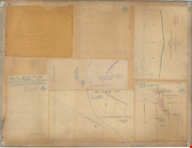
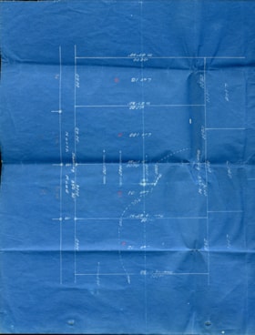
- File consists of four survey plans of District Lots on the east side of North Road, New Westminster Dist / Group 1 and one survey plan including District Lots on the west side of North Road in New Westminster District Group 1.
- Repository
- Burnaby Village Museum
- Collection/Fonds
- Ronald G. Scobbie collection
- Description Level
- File
- Physical Description
- 1 survey plan : ink on waxed linen ; 28.5 x 18 cm + 4 survey plans : blueprints ; 28 x 24 cm and smaller
- Scope and Content
- File consists of four survey plans of District Lots on the east side of North Road, New Westminster Dist / Group 1 and one survey plan including District Lots on the west side of North Road in New Westminster District Group 1.
- Geographic Access
- North Road
- Accession Code
- BV003.83.20
- Access Restriction
- No restrictions
- Reproduction Restriction
- No known restrictions
- Date
- [1911]
- Media Type
- Cartographic Material
- Scan Resolution
- 600
- Scan Date
- 24-Nov-2020
- Scale
- 100
- Notes
- Title based on contents of maps
- Note in black ink on verso of maps reads:"000233"
Images
Survey plans in New Westminster District Group 1 - Maple Ridge, Pitt Meadows
https://search.heritageburnaby.ca/link/museumdescription7074
- Repository
- Burnaby Village Museum
- Date
- [190-]
- Collection/Fonds
- Burnaby Village Museum Map collection
- Description Level
- File
- Physical Description
- 6 plans : graphite and ink on paper and linen; various sizes mounted on 2 sides of cardboard 76 x 102 cm
- Scope and Content
- File consists of a large board with three plans mounted on one side and two on the other side. All plans are located in New Westminster District, Group 2, covering geographic areas within Maple Ridge and Pitt Meadows. Side A: 1. Plan : black ink on linen ; 34 x 86 cm. Title reads: "Survey / of / …
- Repository
- Burnaby Village Museum
- Collection/Fonds
- Burnaby Village Museum Map collection
- Description Level
- File
- Physical Description
- 6 plans : graphite and ink on paper and linen; various sizes mounted on 2 sides of cardboard 76 x 102 cm
- Material Details
- Scales vary (One chain equals 792 inches)
- Indexed number on tape on edge of board reads "105"
- Scope and Content
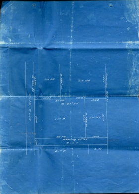
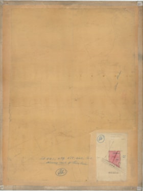
- File consists of a large board with three plans mounted on one side and two on the other side. All plans are located in New Westminster District, Group 2, covering geographic areas within Maple Ridge and Pitt Meadows. Side A: 1. Plan : black ink on linen ; 34 x 86 cm. Title reads: "Survey / of / Dyke and Waterfront / Sec's 9, 10, 11, 13 & 14 / B5N R1E". Scale: 400 feet = 1 inch. Stamp in red ink on plan reads: "Albert J. Hill, M.A., / Civil Engineer / And / Provincial Land Surveyor, / New Westminster, / B.C." (Geographic location: Pitt Meadows) 2. 2 plans : black ink and graphite on paper ; 34.5 x 51 cm. Titles read: "Survey / For Highway / in / Section 4, Township 15, / New Westminster District. / For Maple Ridge Council." and "Survey / for Highway / in / Section 5, Tp. 15, / New Westminster Dist. / For Maple Ridge Council." Survey plan in Section 5, Township 15, covers SW quarter of Sec. 5, Tp. 15 with "Indian Reserve" (Whonnock Indian Reserve No. 1 - Kwantlen First Nation) identified. Stamp in red ink on plan reads: "Albert J. Hill, M.A., / Civil Engineer / And / Provincial Land Surveyor, / New Westminster, / B.C." Scales vary per drawing: 4 chains = 1 inch and 2 chains = 1 inch. (Geographic location: Maple Ridge) 3. Plan, black ink and graphite on paper ; 41 x 34 cm. Title reads: "Plan / of Subdivision / of / Fractional S.E. Quarter / of Sec. 6, TP. 15 / New Westminster District". Scale: 4 chains = 1 inch tamp in red ink on plan reads: "Albert J. Hill, M.A., / Civil Engineer / And / Provincial Land Surveyor, / New Westminster, / B.C." . Annotation in blue crayon reads: "also Board 122. (Geographic location: Maple Ridge) Side B: 1. Plan : black ink and col. red ink on linen ; 25.5 x 16 cm. Title reads: "Plan of Survey in Lot 398 Gr. 1 / For Lougheed & Abernathy". Scale: 3 chains = 1 inch. Plan is signed by "G.K. Burnett" September 25, 1907. (Geographic location: Maple Ridge) 2. Plan : graphite on paper with annotations in blue ; 91 x 67 cm. Title on survey plan reads: "Lot 441, 439, 438, 440, Gr. 1 / Showing bank of Stave River" (in blue crayon). Survey plan includes lot numbers and identifies "Indian Reserve" (Whonnock Indian Reserve No. 1 - Kwantlen First Nation) (Geographic location: Maple Ridge)
- Accession Code
- HV977.93.105
- Access Restriction
- No restrictions
- Reproduction Restriction
- No known restrictions
- Date
- [190-]
- Media Type
- Cartographic Material
- Scan Resolution
- 600
- Scan Date
- 2023-06-26
- Notes
- Title based on contents of file
Zoomable Images
![Survey plans in New Westminster District Group 1 - Maple Ridge, Pitt Meadows, [190-] thumbnail](/media/hpo/_Data/_BVM_Cartographic_Material/1977/1977_0093_0105_003_seadragon/1977_0093_0105_003.jpg?w=280)
Survey plans in New Westminster District Group 1 - Maple Ridge, Pitt Meadows, [190-]
Zoom into ImageTank Site - Central Park
https://search.heritageburnaby.ca/link/archivedescription577
- Repository
- City of Burnaby Archives
- Date
- 1911-1912
- Collection/Fonds
- City Council and Office of the City Clerk fonds
- Description Level
- File
- Physical Description
- Textual record and cartographic material
- Scope and Content
- File contains agreement and correspondence between the Corporation of the District of Burnaby and the Central Park Agricultural Association and Farmers Institute regarding the water tank site. File also contains 3 blueprint plans of the tank site.
- Repository
- City of Burnaby Archives
- Date
- 1911-1912
- Collection/Fonds
- City Council and Office of the City Clerk fonds
- Physical Description
- Textual record and cartographic material
- Description Level
- File
- Record No.
- 2287
- Accession Number
- 2001-02
- Scope and Content
- File contains agreement and correspondence between the Corporation of the District of Burnaby and the Central Park Agricultural Association and Farmers Institute regarding the water tank site. File also contains 3 blueprint plans of the tank site.
- Media Type
- Textual Record
- Cartographic Material
- Notes
- A plan of site for water tank in Central Park : M9-B-3-6
Tram Shelter - Edmonds & Kingsway, Burnaby
https://search.heritageburnaby.ca/link/museumdescription11775
- Repository
- Burnaby Village Museum
- Date
- Dec. 19, 1962
- Collection/Fonds
- Burnaby Centennial '71 Committee collection
- Description Level
- File
- Physical Description
- 2 architectural drawings : blueline prints ; 56 x 87 cm
- Scope and Content
- File consists of architectural plans for a Tram Shelter at Edmonds and Kingsway in Burnaby including "Plan and Details" and "Elevations and Details".
- Repository
- Burnaby Village Museum
- Collection/Fonds
- Burnaby Centennial '71 Committee collection
- Description Level
- File
- Physical Description
- 2 architectural drawings : blueline prints ; 56 x 87 cm
- Material Details
- Scales as noted
- Scope and Content
- File consists of architectural plans for a Tram Shelter at Edmonds and Kingsway in Burnaby including "Plan and Details" and "Elevations and Details".
- Names
- Burnaby Village Museum
- Accession Code
- BV019.52.111
- Access Restriction
- No restrictions
- Reproduction Restriction
- May be restricted by third party rights
- Date
- Dec. 19, 1962
- Media Type
- Architectural Drawing
- Notes
- Title based on contents of drawing
Various copies of plans
https://search.heritageburnaby.ca/link/archivedescription1746
- Repository
- City of Burnaby Archives
- Date
- [1959]-1978
- Collection/Fonds
- City Council and Office of the City Clerk fonds
- Description Level
- File
- Physical Description
- Cartographic material
- Scope and Content
- File contains 8 copies of plans, ca. 1959 to 1978.
- Repository
- City of Burnaby Archives
- Date
- [1959]-1978
- Collection/Fonds
- City Council and Office of the City Clerk fonds
- Physical Description
- Cartographic material
- Description Level
- File
- Record No.
- 3567
- Accession Number
- 2001-02
- Scope and Content
- File contains 8 copies of plans, ca. 1959 to 1978.
- Media Type
- Cartographic Material
- Notes
- Plans/maps are located in file and have not been moved to map case.
vey and Subdivision plans in New Westminster District Group 1 – Burnaby
https://search.heritageburnaby.ca/link/museumdescription6976
- Repository
- Burnaby Village Museum
- Date
- [1900-1910]
- Collection/Fonds
- Burnaby Village Museum Map collection
- Description Level
- File
- Physical Description
- 4 plans : blueprints on paper mounted on 2 sides of cardboard 76 x 102 cm
- Scope and Content
- Item consists of a large board of two New Westminster District plans mounted on one side and two New Westminster District subdivision plans mounted on the other side. Side A: 1. Blueprint "Plan / of Subdivision / of a portion / of / Lot 96 / Group One / New Westminster District / Scale 2 chs = …
- Repository
- Burnaby Village Museum
- Collection/Fonds
- Burnaby Village Museum Map collection
- Description Level
- File
- Physical Description
- 4 plans : blueprints on paper mounted on 2 sides of cardboard 76 x 102 cm
- Material Details
- Scales [between 1:120 and 1:1584]
- Index number on edge of board reads: "7"
- Scope and Content
- Item consists of a large board of two New Westminster District plans mounted on one side and two New Westminster District subdivision plans mounted on the other side. Side A: 1. Blueprint "Plan / of Subdivision / of a portion / of / Lot 96 / Group One / New Westminster District / Scale 2 chs = 1in." (Geographic locaiton: Burnaby) 2. Blueprint "Plan / North Road / from Holmes' Corner, North / Scale 100 ' = 1"" and "Profile on North Road / from / Holmes' Corner, North". The following are identified: Ravine filled, V.W. & Y. Railway, Brunette River, Holmes' Corner, Holmes' Crib, Private Road, North Road, Old Road and New Westminster Municipal Boundary. (Geographic locaiton: Burnaby) Side B: 1. Blueprint "Subdivision / of Blocks 14, 7 and 4 / In the Subdivision / of / Lot 53, Group 1 / New Westminster District / Scale 1 ch = 1 in." Plan also includes two inset Maps showing the location of DL 53 in relation to the City of New Westminster and Vancouver. The subdivision plans identifies: First Avenue, Second Avenue, Third Avenue, Fourth Avenue bordered by Seventeenth Street and Sixteenth Street. (Geographic locaiton: Burnaby) 2. Blueprint with handwritten title "No. 631 / Plan / of / Subdivision / Lots _ see sheets 1-19, 36-53, 69-75.../ Lot 30 Group 1 / ... Scale 2 chs = 1 in." Edmonds Street and Westminster & Vancouver Tramway are identified along with Walter Street, Kemp Street, Fortune Street, Alice Street, Henry Street, Beatrice Street and Humphries Avenue. (Geographic locaiton: Burnaby)
- Accession Code
- HV977.93.7
- Access Restriction
- No restrictions
- Reproduction Restriction
- No known restrictions
- Date
- [1900-1910]
- Media Type
- Cartographic Material
- Scan Resolution
- 300
- Scale
- 72
- Notes
- Title based on contents of file Scale is measured in chains and feet (One chain equals 792 inches)
- The term "Lot" can also refer to a "District Lot"
Images
Walkem Wiggins Roads
https://search.heritageburnaby.ca/link/archivedescription373
- Repository
- City of Burnaby Archives
- Date
- 1911-1912
- Collection/Fonds
- City Council and Office of the City Clerk fonds
- Description Level
- File
- Physical Description
- Textual record and cartographic material
- Scope and Content
- File contains records related to a quit claim agreement sworn out by Charles S. Richmond for DL 166, including blueprint plans. The agreement was made to facilitate the construction of the New Wiggins Road.
- Repository
- City of Burnaby Archives
- Date
- 1911-1912
- Collection/Fonds
- City Council and Office of the City Clerk fonds
- Physical Description
- Textual record and cartographic material
- Description Level
- File
- Record No.
- 2066
- Accession Number
- 2001-02
- Scope and Content
- File contains records related to a quit claim agreement sworn out by Charles S. Richmond for DL 166, including blueprint plans. The agreement was made to facilitate the construction of the New Wiggins Road.
- Media Type
- Textual Record
- Cartographic Material
- Notes
- Plans/maps are located in file and have not been moved to map case.
Walking Tour Project for South Burnaby
https://search.heritageburnaby.ca/link/archivedescription87824
- Repository
- City of Burnaby Archives
- Date
- 1982-1986
- Collection/Fonds
- Mary Forsyth fonds
- Description Level
- File
- Physical Description
- 2 cm of textual records + 1 map : col. on paper ; 65.5 x 70 cm
- Scope and Content
- File consists of Mary Forsyth's proposal "A Walking Environment for South Burnaby" which includes, a City of Burnaby Director's Report (No. 21 1986-Oct-01) from the Parks and Recreation Committee, various notes and articles, correspondence, feedback and comment sheets from her presentation, an essa…
- Repository
- City of Burnaby Archives
- Date
- 1982-1986
- Collection/Fonds
- Mary Forsyth fonds
- Physical Description
- 2 cm of textual records + 1 map : col. on paper ; 65.5 x 70 cm
- Description Level
- File
- Record No.
- MSS185-001
- Access Restriction
- Open access
- Accession Number
- 2014-27
- Scope and Content
- File consists of Mary Forsyth's proposal "A Walking Environment for South Burnaby" which includes, a City of Burnaby Director's Report (No. 21 1986-Oct-01) from the Parks and Recreation Committee, various notes and articles, correspondence, feedback and comment sheets from her presentation, an essay submitted for her Environmental Education course at Simon Fraser University (draft copy and final), an anotated map of various routes of South Burnaby walks and trails and a recognition letter for a Commission Award from the North Fraser Harbour Commission.
- Media Type
- Textual Record
- Cartographic Material
- Notes
- Transcribed title
Water lots, DL 188, 212
https://search.heritageburnaby.ca/link/archivedescription675
- Repository
- City of Burnaby Archives
- Date
- 1911
- Collection/Fonds
- City Council and Office of the City Clerk fonds
- Description Level
- File
- Physical Description
- Textual record and cartographic material
- Scope and Content
- File contains correspondence and memos regarding applications for water lots in DL 188 and 212. File also includes blueprint "Plan of Foreshore Lot in front of Block "C" DL 188."
- Repository
- City of Burnaby Archives
- Date
- 1911
- Collection/Fonds
- City Council and Office of the City Clerk fonds
- Physical Description
- Textual record and cartographic material
- Description Level
- File
- Record No.
- 2400
- Accession Number
- 2001-02
- Scope and Content
- File contains correspondence and memos regarding applications for water lots in DL 188 and 212. File also includes blueprint "Plan of Foreshore Lot in front of Block "C" DL 188."
- Media Type
- Textual Record
- Cartographic Material
- Notes
- Plans/maps are located in file and have not been moved to map case.
Water main crossing - Boundary Road
https://search.heritageburnaby.ca/link/archivedescription811
- Repository
- City of Burnaby Archives
- Date
- 1914
- Collection/Fonds
- City Council and Office of the City Clerk fonds
- Description Level
- File
- Physical Description
- Textual record and cartographic material
- Scope and Content
- File contains correspondence and agreement with B.C. Electric Railway Co. which contains a blueprint "Plan of Portion of DL 161 showing watermain crossing under BCER track Eburne line."
- Repository
- City of Burnaby Archives
- Date
- 1914
- Collection/Fonds
- City Council and Office of the City Clerk fonds
- Physical Description
- Textual record and cartographic material
- Description Level
- File
- Record No.
- 2564
- Accession Number
- 2001-02
- Scope and Content
- File contains correspondence and agreement with B.C. Electric Railway Co. which contains a blueprint "Plan of Portion of DL 161 showing watermain crossing under BCER track Eburne line."
- Media Type
- Textual Record
- Cartographic Material
- Notes
- Plans/maps are located in file and have not been moved to map case.
Water main crossing - West Burnaby station
https://search.heritageburnaby.ca/link/archivedescription812
- Repository
- City of Burnaby Archives
- Date
- 1914
- Collection/Fonds
- City Council and Office of the City Clerk fonds
- Description Level
- File
- Physical Description
- Textual record and cartographic material
- Scope and Content
- File contains correspondence and agreement with B.C. Electric Railway Co. which contains "Plan showing location of Water Pipe crossing BCER at West Burnaby Station."
- Repository
- City of Burnaby Archives
- Date
- 1914
- Collection/Fonds
- City Council and Office of the City Clerk fonds
- Physical Description
- Textual record and cartographic material
- Description Level
- File
- Record No.
- 2565
- Accession Number
- 2001-02
- Scope and Content
- File contains correspondence and agreement with B.C. Electric Railway Co. which contains "Plan showing location of Water Pipe crossing BCER at West Burnaby Station."
- Media Type
- Textual Record
- Cartographic Material
- Notes
- Plans/maps are located in file and have not been moved to map case.
Waterworks system
https://search.heritageburnaby.ca/link/archivedescription374
- Repository
- City of Burnaby Archives
- Date
- 1911
- Collection/Fonds
- City Council and Office of the City Clerk fonds
- Description Level
- File
- Physical Description
- Textual record and cartographic material
- Scope and Content
- File includes records regarding a water works system for Blocks 1 and 7, DL 153; Blocks 1 to 12 and 29 to 32, DL 34; and Blocks 14 to 24 and 40 to 49, DL 35. Includes sketch plan.
- Repository
- City of Burnaby Archives
- Date
- 1911
- Collection/Fonds
- City Council and Office of the City Clerk fonds
- Physical Description
- Textual record and cartographic material
- Description Level
- File
- Record No.
- 2067
- Accession Number
- 2001-02
- Scope and Content
- File includes records regarding a water works system for Blocks 1 and 7, DL 153; Blocks 1 to 12 and 29 to 32, DL 34; and Blocks 14 to 24 and 40 to 49, DL 35. Includes sketch plan.
- Media Type
- Textual Record
- Cartographic Material
- Notes
- Plans/maps are located in file and have not been moved to map case.
Waterworks system for DL 186 (Vancouver Heights)
https://search.heritageburnaby.ca/link/archivedescription391
- Repository
- City of Burnaby Archives
- Date
- 1910-1913
- Collection/Fonds
- City Council and Office of the City Clerk fonds
- Description Level
- File
- Physical Description
- Textual record and cartographic material
- Scope and Content
- File includes some hand drawn sketch plans, tenders, and agreements regarding waterworks in DL 186 (Vancouver Heights).
- Repository
- City of Burnaby Archives
- Date
- 1910-1913
- Collection/Fonds
- City Council and Office of the City Clerk fonds
- Physical Description
- Textual record and cartographic material
- Description Level
- File
- Record No.
- 2084
- Accession Number
- 2001-02
- Scope and Content
- File includes some hand drawn sketch plans, tenders, and agreements regarding waterworks in DL 186 (Vancouver Heights).
- Media Type
- Textual Record
- Cartographic Material
- Notes
- For related records see also file 6-3-4-8 and file 6-3-4-9. A plan showing a watermain for DL 186 : M9-A-6-1
West Burnaby sewerage correspondence
https://search.heritageburnaby.ca/link/archivedescription1364
- Repository
- City of Burnaby Archives
- Date
- 1926-1928
- Collection/Fonds
- City Council and Office of the City Clerk fonds
- Description Level
- File
- Physical Description
- Textual records and architectural drawings
- Scope and Content
- File includes an ink on white linen table titled "West Burnaby Sewers, Tabulation of Bids", and a blueprint of the same. Also included is an ink on white linen plan with some notations in pencil (1927)
- Repository
- City of Burnaby Archives
- Date
- 1926-1928
- Collection/Fonds
- City Council and Office of the City Clerk fonds
- Physical Description
- Textual records and architectural drawings
- Description Level
- File
- Record No.
- 3171
- Accession Number
- 2001-02
- Scope and Content
- File includes an ink on white linen table titled "West Burnaby Sewers, Tabulation of Bids", and a blueprint of the same. Also included is an ink on white linen plan with some notations in pencil (1927)
- Media Type
- Textual Record
- Architectural Drawing
- Notes
- Plans/maps are located in file and have not been moved to map case.
Western Canada Power Company
https://search.heritageburnaby.ca/link/archivedescription395
- Repository
- City of Burnaby Archives
- Date
- 1909-1930
- Collection/Fonds
- City Council and Office of the City Clerk fonds
- Description Level
- File
- Physical Description
- 5 folders textual records and cartographic material
- Scope and Content
- File contains draft bylaws, draft contracts and correspondence related to the operation of the Western Canada Power Company. As well, file contains declarations, news clippings, correspondence, ballots, and tally sheets that resulted from the voting held regarding the Western Canada Power Co. Byla…
- Repository
- City of Burnaby Archives
- Date
- 1909-1930
- Collection/Fonds
- City Council and Office of the City Clerk fonds
- Physical Description
- 5 folders textual records and cartographic material
- Description Level
- File
- Record No.
- 2091
- Accession Number
- 2001-02
- Scope and Content
- File contains draft bylaws, draft contracts and correspondence related to the operation of the Western Canada Power Company. As well, file contains declarations, news clippings, correspondence, ballots, and tally sheets that resulted from the voting held regarding the Western Canada Power Co. Bylaw. Also included are agreements, correspondence and bylaw no. 114. The 1922 agreement includes a blueprint. As well, file contains a white linen plan of DL 15 and blueprint plans of standard power pole and transmission towers on Broadway and Cariboo Roads, 1916.
- Media Type
- Textual Record
- Cartographic Material
- Notes
- For related records see also file 6-1-5-2. A map of the Municipality of Burnaby by Archibald Moir and Co. : M9-B-2-11; blueprint of Burnaby Municipality : M9-B-2-15
![Survey and Subdivision plans in New Westminster District Group 2 - Surrey, ʷməθkʷəy̓əm (Musqueam) Indian Reserve, [190-] thumbnail](/media/hpo/_Data/_BVM_Cartographic_Material/1977/1977_0093_0093_003.jpg?width=280)
![Survey and Subdivision plans in New Westminster District, Group 2 - Surrey, ʷməθkʷəy̓əm (Musqueam) Indian Reserve, [190-] thumbnail](/media/hpo/_Data/_BVM_Cartographic_Material/1977/1977_0093_0099_003.jpg?width=280)
![Survey plans along North Road, [1911] thumbnail](/media/hpo/_Data/_BVM_Cartographic_Material/2003/2003_0083_0020A_001.jpg?width=280)
![Survey plans in New Westminster District Group 1 - Maple Ridge, Pitt Meadows, [190-] thumbnail](/media/hpo/_Data/_BVM_Cartographic_Material/1977/1977_0093_0105_001.jpg?width=280)
![vey and Subdivision plans in New Westminster District Group 1 – Burnaby
, [1900-1910] thumbnail](/media/hpo/_Data/_BVM_Cartographic_Material/1977/1977_0093_0007a_001.jpg?width=280)
