More like 'Reconstructed Central Park Band Stand'
Narrow Results By
Person / Organization
- Armstrong Avenue School 1
- Atcheson, Jean 1
- Bailey, Robert 1
- Baldwin, Ruth 1
- Barnet Mill 1
- BC Society of Model Engineers (BCSME) 1
- Bellinger, Marion 1
- Boy Scouts of Canada 2
- Brentwood Shopping Centre 2
- British Columbia Electric Railway Company 1
- British Columbia Institute of Technology 2
- Brownlee, James Harrison 1
Burnaby Mountain Golf Course staff
https://search.heritageburnaby.ca/link/archivedescription96893
- Repository
- City of Burnaby Archives
- Date
- [2001]
- Collection/Fonds
- Burnaby NewsLeader photograph collection
- Description Level
- File
- Physical Description
- 2 photographs (tiff) : col.
- Scope and Content
- File contains photographs of two staff members at the Burnaby Mountain Golf Course. Photographs depict teaching pro Lindy Miyashiro at the driving range with a golf club, and Jack Kemp posing in a golf cart.
- Repository
- City of Burnaby Archives
- Date
- [2001]
- Collection/Fonds
- Burnaby NewsLeader photograph collection
- Physical Description
- 2 photographs (tiff) : col.
- Description Level
- File
- Record No.
- 535-2451
- Access Restriction
- No restrictions
- Reproduction Restriction
- No restrictions
- Accession Number
- 2018-12
- Scope and Content
- File contains photographs of two staff members at the Burnaby Mountain Golf Course. Photographs depict teaching pro Lindy Miyashiro at the driving range with a golf club, and Jack Kemp posing in a golf cart.
- Media Type
- Photograph
- Photographer
- Bartel, Mario
- Notes
- Title based on caption
- Collected by editorial for use in an April 2001 issue of the Burnaby NewsLeader
- Caption from metadata for 535-2451-1: "Lindy Miyashiro, one of the teaching pros at Burnaby Mountain Golf Course, is busier than ever as the course is rated the busiest in the Lower Mainland."
- Caption from metadata for 535-2451-2: "Jack Kemp, of the Burnaby Mountain Golf Course, takes a break in a rare moment when their are spare carts. The course is rated the busiest in the Lower Mainland."
- Geographic Access
- Halifax Street
- Street Address
- 7600 Halifax Street
- Historic Neighbourhood
- Lochdale (Historic Neighbourhood)
- Planning Study Area
- Sperling-Broadway Area
Images
Digney film 2 - Family in Burnaby, Construction of Simpsons-Sears building and wedding
https://search.heritageburnaby.ca/link/museumdescription10598
- Repository
- Burnaby Village Museum
- Date
- [between 1954 and 1964] (date of original), copied 2019
- Collection/Fonds
- Digney Family fonds
- Description Level
- File
- Physical Description
- 1 video recording (mp4) (26 min., 51 sec.) : digital, 16 fps, col., si.
- Scope and Content
- Film compilation created by Andy Digney and his son Ernest "Dig" Digney. The film opens with scenes of different dogs playing outside; exterior of Andy and Alice Digney’s house on Kaymar Drive; interior of the Digney bowling alley with pins being reset; interior of Andy Digney’s greenhouse at his h…
- Repository
- Burnaby Village Museum
- Collection/Fonds
- Digney Family fonds
- Description Level
- File
- Physical Description
- 1 video recording (mp4) (26 min., 51 sec.) : digital, 16 fps, col., si.
- Scope and Content
- Film compilation created by Andy Digney and his son Ernest "Dig" Digney. The film opens with scenes of different dogs playing outside; exterior of Andy and Alice Digney’s house on Kaymar Drive; interior of the Digney bowling alley with pins being reset; interior of Andy Digney’s greenhouse at his house on Kaymar Drive; construction of the Simpsons-Sears building in 1954 behind the Digney home at 3698 Bonsor Street; unidentified outdoor wedding attended by the Digney's and Swans; Campbell family gathering in Victoria; gathering of friends and family inside Alice and Andy Digney’s home on Kaymar Drive before they leave for their World tour in 1964.
- Creator
- Digney, Andy
- Geographic Access
- Bonsor Avenue
- Kaymar Drive
- Accession Code
- BV019.18.4
- Access Restriction
- No restrictions
- Reproduction Restriction
- No known restrictions
- Date
- [between 1954 and 1964] (date of original), copied 2019
- Media Type
- Moving Images
- Photographer
- Digney, Andy
- Digney, Ernest Frank "Dig"
- Notes
- Title based on contents of film
- Digitized film is a copy from original 8 mm film
- 9 film clips from this compilation are described at item level and available for viewing on Heritage Burnaby
- Contact Burnaby Village Museum to view entire content
2238 South Gilmore Ave
https://search.heritageburnaby.ca/link/archivedescription94329
- Repository
- City of Burnaby Archives
- Date
- 1995
- Collection/Fonds
- Grover, Elliott & Co. Ltd. fonds
- Description Level
- File
- Physical Description
- 36 photographs : col. negatives ; 35 mm
- Scope and Content
- Photographs of a truck trailor parking lot located at 2238 Gilmore Avenue (an address that no longer exists) and the surrounding industrial area of Gilmore Avenue and Henning Drive. File also includes photographs of the Gilmore Avenue railroad crossing one block north of Still Creek Avenue.
- Repository
- City of Burnaby Archives
- Date
- 1995
- Collection/Fonds
- Grover, Elliott & Co. Ltd. fonds
- Physical Description
- 36 photographs : col. negatives ; 35 mm
- Description Level
- File
- Record No.
- 622-114
- Access Restriction
- No restrictions
- Reproduction Restriction
- No restrictions
- Accession Number
- 2017-39
- Scope and Content
- Photographs of a truck trailor parking lot located at 2238 Gilmore Avenue (an address that no longer exists) and the surrounding industrial area of Gilmore Avenue and Henning Drive. File also includes photographs of the Gilmore Avenue railroad crossing one block north of Still Creek Avenue.
- Media Type
- Photograph
- Notes
- Transcribed title
- Title transcribed from envelope photographs were originally housed in
- File no. 95-027-B
- Geographic Access
- Gilmore Avenue
- Historic Neighbourhood
- Broadview (Historic Neighbourhood)
- Planning Study Area
- West Central Valley Area
4350 Grange St
https://search.heritageburnaby.ca/link/archivedescription93886
- Repository
- City of Burnaby Archives
- Date
- March 1993
- Collection/Fonds
- Grover, Elliott & Co. Ltd. fonds
- Description Level
- File
- Physical Description
- 24 photographs : col. negatives ; 35 mm
- Scope and Content
- Photographs of an undeveloped property located at 4350 Grange Street (an address that no longer exists) and the intersection of Grange Street and Wilson Avenue.
- Repository
- City of Burnaby Archives
- Date
- March 1993
- Collection/Fonds
- Grover, Elliott & Co. Ltd. fonds
- Physical Description
- 24 photographs : col. negatives ; 35 mm
- Description Level
- File
- Record No.
- 622-069
- Access Restriction
- No restrictions
- Reproduction Restriction
- No restrictions
- Accession Number
- 2017-39
- Scope and Content
- Photographs of an undeveloped property located at 4350 Grange Street (an address that no longer exists) and the intersection of Grange Street and Wilson Avenue.
- Media Type
- Photograph
- Notes
- Transcribed title
- Title transcribed from envelope photographs were originally housed in
- File no. 93-150-B
- Photographer identified as "J.C."
- Geographic Access
- Grange Street
- Historic Neighbourhood
- Central Park (Historic Neighbourhood)
- Planning Study Area
- Garden Village Area
6745 Station Hill Crt
https://search.heritageburnaby.ca/link/archivedescription94204
- Repository
- City of Burnaby Archives
- Date
- September 1993
- Collection/Fonds
- Grover, Elliott & Co. Ltd. fonds
- Description Level
- File
- Physical Description
- 21 photographs : col. negatives ; 35 mm
- Scope and Content
- Photographs of an undeveloped property located at 6745 Station Hill Court.
- Repository
- City of Burnaby Archives
- Date
- September 1993
- Collection/Fonds
- Grover, Elliott & Co. Ltd. fonds
- Physical Description
- 21 photographs : col. negatives ; 35 mm
- Description Level
- File
- Record No.
- 622-079
- Access Restriction
- No restrictions
- Reproduction Restriction
- No restrictions
- Accession Number
- 2017-39
- Scope and Content
- Photographs of an undeveloped property located at 6745 Station Hill Court.
- Subjects
- Geographic Features - Roads
- Media Type
- Photograph
- Notes
- Transcribed title
- Title transcribed from envelope photographs were originally housed in
- File no. 93-463-B
- Photographer identified as "K.H."
- Geographic Access
- Station Hill Court
- Street Address
- 6745 Station Hill Court
- Historic Neighbourhood
- Edmonds (Historic Neighbourhood)
- Planning Study Area
- Stride Avenue Area
7026 Kingsway, Burnaby
https://search.heritageburnaby.ca/link/archivedescription93819
- Repository
- City of Burnaby Archives
- Date
- January 1993
- Collection/Fonds
- Grover, Elliott & Co. Ltd. fonds
- Description Level
- File
- Physical Description
- 32 photographs : col. negatives ; 35 mm
- Scope and Content
- Photographs of an undeveloped property located at 7026 Kingsway - an address that no longer exists.
- Repository
- City of Burnaby Archives
- Date
- January 1993
- Collection/Fonds
- Grover, Elliott & Co. Ltd. fonds
- Physical Description
- 32 photographs : col. negatives ; 35 mm
- Description Level
- File
- Record No.
- 622-062
- Access Restriction
- No restrictions
- Reproduction Restriction
- No restrictions
- Accession Number
- 2017-39
- Scope and Content
- Photographs of an undeveloped property located at 7026 Kingsway - an address that no longer exists.
- Subjects
- Geographic Features - Roads
- Media Type
- Photograph
- Notes
- Transcribed title
- Title transcribed from envelope photographs were originally housed in
- File no. 93-013-R
- Sticky note adhered to 622-062-4 print reads: "1 / 7026 Kingsway Burnaby, B.C."
- Sticky note adhere to 622-062-8 print reads: "3 / View west along Kingsway"
- Sticky note adhered to 622-062-12 print reads: "5 / View northwest across the site from Beresford Street"
- Sticky note adhered to 622-062-16 print reads: "4 . View [illegible] along to Beresford Ave. right of way at the southeast corner of the [illegible] site"
- Sticky note adhered to 622-062-20 print reads: "6 / View east along Beresford Street at Greenford Avenue"
- Sticky note adhered to 622-062-24 print reads: "7 / View north along Greenford Avenue"
- Sticky note adhered to 622-062-28 print reads: "8 / View northeast across the site from Grenford Avenue"
- Sticky note adhered to 622-062-32 print reads: "2 / View east along Kingsway past subject site"
- Photographer identified as "D.E."
- Geographic Access
- Kingsway
- Historic Neighbourhood
- Edmonds (Historic Neighbourhood)
- Planning Study Area
- Stride Avenue Area
7465 Mulberry Place
https://search.heritageburnaby.ca/link/archivedescription94305
- Repository
- City of Burnaby Archives
- Date
- February 1994
- Collection/Fonds
- Grover, Elliott & Co. Ltd. fonds
- Description Level
- File
- Physical Description
- 22 photographs : col. negatives ; 35 mm
- Scope and Content
- Photographs of an undeveloped, forested property located at 7465 Mulberry Place.
- Repository
- City of Burnaby Archives
- Date
- February 1994
- Collection/Fonds
- Grover, Elliott & Co. Ltd. fonds
- Physical Description
- 22 photographs : col. negatives ; 35 mm
- Description Level
- File
- Record No.
- 622-090
- Access Restriction
- No restrictions
- Reproduction Restriction
- No restrictions
- Accession Number
- 2017-39
- Scope and Content
- Photographs of an undeveloped, forested property located at 7465 Mulberry Place.
- Subjects
- Geographic Features - Forests
- Media Type
- Photograph
- Notes
- Transcribed title
- Title transcribed from envelope photographs were originally housed in
- File no. 94-051-B
- Photographer identified as "J.C."
- Geographic Access
- Mulberry Place
- Street Address
- 7465 Mulberry Place
- Historic Neighbourhood
- East Burnaby (Historic Neighbourhood)
- Planning Study Area
- Cariboo-Armstrong Area
8553 Eastlake Drive
https://search.heritageburnaby.ca/link/archivedescription93729
- Repository
- City of Burnaby Archives
- Date
- March 6, 1989
- Collection/Fonds
- Grover, Elliott & Co. Ltd. fonds
- Description Level
- File
- Physical Description
- 23 photographs : col. negatives ; 35 mm
- Scope and Content
- Photographs of an undeveloped property located at 8553 Eastlake Drive, the roads, and the surrounding area. 8553 Eastlake Drive is an address that no longer exists.
- Repository
- City of Burnaby Archives
- Date
- March 6, 1989
- Collection/Fonds
- Grover, Elliott & Co. Ltd. fonds
- Physical Description
- 23 photographs : col. negatives ; 35 mm
- Description Level
- File
- Record No.
- 622-017
- Access Restriction
- No restrictions
- Reproduction Restriction
- No restrictions
- Accession Number
- 2017-39
- Scope and Content
- Photographs of an undeveloped property located at 8553 Eastlake Drive, the roads, and the surrounding area. 8553 Eastlake Drive is an address that no longer exists.
- Media Type
- Photograph
- Photographer
- Young, J.
- Notes
- Transcribed title
- Title transcribed from original print envelope
- Geographic Access
- Eastlake Drive
- Planning Study Area
- Lake City Area
8678 Greenall Ave
https://search.heritageburnaby.ca/link/archivedescription94335
- Repository
- City of Burnaby Archives
- Date
- April 1995
- Collection/Fonds
- Grover, Elliott & Co. Ltd. fonds
- Description Level
- File
- Physical Description
- 25 photographs : col. negatives ; 35 mm
- Scope and Content
- Photographs of a property located at 8678 Greenal Avenue.
- Repository
- City of Burnaby Archives
- Date
- April 1995
- Collection/Fonds
- Grover, Elliott & Co. Ltd. fonds
- Physical Description
- 25 photographs : col. negatives ; 35 mm
- Description Level
- File
- Record No.
- 622-120
- Access Restriction
- No restrictions
- Reproduction Restriction
- No restrictions
- Accession Number
- 2017-39
- Scope and Content
- Photographs of a property located at 8678 Greenal Avenue.
- Subjects
- Geographic Features - Forests
- Media Type
- Photograph
- Photographer
- Young, Richard
- Notes
- Transcribed title
- Title transcribed from envelope photographs were originally housed in
- File no. 95-171-B
- Geographic Access
- Greenall Avenue
- Street Address
- 8678 Greenall Avenue
- Historic Neighbourhood
- Fraser Arm (Historic Neighbourhood)
- Planning Study Area
- Big Bend Area
Arborists in a forest
https://search.heritageburnaby.ca/link/archivedescription98158
- Repository
- City of Burnaby Archives
- Date
- [1999]
- Collection/Fonds
- Burnaby NewsLeader photograph collection
- Description Level
- File
- Physical Description
- 7 photographs (tiff) : col.
- Scope and Content
- File contains photographs of unidentified arborists climbing and working on trees, and photographs of their climbing equipment, ropes, and saws.
- Repository
- City of Burnaby Archives
- Date
- [1999]
- Collection/Fonds
- Burnaby NewsLeader photograph collection
- Physical Description
- 7 photographs (tiff) : col.
- Description Level
- File
- Record No.
- 535-3236
- Access Restriction
- No restrictions
- Reproduction Restriction
- No restrictions
- Accession Number
- 2018-12
- Scope and Content
- File contains photographs of unidentified arborists climbing and working on trees, and photographs of their climbing equipment, ropes, and saws.
- Media Type
- Photograph
- Notes
- Title based on contents of file
- Collected by editorial for use in a June 1999 issue of the Burnaby NewsLeader
Images
Artificial turf at Burnaby Lake Sports Complex
https://search.heritageburnaby.ca/link/archivedescription98222
- Repository
- City of Burnaby Archives
- Date
- [1999]
- Collection/Fonds
- Burnaby NewsLeader photograph collection
- Description Level
- File
- Physical Description
- 2 photographs (tiff) : col.
- Scope and Content
- File contains photographs of Pierre Alarie, the crew chief for Field Turf International, checking and installing artificial turf at the a new field at the Burnaby Lake Sports Complex.
- Repository
- City of Burnaby Archives
- Date
- [1999]
- Collection/Fonds
- Burnaby NewsLeader photograph collection
- Physical Description
- 2 photographs (tiff) : col.
- Description Level
- File
- Record No.
- 535-3300
- Access Restriction
- No restrictions
- Reproduction Restriction
- No restrictions
- Accession Number
- 2018-12
- Scope and Content
- File contains photographs of Pierre Alarie, the crew chief for Field Turf International, checking and installing artificial turf at the a new field at the Burnaby Lake Sports Complex.
- Media Type
- Photograph
- Photographer
- Bartel, Mario
- Notes
- Title based on caption
- Collected by editorial for use in an August 1999 issue of the Burnaby NewsLeader
- Caption from metadata for 535-3300-1: "Pierre Alarie, the crew chief for Field Turf International, checks the artificial turf his company is installing at the new field complex off Kensington."
- Geographic Access
- Kensington Avenue
- Burnaby Lake Sports Complex
- Historic Neighbourhood
- Burnaby Lake (Historic Neighbourhood)
- Planning Study Area
- Ardingley-Sprott Area
Images
Barnet Marine Park
https://search.heritageburnaby.ca/link/archivedescription91696
- Repository
- City of Burnaby Archives
- Date
- August 25, 1999
- Collection/Fonds
- Doreen Lawson fonds
- Description Level
- File
- Physical Description
- 20 photographs : col. slides ; 35 mm
- Scope and Content
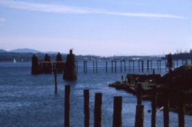
- File consists of photographs of Barnet Marine Park, including the Barnet Beach pilings, people exploring the rocky shoreline and a woman sitting on a bench in the park.
- Repository
- City of Burnaby Archives
- Date
- August 25, 1999
- Collection/Fonds
- Doreen Lawson fonds
- Physical Description
- 20 photographs : col. slides ; 35 mm
- Description Level
- File
- Record No.
- 618-014
- Access Restriction
- No restrictions
- Reproduction Restriction
- No restrictions
- Accession Number
- 2015-15
- Scope and Content
- File consists of photographs of Barnet Marine Park, including the Barnet Beach pilings, people exploring the rocky shoreline and a woman sitting on a bench in the park.
- Media Type
- Photograph
- Photographer
- Lawson, Doreen A.
- Notes
- Title based on contents of photographs
- Geographic Access
- Barnet Marine Park
- Historic Neighbourhood
- Barnet (Historic Neighbourhood)
- Planning Study Area
- Burnaby Mountain Area
Images
Beaver Creek - Royal Oak Avenue
https://search.heritageburnaby.ca/link/archivedescription91582
- Repository
- City of Burnaby Archives
- Date
- August 9, 1996
- Collection/Fonds
- Doreen Lawson fonds
- Description Level
- File
- Physical Description
- 13 photographs : col. slides ; 35 mm
- Scope and Content
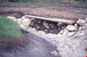
- File consists of photographs of Beaver Creek and Royal Oak Avenue taken during the Royal Oak Avenue Realignment project.
- Repository
- City of Burnaby Archives
- Date
- August 9, 1996
- Collection/Fonds
- Doreen Lawson fonds
- Physical Description
- 13 photographs : col. slides ; 35 mm
- Description Level
- File
- Record No.
- 605-015
- Access Restriction
- No restrictions
- Reproduction Restriction
- No restrictions
- Accession Number
- 2003-30
- Scope and Content
- File consists of photographs of Beaver Creek and Royal Oak Avenue taken during the Royal Oak Avenue Realignment project.
- Subjects
- Geographic Features - Creeks
- Names
- Lawson, Doreen A.
- Media Type
- Photograph
- Photographer
- Lawson, Doreen A.
- Notes
- Title based on contents of photographs
- Geographic Access
- Deer Lake Park
- Historic Neighbourhood
- Burnaby Lake (Historic Neighbourhood)
- Planning Study Area
- Oakalla Area
Images
Burnaby Ambulance Station
https://search.heritageburnaby.ca/link/archivedescription94315
- Repository
- City of Burnaby Archives
- Date
- July 1994
- Collection/Fonds
- Grover, Elliott & Co. Ltd. fonds
- Description Level
- File
- Physical Description
- 45 photographs : col. negatives ; 35 mm
- Scope and Content
- Photographs of a undeveloped, forested property at unidentified location.
- Repository
- City of Burnaby Archives
- Date
- July 1994
- Collection/Fonds
- Grover, Elliott & Co. Ltd. fonds
- Physical Description
- 45 photographs : col. negatives ; 35 mm
- Description Level
- File
- Record No.
- 622-100
- Access Restriction
- No restrictions
- Reproduction Restriction
- No restrictions
- Accession Number
- 2017-39
- Scope and Content
- Photographs of a undeveloped, forested property at unidentified location.
- Subjects
- Geographic Features - Forests
- Media Type
- Photograph
- Notes
- Transcribed title
- Title transcribed from envelope photographs were originally housed in
- File no. 94-268-B
- Photographer identified as "K.H."
Burnaby Lake
https://search.heritageburnaby.ca/link/archivedescription91701
- Repository
- City of Burnaby Archives
- Date
- March 1982 - April 1982
- Collection/Fonds
- Doreen Lawson fonds
- Description Level
- File
- Physical Description
- 17 photographs : col. slides ; 35 mm
- Scope and Content
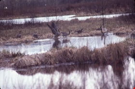
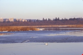
- File consists photographs of Burnaby Lake taken in late winter. The foliage around the lake is primarily brown and wilted with the first new growth of Spring just emerging. Canadian geese swim on the lake in the foreground of several of the photographs, with snow-covered mountains and the Loughee…
- Repository
- City of Burnaby Archives
- Date
- March 1982 - April 1982
- Collection/Fonds
- Doreen Lawson fonds
- Physical Description
- 17 photographs : col. slides ; 35 mm
- Description Level
- File
- Record No.
- 618-019
- Access Restriction
- No restrictions
- Reproduction Restriction
- No restrictions
- Accession Number
- 2015-15
- Scope and Content
- File consists photographs of Burnaby Lake taken in late winter. The foliage around the lake is primarily brown and wilted with the first new growth of Spring just emerging. Canadian geese swim on the lake in the foreground of several of the photographs, with snow-covered mountains and the Lougheed Mall skyline visible in the distance. Also included in the file is one photograph of the forest alongside the Brunette River.
- Media Type
- Photograph
- Photographer
- Lawson, Doreen A.
- Notes
- Transcribed title
- Title transcribed from label on slide sheets photographs originally housed in
- Geographic Access
- Burnaby Lake
- Brunette River
- Historic Neighbourhood
- Burnaby Lake (Historic Neighbourhood)
- Planning Study Area
- Burnaby Lake Area
Images
Burnaby Lake / Ambience
https://search.heritageburnaby.ca/link/archivedescription91690
- Repository
- City of Burnaby Archives
- Date
- 1983-1993
- Collection/Fonds
- Doreen Lawson fonds
- Description Level
- File
- Physical Description
- 15 photographs : col. slides ; 35 mm
- Scope and Content
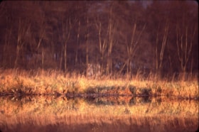
- File consists of scenic photographs of Burnaby Lake compiled by Doreen Lawson. Photographs depict the lake in all seasons with the lake in the foreground and the forest and skyline in the distance. Photographs were taken during daylight and twilight.
- Repository
- City of Burnaby Archives
- Date
- 1983-1993
- Collection/Fonds
- Doreen Lawson fonds
- Physical Description
- 15 photographs : col. slides ; 35 mm
- Description Level
- File
- Record No.
- 618-008
- Access Restriction
- No restrictions
- Reproduction Restriction
- No restrictions
- Accession Number
- 2015-15
- Scope and Content
- File consists of scenic photographs of Burnaby Lake compiled by Doreen Lawson. Photographs depict the lake in all seasons with the lake in the foreground and the forest and skyline in the distance. Photographs were taken during daylight and twilight.
- Media Type
- Photograph
- Notes
- Transcribed title
- Title transcribed from note on slide sheet
- Historic Neighbourhood
- Burnaby Lake (Historic Neighbourhood)
- Planning Study Area
- Burnaby Lake Area
Images
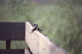
Burnaby Lake / Barn Swallows at Viewing Stands
https://search.heritageburnaby.ca/link/archivedescription91697
- Repository
- City of Burnaby Archives
- Date
- May 3, 1992
- Collection/Fonds
- Doreen Lawson fonds
- Description Level
- File
- Physical Description
- 2 photographs : col. slides ; 35 mm
- Scope and Content
- File consists of two photographs of a pair of barn swallows perched on the wooden railing of the viewing stands located at Burnaby Lake.
- Repository
- City of Burnaby Archives
- Date
- May 3, 1992
- Collection/Fonds
- Doreen Lawson fonds
- Physical Description
- 2 photographs : col. slides ; 35 mm
- Description Level
- File
- Record No.
- 618-015
- Access Restriction
- No restrictions
- Reproduction Restriction
- No restrictions
- Accession Number
- 2015-15
- Scope and Content
- File consists of two photographs of a pair of barn swallows perched on the wooden railing of the viewing stands located at Burnaby Lake.
- Media Type
- Photograph
- Photographer
- Lawson, Doreen A.
- Notes
- Transcribed title
- Title transcribed from label on slide sheet photographs originally housed in
- Geographic Access
- Burnaby Lake
- Historic Neighbourhood
- Burnaby Lake (Historic Neighbourhood)
- Planning Study Area
- Burnaby Lake Area
Images
Burnaby Lake birds
https://search.heritageburnaby.ca/link/archivedescription91685
- Repository
- City of Burnaby Archives
- Date
- 1982-1994
- Collection/Fonds
- Doreen Lawson fonds
- Description Level
- File
- Physical Description
- 54 photographs : col. slides ; 35 mm
- Scope and Content
- File consists of photographs of Burnaby Lake birds compiled by Doreen Lawson. Species depicted include: American coot, pied-billed grebe, barrows and common goldeneye, green-winged teal, wood duck, mallard duck, dowitcher, bittern moved beak, pileated woodpecker, and pigeon.
- Repository
- City of Burnaby Archives
- Date
- 1982-1994
- Collection/Fonds
- Doreen Lawson fonds
- Physical Description
- 54 photographs : col. slides ; 35 mm
- Description Level
- File
- Record No.
- 618-003
- Access Restriction
- No restrictions
- Reproduction Restriction
- May be restricted by third party rights
- Accession Number
- 2015-15
- Scope and Content
- File consists of photographs of Burnaby Lake birds compiled by Doreen Lawson. Species depicted include: American coot, pied-billed grebe, barrows and common goldeneye, green-winged teal, wood duck, mallard duck, dowitcher, bittern moved beak, pileated woodpecker, and pigeon.
- Media Type
- Photograph
- Photographer
- Lawson, Doreen A.
- Notes
- Title based on contents of photographs
- Photographs contents are identified on many of the slide cases within the file.
- Note in black ink on recto of slide sheet photographs 618-003-1 : 618-003-4 originally housed in read: "American Coots".
- Note in black ink on recto of slide sheets photographs 618-003-5 : 618-003-26 originally housed in read: "Burnaby Lake / Duck-like Birds".
- Note in black ink on recto of slide sheets photographs 618-003-27 : 618-003-31 originally housed in read: "Burnaby Lake / Duck-like Birds - Local".
- Note in black ink on recto of slide sheets photographs 618-003-43 : 618-003-51 originally housed in read: "Burnaby Lake / Shore Birds / Long Billed Dowitchers".
- Historic Neighbourhood
- Burnaby Lake (Historic Neighbourhood)
- Planning Study Area
- Burnaby Lake Area
Images
Burnaby Lake / Water Pollution - Oil
https://search.heritageburnaby.ca/link/archivedescription91691
- Repository
- City of Burnaby Archives
- Date
- 1982-1991
- Collection/Fonds
- Doreen Lawson fonds
- Description Level
- File
- Physical Description
- 13 photographs : col. slides ; 35 mm
- Scope and Content
- File consists of photographs of oil on the water surface of Burnaby Lake.
- Repository
- City of Burnaby Archives
- Date
- 1982-1991
- Collection/Fonds
- Doreen Lawson fonds
- Physical Description
- 13 photographs : col. slides ; 35 mm
- Description Level
- File
- Record No.
- 618-009
- Access Restriction
- No restrictions
- Reproduction Restriction
- No restrictions
- Accession Number
- 2015-15
- Scope and Content
- File consists of photographs of oil on the water surface of Burnaby Lake.
- Media Type
- Photograph
- Notes
- Transcribed title
- Title transcribed from note on slide sheet
- Historic Neighbourhood
- Burnaby Lake (Historic Neighbourhood)
- Planning Study Area
- Burnaby Lake Area
Images
Byrne Creek
https://search.heritageburnaby.ca/link/archivedescription91705
- Repository
- City of Burnaby Archives
- Date
- March 25, 1993
- Collection/Fonds
- Doreen Lawson fonds
- Description Level
- File
- Physical Description
- 40 photographs : col. slides ; 35 mm
- Scope and Content
- File consists of photographs of Byrne Creek. The photographs depict the creek prior to clean-up with the water and paths littered with debris. Also included in the file are photographs of an unidentified man pulling a dead fish from the creek.
- Repository
- City of Burnaby Archives
- Date
- March 25, 1993
- Collection/Fonds
- Doreen Lawson fonds
- Physical Description
- 40 photographs : col. slides ; 35 mm
- Description Level
- File
- Record No.
- 618-023
- Access Restriction
- No restrictions
- Reproduction Restriction
- No restrictions
- Accession Number
- 2015-15
- Scope and Content
- File consists of photographs of Byrne Creek. The photographs depict the creek prior to clean-up with the water and paths littered with debris. Also included in the file are photographs of an unidentified man pulling a dead fish from the creek.
- Media Type
- Photograph
- Photographer
- Lawson, Doreen A.
- Glover, Ken
- Notes
- Transcribed title
- Title transcribed from label on slide sheets
- Note in black ink on recto of slide frames 618-023-11, 618-023-12, 618-023-14, 618-023-33, and 618-023-40 reads: "Ken Glover / BOB"
- Geographic Access
- Byrne Creek
- Historic Neighbourhood
- Edmonds (Historic Neighbourhood)
- Planning Study Area
- Stride Avenue Area
![Burnaby Mountain Golf Course staff, [2001] thumbnail](/media/hpo/_Data/_Archives_Images/_Unrestricted/535/535-2451-1.jpg?width=280)
![Arborists in a forest, [1999] thumbnail](/media/hpo/_Data/_Archives_Images/_Unrestricted/535/535-3236-1.jpg?width=280)
![Artificial turf at Burnaby Lake Sports Complex, [1999] thumbnail](/media/hpo/_Data/_Archives_Images/_Unrestricted/535/535-3300-1.jpg?width=280)
