More like 'Digney Film 5 - Okanagan, Mattick's Farm and world tour'
Narrow Results By
Person / Organization
- Baldwin, Ruth 1
- Barnet Mill 1
- BC Society of Model Engineers (BCSME) 3
- British Columbia Electric Railway Company 2
- Brown, Dennis 1
- Brownlee, James Harrison 1
- Burnaby Art Gallery 1
- Burnaby Fire Department 1
- Burnaby Historical Society 1
- Burnaby Lake Rowing Pavilion 1
- Burnaby Mountain Park 1
- Burnaby Village Museum 1
7973-7993 Enterprise St
https://search.heritageburnaby.ca/link/archivedescription94296
- Repository
- City of Burnaby Archives
- Date
- December 1993
- Collection/Fonds
- Grover, Elliott & Co. Ltd. fonds
- Description Level
- File
- Physical Description
- 46 photographs : col. negatives ; 35 mm
- Scope and Content
- Photographs of the commercial complex located at 7973-7993 Enterprise Street.
- Repository
- City of Burnaby Archives
- Date
- December 1993
- Collection/Fonds
- Grover, Elliott & Co. Ltd. fonds
- Physical Description
- 46 photographs : col. negatives ; 35 mm
- Description Level
- File
- Record No.
- 622-081
- Access Restriction
- No restrictions
- Reproduction Restriction
- No restrictions
- Accession Number
- 2017-39
- Scope and Content
- Photographs of the commercial complex located at 7973-7993 Enterprise Street.
- Media Type
- Photograph
- Notes
- Transcribed title
- Title transcribed from envelope photographs were originally housed in
- File no. 93-464-B
- Photographer identified as "K.H."
- Geographic Access
- Enterprise Street
- Street Address
- 7973 Enterprise Street
- 7993 Enterprise Street
- Historic Neighbourhood
- Lozells (Historic Neighbourhood)
- Planning Study Area
- Government Road Area
8357 Tenth Avenue, 8350 and 8353 Eleventh Avenue
https://search.heritageburnaby.ca/link/archivedescription93724
- Repository
- City of Burnaby Archives
- Date
- 1989
- Collection/Fonds
- Grover, Elliott & Co. Ltd. fonds
- Description Level
- File
- Physical Description
- 24 photographs : col. negatives ; 35 mm
- Scope and Content
- Photographs of the exterior of the low-rise apartment complex located at 8357 10th Avenue and 8350 and 8353 11th Avenue and the laneway running between the buildings.
- Repository
- City of Burnaby Archives
- Date
- 1989
- Collection/Fonds
- Grover, Elliott & Co. Ltd. fonds
- Physical Description
- 24 photographs : col. negatives ; 35 mm
- Description Level
- File
- Record No.
- 622-013
- Access Restriction
- No restrictions
- Reproduction Restriction
- No restrictions
- Accession Number
- 2017-39
- Scope and Content
- Photographs of the exterior of the low-rise apartment complex located at 8357 10th Avenue and 8350 and 8353 11th Avenue and the laneway running between the buildings.
- Media Type
- Photograph
- Notes
- Transcribed title
- Title transcribed from original print envelope
- Geographic Access
- 10th Avenue
- 11th Avenue
- Street Address
- 8357 10th Avenue
- 8350 11th Avenue
- 8353 11th Avenue
- Historic Neighbourhood
- East Burnaby (Historic Neighbourhood)
- Planning Study Area
- Cariboo-Armstrong Area
8525 Baxter Place
https://search.heritageburnaby.ca/link/archivedescription93768
- Repository
- City of Burnaby Archives
- Date
- August 4, 1992
- Collection/Fonds
- Grover, Elliott & Co. Ltd. fonds
- Description Level
- File
- Physical Description
- 36 photographs : col. negatives ; 35 mm
- Scope and Content
- Photographs of the exterior of a commercial building located at 8525 Baxter Place.
- Repository
- City of Burnaby Archives
- Date
- August 4, 1992
- Collection/Fonds
- Grover, Elliott & Co. Ltd. fonds
- Physical Description
- 36 photographs : col. negatives ; 35 mm
- Description Level
- File
- Record No.
- 622-052
- Access Restriction
- No restrictions
- Reproduction Restriction
- No restrictions
- Accession Number
- 2017-39
- Scope and Content
- Photographs of the exterior of a commercial building located at 8525 Baxter Place.
- Media Type
- Photograph
- Photographer
- Young, Richard
- Notes
- Transcribed title
- Title transcribed from envelope photographs were originally housed in
- File no. 92-285-B
- Geographic Access
- Baxter Place
- Street Address
- 8525 Baxter Place
- Planning Study Area
- Lake City Area
8555 Baxter Place
https://search.heritageburnaby.ca/link/archivedescription93767
- Repository
- City of Burnaby Archives
- Date
- July 28, 1992
- Collection/Fonds
- Grover, Elliott & Co. Ltd. fonds
- Description Level
- File
- Physical Description
- 23 photographs : col. negatives ; 35 mm
- Scope and Content
- Photographs of commercial buildings along Baxter Place and an undeveloped property located at 8555 Baxter Place.
- Repository
- City of Burnaby Archives
- Date
- July 28, 1992
- Collection/Fonds
- Grover, Elliott & Co. Ltd. fonds
- Physical Description
- 23 photographs : col. negatives ; 35 mm
- Description Level
- File
- Record No.
- 622-051
- Access Restriction
- No restrictions
- Reproduction Restriction
- No restrictions
- Accession Number
- 2017-39
- Scope and Content
- Photographs of commercial buildings along Baxter Place and an undeveloped property located at 8555 Baxter Place.
- Media Type
- Photograph
- Photographer
- Young, Richard
- Notes
- Transcribed title
- Title transcribed from envelope photographs were originally housed in
- File no. 92-278-B
- Geographic Access
- Baxter Place
- Street Address
- 8555 Baxter Place
- Planning Study Area
- Lake City Area
8678 Greenall Ave
https://search.heritageburnaby.ca/link/archivedescription94335
- Repository
- City of Burnaby Archives
- Date
- April 1995
- Collection/Fonds
- Grover, Elliott & Co. Ltd. fonds
- Description Level
- File
- Physical Description
- 25 photographs : col. negatives ; 35 mm
- Scope and Content
- Photographs of a property located at 8678 Greenal Avenue.
- Repository
- City of Burnaby Archives
- Date
- April 1995
- Collection/Fonds
- Grover, Elliott & Co. Ltd. fonds
- Physical Description
- 25 photographs : col. negatives ; 35 mm
- Description Level
- File
- Record No.
- 622-120
- Access Restriction
- No restrictions
- Reproduction Restriction
- No restrictions
- Accession Number
- 2017-39
- Scope and Content
- Photographs of a property located at 8678 Greenal Avenue.
- Subjects
- Geographic Features - Forests
- Media Type
- Photograph
- Photographer
- Young, Richard
- Notes
- Transcribed title
- Title transcribed from envelope photographs were originally housed in
- File no. 95-171-B
- Geographic Access
- Greenall Avenue
- Street Address
- 8678 Greenall Avenue
- Historic Neighbourhood
- Fraser Arm (Historic Neighbourhood)
- Planning Study Area
- Big Bend Area
Arborists in a forest
https://search.heritageburnaby.ca/link/archivedescription98158
- Repository
- City of Burnaby Archives
- Date
- [1999]
- Collection/Fonds
- Burnaby NewsLeader photograph collection
- Description Level
- File
- Physical Description
- 7 photographs (tiff) : col.
- Scope and Content
- File contains photographs of unidentified arborists climbing and working on trees, and photographs of their climbing equipment, ropes, and saws.
- Repository
- City of Burnaby Archives
- Date
- [1999]
- Collection/Fonds
- Burnaby NewsLeader photograph collection
- Physical Description
- 7 photographs (tiff) : col.
- Description Level
- File
- Record No.
- 535-3236
- Access Restriction
- No restrictions
- Reproduction Restriction
- No restrictions
- Accession Number
- 2018-12
- Scope and Content
- File contains photographs of unidentified arborists climbing and working on trees, and photographs of their climbing equipment, ropes, and saws.
- Media Type
- Photograph
- Notes
- Title based on contents of file
- Collected by editorial for use in a June 1999 issue of the Burnaby NewsLeader
Images
Artificial turf at Burnaby Lake Sports Complex
https://search.heritageburnaby.ca/link/archivedescription98222
- Repository
- City of Burnaby Archives
- Date
- [1999]
- Collection/Fonds
- Burnaby NewsLeader photograph collection
- Description Level
- File
- Physical Description
- 2 photographs (tiff) : col.
- Scope and Content
- File contains photographs of Pierre Alarie, the crew chief for Field Turf International, checking and installing artificial turf at the a new field at the Burnaby Lake Sports Complex.
- Repository
- City of Burnaby Archives
- Date
- [1999]
- Collection/Fonds
- Burnaby NewsLeader photograph collection
- Physical Description
- 2 photographs (tiff) : col.
- Description Level
- File
- Record No.
- 535-3300
- Access Restriction
- No restrictions
- Reproduction Restriction
- No restrictions
- Accession Number
- 2018-12
- Scope and Content
- File contains photographs of Pierre Alarie, the crew chief for Field Turf International, checking and installing artificial turf at the a new field at the Burnaby Lake Sports Complex.
- Media Type
- Photograph
- Photographer
- Bartel, Mario
- Notes
- Title based on caption
- Collected by editorial for use in an August 1999 issue of the Burnaby NewsLeader
- Caption from metadata for 535-3300-1: "Pierre Alarie, the crew chief for Field Turf International, checks the artificial turf his company is installing at the new field complex off Kensington."
- Geographic Access
- Kensington Avenue
- Burnaby Lake Sports Complex
- Historic Neighbourhood
- Burnaby Lake (Historic Neighbourhood)
- Planning Study Area
- Ardingley-Sprott Area
Images
Bagpiper Rob MacNeil
https://search.heritageburnaby.ca/link/archivedescription98354
- Repository
- City of Burnaby Archives
- Date
- [1999]
- Collection/Fonds
- Burnaby NewsLeader photograph collection
- Description Level
- File
- Physical Description
- 2 photographs (tiff) : col.
- Scope and Content
- File contains photographs of Rob MacNeil, the manager of the Simon Fraser University Pipe Band. Photographs depict MacNeil in silhouette, playing bagpipes on top of Burnaby Mountain with the cityscape visible in the distance, and posing for a portrait.
- Repository
- City of Burnaby Archives
- Date
- [1999]
- Collection/Fonds
- Burnaby NewsLeader photograph collection
- Physical Description
- 2 photographs (tiff) : col.
- Description Level
- File
- Record No.
- 535-3364
- Access Restriction
- No restrictions
- Reproduction Restriction
- No restrictions
- Accession Number
- 2018-12
- Scope and Content
- File contains photographs of Rob MacNeil, the manager of the Simon Fraser University Pipe Band. Photographs depict MacNeil in silhouette, playing bagpipes on top of Burnaby Mountain with the cityscape visible in the distance, and posing for a portrait.
- Media Type
- Photograph
- Photographer
- Bartel, Mario
- Notes
- Title based on caption
- Collected by editorial for use in an October 1999 issue of the Burnaby NewsLeader
- Caption from metadata for 535-3364-1: "Rob MacNeil, the manager of the SFU Pipe Band, plays a lonely lament for the loss of the band's practice field atop Burnaby Mountain, because of a complaint to the Parks Board."
- Geographic Access
- Burnaby Mountain Conservation Area
- Planning Study Area
- Burnaby Mountain Area
Images
Barnet Marine Park
https://search.heritageburnaby.ca/link/archivedescription91581
- Repository
- City of Burnaby Archives
- Date
- August 9, 1996
- Collection/Fonds
- Doreen Lawson fonds
- Description Level
- File
- Physical Description
- 18 photographs : col. slides ; 35 mm
- Scope and Content
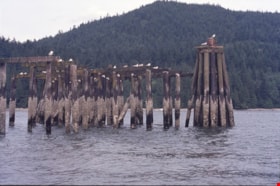
- File consists of photographs of Barnet Marine Park, including Barnet Beach pilings, overpass and people preparing kayaks on the shore.
- Repository
- City of Burnaby Archives
- Date
- August 9, 1996
- Collection/Fonds
- Doreen Lawson fonds
- Physical Description
- 18 photographs : col. slides ; 35 mm
- Description Level
- File
- Record No.
- 605-014
- Access Restriction
- No restrictions
- Reproduction Restriction
- No restrictions
- Accession Number
- 2003-30
- Scope and Content
- File consists of photographs of Barnet Marine Park, including Barnet Beach pilings, overpass and people preparing kayaks on the shore.
- Names
- Lawson, Doreen A.
- Media Type
- Photograph
- Photographer
- Lawson, Doreen A.
- Notes
- Title based on contents of photographs
- Note in black in on recto of slide frames of photographs 605-014-1 : 605-014-7, 605-014-9 : 605-014-11, and 605-014-13 reads: "Barnet Beach Pilings"
- Note in black ink on recto of slide frames of photographs 605-014-8 and 605-014-12 reads: "Barnet Beach Kayaks"
- Note in black ink on recto of slide frames of photographs 605-014-14 : 605-014-18 reads: "Barnet Beach Overpass"
- Geographic Access
- Barnet Marine Park
- Historic Neighbourhood
- Barnet (Historic Neighbourhood)
- Planning Study Area
- Burnaby Mountain Area
Images
Beaver Creek - Royal Oak Avenue
https://search.heritageburnaby.ca/link/archivedescription91582
- Repository
- City of Burnaby Archives
- Date
- August 9, 1996
- Collection/Fonds
- Doreen Lawson fonds
- Description Level
- File
- Physical Description
- 13 photographs : col. slides ; 35 mm
- Scope and Content
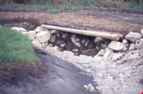
- File consists of photographs of Beaver Creek and Royal Oak Avenue taken during the Royal Oak Avenue Realignment project.
- Repository
- City of Burnaby Archives
- Date
- August 9, 1996
- Collection/Fonds
- Doreen Lawson fonds
- Physical Description
- 13 photographs : col. slides ; 35 mm
- Description Level
- File
- Record No.
- 605-015
- Access Restriction
- No restrictions
- Reproduction Restriction
- No restrictions
- Accession Number
- 2003-30
- Scope and Content
- File consists of photographs of Beaver Creek and Royal Oak Avenue taken during the Royal Oak Avenue Realignment project.
- Subjects
- Geographic Features - Creeks
- Names
- Lawson, Doreen A.
- Media Type
- Photograph
- Photographer
- Lawson, Doreen A.
- Notes
- Title based on contents of photographs
- Geographic Access
- Deer Lake Park
- Historic Neighbourhood
- Burnaby Lake (Historic Neighbourhood)
- Planning Study Area
- Oakalla Area
Images
Burnaby Ambulance Station
https://search.heritageburnaby.ca/link/archivedescription94315
- Repository
- City of Burnaby Archives
- Date
- July 1994
- Collection/Fonds
- Grover, Elliott & Co. Ltd. fonds
- Description Level
- File
- Physical Description
- 45 photographs : col. negatives ; 35 mm
- Scope and Content
- Photographs of a undeveloped, forested property at unidentified location.
- Repository
- City of Burnaby Archives
- Date
- July 1994
- Collection/Fonds
- Grover, Elliott & Co. Ltd. fonds
- Physical Description
- 45 photographs : col. negatives ; 35 mm
- Description Level
- File
- Record No.
- 622-100
- Access Restriction
- No restrictions
- Reproduction Restriction
- No restrictions
- Accession Number
- 2017-39
- Scope and Content
- Photographs of a undeveloped, forested property at unidentified location.
- Subjects
- Geographic Features - Forests
- Media Type
- Photograph
- Notes
- Transcribed title
- Title transcribed from envelope photographs were originally housed in
- File no. 94-268-B
- Photographer identified as "K.H."
Burnaby Central - North - N. Shore Mtns.
https://search.heritageburnaby.ca/link/archivedescription91709
- Repository
- City of Burnaby Archives
- Date
- May 1998 - June 1998
- Collection/Fonds
- Doreen Lawson fonds
- Description Level
- File
- Physical Description
- 12 photographs : col. slides ; 35 mm
- Scope and Content
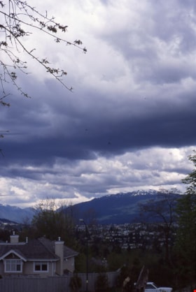
- File consists of landscape photographs of North Burnaby with snow-covered North Shore mountains visible in the distance. The photographs were taken from the Central Burnaby area.
- Repository
- City of Burnaby Archives
- Date
- May 1998 - June 1998
- Collection/Fonds
- Doreen Lawson fonds
- Physical Description
- 12 photographs : col. slides ; 35 mm
- Description Level
- File
- Record No.
- 618-027
- Access Restriction
- No restrictions
- Reproduction Restriction
- No restrictions
- Accession Number
- 2015-15
- Scope and Content
- File consists of landscape photographs of North Burnaby with snow-covered North Shore mountains visible in the distance. The photographs were taken from the Central Burnaby area.
- Media Type
- Photograph
- Photographer
- Lawson, Doreen A.
- Notes
- Transcribed title
- Title transcribed from slide sheet label
- Historic Neighbourhood
- Burnaby Lake (Historic Neighbourhood)
Images
Burnaby Lake morning fog
https://search.heritageburnaby.ca/link/archivedescription95995
- Repository
- City of Burnaby Archives
- Date
- [2004]
- Collection/Fonds
- Burnaby NewsLeader photograph collection
- Description Level
- File
- Physical Description
- 2 photographs (tiff) : col.
- Scope and Content
- File contains photographs of Burnaby Lake Park in early morning fog, with people jogging and walking the park.
- Repository
- City of Burnaby Archives
- Date
- [2004]
- Collection/Fonds
- Burnaby NewsLeader photograph collection
- Physical Description
- 2 photographs (tiff) : col.
- Description Level
- File
- Record No.
- 535-1746
- Access Restriction
- No restrictions
- Reproduction Restriction
- No restrictions
- Accession Number
- 2018-12
- Scope and Content
- File contains photographs of Burnaby Lake Park in early morning fog, with people jogging and walking the park.
- Media Type
- Photograph
- Photographer
- Bartel, Mario
- Notes
- Title based on caption
- Collected by editorial for use in a January 2004 issue of the Burnaby NewsLeader
- Caption from metadata for 535-1746-1: "A lone early-morning jogger emerges from the fog that has shrouded Burnaby Lake park, as warm air descends upon the remnants of last week's snow storm, still laying in the fields."
- Caption from metadata for 535-1746-2: "A dog walker is silhouetted agains the fog that shrouds Burnaby Lake Fields, as warmer air descends on the remnants of last week's snow storm."
- Geographic Access
- Burnaby Lake
- Burnaby Lake Regional Nature Park
- Historic Neighbourhood
- Burnaby Lake (Historic Neighbourhood)
- Planning Study Area
- Burnaby Lake Area
Images
Burnaby Lake Sports Complex observation tower
https://search.heritageburnaby.ca/link/archivedescription97607
- Repository
- City of Burnaby Archives
- Date
- [2002]
- Collection/Fonds
- Burnaby NewsLeader photograph collection
- Description Level
- File
- Physical Description
- 2 photographs (tiff) : col.
- Scope and Content
- File contains photographs of Tom Sadler, an employee with the City of Burnaby Parks and Recreation Department, at the new and under-construction observation tower at the Burnaby Lake Sports Complex. Photographs depict Sadler looking over the fields of the Burnaby Lake Sports Complex from the tower,…
- Repository
- City of Burnaby Archives
- Date
- [2002]
- Collection/Fonds
- Burnaby NewsLeader photograph collection
- Physical Description
- 2 photographs (tiff) : col.
- Description Level
- File
- Record No.
- 535-2923
- Access Restriction
- No restrictions
- Reproduction Restriction
- No restrictions
- Accession Number
- 2018-12
- Scope and Content
- File contains photographs of Tom Sadler, an employee with the City of Burnaby Parks and Recreation Department, at the new and under-construction observation tower at the Burnaby Lake Sports Complex. Photographs depict Sadler looking over the fields of the Burnaby Lake Sports Complex from the tower, and inside the tower, demonstrating the tower's sliding windows.
- Subjects
- Buildings - Recreational - Sports
- Geographic Features - Athletic Fields
- Occupations - Civic Workers
- Media Type
- Photograph
- Photographer
- Bartel, Mario
- Notes
- Title based on caption
- Collected by editorial for use in a January 2002 issue of the Burnaby NewsLeader
- Caption from metadata for 535-2923-1: "Tom Sadler, of Burnaby's Parks and Rec Department, gets a spotter's-eye view of the playing fields at Burnaby Lake Sports Complex from the roof of the new viewing tower that is nearing completion. He says the rooftop area will be particularly useful for spotters working football games. The tower looks out over fields one and three."
- Caption from metadata for 535-2923-2: "Tom Sadler, of Burnaby's Parks and Rec Department, demonstrates how the sliding windows in the new observation tower at Burnaby Lake Sports Complex can open to give an unobstructed view to the playing fields below. The windows had to be specially imported from Germany, and allows a tv camera to be set up inside the tower, safe from the elements, and still shoot the whole field."
- Geographic Access
- Kensington Avenue
- Burnaby Lake Sports Complex
- Historic Neighbourhood
- Burnaby Lake (Historic Neighbourhood)
- Planning Study Area
- Ardingley-Sprott Area
Images
Byrne Creek
https://search.heritageburnaby.ca/link/archivedescription91705
- Repository
- City of Burnaby Archives
- Date
- March 25, 1993
- Collection/Fonds
- Doreen Lawson fonds
- Description Level
- File
- Physical Description
- 40 photographs : col. slides ; 35 mm
- Scope and Content
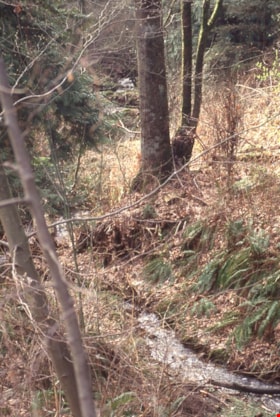
- File consists of photographs of Byrne Creek. The photographs depict the creek prior to clean-up with the water and paths littered with debris. Also included in the file are photographs of an unidentified man pulling a dead fish from the creek.
- Repository
- City of Burnaby Archives
- Date
- March 25, 1993
- Collection/Fonds
- Doreen Lawson fonds
- Physical Description
- 40 photographs : col. slides ; 35 mm
- Description Level
- File
- Record No.
- 618-023
- Access Restriction
- No restrictions
- Reproduction Restriction
- No restrictions
- Accession Number
- 2015-15
- Scope and Content
- File consists of photographs of Byrne Creek. The photographs depict the creek prior to clean-up with the water and paths littered with debris. Also included in the file are photographs of an unidentified man pulling a dead fish from the creek.
- Media Type
- Photograph
- Photographer
- Lawson, Doreen A.
- Glover, Ken
- Notes
- Transcribed title
- Title transcribed from label on slide sheets
- Note in black ink on recto of slide frames 618-023-11, 618-023-12, 618-023-14, 618-023-33, and 618-023-40 reads: "Ken Glover / BOB"
- Geographic Access
- Byrne Creek
- Historic Neighbourhood
- Edmonds (Historic Neighbourhood)
- Planning Study Area
- Stride Avenue Area
Images
Campsite Collection
https://search.heritageburnaby.ca/link/museumdescription4589
- Repository
- Burnaby Village Museum
- Date
- [between 1958 and 2002]
- Collection/Fonds
- Burnaby Girl Guides fonds
- Description Level
- File
- Physical Description
- 1 file : 33 photographs + textual records + other material
- Scope and Content
- File consists of photographs, an illustration, ephemera and histories about Burnaby Guiding Camps including Burnaby Chalet on Cypress Mountain, Galalina Camp at Camp Olave near Sechelt B.C., Burnaby Guide Camp at Wilson Creek and a few postcards of Camp Tsoona, Rosedale B.C. A collection of written…
- Repository
- Burnaby Village Museum
- Collection/Fonds
- Burnaby Girl Guides fonds
- Description Level
- File
- Physical Description
- 1 file : 33 photographs + textual records + other material
- Scope and Content
- File consists of photographs, an illustration, ephemera and histories about Burnaby Guiding Camps including Burnaby Chalet on Cypress Mountain, Galalina Camp at Camp Olave near Sechelt B.C., Burnaby Guide Camp at Wilson Creek and a few postcards of Camp Tsoona, Rosedale B.C. A collection of written material provides historical background regarding the two storey cabin on Hollyburn Mountain. The cabin was purchased by Burnaby Girl Guides in 1964 and appropriately named Burnaby Chalet. A Chalet Committee was formed with representatives from each Division appointing a Chalet Manageress to handle reservations. This typical ski cabin can accomodate up to 40 people. The file also includes a "Campsite Log Book" for the Hollyburn Chalet with handwritten notes from 1981 and 1982, an embroidered triangular shaped badge "Burnaby Royal / Girl Guides / Hollyburn Chalet" and a dedication ceremony program for "Burnaby Guide Camp / June 8, 1958" (Wilson Creek).
- Subjects
- Organizations - Girls' Societies and Clubs
- Recreational Activities - Camping
- Natural Phenomena - Snow
- Geographic Features - Beaches
- Names
- Girl Guides of Canada
- Accession Code
- BV015.35.161
- Access Restriction
- No restrictions
- Reproduction Restriction
- May be restricted by third party rights
- Date
- [between 1958 and 2002]
- Media Type
- Photograph
- Textual Record
- Notes
- Transcribed title
Central Mortgage and Housing Co. photographs
https://search.heritageburnaby.ca/link/archivedescription64875
- Repository
- City of Burnaby Archives
- Date
- 1967
- Collection/Fonds
- Burnaby Historical Society fonds
- Description Level
- File
- Physical Description
- 3 photographs : b&w ; 20.5 x 25.5 cm
- Scope and Content
- Photographs of Hastings Street, Burnaby produced by the Central Mortgage and Housing Corporation.
- Repository
- City of Burnaby Archives
- Date
- 1967
- Collection/Fonds
- Burnaby Historical Society fonds
- Subseries
- Photographs subseries
- Physical Description
- 3 photographs : b&w ; 20.5 x 25.5 cm
- Description Level
- File
- Record No.
- 518-001
- Access Restriction
- No restrictions
- Reproduction Restriction
- Reproduce for fair dealing purposes only
- Accession Number
- BHS1993-05
- Scope and Content
- Photographs of Hastings Street, Burnaby produced by the Central Mortgage and Housing Corporation.
- Subjects
- Geographic Features - Roads
- Media Type
- Photograph
- Photographer
- Central Mortgage and Housing Corporation
- Notes
- Title based on contents of file
- Stamp on verso of 518-001 reads: "Please credit Central Mortgage & Housing Corporation Photo 067 627"
- Stamp on verso of 518-001 reads: "Please credit Central Mortgage & Housing Corporation Photo 067 625"
- Stamp on verso of 518-001 reads: "Please credit Central Mortgage & Housing Corporation Photo 067 628"
- Geographic Access
- Hastings Street
Images
Central Park Pitch & Putt preparation
https://search.heritageburnaby.ca/link/archivedescription96035
- Repository
- City of Burnaby Archives
- Date
- [2004]
- Collection/Fonds
- Burnaby NewsLeader photograph collection
- Description Level
- File
- Physical Description
- 2 photographs (tiff) : col.
- Scope and Content
- File contains photographs of Burnaby Parks Department employee Dave Walters on a riding lawn mower. He is cutting the grass on the course at the Central Park Pitch & Putt.
- Repository
- City of Burnaby Archives
- Date
- [2004]
- Collection/Fonds
- Burnaby NewsLeader photograph collection
- Physical Description
- 2 photographs (tiff) : col.
- Description Level
- File
- Record No.
- 535-1784
- Access Restriction
- No restrictions
- Reproduction Restriction
- No restrictions
- Accession Number
- 2018-12
- Scope and Content
- File contains photographs of Burnaby Parks Department employee Dave Walters on a riding lawn mower. He is cutting the grass on the course at the Central Park Pitch & Putt.
- Media Type
- Photograph
- Photographer
- Bartel, Mario
- Notes
- Title based on caption
- Collected by editorial for use in a February 2004 issue of the Burnaby NewsLeader
- Caption from metadata: "Dave Walters, of the Burnaby Parks Department, keeps a close eye on the cut as he prepares the greens at the Central Park Pitch 'n Putt for a new season. He says the greens wintered well, and they should be in good shape for the course's official opening on Friday."
- Geographic Access
- Central Park
- Imperial Street
- Street Address
- 3883 Imperial Street
- Historic Neighbourhood
- Central Park (Historic Neighbourhood)
- Planning Study Area
- Maywood Area
Images
Clinton Elementary School students releasing salmon in Byrne Creek
https://search.heritageburnaby.ca/link/archivedescription98088
- Repository
- City of Burnaby Archives
- Date
- [1999]
- Collection/Fonds
- Burnaby NewsLeader photograph collection
- Description Level
- File
- Physical Description
- 2 photographs (tiff) : col.
- Scope and Content
- File contains photographs of Clinton Elementary School students releasing salmon fingerlings into Byrne Creek.
- Repository
- City of Burnaby Archives
- Date
- [1999]
- Collection/Fonds
- Burnaby NewsLeader photograph collection
- Physical Description
- 2 photographs (tiff) : col.
- Description Level
- File
- Record No.
- 535-3168
- Access Restriction
- No restrictions
- Reproduction Restriction
- No restrictions
- Accession Number
- 2018-12
- Scope and Content
- File contains photographs of Clinton Elementary School students releasing salmon fingerlings into Byrne Creek.
- Media Type
- Photograph
- Photographer
- Bartel, Mario
- Notes
- Title based on caption
- Collected by editorial for use in a May 1999 issue of the Burnaby NewsLeader
- Caption from metadata for 535-3168-1: "Chantalle Pike, Matthew Jowit and Tyler Seymour, from Clinton Elementary School, release some of the 5,000 year-old Coho salmon into Byrne Creek. The fingerlings, each weighing about 20 grams, were raised at the Bell-Irving Hatchery in Maple Ridge and they will spend a short time in the creek before making their way out to sea."
- Geographic Access
- Byrne Creek
- Historic Neighbourhood
- Edmonds (Historic Neighbourhood)
- Planning Study Area
- Stride Avenue Area
Images
David Doyle
https://search.heritageburnaby.ca/link/archivedescription96298
- Repository
- City of Burnaby Archives
- Date
- [2002]
- Collection/Fonds
- Burnaby NewsLeader photograph collection
- Description Level
- File
- Physical Description
- 2 photographs (tiff) : col.
- Scope and Content
- File contains photographs of David Doyle on Burnaby Mountain. Photographs depict Doyle using a GPS to map streams and watercourses to gather environmental data ahead of the UniverCity development by SFU on Burnaby Mountain.
- Repository
- City of Burnaby Archives
- Date
- [2002]
- Collection/Fonds
- Burnaby NewsLeader photograph collection
- Physical Description
- 2 photographs (tiff) : col.
- Description Level
- File
- Record No.
- 535-1981
- Access Restriction
- No restrictions
- Reproduction Restriction
- No restrictions
- Accession Number
- 2018-12
- Scope and Content
- File contains photographs of David Doyle on Burnaby Mountain. Photographs depict Doyle using a GPS to map streams and watercourses to gather environmental data ahead of the UniverCity development by SFU on Burnaby Mountain.
- Subjects
- Geographic Features - Streams
- Names
- Simon Fraser University
- Media Type
- Photograph
- Photographer
- Bartel, Mario
- Notes
- Title based on caption
- Collected by editorial for use in a February 2002 issue of the Burnaby NewsLeader
- Caption from metadata: "David Doyle uses a satellite Global Positioning System to map streams and watercourses on Burnaby Mountain, in preparation for the Univer-City development around Simon Fraser University. The data he accumulates will be used by the Stoney Creek Environmental Committee to guage the impact construction may have on water quality and fish habitats."
- Geographic Access
- Burnaby Mountain Conservation Area
- Planning Study Area
- Burnaby Mountain Area
![Arborists in a forest, [1999] thumbnail](/media/hpo/_Data/_Archives_Images/_Unrestricted/535/535-3236-1.jpg?width=280)
![Artificial turf at Burnaby Lake Sports Complex, [1999] thumbnail](/media/hpo/_Data/_Archives_Images/_Unrestricted/535/535-3300-1.jpg?width=280)
![Bagpiper Rob MacNeil, [1999] thumbnail](/media/hpo/_Data/_Archives_Images/_Unrestricted/535/535-3364-1.jpg?width=280)
![Burnaby Lake morning fog, [2004] thumbnail](/media/hpo/_Data/_Archives_Images/_Unrestricted/535/535-1746-1.jpg?width=280)
![Burnaby Lake Sports Complex observation tower, [2002] thumbnail](/media/hpo/_Data/_Archives_Images/_Unrestricted/535/535-2923-1.jpg?width=280)
![Central Park Pitch & Putt preparation, [2004] thumbnail](/media/hpo/_Data/_Archives_Images/_Unrestricted/535/535-1784-1.jpg?width=280)
![Clinton Elementary School students releasing salmon in Byrne Creek, [1999] thumbnail](/media/hpo/_Data/_Archives_Images/_Unrestricted/535/535-3168-1.jpg?width=280)
![David Doyle, [2002] thumbnail](/media/hpo/_Data/_Archives_Images/_Unrestricted/535/535-1981-1.jpg?width=280)