Sussex-Nelson Neighbourhood
https://search.heritageburnaby.ca/link/landmark838
- Repository
- Burnaby Heritage Planning
- Associated Dates
- 1955-2008
- Heritage Value
- The Sussex-Nelson Neighbourhood is located just south of Metrotown and in 1980 was characterised as the most populated of all of Burnaby's Planning Study areas. The area immediately south of Metrotown was initially developed as post-war 1950s housing stock, while the sector south of Rumble was developed after the 1960s and 1970s as single-family housing.
- Historic Neighbourhood
- Alta Vista (Historic Neighbourhood)
- Planning Study Area
- Sussex-Nelson Area
Images
West Central Valley Neighbourhood
https://search.heritageburnaby.ca/link/landmark778
- Repository
- Burnaby Heritage Planning
- Associated Dates
- 1955-2008
- Heritage Value
- The West Central Valley Neighbourhood is home to the Bridge Business Park and is a primarily industrial neighbourhood. Similar to the adjacent Dawson-Delta Neighbourhood, West Central Valley offers businesses convenient access to major roads and highways.
- Historic Neighbourhood
- Broadview (Historic Neighbourhood)
- Planning Study Area
- West Central Valley Area
Images
Westridge Neighbourhood
https://search.heritageburnaby.ca/link/landmark791
- Repository
- Burnaby Heritage Planning
- Associated Dates
- 1955-2008
- Heritage Value
- The Westridge Neighbourhood is effectively separated into two areas by Inlet Drive. To the west of the highway lies a typical 1950s subdivision of single-family homes, while to the east is a newer (1970s) subdivision featuring larger lots and some low-rise units. In the 1980 Residential Neighbourhood Environment Study, Westridge was characterised as a stable community with little need for direct Municipal involvement in growth and development.
- Historic Neighbourhood
- Lochdale (Historic Neighbourhood)
- Planning Study Area
- Westridge Area
Images
Willingdon Heights Neighbourhood
https://search.heritageburnaby.ca/link/landmark777
- Repository
- Burnaby Heritage Planning
- Associated Dates
- 1955-2008
- Heritage Value
- The convenient location of Willingdon Heights to the Trans Canada Highway, Lougheed Highway and Hastings Street has fostered its development as a primarily residential commuter neighbourhood. Characterised in the post-World War Two period by predominantly single-family developments, the neighbourhood has retained this identity despite some higher density apartment buildings now found there.
- Planning Study Area
- Willingdon Heights Area
Images
Windsor Neighbourhood
https://search.heritageburnaby.ca/link/landmark803
- Repository
- Burnaby Heritage Planning
- Associated Dates
- 1955-2008
- Heritage Value
- The Windsor Neighbourhood comprises a number of different districts with different characteristics. To the north, stretching to the border of the Deer Lake Park, is the primarily residential area that was developed after the building boom of the 1950s and now consists of a mix of single-family and multi-family housing. To the south, from Kingsway to the Skytrain line, an industrial area was maintained along with a significant commercial corridor along Kingsway. In recent years, the growth and development of this area has been guided by the Royal Oak Community Plan adopted by Council in 1999.
- Planning Study Area
- Windsor Area
Images
Burnaby Village Museum - Presentation drawing
https://search.heritageburnaby.ca/link/museumdescription11755
- Repository
- Burnaby Village Museum
- Date
- [1985]
- Collection/Fonds
- Century Park Museum Association fonds
- Description Level
- Item
- Physical Description
- 1 drawing : b&w print mounted on foamcore board 48 x 75 cm
- Scope and Content
- Item consists of a presentation drawing for proposed Burnaby Village Museum Expansion. (drawing is untitled). The drawing provides an overhead view of the site.
- Repository
- Burnaby Village Museum
- Collection/Fonds
- Century Park Museum Association fonds
- Description Level
- Item
- Physical Description
- 1 drawing : b&w print mounted on foamcore board 48 x 75 cm
- Scope and Content
- Item consists of a presentation drawing for proposed Burnaby Village Museum Expansion. (drawing is untitled). The drawing provides an overhead view of the site.
- Names
- Burnaby Village Museum
- Accession Code
- BV019.52.91
- Access Restriction
- No restrictions
- Reproduction Restriction
- May be restricted by third party rights
- Date
- [1985]
- Media Type
- Architectural Drawing
- Notes
- Title based on contents of drawing
Images
Burnaby Village Museum - side street
https://search.heritageburnaby.ca/link/museumdescription17539
- Repository
- Burnaby Village Museum
- Date
- [1985]
- Collection/Fonds
- Century Park Museum Association fonds
- Description Level
- Item
- Physical Description
- 1 drawing : b&w print hand col. (pencil crayons) on paper 46 x 58 cm ; mounted on foamcore board 71 x 58 cm
- Scope and Content
- Item consists of a presentation drawing for the proposed Burnaby Village Museum Expansion. Title at bottom of drawing "Side Street". Illustration shows buildings on either side of a street with a four people walking down the centre of the road. A building on the right includes inscription on window…
- Repository
- Burnaby Village Museum
- Collection/Fonds
- Century Park Museum Association fonds
- Description Level
- Item
- Physical Description
- 1 drawing : b&w print hand col. (pencil crayons) on paper 46 x 58 cm ; mounted on foamcore board 71 x 58 cm
- Scope and Content
- Item consists of a presentation drawing for the proposed Burnaby Village Museum Expansion. Title at bottom of drawing "Side Street". Illustration shows buildings on either side of a street with a four people walking down the centre of the road. A building on the right includes inscription on windows reading "Village Hardware" and a building on the left appears to be a blacksmith shop.
- Names
- Burnaby Village Museum
- Accession Code
- BV019.52.174
- Access Restriction
- No restrictions
- Reproduction Restriction
- May be restricted by third party rights
- Date
- [1985]
- Media Type
- Architectural Drawing
- Notes
- Title based on contents of drawing
Images
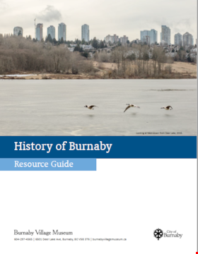
History of Burnaby Resource Guide
https://search.heritageburnaby.ca/link/museumlibrary7492
- Repository
- Burnaby Village Museum
- Collection
- Digital Reference Collection
- Material Type
- Digital Resource
- Accession Code
- BV019.63.1
- Author
- Burnaby Village Museum
- Place of Publication
- Burnaby, BC
- Publisher
- City of Burnaby
- Publication Date
- 2019
- Physical Description
- 21 p. : ill.
- Library Subject (LOC)
- Burnaby (B.C.)--History
- Directories
- Object History
- Created from research gathered by Burnaby Village Museum staff into the diverse History of Burnaby.
Images
Digital Books
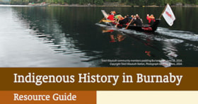
Indigenous History in Burnaby Resource Guide
https://search.heritageburnaby.ca/link/museumlibrary7493
- Repository
- Burnaby Village Museum
- Collection
- Digital Reference Collection
- Material Type
- Digital Resource
- Accession Code
- BV019.64.1
- Call Number
- 971.100497 BVM
- Edition
- First
- Contributor
- Kwantlen First Nation
- Sḵwx̱wú7mesh First Nation
- Tsleil-Waututh First Nation
- ʷməθkʷəy̓əm (Musqueam) First Nation
- Place of Publication
- Burnaby, BC
- Publisher
- City of Burnaby
- Publication Date
- 2019
- Library Subject (LOC)
- Indigenous peoples--British Columbia
- Indigenous peoples--British Columbia--History
- Indigenous peoples--Canada--History
- Subjects
- Indigenous peoples - British Columbia
- Indigenous peoples - British Columbia - Languages
- Indigenous peoples - British Columbia - Societies, etc.
- Name Access
- Burnaby Village Museum
- Object History
- 2019 version of working document developed by Burnaby Village Museum in collaboration with a number of First Nations partners over the course of several years. We recognize that Burnaby falls within the shared, ancestral and unceded territories of the hən̓q̓əmin̓əm and Sḵwx̱wú7mesh speaking people. We equally respect each of the Nations who share territory in Burnaby, and invite and welcome their ongoing participation in developing the contents of the Indigenous History in Burnaby Resource Guide.
Images
Digital Books
Landscape plan for front yard of Mawhinney house
https://search.heritageburnaby.ca/link/museumdescription15582
- Repository
- Burnaby Village Museum
- Date
- [between 1988 and 1990]
- Collection/Fonds
- Reverend Edward S. Gale fonds
- Description Level
- Item
- Physical Description
- 1 architectural drawing : pencil on parchment ; 30 x 56 cm
- Scope and Content
- Item consists of a landscape drawing identifying the layout and types of trees and bushes to be planted on the property of the Mervin Mawhinney house located at 7667 Burris Street in Burnaby while it was owned by Reverend Edward S. Gale. Grounds on the site were re-landscaped by Reverend Edward S. …
- Repository
- Burnaby Village Museum
- Collection/Fonds
- Reverend Edward S. Gale fonds
- Description Level
- Item
- Physical Description
- 1 architectural drawing : pencil on parchment ; 30 x 56 cm
- Scope and Content
- Item consists of a landscape drawing identifying the layout and types of trees and bushes to be planted on the property of the Mervin Mawhinney house located at 7667 Burris Street in Burnaby while it was owned by Reverend Edward S. Gale. Grounds on the site were re-landscaped by Reverend Edward S. Gale between 1988 and 1990..
- Geographic Access
- Burris Street
- Street Address
- 7667 Burris Street
- Accession Code
- BV018.9.48
- Access Restriction
- No restrictions
- Reproduction Restriction
- May be restricted by third party rights
- Date
- [between 1988 and 1990]
- Media Type
- Architectural Drawing
- Planning Study Area
- Morley-Buckingham Area
- Scan Resolution
- 600
- Scan Date
- May 3, 2021
- Scale
- 100
- Notes
- Title based on contents of photograph
Images
Landscape plan for front yard of Mawhinney house
https://search.heritageburnaby.ca/link/museumdescription15583
- Repository
- Burnaby Village Museum
- Date
- [between 1988 and 1990]
- Collection/Fonds
- Reverend Edward S. Gale fonds
- Description Level
- Item
- Physical Description
- 1 architectural drawing : blueline print with pencil ; 42.5 x 59.5 cm
- Scope and Content
- Item consists of an architectural landscape plan identifying the layout and types of trees and bushes to be planted in the front yard of the Mervin Mawhinney house located at 7667 Burris Street in Burnaby while it was owned by Reverend Edward S. Gale. Plantings identified include; Juniper, Rhodendr…
- Repository
- Burnaby Village Museum
- Collection/Fonds
- Reverend Edward S. Gale fonds
- Description Level
- Item
- Physical Description
- 1 architectural drawing : blueline print with pencil ; 42.5 x 59.5 cm
- Scope and Content
- Item consists of an architectural landscape plan identifying the layout and types of trees and bushes to be planted in the front yard of the Mervin Mawhinney house located at 7667 Burris Street in Burnaby while it was owned by Reverend Edward S. Gale. Plantings identified include; Juniper, Rhodendron, Azaleas, abelia, Rosh Rogos. Grounds on the site were re-landscaped by Reverend Edward S. Gale between 1988 and 1990.
- Geographic Access
- Burris Street
- Street Address
- 7667 Burris Street
- Accession Code
- BV018.9.49
- Access Restriction
- No restrictions
- Reproduction Restriction
- May be restricted by third party rights
- Date
- [between 1988 and 1990]
- Media Type
- Architectural Drawing
- Planning Study Area
- Morley-Buckingham Area
- Related Material
- See also BV018.9.30
- Scan Resolution
- 600
- Scan Date
- May 3, 2021
- Scale
- 100
- Notes
- Title based on contents of photograph
Images
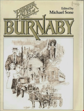
Pioneer tales of Burnaby
https://search.heritageburnaby.ca/link/museumlibrary5860
- Repository
- Burnaby Village Museum
- Collection
- Digital Reference Collection
- Reference Collection
- Material Type
- Book
- ISBN
- 096928280x
- Call Number
- 971.133 SON COPY 4
- Contributor
- Sone, Michael
- Place of Publication
- Burnaby, B.C.
- Publisher
- Corporation of the District of Burnaby
- Publication Date
- c1987
- Physical Description
- 495 p. : ill. ; 31 cm.
- Inscription
- "TR687 - Bryburgh" / handprinted in pencil on frontend page
- Library Subject (LOC)
- Pioneers--British Columbia--Burnaby
- Frontier and pioneer life
- Biography
- Object History
- Early Burnaby as recalled by the settlers themselves who arrived from every corner of the world between 1888 and 1930, some witnessing incorporation of the district in 1892, all seeking a better life for themselves and especially for their children, all helping transform the wilderness into the modern municipality of today.
- Notes
- "Editor Michael Sone".
- Includes index.
- 4 copies held: copy 4


![Burnaby Village Museum - Presentation drawing, [1985] thumbnail](/media/hpo/_Data/_BVM_Architectural_Drawings/2019_0052_0091_001.jpg?width=280)
![Burnaby Village Museum - side street, [1985] thumbnail](/media/hpo/_Data/_BVM_Architectural_Drawings/2019_0052_0174_001.jpg?width=280)


![Landscape plan for front yard of Mawhinney house, [between 1988 and 1990] thumbnail](/media/hpo/_Data/_BVM_Architectural_Drawings/2018_0009_0048_001.jpg?width=280)
![Landscape plan for front yard of Mawhinney house, [between 1988 and 1990] thumbnail](/media/hpo/_Data/_BVM_Architectural_Drawings/2018_0009_0049_001.jpg?width=280)
