More like 'Development on Big Bend agricultural land'
Narrow Results By
Chaffey-Burke School Sports Day
https://search.heritageburnaby.ca/link/archivedescription37571
- Repository
- City of Burnaby Archives
- Date
- [between 1970 and 1974] (date of original), copied 1991
- Collection/Fonds
- Burnaby Historical Society fonds
- Description Level
- Item
- Physical Description
- 1 photograph : b&w ; 4.0 x 4.0 cm print on contact sheet 20.2 x 25.3 cm
- Scope and Content
- Photograph of Sports Day at Chaffey-Burke School. Children are running on a field.
- Repository
- City of Burnaby Archives
- Date
- [between 1970 and 1974] (date of original), copied 1991
- Collection/Fonds
- Burnaby Historical Society fonds
- Subseries
- Burnaby Image Bank subseries
- Physical Description
- 1 photograph : b&w ; 4.0 x 4.0 cm print on contact sheet 20.2 x 25.3 cm
- Description Level
- Item
- Record No.
- 370-159
- Access Restriction
- No restrictions
- Reproduction Restriction
- No restrictions
- Accession Number
- BHS1999-03
- Scope and Content
- Photograph of Sports Day at Chaffey-Burke School. Children are running on a field.
- Media Type
- Photograph
- Notes
- Title based on contents of photograph
- 1 b&w copy negative accompanying
- Copied from a col. photograph
- Geographic Access
- Sardis Street
- Willingdon Avenue
- Historic Neighbourhood
- Central Park (Historic Neighbourhood)
- Planning Study Area
- Garden Village Area
Images
Chaffey-Burke School Sports Day
https://search.heritageburnaby.ca/link/archivedescription37572
- Repository
- City of Burnaby Archives
- Date
- [between 1970 and 1974] (date of original), copied 1991
- Collection/Fonds
- Burnaby Historical Society fonds
- Description Level
- Item
- Physical Description
- 1 photograph : b&w ; 4.0 x 4.0 cm print on contact sheet 20.2 x 25.3 cm
- Scope and Content
- Photograph of Sports Day at Chaffey-Burke School. Children are participating in activities on a field while adults look on. Houses are visible in the background.
- Repository
- City of Burnaby Archives
- Date
- [between 1970 and 1974] (date of original), copied 1991
- Collection/Fonds
- Burnaby Historical Society fonds
- Subseries
- Burnaby Image Bank subseries
- Physical Description
- 1 photograph : b&w ; 4.0 x 4.0 cm print on contact sheet 20.2 x 25.3 cm
- Description Level
- Item
- Record No.
- 370-160
- Access Restriction
- No restrictions
- Reproduction Restriction
- No restrictions
- Accession Number
- BHS1999-03
- Scope and Content
- Photograph of Sports Day at Chaffey-Burke School. Children are participating in activities on a field while adults look on. Houses are visible in the background.
- Media Type
- Photograph
- Notes
- Title based on contents of photograph
- 1 b&w copy negative accompanying
- Copied from a col. photograph
- Geographic Access
- Sardis Street
- Willingdon Avenue
- Historic Neighbourhood
- Central Park (Historic Neighbourhood)
- Planning Study Area
- Garden Village Area
Images
Barn at 6861 Kitchener Street
https://search.heritageburnaby.ca/link/archivedescription78995
- Repository
- City of Burnaby Archives
- Date
- October 4, 1976
- Collection/Fonds
- Burnaby Public Library Contemporary Visual Archive Project
- Description Level
- Item
- Physical Description
- 1 photograph : b&w ; 11 x 16 cm mounted on cardboard
- Scope and Content
- Photograph shows a barn and lot with a horse grazing at 6861 Kitchener Street near Cliff Avenue.
- Repository
- City of Burnaby Archives
- Date
- October 4, 1976
- Collection/Fonds
- Burnaby Public Library Contemporary Visual Archive Project
- Physical Description
- 1 photograph : b&w ; 11 x 16 cm mounted on cardboard
- Description Level
- Item
- Record No.
- 556-079
- Access Restriction
- No restrictions
- Reproduction Restriction
- Reproduce for fair dealing purposes only
- Accession Number
- 2013-13
- Scope and Content
- Photograph shows a barn and lot with a horse grazing at 6861 Kitchener Street near Cliff Avenue.
- Media Type
- Photograph
- Photographer
- Born, A. J.
- Notes
- Scope note taken directly from BPL photograph description.
- 1 b&w copy negative : 10 x 12.5 cm accompanying
- Geographic Access
- Kitchener Street
- Street Address
- 6861 Kitchener Street
- Historic Neighbourhood
- Lochdale (Historic Neighbourhood)
- Planning Study Area
- Lochdale Area
Images
Chicken at Lubbock's farm
https://search.heritageburnaby.ca/link/archivedescription36522
- Repository
- City of Burnaby Archives
- Date
- 1977
- Collection/Fonds
- Burnaby Historical Society fonds
- Description Level
- Item
- Physical Description
- 1 photograph : col. ; 9 x 8.5 cm
- Scope and Content
- Photograph of chickens inside a tall fence at the Lubbock farm. The barn is visible in the background.
- Repository
- City of Burnaby Archives
- Date
- 1977
- Collection/Fonds
- Burnaby Historical Society fonds
- Subseries
- Lubbock family subseries
- Physical Description
- 1 photograph : col. ; 9 x 8.5 cm
- Description Level
- Item
- Record No.
- 289-011
- Access Restriction
- No restrictions
- Reproduction Restriction
- Reproduce for fair dealing purposes only
- Accession Number
- BHS1992-24
- Scope and Content
- Photograph of chickens inside a tall fence at the Lubbock farm. The barn is visible in the background.
- Subjects
- Animals - Poultry
- Agriculture - Farms
- Media Type
- Photograph
- Notes
- Title based on contents of photograph
- Geographic Access
- Grandview Highway
- Canada Way
- Burris Street
- Street Address
- 7803 Burris Street
- Historic Neighbourhood
- Burnaby Lake (Historic Neighbourhood)
- Planning Study Area
- Morley-Buckingham Area
Images
House at 7700 Haszard Street
https://search.heritageburnaby.ca/link/archivedescription78891
- Repository
- City of Burnaby Archives
- Date
- February 7, 1977
- Collection/Fonds
- Burnaby Public Library Contemporary Visual Archive Project
- Description Level
- Item
- Physical Description
- 1 photograph : b&w ; 11 x 16 cm mounted on cardboard
- Scope and Content
- Photograph shows the house and farm yard at 7700 Haszard Street, near Caanda Way.
- Repository
- City of Burnaby Archives
- Date
- February 7, 1977
- Collection/Fonds
- Burnaby Public Library Contemporary Visual Archive Project
- Physical Description
- 1 photograph : b&w ; 11 x 16 cm mounted on cardboard
- Description Level
- Item
- Record No.
- 556-017
- Access Restriction
- No restrictions
- Reproduction Restriction
- Reproduce for fair dealing purposes only
- Accession Number
- 2013-13
- Scope and Content
- Photograph shows the house and farm yard at 7700 Haszard Street, near Caanda Way.
- Subjects
- Agriculture - Farms
- Media Type
- Photograph
- Notes
- Scope note taken directly from BPL photograph description.
- 1 b&w copy negative : 10 x 12.5 cm accompanying
- Photographers identified by surnames only: Carr and Vardeman
- Geographic Access
- Haszard Street
- Street Address
- 7700 Haszard Street
- Historic Neighbourhood
- Burnaby Lake (Historic Neighbourhood)
- Planning Study Area
- Morley-Buckingham Area
Images
Interview with Robert Lowe by Eric Damer November 5, 2012 - Track 2
https://search.heritageburnaby.ca/link/oralhistory354
- Repository
- City of Burnaby Archives
- Date Range
- 1939-2012
- Length
- 0:09:13
- Summary
- This portion of the recording pertains to Robert "Bob" Lowe's memories of the development of property Burnaby. He discusses houses being built by his father, grandfather and himself; this includes the property that he and his wife bought in 1961. Bob also discusses the rise of the automobile.
- Repository
- City of Burnaby Archives
- Summary
- This portion of the recording pertains to Robert "Bob" Lowe's memories of the development of property Burnaby. He discusses houses being built by his father, grandfather and himself; this includes the property that he and his wife bought in 1961. Bob also discusses the rise of the automobile.
- Date Range
- 1939-2012
- Photo Info
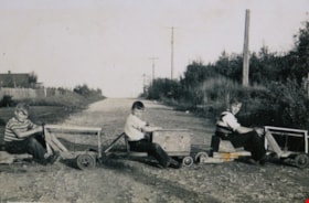
- Robert "Bob" Lowe (at center) and friends riding soap box race cars, [1939]. Item no. 549-041.
- Length
- 0:09:13
- Planning Study Area
- Government Road Area
- Interviewer
- Damer, Eric
- Interview Date
- November 5, 2012
- Scope and Content
- Recording is an interview with Robert "Bob" Lowe conducted by Burnaby Village Museum employee Eric Damer, November 5, 2012. Major theme discussed: the rise of the automobile and its effect on development in Burnaby.
- Biographical Notes
- Robert "Bob" Lowe has lived his entire life in Burnaby. During his childhood, Bob’s family lived at several addresses near Royal Oak and what is now Canada Way. He attended Douglas Road Elementary and South Burnaby High Schools. After graduating, Bob worked for a few years before enrolling in Normal School for a teaching certificate. He began teaching in Vancouver, married in 1952, and started a family. The Lowes moved to Government Road in 1961 and began a hobby farm, while Bob upgraded his formal education and became an administrator in the new college system.
- Total Tracks
- 4
- Total Length
- 0:36:54
- Interviewee Name
- Lowe, Robert "Bob"
- Interview Location
- Interviewee's residence
- Interviewer Bio
- Eric Damer is a lifelong British Columbian born in Victoria, raised in Kamloops, and currently residing in Burnaby. After studying philosophy at the University of Victoria, he became interested in the educational forces that had shaped his own life. He completed master’s and doctoral degrees in educational studies at the University of British Columbia with a particular interest in the history of adult and higher education in the province. In 2012, Eric worked for the City of Burnaby as a field researcher and writer, conducting interviews for the City Archives and Museum Oral History Program.
- Collection/Fonds
- Community Heritage Commission Special Projects fonds
- Transcript Available
- None
- Media Type
- Sound Recording
Images
Audio Tracks
Track two of recording of interview with Bob Lowe
Track two of recording of interview with Bob Lowe
https://search.heritageburnaby.ca/media/hpo/_Data/_Archives_Oral_Histories/_Unrestricted/MSS171-016/MSS171-016_Track_2.mp3Interview with Robert Lowe by Eric Damer November 5, 2012 - Track 3
https://search.heritageburnaby.ca/link/oralhistory355
- Repository
- City of Burnaby Archives
- Date Range
- 1939-1972
- Length
- 0:10:04
- Summary
- This portion of the recording pertains to Robert "Bob" Lowe's memories of growing up in Burnaby. He discusses transportation in Burnaby, including the first cars in his family. Bob talks about recreational activities available to Burnaby residents in the late nineteen-thirties and early nineteen-fo…
- Repository
- City of Burnaby Archives
- Summary
- This portion of the recording pertains to Robert "Bob" Lowe's memories of growing up in Burnaby. He discusses transportation in Burnaby, including the first cars in his family. Bob talks about recreational activities available to Burnaby residents in the late nineteen-thirties and early nineteen-forties, as well as changes that he has seen from his time growing up to the time of raising his own children.
- Date Range
- 1939-1972
- Photo Info
- Robert "Bob" Lowe (at center) and friends riding soap box race cars, [1939]. Item no. 549-041.
- Length
- 0:10:04
- Interviewer
- Damer, Eric
- Interview Date
- November 5, 2012
- Scope and Content
- Recording is an interview with Robert "Bob" Lowe conducted by Burnaby Village Museum employee Eric Damer, November 5, 2012. Major theme discussed: the rise of the automobile and its effect on development in Burnaby.
- Biographical Notes
- Robert "Bob" Lowe has lived his entire life in Burnaby. During his childhood, Bob’s family lived at several addresses near Royal Oak and what is now Canada Way. He attended Douglas Road Elementary and South Burnaby High Schools. After graduating, Bob worked for a few years before enrolling in Normal School for a teaching certificate. He began teaching in Vancouver, married in 1952, and started a family. The Lowes moved to Government Road in 1961 and began a hobby farm, while Bob upgraded his formal education and became an administrator in the new college system.
- Total Tracks
- 4
- Total Length
- 0:36:54
- Interviewee Name
- Lowe, Robert "Bob"
- Interview Location
- Interviewee's residence
- Interviewer Bio
- Eric Damer is a lifelong British Columbian born in Victoria, raised in Kamloops, and currently residing in Burnaby. After studying philosophy at the University of Victoria, he became interested in the educational forces that had shaped his own life. He completed master’s and doctoral degrees in educational studies at the University of British Columbia with a particular interest in the history of adult and higher education in the province. In 2012, Eric worked for the City of Burnaby as a field researcher and writer, conducting interviews for the City Archives and Museum Oral History Program.
- Collection/Fonds
- Community Heritage Commission Special Projects fonds
- Transcript Available
- None
- Media Type
- Sound Recording
Images
Audio Tracks
Track three of recording of interview with Bob Lowe
Track three of recording of interview with Bob Lowe
https://search.heritageburnaby.ca/media/hpo/_Data/_Archives_Oral_Histories/_Unrestricted/MSS171-016/MSS171-016_Track_3.mp3Lubbock family home and farm
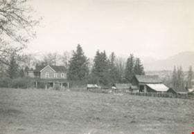
https://search.heritageburnaby.ca/link/archivedescription35861
- Repository
- City of Burnaby Archives
- Date
- [197-] (date of original), copied 1986
- Collection/Fonds
- Burnaby Historical Society fonds
- Description Level
- Item
- Physical Description
- 1 photograph : b&w ; 12.7 x 17.8 cm print
- Scope and Content
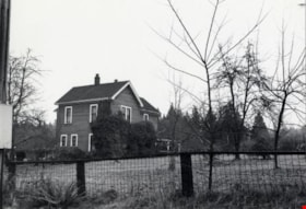
- Photograph of the Lubbock family home and farm, built in 1898 by Edgar Sprott, brother of former Reeve, Charles F. Sprott. The Lubbock family moved into the house in 1915.
- Repository
- City of Burnaby Archives
- Date
- [197-] (date of original), copied 1986
- Collection/Fonds
- Burnaby Historical Society fonds
- Subseries
- Pioneer Tales subseries
- Physical Description
- 1 photograph : b&w ; 12.7 x 17.8 cm print
- Description Level
- Item
- Record No.
- 204-720
- Access Restriction
- No restrictions
- Reproduction Restriction
- Reproduce for fair dealing purposes only
- Accession Number
- BHS1988-03
- Scope and Content
- Photograph of the Lubbock family home and farm, built in 1898 by Edgar Sprott, brother of former Reeve, Charles F. Sprott. The Lubbock family moved into the house in 1915.
- Media Type
- Photograph
- Notes
- Title based on contents of photograph.
- A note with the photograph indicated that the old street address of this farm was 1 Arbor Lane.
- Geographic Access
- Grandview Highway
- Canada Way
- Burris Street
- Street Address
- 7803 Burris Street
- Historic Neighbourhood
- Burnaby Lake (Historic Neighbourhood)
- Planning Study Area
- Morley-Buckingham Area
Images
Lubbock family home and farm
https://search.heritageburnaby.ca/link/archivedescription35862
- Repository
- City of Burnaby Archives
- Date
- [197-] (date of original), copied 1986
- Collection/Fonds
- Burnaby Historical Society fonds
- Description Level
- Item
- Physical Description
- 1 photograph : b&w ; 12.7 x 17.8 cm print
- Scope and Content
- Photograph of cows grazing on the Lubbock farm with the family home seen in the background. The house was built in 1898 by Edgar Sprott, brother of former Reeve, Charles F. Sprott. The Lubbock family moved into the house in 1915.
- Repository
- City of Burnaby Archives
- Date
- [197-] (date of original), copied 1986
- Collection/Fonds
- Burnaby Historical Society fonds
- Subseries
- Pioneer Tales subseries
- Physical Description
- 1 photograph : b&w ; 12.7 x 17.8 cm print
- Description Level
- Item
- Record No.
- 204-721
- Access Restriction
- No restrictions
- Reproduction Restriction
- Reproduce for fair dealing purposes only
- Accession Number
- BHS1988-03
- Scope and Content
- Photograph of cows grazing on the Lubbock farm with the family home seen in the background. The house was built in 1898 by Edgar Sprott, brother of former Reeve, Charles F. Sprott. The Lubbock family moved into the house in 1915.
- Media Type
- Photograph
- Notes
- Title based on contents of photograph.
- A note with this photograph indicated that the old street address of this property was 1 Arbor Lane.
- Geographic Access
- Grandview Highway
- Canada Way
- Burris Street
- Street Address
- 7803 Burris Street
- Historic Neighbourhood
- Burnaby Lake (Historic Neighbourhood)
- Planning Study Area
- Morley-Buckingham Area
Images
Lubbock farm
https://search.heritageburnaby.ca/link/archivedescription37248
- Repository
- City of Burnaby Archives
- Date
- April 1976
- Collection/Fonds
- Burnaby Historical Society fonds
- Description Level
- Item
- Physical Description
- 1 photograph : b&w ; 11.5 x 16.5 cm
- Scope and Content
- Photograph of the Lubbock farm and riding stable.
- Repository
- City of Burnaby Archives
- Date
- April 1976
- Collection/Fonds
- Burnaby Historical Society fonds
- Subseries
- Lubbock family subseries
- Physical Description
- 1 photograph : b&w ; 11.5 x 16.5 cm
- Description Level
- Item
- Record No.
- 342-022
- Access Restriction
- No restrictions
- Reproduction Restriction
- Reproduce for fair dealing purposes only
- Accession Number
- BHS1994-02
- Scope and Content
- Photograph of the Lubbock farm and riding stable.
- Subjects
- Agriculture - Farms
- Media Type
- Photograph
- Notes
- Title based on contents of photograph
- Note on verso of photograph reads: "COLUMBIAN 1976 APRIL"
- Geographic Access
- Grandview Highway
- Canada Way
- Burris Street
- Street Address
- 7803 Burris Street
- Historic Neighbourhood
- Burnaby Lake (Historic Neighbourhood)
- Planning Study Area
- Morley-Buckingham Area
Images
Lubbock photographs from album
https://search.heritageburnaby.ca/link/archivedescription64493
- Repository
- City of Burnaby Archives
- Date
- 1945-1988
- Collection/Fonds
- Burnaby Historical Society fonds
- Description Level
- File
- Physical Description
- 130 photographs : b&w and col. ; 20.5 x 25.5 cm or smaller
- Scope and Content
- Photographs of the Lubbock family, including their riding stables and horses, family events, their pets, and landscape and travel photographs. These photographs were originally housed in a photographic album.
- Repository
- City of Burnaby Archives
- Date
- 1945-1988
- Collection/Fonds
- Burnaby Historical Society fonds
- Subseries
- Lubbock family subseries
- Physical Description
- 130 photographs : b&w and col. ; 20.5 x 25.5 cm or smaller
- Description Level
- File
- Record No.
- 342-046
- Access Restriction
- In Archives only
- Reproduction Restriction
- May be restricted by third party rights
- Accession Number
- BHS1994-02
- Scope and Content
- Photographs of the Lubbock family, including their riding stables and horses, family events, their pets, and landscape and travel photographs. These photographs were originally housed in a photographic album.
- Names
- Lubbock, Ainsly
- Lubbock, Beatrice "Bea"
- Lubbock, Elizabeth
- Lubbock, Gordon
- Lubbock, John
- Lubbock, John Barker
- Lubbock, Mina
- Media Type
- Photograph
- Notes
- Title based on contents of photograph
- Geographic Access
- Grandview Highway
- Canada Way
- Burris Street
- Street Address
- 7803 Burris Street
- Historic Neighbourhood
- Burnaby Lake (Historic Neighbourhood)
- Planning Study Area
- Morley-Buckingham Area
Lubbock's farm
https://search.heritageburnaby.ca/link/archivedescription36517
- Repository
- City of Burnaby Archives
- Date
- 1977
- Collection/Fonds
- Burnaby Historical Society fonds
- Description Level
- Item
- Physical Description
- 1 photograph : col. ; 9 x 8.5 cm
- Scope and Content
- Copyright holder and creator are unknown. Copyright expires in 2053.
- Repository
- City of Burnaby Archives
- Date
- 1977
- Collection/Fonds
- Burnaby Historical Society fonds
- Subseries
- Lubbock family subseries
- Physical Description
- 1 photograph : col. ; 9 x 8.5 cm
- Description Level
- Item
- Record No.
- 289-006
- Access Restriction
- No restrictions
- Reproduction Restriction
- Reproduce for fair dealing purposes only
- Accession Number
- BHS1992-24
- Scope and Content
- Copyright holder and creator are unknown. Copyright expires in 2053.
- Media Type
- Photograph
- Notes
- Title based on contents of photograph
- Geographic Access
- Grandview Highway
- Canada Way
- Burris Street
- Street Address
- 7803 Burris Street
- Historic Neighbourhood
- Burnaby Lake (Historic Neighbourhood)
- Planning Study Area
- Morley-Buckingham Area
Images
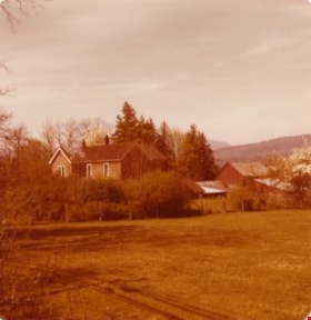
Lubbock's stable and farm house
https://search.heritageburnaby.ca/link/archivedescription36512
- Repository
- City of Burnaby Archives
- Date
- 1977
- Collection/Fonds
- Burnaby Historical Society fonds
- Description Level
- Item
- Physical Description
- 1 photograph : col. ; 9 x 8.5 cm
- Scope and Content
- Photograph of Lubbock's farm taken from Canada Way at Haszard Street. The Lubbock stable and farm house are both visible.
- Repository
- City of Burnaby Archives
- Date
- 1977
- Collection/Fonds
- Burnaby Historical Society fonds
- Subseries
- Lubbock family subseries
- Physical Description
- 1 photograph : col. ; 9 x 8.5 cm
- Description Level
- Item
- Record No.
- 289-001
- Access Restriction
- No restrictions
- Reproduction Restriction
- Reproduce for fair dealing purposes only
- Accession Number
- BHS1992-24
- Scope and Content
- Photograph of Lubbock's farm taken from Canada Way at Haszard Street. The Lubbock stable and farm house are both visible.
- Media Type
- Photograph
- Notes
- Title based on contents of photograph
- Geographic Access
- Grandview Highway
- Canada Way
- Burris Street
- Street Address
- 7803 Burris Street
- Historic Neighbourhood
- Burnaby Lake (Historic Neighbourhood)
- Planning Study Area
- Morley-Buckingham Area
Images
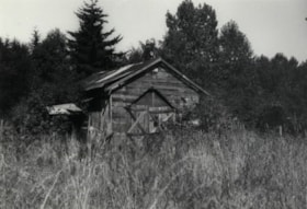
Shack at 7400 Block Halifax Street
https://search.heritageburnaby.ca/link/archivedescription78993
- Repository
- City of Burnaby Archives
- Date
- September 7, 1976
- Collection/Fonds
- Burnaby Public Library Contemporary Visual Archive Project
- Description Level
- Item
- Physical Description
- 1 photograph : b&w ; 11 x 16 cm mounted on cardboard
- Scope and Content
- Photograph shows an old shack in the 7400 Block Halifax Street built in approximately 1930. The shack was a boiler shed for what was then a 40-acre farm specializing in pigs and horses.
- Repository
- City of Burnaby Archives
- Date
- September 7, 1976
- Collection/Fonds
- Burnaby Public Library Contemporary Visual Archive Project
- Physical Description
- 1 photograph : b&w ; 11 x 16 cm mounted on cardboard
- Description Level
- Item
- Record No.
- 556-078
- Access Restriction
- No restrictions
- Reproduction Restriction
- Reproduce for fair dealing purposes only
- Accession Number
- 2013-13
- Scope and Content
- Photograph shows an old shack in the 7400 Block Halifax Street built in approximately 1930. The shack was a boiler shed for what was then a 40-acre farm specializing in pigs and horses.
- Subjects
- Agriculture - Farms
- Media Type
- Photograph
- Photographer
- Born, A. J.
- Notes
- Scope note taken directly from BPL photograph description.
- 1 b&w copy negative : 10 x 12.5 cm accompanying
- Geographic Access
- Halifax Street
- Historic Neighbourhood
- Lochdale (Historic Neighbourhood)
- Planning Study Area
- Sperling-Broadway Area
Images
Burnaby Mountain Park
https://search.heritageburnaby.ca/link/archivedescription93639
- Repository
- City of Burnaby Archives
- Date
- November 19, 1977
- Collection/Fonds
- Burnaby Public Library Contemporary Visual Archive Project
- Description Level
- Item
- Physical Description
- 1 photograph : b&w ; 12.5 x 17.5 cm
- Scope and Content
- Photograph of the hillside on the top of Burnaby Mountain Park, with a person in the foreground looking out to the view. The photograph is taken facing northwest and shows the view over the the Burrard Inlet. Capitol Hill, the North Shore Mountains, and downtown Vancouver are visible in the distanc…
- Repository
- City of Burnaby Archives
- Date
- November 19, 1977
- Collection/Fonds
- Burnaby Public Library Contemporary Visual Archive Project
- Physical Description
- 1 photograph : b&w ; 12.5 x 17.5 cm
- Description Level
- Item
- Record No.
- 556-596
- Access Restriction
- No restrictions
- Reproduction Restriction
- Reproduce for fair dealing purposes only
- Accession Number
- 2017-57
- Scope and Content
- Photograph of the hillside on the top of Burnaby Mountain Park, with a person in the foreground looking out to the view. The photograph is taken facing northwest and shows the view over the the Burrard Inlet. Capitol Hill, the North Shore Mountains, and downtown Vancouver are visible in the distance.
- Names
- Burnaby Mountain Park
- Media Type
- Photograph
- Photographer
- van Mannen, Mark
- Notes
- Title taken from project information form
- Accompanied by a project information form and 1 photograph (b&w negative ; 9.5 x 12.5 cm)
- BPL no. 45
- Geographic Access
- Burnaby Mountain Conservation Area
- Planning Study Area
- Burnaby Mountain Area
Images
Burnaby Mountain Park
https://search.heritageburnaby.ca/link/archivedescription93640
- Repository
- City of Burnaby Archives
- Date
- November 19, 1977
- Collection/Fonds
- Burnaby Public Library Contemporary Visual Archive Project
- Description Level
- Item
- Physical Description
- 1 photograph : b&w ; 12.5 x 17.5 cm
- Scope and Content
- Photograph of the top of Burnaby Mountain Park and the view of Vancouver from the hillside, with a man standing in the foreground. The photograph is taken facing west of southwest. Capitol Hill, the Burrard Inlet, the North Shore Mountains, Vancouver, and Stanley Park are visible in the distance.
- Repository
- City of Burnaby Archives
- Date
- November 19, 1977
- Collection/Fonds
- Burnaby Public Library Contemporary Visual Archive Project
- Physical Description
- 1 photograph : b&w ; 12.5 x 17.5 cm
- Description Level
- Item
- Record No.
- 556-597
- Access Restriction
- No restrictions
- Reproduction Restriction
- Reproduce for fair dealing purposes only
- Accession Number
- 2017-57
- Scope and Content
- Photograph of the top of Burnaby Mountain Park and the view of Vancouver from the hillside, with a man standing in the foreground. The photograph is taken facing west of southwest. Capitol Hill, the Burrard Inlet, the North Shore Mountains, Vancouver, and Stanley Park are visible in the distance.
- Names
- Burnaby Mountain Park
- Media Type
- Photograph
- Photographer
- McGillivray, Don
- Notes
- Title taken from project information form
- Accompanied by a project information form and 1 photograph (b&w negative ; 9.5 x 12.5 cm)
- BPL no. 46
- Geographic Access
- Burnaby Mountain Conservation Area
- Planning Study Area
- Burnaby Mountain Area
Images
Burnaby Mountain Park
https://search.heritageburnaby.ca/link/archivedescription93645
- Repository
- City of Burnaby Archives
- Date
- November 19, 1977
- Collection/Fonds
- Burnaby Public Library Contemporary Visual Archive Project
- Description Level
- Item
- Physical Description
- 1 photograph : b&w ; 12.5 x 17.5 cm
- Scope and Content
- Photograph of the view from Burnaby Mountain of the Burrard Inlet, the oil refinery, and the mountains. The photograph is taken from Burnaby Mountain Park, facing north.
- Repository
- City of Burnaby Archives
- Date
- November 19, 1977
- Collection/Fonds
- Burnaby Public Library Contemporary Visual Archive Project
- Physical Description
- 1 photograph : b&w ; 12.5 x 17.5 cm
- Description Level
- Item
- Record No.
- 556-602
- Access Restriction
- No restrictions
- Reproduction Restriction
- Reproduce for fair dealing purposes only
- Accession Number
- 2017-57
- Scope and Content
- Photograph of the view from Burnaby Mountain of the Burrard Inlet, the oil refinery, and the mountains. The photograph is taken from Burnaby Mountain Park, facing north.
- Subjects
- Geographic Features - Inlets
- Geographic Features - Parks
- Geographic Features - Mountains
- Buildings - Industrial - Refineries
- Names
- Burnaby Mountain Park
- Media Type
- Photograph
- Photographer
- van Mannen, Mark
- Notes
- Title taken from project information form
- Accompanied by a project information form and 1 photograph (b&w negative ; 9.5 x 12.5 cm)
- BPL no. 52
- Geographic Access
- Burnaby Mountain Conservation Area
- Burrard Inlet
- Planning Study Area
- Burnaby Mountain Area
Images
Burnaby Mountain Park Looking West
https://search.heritageburnaby.ca/link/archivedescription93707
- Repository
- City of Burnaby Archives
- Date
- February 15, 1978
- Collection/Fonds
- Burnaby Public Library Contemporary Visual Archive Project
- Description Level
- Item
- Physical Description
- 1 photograph : b&w ; 12.5 x 17.5 cm
- Scope and Content
- Photograph of the view from Burnaby Mountain Park. The photograph is taken facing west and shows the park, part of the parking lot at the Burnaby Centennial Pavilion, and Capitol Hill and the mountains in the distance.
- Repository
- City of Burnaby Archives
- Date
- February 15, 1978
- Collection/Fonds
- Burnaby Public Library Contemporary Visual Archive Project
- Physical Description
- 1 photograph : b&w ; 12.5 x 17.5 cm
- Description Level
- Item
- Record No.
- 556-664
- Access Restriction
- No restrictions
- Reproduction Restriction
- Reproduce for fair dealing purposes only
- Accession Number
- 2017-57
- Scope and Content
- Photograph of the view from Burnaby Mountain Park. The photograph is taken facing west and shows the park, part of the parking lot at the Burnaby Centennial Pavilion, and Capitol Hill and the mountains in the distance.
- Subjects
- Geographic Features - Parks
- Geographic Features - Mountains
- Geographic Features - Automobile Parking Lots
- Names
- Burnaby Mountain Park
- Media Type
- Photograph
- Photographer
- Surridge, Jack
- Notes
- Title taken from project information form
- Accompanied by a project information form and 1 photograph (b&w negative ; 9.5 x 12.5 cm)
- BPL no. 112
- Geographic Access
- Burnaby Mountain Conservation Area
- Street Address
- 100 Centennial Way
- Planning Study Area
- Burnaby Mountain Area
Images
Barnet Beach
https://search.heritageburnaby.ca/link/archivedescription93650
- Repository
- City of Burnaby Archives
- Date
- November 20, 1977
- Collection/Fonds
- Burnaby Public Library Contemporary Visual Archive Project
- Description Level
- Item
- Physical Description
- 1 photograph : b&w ; 12.5 x 17.5 cm
- Scope and Content
- Photograph of Burrard Inlet, taken facing west from Barnet Beach. Capitol Hill and the Second Narrows Bridge are visible in the distance.
- Repository
- City of Burnaby Archives
- Date
- November 20, 1977
- Collection/Fonds
- Burnaby Public Library Contemporary Visual Archive Project
- Physical Description
- 1 photograph : b&w ; 12.5 x 17.5 cm
- Description Level
- Item
- Record No.
- 556-607
- Access Restriction
- No restrictions
- Reproduction Restriction
- Reproduce for fair dealing purposes only
- Accession Number
- 2017-57
- Scope and Content
- Photograph of Burrard Inlet, taken facing west from Barnet Beach. Capitol Hill and the Second Narrows Bridge are visible in the distance.
- Media Type
- Photograph
- Photographer
- Chapman, Fred
- Notes
- Title taken from project information form
- Accompanied by a project information form and 1 photograph (b&w negative ; 9.5 x 12.5 cm)
- BPL no. 57
- Geographic Access
- Barnet Marine Park
- Historic Neighbourhood
- Barnet (Historic Neighbourhood)
- Planning Study Area
- Burnaby Mountain Area
Images
Burnaby Lake Show / originals
https://search.heritageburnaby.ca/link/archivedescription91683
- Repository
- City of Burnaby Archives
- Date
- 1962-1995
- Collection/Fonds
- Doreen Lawson fonds
- Description Level
- File
- Physical Description
- 71 photographs : col. slides ; 35 mm
- Scope and Content
- File consists of photographs compiled by Doreen Lawson for a slideshow presentation about Burnaby Lake. Slideshow primarily depicts the wildlife and foliage of Burnaby Lake, including: the American coot, green-winged teal, bufflehead, heron, american bittern, barn swallow, barn owl, painted turtle,…
- Repository
- City of Burnaby Archives
- Date
- 1962-1995
- Collection/Fonds
- Doreen Lawson fonds
- Physical Description
- 71 photographs : col. slides ; 35 mm
- Description Level
- File
- Record No.
- 618-001
- Access Restriction
- No restrictions
- Reproduction Restriction
- May be restricted by third party rights
- Accession Number
- 2015-15
- Scope and Content
- File consists of photographs compiled by Doreen Lawson for a slideshow presentation about Burnaby Lake. Slideshow primarily depicts the wildlife and foliage of Burnaby Lake, including: the American coot, green-winged teal, bufflehead, heron, american bittern, barn swallow, barn owl, painted turtle, muskrat, Canadian goose, beaver, wood duck, bullrushes, yellow and white waterlilies, yellow iris, and loosestrife. Also included in the slideshow are photographs of the BC Wildlife rescue and fisherman working in the Brunette River.
- Subjects
- Geographic Features - Lakes and Ponds
- Animals - Birds
- Animals
- Geographic Features - Forests
- Media Type
- Photograph
- Photographer
- Lawson, Doreen A.
- Chapman, Fred
- Notes
- Transcribed title
- Title transcribed from sheets slides
- Photographs contents are identified on many of the slide cases within the file.
- Historic Neighbourhood
- Burnaby Lake (Historic Neighbourhood)
- Planning Study Area
- Burnaby Lake Area
![Chaffey-Burke School Sports Day, [between 1970 and 1974] (date of original), copied 1991 thumbnail](/media/hpo/_Data/_Archives_Images/_Unrestricted/370/370-159.jpg?width=280)
![Chaffey-Burke School Sports Day, [between 1970 and 1974] (date of original), copied 1991 thumbnail](/media/hpo/_Data/_Archives_Images/_Unrestricted/370/370-160.jpg?width=280)
![Lubbock family home and farm, [197-] (date of original), copied 1986 thumbnail](/media/hpo/_Data/_Archives_Images/_Unrestricted/204/204-720.jpg?width=280)
![Lubbock family home and farm, [197-] (date of original), copied 1986 thumbnail](/media/hpo/_Data/_Archives_Images/_Unrestricted/204/204-721.jpg?width=280)
