Narrow Results By
Subject
- Advertising Medium - Poster 7
- Advertising Medium - Signs and Signboards 1
- Buildings - Civic 1
- Buildings - Civic - City Halls 1
- Buildings - Recreational 1
- Buildings - Residential 1
- Buildings - Schools - Universities and Colleges 1
- Celebrations - Centennials 9
- Ceremonies - Awards 1
- Documentary Artifacts - Maps 6
- Education 1
- Events - Fundraising 1
![SFU Geography class with maps, [2000] thumbnail](/media/hpo/_Data/_Archives_Images/_Unrestricted/535/535-2626.jpg?width=280)
SFU Geography class with maps
https://search.heritageburnaby.ca/link/archivedescription97099
- Repository
- City of Burnaby Archives
- Date
- [2000]
- Collection/Fonds
- Burnaby NewsLeader photograph collection
- Description Level
- Item
- Physical Description
- 1 photograph (tiff) : col.
- Scope and Content
- Photograph of Mike Carr and Simon Fraser University Geography students Dallas Arcangel, Dave Crossley, Caoimhe Kehler and Peter Schaub with maps of "Salmonopolis." They are standing on the roof of an SFU building with forest and mountains visible in the background.
- Repository
- City of Burnaby Archives
- Date
- [2000]
- Collection/Fonds
- Burnaby NewsLeader photograph collection
- Physical Description
- 1 photograph (tiff) : col.
- Description Level
- Item
- Record No.
- 535-2626
- Access Restriction
- No restrictions
- Reproduction Restriction
- No restrictions
- Accession Number
- 2018-12
- Scope and Content
- Photograph of Mike Carr and Simon Fraser University Geography students Dallas Arcangel, Dave Crossley, Caoimhe Kehler and Peter Schaub with maps of "Salmonopolis." They are standing on the roof of an SFU building with forest and mountains visible in the background.
- Names
- Simon Fraser University
- Media Type
- Photograph
- Photographer
- Bartel, Mario
- Notes
- Title based on caption
- Collected by editorial for use in a July 2000 issue of the Burnaby NewsLeader
- Caption from metadata: "SFU geography instructor Mike Carr, and his team of students (front to back), Dallas Arcangel, Dave Crossley, Caoimhe Kehler and Peter Schaub, examine the maps of "Salmonopolis" they've created as part of a plan to create a sustainable region."
- Geographic Access
- Burnaby Mountain Conservation Area
- University Drive
- Street Address
- 8888 University Drive
- Planning Study Area
- Burnaby Mountain Area
Images
![SFU Geography class with maps, [2000] thumbnail](/media/hpo/_Data/_Archives_Images/_Unrestricted/535/535-2626.jpg)
![City of Burnaby digital mapping system, [2002] thumbnail](/media/hpo/_Data/_Archives_Images/_Unrestricted/535/535-2325.jpg?width=280)
City of Burnaby digital mapping system
https://search.heritageburnaby.ca/link/archivedescription96720
- Repository
- City of Burnaby Archives
- Date
- [2002]
- Collection/Fonds
- Burnaby NewsLeader photograph collection
- Description Level
- Item
- Physical Description
- 1 photograph (tiff) : col.
- Scope and Content
- Photograph of Terry Richard, from the City of Burnaby Engineering Department, posing with a map of Burnaby and a desktop computer displaying the City's new digital mapping system.
- Repository
- City of Burnaby Archives
- Date
- [2002]
- Collection/Fonds
- Burnaby NewsLeader photograph collection
- Physical Description
- 1 photograph (tiff) : col.
- Description Level
- Item
- Record No.
- 535-2325
- Access Restriction
- No restrictions
- Reproduction Restriction
- No restrictions
- Accession Number
- 2018-12
- Scope and Content
- Photograph of Terry Richard, from the City of Burnaby Engineering Department, posing with a map of Burnaby and a desktop computer displaying the City's new digital mapping system.
- Media Type
- Photograph
- Photographer
- Bartel, Mario
- Notes
- Title based on caption
- Collected by editorial for use in an April 2002 issue of the Burnaby NewsLeader
- Caption from metadata: "Terry Richard, of Burnaby's Engineering Department, is overseeing the transfer of its mapping system to the internet."
Images
![City of Burnaby digital mapping system, [2002] thumbnail](/media/hpo/_Data/_Archives_Images/_Unrestricted/535/535-2325.jpg)
![Map of Burnaby, [1971] thumbnail](/media/hpo/_Data/_BVM_Images/2005/2005_0054_0237_001.jpg?width=280)
Map of Burnaby
https://search.heritageburnaby.ca/link/museumdescription2189
- Repository
- Burnaby Village Museum
- Date
- [1971]
- Collection/Fonds
- Donald Copan collection
- Description Level
- Item
- Physical Description
- 1 photograph : b&w ; 8.9 x 12.7 cm
- Scope and Content
- Photograph of large sign with map of Burnaby. Map was used for Burnaby Centennial Celebrations display in 1971.
- Repository
- Burnaby Village Museum
- Collection/Fonds
- Donald Copan collection
- Series
- Copan album series
- Description Level
- Item
- Physical Description
- 1 photograph : b&w ; 8.9 x 12.7 cm
- Scope and Content
- Photograph of large sign with map of Burnaby. Map was used for Burnaby Centennial Celebrations display in 1971.
- Accession Code
- BV005.54.237
- Access Restriction
- No restrictions
- Reproduction Restriction
- May be restricted by third party rights
- Date
- [1971]
- Media Type
- Photograph
- Scan Resolution
- 600
- Scan Date
- July 21, 2020
- Scale
- 100
- Notes
- Title based on contents of photograph
Images
![Map of Burnaby, [1971] thumbnail](/media/hpo/_Data/_BVM_Images/2005/2005_0054_0237_001.jpg)
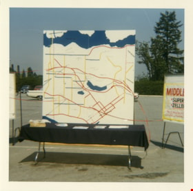
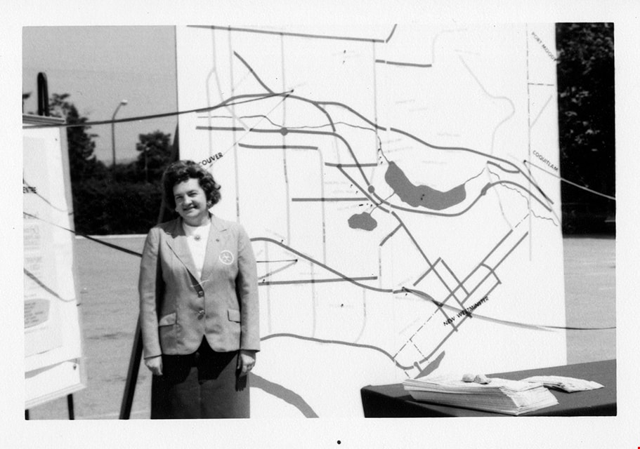
Map of Burnaby
https://search.heritageburnaby.ca/link/museumdescription13259
- Repository
- Burnaby Village Museum
- Date
- 1971
- Collection/Fonds
- Donald Copan collection
- Description Level
- Item
- Physical Description
- 1 photograph : col. ; 8.9 x 8.9 cm
- Scope and Content
- Photograph of a large map of Burnaby displayed on a table in a parking lot. A poster for "Middlegate" Shopping Centre is displayed to the right.
- Repository
- Burnaby Village Museum
- Collection/Fonds
- Donald Copan collection
- Series
- Copan album series
- Description Level
- Item
- Physical Description
- 1 photograph : col. ; 8.9 x 8.9 cm
- Scope and Content
- Photograph of a large map of Burnaby displayed on a table in a parking lot. A poster for "Middlegate" Shopping Centre is displayed to the right.
- Accession Code
- BV005.54.273
- Access Restriction
- No restrictions
- Reproduction Restriction
- May be restricted by third party rights
- Date
- 1971
- Media Type
- Photograph
- Scan Resolution
- 600
- Scan Date
- July 23, 2020
- Scale
- 100
- Notes
- Title based on contents of photograph
Images

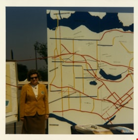
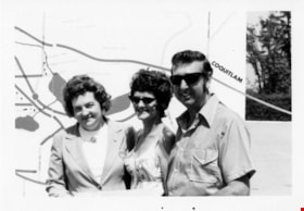
Rose Bancroft with map of Burnaby
https://search.heritageburnaby.ca/link/museumdescription13265
- Repository
- Burnaby Village Museum
- Date
- 1971
- Collection/Fonds
- Donald Copan collection
- Description Level
- Item
- Physical Description
- 1 photograph : col. ; 8.9 x 8.9 cm
- Scope and Content
- Photograph of Burnaby Centennial '71 Committee vice chair Rose Bancroft standing next to a large map of Burnaby at the Burnaby Centennial '71 information booth and display.
- Repository
- Burnaby Village Museum
- Collection/Fonds
- Donald Copan collection
- Series
- Copan album series
- Description Level
- Item
- Physical Description
- 1 photograph : col. ; 8.9 x 8.9 cm
- Scope and Content
- Photograph of Burnaby Centennial '71 Committee vice chair Rose Bancroft standing next to a large map of Burnaby at the Burnaby Centennial '71 information booth and display.
- Names
- Bancroft, Rose
- Accession Code
- BV005.54.279
- Access Restriction
- No restrictions
- Reproduction Restriction
- May be restricted by third party rights
- Date
- 1971
- Media Type
- Photograph
- Scan Resolution
- 600
- Scan Date
- July 23, 2020
- Scale
- 100
- Notes
- Title based on contents of photograph
Images

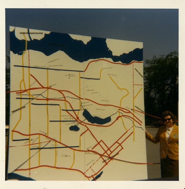
Rose Bancroft with map of Burnaby
https://search.heritageburnaby.ca/link/museumdescription13266
- Repository
- Burnaby Village Museum
- Date
- 1971
- Collection/Fonds
- Donald Copan collection
- Description Level
- Item
- Physical Description
- 1 photograph : col. ; 8.9 x 8.9 cm
- Scope and Content
- Photograph of Burnaby Centennial '71 Committee vice chair Rose Bancroft standing next to a large map of Burnaby at the Burnaby Centennial '71 information booth and display.
- Repository
- Burnaby Village Museum
- Collection/Fonds
- Donald Copan collection
- Series
- Copan album series
- Description Level
- Item
- Physical Description
- 1 photograph : col. ; 8.9 x 8.9 cm
- Scope and Content
- Photograph of Burnaby Centennial '71 Committee vice chair Rose Bancroft standing next to a large map of Burnaby at the Burnaby Centennial '71 information booth and display.
- Names
- Bancroft, Rose
- Accession Code
- BV005.54.280
- Access Restriction
- No restrictions
- Reproduction Restriction
- May be restricted by third party rights
- Date
- 1971
- Media Type
- Photograph
- Scan Resolution
- 600
- Scan Date
- July 23, 2020
- Scale
- 100
- Notes
- Title based on contents of photograph
Images
![SFU development model, [2001] thumbnail](/media/hpo/_Data/_Archives_Images/_Unrestricted/535/535-2256.jpg?width=280)
SFU development model
https://search.heritageburnaby.ca/link/archivedescription96634
- Repository
- City of Burnaby Archives
- Date
- [2001]
- Collection/Fonds
- Burnaby NewsLeader photograph collection
- Description Level
- Item
- Physical Description
- 1 photograph (tiff) : col.
- Scope and Content
- Photograph of Eric Emery, the project manager of a Simon Fraser University development project, standing over a 3D model of the proposal. Maps and other photographs related to the proposal are visible in the background.
- Repository
- City of Burnaby Archives
- Date
- [2001]
- Collection/Fonds
- Burnaby NewsLeader photograph collection
- Physical Description
- 1 photograph (tiff) : col.
- Description Level
- Item
- Record No.
- 535-2256
- Access Restriction
- No restrictions
- Reproduction Restriction
- No restrictions
- Accession Number
- 2018-12
- Scope and Content
- Photograph of Eric Emery, the project manager of a Simon Fraser University development project, standing over a 3D model of the proposal. Maps and other photographs related to the proposal are visible in the background.
- Names
- Simon Fraser University
- Media Type
- Photograph
- Photographer
- Bartel, Mario
- Notes
- Title based on caption
- Collected by editorial for use in an April 2001 issue of the Burnaby NewsLeader
- Caption from metadata: "Eric Emery, the project manager of the SFU development project, looks over a 3-D model of the proposal."
Images
![SFU development model, [2001] thumbnail](/media/hpo/_Data/_Archives_Images/_Unrestricted/535/535-2256.jpg)

Bird's Eye View of the Burnaby Lake Area
https://search.heritageburnaby.ca/link/museumdescription15144
- Repository
- Burnaby Village Museum
- Date
- 1977
- Collection/Fonds
- Century Park Museum Association fonds
- Description Level
- Item
- Physical Description
- 1 map : b&w print on paper ; 43 x 63.5 cm
- Scope and Content
- Item consists of a map titled "Birds Eye View of the Burnaby Lake Area Circa 1910". The overview of the Burnaby Lake area was compiled and drawn at Heritage Village by curator John Adams and artist, Carol Swan. The map identifies the Burnaby Lake inter-urban tram line; roads including: Sperling Ave…
- Repository
- Burnaby Village Museum
- Collection/Fonds
- Century Park Museum Association fonds
- Description Level
- Item
- Physical Description
- 1 map : b&w print on paper ; 43 x 63.5 cm
- Material Details
- Scale indeterminable
- Scope and Content
- Item consists of a map titled "Birds Eye View of the Burnaby Lake Area Circa 1910". The overview of the Burnaby Lake area was compiled and drawn at Heritage Village by curator John Adams and artist, Carol Swan. The map identifies the Burnaby Lake inter-urban tram line; roads including: Sperling Avenue (Pole Line Road); Gilpin Avenue; Douglas Road; trail to Vancouver Westminster Road (Kingsway); Buckingham Avenue; Haszard Street; various farms and residences including: Charles Sprott "Norland"; H.T. Ceperley "Fairacres"; Claude Hill's "Brookfield farm" and "Broadview"; F.J. Hart's "Avalon"; Miss Woodward's former and new home, school and post office; Councillor Edgar's hunting cabin; Edgar Sprott's "Mayfield farm" and "Mayfield Lodge"; F.J. Peers "Greyfriars"; Arthur de Windt Haszard; Bernard Hill's boathouse as well as other landmarks including: Doran's Mill; tram stations; Burnaby Lake Store; logging camps; wood cutter's shacks; ice houses; cranberry bog; Still Creek; Deer Lake; Burnaby Lake; Deer Lake Creek; Provincial Government Reserve Proposed Hospital (later Oakalla Prison).
- Creator
- Adams, John
- Swan, Carol
- Names
- Hill, Arthur Claude
- Sprott, Charles Frederick
- Sprott, Louis "Edgar"
- Hart, Frederick John, 1884-1945
- Ceperley, H.T.
- Woodward, Maude
- Woodward, Harriet
- Peers, Francis J.
- Haszard, Arthur de Windt
- Hill, Bernard R.
- Geographic Access
- Deer Lake Avenue
- Sperling Avenue
- Haszard Street
- Buckingham Avenue
- Accession Code
- BV021.1.3
- Access Restriction
- No restrictions
- Reproduction Restriction
- No known restrictions
- Date
- 1977
- Media Type
- Cartographic Material
- Historic Neighbourhood
- Burnaby Lake (Historic Neighbourhood)
- Planning Study Area
- Burnaby Lake Area
- Related Material
- See also: Life with the Moores of Hart House : pioneer days on Burnaby's Deer Lake
- Scan Resolution
- 600
- Scan Date
- 2021-11-12
- Scale
- 100
- Notes
- Transcribed title
- Compiled by John Adams; illustration by Carol Swan
- The map depicts the Burnaby Lake Tram Line as being double tracked, whereas in reality it was single tracked.
- Map is part of the book "Life with the Moores of Hart House : pioneer days on Burnaby's Deer Lake https://search.heritageburnaby.ca/permalink/museumlibrary6314-102
Images


Bird's Eye View of the Burnaby Lake Area
https://search.heritageburnaby.ca/link/museumdescription17543
- Repository
- Burnaby Village Museum
- Date
- 1977
- Collection/Fonds
- Century Park Museum Association fonds
- Description Level
- Item
- Physical Description
- 1 map : b&w print with watercolour ; 43 x 63.5 cm
- Scope and Content
- Item consists of a map titled "Birds Eye View of the Burnaby Lake Area Circa 1910". The overview of the Burnaby Lake area was compiled and drawn at Heritage Village by curator John Adams and artist, Carol Swan. The map identifies the Burnaby Lake inter-urban tram line; roads including: Sperling Ave…
- Repository
- Burnaby Village Museum
- Collection/Fonds
- Century Park Museum Association fonds
- Description Level
- Item
- Physical Description
- 1 map : b&w print with watercolour ; 43 x 63.5 cm
- Material Details
- Scale indeterminable
- Scope and Content
- Item consists of a map titled "Birds Eye View of the Burnaby Lake Area Circa 1910". The overview of the Burnaby Lake area was compiled and drawn at Heritage Village by curator John Adams and artist, Carol Swan. The map identifies the Burnaby Lake inter-urban tram line; roads including: Sperling Avenue (Pole Line Road); Gilpin Avenue; Douglas Road; trail to Vancouver Westminster Road (Kingsway); Buckingham Avenue; Haszard Street; various farms and residences including: Charles Sprott "Norland"; H.T. Ceperley "Fairacres"; Claude Hill's "Brookfield farm" and "Broadview"; F.J. Hart's "Avalon"; Miss Woodward's former and new home, school and post office; Councillor Edgar's hunting cabin; Edgar Sprott's "Mayfield farm" and "Mayfield Lodge"; F.J. Peers "Greyfriars"; Arthur de Windt Haszard; Bernard Hill's boathouse as well as other landmarks including: Doran's Mill; tram stations; Burnaby Lake Store; logging camps; wood cutter's shacks; ice houses; cranberry bog; Still Creek; Deer Lake; Burnaby Lake; Deer Lake Creek; Provincial Government Reserve Proposed Hospital (later Oakalla Prison).
- Creator
- Adams, John
- Swan, Carol
- Names
- Hill, Arthur Claude
- Sprott, Charles Frederick
- Sprott, Louis "Edgar"
- Hart, Frederick John, 1884-1945
- Ceperley, H.T.
- Woodward, Maude
- Woodward, Harriet
- Peers, Francis J.
- Haszard, Arthur de Windt
- Hill, Bernard R.
- Geographic Access
- Deer Lake Avenue
- Sperling Avenue
- Haszard Street
- Buckingham Avenue
- Accession Code
- BV021.1.4
- Access Restriction
- No restrictions
- Reproduction Restriction
- No known restrictions
- Date
- 1977
- Media Type
- Cartographic Material
- Historic Neighbourhood
- Burnaby Lake (Historic Neighbourhood)
- Planning Study Area
- Burnaby Lake Area
- Related Material
- See also: Life with the Moores of Hart House : pioneer days on Burnaby's Deer Lake
- Scan Resolution
- 600
- Scan Date
- 2021-11-12
- Scale
- 100
- Notes
- Transcribed title
- Compiled by John Adams; illustration by Carol Swan
- The map depicts the Burnaby Lake Tram Line as being double tracked, whereas in reality it was single tracked.
- Map is part of the book "Life with the Moores of Hart House : pioneer days on Burnaby's Deer Lake https://search.heritageburnaby.ca/permalink/museumlibrary6314-102
- This is a print made from original illustration and appears to be hand-coloured with watercolour at a later date.
Images

Burnaby
https://search.heritageburnaby.ca/link/archivedescription65839
- Repository
- City of Burnaby Archives
- Date
- June 1977
- Collection/Fonds
- Burnaby Historical Society fonds
- Description Level
- Item
- Physical Description
- 1 map : col. ink on paper ; 77 x 55 cm folded to 28 x 19 cm
- Scope and Content
- Item is a map of Burnaby District Municipality, British Columbia, compiled by the Burnaby Planning Department. The map indicates locations of schools, parks, cemeteries, improved streets and private roads, etc.
- Repository
- City of Burnaby Archives
- Date
- June 1977
- Collection/Fonds
- Burnaby Historical Society fonds
- Subseries
- Municipal record subseries
- Physical Description
- 1 map : col. ink on paper ; 77 x 55 cm folded to 28 x 19 cm
- Material Details
- Scale : 1 cm = 1/8 of a mile
- Description Level
- Item
- Record No.
- 42694
- Accession Number
- BHS2007-04
- Scope and Content
- Item is a map of Burnaby District Municipality, British Columbia, compiled by the Burnaby Planning Department. The map indicates locations of schools, parks, cemeteries, improved streets and private roads, etc.
- Media Type
- Cartographic Material
Burnaby Zoning Map
https://search.heritageburnaby.ca/link/archivedescription58303
- Repository
- City of Burnaby Archives
- Date
- 1973
- Collection/Fonds
- Burnaby Historical Society fonds
- Description Level
- Item
- Physical Description
- 1 map
- Scope and Content
- Item is a Burnaby Zoning Map describing Bylaw no. 4742 (collected by Evelyn Salisbury).
- Repository
- City of Burnaby Archives
- Date
- 1973
- Collection/Fonds
- Burnaby Historical Society fonds
- Subseries
- Evelyn Salisbury subseries
- Physical Description
- 1 map
- Description Level
- Item
- Record No.
- MSS061-100
- Access Restriction
- No restrictions
- Accession Number
- BHS1991-24
- Scope and Content
- Item is a Burnaby Zoning Map describing Bylaw no. 4742 (collected by Evelyn Salisbury).
- Media Type
- Cartographic Material
![Mountain bikers on Burnaby Mountain, [2005] thumbnail](/media/hpo/_Data/_Archives_Images/_Unrestricted/535/535-1918.jpg?width=280)
Mountain bikers on Burnaby Mountain
https://search.heritageburnaby.ca/link/archivedescription96226
- Repository
- City of Burnaby Archives
- Date
- [2005]
- Collection/Fonds
- Burnaby NewsLeader photograph collection
- Description Level
- Item
- Physical Description
- 1 photograph (tiff) : col.
- Scope and Content
- Photograph of mountain bikers Tom Webster, Gary Hall, Ron Burton, and Dino Sartori standing on a trail on Burnaby Mountain. One of the mountain bikers poses in the foreground on a mountain bike, while the other three stand in the background; one holds a rolled map and reviews another open map.
- Repository
- City of Burnaby Archives
- Date
- [2005]
- Collection/Fonds
- Burnaby NewsLeader photograph collection
- Physical Description
- 1 photograph (tiff) : col.
- Description Level
- Item
- Record No.
- 535-1918
- Access Restriction
- No restrictions
- Reproduction Restriction
- No restrictions
- Accession Number
- 2018-12
- Scope and Content
- Photograph of mountain bikers Tom Webster, Gary Hall, Ron Burton, and Dino Sartori standing on a trail on Burnaby Mountain. One of the mountain bikers poses in the foreground on a mountain bike, while the other three stand in the background; one holds a rolled map and reviews another open map.
- Subjects
- Sports - Cycling
- Names
- Burnaby Mountain Park
- Media Type
- Photograph
- Photographer
- Bartel, Mario
- Notes
- Title based on caption
- Collected by editorial for use in a February 2005 issue of the Burnaby NewsLeader
- Caption from metadata: "Tom Webster, Gary Hall, Ron Burton and Dino Sartori are working with the City of Burnaby to ensure continued access for mountain bikers to the trails on Burnaby Mountain."
- Geographic Access
- Burnaby Mountain Conservation Area
- Planning Study Area
- Burnaby Mountain Area
Images
![Mountain bikers on Burnaby Mountain, [2005] thumbnail](/media/hpo/_Data/_Archives_Images/_Unrestricted/535/535-1918.jpg)
![NewsLeader staff commuting, [2002] thumbnail](/media/hpo/_Data/_Archives_Images/_Unrestricted/535/535-2767.jpg?width=280)
NewsLeader staff commuting
https://search.heritageburnaby.ca/link/archivedescription97392
- Repository
- City of Burnaby Archives
- Date
- [2002]
- Collection/Fonds
- Burnaby NewsLeader photograph collection
- Description Level
- Item
- Physical Description
- 1 photograph (tiff) : col.
- Scope and Content
- Photograph of Wanda Chow, Greg Knill, and David Weir, all Burnaby NewsLeader employees, posing outside of the Lougheed Town Centre SkyTrain station with a car and a map before a morning commute.
- Repository
- City of Burnaby Archives
- Date
- [2002]
- Collection/Fonds
- Burnaby NewsLeader photograph collection
- Physical Description
- 1 photograph (tiff) : col.
- Description Level
- Item
- Record No.
- 535-2767
- Access Restriction
- No restrictions
- Reproduction Restriction
- No restrictions
- Accession Number
- 2018-12
- Scope and Content
- Photograph of Wanda Chow, Greg Knill, and David Weir, all Burnaby NewsLeader employees, posing outside of the Lougheed Town Centre SkyTrain station with a car and a map before a morning commute.
- Media Type
- Photograph
- Photographer
- Bartel, Mario
- Notes
- Title based on caption
- Collected by editorial for use in a September 2002 issue of the Burnaby NewsLeader
- Caption from metadata: "The NewsLeader's commuting team gets ready to face the challenges of morning rush hour. Wanda Chow plots her driving route on a map, editor Greg Knill reviews his notes for his bus route, and David Weir checks to see how long until the next Skytrain."
- Geographic Access
- Lougheed Highway
- Historic Neighbourhood
- Burquitlam (Historic Neighbourhood)
- Planning Study Area
- Cameron Area
Images
![NewsLeader staff commuting, [2002] thumbnail](/media/hpo/_Data/_Archives_Images/_Unrestricted/535/535-2767.jpg)
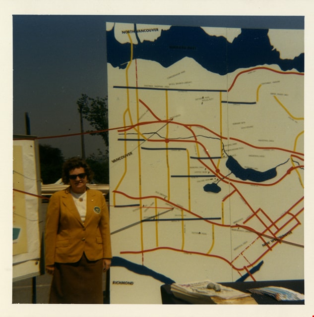
Rose Bancroft with Burnaby map
https://search.heritageburnaby.ca/link/museumdescription13256
- Repository
- Burnaby Village Museum
- Date
- 1971
- Collection/Fonds
- Donald Copan collection
- Description Level
- Item
- Physical Description
- 1 photograph : b&w ; 8.9 x 12.7 cm
- Scope and Content
- Photograph of Burnaby Centennial '71 vice chair Rose Bancroft standing in front of a large map of Burnaby.
- Repository
- Burnaby Village Museum
- Collection/Fonds
- Donald Copan collection
- Series
- Copan album series
- Description Level
- Item
- Physical Description
- 1 photograph : b&w ; 8.9 x 12.7 cm
- Scope and Content
- Photograph of Burnaby Centennial '71 vice chair Rose Bancroft standing in front of a large map of Burnaby.
- Names
- Bancroft, Rose
- Accession Code
- BV005.54.270
- Access Restriction
- No restrictions
- Reproduction Restriction
- May be restricted by third party rights
- Date
- 1971
- Media Type
- Photograph
- Scan Resolution
- 600
- Scan Date
- July 23, 2020
- Scale
- 100
- Notes
- Title based on contents of photograph
Images
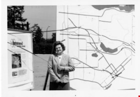
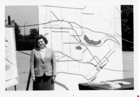
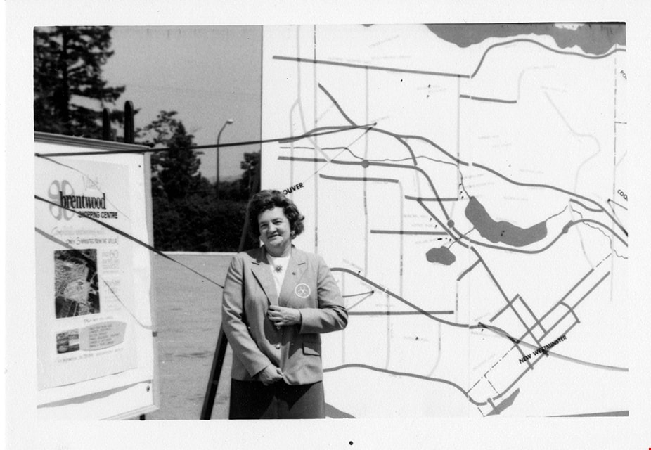
Rose Bancroft with Burnaby map and Brentwood Shopping Centre poster
https://search.heritageburnaby.ca/link/museumdescription13255
- Repository
- Burnaby Village Museum
- Date
- 1971
- Collection/Fonds
- Donald Copan collection
- Description Level
- Item
- Physical Description
- 1 photograph : b&w ; 8.9 x 12.7 cm
- Scope and Content
- Photograph of Burnaby Centennial '71 vice chair Rose Bancroft standing in front of Burnaby map and Brentwood Shopping Centre poster.
- Repository
- Burnaby Village Museum
- Collection/Fonds
- Donald Copan collection
- Series
- Copan album series
- Description Level
- Item
- Physical Description
- 1 photograph : b&w ; 8.9 x 12.7 cm
- Scope and Content
- Photograph of Burnaby Centennial '71 vice chair Rose Bancroft standing in front of Burnaby map and Brentwood Shopping Centre poster.
- Accession Code
- BV005.54.269
- Access Restriction
- No restrictions
- Reproduction Restriction
- May be restricted by third party rights
- Date
- 1971
- Media Type
- Photograph
- Scan Resolution
- 600
- Scan Date
- July 23, 2020
- Scale
- 100
- Notes
- Title based on contents of photograph
Images
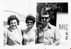
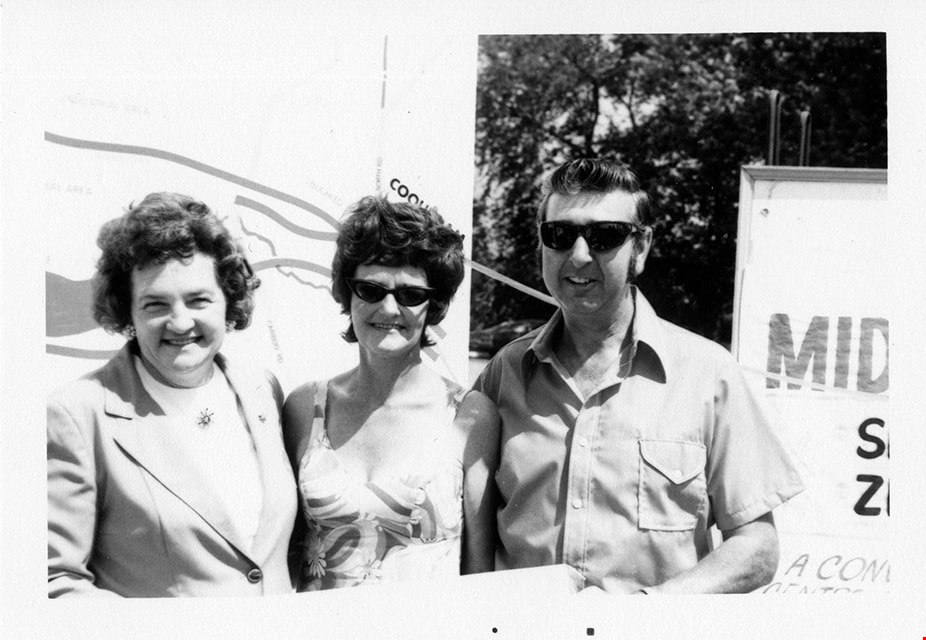
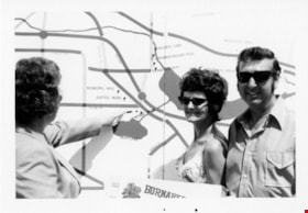
Rose Bancroft with visitors and map
https://search.heritageburnaby.ca/link/museumdescription13247
- Repository
- Burnaby Village Museum
- Date
- 1971
- Collection/Fonds
- Donald Copan collection
- Description Level
- Item
- Physical Description
- 1 photograph : b&w ; 8.9 x 12.7 cm
- Scope and Content
- Photograph of Burnaby Centennial '71 Committee vice chair Rose Bancroft standing with an unidentified woman and man in front of a map of Burnaby.
- Repository
- Burnaby Village Museum
- Collection/Fonds
- Donald Copan collection
- Series
- Copan album series
- Description Level
- Item
- Physical Description
- 1 photograph : b&w ; 8.9 x 12.7 cm
- Scope and Content
- Photograph of Burnaby Centennial '71 Committee vice chair Rose Bancroft standing with an unidentified woman and man in front of a map of Burnaby.
- Names
- Bancroft, Rose
- Accession Code
- BV005.54.261
- Access Restriction
- No restrictions
- Reproduction Restriction
- May be restricted by third party rights
- Date
- 1971
- Media Type
- Photograph
- Scan Resolution
- 600
- Scan Date
- July 23, 2020
- Scale
- 100
- Notes
- Title based on contents of photograph
Images
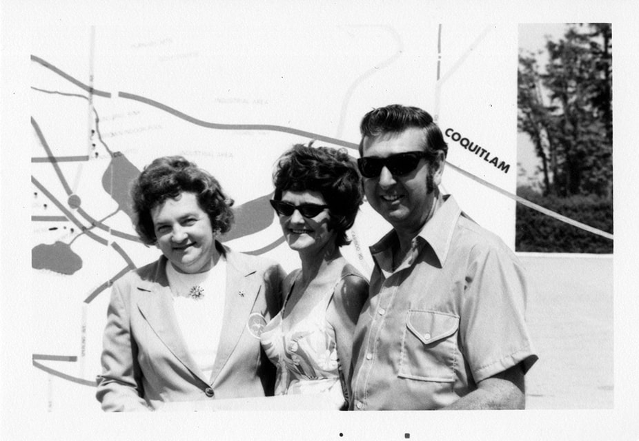
Rose Bancroft with visitors and map
https://search.heritageburnaby.ca/link/museumdescription13248
- Repository
- Burnaby Village Museum
- Date
- 1971
- Collection/Fonds
- Donald Copan collection
- Description Level
- Item
- Physical Description
- 1 photograph : b&w ; 8.9 x 12.7 cm
- Scope and Content
- Photograph of Burnaby Centennial '71 Committee vice chair Rose Bancroft standing with an unidentified woman and man in front of a map of Burnaby.
- Repository
- Burnaby Village Museum
- Collection/Fonds
- Donald Copan collection
- Series
- Copan album series
- Description Level
- Item
- Physical Description
- 1 photograph : b&w ; 8.9 x 12.7 cm
- Scope and Content
- Photograph of Burnaby Centennial '71 Committee vice chair Rose Bancroft standing with an unidentified woman and man in front of a map of Burnaby.
- Names
- Bancroft, Rose
- Accession Code
- BV005.54.262
- Access Restriction
- No restrictions
- Reproduction Restriction
- May be restricted by third party rights
- Date
- 1971
- Media Type
- Photograph
- Scan Resolution
- 600
- Scan Date
- July 23, 2020
- Scale
- 100
- Notes
- Title based on contents of photograph
Images
Rose Bancroft with visitors and map
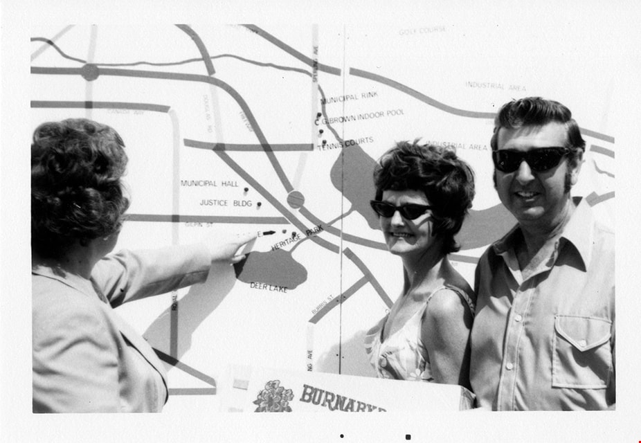
https://search.heritageburnaby.ca/link/museumdescription13249
- Repository
- Burnaby Village Museum
- Date
- 1971
- Collection/Fonds
- Donald Copan collection
- Description Level
- Item
- Physical Description
- 1 photograph : b&w ; 8.9 x 12.7 cm
- Scope and Content
- Photograph of Burnaby Centennial '71 Committee vice chair Rose Bancroft pointing out Heritage Park on a map of Burnaby to an unidentified woman and man.
- Repository
- Burnaby Village Museum
- Collection/Fonds
- Donald Copan collection
- Series
- Copan album series
- Description Level
- Item
- Physical Description
- 1 photograph : b&w ; 8.9 x 12.7 cm
- Scope and Content
- Photograph of Burnaby Centennial '71 Committee vice chair Rose Bancroft pointing out Heritage Park on a map of Burnaby to an unidentified woman and man.
- Names
- Bancroft, Rose
- Accession Code
- BV005.54.263
- Access Restriction
- No restrictions
- Reproduction Restriction
- May be restricted by third party rights
- Date
- 1971
- Media Type
- Photograph
- Scan Resolution
- 600
- Scan Date
- July 23, 2020
- Scale
- 100
- Notes
- Title based on contents of photograph
Images
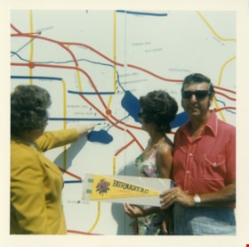
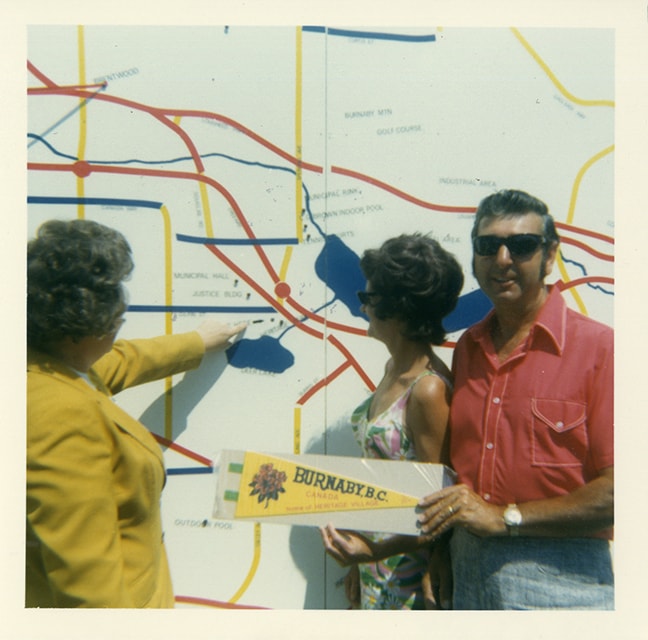
Rose Bancroft with visitors and map
https://search.heritageburnaby.ca/link/museumdescription13262
- Repository
- Burnaby Village Museum
- Date
- 1971
- Collection/Fonds
- Donald Copan collection
- Description Level
- Item
- Physical Description
- 1 photograph : col. ; 8.9 x 8.9 cm
- Scope and Content
- Photograph of Burnaby Centennial '71 Committee vice chair Rose Bancroft pointing out Heritage Park on a map of Burnaby to an unidentified woman and man.
- Repository
- Burnaby Village Museum
- Collection/Fonds
- Donald Copan collection
- Series
- Copan album series
- Description Level
- Item
- Physical Description
- 1 photograph : col. ; 8.9 x 8.9 cm
- Scope and Content
- Photograph of Burnaby Centennial '71 Committee vice chair Rose Bancroft pointing out Heritage Park on a map of Burnaby to an unidentified woman and man.
- Names
- Bancroft, Rose
- Accession Code
- BV005.54.276
- Access Restriction
- No restrictions
- Reproduction Restriction
- May be restricted by third party rights
- Date
- 1971
- Media Type
- Photograph
- Scan Resolution
- 600
- Scan Date
- July 23, 2020
- Scale
- 100
- Notes
- Title based on contents of photograph
Images
![South Burnaby Neighbourhood House car rally, [2002] thumbnail](/media/hpo/_Data/_Archives_Images/_Unrestricted/535/535-2781.jpg?width=280)
South Burnaby Neighbourhood House car rally
https://search.heritageburnaby.ca/link/archivedescription97419
- Repository
- City of Burnaby Archives
- Date
- [2002]
- Collection/Fonds
- Burnaby NewsLeader photograph collection
- Description Level
- Item
- Physical Description
- 1 photograph (tiff) : col.
- Scope and Content
- Photograph of Antonia Beck, Kimberly Barwich, and Lisa Loblaw viewing a map on the food of a red car, in front of the South Burnaby Neighbourhood House, as a promotion for their fundraising rally.
- Repository
- City of Burnaby Archives
- Date
- [2002]
- Collection/Fonds
- Burnaby NewsLeader photograph collection
- Physical Description
- 1 photograph (tiff) : col.
- Description Level
- Item
- Record No.
- 535-2781
- Access Restriction
- No restrictions
- Reproduction Restriction
- No restrictions
- Accession Number
- 2018-12
- Scope and Content
- Photograph of Antonia Beck, Kimberly Barwich, and Lisa Loblaw viewing a map on the food of a red car, in front of the South Burnaby Neighbourhood House, as a promotion for their fundraising rally.
- Media Type
- Photograph
- Photographer
- Bartel, Mario
- Notes
- Title based on caption
- Collected by editorial for use in a September 2002 issue of the Burnaby NewsLeader
- Caption from metadata: "Antonia Beck, Kimberly Barwich, and Lisa Loblaw check the map as they get ready for South Burnaby Neighbourhood House's first car rally. The rally is a fundraiser for its social service programs."
- Historic Neighbourhood
- Central Park (Historic Neighbourhood)
- Planning Study Area
- Maywood Area
Images
![South Burnaby Neighbourhood House car rally, [2002] thumbnail](/media/hpo/_Data/_Archives_Images/_Unrestricted/535/535-2781.jpg)