Burnaby Zoning Bylaw Maps # 1 - 18
https://search.heritageburnaby.ca/link/archivedescription10004
- Repository
- City of Burnaby Archives
- Date
- 1965
- Collection/Fonds
- City Council and Office of the City Clerk fonds
- Description Level
- Item
- Physical Description
- Architectural drawing ; 180cm x 44cm (18 pages)
- Scope and Content
- Burnaby Zoning maps for Zoning Bylaw 1965
- Repository
- City of Burnaby Archives
- Date
- 1965
- Collection/Fonds
- City Council and Office of the City Clerk fonds
- Series
- Zoning and Rezoning series
- Physical Description
- Architectural drawing ; 180cm x 44cm (18 pages)
- Description Level
- Item
- Record No.
- 12970
- Accession Number
- 2002-07
- Scope and Content
- Burnaby Zoning maps for Zoning Bylaw 1965
- Media Type
- Architectural Drawing
Insurance Plan of the Municipality of Burnaby, B.C. Volume 1
https://search.heritageburnaby.ca/link/archivedescription71903
- Repository
- City of Burnaby Archives
- Date
- March 1964
- Collection/Fonds
- Planning Department fonds
- Description Level
- Item
- Physical Description
- 1 plan : col. ; both sides ; on 39 sheets 33 x 30 cm
- Scope and Content
- Item is volume one of the fire insurance plan for the Municipality of Burnaby for 1963, updated to 1964. This item was collected by the Burnaby Planning Department for information purposes. The Fire Insurance plans cover areas east of Boundary Road and west of Gilley Avenue with Burrard Inlet to th…
- Repository
- City of Burnaby Archives
- Date
- March 1964
- Collection/Fonds
- Planning Department fonds
- Series
- Planning General series
- Physical Description
- 1 plan : col. ; both sides ; on 39 sheets 33 x 30 cm
- Material Details
- Scale : 1 inch = 1200 feet
- Description Level
- Item
- Record No.
- 46225
- Accession Number
- 2012-15
- Scope and Content
- Item is volume one of the fire insurance plan for the Municipality of Burnaby for 1963, updated to 1964. This item was collected by the Burnaby Planning Department for information purposes. The Fire Insurance plans cover areas east of Boundary Road and west of Gilley Avenue with Burrard Inlet to the north and the Fraser River to the south.
- Media Type
- Cartographic Material
- Publisher
- Toronto, Ontario : Underwriters Survey Bureau
- Notes
- Transcribed title
Map of Greater Vancouver and Lower Mainland Area
https://search.heritageburnaby.ca/link/archivedescription65644
- Repository
- City of Burnaby Archives
- Date
- [1960]
- Collection/Fonds
- Burnaby Historical Society fonds
- Description Level
- Item
- Physical Description
- 1 map : col. ; on sheet 56 x 88 cm, folded to 19 x 10 cm + 1 p. cover ; 22 x 50 cm folded to 22 x 13 cm
- Scope and Content
- Item is a "Map of Greater Vancouver and Lower Mainland Area" with a detachable cardboard cover that lists "streets, districts, schools, churches, shopping centres, parks, etc."
- Repository
- City of Burnaby Archives
- Date
- [1960]
- Collection/Fonds
- Burnaby Historical Society fonds
- Subseries
- Municipal record subseries
- Physical Description
- 1 map : col. ; on sheet 56 x 88 cm, folded to 19 x 10 cm + 1 p. cover ; 22 x 50 cm folded to 22 x 13 cm
- Description Level
- Item
- Record No.
- 42574
- Accession Number
- BHS1995-15
- Scope and Content
- Item is a "Map of Greater Vancouver and Lower Mainland Area" with a detachable cardboard cover that lists "streets, districts, schools, churches, shopping centres, parks, etc."
- Media Type
- Cartographic Material
Paneloc marketing report
https://search.heritageburnaby.ca/link/museumdescription15067
- Repository
- Burnaby Village Museum
- Date
- [between 1957 and 1960]
- Collection/Fonds
- Elmer Wilson Martin fonds
- Description Level
- Item
- Physical Description
- 1 report : 5 photographs + 6 architectural drawings : blueline prints ; 55 x 85 cm + 1 architectural drawing : blueline print ; 46 x 55 cm
- Scope and Content
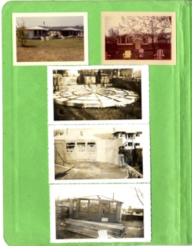
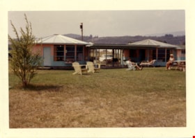
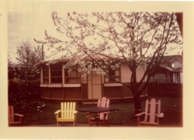
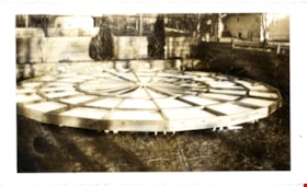
- Item consists of a report created by Paneloc Marketing Ltd. 4217 Hastings Street Burnaby B.C. Architectural drawings within the report are drawn by Jack Pearl and designed by Elmer W. Martin, P. Engineer. Architectural drawings included in the report are titled; Paneloc Homes - All Models (2 drawin…
- Repository
- Burnaby Village Museum
- Collection/Fonds
- Elmer Wilson Martin fonds
- Description Level
- Item
- Physical Description
- 1 report : 5 photographs + 6 architectural drawings : blueline prints ; 55 x 85 cm + 1 architectural drawing : blueline print ; 46 x 55 cm
- Material Details
- Scales differ between 1"=60" and 3/4"=1'-0"
- Scope and Content
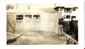
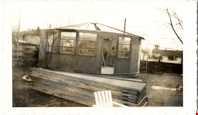
- Item consists of a report created by Paneloc Marketing Ltd. 4217 Hastings Street Burnaby B.C. Architectural drawings within the report are drawn by Jack Pearl and designed by Elmer W. Martin, P. Engineer. Architectural drawings included in the report are titled; Paneloc Homes - All Models (2 drawings); Paneloc Homes - Model 6 - 28 Panel (3 drawings) ; Paneloc Homes - Model 6-24 Panel (1 drawing) ; Paneloc Homes - Model 4 -20 Panel (1 drawing). The report includes five photographs of paneloc homes including two of completed homes and three of a paneloc building in various stages of assembly.
- Responsibility
- Panel Marketing Limited
- Accession Code
- BV019.40.3
- Access Restriction
- No restrictions
- Reproduction Restriction
- May be restricted by third party rights
- Date
- [between 1957 and 1960]
- Media Type
- Photograph
- Architectural Drawing
- Scan Resolution
- 600
- Scan Date
- February 5, 2021
- Scale
- 100
- Notes
- Title based on contents of report
- Architectural drawings were unfolded and removed from duotang binding
- According to an advertisement dated June 14, 1957 for Paneloc Manufacturing in the Vancouver Province newspaper, a paneloc display model was available for viewing at 6635 East Hastings Street in Burnaby. Some of the photographs within this report may have been at this location.
- Architectural drawings have reproduction and access restrictions. Contact Burnaby Village Museum to view.
![Paneloc marketing report, [between 1957 and 1960] thumbnail](/media/hpo/_Data/_BVM_Images/2019/2019_0040_0003_001.jpg?width=280)
