Narrow Results By
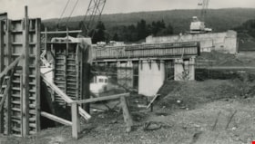
Construction of the Caribou Road to freeway link-up
https://search.heritageburnaby.ca/link/archivedescription45363
- Repository
- City of Burnaby Archives
- Date
- September 1977
- Collection/Fonds
- Columbian Newspaper collection
- Description Level
- Item
- Physical Description
- 1 photograph : b&w ; 10.5 x 18.5 cm
- Scope and Content
- Photograph of the construction of the Cariboo Road to 401 Freeway link-up. This was built in an effort to "ease [the] bottleneck of traffic at Stormount [sic] Interchange." The 401 Freeway is now known as the Trans Canada Highway.
- Repository
- City of Burnaby Archives
- Date
- September 1977
- Collection/Fonds
- Columbian Newspaper collection
- Physical Description
- 1 photograph : b&w ; 10.5 x 18.5 cm
- Description Level
- Item
- Record No.
- 480-258
- Access Restriction
- No restrictions
- Reproduction Restriction
- No restrictions
- Accession Number
- 2003-02
- Scope and Content
- Photograph of the construction of the Cariboo Road to 401 Freeway link-up. This was built in an effort to "ease [the] bottleneck of traffic at Stormount [sic] Interchange." The 401 Freeway is now known as the Trans Canada Highway.
- Subjects
- Construction - Road Construction
- Media Type
- Photograph
- Photographer
- Hodge, Craig
- Notes
- Title based on contents of photograph
- Newspaper clipping attached to verso of photograph reads: "Construction is now well underway on the new Caribou Road-freeway link-up which will ease bottleneck of traffic at Stormount [sic] Interchange."
- Geographic Access
- Trans Canada Highway
- Cariboo Road
- Planning Study Area
- Burnaby Lake Area
- Cariboo-Armstrong Area
Images
Digney film 2 - Construction of Simpsons-Sears
https://search.heritageburnaby.ca/link/museumdescription10640
- Repository
- Burnaby Village Museum
- Date
- [1954] (date of original), copied 2019
- Collection/Fonds
- Digney Family fonds
- Description Level
- Item
- Physical Description
- 1 video recording (mp4) (5 sec.) : digital, 23 fps, col., si.
- Scope and Content
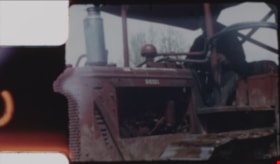
- Short Film clip of a view from the Digney's backyard at 3698 Bonsor Avenue (address changed to 6521 Bonsor Ave. after 1958) of the construction of the Simpsons-Sears building on Kingsway in Burnaby.
- Repository
- Burnaby Village Museum
- Collection/Fonds
- Digney Family fonds
- Description Level
- Item
- Physical Description
- 1 video recording (mp4) (5 sec.) : digital, 23 fps, col., si.
- Scope and Content
- Short Film clip of a view from the Digney's backyard at 3698 Bonsor Avenue (address changed to 6521 Bonsor Ave. after 1958) of the construction of the Simpsons-Sears building on Kingsway in Burnaby.
- Creator
- Digney, Andy
- Subjects
- Buildings - Commercial - Malls
- Names
- Simpsons-Sears Limited
- Geographic Access
- Bonsor Avenue
- Street Address
- 6521 Bonsor Avenue
- Accession Code
- BV019.18.4.9
- Access Restriction
- No restrictions
- Reproduction Restriction
- No known restrictions
- Date
- [1954] (date of original), copied 2019
- Media Type
- Moving Images
- Historic Neighbourhood
- Central Park (Historic Neighbourhood)
- Planning Study Area
- Maywood Area
- Photographer
- Digney, Andy
- Notes
- Title based on contents of film segment
- Film segment originates from digitized version of original 8 mm film (See BV019.18.4)
Images
Video
Digney film 2 - Construction of Simpsons-Sears, [1954] (date of original), copied 2019
Digney film 2 - Construction of Simpsons-Sears, [1954] (date of original), copied 2019
https://search.heritageburnaby.ca/media/hpo/_Data/_BVM_Moving_Images/2019_0018_0004_009.mp4Digney film 2 - Family in Burnaby, Construction of Simpsons-Sears building and wedding
https://search.heritageburnaby.ca/link/museumdescription10598
- Repository
- Burnaby Village Museum
- Date
- [between 1954 and 1964] (date of original), copied 2019
- Collection/Fonds
- Digney Family fonds
- Description Level
- File
- Physical Description
- 1 video recording (mp4) (26 min., 51 sec.) : digital, 16 fps, col., si.
- Scope and Content
- Film compilation created by Andy Digney and his son Ernest "Dig" Digney. The film opens with scenes of different dogs playing outside; exterior of Andy and Alice Digney’s house on Kaymar Drive; interior of the Digney bowling alley with pins being reset; interior of Andy Digney’s greenhouse at his h…
- Repository
- Burnaby Village Museum
- Collection/Fonds
- Digney Family fonds
- Description Level
- File
- Physical Description
- 1 video recording (mp4) (26 min., 51 sec.) : digital, 16 fps, col., si.
- Scope and Content
- Film compilation created by Andy Digney and his son Ernest "Dig" Digney. The film opens with scenes of different dogs playing outside; exterior of Andy and Alice Digney’s house on Kaymar Drive; interior of the Digney bowling alley with pins being reset; interior of Andy Digney’s greenhouse at his house on Kaymar Drive; construction of the Simpsons-Sears building in 1954 behind the Digney home at 3698 Bonsor Street; unidentified outdoor wedding attended by the Digney's and Swans; Campbell family gathering in Victoria; gathering of friends and family inside Alice and Andy Digney’s home on Kaymar Drive before they leave for their World tour in 1964.
- Creator
- Digney, Andy
- Geographic Access
- Bonsor Avenue
- Kaymar Drive
- Accession Code
- BV019.18.4
- Access Restriction
- No restrictions
- Reproduction Restriction
- No known restrictions
- Date
- [between 1954 and 1964] (date of original), copied 2019
- Media Type
- Moving Images
- Photographer
- Digney, Andy
- Digney, Ernest Frank "Dig"
- Notes
- Title based on contents of film
- Digitized film is a copy from original 8 mm film
- 9 film clips from this compilation are described at item level and available for viewing on Heritage Burnaby
- Contact Burnaby Village Museum to view entire content
Digney Film 3 - Construction and opening of Digney bowling Alley, visit to Stanley Park and summer vacations
https://search.heritageburnaby.ca/link/museumdescription10678
- Repository
- Burnaby Village Museum
- Date
- [between 1955 and 1979] (date of original), copied 2019
- Collection/Fonds
- Digney Family fonds
- Description Level
- File
- Physical Description
- 1 video recording (mp4) (20 min., 30 sec.) : digital, 16 fps, col., si.
- Scope and Content
- File consists of a film compliation of short clips created by Andy Digney and his son Ernest "Dig" Digney. Film compilation documents the construction, opening and a tournament of the Digney Bowling Alley located at 6521 Bonsor Avenue in Burnaby along with Digney family outings at Stanley Park in V…
- Repository
- Burnaby Village Museum
- Collection/Fonds
- Digney Family fonds
- Description Level
- File
- Physical Description
- 1 video recording (mp4) (20 min., 30 sec.) : digital, 16 fps, col., si.
- Scope and Content
- File consists of a film compliation of short clips created by Andy Digney and his son Ernest "Dig" Digney. Film compilation documents the construction, opening and a tournament of the Digney Bowling Alley located at 6521 Bonsor Avenue in Burnaby along with Digney family outings at Stanley Park in Vancouver and vacations at Birch Bay, Washington State and Okanagan Lake.
- Creator
- Digney, Andy
- Names
- Digney, Andy
- Swan, Sydney
- Digney Bowling Alley
- Digney, Drew
- Digney, Joyce
- Digney, Bruce
- Digney, Paul
- Geographic Access
- Bonsor Avenue
- Street Address
- 6521 Bonsor Avenue
- Accession Code
- BV019.18.5
- Access Restriction
- No restrictions
- Reproduction Restriction
- No known restrictions
- Date
- [between 1955 and 1979] (date of original), copied 2019
- Media Type
- Moving Images
- Historic Neighbourhood
- Central Park (Historic Neighbourhood)
- Planning Study Area
- Maywood Area
- Notes
- Title based on contents of film compilation
- 4 film segments from this compilation are described at item level and available for viewing on Heritage Burnaby.
- Contact Burnaby Village Museum to view entire content
Digney Film 3 - Construction of Digney Bowling Alley
https://search.heritageburnaby.ca/link/museumdescription10648
- Repository
- Burnaby Village Museum
- Date
- 1955 (date of original), copied 2019
- Collection/Fonds
- Digney Family fonds
- Description Level
- Item
- Physical Description
- 1 video recording (mp4) (8 min., 40 sec.) : digital, 23 fps, col., si.
- Scope and Content
- Film segment documenting the construction of the Digney Bowling Alley in Burnaby. The bowling alley was built on the west side of the Digney family home located at 2698 Bonsor Avenue (address became 6521 Bonsor Avenue after 1958). The film documents Ozzie Cavello using his bulldozer to clear the la…
- Repository
- Burnaby Village Museum
- Collection/Fonds
- Digney Family fonds
- Description Level
- Item
- Physical Description
- 1 video recording (mp4) (8 min., 40 sec.) : digital, 23 fps, col., si.
- Scope and Content
- Film segment documenting the construction of the Digney Bowling Alley in Burnaby. The bowling alley was built on the west side of the Digney family home located at 2698 Bonsor Avenue (address became 6521 Bonsor Avenue after 1958). The film documents Ozzie Cavello using his bulldozer to clear the land followed by construction workers laying cinder block walls, a large crane helping to lay steel girders and lumber for the roof. The opening footage is taken from the parking lot of the Simpsons-Sears store on Kingsway. The Film segment closes with large flower arrangements gathered around the entrance of the Digney Bowling Alley in honour of the grand opening with Andy Digney and his brother in law Sydney Swan at the entrance.
- Creator
- Digney, Andy
- Geographic Access
- Bonsor Avenue
- Street Address
- 6521 Bonsor Avenue
- Accession Code
- BV019.18.5.1
- Access Restriction
- No restrictions
- Reproduction Restriction
- No known restrictions
- Date
- 1955 (date of original), copied 2019
- Media Type
- Moving Images
- Historic Neighbourhood
- Central Park (Historic Neighbourhood)
- Planning Study Area
- Maywood Area
- Photographer
- Digney, Andy
- Digney, Ernest Frank "Dig"
- Notes
- Title based on contents of film segment
- Film segment originates from digitized version of original 8 mm film (See BV019.18.5)
Images
Video
Digney Film 3 - Construction of Digney Bowling Alley, 1955 (date of original), copied 2019
Digney Film 3 - Construction of Digney Bowling Alley, 1955 (date of original), copied 2019
https://search.heritageburnaby.ca/media/hpo/_Data/_BVM_Moving_Images/2019_0018_0005_001.mp4Cariboo Cloverleaf, Government Road and Gaglardi Way
https://search.heritageburnaby.ca/link/archivedescription45379
- Repository
- City of Burnaby Archives
- Date
- [1978]
- Collection/Fonds
- Columbian Newspaper collection
- Description Level
- Item
- Physical Description
- 1 photograph : b&w ; 22.5 x 19 cm
- Scope and Content
- Aerial photograph of the Cariboo Cloverleaf, and the Government Road overpass construction that would join it with Gaglardi Way.
- Repository
- City of Burnaby Archives
- Date
- [1978]
- Collection/Fonds
- Columbian Newspaper collection
- Physical Description
- 1 photograph : b&w ; 22.5 x 19 cm
- Description Level
- Item
- Record No.
- 480-274
- Access Restriction
- No restrictions
- Reproduction Restriction
- No restrictions
- Accession Number
- 2003-02
- Scope and Content
- Aerial photograph of the Cariboo Cloverleaf, and the Government Road overpass construction that would join it with Gaglardi Way.
- Media Type
- Photograph
- Photographer
- King, Basil
- Notes
- Title based on contents of photograph
- Note on recto of photograph reads: "Cariboo cloverleaf in foreground and Government Road overpass construction (centre) will join with Gaglardi Way (top of pic)."
- Geographic Access
- Government Road
- Cariboo Road
- Gaglardi Way
- Historic Neighbourhood
- Burquitlam (Historic Neighbourhood)
- Planning Study Area
- Burnaby Lake Area
- Cariboo-Armstrong Area
- Cameron Area
Images
Cariboo Road Overpass
https://search.heritageburnaby.ca/link/archivedescription45378
- Repository
- City of Burnaby Archives
- Date
- 1977
- Collection/Fonds
- Columbian Newspaper collection
- Description Level
- Item
- Physical Description
- 1 photograph : b&w ; 12.5 x 24 cm
- Scope and Content
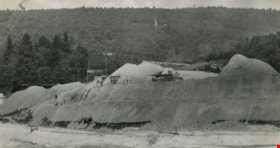
- Photograph of the Cariboo Road Overpass at the begining stage of its construction.
- Repository
- City of Burnaby Archives
- Date
- 1977
- Collection/Fonds
- Columbian Newspaper collection
- Physical Description
- 1 photograph : b&w ; 12.5 x 24 cm
- Description Level
- Item
- Record No.
- 480-273
- Access Restriction
- No restrictions
- Reproduction Restriction
- No restrictions
- Accession Number
- 2003-02
- Scope and Content
- Photograph of the Cariboo Road Overpass at the begining stage of its construction.
- Subjects
- Construction - Road Construction
- Media Type
- Photograph
- Photographer
- Hodge, Craig
- Notes
- Title based on contents of photograph
- Newspaper clipping attached to verso of photograph reads: "Road builders created a sandpile for a giant with the first stage of the $917, 000 Cariboo Rd. overpass in Burnaby. Started several weeks ago the overpass actually consists of two bridges - one crossing railway tracks and Government St., the other spanning the Brunette River - and is expected to be complete early next year."
- Geographic Access
- Cariboo Road
- Trans Canada Highway
- Planning Study Area
- Burnaby Lake Area
Images
Historic photo of Cariboo Road
https://search.heritageburnaby.ca/link/museumdescription13516
- Repository
- Burnaby Village Museum
- Date
- [190-] date of original, copied [198_]
- Collection/Fonds
- Century Park Museum Association fonds
- Description Level
- Item
- Physical Description
- 1 photograph : b&w print ; 8.7 x 12.5 cm
- Scope and Content
- Photograph of a historic photograph of an unidentified man standing on a boardwalk on the corner of Cariboo Road in Burnaby. Historic photograph includes a label in the top corner that reads: "Cariboo Rd / Burnaby". The road is made of dirt and a two story house is visible across the road from the …
- Repository
- Burnaby Village Museum
- Collection/Fonds
- Century Park Museum Association fonds
- Description Level
- Item
- Physical Description
- 1 photograph : b&w print ; 8.7 x 12.5 cm
- Scope and Content
- Photograph of a historic photograph of an unidentified man standing on a boardwalk on the corner of Cariboo Road in Burnaby. Historic photograph includes a label in the top corner that reads: "Cariboo Rd / Burnaby". The road is made of dirt and a two story house is visible across the road from the man.
- Subjects
- Construction - Road Construction
- Names
- Burnaby Village Museum
- Geographic Access
- Cariboo Road
- Accession Code
- BV020.5.860
- Access Restriction
- No restrictions
- Reproduction Restriction
- May be restricted by third party rights
- Date
- [190-] date of original, copied [198_]
- Media Type
- Photograph
- Scan Resolution
- 600
- Scan Date
- 25-Aug-2020
- Scale
- 100
- Photographer
- Brown, Cice Chandler
- Notes
- Title based on contents of photograph
Images
Stormont Overpass
https://search.heritageburnaby.ca/link/archivedescription45376
- Repository
- City of Burnaby Archives
- Date
- August 1978
- Collection/Fonds
- Columbian Newspaper collection
- Description Level
- Item
- Physical Description
- 1 photograph : b&w ; 12.5 x 24 cm
- Scope and Content
- Aerial photograph of Stormont Overpass which would provide a direct link from the Trans Canada Highway (previously named the 401 Freeway) to the Lougheed Highway and Simon Fraser University. This was taken when the excavation work was completed, and grading and paving still need to be done.
- Repository
- City of Burnaby Archives
- Date
- August 1978
- Collection/Fonds
- Columbian Newspaper collection
- Physical Description
- 1 photograph : b&w ; 12.5 x 24 cm
- Description Level
- Item
- Record No.
- 480-271
- Access Restriction
- No restrictions
- Reproduction Restriction
- No restrictions
- Accession Number
- 2003-02
- Scope and Content
- Aerial photograph of Stormont Overpass which would provide a direct link from the Trans Canada Highway (previously named the 401 Freeway) to the Lougheed Highway and Simon Fraser University. This was taken when the excavation work was completed, and grading and paving still need to be done.
- Media Type
- Photograph
- Photographer
- Hodge, Craig
- Notes
- Title based on contents of photograph
- Note in pencil on verso of photograph reads: "Altair Aviation / photo by / Craig Hodge"
- Geographic Access
- Cariboo Road
- Gaglardi Way
- Trans Canada Highway
- Historic Neighbourhood
- Burquitlam (Historic Neighbourhood)
- Planning Study Area
- Burnaby Lake Area
- Cameron Area
Images
Stormont Overpass
https://search.heritageburnaby.ca/link/archivedescription45377
- Repository
- City of Burnaby Archives
- Date
- August 1978
- Collection/Fonds
- Columbian Newspaper collection
- Description Level
- Item
- Physical Description
- 1 photograph : b&w ; 16.5 x 24 cm
- Scope and Content
- Aerial photograph of Stormont Overpass which would provide a direct link from the 401 Freeway to the Lougheed Highway and Simon Fraser University. This was taken when the excavation work was completed, and grading and paving still need to be done.
- Repository
- City of Burnaby Archives
- Date
- August 1978
- Collection/Fonds
- Columbian Newspaper collection
- Physical Description
- 1 photograph : b&w ; 16.5 x 24 cm
- Description Level
- Item
- Record No.
- 480-272
- Access Restriction
- No restrictions
- Reproduction Restriction
- No restrictions
- Accession Number
- 2003-02
- Scope and Content
- Aerial photograph of Stormont Overpass which would provide a direct link from the 401 Freeway to the Lougheed Highway and Simon Fraser University. This was taken when the excavation work was completed, and grading and paving still need to be done.
- Media Type
- Photograph
- Photographer
- Hodge, Craig
- Notes
- Title based on contents of photograph
- Newspaper clipping attached to verso of photograph reads: "After six years, work on the Stormont interchange in Burnaby is only a few weeks from completion. The huge clover-leaf junction of Gaglardi Way and the Freeway is on the top left-hand corner, with Gaglardi Way approaching from the bottom right where a bridge has been completed over the Burlington Northern tracks. An embankment linking that bridge with one over the Brunette River awaits only a layer of tarmac, and a path has been cleared through the woods to link up with the clover-leaf. The present access to the Freeway is along the road running from the left to right across the middle of the picture. The interchange will open next month."
- Note in pencil on verso of photograph reads: "Altair Aviation / photo by / Craig Hodge"
- Geographic Access
- Cariboo Road
- Gaglardi Way
- Trans Canada Highway
- Historic Neighbourhood
- Burquitlam (Historic Neighbourhood)
- Planning Study Area
- Burnaby Lake Area
- Cameron Area
Images
Stormont Overpass
https://search.heritageburnaby.ca/link/archivedescription45380
- Repository
- City of Burnaby Archives
- Date
- [1978]
- Collection/Fonds
- Columbian Newspaper collection
- Description Level
- Item
- Physical Description
- 1 photograph : b&w ; 16 x 24 cm
- Scope and Content
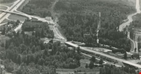
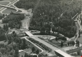
- Aerial photograph of Stormont Overpass which would provide a direct link from the Trans Canada Highway (previously named the 401 Freeway) to the Lougheed Highway and Simon Fraser University. This was taken when the excavation work was completed, and paving still need to be done.
- Repository
- City of Burnaby Archives
- Date
- [1978]
- Collection/Fonds
- Columbian Newspaper collection
- Physical Description
- 1 photograph : b&w ; 16 x 24 cm
- Description Level
- Item
- Record No.
- 480-275
- Access Restriction
- No restrictions
- Reproduction Restriction
- No restrictions
- Accession Number
- 2003-02
- Scope and Content
- Aerial photograph of Stormont Overpass which would provide a direct link from the Trans Canada Highway (previously named the 401 Freeway) to the Lougheed Highway and Simon Fraser University. This was taken when the excavation work was completed, and paving still need to be done.
- Media Type
- Photograph
- Photographer
- King, Basil
- Notes
- Title based on contents of photograph
- Note on verso of photograph reads: "One of the biggest Highways"
- Geographic Access
- Cariboo Road
- Gaglardi Way
- Trans Canada Highway
- Historic Neighbourhood
- Burquitlam (Historic Neighbourhood)
- Planning Study Area
- Burnaby Lake Area
- Cameron Area
![Digney film 2 - Construction of Simpsons-Sears, [1954] (date of original), copied 2019 thumbnail](/media/hpo/_Data/_BVM_Moving_Images/2019_0018_0004_009.jpg?width=280)
![Cariboo Cloverleaf, Government Road and Gaglardi Way, [1978] thumbnail](/media/hpo/_Data/_Archives_Images/_Unrestricted/480/480-274.jpg?width=280)
![Historic photo of Cariboo Road, [190-] date of original, copied [198_] thumbnail](/media/hpo/_Data/_BVM_Images/2020/2020_0005_0860_001.jpg?width=280)
![Stormont Overpass, [1978] thumbnail](/media/hpo/_Data/_Archives_Images/_Unrestricted/480/480-275.jpg?width=280)