More like 'Burnaby Mountain'
Narrow Results By
Subject
- Aerial Photographs 4
- Agricultural Tools and Equipment - Plows 1
- Agriculture - Fruit and Berries 1
- Animals - Birds 2
- Animals - Dogs 5
- Animals - Fowl 1
- Buildings - Commercial - Bus Stations 1
- Buildings - Commercial - Hotels and Motels 1
- Buildings - Recreational - Outdoor Swimming Pools 1
- Buildings - Residences - Houses 1
- Buildings - Residential 1
- Buildings - Residential - Cabins 13
Deer Lake and Sperling Avenue
https://search.heritageburnaby.ca/link/archivedescription37946
- Repository
- City of Burnaby Archives
- Date
- [1946] (date of original), copied 1991
- Collection/Fonds
- Burnaby Historical Society fonds
- Description Level
- Item
- Physical Description
- 1 photograph : b&w ; 3.5 x 4.4 cm print on contact sheet 20.5 x 26.7 cm
- Scope and Content
- Aerial photograph of Deer Lake and the Sperling Avenue area facing north.
- Repository
- City of Burnaby Archives
- Date
- [1946] (date of original), copied 1991
- Collection/Fonds
- Burnaby Historical Society fonds
- Subseries
- Burnaby Image Bank subseries
- Physical Description
- 1 photograph : b&w ; 3.5 x 4.4 cm print on contact sheet 20.5 x 26.7 cm
- Description Level
- Item
- Record No.
- 370-533
- Access Restriction
- No restrictions
- Reproduction Restriction
- No known restrictions
- Accession Number
- BHS1999-03
- Scope and Content
- Aerial photograph of Deer Lake and the Sperling Avenue area facing north.
- Media Type
- Photograph
- Notes
- Title based on contents of photograph
- 1 b&w copy negative accompanying
- Negative has a pink cast
- Geographic Access
- Deer Lake
- Sperling Avenue
- Historic Neighbourhood
- Burnaby Lake (Historic Neighbourhood)
- Planning Study Area
- Morley-Buckingham Area
Images
Delta Avenue and Hastings Street intersection
https://search.heritageburnaby.ca/link/archivedescription37640
- Repository
- City of Burnaby Archives
- Date
- [1943 or 1944] (date of original), copied 1991
- Collection/Fonds
- Burnaby Historical Society fonds
- Description Level
- Item
- Physical Description
- 1 photograph : b&w ; 3.2 x 5.3 cm print on contact sheet 20.2 x 25.3 cm
- Scope and Content
- Photograph of the intersection at Delta Avenue and Hastings Street. The photograph was taken from the southwest corner, facing north.
- Repository
- City of Burnaby Archives
- Date
- [1943 or 1944] (date of original), copied 1991
- Collection/Fonds
- Burnaby Historical Society fonds
- Subseries
- Burnaby Image Bank subseries
- Physical Description
- 1 photograph : b&w ; 3.2 x 5.3 cm print on contact sheet 20.2 x 25.3 cm
- Description Level
- Item
- Record No.
- 370-228
- Access Restriction
- No restrictions
- Reproduction Restriction
- No known restrictions
- Accession Number
- BHS1999-03
- Scope and Content
- Photograph of the intersection at Delta Avenue and Hastings Street. The photograph was taken from the southwest corner, facing north.
- Subjects
- Geographic Features - Roads
- Media Type
- Photograph
- Notes
- Title based on contents of photograph
- 1 b&w copy negative accompanying
- Geographic Access
- Delta Avenue
- Hastings Street
- Historic Neighbourhood
- Capitol Hill (Historic Neighbourhood)
- Planning Study Area
- Capitol Hill Area
Images
Desmond Barrett
https://search.heritageburnaby.ca/link/archivedescription37971
- Repository
- City of Burnaby Archives
- Date
- [1947] (date of original), copied 1991
- Collection/Fonds
- Burnaby Historical Society fonds
- Description Level
- Item
- Physical Description
- 1 photograph : b&w ; 3.9 x 2.6 cm print on contact sheet 20.7 x 26.2 cm
- Scope and Content
- Photograph of Desmond Barrett skating on Deer Lake.
- Repository
- City of Burnaby Archives
- Date
- [1947] (date of original), copied 1991
- Collection/Fonds
- Burnaby Historical Society fonds
- Subseries
- Burnaby Image Bank subseries
- Physical Description
- 1 photograph : b&w ; 3.9 x 2.6 cm print on contact sheet 20.7 x 26.2 cm
- Description Level
- Item
- Record No.
- 370-558
- Access Restriction
- No restrictions
- Reproduction Restriction
- No known restrictions
- Accession Number
- BHS1999-03
- Scope and Content
- Photograph of Desmond Barrett skating on Deer Lake.
- Names
- Barrett, Desmond
- Media Type
- Photograph
- Notes
- Title based on contents of photograph
- 2 b&w copy prints accompanying
- 1 b&w copy negative accompanying
- Geographic Access
- Deer Lake
- Historic Neighbourhood
- Burnaby Lake (Historic Neighbourhood)
- Planning Study Area
- Oakalla Area
Images
Digney family and the Oak Theatre gardens
https://search.heritageburnaby.ca/link/archivedescription85251
- Repository
- City of Burnaby Archives
- Date
- [between 1940 and 1944]
- Collection/Fonds
- Digney Family fonds
- Description Level
- Item
- Physical Description
- 1 film clip (10 min., 12 sec.) : digital, b&w, col., si.
- Scope and Content
- Item is a digitized silent film segment identified as Reel 14. The film opens in with the Digney family in their yard and garden and Grandma Swan's funeral (Royal Oak Cemetery). The remainder of the footage provides views of the gardens surrounding the Oak Theatre and includes footage of a wedding,…
- Repository
- City of Burnaby Archives
- Date
- [between 1940 and 1944]
- Collection/Fonds
- Digney Family fonds
- Physical Description
- 1 film clip (10 min., 12 sec.) : digital, b&w, col., si.
- Description Level
- Item
- Record No.
- 562-003-14
- Access Restriction
- No restrictions
- Reproduction Restriction
- May be restricted by third party rights
- Accession Number
- 2014-04
- Scope and Content
- Item is a digitized silent film segment identified as Reel 14. The film opens in with the Digney family in their yard and garden and Grandma Swan's funeral (Royal Oak Cemetery). The remainder of the footage provides views of the gardens surrounding the Oak Theatre and includes footage of a wedding, family pets at play, men and women playing badminton, views of both the interior and exterior of the Oak Theatre including female ushers. The film then moves on to a War Bond Drive and parade along Kingsway followed by more views of the Oak Theatre gardens.
- Media Type
- Moving Images
- Photographer
- Digney, Andy
- Creator
- Digney, Andy
- Notes
- Title based on contents of film
- Historic Neighbourhood
- Central Park (Historic Neighbourhood)
- Planning Study Area
- Marlborough Area
Images
Video
Digney family and the Oak Theatre gardens, [between 1940 and 1944]
Digney family and the Oak Theatre gardens, [between 1940 and 1944]
https://search.heritageburnaby.ca/media/hpo/_Data/_Archives_Moving_Images/_Unrestricted/562-003-14.m4vDucks in the water
https://search.heritageburnaby.ca/link/museumdescription1425
- Repository
- Burnaby Village Museum
- Date
- 1942
- Collection/Fonds
- Burnaby Village Museum Photograph collection
- Description Level
- Item
- Physical Description
- 1 photograph : b&w ; 9 x 6.5 cm
- Scope and Content
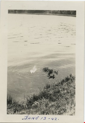
- Photograph of ducks swimming in a lake or a pond. Note the grassy edges around the water. The location is not identified.
- Repository
- Burnaby Village Museum
- Collection/Fonds
- Burnaby Village Museum Photograph collection
- Description Level
- Item
- Physical Description
- 1 photograph : b&w ; 9 x 6.5 cm
- Material Details
- inscribed in blue ballpoint pen, recto, b. "JUNE 13 - 42."
- Scope and Content
- Photograph of ducks swimming in a lake or a pond. Note the grassy edges around the water. The location is not identified.
- Accession Code
- BV985.5799.1
- Access Restriction
- No restrictions
- Reproduction Restriction
- No known restrictions
- Date
- 1942
- Media Type
- Photograph
- Scan Resolution
- 600
- Scan Date
- 2024-02-27
Images
Eddie Manning with a baby carriage
https://search.heritageburnaby.ca/link/archivedescription38029
- Repository
- City of Burnaby Archives
- Date
- [1943] (date of original), copied 1991
- Collection/Fonds
- Burnaby Historical Society fonds
- Description Level
- Item
- Physical Description
- 1 photograph : b&w ; 2.9 x 3.8 cm print on contact sheet 20.6 x 26.3 cm
- Scope and Content
- Photograph of Eddie Manning, a British soldier, at 2224 Antrim Avenue (later renumbered 6957 Antrim Avenue) with a baby carriage. The street and houses can be seen in the background.
- Repository
- City of Burnaby Archives
- Date
- [1943] (date of original), copied 1991
- Collection/Fonds
- Burnaby Historical Society fonds
- Subseries
- Burnaby Image Bank subseries
- Physical Description
- 1 photograph : b&w ; 2.9 x 3.8 cm print on contact sheet 20.6 x 26.3 cm
- Description Level
- Item
- Record No.
- 370-616
- Access Restriction
- No restrictions
- Reproduction Restriction
- No known restrictions
- Accession Number
- BHS1999-03
- Scope and Content
- Photograph of Eddie Manning, a British soldier, at 2224 Antrim Avenue (later renumbered 6957 Antrim Avenue) with a baby carriage. The street and houses can be seen in the background.
- Subjects
- Occupations - Military Personnel
- Clothing - Military Uniforms
- Wars - World War, 1939-1945
- Geographic Features - Roads
- Names
- Manning, Eddie
- Media Type
- Photograph
- Notes
- Title based on contents of photograph
- 1 b&w copy negative accompanying
- Negative has a pink cast
- Geographic Access
- Antrim Avenue
- Street Address
- 6957 Antrim Avenue
- Historic Neighbourhood
- Central Park (Historic Neighbourhood)
- Planning Study Area
- Windsor Area
Images
Evelyn Le Grove
https://search.heritageburnaby.ca/link/archivedescription38017
- Repository
- City of Burnaby Archives
- Date
- [1940] (date of original), copied 1991
- Collection/Fonds
- Burnaby Historical Society fonds
- Description Level
- Item
- Physical Description
- 1 photograph : b&w ; 2.3 x 4.1 cm print on contact sheet 20.6 x 26.9 cm
- Scope and Content
- Photograph of Evelyn Le Grove standing on a sidewalk outside of 2224 Antrim Avenue (later renumbered 6957 Antrim Avenue).
- Repository
- City of Burnaby Archives
- Date
- [1940] (date of original), copied 1991
- Collection/Fonds
- Burnaby Historical Society fonds
- Subseries
- Burnaby Image Bank subseries
- Physical Description
- 1 photograph : b&w ; 2.3 x 4.1 cm print on contact sheet 20.6 x 26.9 cm
- Description Level
- Item
- Record No.
- 370-604
- Access Restriction
- No restrictions
- Reproduction Restriction
- No known restrictions
- Accession Number
- BHS1999-03
- Scope and Content
- Photograph of Evelyn Le Grove standing on a sidewalk outside of 2224 Antrim Avenue (later renumbered 6957 Antrim Avenue).
- Subjects
- Geographic Features - Sidewalks
- Names
- Le Grove, Evelyn Hardy
- Media Type
- Photograph
- Notes
- Title based on contents of photograph
- 1 b&w copy negative accompanying
- Negative has a pink cast
- Geographic Access
- Antrim Avenue
- Street Address
- 6957 Antrim Avenue
- Historic Neighbourhood
- Central Park (Historic Neighbourhood)
- Planning Study Area
- Windsor Area
Images
Field
https://search.heritageburnaby.ca/link/museumdescription3421
- Repository
- Burnaby Village Museum
- Date
- [1944]
- Collection/Fonds
- Burnaby Village Museum Photograph collection
- Description Level
- Item
- Physical Description
- 1 photograph : sepia; 6 x 10 cm
- Scope and Content
- Photograph of an unidentified field.
- Repository
- Burnaby Village Museum
- Collection/Fonds
- Burnaby Village Museum Photograph collection
- Description Level
- Item
- Physical Description
- 1 photograph : sepia; 6 x 10 cm
- Scope and Content
- Photograph of an unidentified field.
- Subjects
- Geographic Features - Fields
- Accession Code
- BV005.30.43
- Access Restriction
- No restrictions
- Date
- [1944]
- Media Type
- Photograph
- Scan Date
- 1/19/2010
- Photographer
- Battersby, Frank
- Notes
- Title based on contents of photograph
Images
Field
https://search.heritageburnaby.ca/link/museumdescription3422
- Repository
- Burnaby Village Museum
- Date
- [1944]
- Collection/Fonds
- Burnaby Village Museum Photograph collection
- Description Level
- Item
- Physical Description
- 1 photograph : sepia; 6 x 10 cm
- Scope and Content
- Photograph of an unidentified field and surrounding countryside.
- Repository
- Burnaby Village Museum
- Collection/Fonds
- Burnaby Village Museum Photograph collection
- Description Level
- Item
- Physical Description
- 1 photograph : sepia; 6 x 10 cm
- Scope and Content
- Photograph of an unidentified field and surrounding countryside.
- Subjects
- Geographic Features - Fields
- Accession Code
- BV005.30.44
- Access Restriction
- No restrictions
- Date
- [1944]
- Media Type
- Photograph
- Scan Date
- 1/19/2010
- Photographer
- Battersby, Frank
- Notes
- Title based on contents of photograph
Images
Fire truck in a park
https://search.heritageburnaby.ca/link/museumdescription1484
- Repository
- Burnaby Village Museum
- Date
- [194-?]
- Collection/Fonds
- Burnaby Village Museum Photograph collection
- Description Level
- Item
- Physical Description
- 1 photograph : sepia ; 10.5 x 6 cm
- Scope and Content
- Photograph of a group of people gathered around a fire truck in a park. A round brick structure with a conical metal top is in the foreground, obstructing a clear view of the crowd. The location has not been identified.
- Repository
- Burnaby Village Museum
- Collection/Fonds
- Burnaby Village Museum Photograph collection
- Description Level
- Item
- Physical Description
- 1 photograph : sepia ; 10.5 x 6 cm
- Scope and Content
- Photograph of a group of people gathered around a fire truck in a park. A round brick structure with a conical metal top is in the foreground, obstructing a clear view of the crowd. The location has not been identified.
- Accession Code
- BV999.55.33
- Access Restriction
- No restrictions
- Date
- [194-?]
- Media Type
- Photograph
- Scan Resolution
- 600
- Scan Date
- 09-Jun-09
- Scale
- 100
- Notes
- Title based on contents of photograph
Images
Fourth Street trail
https://search.heritageburnaby.ca/link/archivedescription88403
- Repository
- City of Burnaby Archives
- Date
- February 1946 (date of original), copied 2014
- Collection/Fonds
- James Massey family fonds
- Description Level
- Item
- Physical Description
- 1 photograph (tiff) : sepia ; 600 dpi
- Scope and Content
- Photograph of the Fourth Street trail into Robert Burnaby Park with snow covered ground and trees.
- Repository
- City of Burnaby Archives
- Date
- February 1946 (date of original), copied 2014
- Collection/Fonds
- James Massey family fonds
- Physical Description
- 1 photograph (tiff) : sepia ; 600 dpi
- Description Level
- Item
- Record No.
- 581-009
- Access Restriction
- No restrictions
- Reproduction Restriction
- No known restrictions
- Accession Number
- 2014-34
- Scope and Content
- Photograph of the Fourth Street trail into Robert Burnaby Park with snow covered ground and trees.
- Subjects
- Geographic Features - Trails
- Names
- Massey, Betty
- Media Type
- Photograph
- Notes
- Title based on contents of photograph
- Historic Neighbourhood
- East Burnaby (Historic Neighbourhood)
- Planning Study Area
- Lakeview-Mayfield Area
Images
Frank Battersby
https://search.heritageburnaby.ca/link/museumdescription3423
- Repository
- Burnaby Village Museum
- Date
- [1944]
- Collection/Fonds
- Burnaby Village Museum Photograph collection
- Description Level
- Item
- Physical Description
- 1 photograph : sepia; 10 x 6 cm
- Scope and Content
- Photograph of Frank Battersby standing on the front steps of an unidentified building.
- Repository
- Burnaby Village Museum
- Collection/Fonds
- Burnaby Village Museum Photograph collection
- Description Level
- Item
- Physical Description
- 1 photograph : sepia; 10 x 6 cm
- Scope and Content
- Photograph of Frank Battersby standing on the front steps of an unidentified building.
- Subjects
- Geographic Features - Fields
- Names
- Battersby, Frank
- Accession Code
- BV005.30.45
- Access Restriction
- No restrictions
- Date
- [1944]
- Media Type
- Photograph
- Scan Date
- 1/19/2010
- Notes
- Title based on contents of photograph
Images
Garden in Robert Burnaby Park
https://search.heritageburnaby.ca/link/archivedescription88405
- Repository
- City of Burnaby Archives
- Date
- [between 1949 and 1959] (date of original), copied 2014
- Collection/Fonds
- James Massey family fonds
- Description Level
- Item
- Physical Description
- 1 photograph (tiff) : sepia ; 600 dpi
- Scope and Content
- Photograph of the garden and fence in Robert Burnaby Park. Alice Massey is standing in the centre of the photograph near a large bunch of poppies with an unidentified woman to the left.
- Repository
- City of Burnaby Archives
- Date
- [between 1949 and 1959] (date of original), copied 2014
- Collection/Fonds
- James Massey family fonds
- Physical Description
- 1 photograph (tiff) : sepia ; 600 dpi
- Description Level
- Item
- Record No.
- 581-011
- Access Restriction
- No restrictions
- Reproduction Restriction
- No restrictions
- Accession Number
- 2014-34
- Scope and Content
- Photograph of the garden and fence in Robert Burnaby Park. Alice Massey is standing in the centre of the photograph near a large bunch of poppies with an unidentified woman to the left.
- Media Type
- Photograph
- Notes
- Title based on contents of photograph
- Historic Neighbourhood
- East Burnaby (Historic Neighbourhood)
- Planning Study Area
- Lakeview-Mayfield Area
Images
George B. Carpenter
https://search.heritageburnaby.ca/link/archivedescription37546
- Repository
- City of Burnaby Archives
- Date
- [between 1945 and 1949] (date of original), copied 1991
- Collection/Fonds
- Burnaby Historical Society fonds
- Description Level
- Item
- Physical Description
- 1 photograph : b&w ; 3.8 x 2.6 cm print on contact sheet 20.2 x 25.3 cm
- Scope and Content
- Photograph of George B. Carpenter, principal of Burnaby North High School, at Confederation Park for a school track meet or other function. In the background is the track and a fence with two young women sitting on it.
- Repository
- City of Burnaby Archives
- Date
- [between 1945 and 1949] (date of original), copied 1991
- Collection/Fonds
- Burnaby Historical Society fonds
- Subseries
- Burnaby Image Bank subseries
- Physical Description
- 1 photograph : b&w ; 3.8 x 2.6 cm print on contact sheet 20.2 x 25.3 cm
- Description Level
- Item
- Record No.
- 370-134
- Access Restriction
- No restrictions
- Reproduction Restriction
- No restrictions
- Accession Number
- BHS1999-03
- Scope and Content
- Photograph of George B. Carpenter, principal of Burnaby North High School, at Confederation Park for a school track meet or other function. In the background is the track and a fence with two young women sitting on it.
- Media Type
- Photograph
- Notes
- Title based on contents of photograph
- 1 b&w copy negative accompanying
- Geographic Access
- Confederation Park
- Willingdon Avenue
- Street Address
- 250 Willingdon Avenue
- Historic Neighbourhood
- Capitol Hill (Historic Neighbourhood)
- Planning Study Area
- Capitol Hill Area
Images
Gilmore Avenue and Douglas Road
https://search.heritageburnaby.ca/link/archivedescription34144
- Repository
- City of Burnaby Archives
- Date
- April 20, 1947
- Collection/Fonds
- Burnaby Historical Society fonds
- Description Level
- Item
- Physical Description
- 1 photograph : b&w negative ; 6.8 x 11.8 cm
- Scope and Content
- Photograph of Gilmore Avenue and Douglas Road. This is part of the Willingdon Heights subdivision site.
- Repository
- City of Burnaby Archives
- Date
- April 20, 1947
- Collection/Fonds
- Burnaby Historical Society fonds
- Subseries
- Alfred Bingham subseries
- Physical Description
- 1 photograph : b&w negative ; 6.8 x 11.8 cm
- Description Level
- Item
- Record No.
- 010-060
- Access Restriction
- No restrictions
- Reproduction Restriction
- No known restrictions
- Accession Number
- BHS2007-04
- Scope and Content
- Photograph of Gilmore Avenue and Douglas Road. This is part of the Willingdon Heights subdivision site.
- Subjects
- Geographic Features - Roads
- Media Type
- Photograph
- Photographer
- Bingham, Alfred "Alf"
- Notes
- Title based on contents of photograph
- Geographic Access
- Gilmore Avenue
- Douglas Road
Images
Gilmore Avenue and Douglas Road
https://search.heritageburnaby.ca/link/archivedescription34164
- Repository
- City of Burnaby Archives
- Date
- May 1, 1947
- Collection/Fonds
- Burnaby Historical Society fonds
- Description Level
- Item
- Physical Description
- 1 photograph : b&w negative ; 6.8 x 11.8 cm
- Scope and Content
- Photograph of cleared land at Gilmore Avenue and Douglas Road. Houses under construction can be seen in the background. This is part of the Willingdon Heights subdivision site.
- Repository
- City of Burnaby Archives
- Date
- May 1, 1947
- Collection/Fonds
- Burnaby Historical Society fonds
- Subseries
- Alfred Bingham subseries
- Physical Description
- 1 photograph : b&w negative ; 6.8 x 11.8 cm
- Description Level
- Item
- Record No.
- 010-081
- Access Restriction
- No restrictions
- Reproduction Restriction
- No known restrictions
- Accession Number
- BHS2007-04
- Scope and Content
- Photograph of cleared land at Gilmore Avenue and Douglas Road. Houses under construction can be seen in the background. This is part of the Willingdon Heights subdivision site.
- Subjects
- Industries - Construction
- Buildings - Residential - Houses
- Land Clearing
- Geographic Features - Roads
- Media Type
- Photograph
- Photographer
- Bingham, Alfred "Alf"
- Notes
- Title based on contents of photograph
- Geographic Access
- Gilmore Avenue
- Douglas Road
Images
Gilmore Avenue and Douglas Road
https://search.heritageburnaby.ca/link/archivedescription34173
- Repository
- City of Burnaby Archives
- Date
- May 9, 1947
- Collection/Fonds
- Burnaby Historical Society fonds
- Description Level
- Item
- Physical Description
- 1 photograph : b&w negative ; 6.8 x 11.6 cm
- Scope and Content
- Photograph of the Gilmore Avenue and Douglas Road intersection with houses under construction on either side of the road, and a bicycle in foreground. This is part of the Willingdon Heights subdivision site.
- Repository
- City of Burnaby Archives
- Date
- May 9, 1947
- Collection/Fonds
- Burnaby Historical Society fonds
- Subseries
- Alfred Bingham subseries
- Physical Description
- 1 photograph : b&w negative ; 6.8 x 11.6 cm
- Description Level
- Item
- Record No.
- 010-090
- Access Restriction
- No restrictions
- Reproduction Restriction
- No known restrictions
- Accession Number
- BHS2007-04
- Scope and Content
- Photograph of the Gilmore Avenue and Douglas Road intersection with houses under construction on either side of the road, and a bicycle in foreground. This is part of the Willingdon Heights subdivision site.
- Subjects
- Transportation - Bicycles
- Industries - Construction
- Buildings - Residential - Houses
- Geographic Features - Roads
- Media Type
- Photograph
- Photographer
- Bingham, Alfred "Alf"
- Notes
- Title based on contents of photograph
- Geographic Access
- Gilmore Avenue
- Douglas Road
Images
Grant Street and Gilmore Avenue
https://search.heritageburnaby.ca/link/archivedescription34110
- Repository
- City of Burnaby Archives
- Date
- March 22, 1947
- Collection/Fonds
- Burnaby Historical Society fonds
- Description Level
- Item
- Physical Description
- 1 photograph : b&w negative ; 6.8 x 11.1 cm
- Scope and Content
- Photograph of Grant Street and Gilmore Avenue. This is part of the Willingdon Heights subdivision site.
- Repository
- City of Burnaby Archives
- Date
- March 22, 1947
- Collection/Fonds
- Burnaby Historical Society fonds
- Subseries
- Alfred Bingham subseries
- Physical Description
- 1 photograph : b&w negative ; 6.8 x 11.1 cm
- Description Level
- Item
- Record No.
- 010-026
- Access Restriction
- No restrictions
- Reproduction Restriction
- No known restrictions
- Accession Number
- BHS2007-04
- Scope and Content
- Photograph of Grant Street and Gilmore Avenue. This is part of the Willingdon Heights subdivision site.
- Subjects
- Geographic Features - Roads
- Media Type
- Photograph
- Photographer
- Bingham, Alfred "Alf"
- Notes
- Title based on contents of photograph
- Geographic Access
- Grant Street
- Gilmore Avenue
Images
Graveley Street and Willingdon Avenue
https://search.heritageburnaby.ca/link/archivedescription34113
- Repository
- City of Burnaby Archives
- Date
- March 22, 1947
- Collection/Fonds
- Burnaby Historical Society fonds
- Description Level
- Item
- Physical Description
- 1 photograph : b&w negative ; 6.8 x 11.3 cm
- Scope and Content
- Photograph of Graveley Street and Willingdon Avenue (north) with houses along one side and trees and brush along the other side. This is part of the Willingdon Heights subdivision site.
- Repository
- City of Burnaby Archives
- Date
- March 22, 1947
- Collection/Fonds
- Burnaby Historical Society fonds
- Subseries
- Alfred Bingham subseries
- Physical Description
- 1 photograph : b&w negative ; 6.8 x 11.3 cm
- Description Level
- Item
- Record No.
- 010-029
- Access Restriction
- No restrictions
- Reproduction Restriction
- No known restrictions
- Accession Number
- BHS2007-04
- Scope and Content
- Photograph of Graveley Street and Willingdon Avenue (north) with houses along one side and trees and brush along the other side. This is part of the Willingdon Heights subdivision site.
- Subjects
- Geographic Features - Roads
- Media Type
- Photograph
- Photographer
- Bingham, Alfred "Alf"
- Notes
- Title based on contents of photograph
- Geographic Access
- Graveley Street
- Willingdon Avenue
Images
Graveley Street and Willingdon Avenue
https://search.heritageburnaby.ca/link/archivedescription34201
- Repository
- City of Burnaby Archives
- Date
- June 17, 1947
- Collection/Fonds
- Burnaby Historical Society fonds
- Description Level
- Item
- Physical Description
- 1 photograph : b&w negative ; 6.8 x 11.6 cm
- Scope and Content
- Photograph of Graveley Street at Willingdon Avenue; the road is in the foreground with brush and cleared land visible beside the road. This is part of the Willingdon Heights subdivision site.
- Repository
- City of Burnaby Archives
- Date
- June 17, 1947
- Collection/Fonds
- Burnaby Historical Society fonds
- Subseries
- Alfred Bingham subseries
- Physical Description
- 1 photograph : b&w negative ; 6.8 x 11.6 cm
- Description Level
- Item
- Record No.
- 010-117
- Access Restriction
- No restrictions
- Reproduction Restriction
- No known restrictions
- Accession Number
- BHS2007-04
- Scope and Content
- Photograph of Graveley Street at Willingdon Avenue; the road is in the foreground with brush and cleared land visible beside the road. This is part of the Willingdon Heights subdivision site.
- Subjects
- Land Clearing
- Geographic Features - Roads
- Media Type
- Photograph
- Photographer
- Bingham, Alfred "Alf"
- Notes
- Title based on contents of photograph
- Geographic Access
- Graveley Street
- Willingdon Avenue
![Deer Lake and Sperling Avenue, [1946] (date of original), copied 1991 thumbnail](/media/hpo/_Data/_Archives_Images/_Unrestricted/370/370-533.jpg?width=280)
![Delta Avenue and Hastings Street intersection, [1943 or 1944] (date of original), copied 1991 thumbnail](/media/hpo/_Data/_Archives_Images/_Unrestricted/370/370-228.jpg?width=280)
![Desmond Barrett, [1947] (date of original), copied 1991 thumbnail](/media/hpo/_Data/_Archives_Images/_Unrestricted/370/370-558.jpg?width=280)
![Digney family and the Oak Theatre gardens, [between 1940 and 1944] thumbnail](/media/Hpo/_Data/_Archives_Moving_Images/_Unrestricted/562-003-14.jpg?width=280)
![Eddie Manning with a baby carriage, [1943] (date of original), copied 1991 thumbnail](/media/hpo/_Data/_Archives_Images/_Unrestricted/370/370-616.jpg?width=280)
![Evelyn Le Grove, [1940] (date of original), copied 1991 thumbnail](/media/hpo/_Data/_Archives_Images/_Unrestricted/370/370-604.jpg?width=280)
![Field, [1944] thumbnail](/media/hpo/_Data/_BVM_Images/2000/200500300043.jpg?width=280)
![Field, [1944] thumbnail](/media/hpo/_Data/_BVM_Images/2000/200500300044.jpg?width=280)
![Fire truck in a park, [194-?] thumbnail](/media/hpo/_Data/_BVM_Images/1990/199900550033.jpg?width=280)
![Frank Battersby, [1944] thumbnail](/media/hpo/_Data/_BVM_Images/2000/200500300045.jpg?width=280)
![Garden in Robert Burnaby Park, [between 1949 and 1959] (date of original), copied 2014 thumbnail](/media/hpo/_Data/_Archives_Images/_Unrestricted/580/581-011.jpg?width=280)
![George B. Carpenter, [between 1945 and 1949] (date of original), copied 1991 thumbnail](/media/hpo/_Data/_Archives_Images/_Unrestricted/370/370-134.jpg?width=280)
