More like 'carrying basket'
Narrow Results By

Commercial Map of Greater Vancouver and District
https://search.heritageburnaby.ca/link/museumdescription9552
- Repository
- Burnaby Village Museum
- Date
- July 1921
- Collection/Fonds
- Burnaby Village Museum Map collection
- Description Level
- Item
- Physical Description
- 1 map : col. lithograph mounted on linen ; 107 x 138 cm
- Scope and Content
- Commercial map of Greater Vancouver and District. Map depicts district lots, railroads, electric railways, streets, street car stops, schools, buildings, postal block numbers, parks and First Nations reserves. Map covers the geographcial areas of Vancouver, Burnaby, New Westminster, portions of Ric…
- Repository
- Burnaby Village Museum
- Collection/Fonds
- Burnaby Village Museum Map collection
- Description Level
- Item
- Physical Description
- 1 map : col. lithograph mounted on linen ; 107 x 138 cm
- Material Details
- Includes Legend and Index
- Scope and Content
- Commercial map of Greater Vancouver and District. Map depicts district lots, railroads, electric railways, streets, street car stops, schools, buildings, postal block numbers, parks and First Nations reserves. Map covers the geographcial areas of Vancouver, Burnaby, New Westminster, portions of Richmond, West Vancouver, North Vancouver, and Surrey with half mile circles that radiate from Vancouver City Hall on the corner of Main and Hastings. Bottom of map includes an index of street names, along with their corresponding map grid locations. The map is bordered by Marine Drive to the west, North Road to the east, Dempsey Street to the north and 20th Road to the south.
- History
- Bought by donor at thrift store years ago. No known provenance.
- Publisher
- Produced by Photo - Lithography, Colonist , Victoria, B.C.
- Geographic Access
- Vancouver
- Accession Code
- BV018.24.1
- Access Restriction
- No restrictions
- Reproduction Restriction
- No known restrictions
- Date
- July 1921
- Media Type
- Cartographic Material
- Scan Resolution
- 300
- Scan Date
- 16-Jun-20
- Scale
- 100
- Notes
- Transcribed title
- Title on map reads: "COMMERCIAL MAP / OF / GREATER VANCOUVER / AND / DISTRICT / Compiled and Published by / The Vancouver Map & Blueprint Co. Ltd. / 441 Seymour St. Vancouver B.C. / July, 1921".
Images

![The Lions from Burnaby Park, [between 1926 and 1929] thumbnail](/media/hpo/_Data/_BVM_Images/1971/197202040003.jpg?width=280)
The Lions from Burnaby Park
https://search.heritageburnaby.ca/link/museumdescription3109
- Repository
- Burnaby Village Museum
- Date
- [between 1926 and 1929]
- Collection/Fonds
- Burnaby Village Museum Photograph collection
- Description Level
- Item
- Physical Description
- 1 photograph : b&w photogravure ; 14.5 x 9.5 cm
- Scope and Content
- Photograph of the north shore mountains, including the Lions, taken from Robert Burnaby Park.
- Repository
- Burnaby Village Museum
- Collection/Fonds
- Burnaby Village Museum Photograph collection
- Description Level
- Item
- Physical Description
- 1 photograph : b&w photogravure ; 14.5 x 9.5 cm
- Scope and Content
- Photograph of the north shore mountains, including the Lions, taken from Robert Burnaby Park.
- Geographic Access
- Wedgewood Street
- Robert Burnaby Park
- Street Address
- 8155 Wedgewood Street
- Accession Code
- HV972.204.3
- Access Restriction
- No restrictions
- Reproduction Restriction
- No known restrictions
- Date
- [between 1926 and 1929]
- Media Type
- Photograph
- Historic Neighbourhood
- Burnaby Lake (Historic Neighbourhood)
- Planning Study Area
- Lakeview-Mayfield Area
- Related Material
- For other photographs from the same album, see HV972.204.3 - .14
- Scan Resolution
- 600
- Scan Date
- 2023-04-25
- Photographer
- Lloyd, Frank Ernest
- Notes
- Annotations made in white paint on recto of photograph read: "'The Lions' from Burnaby Park" and "Lloyd Studio, McKay."
Images
![The Lions from Burnaby Park, [between 1926 and 1929] thumbnail](/media/hpo/_Data/_BVM_Images/1971/197202040003.jpg)

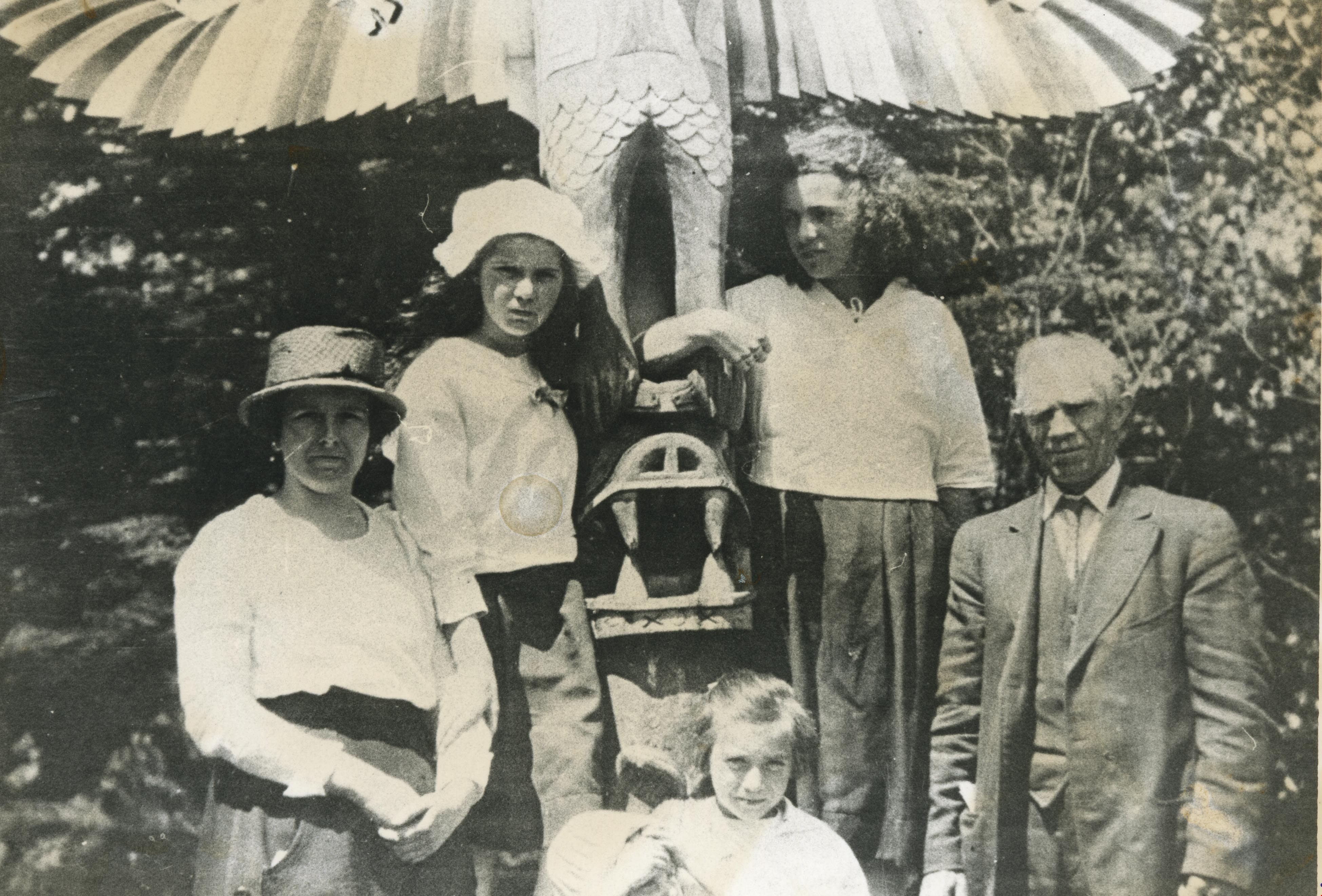
Butcher family
https://search.heritageburnaby.ca/link/archivedescription35685
- Repository
- City of Burnaby Archives
- Date
- 1920 (date of original), copied 1986
- Collection/Fonds
- Burnaby Historical Society fonds
- Description Level
- Item
- Physical Description
- 1 photograph : b&w ; 12.7 x 17.8 cm print
- Scope and Content
- Photograph of the Butcher family standing next to a totem pole. Back row, left to right: Florence Butcher (mother), Violet Butcher (sister), Thelma Butcher (sister), and Reuben Butcher (father). Front row: Dorothy Butcher (sister) and Patricia Butcher (baby sister).
- Repository
- City of Burnaby Archives
- Date
- 1920 (date of original), copied 1986
- Collection/Fonds
- Burnaby Historical Society fonds
- Subseries
- Pioneer Tales subseries
- Physical Description
- 1 photograph : b&w ; 12.7 x 17.8 cm print
- Description Level
- Item
- Record No.
- 204-543
- Access Restriction
- No restrictions
- Reproduction Restriction
- No known restrictions
- Accession Number
- BHS1988-03
- Scope and Content
- Photograph of the Butcher family standing next to a totem pole. Back row, left to right: Florence Butcher (mother), Violet Butcher (sister), Thelma Butcher (sister), and Reuben Butcher (father). Front row: Dorothy Butcher (sister) and Patricia Butcher (baby sister).
- Names
- Butcher, Dorothy
- Butcher, Florence
- Butcher, Patricia
- Butcher, Reuben
- Butcher, Thelma
- Lynds, Violet Butcher
- Media Type
- Photograph
- Notes
- Title based on contents of photograph
Images