More like 'Nichols Chemical Co. Ltd. - Sulphide Works'
![Woodworking Plant, [192-] (date of original), copied 1986 thumbnail](/media/hpo/_Data/_Archives_Images/_Unrestricted/204/204-106.jpg?width=280)
Woodworking Plant
https://search.heritageburnaby.ca/link/archivedescription35249
- Repository
- City of Burnaby Archives
- Date
- [192-] (date of original), copied 1986
- Collection/Fonds
- Burnaby Historical Society fonds
- Description Level
- Item
- Physical Description
- 1 photograph : b&w ; 12.7 x 17.8 cm print
- Scope and Content
- Photograph of James Brookes Woodworking Plant located at 7730 6th Street. This site has also served as Cliff's Can Factory and Western Canadian Can Factory. Note the spur street car line (no. 2) where B.C. Electric Railway freight cars could load and unload.
- Repository
- City of Burnaby Archives
- Date
- [192-] (date of original), copied 1986
- Collection/Fonds
- Burnaby Historical Society fonds
- Subseries
- Pioneer Tales subseries
- Physical Description
- 1 photograph : b&w ; 12.7 x 17.8 cm print
- Description Level
- Item
- Record No.
- 204-106
- Access Restriction
- No restrictions
- Reproduction Restriction
- No known restrictions
- Accession Number
- BHS1988-03
- Scope and Content
- Photograph of James Brookes Woodworking Plant located at 7730 6th Street. This site has also served as Cliff's Can Factory and Western Canadian Can Factory. Note the spur street car line (no. 2) where B.C. Electric Railway freight cars could load and unload.
- Subjects
- Buildings - Industrial - Factories
- Media Type
- Photograph
- Notes
- Title based on contents of photograph
- Geographic Access
- 6th Street
- Street Address
- 7730 6th Street
- Historic Neighbourhood
- East Burnaby (Historic Neighbourhood)
- Planning Study Area
- Second Street Area
Images
![Woodworking Plant, [192-] (date of original), copied 1986 thumbnail](/media/hpo/_Data/_Archives_Images/_Unrestricted/204/204-106.jpg)
![Woodworking Plant, [192-] (date of original), copied 1986 thumbnail](/media/hpo/_Data/_Archives_Images/_Unrestricted/204/204-107.jpg?width=280)
Woodworking Plant
https://search.heritageburnaby.ca/link/archivedescription35250
- Repository
- City of Burnaby Archives
- Date
- [192-] (date of original), copied 1986
- Collection/Fonds
- Burnaby Historical Society fonds
- Description Level
- Item
- Physical Description
- 1 photograph : b&w ; 12.7 x 17.8 cm print
- Scope and Content
- Photograph of James Brookes Woodworking Plant, located at 7730 6th Street, taken from 13th Avenue. This site has also served as Cliff's Can Factory and Western Canadian Can Factory.
- Repository
- City of Burnaby Archives
- Date
- [192-] (date of original), copied 1986
- Collection/Fonds
- Burnaby Historical Society fonds
- Subseries
- Pioneer Tales subseries
- Physical Description
- 1 photograph : b&w ; 12.7 x 17.8 cm print
- Description Level
- Item
- Record No.
- 204-107
- Access Restriction
- No restrictions
- Reproduction Restriction
- No known restrictions
- Accession Number
- BHS1988-03
- Scope and Content
- Photograph of James Brookes Woodworking Plant, located at 7730 6th Street, taken from 13th Avenue. This site has also served as Cliff's Can Factory and Western Canadian Can Factory.
- Subjects
- Buildings - Industrial - Factories
- Media Type
- Photograph
- Notes
- Title based on contents of photograph
- Geographic Access
- 6th Street
- Street Address
- 7730 6th Street
- Historic Neighbourhood
- East Burnaby (Historic Neighbourhood)
- Planning Study Area
- Second Street Area
Images
![Woodworking Plant, [192-] (date of original), copied 1986 thumbnail](/media/hpo/_Data/_Archives_Images/_Unrestricted/204/204-107.jpg)
![Woodworking Plant, [192-] (date of original), copied 1986 thumbnail](/media/hpo/_Data/_Archives_Images/_Unrestricted/204/204-108.jpg?width=280)
Woodworking Plant
https://search.heritageburnaby.ca/link/archivedescription35251
- Repository
- City of Burnaby Archives
- Date
- [192-] (date of original), copied 1986
- Collection/Fonds
- Burnaby Historical Society fonds
- Description Level
- Item
- Physical Description
- 1 photograph : b&w ; 12.7 x 17.8 cm print
- Scope and Content
- Photograph of James Brookes Woodworking Plant, located at 7730 6th Street, taken from 6th Street. It was an East Burnaby landmark, established in 1902 as a can company by Edwin Cliff. This site has also served as Cliff's Can Factory and Western Canadian Can Factory.
- Repository
- City of Burnaby Archives
- Date
- [192-] (date of original), copied 1986
- Collection/Fonds
- Burnaby Historical Society fonds
- Subseries
- Pioneer Tales subseries
- Physical Description
- 1 photograph : b&w ; 12.7 x 17.8 cm print
- Description Level
- Item
- Record No.
- 204-108
- Access Restriction
- No restrictions
- Reproduction Restriction
- No known restrictions
- Accession Number
- BHS1988-03
- Scope and Content
- Photograph of James Brookes Woodworking Plant, located at 7730 6th Street, taken from 6th Street. It was an East Burnaby landmark, established in 1902 as a can company by Edwin Cliff. This site has also served as Cliff's Can Factory and Western Canadian Can Factory.
- Subjects
- Buildings - Industrial - Factories
- Media Type
- Photograph
- Notes
- Title based on contents of photograph
- Geographic Access
- 6th Street
- Street Address
- 7730 6th Street
- Historic Neighbourhood
- East Burnaby (Historic Neighbourhood)
- Planning Study Area
- Second Street Area
Images
![Woodworking Plant, [192-] (date of original), copied 1986 thumbnail](/media/hpo/_Data/_Archives_Images/_Unrestricted/204/204-108.jpg)
![Adley Substation, [1920] (date of original), copied 1986 thumbnail](/media/hpo/_Data/_Archives_Images/_Unrestricted/126/158-002.jpg?width=280)
Adley Substation
https://search.heritageburnaby.ca/link/archivedescription34917
- Repository
- City of Burnaby Archives
- Date
- [1920] (date of original), copied 1986
- Collection/Fonds
- Burnaby Historical Society fonds
- Description Level
- Item
- Physical Description
- 1 photograph : b&w ; 8.8 x 12.5 cm print
- Scope and Content
- Photograph of the exterior of the Adley Substation, beside the Great Northern Railway tracks near Willingdon Avenue. Signs on the building read: "Western Canada Power Co. Ltd." and "Use Stave Lake Power."
- Repository
- City of Burnaby Archives
- Date
- [1920] (date of original), copied 1986
- Collection/Fonds
- Burnaby Historical Society fonds
- Subseries
- Photographs subseries
- Physical Description
- 1 photograph : b&w ; 8.8 x 12.5 cm print
- Description Level
- Item
- Record No.
- 158-002
- Access Restriction
- No restrictions
- Reproduction Restriction
- No known restrictions
- Accession Number
- BHS1986-08
- Scope and Content
- Photograph of the exterior of the Adley Substation, beside the Great Northern Railway tracks near Willingdon Avenue. Signs on the building read: "Western Canada Power Co. Ltd." and "Use Stave Lake Power."
- Subjects
- Buildings - Industrial - Powerhouses
- Media Type
- Photograph
- Notes
- Title based on contents of photograph
- Geographic Access
- Willingdon Avenue
Images
![Adley Substation, [1920] (date of original), copied 1986 thumbnail](/media/hpo/_Data/_Archives_Images/_Unrestricted/126/158-002.jpg)

Aeroplane view of the Barnet Lumber Co.
https://search.heritageburnaby.ca/link/archivedescription38679
- Repository
- City of Burnaby Archives
- Date
- 1927
- Collection/Fonds
- Burnaby Historical Society fonds
- Description Level
- Item
- Physical Description
- 1 photograph : sepia postcard ; 8.9 x 13.4 cm
- Scope and Content
- Aerial photographic postcard of Barnet Lumber Company's Mill. The handwritten caption on the lower left corner of the postcard reads: "Aeroplane view of the Barnet Lumber Co. Ltd./ Barnet BC." The handwritten caption on the lower right corner reads: "Copyright 1927/ Pacific Airway Ltd./ Vancouver …
- Repository
- City of Burnaby Archives
- Date
- 1927
- Collection/Fonds
- Burnaby Historical Society fonds
- Subseries
- North Burnaby Board of Trade subseries
- Physical Description
- 1 photograph : sepia postcard ; 8.9 x 13.4 cm
- Description Level
- Item
- Record No.
- 476-022
- Access Restriction
- No restrictions
- Reproduction Restriction
- No known restrictions
- Accession Number
- BHS2005-8
- Scope and Content
- Aerial photographic postcard of Barnet Lumber Company's Mill. The handwritten caption on the lower left corner of the postcard reads: "Aeroplane view of the Barnet Lumber Co. Ltd./ Barnet BC." The handwritten caption on the lower right corner reads: "Copyright 1927/ Pacific Airway Ltd./ Vancouver B.C.".
- Subjects
- Aerial Photographs
- Industries - Forestry
- Buildings - Industrial - Mills
- Documentary Artifacts - Postcards
- Industries - Logging/lumber
- Names
- Barnet Mill
- Media Type
- Photograph
- Photographer
- Pacific Airway Ltd.
- Responsibility
- Published by the Gowen, Sutton Co. Ltd., Vancouver
- Notes
- Transcribed title
- Geographic Access
- Barnet Village
- Texaco Drive
- Street Address
- 8059 Texaco Drive
- Historic Neighbourhood
- Barnet (Historic Neighbourhood)
- Planning Study Area
- Burnaby Mountain Area
Images

![Barnet Lumber mill, [192-] (date of original), copied 2004 thumbnail](/media/hpo/_Data/_BVM_Images/2019/2019_0032_0051_001.jpg?width=280)
Barnet Lumber mill
https://search.heritageburnaby.ca/link/museumdescription15232
- Repository
- Burnaby Village Museum
- Date
- [192-] (date of original), copied 2004
- Collection/Fonds
- In the Shadow by the Sea collection
- Description Level
- Item
- Physical Description
- 1 photograph (tiff) : 300 dpi
- Scope and Content
- Photograph of the Barnet Lumber Company mill in operation. C.P.R. railroad tracks are visible in the foreground and trees on the north shore of Burrard Inlet are visible in the distance. Plumes of smoke are rising from the mill chimneys.
- Repository
- Burnaby Village Museum
- Collection/Fonds
- In the Shadow by the Sea collection
- Description Level
- Item
- Physical Description
- 1 photograph (tiff) : 300 dpi
- Scope and Content
- Photograph of the Barnet Lumber Company mill in operation. C.P.R. railroad tracks are visible in the foreground and trees on the north shore of Burrard Inlet are visible in the distance. Plumes of smoke are rising from the mill chimneys.
- Names
- Barnet Lumber Company
- Geographic Access
- Burrard Inlet
- Accession Code
- BV019.32.51
- Access Restriction
- No restrictions
- Reproduction Restriction
- No known restrictions
- Date
- [192-] (date of original), copied 2004
- Media Type
- Photograph
- Historic Neighbourhood
- Barnet (Historic Neighbourhood)
- Planning Study Area
- Burnaby Mountain Area
- Notes
- Title based on contents of photograph
Images
![Barnet Lumber mill, [192-] (date of original), copied 2004 thumbnail](/media/hpo/_Data/_BVM_Images/2019/2019_0032_0051_001.jpg)
Dumbolten's on Siwash Creek
https://search.heritageburnaby.ca/link/archivedescription34370
- Repository
- City of Burnaby Archives
- Date
- 1925
- Collection/Fonds
- Burnaby Historical Society fonds
- Description Level
- Item
- Physical Description
- 1 photograph : b&w ; 7 x 9.5 cm on page 17.5 x 26.3 cm
- Scope and Content
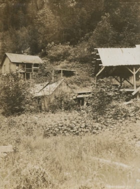
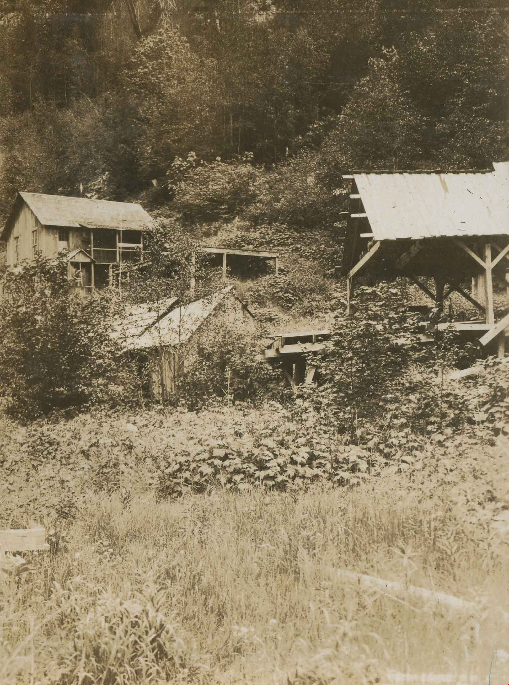
- Photograph is identified by the caption as being "Dumbolten's on Siwash Creek" with a number of wooden buildings and structures built on the side of a hill. This photograph appears to have been taken by Arthur Peers, who travelled through the Fraser River Valley and worked on the construction of th…
- Repository
- City of Burnaby Archives
- Date
- 1925
- Collection/Fonds
- Burnaby Historical Society fonds
- Subseries
- Peers family subseries
- Physical Description
- 1 photograph : b&w ; 7 x 9.5 cm on page 17.5 x 26.3 cm
- Description Level
- Item
- Record No.
- 020-077
- Access Restriction
- No restrictions
- Reproduction Restriction
- No known restrictions
- Accession Number
- BHS2007-04
- Scope and Content
- Photograph is identified by the caption as being "Dumbolten's on Siwash Creek" with a number of wooden buildings and structures built on the side of a hill. This photograph appears to have been taken by Arthur Peers, who travelled through the Fraser River Valley and worked on the construction of the Trans-Provincial Highway during the later 1920s.
- Subjects
- Buildings - Industrial
- Media Type
- Photograph
- Photographer
- Peers, Arthur Francis "Mike"
- Notes
- Title based on caption accompanying photograph
Images
![Horne Payne Receiving Station, [1920] (date of original), copied 1986 thumbnail](/media/hpo/_Data/_Archives_Images/_Unrestricted/126/158-001.jpg?width=280)
Horne Payne Receiving Station
https://search.heritageburnaby.ca/link/archivedescription34916
- Repository
- City of Burnaby Archives
- Date
- [1920] (date of original), copied 1986
- Collection/Fonds
- Burnaby Historical Society fonds
- Description Level
- Item
- Physical Description
- 1 photograph : b&w ; 8.8 x 12.5 cm print
- Scope and Content
- Photograph of the exterior of the Horne Payne substation, Boundary Road.
- Repository
- City of Burnaby Archives
- Date
- [1920] (date of original), copied 1986
- Collection/Fonds
- Burnaby Historical Society fonds
- Subseries
- Photographs subseries
- Physical Description
- 1 photograph : b&w ; 8.8 x 12.5 cm print
- Description Level
- Item
- Record No.
- 158-001
- Access Restriction
- No restrictions
- Reproduction Restriction
- No known restrictions
- Accession Number
- BHS1986-08
- Scope and Content
- Photograph of the exterior of the Horne Payne substation, Boundary Road.
- Subjects
- Buildings - Industrial - Powerhouses
- Media Type
- Photograph
- Notes
- Caption at lower right of photograph: "Horne-Payne Receiving Station"
- Geographic Access
- 2nd Avenue
- Street Address
- 3700 2nd Avenue
- Historic Neighbourhood
- Broadview (Historic Neighbourhood)
- Planning Study Area
- West Central Valley Area
Images
![Horne Payne Receiving Station, [1920] (date of original), copied 1986 thumbnail](/media/hpo/_Data/_Archives_Images/_Unrestricted/126/158-001.jpg)
![Mill and Water Front, [1924] thumbnail](/media/hpo/_Data/_BVM_Images/1974/197500330003an.jpg?width=280)
Mill and Water Front
https://search.heritageburnaby.ca/link/museumdescription3525
- Repository
- Burnaby Village Museum
- Date
- [1924]
- Collection/Fonds
- Burnaby Village Museum Photograph collection
- Description Level
- Item
- Physical Description
- 1 photograph : sepia ; 8 x 13 cm
- Scope and Content
- Photograph of the mill and waterfront at Powell River.
- Repository
- Burnaby Village Museum
- Collection/Fonds
- Burnaby Village Museum Photograph collection
- Description Level
- Item
- Physical Description
- 1 photograph : sepia ; 8 x 13 cm
- Scope and Content
- Photograph of the mill and waterfront at Powell River.
- Accession Code
- HV975.33.3an
- Access Restriction
- No restrictions
- Date
- [1924]
- Media Type
- Photograph
- Scan Resolution
- 600
- Scan Date
- 2/2/2010
- Scale
- 100
- Notes
- Continuation of title: "...Powell River / B.C."
- Image from personal photograph album of Tom "Tommy" Irvine (HV975.33.3)
Images
![Mill and Water Front, [1924] thumbnail](/media/hpo/_Data/_BVM_Images/1974/197500330003an.jpg)

Opening of the Hastings-Barnet Road
https://search.heritageburnaby.ca/link/archivedescription38660
- Repository
- City of Burnaby Archives
- Date
- 1927
- Collection/Fonds
- Burnaby Historical Society fonds
- Description Level
- Item
- Physical Description
- 1 photograph : sepia ; 17.5 x 26.5 cm
- Scope and Content
- Photograph of the official opening of the newly paved Hastings-Barnet Road which opened on Saturday December 10, 1927. In the foreground the Provincial Minister of Public Works Dr. W.H. Sutherland is opening a wooden gate, with a large crowd gathered around. The Barnet Lumber Company Ltd. building …
- Repository
- City of Burnaby Archives
- Date
- 1927
- Collection/Fonds
- Burnaby Historical Society fonds
- Subseries
- North Burnaby Board of Trade subseries
- Physical Description
- 1 photograph : sepia ; 17.5 x 26.5 cm
- Description Level
- Item
- Record No.
- 476-003
- Access Restriction
- No restrictions
- Reproduction Restriction
- No known restrictions
- Accession Number
- BHS2005-8
- Scope and Content
- Photograph of the official opening of the newly paved Hastings-Barnet Road which opened on Saturday December 10, 1927. In the foreground the Provincial Minister of Public Works Dr. W.H. Sutherland is opening a wooden gate, with a large crowd gathered around. The Barnet Lumber Company Ltd. building on Hastings Street is in the background.
- Subjects
- Geographic Features - Roads
- Persons - Crowds
- Buildings - Industrial - Mills
- Officials - Elected Officials
- Public Services - Public Works
- Names
- Barnet Mill
- Sutherland, W.H.
- Media Type
- Photograph
- Notes
- Title based on contents of photograph
- Geographic Access
- Hastings Street
- Street Address
- 3995 Hastings Street
- Historic Neighbourhood
- Vancouver Heights (Historic Neighbourhood)
- Planning Study Area
- Burnaby Heights Area
Images

![Pacific Guano Plant, [1920] (date of original), copied 1991 thumbnail](/media/hpo/_Data/_Archives_Images/_Unrestricted/370/370-293.jpg?width=280)
Pacific Guano Plant
https://search.heritageburnaby.ca/link/archivedescription37705
- Repository
- City of Burnaby Archives
- Date
- [1920] (date of original), copied 1991
- Collection/Fonds
- Burnaby Historical Society fonds
- Description Level
- Item
- Physical Description
- 1 photograph : b&w ; 3.1 x 3.9 cm print on contact sheet 20.2 x 25.3 cm
- Scope and Content
- Photograph of the Pacific Guano plant on Burrard Inlet at the foot of Burnaby Mountain. It was also used as chemical plant, processing guano. (Any excrement from birds, seals, or bats, with value to humans as fertilizer, may be referred to as guano).
- Repository
- City of Burnaby Archives
- Date
- [1920] (date of original), copied 1991
- Collection/Fonds
- Burnaby Historical Society fonds
- Subseries
- Burnaby Image Bank subseries
- Physical Description
- 1 photograph : b&w ; 3.1 x 3.9 cm print on contact sheet 20.2 x 25.3 cm
- Description Level
- Item
- Record No.
- 370-293
- Access Restriction
- No restrictions
- Reproduction Restriction
- No known restrictions
- Accession Number
- BHS1999-03
- Scope and Content
- Photograph of the Pacific Guano plant on Burrard Inlet at the foot of Burnaby Mountain. It was also used as chemical plant, processing guano. (Any excrement from birds, seals, or bats, with value to humans as fertilizer, may be referred to as guano).
- Subjects
- Buildings - Industrial
- Names
- Pacific Guano
- Media Type
- Photograph
- Notes
- Title based on contents of photograph
- 1 b&w copy negative accompanying
- Geographic Access
- Barnet Road
- Historic Neighbourhood
- Barnet (Historic Neighbourhood)
- Planning Study Area
- Burnaby Mountain Area
Images
![Pacific Guano Plant, [1920] (date of original), copied 1991 thumbnail](/media/hpo/_Data/_Archives_Images/_Unrestricted/370/370-293.jpg)
![Penstocks, [1924] thumbnail](/media/hpo/_Data/_BVM_Images/1974/197500330003r.jpg?width=280)
Penstocks
https://search.heritageburnaby.ca/link/museumdescription3502
- Repository
- Burnaby Village Museum
- Date
- [1924]
- Collection/Fonds
- Burnaby Village Museum Photograph collection
- Description Level
- Item
- Physical Description
- 1 photograph : sepia ; 13 x 8 cm
- Scope and Content
- Photograph of the penstocks at the pulp and paper mill (most likely penstock no.4 in Powell River). Tom Irvine was involved in the building of the trusses for this structure.
- Repository
- Burnaby Village Museum
- Collection/Fonds
- Burnaby Village Museum Photograph collection
- Description Level
- Item
- Physical Description
- 1 photograph : sepia ; 13 x 8 cm
- Scope and Content
- Photograph of the penstocks at the pulp and paper mill (most likely penstock no.4 in Powell River). Tom Irvine was involved in the building of the trusses for this structure.
- Subjects
- Buildings - Industrial - Mills
- Accession Code
- HV975.33.3r
- Access Restriction
- No restrictions
- Date
- [1924]
- Media Type
- Photograph
- Scan Resolution
- 600
- Scan Date
- 2/2/2010
- Scale
- 100
- Notes
- Title based on contents of photograph
- Image from personal photograph album of Tom "Tommy" Irvine (HV975.33.3)
Images
![Penstocks, [1924] thumbnail](/media/hpo/_Data/_BVM_Images/1974/197500330003r.jpg)
![Phillips Dairy Farm, [192-] (date of original), copied 1986 thumbnail](/media/hpo/_Data/_Archives_Images/_Unrestricted/204/204-519.jpg?width=280)
Phillips Dairy Farm
https://search.heritageburnaby.ca/link/archivedescription35661
- Repository
- City of Burnaby Archives
- Date
- [192-] (date of original), copied 1986
- Collection/Fonds
- Burnaby Historical Society fonds
- Description Level
- Item
- Physical Description
- 1 photograph : b&w ; 12.7 x 17.8 cm print
- Scope and Content
- Photograph of Phillips dairy farm at 515 Byrne Road (later renumbered 5670 Byrne Road). The dairy and barn are shown with Norman Phillips (son of John and Lily Phillips).
- Repository
- City of Burnaby Archives
- Date
- [192-] (date of original), copied 1986
- Collection/Fonds
- Burnaby Historical Society fonds
- Subseries
- Pioneer Tales subseries
- Physical Description
- 1 photograph : b&w ; 12.7 x 17.8 cm print
- Description Level
- Item
- Record No.
- 204-519
- Access Restriction
- No restrictions
- Reproduction Restriction
- No known restrictions
- Accession Number
- BHS1988-03
- Scope and Content
- Photograph of Phillips dairy farm at 515 Byrne Road (later renumbered 5670 Byrne Road). The dairy and barn are shown with Norman Phillips (son of John and Lily Phillips).
- Media Type
- Photograph
- Notes
- Title based on contents of photograph
- Geographic Access
- Byrne Road
- Street Address
- 5670 Byrne Road
- Historic Neighbourhood
- Fraser Arm (Historic Neighbourhood)
- Planning Study Area
- Big Bend Area
Images
![Phillips Dairy Farm, [192-] (date of original), copied 1986 thumbnail](/media/hpo/_Data/_Archives_Images/_Unrestricted/204/204-519.jpg)
Stave River Powerhouse
https://search.heritageburnaby.ca/link/archivedescription34441
- Repository
- City of Burnaby Archives
- Date
- 1929
- Collection/Fonds
- Burnaby Historical Society fonds
- Description Level
- Item
- Physical Description
- 1 photograph : b&w ; 6.5 x 10.4 cm on page 17.5 x 26.3 cm
- Scope and Content
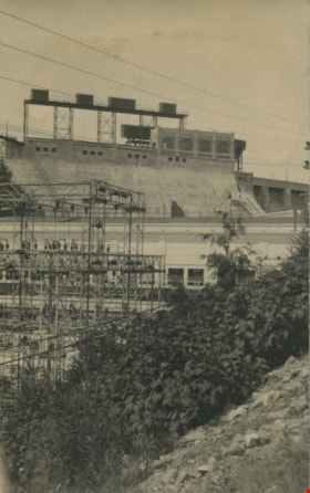
- Photograph of the Stave River Powerhouse in Mission, BC.
- Repository
- City of Burnaby Archives
- Date
- 1929
- Collection/Fonds
- Burnaby Historical Society fonds
- Subseries
- Peers family subseries
- Physical Description
- 1 photograph : b&w ; 6.5 x 10.4 cm on page 17.5 x 26.3 cm
- Description Level
- Item
- Record No.
- 020-148
- Access Restriction
- No restrictions
- Reproduction Restriction
- No known restrictions
- Accession Number
- BHS2007-04
- Scope and Content
- Photograph of the Stave River Powerhouse in Mission, BC.
- Subjects
- Buildings - Industrial - Powerhouses
- Media Type
- Photograph
- Notes
- Title based on caption accompanying photograph
Images

Stave River Powerhouse
https://search.heritageburnaby.ca/link/archivedescription34442
- Repository
- City of Burnaby Archives
- Date
- 1929
- Collection/Fonds
- Burnaby Historical Society fonds
- Description Level
- Item
- Physical Description
- 1 photograph : b&w ; 7 x 12 cm on page 17.5 x 26.3 cm
- Scope and Content
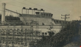
- Photograph of the Stave River Powerhouse in Mission, BC.
- Repository
- City of Burnaby Archives
- Date
- 1929
- Collection/Fonds
- Burnaby Historical Society fonds
- Subseries
- Peers family subseries
- Physical Description
- 1 photograph : b&w ; 7 x 12 cm on page 17.5 x 26.3 cm
- Description Level
- Item
- Record No.
- 020-149
- Access Restriction
- No restrictions
- Reproduction Restriction
- No known restrictions
- Accession Number
- BHS2007-04
- Scope and Content
- Photograph of the Stave River Powerhouse in Mission, BC.
- Subjects
- Buildings - Industrial - Powerhouses
- Media Type
- Photograph
- Notes
- Title based on caption accompanying photograph
Images

![Wagner blacksmith shop, [before June 11, 1926] thumbnail](/media/hpo/_Data/_BVM_Images/1990/199200450055.jpg?width=280)
Wagner blacksmith shop
https://search.heritageburnaby.ca/link/museumdescription1164
- Repository
- Burnaby Village Museum
- Date
- [before June 11, 1926]
- Collection/Fonds
- Burnaby Village Museum Photograph collection
- Description Level
- Item
- Physical Description
- 1 photograph : b&w ; 6 x 10.5 cm
- Scope and Content
- Photograph of the Wagner blacksmith shop on Kingsway (across from the gate to Central Park). Three men are standing in the doorway below a sign reading "The Wagner Bumper Made Here, Auto springs repaired." The man on the left is holding a bumper in his hands. A car is parked on the right and on the…
- Repository
- Burnaby Village Museum
- Collection/Fonds
- Burnaby Village Museum Photograph collection
- Description Level
- Item
- Physical Description
- 1 photograph : b&w ; 6 x 10.5 cm
- Scope and Content
- Photograph of the Wagner blacksmith shop on Kingsway (across from the gate to Central Park). Three men are standing in the doorway below a sign reading "The Wagner Bumper Made Here, Auto springs repaired." The man on the left is holding a bumper in his hands. A car is parked on the right and on the left a sign that reads, "TRIPLE SPRING BUMPER, FOR SALE, MADE TO FIT ANY CAR."
- Geographic Access
- Kingsway
- Accession Code
- BV992.45.55
- Access Restriction
- No restrictions
- Date
- [before June 11, 1926]
- Media Type
- Photograph
- Historic Neighbourhood
- Central Park (Historic Neighbourhood)
- Planning Study Area
- Maywood Area
- Scan Resolution
- 600
- Scan Date
- 01-Jun-09
- Scale
- 100
- Notes
- Title based on contents of photograph
- 1 b&w enlarged copy print accompanying
- Postal impression on recto of photograph reads: "Jun. 11/26 Burnaby"
- Note in blue ink on verso of photograph reads: "The new Shop / And our little Hall"
Images
![Wagner blacksmith shop, [before June 11, 1926] thumbnail](/media/hpo/_Data/_BVM_Images/1990/199200450055.jpg)
![Alice and William Goodridge in front of store, [between 1925 and 1935] thumbnail](/media/hpo/_Data/_BVM_Images/2023/2023_0015_0001_001.jpg?width=280)
Alice and William Goodridge in front of store
https://search.heritageburnaby.ca/link/museumdescription20274
- Repository
- Burnaby Village Museum
- Date
- [between 1925 and 1935]
- Collection/Fonds
- Burnaby Village Museum Photograph collection
- Description Level
- Item
- Physical Description
- 1 photograph : b&w negative ; 12.5 x 10 cm
- Scope and Content
- Photograph of Alice Victoria (Goodridge) Norman and her brother William "Bill" Goodridge seated on the stoop outside the Goodridge grocery store located at 4835 Hastings Street in Burnaby. Signage on the windows and on the front of the store identify some of the trademarks of products sold in the s…
- Repository
- Burnaby Village Museum
- Collection/Fonds
- Burnaby Village Museum Photograph collection
- Description Level
- Item
- Physical Description
- 1 photograph : b&w negative ; 12.5 x 10 cm
- Scope and Content
- Photograph of Alice Victoria (Goodridge) Norman and her brother William "Bill" Goodridge seated on the stoop outside the Goodridge grocery store located at 4835 Hastings Street in Burnaby. Signage on the windows and on the front of the store identify some of the trademarks of products sold in the store including "Royal Crown Soap", "Cowan's" and "Winchester cigarettes". Two post office boxes are visible to the right of the couple.
- Subjects
- Buildings - Commercial
- Buildings - Commercial - Grocery Stores
- Buildings - Public - Post Offices
- Accession Code
- BV023.15.1
- Access Restriction
- No restrictions
- Reproduction Restriction
- No known restrictions
- Date
- [between 1925 and 1935]
- Media Type
- Photograph
- Scan Resolution
- 3200
- Scan Date
- 2023-09-21
- Notes
- Title based on contents of photograph
- 1 b&w contact sheet accompanying
Images
![Alice and William Goodridge in front of store, [between 1925 and 1935] thumbnail](/media/hpo/_Data/_BVM_Images/2023/2023_0015_0001_001.jpg)

Brookes family home, "Normanna"
https://search.heritageburnaby.ca/link/archivedescription35246
- Repository
- City of Burnaby Archives
- Date
- 1927
- Collection/Fonds
- Burnaby Historical Society fonds
- Description Level
- Item
- Physical Description
- 1 photograph : b&w ; 12.7 x 17.8 cm print
- Scope and Content
- Photograph of "Normanna," the Brookes family residence. This new Brookes family home was built in 1927 on the same site as the original house at 441 12th Avenue (later renumbered 7979 12th Avenue). Eventually, this became Normanna Norwegian rest home. The original house was built by Burnaby's firs…
- Repository
- City of Burnaby Archives
- Date
- 1927
- Collection/Fonds
- Burnaby Historical Society fonds
- Subseries
- Pioneer Tales subseries
- Physical Description
- 1 photograph : b&w ; 12.7 x 17.8 cm print
- Description Level
- Item
- Record No.
- 204-103
- Access Restriction
- No restrictions
- Reproduction Restriction
- No known restrictions
- Accession Number
- BHS1988-03
- Scope and Content
- Photograph of "Normanna," the Brookes family residence. This new Brookes family home was built in 1927 on the same site as the original house at 441 12th Avenue (later renumbered 7979 12th Avenue). Eventually, this became Normanna Norwegian rest home. The original house was built by Burnaby's first Reeve, Charles Shaw, and is now a designated heritage site at 7725 4th Street.
- Subjects
- Geographic Features - Gardens
- Buildings - Residential - Houses
- Buildings - Residential - Seniors Housing
- Buildings - Heritage
- Names
- Normanna Rest Home
- Media Type
- Photograph
- Notes
- Title based on contents of photograph
- Geographic Access
- 4th Street
- Street Address
- 7725 4th Street
- Historic Neighbourhood
- East Burnaby (Historic Neighbourhood)
- Planning Study Area
- Second Street Area
Images


Deer Lake
https://search.heritageburnaby.ca/link/archivedescription34297
- Repository
- City of Burnaby Archives
- Date
- 1923
- Collection/Fonds
- Burnaby Historical Society fonds
- Description Level
- Item
- Physical Description
- 1 photograph : sepia
- Scope and Content
- Photograph looking over Deer Lake and snow-covered ground towards buildings and houses. To the left is the cottage and house belonging to the Woodward sisters, Harriet and Maude. The cottage, and later the house, were also used as the Burnaby Lake Post Office and a school run by Harriet Woodward. …
- Repository
- City of Burnaby Archives
- Date
- 1923
- Collection/Fonds
- Burnaby Historical Society fonds
- Subseries
- Peers family subseries
- Physical Description
- 1 photograph : sepia
- Description Level
- Item
- Record No.
- 020-004
- Access Restriction
- No restrictions
- Reproduction Restriction
- No known restrictions
- Accession Number
- BHS2007-04
- Scope and Content
- Photograph looking over Deer Lake and snow-covered ground towards buildings and houses. To the left is the cottage and house belonging to the Woodward sisters, Harriet and Maude. The cottage, and later the house, were also used as the Burnaby Lake Post Office and a school run by Harriet Woodward. At the time of this photograph, it was in use as the Burnaby Lake United Church. In the middle of the picture, numerous boathouses and a diving tower can be seen at the shoreline of the lake. To the right of the copse of trees, on the hill, is the house and post office belonging to the Woodward sisters and right of that is the home built for William J. Walker in 1907 but owned by D.R. Boucher during the 1920s. To the far right the Pole Line Road (later, Sperling Avenue) is visible along with the home of Francis J. Peers, known as Greyfriars.
- Subjects
- Buildings - Heritage
- Buildings - Residential - Houses
- Geographic Features - Lakes and Ponds
- Buildings - Religious - Churches
- Media Type
- Photograph
- Notes
- Title based on caption accompanying photograph
- Geographic Access
- Sperling Avenue
- Deer Lake
- Rugby Street
- Historic Neighbourhood
- Burnaby Lake (Historic Neighbourhood)
- Planning Study Area
- Morley-Buckingham Area
Images

![John Charles Goodridge holding grandchild, [between 1925 and 1935] thumbnail](/media/hpo/_Data/_BVM_Images/2023/2023_0015_0004_001.jpg?width=280)
John Charles Goodridge holding grandchild
https://search.heritageburnaby.ca/link/museumdescription20278
- Repository
- Burnaby Village Museum
- Date
- [between 1925 and 1935]
- Collection/Fonds
- Burnaby Village Museum Photograph collection
- Description Level
- Item
- Physical Description
- 1 photograph : b&w negative ; 12.5 x 10 cm
- Scope and Content
- Photograph of John Charles Bertram Goodridge holding his grandchild outside the Goodridge grocery store on Hastings Street in Burnaby. Canada Post mail boxes are visible behind them. One of the mail boxes is mounted on the door of the building and the other is free standing.
- Repository
- Burnaby Village Museum
- Collection/Fonds
- Burnaby Village Museum Photograph collection
- Description Level
- Item
- Physical Description
- 1 photograph : b&w negative ; 12.5 x 10 cm
- Scope and Content
- Photograph of John Charles Bertram Goodridge holding his grandchild outside the Goodridge grocery store on Hastings Street in Burnaby. Canada Post mail boxes are visible behind them. One of the mail boxes is mounted on the door of the building and the other is free standing.
- Subjects
- Buildings - Commercial
- Buildings - Commercial - Grocery Stores
- Buildings - Public - Post Offices
- Persons - Children
- Accession Code
- BV023.15.4
- Access Restriction
- No restrictions
- Reproduction Restriction
- No known restrictions
- Date
- [between 1925 and 1935]
- Media Type
- Photograph
- Scan Resolution
- 3200
- Scan Date
- 2023-09-21
- Notes
- Title based on contents of photograph
- 1 b&w contact sheet accompanying
Images
![John Charles Goodridge holding grandchild, [between 1925 and 1935] thumbnail](/media/hpo/_Data/_BVM_Images/2023/2023_0015_0004_001.jpg)