More like 'Burnaby Park'
Narrow Results By
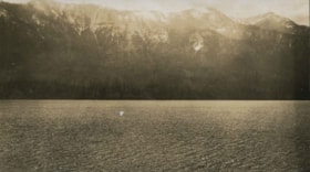
![Kensington Pitch & Putt, [2000] thumbnail](/media/hpo/_Data/_Archives_Images/_Unrestricted/535/535-3103.jpg?width=280)
Kensington Pitch & Putt
https://search.heritageburnaby.ca/link/archivedescription97999
- Repository
- City of Burnaby Archives
- Date
- [2000]
- Collection/Fonds
- Burnaby NewsLeader photograph collection
- Description Level
- Item
- Physical Description
- 1 photograph (tiff) : col.
- Scope and Content
- Photograph of Joaquin Ortega putting on a green at the Kensington Pitch & Putt course. The snow-covered mountains are visible in the background.
- Repository
- City of Burnaby Archives
- Date
- [2000]
- Collection/Fonds
- Burnaby NewsLeader photograph collection
- Physical Description
- 1 photograph (tiff) : col.
- Description Level
- Item
- Record No.
- 535-3103
- Access Restriction
- No restrictions
- Reproduction Restriction
- No restrictions
- Accession Number
- 2018-12
- Scope and Content
- Photograph of Joaquin Ortega putting on a green at the Kensington Pitch & Putt course. The snow-covered mountains are visible in the background.
- Media Type
- Photograph
- Photographer
- Bartel, Mario
- Notes
- Title based on caption
- Collected by editorial for use in a February 2000 issue of the Burnaby NewsLeader
- Caption from metadata: "A sure sign of Spring is the official opening of the Kensington Pitch & Putt golf course. Joaquin Ortega putts out on a beautiful sunny morning."
- Geographic Access
- Curtis Street
- Street Address
- 5889 Curtis Street
- Planning Study Area
- Parkcrest-Aubrey Area
Images
![Kensington Pitch & Putt, [2000] thumbnail](/media/hpo/_Data/_Archives_Images/_Unrestricted/535/535-3103.jpg)
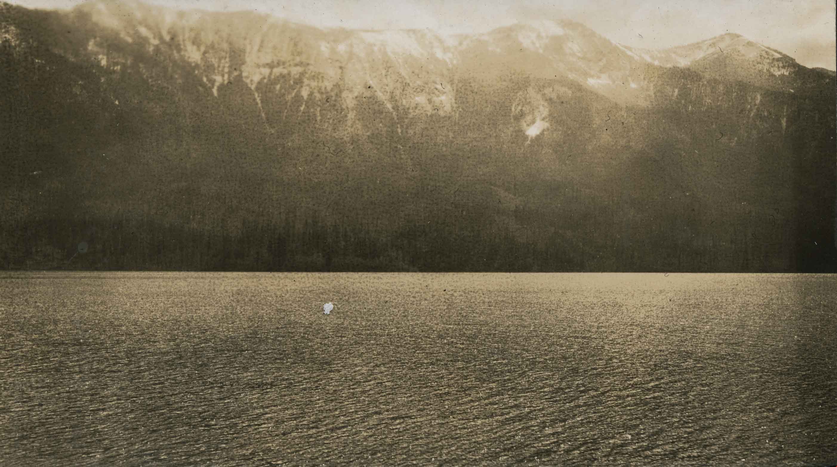
![The Lions from Burnaby Park, [between 1926 and 1929] thumbnail](/media/hpo/_Data/_BVM_Images/1971/197202040003.jpg?width=280)
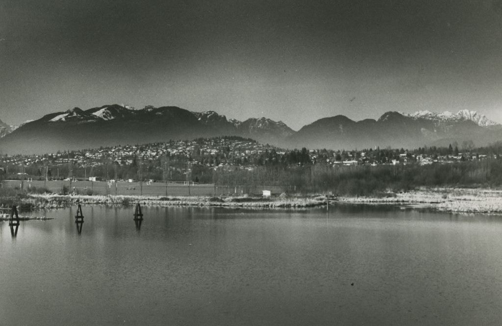
The Lions from Burnaby Park
https://search.heritageburnaby.ca/link/museumdescription3109
- Repository
- Burnaby Village Museum
- Date
- [between 1926 and 1929]
- Collection/Fonds
- Burnaby Village Museum Photograph collection
- Description Level
- Item
- Physical Description
- 1 photograph : b&w photogravure ; 14.5 x 9.5 cm
- Scope and Content
- Photograph of the north shore mountains, including the Lions, taken from Robert Burnaby Park.
- Repository
- Burnaby Village Museum
- Collection/Fonds
- Burnaby Village Museum Photograph collection
- Description Level
- Item
- Physical Description
- 1 photograph : b&w photogravure ; 14.5 x 9.5 cm
- Scope and Content
- Photograph of the north shore mountains, including the Lions, taken from Robert Burnaby Park.
- Geographic Access
- Wedgewood Street
- Robert Burnaby Park
- Street Address
- 8155 Wedgewood Street
- Accession Code
- HV972.204.3
- Access Restriction
- No restrictions
- Reproduction Restriction
- No known restrictions
- Date
- [between 1926 and 1929]
- Media Type
- Photograph
- Historic Neighbourhood
- Burnaby Lake (Historic Neighbourhood)
- Planning Study Area
- Lakeview-Mayfield Area
- Related Material
- For other photographs from the same album, see HV972.204.3 - .14
- Scan Resolution
- 600
- Scan Date
- 2023-04-25
- Photographer
- Lloyd, Frank Ernest
- Notes
- Annotations made in white paint on recto of photograph read: "'The Lions' from Burnaby Park" and "Lloyd Studio, McKay."
Images
![The Lions from Burnaby Park, [between 1926 and 1929] thumbnail](/media/hpo/_Data/_BVM_Images/1971/197202040003.jpg)
![Trans Canada Trail, [2000] thumbnail](/media/hpo/_Data/_Archives_Images/_Unrestricted/535/535-2372.jpg?width=280)
Trans Canada Trail
https://search.heritageburnaby.ca/link/archivedescription96814
- Repository
- City of Burnaby Archives
- Date
- [2000]
- Collection/Fonds
- Burnaby NewsLeader photograph collection
- Description Level
- Item
- Physical Description
- 1 photograph (tiff) : b&w
- Scope and Content
- Photograph of an unidentified person and their dog on the Trans Canada Trail in North Burnaby, overlooking the Burrard Inlet. Industrial ports and plants on the North Shore and the North Shore mountains are visible on the other side of the Inlet.
- Repository
- City of Burnaby Archives
- Date
- [2000]
- Collection/Fonds
- Burnaby NewsLeader photograph collection
- Physical Description
- 1 photograph (tiff) : b&w
- Description Level
- Item
- Record No.
- 535-2372
- Access Restriction
- No restrictions
- Reproduction Restriction
- No restrictions
- Accession Number
- 2018-12
- Scope and Content
- Photograph of an unidentified person and their dog on the Trans Canada Trail in North Burnaby, overlooking the Burrard Inlet. Industrial ports and plants on the North Shore and the North Shore mountains are visible on the other side of the Inlet.
- Media Type
- Photograph
- Photographer
- Bartel, Mario
- Notes
- Title based on caption
- Collected by editorial for use in an April 2000 issue of the Burnaby NewsLeader
- Caption from metadata: "The Trans Canada Trail is popular with dog walkers, offering spectacular vistas of Burrard Inlet and the North Shore Mountains."
- Geographic Access
- Burrard Inlet
- Historic Neighbourhood
- Capitol Hill (Historic Neighbourhood)
- Planning Study Area
- Capitol Hill Area
Images
![Trans Canada Trail, [2000] thumbnail](/media/hpo/_Data/_Archives_Images/_Unrestricted/535/535-2372.jpg)
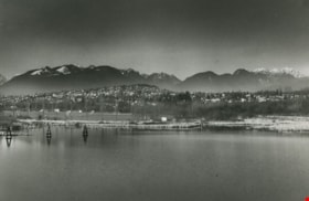
View of a Lake, City, and Mountains
https://search.heritageburnaby.ca/link/archivedescription59024
- Repository
- City of Burnaby Archives
- Date
- ca.1983
- Collection/Fonds
- Columbian Newspaper collection
- Description Level
- Item
- Physical Description
- 1 photograph : b&w
- Scope and Content
- Photograph of a lake and residential neighbourhood, with the North Shore mountains in the background.
- Repository
- City of Burnaby Archives
- Date
- ca.1983
- Collection/Fonds
- Columbian Newspaper collection
- Physical Description
- 1 photograph : b&w
- Description Level
- Item
- Record No.
- 480-1430
- Access Restriction
- No restrictions
- Reproduction Restriction
- Reproduce for fair dealing purposes only
- Accession Number
- 2009-01
- Scope and Content
- Photograph of a lake and residential neighbourhood, with the North Shore mountains in the background.
- Subjects
- Geographic Features - Beaches
- Geographic Features - Lakes and Ponds
- Geographic Features - Mountains
- Media Type
- Photograph
- Photographer
- King, Basil
- Notes
- Title based on contents of photograph
Images
![Burnaby rivers, [2002] thumbnail](/media/hpo/_Data/_Archives_Images/_Unrestricted/535/535-2800-1.jpg?width=280)
Burnaby rivers
https://search.heritageburnaby.ca/link/archivedescription97440
- Repository
- City of Burnaby Archives
- Date
- [2002]
- Collection/Fonds
- Burnaby NewsLeader photograph collection
- Description Level
- File
- Physical Description
- 4 photographs (tiff) : col.
- Scope and Content
- File contains photographs of people with Burnaby rivers and creeks. Photographs depict BCIT river conservationist Mark Angelo posing in Deer Lake Brook by Burnaby Village Museum, and Lorna Johnson, Gordie Cook, and Jack McAfee enjoying Fraser Foreshore Park by the Fraser River.
- Repository
- City of Burnaby Archives
- Date
- [2002]
- Collection/Fonds
- Burnaby NewsLeader photograph collection
- Physical Description
- 4 photographs (tiff) : col.
- Description Level
- File
- Record No.
- 535-2800
- Access Restriction
- No restrictions
- Reproduction Restriction
- No restrictions
- Accession Number
- 2018-12
- Scope and Content
- File contains photographs of people with Burnaby rivers and creeks. Photographs depict BCIT river conservationist Mark Angelo posing in Deer Lake Brook by Burnaby Village Museum, and Lorna Johnson, Gordie Cook, and Jack McAfee enjoying Fraser Foreshore Park by the Fraser River.
- Media Type
- Photograph
- Photographer
- Bartel, Mario
- Notes
- Title based on caption
- Collected by editorial for use in a September 2002 issue of the Burnaby NewsLeader
- Caption from metadata for 535-2800-1 and 535-2800-2: "Mark Angelo, of BCIT, who's made it his mission to save and preserve Burnaby's rivers and creeks, says he's particularly proud of Deer Lake Brook, as it babbles through Burnaby Village Museum, on its way to Burnaby Lake."
- Caption from metadata for 535-2800-3: "Lorna Johnson hits a tennis ball out into the Fraser River at Fraser Foreshore Park, to her dog, Keiko."
- Caption from metadata for 535-2800-4: "Gordie Cook and Jack McAfee shoot the breeze and enjoy the sunshine along the Fraser River, at Fraser Foreshore Park in Burnaby."
- Geographic Access
- Deer Lake Brook
- Burnaby Fraser Foreshore Park
- Fraser River
- Historic Neighbourhood
- Fraser Arm (Historic Neighbourhood)
- Burnaby Lake (Historic Neighbourhood)
- Planning Study Area
- Morley-Buckingham Area
- Big Bend Area
Images
![Burnaby rivers, [2002] thumbnail](/media/hpo/_Data/_Archives_Images/_Unrestricted/535/535-2800-1.jpg)

Canada geese in the park
https://search.heritageburnaby.ca/link/archivedescription59046
- Repository
- City of Burnaby Archives
- Date
- ca.1983
- Collection/Fonds
- Columbian Newspaper collection
- Description Level
- Item
- Physical Description
- 1 photograph : b&w ; 17.5 x 20 cm
- Scope and Content
- Photograph of a flock of Canada geese on a grassy field in a park.
- Repository
- City of Burnaby Archives
- Date
- ca.1983
- Collection/Fonds
- Columbian Newspaper collection
- Physical Description
- 1 photograph : b&w ; 17.5 x 20 cm
- Description Level
- Item
- Record No.
- 480-1452
- Access Restriction
- No restrictions
- Reproduction Restriction
- Reproduce for fair dealing purposes only
- Accession Number
- 2009-01
- Scope and Content
- Photograph of a flock of Canada geese on a grassy field in a park.
- Subjects
- Geographic Features - Fields
- Geographic Features - Lakes and Ponds
- Geographic Features - Parks
- Animals - Birds
- Media Type
- Photograph
- Photographer
- Battistoni, Peter
- Notes
- Title based on contents of photograph
- Photographer's stamp on verso
- Note on verso reads: "page 4 / Burnaby / Today / PMT 100%"
Images

Interview with John Templeton, Alan James and Christine Leston by Kathy Bossort October 26, 2015 - Track 9
https://search.heritageburnaby.ca/link/oralhistory595
- Repository
- City of Burnaby Archives
- Date Range
- 1995-2015
- Length
- 0:12:28
- Summary
- This portion of the interview is about the Stoney Creek Environment Committee members’ discussion of how the history of the forest and natural area on Burnaby Mountain forms part of our appreciation for the mountain. They talk about the impact of the conservation area on adjacent urban areas such a…
- Repository
- City of Burnaby Archives
- Summary
- This portion of the interview is about the Stoney Creek Environment Committee members’ discussion of how the history of the forest and natural area on Burnaby Mountain forms part of our appreciation for the mountain. They talk about the impact of the conservation area on adjacent urban areas such as the neighbourhood of Forest Grove, and the future of the urban forest on Burnaby Mountain.
- Date Range
- 1995-2015
- Length
- 0:12:28
- Geographic Access
- Burnaby Mountain Conservation Area
- Stoney Creek
- Interviewer
- Bossort, Kathy
- Interview Date
- October 26, 2015
- Scope and Content
- Recording is of an interview with John Templeton, Alan James & Christine Leston, members of the Stoney Creek Environment Committee, conducted by Kathy Bossort. The three members of SCEC were among 23 participants interviewed as part of the Community Heritage Commission’s Burnaby Mountain Oral History Project. The interview is mainly about the history and work of the stream keeper group Stoney Creek Environment Committee (SCEC) and the Stoney Creek Environmental Working Group, and about SCEC’s founder Jennifer Atkinson. The interview is made richer by the complementary views of the three interviewees, John Templeton (SCEC Chair), Alan James (Member-at-Large - Education), and Christine Leston (Treasurer).
- Biographical Notes
- The Stoney Creek Environment Committee is a streamkeeper group and registered non-profit society dedicated to protecting and restoring viable salmon-bearing streams within the Stoney Creek Watershed. (Stoney Creek originates on Burnaby Mountain and is part of the Brunette watershed which empties into the Fraser River.) The volunteer group, formed in 1995, was guided by the tireless efforts of Jennifer Atchison (1938-2010) after whom the Jennifer Atchison Environmental Centre in North Burnaby is named. The volunteer members of SCEC monitor water quality, generate inventories and reports on the biophysical assets and health of the watershed, provide educational opportunities, enhance stream and stream bank habitat, and speak on behalf of the Stoney Creek watershed. One of its key events is The Great Salmon Send-Off, the release of young salmon into Stoney Creek in May, which celebrated its 25th anniversary in 2015. The Stoney Creek Environmental Working Group (1999-present), managed by the City of Burnaby, undertakes to coordinate the actions of all stakeholders in the Stoney Creek watershed. It is comprised of representatives from community groups, such as SCEC, governmental and institutional agencies, and industries who are committed to sustaining and improving the quality of the Stoney Creek watershed’s water, wildlife and environment. John Templeton, currently SCEC Chair, joined SCEC in 2004. He was born in Coleraine ,County Londonderry, Northern Ireland, in 1957, and after immigrating to Canada, came to live in Burnaby in 1992, first in Forest Grove (1992-2014) and then in Forest Hills. He works as a millwright. Alan James,Member-at-large - Education, joined SCEC in 2003 He was born in 1939 in Berkeley, California, and came to live in Burnaby in about 2000. He is a retired geophycisist and computer consultant. Christine Leston joined SCEC in 1997, serving first as Secretary and then as Treasurer. She was born in 1943 in Cheshire, England, and came to live in Burnaby in 1974, first in Greentree Village, then Simon Fraser Village (1974-2004) and now the Edmonds area. She is a retired technical writer.
- Total Tracks
- 9
- Total Length
- 2:08:27
- Interviewee Name
- Templeton, John R.
- James, Alan C.
- Leston, Christine
- Interview Location
- Jennifer Atchison Environmental Centre, Burnaby
- Interviewer Bio
- Kathy Bossort is a retired archivist living in Ladner, BC. She worked at the Delta Museum and Archives after graduating from SLAIS (UBC) in 2001 with Masters degrees in library science and archival studies. Kathy grew up in Calgary, Alberta, and, prior to this career change, she lived in the West Kootenays, earning her living as a cook for BC tourist lodges and work camps. She continues to be interested in oral histories as a way to fill the gaps in the written record and bring richer meaning to history.
- Collection/Fonds
- Community Heritage Commission Special Projects fonds
- Media Type
- Sound Recording
Audio Tracks
Track nine of interview with John Templeton, Alan James & Christine Leston
Track nine of interview with John Templeton, Alan James & Christine Leston
https://search.heritageburnaby.ca/media/hpo/_Data/_Archives_Oral_Histories/_Unrestricted/MSS196-006/MSS196-006_Track_9.mp3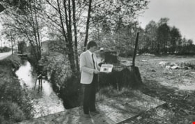
Man in the park
https://search.heritageburnaby.ca/link/archivedescription58992
- Repository
- City of Burnaby Archives
- Date
- 1983
- Collection/Fonds
- Columbian Newspaper collection
- Description Level
- Item
- Physical Description
- 1 photograph : b&w ; 18 x 25.5 cm
- Scope and Content
- Photograph of a man in a suit next to an empty lot or park. He is standing on a plank bridge over a ditch by the road that is filled with water and reviewing a book or report.
- Repository
- City of Burnaby Archives
- Date
- 1983
- Collection/Fonds
- Columbian Newspaper collection
- Physical Description
- 1 photograph : b&w ; 18 x 25.5 cm
- Description Level
- Item
- Record No.
- 480-1402
- Access Restriction
- No restrictions
- Reproduction Restriction
- Reproduce for fair dealing purposes only
- Accession Number
- 2009-01
- Scope and Content
- Photograph of a man in a suit next to an empty lot or park. He is standing on a plank bridge over a ditch by the road that is filled with water and reviewing a book or report.
- Media Type
- Photograph
- Photographer
- Battistoni, Peter
- Notes
- Title based on contents of photograph
- Photographer's stamp on verso
- Note on verso reads: "PMT 100% / page A-3 / Burnaby Today"
Images

At the river's edge
https://search.heritageburnaby.ca/link/archivedescription34445
- Repository
- City of Burnaby Archives
- Date
- 1927
- Collection/Fonds
- Burnaby Historical Society fonds
- Description Level
- Item
- Physical Description
- 1 photograph : b&w ; 6.8 x 12 cm on page 17.4 x 26 cm
- Scope and Content
- Photograph of a house sitting near the river bank in the vicinity of Nicomen Island, Deroche and Dewndey. Mountains are visible in the background
- Repository
- City of Burnaby Archives
- Date
- 1927
- Collection/Fonds
- Burnaby Historical Society fonds
- Subseries
- Peers family subseries
- Physical Description
- 1 photograph : b&w ; 6.8 x 12 cm on page 17.4 x 26 cm
- Description Level
- Item
- Record No.
- 020-152
- Access Restriction
- No restrictions
- Reproduction Restriction
- No known restrictions
- Accession Number
- BHS2007-04
- Scope and Content
- Photograph of a house sitting near the river bank in the vicinity of Nicomen Island, Deroche and Dewndey. Mountains are visible in the background
- Media Type
- Photograph
- Notes
- Title based on contents of photograph
Images


Burnaby Lake
https://search.heritageburnaby.ca/link/archivedescription34563
- Repository
- City of Burnaby Archives
- Date
- 1923
- Collection/Fonds
- Burnaby Historical Society fonds
- Description Level
- Item
- Physical Description
- 1 photograph : b&w ; 17.4 x 35.3 cm
- Scope and Content
- Photograph of Burnaby Lake, looking northwest. The north shore mountains, including The Lions, can be seen in the background.
- Repository
- City of Burnaby Archives
- Date
- 1923
- Collection/Fonds
- Burnaby Historical Society fonds
- Subseries
- Photographs subseries
- Physical Description
- 1 photograph : b&w ; 17.4 x 35.3 cm
- Description Level
- Item
- Record No.
- 050-001
- Access Restriction
- No restrictions
- Reproduction Restriction
- No known restrictions
- Accession Number
- BHS2007-04
- Scope and Content
- Photograph of Burnaby Lake, looking northwest. The north shore mountains, including The Lions, can be seen in the background.
- Media Type
- Photograph
- Notes
- Title based on contents of photograph
- Geographic Access
- Burnaby Lake
- Historic Neighbourhood
- Burnaby Lake (Historic Neighbourhood)
- Planning Study Area
- Burnaby Lake Area
Images

![Burrard Inlet, [1926] (date of original), copied 1986 thumbnail](/media/hpo/_Data/_Archives_Images/_Unrestricted/204/204-455.jpg?width=280)
Burrard Inlet
https://search.heritageburnaby.ca/link/archivedescription35597
- Repository
- City of Burnaby Archives
- Date
- [1926] (date of original), copied 1986
- Collection/Fonds
- Burnaby Historical Society fonds
- Description Level
- Item
- Physical Description
- 1 photograph : b&w ; 12.7 x 17.8 cm print
- Scope and Content
- Photograph looking across Burrard Inlet from the Donovan family home, 4112 Yale Street, before the Second Narrows Bridge was built at this spot.
- Repository
- City of Burnaby Archives
- Date
- [1926] (date of original), copied 1986
- Collection/Fonds
- Burnaby Historical Society fonds
- Subseries
- Pioneer Tales subseries
- Physical Description
- 1 photograph : b&w ; 12.7 x 17.8 cm print
- Description Level
- Item
- Record No.
- 204-455
- Access Restriction
- No restrictions
- Reproduction Restriction
- No known restrictions
- Accession Number
- BHS1988-03
- Scope and Content
- Photograph looking across Burrard Inlet from the Donovan family home, 4112 Yale Street, before the Second Narrows Bridge was built at this spot.
- Media Type
- Photograph
- Notes
- Title based on contents of photograph
- Geographic Access
- Burrard Inlet
- Historic Neighbourhood
- Vancouver Heights (Historic Neighbourhood)
- Planning Study Area
- Burnaby Heights Area
Images
![Burrard Inlet, [1926] (date of original), copied 1986 thumbnail](/media/hpo/_Data/_Archives_Images/_Unrestricted/204/204-455.jpg)

Burrard Inlet
https://search.heritageburnaby.ca/link/archivedescription35598
- Repository
- City of Burnaby Archives
- Date
- 1928 (date of original), copied 1986
- Collection/Fonds
- Burnaby Historical Society fonds
- Description Level
- Item
- Physical Description
- 1 photograph : b&w ; 12.7 x 17.8 cm print
- Scope and Content
- Photograph of Burrard Inlet looking north from the 3800 block of Yale Street, the closest street to the water at that time. Power lines were being strung across the inlet that year.
- Repository
- City of Burnaby Archives
- Date
- 1928 (date of original), copied 1986
- Collection/Fonds
- Burnaby Historical Society fonds
- Subseries
- Pioneer Tales subseries
- Physical Description
- 1 photograph : b&w ; 12.7 x 17.8 cm print
- Description Level
- Item
- Record No.
- 204-456
- Access Restriction
- No restrictions
- Reproduction Restriction
- No known restrictions
- Accession Number
- BHS1988-03
- Scope and Content
- Photograph of Burrard Inlet looking north from the 3800 block of Yale Street, the closest street to the water at that time. Power lines were being strung across the inlet that year.
- Media Type
- Photograph
- Notes
- Title based on contents of photograph
- Geographic Access
- Burrard Inlet
- Historic Neighbourhood
- Vancouver Heights (Historic Neighbourhood)
- Planning Study Area
- Burnaby Heights Area
Images

![Burrard Inlet in winter, [192-] thumbnail](/media/hpo/_Data/_BVM_Images/2007/2007_0045_0017_001.jpg?width=280)
Burrard Inlet in winter
https://search.heritageburnaby.ca/link/museumdescription3902
- Repository
- Burnaby Village Museum
- Date
- [192-]
- Collection/Fonds
- Burnaby Village Museum Photograph collection
- Description Level
- Item
- Physical Description
- 1 photograph : b&w ; 26.5 x 16 cm
- Scope and Content
- Photograph of a Vancouver Heights streetscape in winter. There is snow on the ground. One of the houses across the street has what appears to be a radio mast in the front yard. The photograph is taken looking Northeast toward the Burrard Inlet with Mount Seymour in the background.
- Repository
- Burnaby Village Museum
- Collection/Fonds
- Burnaby Village Museum Photograph collection
- Description Level
- Item
- Physical Description
- 1 photograph : b&w ; 26.5 x 16 cm
- Material Details
- "Burrard Inlet - winter" written in ink on back of photo. "37" written in pencil on back of photo.
- Scope and Content
- Photograph of a Vancouver Heights streetscape in winter. There is snow on the ground. One of the houses across the street has what appears to be a radio mast in the front yard. The photograph is taken looking Northeast toward the Burrard Inlet with Mount Seymour in the background.
- History
- George Vincent Martin was born in 1892 in England. He married Matilda Florence Reed in 1916. He purchased a property in North Burnaby in the 1920s on Trinity Street. There was a main house and a "shack" on the property split up onto two lots.
- Subjects
- Natural Phenomena - Snow
- Geographic Features - Mountains
- Geographic Features - Inlets
- Buildings - Residential - Houses
- Accession Code
- BV007.45.17
- Access Restriction
- No restrictions
- Reproduction Restriction
- No known restrictions
- Date
- [192-]
- Media Type
- Photograph
- Scan Resolution
- 300
- Scan Date
- 29-Nov-2018
- Scale
- 96
- Notes
- Title based on content of the photograph
Images
![Burrard Inlet in winter, [192-] thumbnail](/media/hpo/_Data/_BVM_Images/2007/2007_0045_0017_001.jpg)

Cable Crossing at Mile 57
https://search.heritageburnaby.ca/link/archivedescription34397
- Repository
- City of Burnaby Archives
- Date
- 1926
- Collection/Fonds
- Burnaby Historical Society fonds
- Description Level
- Item
- Physical Description
- 1 photograph : b&w ; 7.2 x 9.5 cm on page 17.4 x 26.2 cm
- Scope and Content
- Photograph taken looking over a river towards Cheam Peak, which is visible in the background. A cable can be seen stretching over the river. This photograph appears to have been taken by Arthur Peers, who travelled through the Fraser River Valley and worked on the construction of the Trans-Provinc…
- Repository
- City of Burnaby Archives
- Date
- 1926
- Collection/Fonds
- Burnaby Historical Society fonds
- Subseries
- Peers family subseries
- Physical Description
- 1 photograph : b&w ; 7.2 x 9.5 cm on page 17.4 x 26.2 cm
- Description Level
- Item
- Record No.
- 020-104
- Access Restriction
- No restrictions
- Reproduction Restriction
- No known restrictions
- Accession Number
- BHS2007-04
- Scope and Content
- Photograph taken looking over a river towards Cheam Peak, which is visible in the background. A cable can be seen stretching over the river. This photograph appears to have been taken by Arthur Peers, who travelled through the Fraser River Valley and worked on the construction of the Trans-Provincial Highway during the later 1920s.
- Media Type
- Photograph
- Photographer
- Peers, Arthur Francis "Mike"
- Notes
- Title based on caption accompanying photograph
Images

Cultus Lake
https://search.heritageburnaby.ca/link/archivedescription34393
- Repository
- City of Burnaby Archives
- Date
- 1926
- Collection/Fonds
- Burnaby Historical Society fonds
- Description Level
- Item
- Physical Description
- 1 photograph : b&w ; 6.7 x 12 cm on page 17.4 x 26.4 cm
- Scope and Content
- Photograph taken looking over Cultus Lake towards the mountains. This photograph appears to have been taken by Arthur Peers, who travelled through the Fraser River Valley and worked on the construction of the Trans-Provincial Highway during the later 1920s.
- Repository
- City of Burnaby Archives
- Date
- 1926
- Collection/Fonds
- Burnaby Historical Society fonds
- Subseries
- Peers family subseries
- Physical Description
- 1 photograph : b&w ; 6.7 x 12 cm on page 17.4 x 26.4 cm
- Description Level
- Item
- Record No.
- 020-100
- Access Restriction
- No restrictions
- Reproduction Restriction
- No known restrictions
- Accession Number
- BHS2007-04
- Scope and Content
- Photograph taken looking over Cultus Lake towards the mountains. This photograph appears to have been taken by Arthur Peers, who travelled through the Fraser River Valley and worked on the construction of the Trans-Provincial Highway during the later 1920s.
- Media Type
- Photograph
- Photographer
- Peers, Arthur Francis "Mike"
- Notes
- Title based on caption accompanying photograph
Images

Cultus Lake
https://search.heritageburnaby.ca/link/archivedescription34396
- Repository
- City of Burnaby Archives
- Date
- 1926
- Collection/Fonds
- Burnaby Historical Society fonds
- Description Level
- Item
- Physical Description
- 1 photograph : b&w ; 7 x 12.2 cm on page 17.4 x 26.2 cm
- Scope and Content
- Photograph of Cultus Lake, looking towards the mountains. A wooden pier can be seen in the foreground and a row of cabins are visible on the far shore. This photograph appears to have been taken by Arthur Peers, who travelled through the Fraser River Valley and worked on the construction of the T…
- Repository
- City of Burnaby Archives
- Date
- 1926
- Collection/Fonds
- Burnaby Historical Society fonds
- Subseries
- Peers family subseries
- Physical Description
- 1 photograph : b&w ; 7 x 12.2 cm on page 17.4 x 26.2 cm
- Description Level
- Item
- Record No.
- 020-103
- Access Restriction
- No restrictions
- Reproduction Restriction
- No known restrictions
- Accession Number
- BHS2007-04
- Scope and Content
- Photograph of Cultus Lake, looking towards the mountains. A wooden pier can be seen in the foreground and a row of cabins are visible on the far shore. This photograph appears to have been taken by Arthur Peers, who travelled through the Fraser River Valley and worked on the construction of the Trans-Provincial Highway during the later 1920s.
- Subjects
- Geographic Features - Lakes and Ponds
- Structures - Piers and Wharves
- Geographic Features - Mountains
- Media Type
- Photograph
- Notes
- Title based on caption accompanying photograph
Images

![Herbert, Louisa, Dorothy, and Alexander Vidal, [between 1920 and 1934] thumbnail](/media/hpo/_Data/_Archives_Images/_Unrestricted/550/550-073.jpg?width=280)
Herbert, Louisa, Dorothy, and Alexander Vidal
https://search.heritageburnaby.ca/link/archivedescription82490
- Repository
- City of Burnaby Archives
- Date
- [between 1920 and 1934]
- Collection/Fonds
- Hill family and Vidal family fonds
- Description Level
- Item
- Physical Description
- 1 photograph : sepia ; 7 x 11 cm
- Scope and Content
- Photograph is a portrait of two women and two men identified from left to right as Louisa, Herbert, Dorothy and Alexander Vidal. They are sitting on a rock near a body of water.
- Repository
- City of Burnaby Archives
- Date
- [between 1920 and 1934]
- Collection/Fonds
- Hill family and Vidal family fonds
- Physical Description
- 1 photograph : sepia ; 7 x 11 cm
- Description Level
- Item
- Record No.
- 550-073
- Access Restriction
- No restrictions
- Reproduction Restriction
- No restrictions
- Accession Number
- 2013-03
- Scope and Content
- Photograph is a portrait of two women and two men identified from left to right as Louisa, Herbert, Dorothy and Alexander Vidal. They are sitting on a rock near a body of water.
- Names
- Loomis, Dorothy Kate Vidal
- Vidal, Alexander
- Vidal, Alexander E. E. "Bill"
- Vidal, Louisa Sophia "Lou" Jones
- Media Type
- Photograph
- Notes
- Title based on note accompanying photograph
- Note in pencil on album page photograph reads: "Louisa Vidal / Herbert Vidal / Dorothy / Alexander"
- Note in blue pen on verso reads: "Gan & Grandad / Aunt Dor & Uncle Bill"
Images
![Herbert, Louisa, Dorothy, and Alexander Vidal, [between 1920 and 1934] thumbnail](/media/hpo/_Data/_Archives_Images/_Unrestricted/550/550-073.jpg)

Looking down river from the dykes
https://search.heritageburnaby.ca/link/archivedescription34399
- Repository
- City of Burnaby Archives
- Date
- 1926
- Collection/Fonds
- Burnaby Historical Society fonds
- Description Level
- Item
- Physical Description
- 1 photograph : b&w ; 7 x 10.7 cm on page 17.5 x 26.5 cm
- Scope and Content
- Photograph of an unidentified river at the foot of the mountains with railroad tracks in the foregound. Snow is covering the ground. This photograph appears to have been taken by Arthur Peers, who travelled through the Fraser River Valley and worked on the construction of the Trans-Provincial Highw…
- Repository
- City of Burnaby Archives
- Date
- 1926
- Collection/Fonds
- Burnaby Historical Society fonds
- Subseries
- Peers family subseries
- Physical Description
- 1 photograph : b&w ; 7 x 10.7 cm on page 17.5 x 26.5 cm
- Description Level
- Item
- Record No.
- 020-106
- Access Restriction
- No restrictions
- Reproduction Restriction
- No known restrictions
- Accession Number
- BHS2007-04
- Scope and Content
- Photograph of an unidentified river at the foot of the mountains with railroad tracks in the foregound. Snow is covering the ground. This photograph appears to have been taken by Arthur Peers, who travelled through the Fraser River Valley and worked on the construction of the Trans-Provincial Highway during the later 1920s.
- Media Type
- Photograph
- Photographer
- Peers, Arthur Francis "Mike"
- Notes
- Title based on caption accompanying photograph
Images


Road round 1st tunnel
https://search.heritageburnaby.ca/link/archivedescription34407
- Repository
- City of Burnaby Archives
- Date
- 1925
- Collection/Fonds
- Burnaby Historical Society fonds
- Description Level
- Item
- Physical Description
- 1 photograph : b&w ; 7 x 12.2 cm on page 17.5 x 26.5 cm
- Scope and Content
- Photographs taken in Yale, looking toward a tunnel cut through a rock face at the side of a mountain. A caption written under the photograph reads "road round [sic] 1st tunnel." This photograph appears to have been taken by Arthur Peers, who travelled through the Fraser River Valley and worked on …
- Repository
- City of Burnaby Archives
- Date
- 1925
- Collection/Fonds
- Burnaby Historical Society fonds
- Subseries
- Peers family subseries
- Physical Description
- 1 photograph : b&w ; 7 x 12.2 cm on page 17.5 x 26.5 cm
- Description Level
- Item
- Record No.
- 020-114
- Access Restriction
- No restrictions
- Reproduction Restriction
- No known restrictions
- Accession Number
- BHS2007-04
- Scope and Content
- Photographs taken in Yale, looking toward a tunnel cut through a rock face at the side of a mountain. A caption written under the photograph reads "road round [sic] 1st tunnel." This photograph appears to have been taken by Arthur Peers, who travelled through the Fraser River Valley and worked on the construction of the Trans-Provincial Highway during the later 1920s.
- Media Type
- Photograph
- Photographer
- Peers, Arthur Francis "Mike"
- Notes
- Title based on caption accompanying photograph
Images

![Rower on Burnaby Lake, [2004] thumbnail](/media/hpo/_Data/_Archives_Images/_Unrestricted/535/535-1798.jpg?width=280)
Rower on Burnaby Lake
https://search.heritageburnaby.ca/link/archivedescription96049
- Repository
- City of Burnaby Archives
- Date
- [2004]
- Collection/Fonds
- Burnaby NewsLeader photograph collection
- Description Level
- Item
- Physical Description
- 1 photograph (tiff) : col.
- Scope and Content
- Photograph of a single rower on Burnaby Lake. The snow-covered North Shore mountains are visible in the background.
- Repository
- City of Burnaby Archives
- Date
- [2004]
- Collection/Fonds
- Burnaby NewsLeader photograph collection
- Physical Description
- 1 photograph (tiff) : col.
- Description Level
- Item
- Record No.
- 535-1798
- Access Restriction
- No restrictions
- Reproduction Restriction
- No restrictions
- Accession Number
- 2018-12
- Scope and Content
- Photograph of a single rower on Burnaby Lake. The snow-covered North Shore mountains are visible in the background.
- Subjects
- Recreational Activities - Boating
- Geographic Features - Lakes and Ponds
- Geographic Features - Mountains
- Media Type
- Photograph
- Photographer
- Bartel, Mario
- Notes
- Title based on caption
- Collected by editorial for use in a February 2004 issue of the Burnaby NewsLeader
- Caption from metadata: "A rower heading out into Burnaby Lake Saturday for a morning workout is dwarfed by the majestic North Shore mountains."
- Geographic Access
- Burnaby Lake Regional Nature Park
- Burnaby Lake
- Historic Neighbourhood
- Burnaby Lake (Historic Neighbourhood)
- Planning Study Area
- Burnaby Lake Area
Images
![Rower on Burnaby Lake, [2004] thumbnail](/media/hpo/_Data/_Archives_Images/_Unrestricted/535/535-1798.jpg)