Narrow Results By
Subject
- Buildings - Commercial - Malls 2
- Buildings - Commercial - Stores 1
- Buildings - Heritage 1
- Buildings - Recreational - Bowling Alleys 3
- Buildings - Religious - Churches 3
- Buildings - Schools 1
- Exhibitions 1
- First Nations reserves - British Columbia 1
- Occupations - Fire Fighters 1
- Public Services - Civil Defence 1
- Sports - Bowling 3
- Sports - Skiing 1
Person / Organization
- Digney, Andy 1
- Digney Bowling Alley 3
- Digney, Ernest Frank "Dig" 1
- Digney, Joyce 1
- East Burnaby United Church, 1925-2008 1
- Love Family 1
- Parker, Albert "Bert" 1
- Parker, William "Bill" Charles 1
- Simpsons-Sears Limited 2
- Stevens, Colin 1
- St. Margaret of Scotland Anglican Church 1
- St. Nicholas Anglican Church 1
![Digney film 2 - Construction of Simpsons-Sears building, [1954] (date of original), copied 2019 thumbnail](/media/hpo/_Data/_BVM_Moving_Images/2019_0018_0004_013.jpg?width=280)
Digney film 2 - Construction of Simpsons-Sears building
https://search.heritageburnaby.ca/link/museumdescription10644
- Repository
- Burnaby Village Museum
- Date
- [1954] (date of original), copied 2019
- Collection/Fonds
- Digney Family fonds
- Description Level
- Item
- Physical Description
- 1 video recording (mp4) (1 min., 30 sec.) : digital, 23 fps, col., si.
- Scope and Content
- Film segment documenting the construction of the Simpsons-Sears building located at 3660 Kingsway in Burnaby (address changed to 4750 Kingsway after 1958). The film footage is shot by Andy Digney from his backyard at 2698 Bonsor Avenue (address changed to 6521 Bonsor Avenue after 1958).
- Repository
- Burnaby Village Museum
- Collection/Fonds
- Digney Family fonds
- Description Level
- Item
- Physical Description
- 1 video recording (mp4) (1 min., 30 sec.) : digital, 23 fps, col., si.
- Scope and Content
- Film segment documenting the construction of the Simpsons-Sears building located at 3660 Kingsway in Burnaby (address changed to 4750 Kingsway after 1958). The film footage is shot by Andy Digney from his backyard at 2698 Bonsor Avenue (address changed to 6521 Bonsor Avenue after 1958).
- Creator
- Digney, Andy
- Names
- Simpsons-Sears Limited
- Geographic Access
- Kingsway
- Street Address
- 4750 Kingsway
- Accession Code
- BV019.18.4.13
- Access Restriction
- No restrictions
- Reproduction Restriction
- No known restrictions
- Date
- [1954] (date of original), copied 2019
- Media Type
- Moving Images
- Historic Neighbourhood
- Central Park (Historic Neighbourhood)
- Planning Study Area
- Maywood Area
- Photographer
- Digney, Andy
- Notes
- Title based on contents of film segment
- Film segment originates from digitized version of original 8 mm film (See BV019.18.4)
Images
![Digney film 2 - Construction of Simpsons-Sears building, [1954] (date of original), copied 2019 thumbnail](/media/hpo/_Data/_BVM_Moving_Images/2019_0018_0004_013.jpg)
Video
Digney film 2 - Construction of Simpsons-Sears building, [1954] (date of original), copied 2019
Digney film 2 - Construction of Simpsons-Sears building, [1954] (date of original), copied 2019
https://search.heritageburnaby.ca/media/hpo/_Data/_BVM_Moving_Images/2019_0018_0004_013.mp4![Digney film 2 - Construction of Simpsons-Sears, [1954] (date of original), copied 2019 thumbnail](/media/hpo/_Data/_BVM_Moving_Images/2019_0018_0004_009.jpg?width=280)
Digney film 2 - Construction of Simpsons-Sears
https://search.heritageburnaby.ca/link/museumdescription10640
- Repository
- Burnaby Village Museum
- Date
- [1954] (date of original), copied 2019
- Collection/Fonds
- Digney Family fonds
- Description Level
- Item
- Physical Description
- 1 video recording (mp4) (5 sec.) : digital, 23 fps, col., si.
- Scope and Content
- Short Film clip of a view from the Digney's backyard at 3698 Bonsor Avenue (address changed to 6521 Bonsor Ave. after 1958) of the construction of the Simpsons-Sears building on Kingsway in Burnaby.
- Repository
- Burnaby Village Museum
- Collection/Fonds
- Digney Family fonds
- Description Level
- Item
- Physical Description
- 1 video recording (mp4) (5 sec.) : digital, 23 fps, col., si.
- Scope and Content
- Short Film clip of a view from the Digney's backyard at 3698 Bonsor Avenue (address changed to 6521 Bonsor Ave. after 1958) of the construction of the Simpsons-Sears building on Kingsway in Burnaby.
- Creator
- Digney, Andy
- Subjects
- Buildings - Commercial - Malls
- Names
- Simpsons-Sears Limited
- Geographic Access
- Bonsor Avenue
- Street Address
- 6521 Bonsor Avenue
- Accession Code
- BV019.18.4.9
- Access Restriction
- No restrictions
- Reproduction Restriction
- No known restrictions
- Date
- [1954] (date of original), copied 2019
- Media Type
- Moving Images
- Historic Neighbourhood
- Central Park (Historic Neighbourhood)
- Planning Study Area
- Maywood Area
- Photographer
- Digney, Andy
- Notes
- Title based on contents of film segment
- Film segment originates from digitized version of original 8 mm film (See BV019.18.4)
Images
![Digney film 2 - Construction of Simpsons-Sears, [1954] (date of original), copied 2019 thumbnail](/media/hpo/_Data/_BVM_Moving_Images/2019_0018_0004_009.jpg)
Video
Digney film 2 - Construction of Simpsons-Sears, [1954] (date of original), copied 2019
Digney film 2 - Construction of Simpsons-Sears, [1954] (date of original), copied 2019
https://search.heritageburnaby.ca/media/hpo/_Data/_BVM_Moving_Images/2019_0018_0004_009.mp4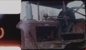
Digney Film 3 - Construction of Digney Bowling Alley
https://search.heritageburnaby.ca/link/museumdescription10648
- Repository
- Burnaby Village Museum
- Date
- 1955 (date of original), copied 2019
- Collection/Fonds
- Digney Family fonds
- Description Level
- Item
- Physical Description
- 1 video recording (mp4) (8 min., 40 sec.) : digital, 23 fps, col., si.
- Scope and Content
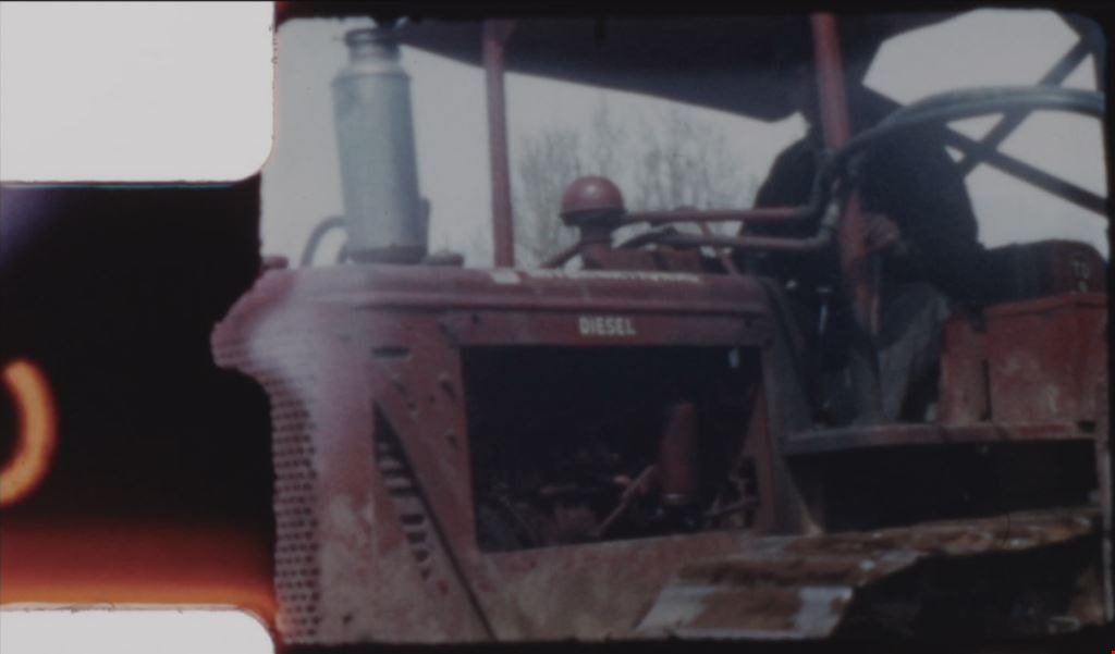
- Film segment documenting the construction of the Digney Bowling Alley in Burnaby. The bowling alley was built on the west side of the Digney family home located at 2698 Bonsor Avenue (address became 6521 Bonsor Avenue after 1958). The film documents Ozzie Cavello using his bulldozer to clear the la…
- Repository
- Burnaby Village Museum
- Collection/Fonds
- Digney Family fonds
- Description Level
- Item
- Physical Description
- 1 video recording (mp4) (8 min., 40 sec.) : digital, 23 fps, col., si.
- Scope and Content
- Film segment documenting the construction of the Digney Bowling Alley in Burnaby. The bowling alley was built on the west side of the Digney family home located at 2698 Bonsor Avenue (address became 6521 Bonsor Avenue after 1958). The film documents Ozzie Cavello using his bulldozer to clear the land followed by construction workers laying cinder block walls, a large crane helping to lay steel girders and lumber for the roof. The opening footage is taken from the parking lot of the Simpsons-Sears store on Kingsway. The Film segment closes with large flower arrangements gathered around the entrance of the Digney Bowling Alley in honour of the grand opening with Andy Digney and his brother in law Sydney Swan at the entrance.
- Creator
- Digney, Andy
- Geographic Access
- Bonsor Avenue
- Street Address
- 6521 Bonsor Avenue
- Accession Code
- BV019.18.5.1
- Access Restriction
- No restrictions
- Reproduction Restriction
- No known restrictions
- Date
- 1955 (date of original), copied 2019
- Media Type
- Moving Images
- Historic Neighbourhood
- Central Park (Historic Neighbourhood)
- Planning Study Area
- Maywood Area
- Photographer
- Digney, Andy
- Digney, Ernest Frank "Dig"
- Notes
- Title based on contents of film segment
- Film segment originates from digitized version of original 8 mm film (See BV019.18.5)
Images
Video
Digney Film 3 - Construction of Digney Bowling Alley, 1955 (date of original), copied 2019
Digney Film 3 - Construction of Digney Bowling Alley, 1955 (date of original), copied 2019
https://search.heritageburnaby.ca/media/hpo/_Data/_BVM_Moving_Images/2019_0018_0005_001.mp4![Digney Film 3 - Inside Digney Bowling Alley, [1955] (date of original), copied 2019 thumbnail](/media/hpo/_Data/_BVM_Moving_Images/2019_0018_0005_003.jpg?width=280)
Digney Film 3 - Inside Digney Bowling Alley
https://search.heritageburnaby.ca/link/museumdescription10650
- Repository
- Burnaby Village Museum
- Date
- [1955] (date of original), copied 2019
- Collection/Fonds
- Digney Family fonds
- Description Level
- Item
- Physical Description
- 1 video recording (mp4) (48 sec.) : digital, 23 fps, col., si.
- Scope and Content
- Film segment documenting the inside of the Digney Bowling Alley. Views of kitchen and counter staff working and serving customers who are gathered at the bar. The camera pans back outside and shows buses parked outside from "Channel / Chan TV. 8". Sign on roof of building reads: "BOWL" and "DIGNE…
- Repository
- Burnaby Village Museum
- Collection/Fonds
- Digney Family fonds
- Description Level
- Item
- Physical Description
- 1 video recording (mp4) (48 sec.) : digital, 23 fps, col., si.
- Scope and Content
- Film segment documenting the inside of the Digney Bowling Alley. Views of kitchen and counter staff working and serving customers who are gathered at the bar. The camera pans back outside and shows buses parked outside from "Channel / Chan TV. 8". Sign on roof of building reads: "BOWL" and "DIGNEY" sign hangs vertically out front.
- Creator
- Digney, Andy
- Names
- Digney Bowling Alley
- Geographic Access
- Bonsor Avenue
- Street Address
- 6521 Bonsor Avenue
- Accession Code
- BV019.18.5.3
- Access Restriction
- No restrictions
- Reproduction Restriction
- No known restrictions
- Date
- [1955] (date of original), copied 2019
- Media Type
- Moving Images
- Historic Neighbourhood
- Central Park (Historic Neighbourhood)
- Planning Study Area
- Maywood Area
- Photographer
- Digney, Andy
- Notes
- Title based on contents of film segment
- Film segment originates from digitized version of original 8 mm film (See BV019.18.5)
- Film segment may have been taken on the same day as BV019.18.4.2
Images
![Digney Film 3 - Inside Digney Bowling Alley, [1955] (date of original), copied 2019 thumbnail](/media/hpo/_Data/_BVM_Moving_Images/2019_0018_0005_003.jpg)
Video
Digney Film 3 - Inside Digney Bowling Alley, [1955] (date of original), copied 2019
Digney Film 3 - Inside Digney Bowling Alley, [1955] (date of original), copied 2019
https://search.heritageburnaby.ca/media/hpo/_Data/_BVM_Moving_Images/2019_0018_0005_003.mp4![Digney Film 3 - Tournament at Digney Bowling Alley, [1955] (date of original), copied 2019 thumbnail](/media/hpo/_Data/_BVM_Moving_Images/2019_0018_0005_002.jpg?width=280)
Digney Film 3 - Tournament at Digney Bowling Alley
https://search.heritageburnaby.ca/link/museumdescription10649
- Repository
- Burnaby Village Museum
- Date
- [1955] (date of original), copied 2019
- Collection/Fonds
- Digney Family fonds
- Description Level
- Item
- Physical Description
- 1 video recording (mp4) (3 min., 12 sec.) : digital, 23 fps, col., si.
- Scope and Content
- Film segment documenting a bowling tournament at the Digney Bowling Alley at 2698 Bonsor Avenue (address became 6521 Bonsor Avenue after 1958). Two male and female pairs appear to be competing against each other and a camera man and camera from Channel 8 - Chan TV are filming the event. One of the …
- Repository
- Burnaby Village Museum
- Collection/Fonds
- Digney Family fonds
- Description Level
- Item
- Physical Description
- 1 video recording (mp4) (3 min., 12 sec.) : digital, 23 fps, col., si.
- Scope and Content
- Film segment documenting a bowling tournament at the Digney Bowling Alley at 2698 Bonsor Avenue (address became 6521 Bonsor Avenue after 1958). Two male and female pairs appear to be competing against each other and a camera man and camera from Channel 8 - Chan TV are filming the event. One of the couples are wearing shirts with "Digney Bowl" printed on the back. Ernest "Dig" Digney assists in handing out awards at the end. Joyce Digney is identified working in the kitchen. The camera pans outside where there are two "Channel 8 - Chan TV" buses parked in the parking lot of the Digney Bowl.
- Creator
- Digney, Andy
- Geographic Access
- Bonsor Avenue
- Street Address
- 6521 Bonsor Avenue
- Accession Code
- BV019.18.5.2
- Access Restriction
- No restrictions
- Reproduction Restriction
- No known restrictions
- Date
- [1955] (date of original), copied 2019
- Media Type
- Moving Images
- Historic Neighbourhood
- Central Park (Historic Neighbourhood)
- Planning Study Area
- Maywood Area
- Photographer
- Digney, Andy
- Notes
- Title based on contents of film segment
- Film segment originates from digitized version of original 8 mm film (See BV019.18.5)
Images
![Digney Film 3 - Tournament at Digney Bowling Alley, [1955] (date of original), copied 2019 thumbnail](/media/hpo/_Data/_BVM_Moving_Images/2019_0018_0005_002.jpg)
Video
Digney Film 3 - Tournament at Digney Bowling Alley, [1955] (date of original), copied 2019
Digney Film 3 - Tournament at Digney Bowling Alley, [1955] (date of original), copied 2019
https://search.heritageburnaby.ca/media/hpo/_Data/_BVM_Moving_Images/2019_0018_0005_002.mp4![East Burnaby United Church, [ca.1925] thumbnail](/media/hpo/_Data/_BVM_Cartographic_Material/2003/2003_0083_0054_001.jpg?width=280)
East Burnaby United Church
https://search.heritageburnaby.ca/link/museumdescription11932
- Repository
- Burnaby Village Museum
- Date
- [ca.1925]
- Collection/Fonds
- Ronald G. Scobbie collection
- Description Level
- Item
- Physical Description
- 1 plan : black ink and watercol. on paper ; 30.45 x 30.5 cm
- Scope and Content
- Item consists of a building insurance plan of "East Burnaby United Church / Lot 1 BK 2 south Part DL 28 GP 1 N.W.D.". Twelfth Avenue is identified to the north and Douglas Road to the west.
- Repository
- Burnaby Village Museum
- Collection/Fonds
- Ronald G. Scobbie collection
- Description Level
- Item
- Physical Description
- 1 plan : black ink and watercol. on paper ; 30.45 x 30.5 cm
- Material Details
- Scale 1 inch = 20 feet
- Scope and Content
- Item consists of a building insurance plan of "East Burnaby United Church / Lot 1 BK 2 south Part DL 28 GP 1 N.W.D.". Twelfth Avenue is identified to the north and Douglas Road to the west.
- Subjects
- Buildings - Religious - Churches
- Accession Code
- BV003.83.54
- Access Restriction
- No restrictions
- Reproduction Restriction
- No known restrictions
- Date
- [ca.1925]
- Media Type
- Cartographic Material
- Scan Resolution
- 600
- Scan Date
- 15-Jan-2021
- Scale
- 100
- Notes
- Transcribed title
- Note in pencil on verso reads: "East Burnaby United Church / Lot 1 BK 2 south Part DL 28 / 1" = 20' "
- Note in black ink on verso reads: "3704"
Images
![East Burnaby United Church, [ca.1925] thumbnail](/media/hpo/_Data/_BVM_Cartographic_Material/2003/2003_0083_0054_001.jpg)

Interviews with Bill and Albert Parker by Colin Stevens January 17, 1992
https://search.heritageburnaby.ca/link/museumdescription9840
- Repository
- Burnaby Village Museum
- Date
- 1920-1930 (interview content), interviewed January 17, 1992 (date of original), digitized 2020
- Collection/Fonds
- Burnaby Village Museum fonds
- Description Level
- Item
- Physical Description
- 1 videocassette (53 min., 14 sec.) : col. , sd.
- Scope and Content
- Film footage documenting informal interviews with brothers William “Bill” and Albert Parker conducted by Burnaby Village Museum curator, Colin Stevens. The footage opens in the administration building of the Burnaby Village Museum where Bill Parker describes a pair of cross country skis that he is …
- Repository
- Burnaby Village Museum
- Collection/Fonds
- Burnaby Village Museum fonds
- Series
- Jesse Love farmhouse series
- Description Level
- Item
- Physical Description
- 1 videocassette (53 min., 14 sec.) : col. , sd.
- Material Details
- Interviewer: Colin Stevens
- Interviewee:William (Bill) Parker; Albert Parker; Mrs. William Parker
- Location of Interview: Jesse Love farmhouse at the Burnaby Village Museum
- Camera: Susan Green and Colin Stevens
- Scope and Content
- Film footage documenting informal interviews with brothers William “Bill” and Albert Parker conducted by Burnaby Village Museum curator, Colin Stevens. The footage opens in the administration building of the Burnaby Village Museum where Bill Parker describes a pair of cross country skis that he is donating to the museum. Bill recollects how he constructed the skis out of cedar in the late 1920s when he was about 9 or 10 years old. Bill tells of how he skied in the neighbourhood of the Jesse Love farmhouse on Cumberland Road, using the skis until the mid to late 1930s. The film continues with a tour of the Jesse Love farmhouse which is under restoration on site of the Burnaby Village Museum. Curator Colin Stevens takes Albert and Bill Parker through various rooms inside of the house sharing details of what staff have discovered during the restoration process and gathers informative details by interviewing them. During the interviews, the brothers recollect what it was like living in the house in the 1920s. They provide details on the house’s construction, fixtures, heating and water systems along with particulars regarding furnishings and décor. Information that was gathered through interviews such as this, supported the restoration to be completed as accurately as possible.
- History
- Albert and William Charles “Bill” Parker are the sons of Sarah Parker (nee Love) and William Parker. Sarah Parker was the daughter of Jesse and Martha Love and grew up in the Love farmhouse located at 1390 Cumberland Road in Burnaby. Sarah and William Parker and their three children (Albert, Bill and Elsie) moved into the Love farmhouse in about 1925, eventually buying it in 1928 following the death of Sarah’s father Jesse Love. Sarah continued to live in the house until after her husband William died and eventually sold the house to her daughter Elsie Hughes and her husband John Hughes in 1966.
- Creator
- Burnaby Village Museum
- Subjects
- Sports - Skiing
- Buildings - Heritage
- Accession Code
- BV018.41.50
- Access Restriction
- Restricted access
- Reproduction Restriction
- May be restricted by third party rights
- Date
- 1920-1930 (interview content), interviewed January 17, 1992 (date of original), digitized 2020
- Media Type
- Moving Images
- Photographer
- Green, Susan
- Stevens, Colin
- Notes
- Title based on contents of video
- Video was digitized to mp4 in March 2020 from original VHS tape
Images

Video
Interviews with Bill and Albert Parker by Colin Stevens January 17, 1992, 1920-1930 (interview content), interviewed January 17, 1992 (date of original), digitized 2020
Interviews with Bill and Albert Parker by Colin Stevens January 17, 1992, 1920-1930 (interview content), interviewed January 17, 1992 (date of original), digitized 2020
https://search.heritageburnaby.ca/media/hpo/_Data/_BVM_Moving_Images/2018_0041_0050_001.mp4![Map of location of Toishan Middle school, [between 1919 and 1926] thumbnail](/media/hpo/_Data/_BVM_Cartographic_Material/1985/1985_5331_0009_002%20Web.jpg?width=280)
Map of location of Toishan Middle school
https://search.heritageburnaby.ca/link/museumdescription8695
- Repository
- Burnaby Village Museum
- Date
- [between 1919 and 1926]
- Collection/Fonds
- Way Sang Yuen Wat Kee & Co. fonds
- Description Level
- Item
- Physical Description
- 1 map : blueprint ink on paper ; 41.5 x 25.5 cm
- Scope and Content
- Item consists of a topographic map with Chinese characters indicating the location of where the Toishan Middle school will be constructed. Overseas Chinese who originated from Toishan county in China participated in the fundraising efforts for the first phase of building this school (there were thr…
- Repository
- Burnaby Village Museum
- Collection/Fonds
- Way Sang Yuen Wat Kee & Co. fonds
- Description Level
- Item
- Physical Description
- 1 map : blueprint ink on paper ; 41.5 x 25.5 cm
- Material Details
- Map details include elevation contours, marsh, roads, water and rail
- Scope and Content
- Item consists of a topographic map with Chinese characters indicating the location of where the Toishan Middle school will be constructed. Overseas Chinese who originated from Toishan county in China participated in the fundraising efforts for the first phase of building this school (there were three phases in total). The block of text on the bottom right describes the geographical location of the school. It also mentions some of the amenities that they want to add to the school grounds, which requires additional funding.
- Subjects
- Buildings - Schools
- Accession Code
- BV985.5331.9
- Access Restriction
- No restrictions
- Reproduction Restriction
- No known restrictions
- Date
- [between 1919 and 1926]
- Media Type
- Cartographic Material
- Scan Resolution
- 300
- Scan Date
- December 2020
- Scale
- 100
- Notes
- Title based on contents of map
Images
![Map of location of Toishan Middle school, [between 1919 and 1926] thumbnail](/media/hpo/_Data/_BVM_Cartographic_Material/1985/1985_5331_0009_002%20Web.jpg)
![St. Margaret's Anglican Mission, [1929] thumbnail](/media/hpo/_Data/_BVM_Cartographic_Material/2003/2003_0083_0050_001.jpg?width=280)
St. Margaret's Anglican Mission
https://search.heritageburnaby.ca/link/museumdescription11928
- Repository
- Burnaby Village Museum
- Date
- [1929]
- Collection/Fonds
- Ronald G. Scobbie collection
- Description Level
- Item
- Physical Description
- 1 plan : black ink and watercol. on paper ; 30.45 x 30.5 cm
- Scope and Content
- Item consists of building insurance plan for St. Margaret of Scotland Anglican Church. Title of plan reads: "St. Margaret's Anglican Mission (note:"Church" has been crossed out and corrected with "Mission") / Lot 10, DL 132 / GP1 N.W.D." . Curtis Street is identified to the north and Sperling Av…
- Repository
- Burnaby Village Museum
- Collection/Fonds
- Ronald G. Scobbie collection
- Description Level
- Item
- Physical Description
- 1 plan : black ink and watercol. on paper ; 30.45 x 30.5 cm
- Material Details
- Scale 1 inch = 40 feet
- Scope and Content
- Item consists of building insurance plan for St. Margaret of Scotland Anglican Church. Title of plan reads: "St. Margaret's Anglican Mission (note:"Church" has been crossed out and corrected with "Mission") / Lot 10, DL 132 / GP1 N.W.D." . Curtis Street is identified to the north and Sperling Ave. to the west.
- Subjects
- Buildings - Religious - Churches
- Geographic Access
- Sperling Avenue
- Curtis Street
- Accession Code
- BV003.83.50
- Access Restriction
- No restrictions
- Reproduction Restriction
- No known restrictions
- Date
- [1929]
- Media Type
- Cartographic Material
- Scan Resolution
- 600
- Scan Date
- 15-Jan-2021
- Scale
- 100
- Notes
- Transcribed title
- Note in pencil on verso reads: "St. Margaret's Anglican Mission / Lot 10, DL 132 / 1" = 40' "
- Note in balck in on verso reads: "3704"
Images
![St. Margaret's Anglican Mission, [1929] thumbnail](/media/hpo/_Data/_BVM_Cartographic_Material/2003/2003_0083_0050_001.jpg)
![St. Nicolas Parish Church, [ca.1912] thumbnail](/media/hpo/_Data/_BVM_Cartographic_Material/2003/2003_0083_0053_001.jpg?width=280)
St. Nicolas Parish Church
https://search.heritageburnaby.ca/link/museumdescription11931
- Repository
- Burnaby Village Museum
- Date
- [ca.1912]
- Collection/Fonds
- Ronald G. Scobbie collection
- Description Level
- Item
- Physical Description
- 1 plan : black ink and watercol. on paper ; 30.45 x 30.5 cm
- Scope and Content
- Item consists of a building insurance plan of St. Nicholas Anglican Church. Title on plan reads "St. Nicolas [sic] Parish Church / Lots 11 & 12 BK 10 DL 186 GP 1 / N.W.D.". Ingleton Avenue is identified to the east and Triumph Street to the south.
- Repository
- Burnaby Village Museum
- Collection/Fonds
- Ronald G. Scobbie collection
- Description Level
- Item
- Physical Description
- 1 plan : black ink and watercol. on paper ; 30.45 x 30.5 cm
- Material Details
- Scale 1 inch = 20 feet
- Scope and Content
- Item consists of a building insurance plan of St. Nicholas Anglican Church. Title on plan reads "St. Nicolas [sic] Parish Church / Lots 11 & 12 BK 10 DL 186 GP 1 / N.W.D.". Ingleton Avenue is identified to the east and Triumph Street to the south.
- Subjects
- Buildings - Religious - Churches
- Geographic Access
- Triumph Street
- Street Address
- 3883 Triumph Street
- Accession Code
- BV003.83.53
- Access Restriction
- No restrictions
- Reproduction Restriction
- No known restrictions
- Date
- [ca.1912]
- Media Type
- Cartographic Material
- Historic Neighbourhood
- Vancouver Heights (Historic Neighbourhood)
- Scan Resolution
- 600
- Scan Date
- 15-Jan-2021
- Scale
- 100
- Notes
- Transcribed title
- Note in pencil on verso reads: "St. Nicholas Parish Church / Lots 11 & 12 BK 10 DL 186 / 1" = 20' "
- Note in black ink on verso reads: "3704"
Images
![St. Nicolas Parish Church, [ca.1912] thumbnail](/media/hpo/_Data/_BVM_Cartographic_Material/2003/2003_0083_0053_001.jpg)

Commercial Map of Greater Vancouver and District
https://search.heritageburnaby.ca/link/museumdescription9552
- Repository
- Burnaby Village Museum
- Date
- July 1921
- Collection/Fonds
- Burnaby Village Museum Map collection
- Description Level
- Item
- Physical Description
- 1 map : col. lithograph mounted on linen ; 107 x 138 cm
- Scope and Content
- Commercial map of Greater Vancouver and District. Map depicts district lots, railroads, electric railways, streets, street car stops, schools, buildings, postal block numbers, parks and First Nations reserves. Map covers the geographcial areas of Vancouver, Burnaby, New Westminster, portions of Ric…
- Repository
- Burnaby Village Museum
- Collection/Fonds
- Burnaby Village Museum Map collection
- Description Level
- Item
- Physical Description
- 1 map : col. lithograph mounted on linen ; 107 x 138 cm
- Material Details
- Includes Legend and Index
- Scope and Content
- Commercial map of Greater Vancouver and District. Map depicts district lots, railroads, electric railways, streets, street car stops, schools, buildings, postal block numbers, parks and First Nations reserves. Map covers the geographcial areas of Vancouver, Burnaby, New Westminster, portions of Richmond, West Vancouver, North Vancouver, and Surrey with half mile circles that radiate from Vancouver City Hall on the corner of Main and Hastings. Bottom of map includes an index of street names, along with their corresponding map grid locations. The map is bordered by Marine Drive to the west, North Road to the east, Dempsey Street to the north and 20th Road to the south.
- History
- Bought by donor at thrift store years ago. No known provenance.
- Publisher
- Produced by Photo - Lithography, Colonist , Victoria, B.C.
- Geographic Access
- Vancouver
- Accession Code
- BV018.24.1
- Access Restriction
- No restrictions
- Reproduction Restriction
- No known restrictions
- Date
- July 1921
- Media Type
- Cartographic Material
- Scan Resolution
- 300
- Scan Date
- 16-Jun-20
- Scale
- 100
- Notes
- Transcribed title
- Title on map reads: "COMMERCIAL MAP / OF / GREATER VANCOUVER / AND / DISTRICT / Compiled and Published by / The Vancouver Map & Blueprint Co. Ltd. / 441 Seymour St. Vancouver B.C. / July, 1921".
Images

![Map of proposed provincial exhibition site at Burnaby Lake, [between 1929 and 1931] thumbnail](/media/hpo/_Data/_BVM_Cartographic_Material/2017/2017_0002_0009_005.jpg?width=280)
Map of proposed provincial exhibition site at Burnaby Lake
https://search.heritageburnaby.ca/link/museumdescription8703
- Repository
- Burnaby Village Museum
- Date
- [between 1929 and 1931]
- Collection/Fonds
- Burnaby Village Museum Map collection
- Description Level
- Item
- Physical Description
- 1 map : photostat print ; 3 parts 45 x 33.7 cm totalling 45 x 101 cm
- Scope and Content
- Item consists of a tri-part folding map of a proposed Provincial Exhibition site located along the southern and western shore of Burnaby Lake. Exhibtion site on map identifies proposed locations for a golf course, pier, hydroplane landing ramp, sports ground, one-mile horse racing track and various…
- Repository
- Burnaby Village Museum
- Collection/Fonds
- Burnaby Village Museum Map collection
- Description Level
- Item
- Physical Description
- 1 map : photostat print ; 3 parts 45 x 33.7 cm totalling 45 x 101 cm
- Material Details
- Scale [1:1800]
- Scope and Content
- Item consists of a tri-part folding map of a proposed Provincial Exhibition site located along the southern and western shore of Burnaby Lake. Exhibtion site on map identifies proposed locations for a golf course, pier, hydroplane landing ramp, sports ground, one-mile horse racing track and various buildings for mechanical, agricultural and botanical displays.
- Subjects
- Exhibitions
- Accession Code
- BV017.2.9
- Access Restriction
- No restrictions
- Reproduction Restriction
- No known restrictions
- Date
- [between 1929 and 1931]
- Media Type
- Cartographic Material
- Historic Neighbourhood
- Burnaby Lake (Historic Neighbourhood)
- Planning Study Area
- Burnaby Lake Area
- Scan Resolution
- 400
- Scan Date
- 2021-11-18
- Notes
- Title based on contents of map
- Scale on map reads: "150 feet to 1 inch"
- Overall measurements when fully opened: L: 98.0 cm x H: 45.3 cm ; Individual map parts: L: 32.7 cm x H: 45.0 cm
- Commercially printed label on front of portfolio card reads "PLOWRIGHT PRINTING COMPANY / TELEPHONE N.W. 1942 / 39 McKENZIE STREET NEW WESTMINSTER, B.C. / TO: [illegible writing in pencil]" in blue ink. Red typewritten text reads: "PHOTOSTAT OF BURNABY LAKE".
Images
![Map of proposed provincial exhibition site at Burnaby Lake, [between 1929 and 1931] thumbnail](/media/hpo/_Data/_BVM_Cartographic_Material/2017/2017_0002_0009_005.jpg)


![Sectional map and street directory of Vancouver : Dial map of greater Vancouver including adjacent municipalities, [ca. 1950] thumbnail](/media/hpo/_Data/_BVM_Cartographic_Material/2000/2000_0003_0011_001%20WEB.jpg?width=280)
Sectional map and street directory of Vancouver : Dial map of greater Vancouver including adjacent municipalities
https://search.heritageburnaby.ca/link/museumdescription8697
- Repository
- Burnaby Village Museum
- Date
- [ca. 1950]
- Collection/Fonds
- Burnaby Village Museum Map collection
- Description Level
- Item
- Physical Description
- 2 maps and 1 p. of textual records on 1 sheet : lithographic prints, col. ; 55.5 x 75 cm + 2 dials and 25 x 72 cm + directory on sheet 55.5 x 75 cm, folded to 28.5 x 12.5 cm
- Scope and Content
- Item is a sectional map and street directory titled "Dial Map of Greater Vancouver and adjacent Municipalities" with a map on one side titled "Dial Map of Greater Vancouver and Suburbs" including Vancouver, West Vancouver, North Vancouver and Burnaby and includes street car and bus lines, railways,…
- Repository
- Burnaby Village Museum
- Collection/Fonds
- Burnaby Village Museum Map collection
- Description Level
- Item
- Physical Description
- 2 maps and 1 p. of textual records on 1 sheet : lithographic prints, col. ; 55.5 x 75 cm + 2 dials and 25 x 72 cm + directory on sheet 55.5 x 75 cm, folded to 28.5 x 12.5 cm
- Material Details
- Scales 1:42240, 1:144823
- 2 alphabetic dials on narrow strips of paper attached to map by grommets
- Scope and Content
- Item is a sectional map and street directory titled "Dial Map of Greater Vancouver and adjacent Municipalities" with a map on one side titled "Dial Map of Greater Vancouver and Suburbs" including Vancouver, West Vancouver, North Vancouver and Burnaby and includes street car and bus lines, railways, hospitals, parks, block nos. and street indexes with two alphabetic dials, one for Vancouver, the other for New Westminster. The other side of the map includes a map of "Fraser Valley" along with a directory of Vancouver street car and bus routes, business blocks, public buildings, hospitals, bathing beaches, locations of Vancouver fire halls and Vancouver city schools.
- Creator
- Dominion Map and Blueprint Co.
- Publisher
- Sectional Map and Street Directory Company
- Geographic Access
- Vancouver
- Accession Code
- BV000.3.11
- Access Restriction
- No restrictions
- Reproduction Restriction
- No known restrictions
- Date
- [ca. 1950]
- Media Type
- Cartographic Material
- Scan Resolution
- 380
- Scan Date
- 22-Dec-2020
- Scale
- 100
- Notes
- Title based on contents of map
Images
![Sectional map and street directory of Vancouver : Dial map of greater Vancouver including adjacent municipalities, [ca. 1950] thumbnail](/media/hpo/_Data/_BVM_Cartographic_Material/2000/2000_0003_0011_001%20WEB.jpg)


Burnaby Mountain sod turning
https://search.heritageburnaby.ca/link/museumdescription11934
- Repository
- Burnaby Village Museum
- Date
- October 7, 1957 (date of original), digitized in 2020
- Collection/Fonds
- Burnaby Village Museum Film and Video collection
- Description Level
- Item
- Physical Description
- 1 film reel (1 min., 22 sec.) : acetate, b&w, silent ; 16 mm
- Scope and Content
- Item consists of a silent CBUT News item from October 7, 1957 titled "Burnaby Mountain Sod Turning". The film documents the memorable occasion of the Burnaby Mountain Centennial Project with Lieutenant Governor Frank M. Ross providing a brief address to the attendees before taking a shovel to turn…
- Repository
- Burnaby Village Museum
- Collection/Fonds
- Burnaby Village Museum Film and Video collection
- Description Level
- Item
- Physical Description
- 1 film reel (1 min., 22 sec.) : acetate, b&w, silent ; 16 mm
- Material Details
- Label around film container reads: "CBUT NEWS ITEM of October 7, 1957 "BURNABY MOUNTAIN SOD TURNING" ( Duncan) on permanent loan to Burnaby Centennial Comm."
- Scope and Content
- Item consists of a silent CBUT News item from October 7, 1957 titled "Burnaby Mountain Sod Turning". The film documents the memorable occasion of the Burnaby Mountain Centennial Project with Lieutenant Governor Frank M. Ross providing a brief address to the attendees before taking a shovel to turn the sod. Other attendees identified include, Councillor Sam Hughes of the Centennial Committee and British Columbia Recreation Minister, Honourable Earl C. Westwood. This event marks the development of a portion of Burnaby Mountain park including the erection of a Centennial building which opened in 1958. The film footage captures views of Burrard Inlet from the mountain top as well as newly erected roads on Burnaby mountain. According to the Burnaby Adverstiser (Vol. 25 No. 27 - October 10, 1957 p.1), Lieutenant Governor Frank M. Ross provided a brief address for the sod turning ceremony which is quoted; "What Burnaby has undertaken is not merely to celebrate the Centennial observance, but it has started something which will last down through the years and provide a lot of pleasure for future generations."
- History
- This event marks the beginning of a Centennial project to develop a park and erect a pavillion as part of the British Columbia Centennial in 1958. In October 1956, a Burnaby Centennial Committee was appointed to govern over the project with the Reeve and Council at the head of the committee. Councillor S.E. Hughes was appointed as Chairman and W.M. Morrison as Vice Chairman with the organizational structure to include the provision for Honorary Vice Chairman, secretary, treasurer, advisory staff and representative delegates from community groups and working committees. In September 1957, the Centennial Committee submitted detailed plans for a proposed building to be located on the Centennial site on Burnaby Mountain together with a recommendation to create a Building Committee as part of the Centennial Committee. In November 1957, the Burnaby Centennial Committee recommended that the new road from Badger Street and Hastings Street to the Burnaby Mountain site be named Centennial Way. January 1958, councillors Mather and Jamieson were appointed to the committee by council to replace former council members that were no longer in office. Councillor Mather was appointed as Vice Chairman. CBUT station was owned by CBC and was first broadcast on December 16, 1953. "In 1975, the CBC consolidated its Vancouver radio and television operations into one building. Prior to this, CBC's Vancouver radio properties – CBU (690 AM), CBU-FM (105.7) and CBUF-FM (97.7) – had operated from a separate studio facility at 701 Hornby Street, within the basement of the Hotel Vancouver. Together, those stations formed the basis of the Regional Broadcast Centre at 700 Hamilton Street, a few blocks east of its previous radio and television facilities.
- Responsibility
- Canadian Broadcasting Corporation
- Geographic Access
- Burnaby Mountain Conservation Area
- Accession Code
- HV971.30.2
- Access Restriction
- No restrictions
- Reproduction Restriction
- May be restricted by third party rights
- Date
- October 7, 1957 (date of original), digitized in 2020
- Media Type
- Moving Images
- Notes
- Transcribed title
- Copyright is held by CBC
Images

Video
Burnaby Mountain sod turning, October 7, 1957 (date of original), digitized in 2020
Burnaby Mountain sod turning, October 7, 1957 (date of original), digitized in 2020
https://search.heritageburnaby.ca/media/hpo/_Data/_BVM_Moving_Images/1971_0030_0002_001.mp4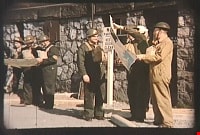
Operation Mink Farm
https://search.heritageburnaby.ca/link/archivedescription72207
- Repository
- City of Burnaby Archives
- Date
- April 24, 1955
- Collection/Fonds
- Planning Department fonds
- Description Level
- Item
- Physical Description
- 1 film reel ( 6 min., 8 sec.) : col. , si. ; 16 mm
- Scope and Content
- Item consists of a silent motion picture civil defense film entitled, "Operation Mink Farm" produced by the Corporation of the District of Burnaby. The film footage was shot in Burnaby, B.C. on April 24th, 1955. A resolution was passed in February 1955 by the Corporation of the District of Burnaby …
- Repository
- City of Burnaby Archives
- Date
- April 24, 1955
- Collection/Fonds
- Planning Department fonds
- Physical Description
- 1 film reel ( 6 min., 8 sec.) : col. , si. ; 16 mm
- Description Level
- Item
- Record No.
- 566-001
- Access Restriction
- No restrictions
- Reproduction Restriction
- No known restrictions
- Accession Number
- 2009-08
- Scope and Content
- Item consists of a silent motion picture civil defense film entitled, "Operation Mink Farm" produced by the Corporation of the District of Burnaby. The film footage was shot in Burnaby, B.C. on April 24th, 1955. A resolution was passed in February 1955 by the Corporation of the District of Burnaby to create a Civil Defense Board comprised of council members and appointees, whereby the Reeve would act as the chair of the board. Several municipal employees and council members went through Civil Defense training in preparation for an attack or catastrophe. The first portion of the film takes place at the old City Hall (the stone building) with uniformed Air Raid Precaution (A.R.P.) members performing civil defense exercises in the case of a nuclear war and how to care for and rescue injured civilians. Volunteers pose as the injured as they are cared for and transported on stretchers. In the second portion of the film, the local fire department and civil defense members endeavor to get a fire under control with water hoses. The film takes place at a former mink farm in North Burnaby as referred to in the title.
- Media Type
- Moving Images
- Photographer
- Scott, A.F.
- Notes
- Transcribed title
Images

Video
Operation Mink Farm, April 24, 1955
Operation Mink Farm, April 24, 1955
https://search.heritageburnaby.ca/media/hpo/_Data/_Archives_Moving_Images/_Unrestricted/566-001.m4v