Narrow Results By
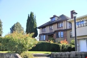
Ernest & Katherine Hermon Residence
https://search.heritageburnaby.ca/link/landmark577
- Repository
- Burnaby Heritage Planning
- Description
- Residential building.
- Associated Dates
- 1911
- Street View URL
- Google Maps Street View
- Repository
- Burnaby Heritage Planning
- Geographic Access
- Yale Street
- Associated Dates
- 1911
- Description
- Residential building.
- Heritage Value
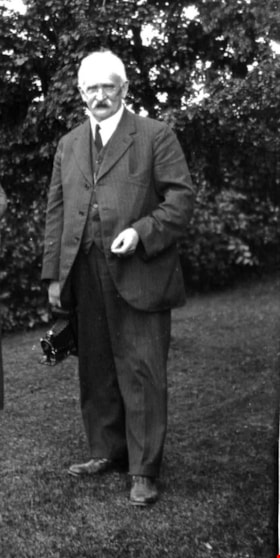
- Mr. Ernest Bolton Hermon, of the prominent engineering firm Hermon & Burwell, built this residence, and he and his wife, Katherine, lived here until 1935. The British Columbian described this home as “…a splendid mansion …which cost in the neighbourhood of $15,000.” Hermon was born into a Dutch family in Ontario in 1863, and moved to British Columbia in 1886. This is one of only three examples of the work of Samuel Maclure in Burnaby and is an outstanding example of his firm’s typical British Arts and Crafts style designs. Samuel Maclure (1860-1929) was known for his British Arts and Crafts style with meticulous attention paid to functional and beautiful interiors that utilized native wood combined with luxurious imported fittings. He was a leading exponent of the Art and Crafts design movement, and established a sophisticated local variation of residential architecture. Maclure’s Vancouver office, in association with his partner Cecil Croker Fox (1879-1916), received some sixty residential commissions between 1909-1915 as a result of the booming local economy and subsequent development of new residential districts. This partnership lasted until when Fox was killed overseas in active service during the First World War.The house has received some alterations, including stucco and brick being added to the lower floor, but it has retained its original form and massing including its symmetrical design, hipped roof and second floor half timbering.
- Locality
- Vancouver Heights
- Historic Neighbourhood
- Vancouver Heights (Historic Neighbourhood)
- Planning Study Area
- Burnaby Heights Area
- Architect
- Maclure & Fox
- Area
- 1133.42
- Contributing Resource
- Building
- Ownership
- Private
- Street Address
- 3870 Yale Street
- Street View URL
- Google Maps Street View
Images
Map of the Dominion of Canada
https://search.heritageburnaby.ca/link/museumdescription18944
- Repository
- Burnaby Village Museum
- Date
- 1911
- Collection/Fonds
- Burnaby Village Museum Map collection
- Description Level
- Item
- Physical Description
- 1 map : col. lithographic print on white paper ; 49.5 x 88.5 cm on sheet 63.5 x 90.5 cm
- Scope and Content
- Item consists of a "MAP OF THE DOMINION OF CANADA" produced by the Department of the Interior in 1911 . Text in lower border below map reads "THIS MAP IS PRESENTED WITH THE COMPLIMENTS OF THE ROYAL BANK OF CANADA" "WITH ITS FORTY-SECOND ANNUAL REPORT, 31st DECEMBER, 1911" at bottom centre, with lis…
- Repository
- Burnaby Village Museum
- Collection/Fonds
- Burnaby Village Museum Map collection
- Description Level
- Item
- Physical Description
- 1 map : col. lithographic print on white paper ; 49.5 x 88.5 cm on sheet 63.5 x 90.5 cm
- Material Details
- Scale: 100 miles = 1 inch
- Scope and Content
- Item consists of a "MAP OF THE DOMINION OF CANADA" produced by the Department of the Interior in 1911 . Text in lower border below map reads "THIS MAP IS PRESENTED WITH THE COMPLIMENTS OF THE ROYAL BANK OF CANADA" "WITH ITS FORTY-SECOND ANNUAL REPORT, 31st DECEMBER, 1911" at bottom centre, with list of branches in Canada and in other countries; at left is list of "PRINCIPAL FOREIGN CORRESPONDENTS"; at right is general information, "INCORPORATED 1869", "HEAD OFFICE MONTREAL", with "CAPITAL PAID UP", "RESERVE FUNDS", "AGGREGATE ASSETS" all listed, and "BOARD OF DIRECTORS" listed. Map shows proposed additions to Quebec, Ontario and Manitoba. Provincial and territorial borders, shipping routes, railway lines are identified. Two charts at upper right of distances, red print, one for distances in Canada from Montreal, the other for Montreal, Halifax and Churchill to foreign ports.
- Publisher
- Royal Bank of Canada
- Accession Code
- BV988.56.4
- Access Restriction
- No restrictions
- Reproduction Restriction
- No known restrictions
- Date
- 1911
- Media Type
- Cartographic Material
- Notes
- Title based on contents of map

