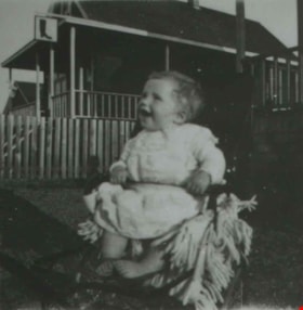
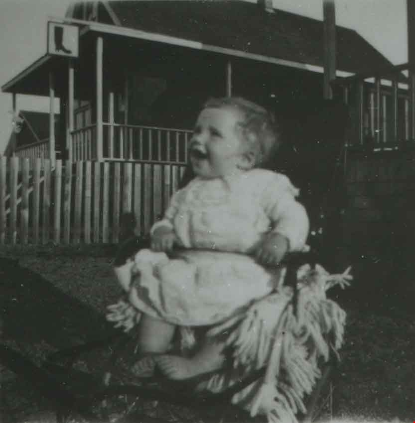
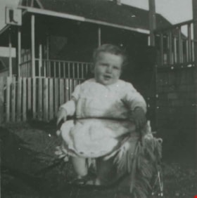
More like 'Members of Lee family in front of C&L Grocery Confectionery'
Narrow Results By
![Mrs. Tom Jun, Mrs. Chang Yat Wing, and Alice Grant, [191-?] (date of original), copied 1992 thumbnail](/media/hpo/_Data/_Archives_Images/_Unrestricted/315/315-338.jpg?width=280)
Mrs. Tom Jun, Mrs. Chang Yat Wing, and Alice Grant
https://search.heritageburnaby.ca/link/archivedescription36880
- Repository
- City of Burnaby Archives
- Date
- [191-?] (date of original), copied 1992
- Collection/Fonds
- Burnaby Historical Society fonds
- Description Level
- Item
- Physical Description
- 1 photograph : b&w ; 8.6 x 12.7 cm print
- Scope and Content
- Photograph of Mrs. Tom Jun, Mrs. Chang Yat Wing and Alice Grant standing in front of a house.
- Repository
- City of Burnaby Archives
- Date
- [191-?] (date of original), copied 1992
- Collection/Fonds
- Burnaby Historical Society fonds
- Subseries
- Burnaby Centennial Anthology subseries
- Physical Description
- 1 photograph : b&w ; 8.6 x 12.7 cm print
- Description Level
- Item
- Record No.
- 315-338
- Access Restriction
- No restrictions
- Reproduction Restriction
- No restrictions
- Accession Number
- BHS1994-04
- Scope and Content
- Photograph of Mrs. Tom Jun, Mrs. Chang Yat Wing and Alice Grant standing in front of a house.
- Subjects
- Persons - Chinese Canadians
- Media Type
- Photograph
- Notes
- Title based on contents of photograph;
- Annotation on back of photo reads, "Mr. Grant's clients"
Images
![Mrs. Tom Jun, Mrs. Chang Yat Wing, and Alice Grant, [191-?] (date of original), copied 1992 thumbnail](/media/hpo/_Data/_Archives_Images/_Unrestricted/315/315-338.jpg)
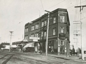
![Edmonds Block, Edmonds and Kingsway, [1912] (date of original), copied [between 1975 and 1985] thumbnail](/media/hpo/_Data/_Archives_Images/_Unrestricted/001/001-015.jpg?width=280)
Edmonds Block, Edmonds and Kingsway
https://search.heritageburnaby.ca/link/archivedescription34039
- Repository
- City of Burnaby Archives
- Date
- [1912] (date of original), copied [between 1975 and 1985]
- Collection/Fonds
- Burnaby Historical Society fonds
- Description Level
- Item
- Physical Description
- 1 photograph : b&w negative ; 8.1 x 10.6 cm
- Scope and Content
- Photograph of the triangular Edmonds Block, located at Edmonds Street and Kingsway. The building on this block housed a store, a doctor's office, and a post office. Seen in the picture are various business signs, including, "P.C. Brown Auctioneer / Real Estate / Notary Public," "Edmonds Drug Store…
- Repository
- City of Burnaby Archives
- Date
- [1912] (date of original), copied [between 1975 and 1985]
- Collection/Fonds
- Burnaby Historical Society fonds
- Subseries
- Stride family subseries
- Physical Description
- 1 photograph : b&w negative ; 8.1 x 10.6 cm
- Description Level
- Item
- Record No.
- 001-015
- Access Restriction
- No restrictions
- Reproduction Restriction
- No known restrictions
- Accession Number
- BHS2007-04
- Scope and Content
- Photograph of the triangular Edmonds Block, located at Edmonds Street and Kingsway. The building on this block housed a store, a doctor's office, and a post office. Seen in the picture are various business signs, including, "P.C. Brown Auctioneer / Real Estate / Notary Public," "Edmonds Drug Store," "General Store," and "Dr. Watson Physician." Coming out from an alley behind the building is an unidentified man driving a horse and a cart. The streets are lined with electric poles.
- Media Type
- Photograph
- Notes
- Title based on contents of photograph
- 1 b&w copy print accompanying
- Geographic Access
- Edmonds Street
- Kingsway
- Street Address
- 7338 Kingsway
- Historic Neighbourhood
- Edmonds (Historic Neighbourhood)
- Planning Study Area
- Edmonds Area
Images
![Edmonds Block, Edmonds and Kingsway, [1912] (date of original), copied [between 1975 and 1985] thumbnail](/media/hpo/_Data/_Archives_Images/_Unrestricted/001/001-015.jpg)

Edmonds Triangle Block
https://search.heritageburnaby.ca/link/archivedescription38508
- Repository
- City of Burnaby Archives
- Date
- 1911
- Collection/Fonds
- Burnaby Historical Society fonds
- Description Level
- Item
- Physical Description
- 1 photograph: b&w postcard ; 8.5 x 14 cm
- Scope and Content
- Photographic postcard of the "triangle block" at Kingsway and Edmonds. The building housed stores, the post office, and Doctor Watson's apartment. Although the postcard bears no postmark, a note is written on the reverse which reads: "This is the new store at Edmonds. The shop at the end (before…
- Repository
- City of Burnaby Archives
- Date
- 1911
- Collection/Fonds
- Burnaby Historical Society fonds
- Subseries
- Photographs subseries
- Physical Description
- 1 photograph: b&w postcard ; 8.5 x 14 cm
- Description Level
- Item
- Record No.
- 449-003
- Access Restriction
- No restrictions
- Reproduction Restriction
- No known restrictions
- Accession Number
- BHS2007-04
- Scope and Content
- Photographic postcard of the "triangle block" at Kingsway and Edmonds. The building housed stores, the post office, and Doctor Watson's apartment. Although the postcard bears no postmark, a note is written on the reverse which reads: "This is the new store at Edmonds. The shop at the end (before it was opened) where the man is outside is the Post Office. Round the other side is a cafe, and upstairs we a Doctor living." A sign on the building reads "Edmonds General Store Co." and three unidentified people can be seen standing on the steps. In the foreground, the streetcar lines can be seen.
- Media Type
- Photograph
- Notes
- Title based on contents of photograph
- Geographic Access
- Edmonds Street
- Kingsway
- Street Address
- 7338 Kingsway
- Historic Neighbourhood
- Edmonds (Historic Neighbourhood)
- Planning Study Area
- Edmonds Area
Images


Edmonds Triangle Block
https://search.heritageburnaby.ca/link/archivedescription38511
- Repository
- City of Burnaby Archives
- Date
- 1911
- Collection/Fonds
- Burnaby Historical Society fonds
- Description Level
- Item
- Physical Description
- 1 photograph: b&w postcard ; 8.5 x 14 cm
- Scope and Content
- Photographic postcard of a car driving across the railway crossing in front of the Edmonds Block at Edmonds and Kingsway. The building on this block housed a store, a doctor's office, and a post office. Visible in this picture are the interurban tracks and Dr. Watson's apartment. The postcard be…
- Repository
- City of Burnaby Archives
- Date
- 1911
- Collection/Fonds
- Burnaby Historical Society fonds
- Subseries
- Photographs subseries
- Physical Description
- 1 photograph: b&w postcard ; 8.5 x 14 cm
- Description Level
- Item
- Record No.
- 449-006
- Access Restriction
- No restrictions
- Reproduction Restriction
- No known restrictions
- Accession Number
- BHS2007-04
- Scope and Content
- Photographic postcard of a car driving across the railway crossing in front of the Edmonds Block at Edmonds and Kingsway. The building on this block housed a store, a doctor's office, and a post office. Visible in this picture are the interurban tracks and Dr. Watson's apartment. The postcard bears a postmark dated October 19, 1911 and a note written by Dr. Watson to a Miss Watson, of Cheshire, England. The note reads: "This is a picture of our block. We occupy the rooms on the left side of the first floor including the end one facing which is one of the windows in my waiting room. The entrance is seen to the right. The photo has been taken from Edmonds Station. Both car lines run into New Westminster, that on the right is the most direct one. The one on the left goes round via East Burnaby and at present its terminus is below our window. Your letter of the 14th [illegible] will answer more fully soon. We are well. So sorry to hear of that terrible motor accident. Yours, G."
- Media Type
- Photograph
- Geographic Access
- Edmonds Street
- Kingsway
- Street Address
- 7338 Kingsway
- Historic Neighbourhood
- Edmonds (Historic Neighbourhood)
- Planning Study Area
- Edmonds Area
Images

![Esmond and Hastings Vicinity, [1915] (date of original), copied 1986 thumbnail](/media/hpo/_Data/_Archives_Images/_Unrestricted/204/204-306.jpg?width=280)
Esmond and Hastings Vicinity
https://search.heritageburnaby.ca/link/archivedescription35448
- Repository
- City of Burnaby Archives
- Date
- [1915] (date of original), copied 1986
- Collection/Fonds
- Burnaby Historical Society fonds
- Description Level
- Item
- Physical Description
- 1 photograph : b&w ; 12.7 x 17.8 cm print
- Scope and Content
- Photograph of the Arthur Wall Block (right), 3722 Hastings Street, at the corner of Hastings Street and Boundary Road, and the Matheson Block (left), 3730 Hastings Street. The British Columbia Electric Railway (BCER) Hastings car can be seen.
- Repository
- City of Burnaby Archives
- Date
- [1915] (date of original), copied 1986
- Collection/Fonds
- Burnaby Historical Society fonds
- Subseries
- Pioneer Tales subseries
- Physical Description
- 1 photograph : b&w ; 12.7 x 17.8 cm print
- Description Level
- Item
- Record No.
- 204-306
- Access Restriction
- No restrictions
- Reproduction Restriction
- No restrictions
- Accession Number
- BHS1988-03
- Scope and Content
- Photograph of the Arthur Wall Block (right), 3722 Hastings Street, at the corner of Hastings Street and Boundary Road, and the Matheson Block (left), 3730 Hastings Street. The British Columbia Electric Railway (BCER) Hastings car can be seen.
- Media Type
- Photograph
- Photographer
- Eaton, Dr. Carl
- Notes
- Title based on contents of photograph
- Geographic Access
- Hastings Street
- Street Address
- 3722 Hastings Street
- 3730 Hastings Street
- Historic Neighbourhood
- Vancouver Heights (Historic Neighbourhood)
- Planning Study Area
- Willingdon Heights Area
Images
![Esmond and Hastings Vicinity, [1915] (date of original), copied 1986 thumbnail](/media/hpo/_Data/_Archives_Images/_Unrestricted/204/204-306.jpg)

Yorston family home
https://search.heritageburnaby.ca/link/archivedescription35479
- Repository
- City of Burnaby Archives
- Date
- 1910 (date of original), copied 1986
- Collection/Fonds
- Burnaby Historical Society fonds
- Description Level
- Item
- Physical Description
- 1 photograph : b&w ; 12.7 x 17.8 cm print
- Scope and Content
- Photograph of the Yorston family home and Yorston real estate office at 4080 East Hastings (later 4050 Hastings Street), built in 1909. This was one of the first structures in Vancouver Heights on Hastings Street east of Boundary Road It was the home of Ernest A. Yorston, his wife Florence L. Yors…
- Repository
- City of Burnaby Archives
- Date
- 1910 (date of original), copied 1986
- Collection/Fonds
- Burnaby Historical Society fonds
- Subseries
- Pioneer Tales subseries
- Physical Description
- 1 photograph : b&w ; 12.7 x 17.8 cm print
- Description Level
- Item
- Record No.
- 204-337
- Access Restriction
- No restrictions
- Reproduction Restriction
- No known restrictions
- Accession Number
- BHS1988-03
- Scope and Content
- Photograph of the Yorston family home and Yorston real estate office at 4080 East Hastings (later 4050 Hastings Street), built in 1909. This was one of the first structures in Vancouver Heights on Hastings Street east of Boundary Road It was the home of Ernest A. Yorston, his wife Florence L. Yorston (nee Marston) and their children. The L.C. Tull furniture store can be seen in the background.
- Subjects
- Buildings - Residential - Houses
- Businesses - Real Estate Agencies
- Buildings - Commercial - Stores
- Names
- Yorston Real Estate
- Media Type
- Photograph
- Notes
- Title based on contents of photograph
- Geographic Access
- Hastings Street
- Street Address
- 4050 Hastings Street
- Historic Neighbourhood
- Vancouver Heights (Historic Neighbourhood)
- Planning Study Area
- Willingdon Heights Area
Images

![A. MacKenzie and Company Jubilee Store, [1912] thumbnail](/media/hpo/_Data/_Archives_Images/_Unrestricted/205/228-005.jpg?width=280)
A. MacKenzie and Company Jubilee Store
https://search.heritageburnaby.ca/link/archivedescription36144
- Repository
- City of Burnaby Archives
- Date
- [1912]
- Collection/Fonds
- Burnaby Historical Society fonds
- Description Level
- Item
- Physical Description
- 1 photograph : sepia ; 11.5 x 16.5 cm
- Scope and Content
- Photograph of the exterior side view of A. MacKenzie & Co / Jubilee Store. There are two men in suits standing beside a wagon, one with his hands on his hips, surveying a pile of bundles of wood that look like they have just fallen from the wagoon into the snow. A child stands at the front door of…
- Repository
- City of Burnaby Archives
- Date
- [1912]
- Collection/Fonds
- Burnaby Historical Society fonds
- Physical Description
- 1 photograph : sepia ; 11.5 x 16.5 cm
- Description Level
- Item
- Record No.
- 228-005
- Access Restriction
- No restrictions
- Reproduction Restriction
- No known restrictions
- Accession Number
- BHS1989-22
- Scope and Content
- Photograph of the exterior side view of A. MacKenzie & Co / Jubilee Store. There are two men in suits standing beside a wagon, one with his hands on his hips, surveying a pile of bundles of wood that look like they have just fallen from the wagoon into the snow. A child stands at the front door of the shop, also looking at the bundles. The store was owned by Alexander MacKenzie, (1870-1949) who arrived in Vancouver in 1907. This store later became the Matheson and Sons Market.
- Media Type
- Photograph
- Notes
- Title based on contents of photograph
- Geographic Access
- Kingsway
- Nelson Avenue
- Historic Neighbourhood
- Central Park (Historic Neighbourhood)
Images
![A. MacKenzie and Company Jubilee Store, [1912] thumbnail](/media/hpo/_Data/_Archives_Images/_Unrestricted/205/228-005.jpg)
![Burnaby Lake Store, [1911] (date of original), copied ca. 2004 thumbnail](/media/hpo/_Data/_Archives_Images/_Unrestricted/371/475-001.jpg?width=280)
Burnaby Lake Store
https://search.heritageburnaby.ca/link/archivedescription38657
- Repository
- City of Burnaby Archives
- Date
- [1911] (date of original), copied ca. 2004
- Collection/Fonds
- Burnaby Historical Society fonds
- Description Level
- Item
- Physical Description
- 1 photograph : sepia ; 21 x 26 cm print
- Scope and Content
- Photograph of two unidentified men standing outside the Burnaby Lake Store on Douglas Road and Sperling Avenue (old street naming system, this portion of Douglas Road is now Canada Way).
- Repository
- City of Burnaby Archives
- Date
- [1911] (date of original), copied ca. 2004
- Collection/Fonds
- Burnaby Historical Society fonds
- Subseries
- Photographs subseries
- Physical Description
- 1 photograph : sepia ; 21 x 26 cm print
- Description Level
- Item
- Record No.
- 475-001
- Access Restriction
- No restrictions
- Reproduction Restriction
- No known restrictions
- Accession Number
- BHS2005-7
- Scope and Content
- Photograph of two unidentified men standing outside the Burnaby Lake Store on Douglas Road and Sperling Avenue (old street naming system, this portion of Douglas Road is now Canada Way).
- Names
- Burnaby Lake Store
- Media Type
- Photograph
- Notes
- Title based on contents of photograph
- Geographic Access
- Douglas Road
- Canada Way
- Sperling Avenue
- Historic Neighbourhood
- Burnaby Lake (Historic Neighbourhood)
- Planning Study Area
- Morley-Buckingham Area
Images
![Burnaby Lake Store, [1911] (date of original), copied ca. 2004 thumbnail](/media/hpo/_Data/_Archives_Images/_Unrestricted/371/475-001.jpg)
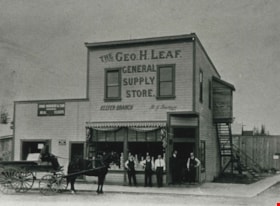
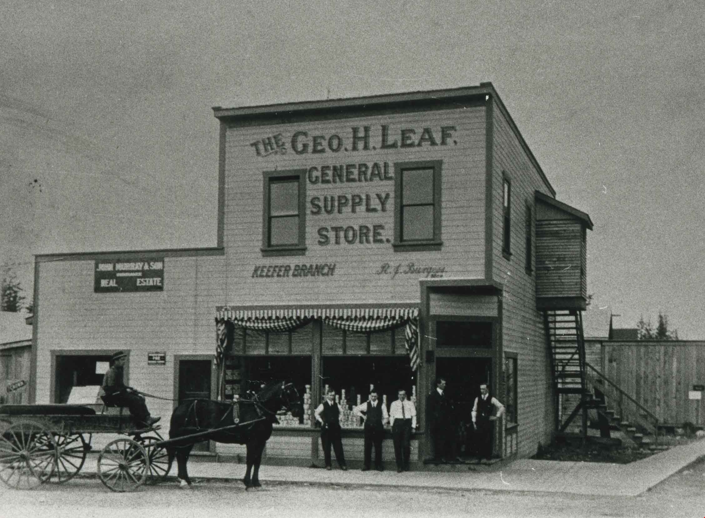
George Leaf General Store
https://search.heritageburnaby.ca/link/archivedescription35362
- Repository
- City of Burnaby Archives
- Date
- 1913 (date of original), copied 1986
- Collection/Fonds
- Burnaby Historical Society fonds
- Description Level
- Item
- Physical Description
- 1 photograph : b&w ; 12.7 x 17.8 cm print
- Scope and Content
- Photograph of the second George Leaf General Store, located on Keefer Road (now McKay Avenue). Bob Burgess (half-brother to George Leaf) was the manager of the store. George Leaf's first general store, located at 12th Avenue and 6th Street, 7745 6th Street, burned down in 1913.
- Repository
- City of Burnaby Archives
- Date
- 1913 (date of original), copied 1986
- Collection/Fonds
- Burnaby Historical Society fonds
- Subseries
- Pioneer Tales subseries
- Physical Description
- 1 photograph : b&w ; 12.7 x 17.8 cm print
- Description Level
- Item
- Record No.
- 204-219
- Access Restriction
- No restrictions
- Reproduction Restriction
- No known restrictions
- Accession Number
- BHS1988-03
- Scope and Content
- Photograph of the second George Leaf General Store, located on Keefer Road (now McKay Avenue). Bob Burgess (half-brother to George Leaf) was the manager of the store. George Leaf's first general store, located at 12th Avenue and 6th Street, 7745 6th Street, burned down in 1913.
- Media Type
- Photograph
- Notes
- Title based on contents of photograph
- Geographic Access
- McKay Avenue
- Historic Neighbourhood
- Central Park (Historic Neighbourhood)
- Planning Study Area
- Maywood Area
Images

Hastings Street
https://search.heritageburnaby.ca/link/archivedescription35429
- Repository
- City of Burnaby Archives
- Date
- 1915 (date of original), copied 1986
- Collection/Fonds
- Burnaby Historical Society fonds
- Description Level
- Item
- Physical Description
- 1 photograph : b&w ; 12.7 x 17.8 cm print
- Scope and Content
- Photograph of the south side of Hastings Street at MacDonald Avenue; business blocks located at 3986 and 3952 Hastings Street.
- Repository
- City of Burnaby Archives
- Date
- 1915 (date of original), copied 1986
- Collection/Fonds
- Burnaby Historical Society fonds
- Subseries
- Pioneer Tales subseries
- Physical Description
- 1 photograph : b&w ; 12.7 x 17.8 cm print
- Description Level
- Item
- Record No.
- 204-287
- Access Restriction
- No restrictions
- Reproduction Restriction
- No restrictions
- Accession Number
- BHS1988-03
- Scope and Content
- Photograph of the south side of Hastings Street at MacDonald Avenue; business blocks located at 3986 and 3952 Hastings Street.
- Subjects
- Buildings - Commercial - Stores
- Media Type
- Photograph
- Photographer
- Eaton, Dr. Carl
- Notes
- Title based on contents of photograph
- Geographic Access
- Hastings Street
- Street Address
- 3952 Hastings Street
- 3986 Hastings Street
- Historic Neighbourhood
- Vancouver Heights (Historic Neighbourhood)
- Planning Study Area
- Willingdon Heights Area
Images

![Harry Royle smiling, in a suit and tie, photographed by Chidwich Studio [193-]. Item no. BV005.20.20 thumbnail](/media/hpo/_Data/_Archives_Images/_Unrestricted/2000/200500200020.jpg?width=280)
Interview with Harry Royle June 20, 1975 - Track 2
https://search.heritageburnaby.ca/link/oralhistory112
- Repository
- City of Burnaby Archives
- Date Range
- 1919-1945
- Length
- 0:10:17
- Summary
- This portion of the interview pertains to Harry Royle's memories of returning from the war and setting up his general store at Capitol Hill.
- Repository
- City of Burnaby Archives
- Summary
- This portion of the interview pertains to Harry Royle's memories of returning from the war and setting up his general store at Capitol Hill.
- Date Range
- 1919-1945
- Photo Info
- Harry Royle smiling, in a suit and tie, photographed by Chidwich Studio [193-]. Item no. BV005.20.20
- Length
- 0:10:17
- Names
- Harry's
- Historic Neighbourhood
- Capitol Hill (Historic Neighbourhood)
- Interviewer
- McLeod, Ross S.
- Bradbury, Dr. Bettina
- Interview Date
- June 20, 1975
- Scope and Content
- Recording is of an interview with Harry Royle by Ross S. McLeod (and Bettina Bradbury) June 20, 1975. Major themes discussed are: the Depression and the running of a grocery store. To view "Narrow By" terms for each track expand this description and see "Notes".
- Biographical Notes
- Harry Royle was born in Gibraltar in 1898 to a Spanish mother and an English father (all of the Royle children except for one were born in Gibraltar). Harry's father served in the army for twenty-one years and because of that, the family moved regularly. While Harry was still a young baby, the Royle family moved to Ireland for six years, where he began his first years of schooling at the age of four. His dad retired from the army in 1907 and was sent to Canada with the BC Electric Company (the London General Army Buses Company). The rest of his family followed two years afterward in 1909 and settled in South Vancouver. Harry and his three brothers joined the army and were sent overseas as part of the second division. Luckily, they all returned home to Vancouver in 1919. Harry worked at the Hudson's Bay Company "counter jumping" before opening his own store in 1924 at 5527 Hastings Street and Ellesmere Avenue, a confectionery and general hangout for neighbourhood children."Harry's" was only twenty-five foot square and carried groceries obtained mainly from Kelly Douglas wholesalers. Most of Harry's customers worked at the mill at Barnet. Those that worked for the Canadian Pacific Railway were the few that still held jobs during the Depression. The store continued to serve the people of Capitol Hill throughout the Depression and war years, until Harry closed shop in 1945.
- Total Tracks
- 7
- Total Length
- 1:01:43
- Interviewee Name
- Royle, Harry
- Interviewer Bio
- Bettina Bradbury teaches history and women's studies at York University. She is the author of Wife to Widow. Lives, Laws and Politics in Nineteenth-century Montreal. (Vancouver: University of British Columbia Press, June 2011), 520p; Working Families. Age, Gender and Daily Survival in Industrializing Montreal. (Toronto: Canadian Social History Series, McClelland and Stewart, 1993); (Republished Toronto: Oxford University Press, 1996) (3rd edition, Toronto: University of Toronto Press, 2007). These interviews were undertaken after she completed her MA at Simon Fraser University in 1975 with the support of an LIP grant.
- Collection/Fonds
- Burnaby Historical Society fonds
- Subseries
- Oral history subseries
- Media Type
- Sound Recording
- Web Notes
- Interview was digitized in 2010 allowing it to be accessible on Heritage Burnaby. The digitization project was initiated by the Community Heritage Commission with support from City of Burnaby Council and the BC History Digitization Program of the Irving K. Barber Learning Centre, University of British Columbia. It was recognized by the Heritage Society of BC with an award in 2012.
Images
![Harry Royle smiling, in a suit and tie, photographed by Chidwich Studio [193-]. Item no. BV005.20.20 thumbnail](/media/hpo/_Data/_Archives_Images/_Unrestricted/2000/200500200020.jpg)
Audio Tracks
Track two of interview with Harry Royle
Track two of interview with Harry Royle
https://search.heritageburnaby.ca/media/hpo/_Data/_Archives_Oral_Histories/_Unrestricted/100-13-12/100-13-12_Track_2.mp3Interview with John Ferguson July 3, 1975 - Track 1
https://search.heritageburnaby.ca/link/oralhistory180
- Repository
- City of Burnaby Archives
- Date Range
- 1900-1939
- Length
- 0:08:23
- Summary
- This portion of the interview pertains to John Ferguson's memories of first coming to Burnaby in 1931. He describes the neighbourhood of Vancouver Heights and the people that lived there. He also describes the types of goods he sold at his Vancouver Heights Hardware Store.
- Repository
- City of Burnaby Archives
- Summary
- This portion of the interview pertains to John Ferguson's memories of first coming to Burnaby in 1931. He describes the neighbourhood of Vancouver Heights and the people that lived there. He also describes the types of goods he sold at his Vancouver Heights Hardware Store.
- Date Range
- 1900-1939
- Length
- 0:08:23
- Historic Neighbourhood
- Vancouver Heights (Historic Neighbourhood)
- Interviewer
- McLeod, Ross S.
- Interview Date
- July 3, 1975
- Scope and Content
- Recording is of an interview with John Ferguson by history student Ross S. McLeod, July 3, 1975. Major themes discussed are: the Depression.
- Biographical Notes
- John Ferguson was born in Glasgow in 1900. He came to Canada with his family in 1910, and settled on Vancouver Island. In 1931 John Ferguson purchased the hardware store on the 3900 block of Hastings Street.
- Total Tracks
- 4
- Total Length
- 0:32:21
- Interviewee Name
- Ferguson, John
- Collection/Fonds
- Burnaby Historical Society fonds
- Subseries
- Oral history subseries
- Media Type
- Sound Recording
- Web Notes
- Interview was digitized in 2010 allowing it to be accessible on Heritage Burnaby. The digitization project was initiated by the Community Heritage Commission with support from City of Burnaby Council and the BC History Digitization Program of the Irving K. Barber Learning Centre, University of British Columbia. It was recognized by the Heritage Society of BC with an award in 2012.
Audio Tracks
Track one of interview with John Ferguson
Track one of interview with John Ferguson
https://search.heritageburnaby.ca/media/hpo/_Data/_Archives_Oral_Histories/_Unrestricted/100-13-18/100-13-18_Track_1.mp3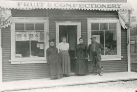
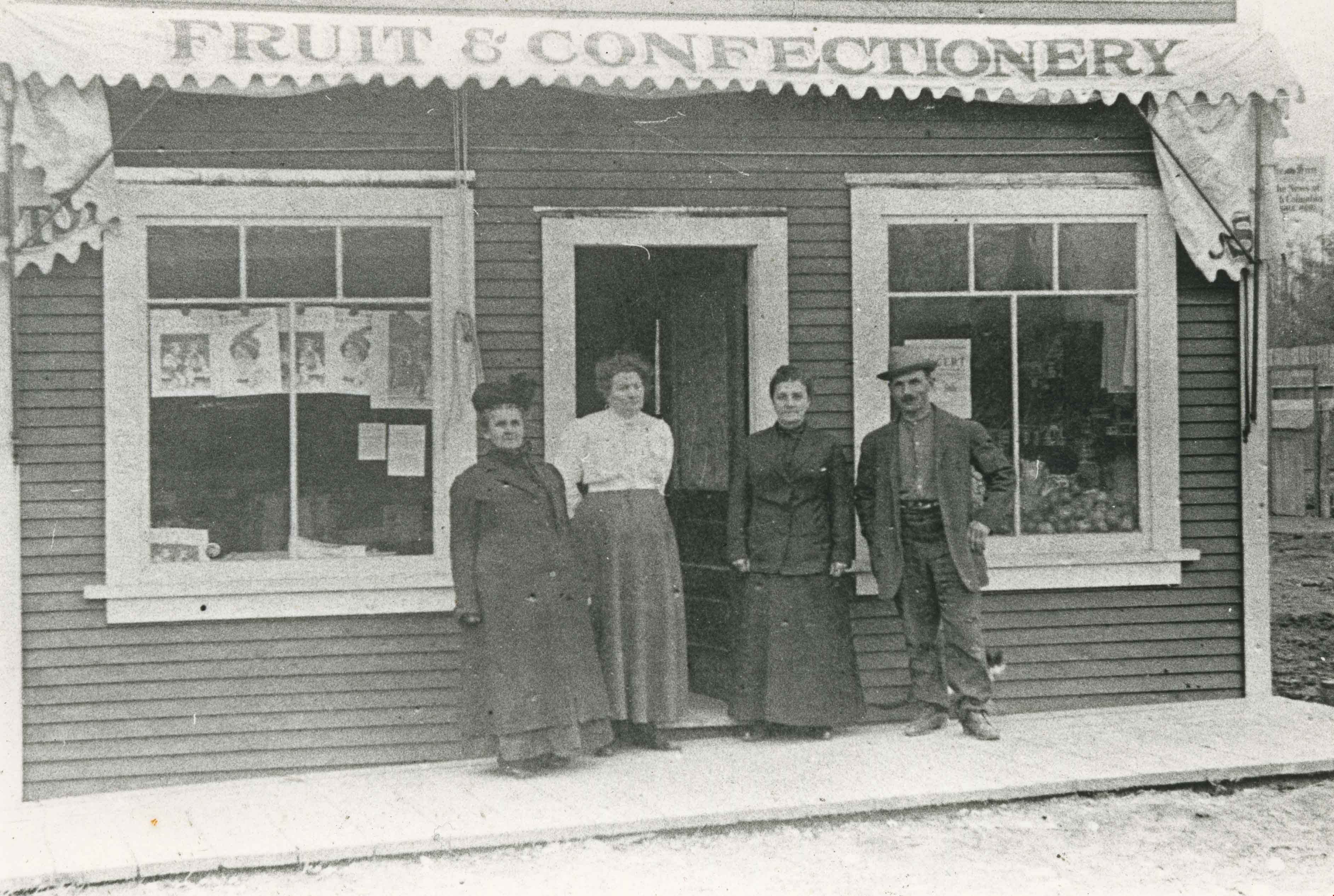
Joe Davis at his store
https://search.heritageburnaby.ca/link/archivedescription35234
- Repository
- City of Burnaby Archives
- Date
- 1912 (date of original), copied 1986
- Collection/Fonds
- Burnaby Historical Society fonds
- Description Level
- Item
- Physical Description
- 1 photograph : b&w ; 12.7 x 17.8 cm print
- Scope and Content
- Photograph of Joseph "Joe" Davis and three women standing outside his Fruit and Confectionary store on Royal Oak Avenue located adjacent to the Royal Oak station on the Central Park Interurban tram line.
- Repository
- City of Burnaby Archives
- Date
- 1912 (date of original), copied 1986
- Collection/Fonds
- Burnaby Historical Society fonds
- Subseries
- Pioneer Tales subseries
- Physical Description
- 1 photograph : b&w ; 12.7 x 17.8 cm print
- Description Level
- Item
- Record No.
- 204-091
- Access Restriction
- No restrictions
- Reproduction Restriction
- No known restrictions
- Accession Number
- BHS1988-03
- Scope and Content
- Photograph of Joseph "Joe" Davis and three women standing outside his Fruit and Confectionary store on Royal Oak Avenue located adjacent to the Royal Oak station on the Central Park Interurban tram line.
- Subjects
- Buildings - Commercial - Stores
- Names
- Davis, Joseph "Joe"
- Media Type
- Photograph
- Notes
- Title based on contents of photograph
- Geographic Access
- Royal Oak Avenue
- Street Address
- 6929 Royal Oak Avenue
- Historic Neighbourhood
- Central Park (Historic Neighbourhood)
- Planning Study Area
- Marlborough Area
Images
Kingsway and Edmonds Street
https://search.heritageburnaby.ca/link/archivedescription35913
- Repository
- City of Burnaby Archives
- Date
- 1914 (date of original), copied 1986
- Collection/Fonds
- Burnaby Historical Society fonds
- Description Level
- Item
- Physical Description
- 1 photograph : b&w ; 12.7 x 17.8 cm print
- Scope and Content
- Photograph of a triangular block at Edmonds Street and Kingsway, housing P.B. Brown real estate, a printing works, Edmonds Drug Store, a soda fountain, and doctors' offices.
- Repository
- City of Burnaby Archives
- Date
- 1914 (date of original), copied 1986
- Collection/Fonds
- Burnaby Historical Society fonds
- Subseries
- Pioneer Tales subseries
- Physical Description
- 1 photograph : b&w ; 12.7 x 17.8 cm print
- Description Level
- Item
- Record No.
- 204-772
- Access Restriction
- No restrictions
- Reproduction Restriction
- No known restrictions
- Accession Number
- BHS1988-03
- Scope and Content
- Photograph of a triangular block at Edmonds Street and Kingsway, housing P.B. Brown real estate, a printing works, Edmonds Drug Store, a soda fountain, and doctors' offices.
- Subjects
- Buildings - Commercial - Stores
- Media Type
- Photograph
- Notes
- Title based on contents of photograph
- Geographic Access
- Kingsway
- Street Address
- 7338 Kingsway
- Historic Neighbourhood
- Edmonds (Historic Neighbourhood)
- Planning Study Area
- Edmonds Area
Images

Lyle Le Grove
https://search.heritageburnaby.ca/link/archivedescription38044
- Repository
- City of Burnaby Archives
- Date
- 1915 (date of original), copied 1991
- Collection/Fonds
- Burnaby Historical Society fonds
- Description Level
- Item
- Physical Description
- 1 photograph : b&w ; 3.6 x 3.5 cm print on contact sheet 21.5 x 26.8 cm
- Scope and Content
- Photograph of Lyle Le Grove at 3250 Neville Street (later renumbered 5422 Neville Street). The Sam Bickerton boot repair business is in the background.
- Repository
- City of Burnaby Archives
- Date
- 1915 (date of original), copied 1991
- Collection/Fonds
- Burnaby Historical Society fonds
- Subseries
- Burnaby Image Bank subseries
- Physical Description
- 1 photograph : b&w ; 3.6 x 3.5 cm print on contact sheet 21.5 x 26.8 cm
- Description Level
- Item
- Record No.
- 370-631
- Access Restriction
- No restrictions
- Reproduction Restriction
- No known restrictions
- Accession Number
- BHS1999-03
- Scope and Content
- Photograph of Lyle Le Grove at 3250 Neville Street (later renumbered 5422 Neville Street). The Sam Bickerton boot repair business is in the background.
- Subjects
- Buildings - Commercial - Stores
- Media Type
- Photograph
- Notes
- Title based on contents of photograph
- 1 b&w copy negative accompanying
- Negative has a pink cast
- Geographic Access
- Neville Street
- Street Address
- 5422 Neville Street
- Historic Neighbourhood
- Alta-Vista (Historic Neighbourhood)
- Planning Study Area
- Clinton-Glenwood Area
Images
Lyle Le Grove
https://search.heritageburnaby.ca/link/archivedescription38045
- Repository
- City of Burnaby Archives
- Date
- 1915 (date of original), copied 1991
- Collection/Fonds
- Burnaby Historical Society fonds
- Description Level
- Item
- Physical Description
- 1 photograph : b&w ; 3.6 x 3.5 cm print on contact sheet 21.5 x 26.8 cm
- Scope and Content
- Photograph of Lyle Le Grove at 3250 Neville Street (later renumbered 5422 Neville Street). The Sam Bickerton boot repair business is in the background.
- Repository
- City of Burnaby Archives
- Date
- 1915 (date of original), copied 1991
- Collection/Fonds
- Burnaby Historical Society fonds
- Subseries
- Burnaby Image Bank subseries
- Physical Description
- 1 photograph : b&w ; 3.6 x 3.5 cm print on contact sheet 21.5 x 26.8 cm
- Description Level
- Item
- Record No.
- 370-632
- Access Restriction
- No restrictions
- Reproduction Restriction
- No known restrictions
- Accession Number
- BHS1999-03
- Scope and Content
- Photograph of Lyle Le Grove at 3250 Neville Street (later renumbered 5422 Neville Street). The Sam Bickerton boot repair business is in the background.
- Subjects
- Buildings - Commercial - Stores
- Media Type
- Photograph
- Notes
- Title based on contents of photograph
- 1 b&w copy negative accompanying
- Negative has a pink cast
- Geographic Access
- Neville Street
- Street Address
- 5422 Neville Street
- Historic Neighbourhood
- Alta-Vista (Historic Neighbourhood)
- Planning Study Area
- Clinton-Glenwood Area
Images
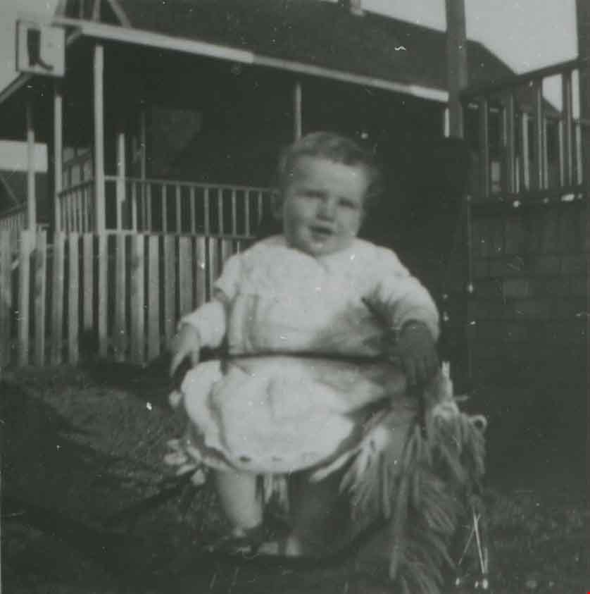

Andy Johnson's "Glenedward"
https://search.heritageburnaby.ca/link/archivedescription35046
- Repository
- City of Burnaby Archives
- Date
- 1912 (date of original), copied 1986
- Collection/Fonds
- Burnaby Historical Society fonds
- Description Level
- Item
- Physical Description
- 1 photograph : b&w copy print ; 8.7 x 12.7 cm + copy negative
- Scope and Content
- Photograph of the exterior of Andrew M. Johnson's house "Glenedward," at 5152 Kingsway. Two men and two boys are outside the house, with the youngest boy is seated in a toy car. A low stone wall is surrounding the yard.
- Repository
- City of Burnaby Archives
- Date
- 1912 (date of original), copied 1986
- Collection/Fonds
- Burnaby Historical Society fonds
- Subseries
- Photographs subseries
- Physical Description
- 1 photograph : b&w copy print ; 8.7 x 12.7 cm + copy negative
- Description Level
- Item
- Record No.
- 181-001
- Access Restriction
- No restrictions
- Reproduction Restriction
- No known restrictions
- Accession Number
- BHS1986-29
- Scope and Content
- Photograph of the exterior of Andrew M. Johnson's house "Glenedward," at 5152 Kingsway. Two men and two boys are outside the house, with the youngest boy is seated in a toy car. A low stone wall is surrounding the yard.
- Media Type
- Photograph
- Notes
- Title based on contents of photograph
- Geographic Access
- Kingsway
- Street Address
- 5152 Kingsway
- Historic Neighbourhood
- Central Park (Historic Neighbourhood)
- Planning Study Area
- Marlborough Area
Images

![Carnarvon Street Building, [1912] thumbnail](/media/hpo/_Data/_Archives_Images/_Unrestricted/477/477-939.jpg?width=280)
Carnarvon Street Building
https://search.heritageburnaby.ca/link/archivedescription66213
- Repository
- City of Burnaby Archives
- Date
- [1912]
- Collection/Fonds
- Peers Family and Hill Family fonds
- Description Level
- Item
- Physical Description
- 1 photograph : sepia ; 19.5 x 24 cm
- Scope and Content
- Photograph of the Carnarvon Street building in New Westminster, built by Claude Hill and E. B. Wetenhall (architect). Three cars can be seen on the street, one with two unidentified men seated inside. A note on the back of the photograph indicates that the building in the background is the New We…
- Repository
- City of Burnaby Archives
- Date
- [1912]
- Collection/Fonds
- Peers Family and Hill Family fonds
- Physical Description
- 1 photograph : sepia ; 19.5 x 24 cm
- Description Level
- Item
- Record No.
- 477-939
- Access Restriction
- No restrictions
- Reproduction Restriction
- No known restrictions
- Accession Number
- 2007-12
- Scope and Content
- Photograph of the Carnarvon Street building in New Westminster, built by Claude Hill and E. B. Wetenhall (architect). Three cars can be seen on the street, one with two unidentified men seated inside. A note on the back of the photograph indicates that the building in the background is the New Westminster Opera House and a sign on the building in the foreground reads "Ford Cars - Fraser Valley Motor Co. Limited."
- Subjects
- Transportation - Automobiles
- Buildings - Commercial
- Buildings - Commercial - Automobile Dealerships
- Media Type
- Photograph
- Notes
- Title based on contents of photograph
- Note on verso reads: "Carnarvon St. Bldg. / built by L.C. Hill & EB Wetenhall (architect) / old New Westminster Opera House / r. background - / app. 1912 -"
Images
![Carnarvon Street Building, [1912] thumbnail](/media/hpo/_Data/_Archives_Images/_Unrestricted/477/477-939.jpg)
Interview with Toki Miyashita by Rod Fowler February 27, 1990 - Track 1
https://search.heritageburnaby.ca/link/oralhistory516
- Repository
- City of Burnaby Archives
- Date Range
- 1900-1946
- Length
- 00:07:05
- Summary
- This portion of the interview is about Toki Miyashita’s family’s internment during WWII, and her Oikawa grandparent’s immigration to BC and settlement on Lion and Don Islands at the mouth of the Fraser River. She describes how the family was moved to the internment camp “The Orchard” in New Denver,…
- Repository
- City of Burnaby Archives
- Summary
- This portion of the interview is about Toki Miyashita’s family’s internment during WWII, and her Oikawa grandparent’s immigration to BC and settlement on Lion and Don Islands at the mouth of the Fraser River. She describes how the family was moved to the internment camp “The Orchard” in New Denver, but managed to find a place to live outside the camp where her grandmother grew a large garden from seeds brought in the seams of her clothing. She notes that the Lion Islands were named Oikawa-shima by the Japanese settlers.
- Date Range
- 1900-1946
- Length
- 00:07:05
- Interviewer
- Fowler, Rod
- Interview Date
- February 27, 1990
- Scope and Content
- Recording is of an interview with Toki Miyashita, conducted by Rod Fowler. Toki Miyashita was one of eleven participants interviewed as part of the SFU/Burnaby Centennial Committee's oral history series titled, "Voices of Burnaby". The interview is about Toki Miyashita’s family’s internment during WWII, her awakening interest in Japanese culture after the war, her subsequent interest in teaching others about Japanese crafts and arts, and becoming a helpful intermediary between Burnaby and visitors from Japan. The interview explores her interest in the Ainu of Japan and their possible link to the aboriginals of BC, her impressions of the Ainu carver Nuburi Toko, and her involvement in the events surrounding the creation of the sculpture “Playground of the Gods” for Burnaby Mountain. The interview also contains interesting details about the art of Japanese flower-arranging. To view “Narrow By” terms for each track expand this description and see “Notes”.
- Biographical Notes
- Toki Miyashita was born in Richmond B.C., ca. 1935, at the Nelson Brothers “fishery”, a second generation Canadian descended from the Oikawa family who settled on Don and Lion Islands (Oikawa-shima). In 1942 the Japanese Canadians in BC were forcibly moved from the coast and their belongings confiscated. Toki Miyashita, her parents, two brothers, and grandparents were first taken to Hastings Park where her father was separated from the family to work in road camps, and the rest of the family were interned in New Denver. Her resourceful grandmother moved the family to land outside the internment camp, growing a large garden from seeds brought with her. In 1946 the family moved to Kamloops and in 1958, after finishing high school, Toki Miyashita moved to Montreal to be with relatives and a small Japanese community. At this time she became interested in Japanese culture and took a Japanese language course at age 22. She learned about Japanese flower-arranging (Ikebana), paper folding (Origami), silk doll making (from a Russian Jew), and how to wear a kimono. She began demonstrating these arts in schools and to other groups, which she continued doing when she, her husband and two young children moved to Burnaby in 1969. Toki Miyashita has been called an unpaid “ambassador” of Japanese culture to the Lower Mainland. She has acted as liaison between Burnaby and her sister city Kushiro in Japan, which involved her in the creation of the Ainu sculpture “Playground of the Gods” on Burnaby Mountain for Burnaby’s Centennial. Toki Miyashita is a recognized Master in Ikebana Sogetsu, a school of flower-arranging, and has served on the board of the Vancouver Ikebana Association. She also served on Burnaby’s Family Court in the 1980s.
- Total Tracks
- 11
- Total Length
- 01:34:10
- Interviewee Name
- Miyashita, Toki
- Interviewer Bio
- Rod Fowler returned to university as a mature student in the 1980s after working about twenty years in the field of economics and computerization in business in England, Europe and Western Canada. He graduated with a BA from SFU in both History and Sociology in 1987, his MA degree in Geography in 1989, and his PhD in Cultural Geography at SFU. He taught courses in Geography, Sociology, History and Canadian Studies at several Lower Mainland colleges, before becoming a full time member of the Geography Department at Kwantlen University College.
- Collection/Fonds
- SFU/Burnaby Centennial Committee fonds
- Transcript Available
- Transcript available
- Media Type
- Sound Recording
- Web Notes
- Interviews were digitized in 2015 allowing them to be accessible on Heritage Burnaby. The digitization project was initiated by the Community Heritage Commission with support from City of Burnaby Council.
Audio Tracks
Track one of interview with Toki Miyashita
Track one of interview with Toki Miyashita
https://search.heritageburnaby.ca/media/hpo/_Data/_Archives_Oral_Histories/_Unrestricted/MSS187-017/MSS187-017_Track_1.mp3
Boundary Road and Hastings Street vicinity
https://search.heritageburnaby.ca/link/archivedescription35447
- Repository
- City of Burnaby Archives
- Date
- 1915 (date of original), copied 1986
- Collection/Fonds
- Burnaby Historical Society fonds
- Description Level
- Item
- Physical Description
- 1 photograph : b&w ; 12.7 x 17.8 cm print
- Scope and Content
- Photograph taken in Vancouver on Hastings Street looking east toward Burnaby and Boundary Road. The Hastings Street British Columbia Electric Railway (BCER) cars can be seen labouring up the hill.
- Repository
- City of Burnaby Archives
- Date
- 1915 (date of original), copied 1986
- Collection/Fonds
- Burnaby Historical Society fonds
- Subseries
- Pioneer Tales subseries
- Physical Description
- 1 photograph : b&w ; 12.7 x 17.8 cm print
- Description Level
- Item
- Record No.
- 204-305
- Access Restriction
- No restrictions
- Reproduction Restriction
- No restrictions
- Accession Number
- BHS1988-03
- Scope and Content
- Photograph taken in Vancouver on Hastings Street looking east toward Burnaby and Boundary Road. The Hastings Street British Columbia Electric Railway (BCER) cars can be seen labouring up the hill.
- Media Type
- Photograph
- Photographer
- Eaton, Dr. Carl
- Notes
- Title based on contents of photograph
- Geographic Access
- Boundary Road
- Hastings Street
- Historic Neighbourhood
- Vancouver Heights (Historic Neighbourhood)
- Planning Study Area
- Willingdon Heights Area
Images
