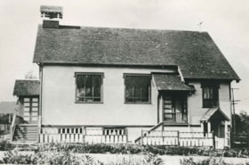
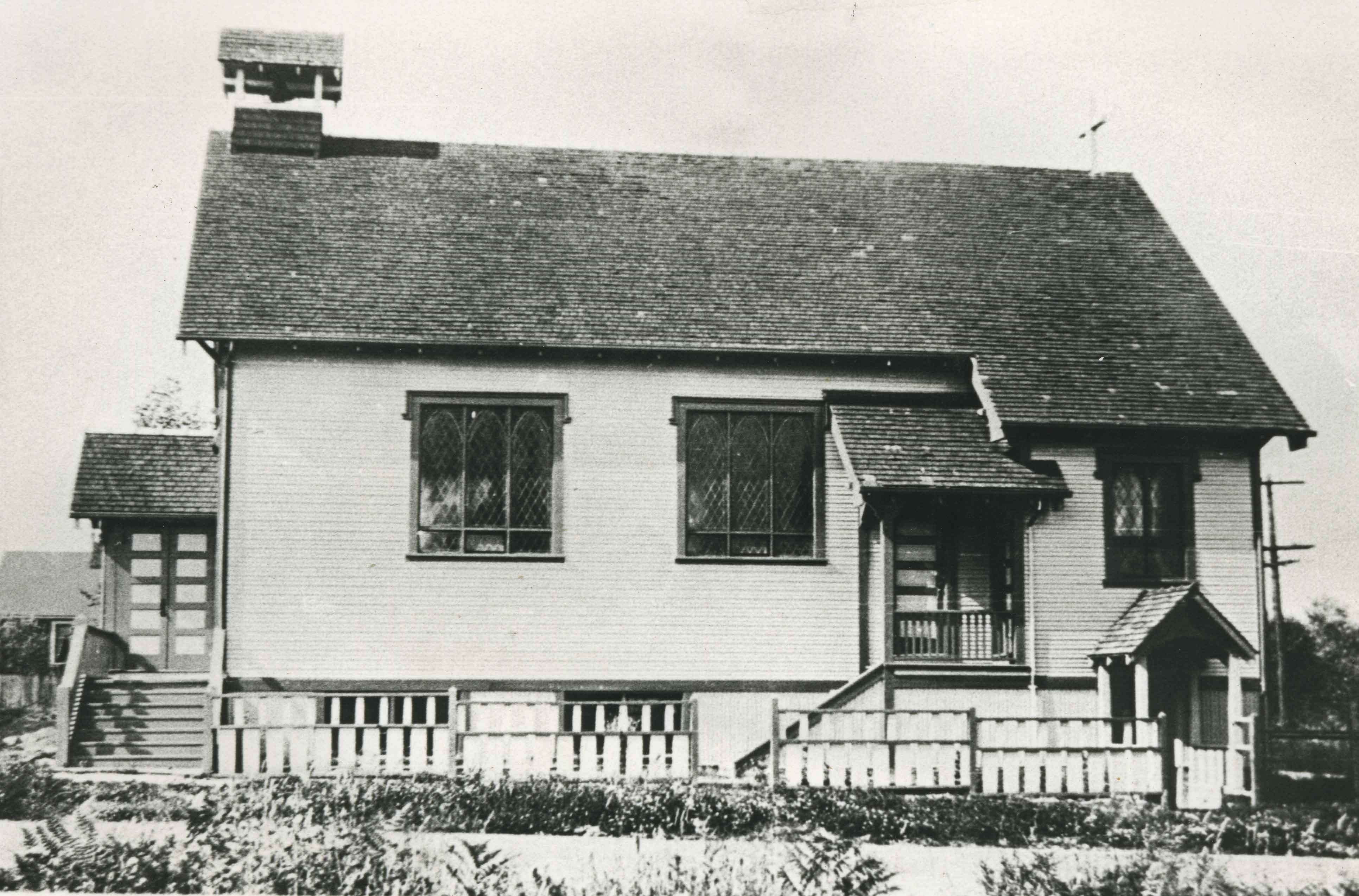
More like 'Jubilee Methodist Church'
Narrow Results By
Decade
- 2020s 87
- 2010s 41
- 2000s 491
- 1990s 401
- 1980s 387
- 1970s 803
- 1960s 316
- 1950s 476
- 1940s 489
- 1930s 393
- 1920s 439
- 1910s
- 1900s 209
- 1890s 39
- 1880s 56
- 1870s 5
- 1860s 3
- 1850s 3
- 1840s 1
- 1830s 2
- 1820s 1
- 1810s 1
- 1800s 1
- 1790s 1
- 1780s 1
- 1770s 1
- 1760s 1
- 1750s 1
- 1740s 1
- 1730s 1
- 1720s 1
- 1710s 1
- 1700s 1
- 1690s 1
- 1680s 1
- 1670s 1
- 1660s 1
- 1650s 1
- 1640s 1
- 1630s 1
- 1620s 1
- 1610s 1
- 1600s 1
Creator
- Barrowclough, G.A. 1
- BC Photo Card Company 1
- Brown, W. 1
- Burnaby Village Museum 4
- Burnett and McGugan B.C. Land Surveyors, New Westminster 5
- Burnett, Geoffrey K. 3
- Burnett & McGugan, Engineers and Surveyors 22
- Canadian Photo Company 14
- Challoner-Courtenay, E.J. 2
- Chambers, Robert W. (Robert William), 1865-1933 1
- Coburn, Frederick Simpson, 1871-1960 1
- Dean, H.M. 9
![Woman standing outside a Grocery Store, [191-?] thumbnail](/media/hpo/_Data/_BVM_Images/1984/1984_0051_0054_001.jpg?width=280)
Woman standing outside a Grocery Store
https://search.heritageburnaby.ca/link/museumdescription270
- Repository
- Burnaby Village Museum
- Date
- [191-?]
- Collection/Fonds
- Burnaby Village Museum Photograph collection
- Description Level
- Item
- Physical Description
- 1 photograph : b&w postcard ; 9.1 x 13.9 cm
- Scope and Content
- Photographic postcard of an unidentified woman standing outside a grocery store. The store is a unit on the ground level of a brick building, behind which another building is visible. The display window includes stacks of canned goods, and advertisements for Rowntree's Cocoa, butter and margarine.…
- Repository
- Burnaby Village Museum
- Collection/Fonds
- Burnaby Village Museum Photograph collection
- Description Level
- Item
- Physical Description
- 1 photograph : b&w postcard ; 9.1 x 13.9 cm
- Scope and Content
- Photographic postcard of an unidentified woman standing outside a grocery store. The store is a unit on the ground level of a brick building, behind which another building is visible. The display window includes stacks of canned goods, and advertisements for Rowntree's Cocoa, butter and margarine. The sign on top of the display window was partially blocked by putting something over the area while printing the photograph. It reads, "Family Grocer [blocked letters] & Corn Dealer."
- Subjects
- Buildings - Commercial - Grocery Stores
- Advertising Medium - Signs and Signboards
- Documentary Artifacts - Postcards
- Accession Code
- HV984.51.54
- Access Restriction
- No restrictions
- Reproduction Restriction
- No known restrictions
- Date
- [191-?]
- Media Type
- Photograph
- Scan Resolution
- 600
- Scan Date
- 2023-10-31
- Notes
- Title based on contents of photograph
Images
![Woman standing outside a Grocery Store, [191-?] thumbnail](/media/hpo/_Data/_BVM_Images/1984/1984_0051_0054_001.jpg)
![All Saints Church, [ca.1910] thumbnail](/media/hpo/_Data/_BVM_Cartographic_Material/2003/2003_0083_0046_001.jpg?width=280)
All Saints Church
https://search.heritageburnaby.ca/link/museumdescription11924
- Repository
- Burnaby Village Museum
- Date
- [ca.1910]
- Collection/Fonds
- Ronald G. Scobbie collection
- Description Level
- Item
- Physical Description
- 1 plan : black ink and watercol. on paper ; 30.45 x 30.5 cm
- Scope and Content
- Item consists of building insurance plan of "All Saints Church / Lot "A" BK 29 DL 98 GP1 N.W.D.". Watling Street is idenfied to the north of the church building and Royal Oak Avenue to the west.
- Repository
- Burnaby Village Museum
- Collection/Fonds
- Ronald G. Scobbie collection
- Description Level
- Item
- Physical Description
- 1 plan : black ink and watercol. on paper ; 30.45 x 30.5 cm
- Material Details
- Scale 1 inch = 20 feet
- Scope and Content
- Item consists of building insurance plan of "All Saints Church / Lot "A" BK 29 DL 98 GP1 N.W.D.". Watling Street is idenfied to the north of the church building and Royal Oak Avenue to the west.
- Subjects
- Buildings - Religious - Churches
- Accession Code
- BV003.83.46
- Access Restriction
- No restrictions
- Reproduction Restriction
- No known restrictions
- Date
- [ca.1910]
- Media Type
- Cartographic Material
- Scan Resolution
- 600
- Scan Date
- 15-Jan-2021
- Scale
- 100
- Notes
- Transcribed title
- Note in pencil on verso reads: ""All Saints Church / Lot "A" BK 29 DL 98 / Scale 1 inch = 20 feet"
- Note in balck in on verso reads: "3704"
Images
![All Saints Church, [ca.1910] thumbnail](/media/hpo/_Data/_BVM_Cartographic_Material/2003/2003_0083_0046_001.jpg)
![Anglican Church, [ca.1910] thumbnail](/media/hpo/_Data/_BVM_Cartographic_Material/2003/2003_0083_0043_001.jpg?width=280)
Anglican Church
https://search.heritageburnaby.ca/link/museumdescription11921
- Repository
- Burnaby Village Museum
- Date
- [ca.1910]
- Collection/Fonds
- Ronald G. Scobbie collection
- Description Level
- Item
- Physical Description
- 1 plan : black ink and watercol. on paper ; 30.45 x 30.5 cm
- Scope and Content
- Item consists of building insurance plan of "Anglican Church / Lot 2 BK 37 DL69, GP.1, N.W.D. (15th Ave. (Dominion) is identified to the north of Lots 1, 2 and 3).
- Repository
- Burnaby Village Museum
- Collection/Fonds
- Ronald G. Scobbie collection
- Description Level
- Item
- Physical Description
- 1 plan : black ink and watercol. on paper ; 30.45 x 30.5 cm
- Material Details
- Scale 1 inch = 20 feet
- Scope and Content
- Item consists of building insurance plan of "Anglican Church / Lot 2 BK 37 DL69, GP.1, N.W.D. (15th Ave. (Dominion) is identified to the north of Lots 1, 2 and 3).
- Subjects
- Buildings - Religious - Churches
- Accession Code
- BV003.83.43
- Access Restriction
- No restrictions
- Reproduction Restriction
- No known restrictions
- Date
- [ca.1910]
- Media Type
- Cartographic Material
- Scan Resolution
- 600
- Scan Date
- 15-Jan-2021
- Scale
- 100
- Notes
- Transcribed title
- Note in pencil on verso reads: "Anglican Church / Lot 2 Bk 37 DL69 / 1"=20' "
- Note in balck in on verso reads: "3704"
Images
![Anglican Church, [ca.1910] thumbnail](/media/hpo/_Data/_BVM_Cartographic_Material/2003/2003_0083_0043_001.jpg)
![Broadview Presbyterian Church, [ca.1910] thumbnail](/media/hpo/_Data/_BVM_Cartographic_Material/2003/2003_0083_0049_001.jpg?width=280)
Broadview Presbyterian Church
https://search.heritageburnaby.ca/link/museumdescription11927
- Repository
- Burnaby Village Museum
- Date
- [ca.1910]
- Collection/Fonds
- Ronald G. Scobbie collection
- Description Level
- Item
- Physical Description
- 1 plan : black ink and watercol. on paper ; 30.45 x 30.5 cm
- Scope and Content
- Item consists of building insurance plan of "Broadview Presbyterian Church / Lot 6, BK 31, DL 69 / GP1 N.W.D." . Fourteenth Avenue (Manor) is identified to the north and Douglas Ave. to the east.
- Repository
- Burnaby Village Museum
- Collection/Fonds
- Ronald G. Scobbie collection
- Description Level
- Item
- Physical Description
- 1 plan : black ink and watercol. on paper ; 30.45 x 30.5 cm
- Material Details
- Scale 1 inch = 20 feet
- Scope and Content
- Item consists of building insurance plan of "Broadview Presbyterian Church / Lot 6, BK 31, DL 69 / GP1 N.W.D." . Fourteenth Avenue (Manor) is identified to the north and Douglas Ave. to the east.
- Subjects
- Buildings - Religious - Churches
- Accession Code
- BV003.83.49
- Access Restriction
- No restrictions
- Reproduction Restriction
- No known restrictions
- Date
- [ca.1910]
- Media Type
- Cartographic Material
- Scan Resolution
- 600
- Scan Date
- 15-Jan-2021
- Scale
- 100
- Notes
- Transcribed title
- Note in pencil on verso reads: "Broadview Presbyterian Church / Lot 6, BK 31, DL 69 / 1" = 20' "
- Note in balck in on verso reads: "3704"
Images
![Broadview Presbyterian Church, [ca.1910] thumbnail](/media/hpo/_Data/_BVM_Cartographic_Material/2003/2003_0083_0049_001.jpg)

Central Park Presbyterian Church
https://search.heritageburnaby.ca/link/archivedescription36672
- Repository
- City of Burnaby Archives
- Date
- 1912 (date of original), copied 1992
- Collection/Fonds
- Burnaby Historical Society fonds
- Description Level
- Item
- Physical Description
- 1 photograph : b&w ; 10.1 x 14.9 cm print
- Scope and Content
- Photograph of Central Park Presbyterian Church and the surrounding area. The church was located on Westminster Road (later Kingsway) across from Central Park.
- Repository
- City of Burnaby Archives
- Date
- 1912 (date of original), copied 1992
- Collection/Fonds
- Burnaby Historical Society fonds
- Subseries
- Burnaby Centennial Anthology subseries
- Physical Description
- 1 photograph : b&w ; 10.1 x 14.9 cm print
- Description Level
- Item
- Record No.
- 315-027
- Access Restriction
- No restrictions
- Reproduction Restriction
- No known restrictions
- Accession Number
- BHS1994-04
- Scope and Content
- Photograph of Central Park Presbyterian Church and the surrounding area. The church was located on Westminster Road (later Kingsway) across from Central Park.
- Media Type
- Photograph
- Geographic Access
- Westminster Avenue
- Kingsway
- Street Address
- 3777 Kingsway
- Historic Neighbourhood
- Central Park (Historic Neighbourhood)
- Planning Study Area
- Garden Village Area
Images

![Church building, [1910] thumbnail](/media/hpo/_Data/_BVM_Images/1973/1973_0110_0056_001.jpg?width=280)
Church building
https://search.heritageburnaby.ca/link/museumdescription1042
- Repository
- Burnaby Village Museum
- Date
- [1910]
- Collection/Fonds
- Burnaby Village Museum Photograph collection
- Description Level
- Item
- Physical Description
- 1 photograph : sepia
- Scope and Content
- Photograph of an unidentified church building. The inscription indicates that the building is in Los Gates, California.
- Repository
- Burnaby Village Museum
- Collection/Fonds
- Burnaby Village Museum Photograph collection
- Description Level
- Item
- Physical Description
- 1 photograph : sepia
- Material Details
- inscribed in pencil, verso, t. "Oha/ In Los Gates/ California"
- Scope and Content
- Photograph of an unidentified church building. The inscription indicates that the building is in Los Gates, California.
- Subjects
- Buildings - Religious - Churches
- Accession Code
- HV973.110.56
- Access Restriction
- No restrictions
- Reproduction Restriction
- No known restrictions
- Date
- [1910]
- Media Type
- Photograph
- Scan Resolution
- 600
- Scan Date
- 2023-05-30
- Notes
- Title based on contents of photograph
Images
![Church building, [1910] thumbnail](/media/hpo/_Data/_BVM_Images/1973/1973_0110_0056_001.jpg)
![Dundonald United Church, [between 1911 and 1919] thumbnail](/media/hpo/_Data/_Archives_Images/_Unrestricted/316/325-022.jpg?width=280)
Dundonald United Church
https://search.heritageburnaby.ca/link/archivedescription37150
- Repository
- City of Burnaby Archives
- Date
- [between 1911 and 1919]
- Collection/Fonds
- Burnaby Historical Society fonds
- Description Level
- Item
- Physical Description
- 1 photograph : b&w ; 8.5 x 12.5 cm print
- Scope and Content
- Photograph of Dundonald United Church, taken from the school grounds of Riverway East (later renamed Dundonald School).
- Repository
- City of Burnaby Archives
- Date
- [between 1911 and 1919]
- Collection/Fonds
- Burnaby Historical Society fonds
- Subseries
- Disney family subseries
- Physical Description
- 1 photograph : b&w ; 8.5 x 12.5 cm print
- Description Level
- Item
- Record No.
- 325-022
- Access Restriction
- No restrictions
- Reproduction Restriction
- No known restrictions
- Accession Number
- BHS1996-04
- Scope and Content
- Photograph of Dundonald United Church, taken from the school grounds of Riverway East (later renamed Dundonald School).
- Subjects
- Buildings - Religious - Churches
- Media Type
- Photograph
- Photographer
- Disney, John Harold "Jack"
- Notes
- Title based on contents of photograph
- Geographic Access
- Marine Drive
- Clinton Street
- Gilley Avenue
- Curragh Avenue
- Historic Neighbourhood
- Alta-Vista (Historic Neighbourhood)
- Planning Study Area
- Clinton-Glenwood Area
Images
![Dundonald United Church, [between 1911 and 1919] thumbnail](/media/hpo/_Data/_Archives_Images/_Unrestricted/316/325-022.jpg)
![Dundonald United Church, [ca.1910] thumbnail](/media/hpo/_Data/_BVM_Cartographic_Material/2003/2003_0083_0052_001.jpg?width=280)
Dundonald United Church
https://search.heritageburnaby.ca/link/museumdescription11930
- Repository
- Burnaby Village Museum
- Date
- [ca.1910]
- Collection/Fonds
- Ronald G. Scobbie collection
- Description Level
- Item
- Physical Description
- 1 plan : black ink and watercol. on paper ; 30.45 x 30.5 cm
- Scope and Content
- Item consists of a building insurance plan of "Dundonald United Church / Lots 9, 10 BK 28 DL 159 GP 1 / N.W.D.". Clinton Street is identified to the north of Lots nine and ten.
- Repository
- Burnaby Village Museum
- Collection/Fonds
- Ronald G. Scobbie collection
- Description Level
- Item
- Physical Description
- 1 plan : black ink and watercol. on paper ; 30.45 x 30.5 cm
- Material Details
- Scale 1 inch = 20 feet
- Scope and Content
- Item consists of a building insurance plan of "Dundonald United Church / Lots 9, 10 BK 28 DL 159 GP 1 / N.W.D.". Clinton Street is identified to the north of Lots nine and ten.
- Subjects
- Buildings - Religious - Churches
- Names
- Dundonald United Church
- Accession Code
- BV003.83.52
- Access Restriction
- No restrictions
- Reproduction Restriction
- No known restrictions
- Date
- [ca.1910]
- Media Type
- Cartographic Material
- Scan Resolution
- 600
- Scan Date
- 15-Jan-2021
- Scale
- 100
- Notes
- Transcribed title
- Note in pencil on verso reads: "_ _Church / Lots 9 & 10 BK 28 DL 159 / 1" = 20' "
- Note in black ink on verso reads: "3704"
Images
![Dundonald United Church, [ca.1910] thumbnail](/media/hpo/_Data/_BVM_Cartographic_Material/2003/2003_0083_0052_001.jpg)
![Gordon Presbyterian Church, [ca.1912] thumbnail](/media/hpo/_Data/_BVM_Cartographic_Material/2003/2003_0083_0045_001.jpg?width=280)
Gordon Presbyterian Church
https://search.heritageburnaby.ca/link/museumdescription11923
- Repository
- Burnaby Village Museum
- Date
- [ca.1912]
- Collection/Fonds
- Ronald G. Scobbie collection
- Description Level
- Item
- Physical Description
- 1 plan : black ink and watercol. on paper ; 30.45 x 30.5 cm
- Scope and Content
- Item consists of building insurance plan of "Gordon Presbyterian Church / Blocks 1-2 BK 7 DL 30 GP1 N.W.D.". Arbutus Street is identified to the north of Lots 1, 2, & 3 and Humphries Avenue to the east.
- Repository
- Burnaby Village Museum
- Collection/Fonds
- Ronald G. Scobbie collection
- Description Level
- Item
- Physical Description
- 1 plan : black ink and watercol. on paper ; 30.45 x 30.5 cm
- Material Details
- Scale 1 inch = 20 feet
- Scope and Content
- Item consists of building insurance plan of "Gordon Presbyterian Church / Blocks 1-2 BK 7 DL 30 GP1 N.W.D.". Arbutus Street is identified to the north of Lots 1, 2, & 3 and Humphries Avenue to the east.
- Subjects
- Buildings - Religious - Churches
- Accession Code
- BV003.83.45
- Access Restriction
- No restrictions
- Reproduction Restriction
- No known restrictions
- Date
- [ca.1912]
- Media Type
- Cartographic Material
- Scan Resolution
- 600
- Scan Date
- 15-Jan-2021
- Scale
- 100
- Notes
- Transcribed title
- Note in pencil on verso reads: "Gordon Presbyterian Church / Blocks 1-2 BK 7 DL 30 / Scale 1 inch = 20 feet" "Total area Lot 1 / Portion exempted / Total area Lot 2 / Portion exempted"
- Note in balck in on verso reads: "3704"
Images
![Gordon Presbyterian Church, [ca.1912] thumbnail](/media/hpo/_Data/_BVM_Cartographic_Material/2003/2003_0083_0045_001.jpg)
![St. Albans Church and Rectory, [between 1911 and 1919] thumbnail](/media/hpo/_Data/_Archives_Images/_Unrestricted/316/325-013.jpg?width=280)
St. Albans Church and Rectory
https://search.heritageburnaby.ca/link/archivedescription37141
- Repository
- City of Burnaby Archives
- Date
- [between 1911 and 1919]
- Collection/Fonds
- Burnaby Historical Society fonds
- Description Level
- Item
- Physical Description
- 1 photograph : b&w ; 8 x 12.5 cm print
- Scope and Content
- Photograph of St. Albans Church and Rectory on Douglas Road (at Canada Way and Edmonds).
- Repository
- City of Burnaby Archives
- Date
- [between 1911 and 1919]
- Collection/Fonds
- Burnaby Historical Society fonds
- Subseries
- Disney family subseries
- Physical Description
- 1 photograph : b&w ; 8 x 12.5 cm print
- Description Level
- Item
- Record No.
- 325-013
- Access Restriction
- No restrictions
- Reproduction Restriction
- No known restrictions
- Accession Number
- BHS1996-04
- Scope and Content
- Photograph of St. Albans Church and Rectory on Douglas Road (at Canada Way and Edmonds).
- Subjects
- Buildings - Religious - Churches
- Media Type
- Photograph
- Photographer
- Disney, John Harold "Jack"
- Notes
- Title based on contents of photograph
- Geographic Access
- 19th Avenue
- Street Address
- 7717 19th Avenue
- Historic Neighbourhood
- Edmonds (Historic Neighbourhood)
- Planning Study Area
- Edmonds Area
Images
![St. Albans Church and Rectory, [between 1911 and 1919] thumbnail](/media/hpo/_Data/_Archives_Images/_Unrestricted/316/325-013.jpg)
![St. Albans the Martyr, [ca.1910] thumbnail](/media/hpo/_Data/_BVM_Cartographic_Material/2003/2003_0083_0048_001.jpg?width=280)
St. Albans the Martyr
https://search.heritageburnaby.ca/link/museumdescription11926
- Repository
- Burnaby Village Museum
- Date
- [ca.1910]
- Collection/Fonds
- Ronald G. Scobbie collection
- Description Level
- Item
- Physical Description
- 1 plan : black ink and watercol. on paper ; 30.45 x 30.5 cm
- Scope and Content
- Item consists of building insurance plan of "St. Albans the Martyr / Lots 45 & 46 North Part DL 28 / GP1 N.W.D." Edmonds Street is to the north, Douglas Road to the west and 19th Avenue to the south.
- Repository
- Burnaby Village Museum
- Collection/Fonds
- Ronald G. Scobbie collection
- Description Level
- Item
- Physical Description
- 1 plan : black ink and watercol. on paper ; 30.45 x 30.5 cm
- Material Details
- Scale 1 inch = 40 feet
- Scope and Content
- Item consists of building insurance plan of "St. Albans the Martyr / Lots 45 & 46 North Part DL 28 / GP1 N.W.D." Edmonds Street is to the north, Douglas Road to the west and 19th Avenue to the south.
- Subjects
- Buildings - Religious - Churches
- Accession Code
- BV003.83.48
- Access Restriction
- No restrictions
- Reproduction Restriction
- No known restrictions
- Date
- [ca.1910]
- Media Type
- Cartographic Material
- Scan Resolution
- 600
- Scan Date
- 15-Jan-2021
- Scale
- 100
- Notes
- Transcribed title
- Note in pencil on verso reads: "St. Albans the Martyr / Lots 45 & 46 North Part DL 28 / 1" = 40' "
- Note in balck in on verso reads: "3704"
Images
![St. Albans the Martyr, [ca.1910] thumbnail](/media/hpo/_Data/_BVM_Cartographic_Material/2003/2003_0083_0048_001.jpg)
![St. Helen's Catholic Church, [1912] (date of original), copied 1986 thumbnail](/media/hpo/_Data/_Archives_Images/_Unrestricted/204/204-288.jpg?width=280)
St. Helen's Catholic Church
https://search.heritageburnaby.ca/link/archivedescription35430
- Repository
- City of Burnaby Archives
- Date
- [1912] (date of original), copied 1986
- Collection/Fonds
- Burnaby Historical Society fonds
- Description Level
- Item
- Physical Description
- 1 photograph : b&w ; 12.7 x 17.8 cm print
- Scope and Content
- Photograph of St. Helen's Catholic Church soon after it was built at 3894 Triumph Street. Photo by Dr. Carl Eaton.
- Repository
- City of Burnaby Archives
- Date
- [1912] (date of original), copied 1986
- Collection/Fonds
- Burnaby Historical Society fonds
- Subseries
- Pioneer Tales subseries
- Physical Description
- 1 photograph : b&w ; 12.7 x 17.8 cm print
- Description Level
- Item
- Record No.
- 204-288
- Access Restriction
- No restrictions
- Reproduction Restriction
- No restrictions
- Accession Number
- BHS1988-03
- Scope and Content
- Photograph of St. Helen's Catholic Church soon after it was built at 3894 Triumph Street. Photo by Dr. Carl Eaton.
- Subjects
- Buildings - Religious - Churches
- Media Type
- Photograph
- Photographer
- Eaton, Dr. Carl
- Notes
- Title based on contents of photograph
- Geographic Access
- Triumph Street
- Street Address
- 3894 Triumph Street
- Historic Neighbourhood
- Vancouver Heights (Historic Neighbourhood)
- Planning Study Area
- Burnaby Heights Area
Images
![St. Helen's Catholic Church, [1912] (date of original), copied 1986 thumbnail](/media/hpo/_Data/_Archives_Images/_Unrestricted/204/204-288.jpg)
![St. Helen's Church, [ca.1910] thumbnail](/media/hpo/_Data/_BVM_Cartographic_Material/2003/2003_0083_0051_001.jpg?width=280)
St. Helen's Church
https://search.heritageburnaby.ca/link/museumdescription11929
- Repository
- Burnaby Village Museum
- Date
- [ca.1910]
- Collection/Fonds
- Ronald G. Scobbie collection
- Description Level
- Item
- Physical Description
- 1 plan : black ink and watercol. on paper ; 30.45 x 30.5 cm
- Scope and Content
- Item consists of building insurance plan of "St. Helen's Church / Lots 11 & 12 BK 7 DL 186 / GP1 N.W.D." . Ingleton Ave is identified to the east and Pandora St. to the south.
- Repository
- Burnaby Village Museum
- Collection/Fonds
- Ronald G. Scobbie collection
- Description Level
- Item
- Physical Description
- 1 plan : black ink and watercol. on paper ; 30.45 x 30.5 cm
- Material Details
- Scale 1 inch = 20 feet
- Scope and Content
- Item consists of building insurance plan of "St. Helen's Church / Lots 11 & 12 BK 7 DL 186 / GP1 N.W.D." . Ingleton Ave is identified to the east and Pandora St. to the south.
- Subjects
- Buildings - Religious - Churches
- Accession Code
- BV003.83.51
- Access Restriction
- No restrictions
- Reproduction Restriction
- No known restrictions
- Date
- [ca.1910]
- Media Type
- Cartographic Material
- Scan Resolution
- 600
- Scan Date
- 15-Jan-2021
- Scale
- 100
- Notes
- Transcribed title
- Note in pencil on verso reads: ""St. Helen's Church / Lots 11 & 12 BK 7 DL 186 / 1" = 20' "
- Note in balck in on verso reads: "3704"
Images
![St. Helen's Church, [ca.1910] thumbnail](/media/hpo/_Data/_BVM_Cartographic_Material/2003/2003_0083_0051_001.jpg)
![St. John the Divine, [ca.1910] thumbnail](/media/hpo/_Data/_BVM_Cartographic_Material/2003/2003_0083_0044_001.jpg?width=280)
St. John the Divine
https://search.heritageburnaby.ca/link/museumdescription11922
- Repository
- Burnaby Village Museum
- Date
- [ca.1910]
- Collection/Fonds
- Ronald G. Scobbie collection
- Description Level
- Item
- Physical Description
- 1 plan : black ink and watercol. on paper ; 30.45 x 30.5 cm
- Scope and Content
- Item consists of building insurance plan of "St. John the Divine / Lot "A" BK. 49 DL 35 GP1 N.W.D.". Kingsway is identified to the south of building.
- Repository
- Burnaby Village Museum
- Collection/Fonds
- Ronald G. Scobbie collection
- Description Level
- Item
- Physical Description
- 1 plan : black ink and watercol. on paper ; 30.45 x 30.5 cm
- Material Details
- Scale 1 inch = 20 feet
- Scope and Content
- Item consists of building insurance plan of "St. John the Divine / Lot "A" BK. 49 DL 35 GP1 N.W.D.". Kingsway is identified to the south of building.
- Subjects
- Buildings - Religious - Churches
- Accession Code
- BV003.83.44
- Access Restriction
- No restrictions
- Reproduction Restriction
- No known restrictions
- Date
- [ca.1910]
- Media Type
- Cartographic Material
- Scan Resolution
- 600
- Scan Date
- 15-Jan-2021
- Scale
- 100
- Notes
- Transcribed title
- Note in pencil on verso reads: "St. John the Divine / Lot "A" BK. 49 DL 35 / 1"=20' "
- Note in balck in on verso reads: "3704"
Images
![St. John the Divine, [ca.1910] thumbnail](/media/hpo/_Data/_BVM_Cartographic_Material/2003/2003_0083_0044_001.jpg)
St. Nicholas Anglican Church
https://search.heritageburnaby.ca/link/archivedescription35378
- Repository
- City of Burnaby Archives
- Date
- 1912 (date of original), copied 1986
- Collection/Fonds
- Burnaby Historical Society fonds
- Description Level
- Item
- Physical Description
- 1 photograph : b&w ; 12.7 x 17.8 cm print
- Scope and Content
- Photograph of St. Nicholas Anglican Church at Triumph Street and Ingleton Avenue, 3883 Triumph Street.
- Repository
- City of Burnaby Archives
- Date
- 1912 (date of original), copied 1986
- Collection/Fonds
- Burnaby Historical Society fonds
- Subseries
- Pioneer Tales subseries
- Physical Description
- 1 photograph : b&w ; 12.7 x 17.8 cm print
- Description Level
- Item
- Record No.
- 204-235
- Access Restriction
- No restrictions
- Reproduction Restriction
- No known restrictions
- Accession Number
- BHS1988-03
- Scope and Content
- Photograph of St. Nicholas Anglican Church at Triumph Street and Ingleton Avenue, 3883 Triumph Street.
- Subjects
- Buildings - Religious - Churches
- Media Type
- Photograph
- Notes
- Title based on contents of photograph
- Geographic Access
- Triumph Street
- Street Address
- 3883 Triumph Street
- Historic Neighbourhood
- Vancouver Heights (Historic Neighbourhood)
- Planning Study Area
- Burnaby Heights Area
Images
![St. Nicolas Parish Church, [ca.1912] thumbnail](/media/hpo/_Data/_BVM_Cartographic_Material/2003/2003_0083_0053_001.jpg?width=280)
St. Nicolas Parish Church
https://search.heritageburnaby.ca/link/museumdescription11931
- Repository
- Burnaby Village Museum
- Date
- [ca.1912]
- Collection/Fonds
- Ronald G. Scobbie collection
- Description Level
- Item
- Physical Description
- 1 plan : black ink and watercol. on paper ; 30.45 x 30.5 cm
- Scope and Content
- Item consists of a building insurance plan of St. Nicholas Anglican Church. Title on plan reads "St. Nicolas [sic] Parish Church / Lots 11 & 12 BK 10 DL 186 GP 1 / N.W.D.". Ingleton Avenue is identified to the east and Triumph Street to the south.
- Repository
- Burnaby Village Museum
- Collection/Fonds
- Ronald G. Scobbie collection
- Description Level
- Item
- Physical Description
- 1 plan : black ink and watercol. on paper ; 30.45 x 30.5 cm
- Material Details
- Scale 1 inch = 20 feet
- Scope and Content
- Item consists of a building insurance plan of St. Nicholas Anglican Church. Title on plan reads "St. Nicolas [sic] Parish Church / Lots 11 & 12 BK 10 DL 186 GP 1 / N.W.D.". Ingleton Avenue is identified to the east and Triumph Street to the south.
- Subjects
- Buildings - Religious - Churches
- Geographic Access
- Triumph Street
- Street Address
- 3883 Triumph Street
- Accession Code
- BV003.83.53
- Access Restriction
- No restrictions
- Reproduction Restriction
- No known restrictions
- Date
- [ca.1912]
- Media Type
- Cartographic Material
- Historic Neighbourhood
- Vancouver Heights (Historic Neighbourhood)
- Scan Resolution
- 600
- Scan Date
- 15-Jan-2021
- Scale
- 100
- Notes
- Transcribed title
- Note in pencil on verso reads: "St. Nicholas Parish Church / Lots 11 & 12 BK 10 DL 186 / 1" = 20' "
- Note in black ink on verso reads: "3704"
Images
![St. Nicolas Parish Church, [ca.1912] thumbnail](/media/hpo/_Data/_BVM_Cartographic_Material/2003/2003_0083_0053_001.jpg)
![St. Stephens, [ca.1912] thumbnail](/media/hpo/_Data/_BVM_Cartographic_Material/2003/2003_0083_0047_001.jpg?width=280)
St. Stephens
https://search.heritageburnaby.ca/link/museumdescription11925
- Repository
- Burnaby Village Museum
- Date
- [ca.1912]
- Collection/Fonds
- Ronald G. Scobbie collection
- Description Level
- Item
- Physical Description
- 1 plan : black ink and watercol. on paper ; 30.45 x 30.5 cm
- Scope and Content
- Item consists of building insurance plan of "St. Stephens / Lot A BK 1 DL 6 GP1 N.W.D." Cameron Street is indentified to the south of Lot A BK 1. District Lot 6.
- Repository
- Burnaby Village Museum
- Collection/Fonds
- Ronald G. Scobbie collection
- Description Level
- Item
- Physical Description
- 1 plan : black ink and watercol. on paper ; 30.45 x 30.5 cm
- Material Details
- Scale 1 inch = 30 feet
- Scope and Content
- Item consists of building insurance plan of "St. Stephens / Lot A BK 1 DL 6 GP1 N.W.D." Cameron Street is indentified to the south of Lot A BK 1. District Lot 6.
- Subjects
- Buildings - Religious - Churches
- Accession Code
- BV003.83.47
- Access Restriction
- No restrictions
- Reproduction Restriction
- No known restrictions
- Date
- [ca.1912]
- Media Type
- Cartographic Material
- Scan Resolution
- 600
- Scan Date
- 15-Jan-2021
- Scale
- 100
- Notes
- Transcribed title
- Note in pencil on verso reads: "St. Stephens / Lot A BK 1, DL 6 / 30' = 1" "
- Note in balck in on verso reads: "3704"
Images
![St. Stephens, [ca.1912] thumbnail](/media/hpo/_Data/_BVM_Cartographic_Material/2003/2003_0083_0047_001.jpg)

Armstrong Avenue school site
https://search.heritageburnaby.ca/link/archivedescription34064
- Repository
- City of Burnaby Archives
- Date
- 1911
- Collection/Fonds
- Burnaby Historical Society fonds
- Description Level
- Item
- Physical Description
- 1 photograph : b&w postcard ; 6.2 x 10.4 cm
- Scope and Content
- Photographic postcard of men sawing down a tree at the Armstrong Avenue School site at 8757 Armstrong Avenue. The accompanying description refers to it as the "bee tree."
- Repository
- City of Burnaby Archives
- Date
- 1911
- Collection/Fonds
- Burnaby Historical Society fonds
- Subseries
- Photographs subseries
- Physical Description
- 1 photograph : b&w postcard ; 6.2 x 10.4 cm
- Description Level
- Item
- Record No.
- 007-001
- Access Restriction
- No restrictions
- Reproduction Restriction
- No known restrictions
- Accession Number
- BHS2007-04
- Scope and Content
- Photographic postcard of men sawing down a tree at the Armstrong Avenue School site at 8757 Armstrong Avenue. The accompanying description refers to it as the "bee tree."
- Names
- Armstrong Avenue School
- Media Type
- Photograph
- Notes
- Title based on contents of photograph
- Postcard has been cropped
- Geographic Access
- Armstrong Avenue
- Street Address
- 8757 Armstrong Avenue
- Historic Neighbourhood
- East Burnaby (Historic Neighbourhood)
- Planning Study Area
- Cariboo-Armstrong Area
Images

At Union Street
https://search.heritageburnaby.ca/link/archivedescription34886
- Repository
- City of Burnaby Archives
- Date
- 1911
- Collection/Fonds
- Burnaby Historical Society fonds
- Description Level
- Item
- Physical Description
- 1 photograph : sepia postcard ; 8.5 x 13.8 cm
- Scope and Content
- Photographic postcard of a group of men, women and children outside at 4900 Union Street. Identified on the back of the postcard: Tom Simms, Municipal worker, upper right corner; and, Mirium Beckman, girl in lower right corner.
- Repository
- City of Burnaby Archives
- Date
- 1911
- Collection/Fonds
- Burnaby Historical Society fonds
- Subseries
- Olive Cullum subseries
- Physical Description
- 1 photograph : sepia postcard ; 8.5 x 13.8 cm
- Description Level
- Item
- Record No.
- 154-002
- Access Restriction
- No restrictions
- Reproduction Restriction
- No known restrictions
- Accession Number
- BHS1985-27
- Scope and Content
- Photographic postcard of a group of men, women and children outside at 4900 Union Street. Identified on the back of the postcard: Tom Simms, Municipal worker, upper right corner; and, Mirium Beckman, girl in lower right corner.
- Names
- Beckman, Mirium
- Simms, Tom
- Media Type
- Photograph
- Notes
- Title based on contents of photograph
- Geographic Access
- Union Street
- Street Address
- 4900 Union Street
- Planning Study Area
- Brentwood Area
Images

![BC Electric Towers, Barnet, BC, [191-] thumbnail](/media/hpo/_Data/_Archives_Images/_Unrestricted/540/540-003.jpg?width=280)
BC Electric Towers, Barnet, BC
https://search.heritageburnaby.ca/link/archivedescription73595
- Repository
- City of Burnaby Archives
- Date
- [191-]
- Collection/Fonds
- LaFavor Family fonds
- Description Level
- Item
- Physical Description
- 1 photograph : sepia postcard ; 8.5 x 14 cm
- Scope and Content
- Photographic postcard depicting the B.C. Electric Towers in Barnet, BC.
- Repository
- City of Burnaby Archives
- Date
- [191-]
- Collection/Fonds
- LaFavor Family fonds
- Physical Description
- 1 photograph : sepia postcard ; 8.5 x 14 cm
- Description Level
- Item
- Record No.
- 540-003
- Access Restriction
- No restrictions
- Reproduction Restriction
- No restrictions
- Accession Number
- 2007-03
- Scope and Content
- Photographic postcard depicting the B.C. Electric Towers in Barnet, BC.
- Media Type
- Photograph
- Photographer
- Canadian Photo Company
- Notes
- Transcribed title
- Geographic Access
- Barnet Village
- Historic Neighbourhood
- Barnet (Historic Neighbourhood)
- Planning Study Area
- Burnaby Mountain Area
Images
![BC Electric Towers, Barnet, BC, [191-] thumbnail](/media/hpo/_Data/_Archives_Images/_Unrestricted/540/540-003.jpg)