More like 'Interview with Leonard Evenden and Allen Seager by Kathy Bossort November 18, 2015 - Track 3'
Narrow Results By
Alfred Bingham's writings - Track 1
https://search.heritageburnaby.ca/link/oralhistory251
- Repository
- City of Burnaby Archives
- Date Range
- 1865-1919
- Length
- 0:10:18
- Summary
- This portion of the recording includes Alfred Bingham's essay entitled Stump Rangers, a listing of early settlers that includes addresses and short descriptions, essays on Confederation Park, land clearing and on Burnaby's first Council meeting.
- Repository
- City of Burnaby Archives
- Summary
- This portion of the recording includes Alfred Bingham's essay entitled Stump Rangers, a listing of early settlers that includes addresses and short descriptions, essays on Confederation Park, land clearing and on Burnaby's first Council meeting.
- Date Range
- 1865-1919
- Photo Info
- Alfred Bingham, April 20, 1947. Item no. 010-066
- Length
- 0:10:18
- Scope and Content
- Recording is of Alfred Bingham's writings, as read by Alfred Bingham. Major themes discussed are: Pioneers, early days in Burnaby and the Co-op Movement. To view "Narrow By" terms for each track expand this description and see "Notes".
- Biographical Notes
- Alfred "Alf" Bingham was born in England in 1892 and moved to Canada in 1912. His first job in Canada was laying track for the Grand Trunk Pacific Railway (GTPR) from Edmonton to McBride in 1912. His second was in Vancouver at the Rat Portage Mill on False Creek, working on the Resaw machine. He quit after one week due to poor working conditions. After taking part in the 1919 Winnipeg General Strike as a delegate of the Retail and Mailorder Union (A.F.L.) on the Winnipeg Trades and Labour Council, Alfred moved to Burnaby where he and fellow Burnaby residents Aungus McLean and Percy Little worked ten hour days to build a Shingle Mill on the edge of Burnaby Lake for Simpson & Giberson. George Green, carpenter and millwright (author of “The History of Burnaby”) also helped in the construction of the mill. Alfred built his own home from lumber cut from the mill in the Lochdale area on Sherlock Street between Curtis Street and Kitchener Street. On April 10, 1920 Alfred married Mary Jane “Ada” Reynolds. Alfred and Ada often took in foster children during their marriage. Due to her nursing experience, Ada was often called upon to deliver babies in the Burnaby area. Alfred and Ada Bingham were instrumental members of the Army of the Common Good, collecting vegetables and grains from growers in the area and even producing over 125 tons of vegetables from its own gardens to feed children and youth suffering from the lack of resources during the Depression years. The army was in operation for ten years and during that time the members organised the Credit Union movement of British Columbia and drew up the Credit Union act thorough the Vancouver Co-operative Council. They also started Co-Op stores and the Co-Op Wholesale Society. Alfred was also Secretary of the Burnaby Housing committee and in 1946 he became the Secretary of the North Burnaby Labour Progressive Party (LPP). Mary Jane “Ada” (Reynolds) Bingham died on August 9, 1969. Her husband Alfred died on April 29, 1979.
- Total Tracks
- 12
- Total Length
- 1:38:06
- Interviewee Name
- Bingham, Alfred "Alf"
- Collection/Fonds
- Burnaby Historical Society fonds
- Subseries
- Oral history subseries
- Transcript Available
- MSS142-001 contains transcripts for each of the short stories
- Media Type
- Sound Recording
- Web Notes
- Interview was digitized in 2010 allowing it to be accessible on Heritage Burnaby. The digitization project was initiated by the Community Heritage Commission with support from City of Burnaby Council and the BC History Digitization Program of the Irving K. Barber Learning Centre, University of British Columbia. It was recognized by the Heritage Society of BC with an award in 2012.
Images
Audio Tracks
Track one of recording of Alfred Bingham's writings
Track one of recording of Alfred Bingham's writings
https://search.heritageburnaby.ca/media/hpo/_Data/_Archives_Oral_Histories/_Unrestricted/100-13-20-2/100-13-20-2_Track_1.mp3Burnaby Park
https://search.heritageburnaby.ca/link/archivedescription34577
- Repository
- City of Burnaby Archives
- Date
- 1927
- Collection/Fonds
- Burnaby Historical Society fonds
- Description Level
- Item
- Physical Description
- 1 photograph : b&w ; 34.5 x 23.3 cm mounted on 49.5 x 35.1 cm cardboard
- Scope and Content
- Photograph taken from Burnaby Park, including trees and mountains in the distance.
- Repository
- City of Burnaby Archives
- Date
- 1927
- Collection/Fonds
- Burnaby Historical Society fonds
- Subseries
- Photographs subseries
- Physical Description
- 1 photograph : b&w ; 34.5 x 23.3 cm mounted on 49.5 x 35.1 cm cardboard
- Description Level
- Item
- Record No.
- 055-002
- Access Restriction
- No restrictions
- Reproduction Restriction
- No known restrictions
- Accession Number
- BHS2007-04
- Scope and Content
- Photograph taken from Burnaby Park, including trees and mountains in the distance.
- Media Type
- Photograph
- Photographer
- Lloyd's Studio
- Notes
- Title based on contents of photograph
- Annotation on bottom front of cardboard reads, "Burnaby Park / Officially Opened August 6th, 1927"
- Geographic Access
- Robert Burnaby Park
- Wedgewood Street
- Street Address
- 8155 Wedgewood Street
- Historic Neighbourhood
- Burnaby Lake (Historic Neighbourhood)
- Planning Study Area
- Lakeview-Mayfield Area
Images
The Lions from Burnaby Park
https://search.heritageburnaby.ca/link/museumdescription3109
- Repository
- Burnaby Village Museum
- Date
- [between 1926 and 1929]
- Collection/Fonds
- Burnaby Village Museum Photograph collection
- Description Level
- Item
- Physical Description
- 1 photograph : b&w photogravure ; 14.5 x 9.5 cm
- Scope and Content
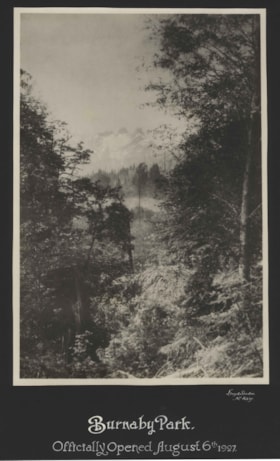
- Photograph of the north shore mountains, including the Lions, taken from Robert Burnaby Park.
- Repository
- Burnaby Village Museum
- Collection/Fonds
- Burnaby Village Museum Photograph collection
- Description Level
- Item
- Physical Description
- 1 photograph : b&w photogravure ; 14.5 x 9.5 cm
- Scope and Content
- Photograph of the north shore mountains, including the Lions, taken from Robert Burnaby Park.
- Geographic Access
- Wedgewood Street
- Robert Burnaby Park
- Street Address
- 8155 Wedgewood Street
- Accession Code
- HV972.204.3
- Access Restriction
- No restrictions
- Reproduction Restriction
- No known restrictions
- Date
- [between 1926 and 1929]
- Media Type
- Photograph
- Historic Neighbourhood
- Burnaby Lake (Historic Neighbourhood)
- Planning Study Area
- Lakeview-Mayfield Area
- Related Material
- For other photographs from the same album, see HV972.204.3 - .14
- Scan Resolution
- 600
- Scan Date
- 2023-04-25
- Photographer
- Lloyd, Frank Ernest
- Notes
- Annotations made in white paint on recto of photograph read: "'The Lions' from Burnaby Park" and "Lloyd Studio, McKay."
Images
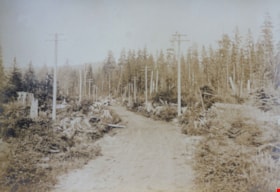
Barnet Wagon Road
https://search.heritageburnaby.ca/link/archivedescription38306
- Repository
- City of Burnaby Archives
- Date
- June 1903 (date of original), copied ca. 1990
- Collection/Fonds
- Burnaby Historical Society fonds
- Description Level
- Item
- Physical Description
- 1 photograph : b&w ; 10 x 15 cm print
- Scope and Content
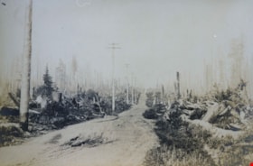
- Photograph of the Barnet Wagon Road looking west from Sperling Avenue.
- Repository
- City of Burnaby Archives
- Date
- June 1903 (date of original), copied ca. 1990
- Collection/Fonds
- Burnaby Historical Society fonds
- Subseries
- Photographs subseries
- Physical Description
- 1 photograph : b&w ; 10 x 15 cm print
- Description Level
- Item
- Record No.
- 403-001
- Access Restriction
- No restrictions
- Reproduction Restriction
- No known restrictions
- Accession Number
- BHS2007-04
- Scope and Content
- Photograph of the Barnet Wagon Road looking west from Sperling Avenue.
- Subjects
- Land Clearing
- Geographic Features - Roads
- Media Type
- Photograph
- Notes
- Title based on contents of photograph
- Geographic Access
- Barnet Road
- Sperling Avenue
- Historic Neighbourhood
- Lochdale (Historic Neighbourhood)
- Planning Study Area
- Westridge Area
Images
Barnet Wagon Road
https://search.heritageburnaby.ca/link/archivedescription38307
- Repository
- City of Burnaby Archives
- Date
- June 1903 (date of original), copied ca. 1990
- Collection/Fonds
- Burnaby Historical Society fonds
- Description Level
- Item
- Physical Description
- 1 photograph : b&w ; 10 x 15 cm print
- Scope and Content
- Photograph of the Barnet Wagon Road looking east, near Barnet and Hastings.
- Repository
- City of Burnaby Archives
- Date
- June 1903 (date of original), copied ca. 1990
- Collection/Fonds
- Burnaby Historical Society fonds
- Subseries
- Photographs subseries
- Physical Description
- 1 photograph : b&w ; 10 x 15 cm print
- Description Level
- Item
- Record No.
- 403-002
- Access Restriction
- No restrictions
- Reproduction Restriction
- No known restrictions
- Accession Number
- BHS2007-04
- Scope and Content
- Photograph of the Barnet Wagon Road looking east, near Barnet and Hastings.
- Subjects
- Land Clearing
- Geographic Features - Roads
- Media Type
- Photograph
- Notes
- Title based on contents of photograph
- Geographic Access
- Barnet Road
- Hastings Street
- Historic Neighbourhood
- Lochdale (Historic Neighbourhood)
- Planning Study Area
- Westridge Area
Images
Kinnunen's Creek
https://search.heritageburnaby.ca/link/archivedescription34381
- Repository
- City of Burnaby Archives
- Date
- 1926
- Collection/Fonds
- Burnaby Historical Society fonds
- Description Level
- Item
- Physical Description
- 1 photograph : b&w ; 6 x 12.4 cm on page 17.5 x 26.5 cm
- Scope and Content
- Photograph taken looking down Kinnunen's Creek with fallen trees and branches along the banks. This photograph appears to have been taken by Arthur Peers, who travelled through the Fraser River Valley and worked on the construction of the Trans-Provincial Highway during the later 1920s.
- Repository
- City of Burnaby Archives
- Date
- 1926
- Collection/Fonds
- Burnaby Historical Society fonds
- Subseries
- Peers family subseries
- Physical Description
- 1 photograph : b&w ; 6 x 12.4 cm on page 17.5 x 26.5 cm
- Description Level
- Item
- Record No.
- 020-088
- Access Restriction
- No restrictions
- Reproduction Restriction
- No known restrictions
- Accession Number
- BHS2007-04
- Scope and Content
- Photograph taken looking down Kinnunen's Creek with fallen trees and branches along the banks. This photograph appears to have been taken by Arthur Peers, who travelled through the Fraser River Valley and worked on the construction of the Trans-Provincial Highway during the later 1920s.
- Media Type
- Photograph
- Photographer
- Peers, Arthur Francis "Mike"
- Notes
- Title based on caption accompanying photograph
Images
Lake
https://search.heritageburnaby.ca/link/archivedescription38816
- Repository
- City of Burnaby Archives
- Date
- [1905]
- Collection/Fonds
- Peers Family and Hill Family fonds
- Description Level
- Item
- Physical Description
- 1 photograph : b&w ; 5.5 x 5.5 cm on page 11.5 x 14 cm (pasted in album)
- Scope and Content
- Photograph of a lake (either Deer Lake or Burnaby Lake) with cleared land in the background.
- Repository
- City of Burnaby Archives
- Date
- [1905]
- Collection/Fonds
- Peers Family and Hill Family fonds
- Physical Description
- 1 photograph : b&w ; 5.5 x 5.5 cm on page 11.5 x 14 cm (pasted in album)
- Description Level
- Item
- Record No.
- 477-135
- Access Restriction
- No restrictions
- Reproduction Restriction
- No known restrictions
- Accession Number
- 2007-12
- Scope and Content
- Photograph of a lake (either Deer Lake or Burnaby Lake) with cleared land in the background.
- Media Type
- Photograph
- Notes
- Title based on contents of photograph
- Historic Neighbourhood
- Burnaby Lake (Historic Neighbourhood)
Images
Land Clearing on the shores of Deer Lake
https://search.heritageburnaby.ca/link/archivedescription38815
- Repository
- City of Burnaby Archives
- Date
- [1905]
- Collection/Fonds
- Peers Family and Hill Family fonds
- Description Level
- Item
- Physical Description
- 1 photograph : sepia ; 5.5 x 5.5 cm on page 11.5 x 14 cm (pasted in album)
- Scope and Content
- Photograph taken looking north across Deer Lake. Smoke from a land clearing operation is visible in the background.
- Repository
- City of Burnaby Archives
- Date
- [1905]
- Collection/Fonds
- Peers Family and Hill Family fonds
- Physical Description
- 1 photograph : sepia ; 5.5 x 5.5 cm on page 11.5 x 14 cm (pasted in album)
- Description Level
- Item
- Record No.
- 477-134
- Access Restriction
- No restrictions
- Reproduction Restriction
- No known restrictions
- Accession Number
- 2007-12
- Scope and Content
- Photograph taken looking north across Deer Lake. Smoke from a land clearing operation is visible in the background.
- Media Type
- Photograph
- Notes
- Title based on contents of photograph
- Geographic Access
- Deer Lake
- Historic Neighbourhood
- Burnaby Lake (Historic Neighbourhood)
Images
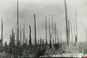
Linden Avenue
https://search.heritageburnaby.ca/link/archivedescription35000
- Repository
- City of Burnaby Archives
- Date
- 1908 (date of original), copied 1986
- Collection/Fonds
- Burnaby Historical Society fonds
- Description Level
- Item
- Physical Description
- 1 photograph : b&w ; 8.8 x 12.5 cm print
- Scope and Content
- Photograph of trees and stumps on Linden Avenue, Edmonds District. The caption at the bottom right of the photograph reads, "Linden Ave. / Edmonds 1908."
- Repository
- City of Burnaby Archives
- Date
- 1908 (date of original), copied 1986
- Collection/Fonds
- Burnaby Historical Society fonds
- Subseries
- Patterson family subseries
- Physical Description
- 1 photograph : b&w ; 8.8 x 12.5 cm print
- Description Level
- Item
- Record No.
- 171-021
- Access Restriction
- No restrictions
- Reproduction Restriction
- No known restrictions
- Accession Number
- BHS1986-20
- Scope and Content
- Photograph of trees and stumps on Linden Avenue, Edmonds District. The caption at the bottom right of the photograph reads, "Linden Ave. / Edmonds 1908."
- Media Type
- Photograph
- Geographic Access
- Linden Avenue
- Historic Neighbourhood
- Edmonds (Historic Neighbourhood)
- Planning Study Area
- Richmond Park Area
Images
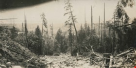
Looking down north Poleline Hill
https://search.heritageburnaby.ca/link/museumdescription796
- Repository
- Burnaby Village Museum
- Date
- [1908]
- Collection/Fonds
- Burnaby Village Museum Photograph collection
- Description Level
- Item
- Physical Description
- 1 photograph : b&w ; 20.32 x 25.4 cm print
- Scope and Content
- Photograph looking north along the Pole Line Road (later Sperling Avenue). To the far left is Deer Lake and at the top right is Burnaby Lake. The smoke and debris from land clearing is a result of logging operations being carried out by the Doran Brothers logging company, the Deer Lake Mill Company…
- Repository
- Burnaby Village Museum
- Collection/Fonds
- Burnaby Village Museum Photograph collection
- Description Level
- Item
- Physical Description
- 1 photograph : b&w ; 20.32 x 25.4 cm print
- Material Details
- inscribed in pencil, verso, l.l. "Looking down north Poleline Hill (now Sperling) Deer Lake at left. "
- Scope and Content
- Photograph looking north along the Pole Line Road (later Sperling Avenue). To the far left is Deer Lake and at the top right is Burnaby Lake. The smoke and debris from land clearing is a result of logging operations being carried out by the Doran Brothers logging company, the Deer Lake Mill Company. Above Deer Lake, Douglas Road is visible with Claude Hill's Brookfield property (later 6501 Deer Lake Avenue) on the south side of the road and Bernard Hill's home on the north side (later 4990 Canada Way). Just northeast of Brookfield is the George Every-Clayton farm (amongst the trees) on what would later become the Henry and Grace Ceperley estate grounds known as Fairacres. The house in the centre of the picture is the Walker house (later 5255 Sperling Avenue). Mountains can be seen to the north.
- Subjects
- Land Clearing
- Geographic Features - Roads
- Industries - Forestry
- Industries - Logging/lumber
- Geographic Access
- Sperling Avenue
- Deer Lake
- Douglas Road
- Canada Way
- Accession Code
- HV976.139.47
- Access Restriction
- No restrictions
- Reproduction Restriction
- No known restrictions
- Date
- [1908]
- Media Type
- Photograph
- Historic Neighbourhood
- Burnaby Lake (Historic Neighbourhood)
- Planning Study Area
- Morley-Buckingham Area
- Scan Resolution
- 600
- Scan Date
- 2023-06-27
- Notes
- Title based on contents of photograph
Images
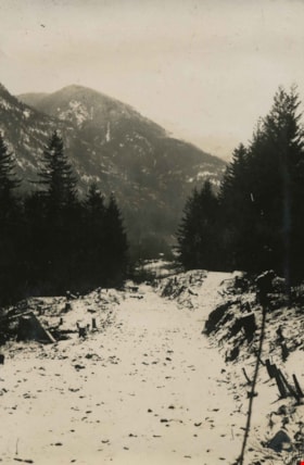
Road cleared through a forest
https://search.heritageburnaby.ca/link/archivedescription34400
- Repository
- City of Burnaby Archives
- Date
- 1926
- Collection/Fonds
- Burnaby Historical Society fonds
- Description Level
- Item
- Physical Description
- 1 photograph : b&w ; 6.5 x 10 cm on page 17.5 x 26.5 cm
- Scope and Content
- Photograph of a roadway that has been cut through the forest. Tree stumps are lining the road and the ground is covered with snow. A caption adjacent to the photograph reads "Tony's Work." This photograph appears to have been taken by Arthur Peers, who travelled through the Fraser River Valley and…
- Repository
- City of Burnaby Archives
- Date
- 1926
- Collection/Fonds
- Burnaby Historical Society fonds
- Subseries
- Peers family subseries
- Physical Description
- 1 photograph : b&w ; 6.5 x 10 cm on page 17.5 x 26.5 cm
- Description Level
- Item
- Record No.
- 020-107
- Access Restriction
- No restrictions
- Reproduction Restriction
- No known restrictions
- Accession Number
- BHS2007-04
- Scope and Content
- Photograph of a roadway that has been cut through the forest. Tree stumps are lining the road and the ground is covered with snow. A caption adjacent to the photograph reads "Tony's Work." This photograph appears to have been taken by Arthur Peers, who travelled through the Fraser River Valley and worked on the construction of the Trans-Provincial Highway during the later 1920s.
- Media Type
- Photograph
- Photographer
- Peers, Arthur Francis "Mike"
- Notes
- Title based on contents of photograph
Images
At the park
https://search.heritageburnaby.ca/link/archivedescription36777
- Repository
- City of Burnaby Archives
- Date
- [192-] (date of original), copied 1992
- Collection/Fonds
- Burnaby Historical Society fonds
- Description Level
- Item
- Physical Description
- 1 photograph : b&w ; 12.7 x 8.7 cm print
- Scope and Content
- Photograph of a group people at a park, including members of the Winter family. Identified: (back row, 2nd from left) Mary Winter, (back row, 4th from left) George Winter, and (front row, 2nd from left) Teresa Winter.
- Repository
- City of Burnaby Archives
- Date
- [192-] (date of original), copied 1992
- Collection/Fonds
- Burnaby Historical Society fonds
- Subseries
- Burnaby Centennial Anthology subseries
- Physical Description
- 1 photograph : b&w ; 12.7 x 8.7 cm print
- Description Level
- Item
- Record No.
- 315-134
- Access Restriction
- No restrictions
- Reproduction Restriction
- No known restrictions
- Accession Number
- BHS1994-04
- Scope and Content
- Photograph of a group people at a park, including members of the Winter family. Identified: (back row, 2nd from left) Mary Winter, (back row, 4th from left) George Winter, and (front row, 2nd from left) Teresa Winter.
- Subjects
- Geographic Features - Parks
- Media Type
- Photograph
- Notes
- Title based on contents of photograph
Images
Bandsand in Stanley Park, Vancouver, BC
https://search.heritageburnaby.ca/link/museumdescription1071
- Repository
- Burnaby Village Museum
- Date
- [between 1908 and 1911]
- Collection/Fonds
- Burnaby Village Museum Photograph collection
- Description Level
- Item
- Physical Description
- 1 photograph : sepia ; 7.3 x 9.9 cm
- Scope and Content
- Photograph of people walking towards the bandstand in Stanley Park, Vancouver. In 1934, the Malkin Bowl was erected at the site where the banstand used to be. An annotation on the back of the photograph reads, "Band stand in Stanley Park where Malkin Bowl now stands."
- Repository
- Burnaby Village Museum
- Collection/Fonds
- Burnaby Village Museum Photograph collection
- Description Level
- Item
- Physical Description
- 1 photograph : sepia ; 7.3 x 9.9 cm
- Scope and Content
- Photograph of people walking towards the bandstand in Stanley Park, Vancouver. In 1934, the Malkin Bowl was erected at the site where the banstand used to be. An annotation on the back of the photograph reads, "Band stand in Stanley Park where Malkin Bowl now stands."
- Geographic Access
- Vancouver
- Accession Code
- HV972.50.10
- Access Restriction
- No restrictions
- Reproduction Restriction
- No known restrictions
- Date
- [between 1908 and 1911]
- Media Type
- Photograph
- Scan Resolution
- 600
- Scan Date
- 2023-04-04
- Photographer
- Dean, H.M.
- Notes
- Title based on contents of photograph
Images
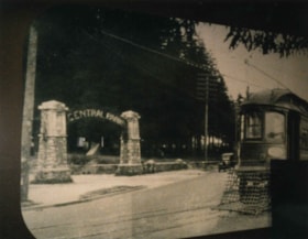
Central Park
https://search.heritageburnaby.ca/link/archivedescription34862
- Repository
- City of Burnaby Archives
- Date
- 1920 (date of original), photographed 1985
- Collection/Fonds
- Burnaby Historical Society fonds
- Description Level
- Item
- Physical Description
- 1 photograph : b&w ; 8.8 x 11.3 cm
- Scope and Content
- Photograph of the Central Park entrance arch with the "Central Park" electric sign. An Interurban tram can be seen on the right. This photograph used to be hung at the Central Park branch of the Burnaby Public Library.
- Repository
- City of Burnaby Archives
- Date
- 1920 (date of original), photographed 1985
- Collection/Fonds
- Burnaby Historical Society fonds
- Subseries
- Evelyn Salisbury subseries
- Physical Description
- 1 photograph : b&w ; 8.8 x 11.3 cm
- Description Level
- Item
- Record No.
- 145-010
- Access Restriction
- No restrictions
- Reproduction Restriction
- No known restrictions
- Accession Number
- BHS1985-15
- Scope and Content
- Photograph of the Central Park entrance arch with the "Central Park" electric sign. An Interurban tram can be seen on the right. This photograph used to be hung at the Central Park branch of the Burnaby Public Library.
- Subjects
- Structures - Arches
- Advertising Medium - Signs and Signboards
- Geographic Features - Parks
- Transportation - Electric Railroads
- Media Type
- Photograph
- Notes
- Title based on contents of photograph
- Geographic Access
- Central Park
- Imperial Street
- Street Address
- 3883 Imperial Street
- Historic Neighbourhood
- Central Park (Historic Neighbourhood)
- Planning Study Area
- Maywood Area
Images
Central Park Auto Tourist Grounds, Vancouver Canada
https://search.heritageburnaby.ca/link/archivedescription38512
- Repository
- City of Burnaby Archives
- Date
- [1923]
- Collection/Fonds
- Burnaby Historical Society fonds
- Description Level
- Item
- Physical Description
- 1 photograph : sepia postcard ; 9 x 14 cm
- Scope and Content
- Photographic postcard of the Central Park auto tourist grounds. Two unidentified men can be seen standing in front of a car which is parked next to the campground building. In the background, a clothesline has been strung holding towels and blankets.
- Repository
- City of Burnaby Archives
- Date
- [1923]
- Collection/Fonds
- Burnaby Historical Society fonds
- Subseries
- Photographs subseries
- Physical Description
- 1 photograph : sepia postcard ; 9 x 14 cm
- Description Level
- Item
- Record No.
- 449-007
- Access Restriction
- No restrictions
- Reproduction Restriction
- No known restrictions
- Accession Number
- BHS2007-04
- Scope and Content
- Photographic postcard of the Central Park auto tourist grounds. Two unidentified men can be seen standing in front of a car which is parked next to the campground building. In the background, a clothesline has been strung holding towels and blankets.
- Subjects
- Buildings - Commercial - Hotels and Motels
- Geographic Features - Parks
- Documentary Artifacts - Postcards
- Recreational Activities - Camping
- Media Type
- Photograph
- Notes
- Title based on caption
- Geographic Access
- Central Park
- Imperial Street
- Street Address
- 3883 Imperial Street
- Historic Neighbourhood
- Central Park (Historic Neighbourhood)
- Planning Study Area
- Maywood Area
Images
Confederation Park playground
https://search.heritageburnaby.ca/link/archivedescription38667
- Repository
- City of Burnaby Archives
- Date
- 1927
- Collection/Fonds
- Burnaby Historical Society fonds
- Description Level
- Item
- Physical Description
- 1 photograph : b&w ; 19 x 23.5 cm
- Scope and Content
- Photograph of the opening of the Confederation Park playground. A group of children and adults can be seen gathered around and using the swings and slides and other playground equipment. A number of homes on Capitol Hill can be seen in the backgound. Confederation Park opened on June 25, 1927.
- Repository
- City of Burnaby Archives
- Date
- 1927
- Collection/Fonds
- Burnaby Historical Society fonds
- Subseries
- North Burnaby Board of Trade subseries
- Physical Description
- 1 photograph : b&w ; 19 x 23.5 cm
- Description Level
- Item
- Record No.
- 476-010
- Access Restriction
- No restrictions
- Reproduction Restriction
- No known restrictions
- Accession Number
- BHS2005-8
- Scope and Content
- Photograph of the opening of the Confederation Park playground. A group of children and adults can be seen gathered around and using the swings and slides and other playground equipment. A number of homes on Capitol Hill can be seen in the backgound. Confederation Park opened on June 25, 1927.
- Subjects
- Geographic Features - Parks
- Recreational Devices - Playgrounds
- Persons - Crowds
- Events - Openings
- Media Type
- Photograph
- Notes
- Title based on contents of photograph
- Geographic Access
- Confederation Park
- Willingdon Avenue
- Street Address
- 250 Willingdon Avenue
- Historic Neighbourhood
- Capitol Hill (Historic Neighbourhood)
- Planning Study Area
- Capitol Hill Area
Images
Confederation Park's new playground
https://search.heritageburnaby.ca/link/museumdescription1088
- Repository
- Burnaby Village Museum
- Date
- 1927
- Collection/Fonds
- Burnaby Village Museum Photograph collection
- Description Level
- Item
- Physical Description
- 1 photograph : sepia ; 19 x 23.5 cm
- Scope and Content
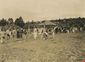
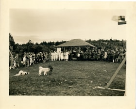
- Photograph of a large gathering of adults and children at Confederation Park for the opening ceremony for the new playground. A man on a pedestal is speaking and a crowd of people are surrounding him. There are six women in front of the gazebo wearing tags attached to the front of their dresses tha…
- Repository
- Burnaby Village Museum
- Collection/Fonds
- Burnaby Village Museum Photograph collection
- Description Level
- Item
- Physical Description
- 1 photograph : sepia ; 19 x 23.5 cm
- Scope and Content
- Photograph of a large gathering of adults and children at Confederation Park for the opening ceremony for the new playground. A man on a pedestal is speaking and a crowd of people are surrounding him. There are six women in front of the gazebo wearing tags attached to the front of their dresses that spell out "CANADA". There are three dogs in the foreground playing, and a Union Jack is flying in the upper right corner of the photograph.
- Subjects
- Recreational Devices - Playgrounds
- Geographic Features - Parks
- Persons - Crowds
- Events - Openings
- Geographic Access
- Confederation Park
- Willingdon Avenue
- Street Address
- 250 Willingdon Avenue
- Accession Code
- HV972.51.15
- Access Restriction
- No restrictions
- Reproduction Restriction
- No known restrictions
- Date
- 1927
- Media Type
- Photograph
- Historic Neighbourhood
- Capitol Hill (Historic Neighbourhood)
- Planning Study Area
- Capitol Hill Area
- Scan Resolution
- 600
- Scan Date
- 2023-04-04
- Photographer
- Charlton and Rathburn
- Notes
- Title based on contents of photograph
- Embossed inscription beneath photograph reads: "Charlton and Rathburn. / Vancouver. B.C."
- Handwritten inscription on verso of photograph reads: "Playground opening / Confederation Park / opening of Playground / Confederation Park / about 1927 / JCD on platform speaking"
- 1 b&w copy print accompanying
Images
Interview with Alekxos Sarter by Kathy Bossort October 16, 2015 - Track 3
https://search.heritageburnaby.ca/link/oralhistory579
- Repository
- City of Burnaby Archives
- Date Range
- 1910-1960
- Length
- 0:21:54
- Summary
- This portion of the interview is about Alekxos Sarter’s historical overview of early public recreation, and intentions to set aside parkland, on Burnaby Mountain; Acting-Commissioner Richard Bolton’s signing of By Law 1772 that created Barnet Mountain Park in 1942; and her explanation about the fun…
- Repository
- City of Burnaby Archives
- Summary
- This portion of the interview is about Alekxos Sarter’s historical overview of early public recreation, and intentions to set aside parkland, on Burnaby Mountain; Acting-Commissioner Richard Bolton’s signing of By Law 1772 that created Barnet Mountain Park in 1942; and her explanation about the function and kinds of park dedications used in Burnaby.
- Date Range
- 1910-1960
- Length
- 0:21:54
- Geographic Access
- Burnaby Mountain Conservation Area
- Interviewer
- Bossort, Kathy
- Interview Date
- October 16, 2015
- Scope and Content
- Recording is of an interview with Alekxos Sarter conducted by Kathy Bossort. Alekxos Sarter was one of 23 participants interviewed as part of the Community Heritage Commission’s Burnaby Mountain Oral History Project. The interview is mainly about the history of setting aside parkland on Burnaby Mountain from Alekxos Sarter’s perspective and experience as employee in the City of Burnaby Parks, Recreation and Cultural Services. The interview provides an excellent explanation of the history and function of kinds of park dedications used by the City of Burnaby; an overview of issues around including the Trans Mountain tank farm in the conservation area; and the background to the land use and ownership disagreement between the City of Burnaby and Simon Fraser University, its resolution, and the subsequent development of SFU’s UniverCity. Alekxos Sarter talks about Richard Bolton, Burnaby’s Acting-Commissioner who was responsible for dedicating the first park on Burnaby Mountain in 1942, and the creation of a park named after him in UniverCity.
- Biographical Notes
- Alekxos Sarter was born in Vancouver in 1961, to Daine and Kasandra Sarter. She grew up in North Vancouver and since 1994 has lived on a sailboat in False Creek. After attending UBC where she studied landscape architecture, she was hired by the City of Burnaby Parks, Recreation and Cultural Services in 1986. Working first in parks design, Alekxos quickly moved into parks planning, her preferred career. As Research Officer she covers research, planning, public consultation, parks and facility inventory, parkland acquisition, among other duties.
- Total Tracks
- 9
- Total Length
- 2:20:47
- Interviewee Name
- Sarter, Alekxos T.
- Interview Location
- City of Burnaby Parks, Recreation and Cultural Services meeting room
- Interviewer Bio
- Kathy Bossort is a retired archivist living in Ladner, BC. She worked at the Delta Museum and Archives after graduating from SLAIS (UBC) in 2001 with Masters degrees in library science and archival studies. Kathy grew up in Calgary, Alberta, and, prior to this career change, she lived in the West Kootenays, earning her living as a cook for BC tourist lodges and work camps. She continues to be interested in oral histories as a way to fill the gaps in the written record and bring richer meaning to history.
- Collection/Fonds
- Community Heritage Commission Special Projects fonds
- Media Type
- Sound Recording
Audio Tracks
Track three of interview with Alekxos Sarter
Track three of interview with Alekxos Sarter
https://search.heritageburnaby.ca/media/hpo/_Data/_Archives_Oral_Histories/_Unrestricted/MSS196-005/MSS196-005_Track_3.mp3Interview with Basil Luksun and Jack Belhouse by Kathy Bossort November 24, 2015 - Track 2
https://search.heritageburnaby.ca/link/oralhistory628
- Repository
- City of Burnaby Archives
- Date Range
- 1913-2015
- Length
- 0:19:24
- Summary
- This portion of the interview is about Basil Luksun and Jack Belhouse talking about the history of setting aside parkland on Burnaby Mountain beginning in 1942 with By-Law 1772; the kinds of park dedications used by the City and shift in nature of dedications to accommodate long range park planning…
- Repository
- City of Burnaby Archives
- Summary
- This portion of the interview is about Basil Luksun and Jack Belhouse talking about the history of setting aside parkland on Burnaby Mountain beginning in 1942 with By-Law 1772; the kinds of park dedications used by the City and shift in nature of dedications to accommodate long range park planning; and looking at the big picture policy and programs for land assembly for major open spaces and linkages.
- Date Range
- 1913-2015
- Length
- 0:19:24
- Subjects
- Geographic Features - Parks
- Planning
- Geographic Access
- Burnaby Mountain Conservation Area
- Interviewer
- Bossort, Kathy
- Interview Date
- November 24, 2015
- Scope and Content
- Recording is of an interview with Basil Luksun and Jack Belhouse conducted by Kathy Bossort. Basil Luksun and Jack Belhouse were two of 23 participants interviewed as part of the Community Heritage Commission’s Burnaby Mountain Oral History Project. The interview is mainly about the history of setting aside parkland by dedication on Burnaby Mountain, the 1974/76 delineation of the conservation area on Burnaby Mountain, and the dispute between Burnaby and Simon Fraser University over land ownership and control on Burnaby Mountain, as discussed by two retired participants in these events from the City of Burnaby’s Planning and Building Department, Basil Luksun and Jack Belhouse. They also talk about their interaction with the public in developing policies, particularly for the 1974 report “The Public Meetings - Phase One”, and the importance of a strong policy base for long range planning and the patience needed to assemble land for large parks. They talk as well about their careers, their close working relationship in the department, and the cooperation between City and SFU staff in the development of UniverCity.
- Biographical Notes
- Basil Luksun was born and educated in South Africa, immigrating to Canada and Burnaby in 1972 to escape the harmful effects of apartheid. He holds a BSc degree from the University of Cape Town and a Post-Graduate Diploma in Town Planning from the University of Witwatersrand. He joined the City of Burnaby’s Planning and Building Department in 1973, working his way up through the organization to Director of the department before retiring after 39 years in 2012. When he started work in the 1970s, the City of Burnaby was focusing on green space planning projects and he takes great pride in these projects as well as the city’s focus on long-term planning. Basil lived in the Capital Hill area from 1972 to 1990. He currently resides in Vancouver and has two sons, Warren and Derek. Jack Belhouse was born in 1946 in Vancouver and attended UBC, York University and SFU (1965-1972), majoring in urban geography. He began working in Burnaby’s planning department as a summer student in 1968, and was offered a full-time position when he graduated from university. He became Director of the Planning and Building Department before retiring after 38 years with the city in 2006. He and Basil Luksun worked closely together in long range planning in the department. Jack lives in Coquitlam with his wife Linda and has two children, Brad and Lori.
- Total Tracks
- 8
- Total Length
- 1:58:23
- Interviewee Name
- Luksun, Basil
- Belhouse, Jack
- Interview Location
- Basil Luksun's home in Vancouver
- Interviewer Bio
- Kathy Bossort is a retired archivist living in Ladner, BC. She worked at the Delta Museum and Archives after graduating from SLAIS (UBC) in 2001 with Masters degrees in library science and archival studies. Kathy grew up in Calgary, Alberta, and, prior to this career change, she lived in the West Kootenays, earning her living as a cook for BC tourist lodges and work camps. She continues to be interested in oral histories as a way to fill the gaps in the written record and bring richer meaning to history.
- Collection/Fonds
- Community Heritage Commission Special Projects fonds
- Media Type
- Sound Recording
Audio Tracks
Track two of interview with Basil Luksun and Jack Belhouse
Track two of interview with Basil Luksun and Jack Belhouse
https://search.heritageburnaby.ca/media/hpo/_Data/_Archives_Oral_Histories/_Unrestricted/MSS196-012/MSS196-012_Track_2.mp3Interview with Rick Sporns by Kathy Bossort October 30, 2015 - Track 4
https://search.heritageburnaby.ca/link/oralhistory606
- Repository
- City of Burnaby Archives
- Date Range
- 1900-2015
- Length
- 0:17:11
- Summary
- This portion of the interview is about Rick Sporn’s discussion of the value of natural areas to Burnaby, the city’s history of protecting green spaces, and the complementary role the Pavilion area plays in the Burnaby Mountain Conservation Area. He talks about how the rose garden and “Playground of…
- Repository
- City of Burnaby Archives
- Summary
- This portion of the interview is about Rick Sporn’s discussion of the value of natural areas to Burnaby, the city’s history of protecting green spaces, and the complementary role the Pavilion area plays in the Burnaby Mountain Conservation Area. He talks about how the rose garden and “Playground of the Gods” sculptures (Kamui Mintara) help Pavilion area visitors more fully appreciate the mountain setting. He also talks about the history of the construction of the Kamui Mintara sculptures.
- Date Range
- 1900-2015
- Length
- 0:17:11
- Names
- Burnaby Mountain Centennial Rose Garden
- Burnaby Mountain Centennial Park
- Kamui Mintara
- Central Park
- Geographic Access
- Burnaby Mountain Conservation Area
- Interviewer
- Bossort, Kathy
- Interview Date
- October 30, 2015
- Scope and Content
- Recording is of an interview with Rick Sporns conducted by Kathy Bossort. Rick Sporns was one of 23 participants interviewed as part of the Community Heritage Commission’s Burnaby Mountain Oral History Project. The interview is mainly about Rick Sporn’s description of the history and design of Burnaby Mountain Centennial Rose Garden and the significance of the Centennial Pavilion area in the Burnaby Mountain Conservation Area. Rick Sporns also talks about his career with the City of Burnaby’s Parks, Recreation and Cultural Services, management of Burnaby Mountain Conservation Area, and the value of natural areas to Burnaby.
- Biographical Notes
- Richard Sporns was born in 1957 in Daly Municipality, Manitoba, to Ulrich and Charlotte Sporns. The family moved to the Burquitlam Area of Burnaby in about 1965. Rick Sporns obtained his BSc degree in biology at SFU and a degree in landscape architecture at UBC. In 1985 he began his career in the City of Burnaby’s Park, Recreation and Cultural Services department where he currently is Assistant Manager - Parks Design. Rick was responsible for designing Burnaby Mountain Centennial Rose Garden, a legacy project proposed by Mark Stockdale to commemorate Burnaby’s 1992 Centennial. The rose garden opened to the public July 18, 1992.
- Total Tracks
- 6
- Total Length
- 1:01:40
- Interviewee Name
- Sporns, Richard "Rick"
- Interview Location
- City of Burnaby Parks, Recreation and Cultural Services meeting room
- Interviewer Bio
- Kathy Bossort is a retired archivist living in Ladner, BC. She worked at the Delta Museum and Archives after graduating from SLAIS (UBC) in 2001 with Masters degrees in library science and archival studies. Kathy grew up in Calgary, Alberta, and, prior to this career change, she lived in the West Kootenays, earning her living as a cook for BC tourist lodges and work camps. She continues to be interested in oral histories as a way to fill the gaps in the written record and bring richer meaning to history.
- Collection/Fonds
- Community Heritage Commission Special Projects fonds
- Media Type
- Sound Recording
Audio Tracks
Track four of interview with Rick Sporns
Track four of interview with Rick Sporns
https://search.heritageburnaby.ca/media/hpo/_Data/_Archives_Oral_Histories/_Unrestricted/MSS196-008/MSS196-008_Track_4.mp3
![The Lions from Burnaby Park, [between 1926 and 1929] thumbnail](/media/hpo/_Data/_BVM_Images/1971/197202040003.jpg?width=280)
![Lake, [1905] thumbnail](/media/hpo/_Data/_Archives_Images/_Unrestricted/477/477-135.jpg?width=280)
![Land Clearing on the shores of Deer Lake, [1905] thumbnail](/media/hpo/_Data/_Archives_Images/_Unrestricted/477/477-134.jpg?width=280)
![Looking down north Poleline Hill, [1908] thumbnail](/media/hpo/_Data/_BVM_Images/1976/1976_0139_0047_001.jpg?width=280)
![At the park, [192-] (date of original), copied 1992 thumbnail](/media/hpo/_Data/_Archives_Images/_Unrestricted/315/315-134.jpg?width=280)
![Bandsand in Stanley Park, Vancouver, BC, [between 1908 and 1911] thumbnail](/media/hpo/_Data/_BVM_Images/1972/1972_0050_0010_001.jpg?width=280)
![Central Park Auto Tourist Grounds, Vancouver Canada, [1923] thumbnail](/media/hpo/_Data/_Archives_Images/_Unrestricted/371/449-007.jpg?width=280)
