Narrow Results By
Format
- Architectural Drawing 8
- Book
- Bylaws - Adopted
- Bylaws - Other
- Bylaws - Repealed
- Cartographic Material
- Council - Committee Report 1408
- Council - Manager's Report 2619
- Council - Mayor/Councillor/Staff Report 1198
- Council - Public Hearing Minutes 100
- Council - Regular Council Minutes 476
- Graphic Material 16
Subject
- Agriculture 1
- Animals 1
- Animals - Birds 1
- Buildings 1
- Buildings - Heritage 1
- Documentary Artifacts - Books 1
- First Nations reserves - British Columbia 2
- Indigenous peoples 1
- Indigenous peoples - British Columbia 4
- Indigenous peoples - British Columbia - Languages 1
- Indigenous peoples - British Columbia - Social life and customs 1
- Indigenous peoples - British Columbia - Societies, etc. 1
Person / Organization
- British Columbia Hydro and Power Authority 1
- Burnaby Art Gallery 1
- Burnaby Village Museum 1
- Canadian Pacific Railway Company 2
- Exworthy, William Albert "Bert" 2
- Gilmore Avenue School 1
- Hall, James Edward 1
- Hall, Joseph 1
- Harrison, John 1
- Henderson, Gibb Gilmour 5
- Love Family 1
- Love, George Richard 2
![Survey and Subdivision plans in New Westminster District Group 1 – Burnaby
, [1892-1908] thumbnail](/media/hpo/_Data/_BVM_Cartographic_Material/1977/1977_0093_0020a_001.jpg?width=280)
Survey and Subdivision plans in New Westminster District Group 1 – Burnaby
https://search.heritageburnaby.ca/link/museumdescription6989
- Repository
- Burnaby Village Museum
- Date
- [1892-1908]
- Collection/Fonds
- Burnaby Village Museum Map collection
- Description Level
- File
- Physical Description
- 12 plans : 6 plans : black ink on paper + 6 plans : graphite on paper mounted on 2 sides of cardboard 76 x 102 cm
- Scope and Content
- Item consists of a large board of six New Westminster District Gp 1 - subdivision plans mounted on one side and three New Westminster District Gp 1 - subdivision plans mounted on the other side. Side A: 1. Plan drawn in graphite with markings "Plan 535" "Scale 3 chs = 1 in." Plan appears to ext…
- Repository
- Burnaby Village Museum
- Collection/Fonds
- Burnaby Village Museum Map collection
- Description Level
- File
- Physical Description
- 12 plans : 6 plans : black ink on paper + 6 plans : graphite on paper mounted on 2 sides of cardboard 76 x 102 cm
- Material Details
- Scales [between 1:240 and 1:7920]
- Index number on edge of board reads: "20"
- Scope and Content
- Item consists of a large board of six New Westminster District Gp 1 - subdivision plans mounted on one side and three New Westminster District Gp 1 - subdivision plans mounted on the other side. Side A: 1. Plan drawn in graphite with markings "Plan 535" "Scale 3 chs = 1 in." Plan appears to extend onto another piece of paper with a title "Lo [sic] 506" ans "Scale 2 chs = 1 in." Plan is stamped: "Albert J. Hill, Civil Engineer / and / Provincial Land Surveyor, / New Westminster, / B.C." (Geographic location: Burnaby) 2. Plan of "Douglas Road" (written at top in blue pencil) and "Plan 642 / Reg. Apr. 8 1892 / ....Lots / 3 & 4 Bl. I...[sic]" (written in graphite). Road runs through Lots 29, 28, 30, 90 and 91. Note in red ink at bottom of plan reads: "Sketch plans as sent to Council / Aug. 28_1893 / ..." Plan is stamped: "Albert J. Hill, Civil Engineer / and / Provincial Land Surveyor, / New Westminster, / B.C." (Geographic location: Burnaby) 3. Plan drawn in graphite identified with markings "L.9 in / L. 88" "Scale 3 chs = 1 in. / Albert J. Hill / B.C.L.S. / 11/3/08" (Geographic location: Burnaby) 4. Plan in black ink identified as "No.2" / Lot 101 & 100 / Gr.1" / Lot 3 Gr. 1" (handwritten in blue pencil) with "Scale : 2 Inches = 1 Mile". Plan is stamped: "Albert J. Hill, Civil Engineer / and / Provincial Land Surveyor, / New Westminster, / B.C." (Geographic location: Burnaby) 5. Plan in black ink identified as "Sub. L. 28 and 29 of / Lot 35, G - 1" (handwritten in blue pencil) "Scale 100' = 1 in." (Geographic location: Burnaby) 6. Plan drawn in graphite with markings "Lot 165 Gr.1" (handwritten in blue pencil) "Scale 10 chs = 1 in. / Albert J. Hill / B.C.L.S." (Geographic location: Burnaby) 7. "Plan / of Subdivision / of / Subdivision of Lot 10 [sic] / of Lot 53 / Group One / New Westminster Dist. / Scale 1 chs = 1 inc." (drawn and written in graphite) Plan is stamped: "Albert J. Hill, Civil Engineer / and / Provincial Land Surveyor, / New Westminster, / B.C." (Geographic location: Burnaby) Side B: 1. "Plan / of Subdivision / of / Lots 10 and 11, / in the Subdivision / of / Lot 156 Gr.1 / New Westminster District / Scale 100' = 1 "" (drawn and written in graphite) (Geographic location: Burnaby) 2. "Plan / of Subdivision / of a Portion / of / Lot 95 / Group One / New Westminster District / Scale 3 chs = 1 in." (drawn in graphite and black ink) Plan is stamped: "Albert J. Hill, Civil Engineer / and / Provincial Land Surveyor, / New Westminster, / B.C." (Geographic location: Burnaby) 3. Plan drawn in graphite and identified as "Lot 98, Gr.1" (handwritten in blue pencil). Plan identifies a "Road Reservation", "Royal Oak Road" and "Electric Tramway" and "Lot 94" to the north of "Lot 98" (Geographic location: Burnaby) 4. Plan drawn in graphite and identified as "Lot 25, Gr.1" (handwritten in blue pencil) Lot 25 is identified as "Love" "Scale 7 chs = 1 in. / Albert J. Hill B.C.L.S." Plan is dated "24/7/07" Plan is stamped: "Albert J. Hill, Civil Engineer / and / Provincial Land Surveyor, / New Westminster, / B.C." (Geographic location: Burnaby) 5. Profile plan in black ink with marking "Douglas Road" and intials "RGS" [sic] (handwritten in blue pencil) "City Boundary / Hastings Road / Scale Hor 200' = 1" / Vert 20' = 1"" Plan is also marked in red pencil and reads: "Please / See other side". Plan is stamped: "Albert J. Hill, Civil Engineer / and / Provincial Land Surveyor, / New Westminster, / B.C." (Geographic location: Burnaby) 6. Plan of "Profile / on Tramway Track / New Vancouver Road / Scales Hor 200 ft = 1 inch / Vert 20 ft = 1 inch" (Geographic location: Burnaby)
- Creator
- Hill, Albert James
- Accession Code
- HV977.93.20
- Access Restriction
- No restrictions
- Reproduction Restriction
- No known restrictions
- Date
- [1892-1908]
- Media Type
- Cartographic Material
- Scan Resolution
- 300
- Scale
- 72
- Notes
- Title based on contents of file
- Scale is measured in chains and feet. (One chain equals 792 inches)
- The term "Lot" can also refer to a "District Lot”
Images
![Survey and Subdivision plans in New Westminster District Group 1 – Burnaby
, [1892-1908] thumbnail](/media/hpo/_Data/_BVM_Cartographic_Material/1977/1977_0093_0020a_001.jpg)

![Survey and Subdivision plans in New Westminster District Group 1 – Burnaby, Port Moody, [1862-1908] thumbnail](/media/hpo/_Data/_BVM_Cartographic_Material/1977/1977_0093_0026a_001.jpg?width=280)
Survey and Subdivision plans in New Westminster District Group 1 – Burnaby, Port Moody
https://search.heritageburnaby.ca/link/museumdescription6995
- Repository
- Burnaby Village Museum
- Date
- [1862-1908]
- Collection/Fonds
- Burnaby Village Museum Map collection
- Description Level
- File
- Physical Description
- 9 plans : 6 plans : black ink on paper ; 57 x 36.5 cm or smaller + 1 plan : black ink and grahite on paper ; 46.5 x 49 cm + 1 plan : blueprint on paper ; 15.5 x 19.5 cm + cm + 1 plan : graphite on paper ; 25 x 17 cm ; mounted on both sides of board 76 x 102 cm
- Scope and Content
- Item consists of a large board of four New Westminster District subdivision plans mounted on one side and five New Westminster District subdivision plans mounted on the other side. Side A: 1. "Plan / of Subdivision / of a Portion / of / Lot 87 / Group One / New Westminster District / Scale 4 chs…
- Repository
- Burnaby Village Museum
- Collection/Fonds
- Burnaby Village Museum Map collection
- Description Level
- File
- Physical Description
- 9 plans : 6 plans : black ink on paper ; 57 x 36.5 cm or smaller + 1 plan : black ink and grahite on paper ; 46.5 x 49 cm + 1 plan : blueprint on paper ; 15.5 x 19.5 cm + cm + 1 plan : graphite on paper ; 25 x 17 cm ; mounted on both sides of board 76 x 102 cm
- Material Details
- Scales [between 1:792 and 1:3600]
- Index number on edge of board reads: "26"
- Scope and Content
- Item consists of a large board of four New Westminster District subdivision plans mounted on one side and five New Westminster District subdivision plans mounted on the other side. Side A: 1. "Plan / of Subdivision / of a Portion / of / Lot 87 / Group One / New Westminster District / Scale 4 chs = 1 in". Plan is stamped: "Albert J. Hill, Civil Engineer / and / Provincial Land Surveyor, / New Westminster, / B.C." and intialed by: "RB" [sic] (in blue pencil crayon). Names two of the subdivisons of District Lot 87 are identified as, "L.E. Sprott" and "John Ledger". (Geographic location: Burnaby) 2. "Plan of Subdivision / of / Portions of / Lot 136, 131 and Lots 44 and 78 Gr.1 / New Westminster District / Scale 300 ft = 1 inch". Annotation above title reads: "No. 901 / Deposited in Land Registry Office / New Westminster / Aug. 19th 1905 / Charles S. Keith D. Reg." Annotations and signatures at bottom of plan read: "I, William Nelson Draper, / W.H.R. Collister / Charles E. Perkins / E.B. Morgan / make / Surveys / correct / representation / upon / the / Land Registry Act / (sgd) W.N. Draper, P.L.S.". Plan includes a handwritten title: "Lots 136, 131, 44 & 78" and is initialed: "RB" [sic] (in blue pencil crayon) (Geographic location: Burnaby) 3. "Survey / of / a Portion / of / Lot 95, Gr.1 / Scale 1 ch = 1in." Plan is stamped: "Albert J. Hill, Civil Engineer / and / Provincial Land Surveyor, / New Westminster, / B.C." and is initialed : "RB" [sic] (in blue pencil crayon) (Geographic location: Burnaby) 4. Blueprint plan of "Lot 396. Group One." with Scale : 3 chs = 1 in. A two acre portion of District Lot 396 is filled in with red ink." Plan is signed by "Albert J. Hill / B.C.L.S." (Geographic location: Port Moody) Side B: 1. Plan titled "District Lot 92 / Burnaby / Municipality / for sale by / Mahon / McFarland & / Mahon Ltd. / Vancouver, B.C. / Scale : 4 chains to one inch". District Lot 92 is subdivided into 161 lots and identifies roads: Norwich Road, Pole Line Road, Oakland Road, Stanley Road, Burford Road, Dalhousie Road, Brantford Road, Colborne Road, Roberts Road, Vancouver & Westminster Road, B.C. Electric Railway, Gilley Stn. and Burnaby (Power House). The bottom of the plan reads: "G.S. Dawson, P.LS. Vancouver, B.C." (Geographic location: Burnaby) 2. "Plan / of Subdivision / of a Portion / of / Lot 29 / Group 1 / New Westminster District / Scale 2 chs = 1 in". Plan is stamped: "Albert J. Hill, Civil Engineer / and / Provincial Land Surveyor, / New Westminster, / B.C." and is initialed by: "RB" [sic] (in blue pencil crayon) (Geographic location: Burnaby) 3. Small handrawn plan (no title) identifying "Lot 84 / Hydes, Claim" at the centre surrounded by lots and features identified as: "Lot 85", "Lot 93", "Lot 94", "Lot 32", "Lot 82", "Lot 83", "Lot 79", "swamp" and a "Small Lake" (Burnaby Lake). Identifying marks in the right corner of the plan read: "Page 13 / Surveyed by G. Turner / May 62". Plan also includes surveyor's bearing measurements and trails to "Small Lake" (Burnaby Lake). (Geographic location: Burnaby) 4. Untitled plan showing District Lots west of North Road and north of Burnaby Lake including: Lots 2, 4, 6, 8, 15, 10, 56, 148, 57, 58, 40. and Lots 3, 5, 7 east of North Road (Coquitlam). Lots in Burnaby are identifed for timber including: "Heavily Timbered" (Lot 57), " "Some Fir and Cedar" (Lot 40), "Splendid Fir and Cedar" (Lot 143), "Heavy Fir etc" (Lots 143 and 148), " "Fine Cedar" (Lot 15), "Rough Light Timber" (Lot 56). Other features identified at the lower portion of the plan include "Burnaby Lake" and "Brunette River". (Geographic location: Burnaby) 5. Untitled plan drawn in graphite showing sections of District Lot 85 south of Burnaby Lake and north of Hazsard Road. Plan is signed: "Albert J. Hill / B.C.L.S." and dated "12/26/08". Plan is initialed by: "RB" [sic] (in blue pencil crayon) (Geographic location: Burnaby)
- Publisher
- Mahon, McFarland & Mahon Ltd
- Accession Code
- HV977.93.26
- Access Restriction
- No restrictions
- Reproduction Restriction
- No known restrictions
- Date
- [1862-1908]
- Media Type
- Cartographic Material
- Historic Neighbourhood
- Burnaby Lake (Historic Neighbourhood)
- Burquitlam (Historic Neighbourhood)
- Planning Study Area
- Burnaby Lake Area
- Scan Resolution
- 300
- Scale
- 72
- Notes
- Title based on contents of file
- Scale is measured in chains and feet. (One chain equals 792 inches)
- The term "Lot" can also refer to a "District Lot”
Images
![Survey and Subdivision plans in New Westminster District Group 1 – Burnaby, Port Moody, [1862-1908] thumbnail](/media/hpo/_Data/_BVM_Cartographic_Material/1977/1977_0093_0026a_001.jpg)


![Survey and Subdivision plans in New Westminster District Group 1 & Group 2 - Port Moody, Surrey
, [1898-1910] thumbnail](/media/hpo/_Data/_BVM_Cartographic_Material/1977/1977_0093_0073_001.jpg?width=280)
Survey and Subdivision plans in New Westminster District Group 1 & Group 2 - Port Moody, Surrey
https://search.heritageburnaby.ca/link/museumdescription7042
- Repository
- Burnaby Village Museum
- Date
- [1898-1910]
- Collection/Fonds
- Burnaby Village Museum Map collection
- Description Level
- File
- Physical Description
- 10 plans : graphite and ink on paper and linen; various sizes mounted on 2 sides of cardboard 76 x 102 cm
- Scope and Content
- File consists of a large board with four plans in New Westminster District mounted on one side and six plans mounted on the other side. Side A: 1. Plan : black ink and graphite on paper ; 46.5 x 37.5 cm. Title reads: "Bon Accord Hatchery / Sec 6 B5N R1W". Signed by Albert J. Hill P.L.S. August 1…
- Repository
- Burnaby Village Museum
- Collection/Fonds
- Burnaby Village Museum Map collection
- Description Level
- File
- Physical Description
- 10 plans : graphite and ink on paper and linen; various sizes mounted on 2 sides of cardboard 76 x 102 cm
- Material Details
- Scales vary (One chain equals 792 inches)
- Indexed number on tape on edge of board reads "73"
- Scope and Content
- File consists of a large board with four plans in New Westminster District mounted on one side and six plans mounted on the other side. Side A: 1. Plan : black ink and graphite on paper ; 46.5 x 37.5 cm. Title reads: "Bon Accord Hatchery / Sec 6 B5N R1W". Signed by Albert J. Hill P.L.S. August 12, 1903. Plan covers land identified as Section 6, Section 7, Located along the south shore of the Fraser River in Port Mann (Geographic location: Surrey). 2. Plan : black ink and graphite on paper ; 36 x 31 cm. Title reads: "Survey of Portions of Sec. 20 B5N R2W". Plan is stamped in red ink: "Albert J. Hill, Civil Engineer". Scale 4 chains = 1 inch. 3. Plan : black ink on linen ; 14 x 23 cm. Title reads:"Port Moody". Plan covers sections in Lot 191 (District Lot 191) bordered by Burrard Inlet to the west and Lot 235 and Lot 233 to the south. Streets identified include Water Street, Beauregard Street, Yonge Street, Clinton Street and Oxford Street. 4. Plan: graphite and ink on paper ; 43.5 x 64.5 cm. Title reads: "Sketch Plan Approved by Council [sic] / _[sic]1898". (No identifying geographic landmarks provided) Side B: 1. Plan : graphite on paper ; 53.5 x 31 cm. Title reads: "Plan of Lot 13, Gr. II, N.W. Dist". Sketch plan covers area along the Fraser River in District Lot 13, New Westminster District, Group 2. District Lot 13 is bordered by District Lot 14 (to the west) and Lot 12 (to the east). Natural geographic features within District Lot 13 are noted as "dense brush and fallen timber / sallal / rough spruce and cedar / swamp / fine alder / sallal / fine alder bottom land / fine brook". Scale: 3 chains = 1 inch (Geographic location: Surrey) 2. Plan : black ink on paper ; 50.5 x 34.5 cm. Title reads: "Indian Reserve / Opposite / New Westminster". Plan covers area on the south shore of the Fraser River in New Westminster District Group 2 in an area known as Brownsville. Lots are identified as District Lots 1, 2, 3, 4, 18, 17 and 8 and Sections A and B. Two areas of land are noted as "Indian Reserve"; one 6.3 acre parcel and one 104.25 acre parcel, both within District Lot 1. Note on plan reads: "N.B. this plan shows reserves and adjacent properties as they are on the ground". (Geographic location: Surrey) 3. Plan : black and col. ink on paper ; 19.5 x 31.5 cm. Title reads: "Bon Accord Road". Plan shows elevation. "Average section 10 feet = 1 inch". Plan is stamped in red ink: "Albert J. Hill, Civil Engineer and Provincial Land Surveyor, New Westminster, B.C." (Geographic location: Surrey) 4. Plan : black and col. ink on linen ; 16.5 x 25.5 cm. (no formal title) Plan covers area of Section 35, south of Yale Wagon Road and east of Quible Road. Plan is signed by "Albert J. Hill / B.C.L.S." (Geographic location: Surrey) 5. Plan: black and col. ink on linen ; 22.5 x 22.5 cm. (no formal title) Plan covers area between Yale Road and Townline Road in Surrey. Scale: 4 chains = 1 inch. Plan is signed by Albert J. Hill B.C.L.S. [190-] (Geographic location: Surrey) 6. Plan : graphite on paper ; 24 x 54 cm. (no formal title) Plan covers sectioned areas along Bon Accord Road. Sections are identified as " Sec. 8 / T.F. Patterson"; "Sec. 9 / Russell"; "Elliott_Burnett_Crean / Sec. 16"; "Dom. Govt. / Sec. 17". (Geographic location: Surrey, beneath the Port Mann bridge)
- Names
- ʷməθkʷəy̓əm (Musqueam)
- Accession Code
- HV977.93.73
- Access Restriction
- No restrictions
- Reproduction Restriction
- No known restrictions
- Date
- [1898-1910]
- Media Type
- Cartographic Material
- Scan Resolution
- 600
- Scan Date
- 2023-06-26
- Notes
- Title based on contents of file
- Note re plan 2B: The sight of Brownsville was also the former site of the Qayqayt First Nation and one of the main summer villages of the Kwantlen and ʷməθkʷəy̓əm (Musqueam) peoples
Zoomable Images
![Survey and Subdivision plans in New Westminster District Group 1 & Group 2 - Port Moody, Surrey
, [1898-1910] thumbnail](/media/hpo/_Data/_BVM_Cartographic_Material/1977/1977_0093_0073_003_seadragon/1977_0093_0073_003.jpg?w=280)
Survey and Subdivision plans in New Westminster District Group 1 & Group 2 - Port Moody, Surrey , [1898-1910]
Zoom into Image
![Survey and Subdivision plans in New Westminster District Group 2 - Surrey, Delta
, [1898-1910] thumbnail](/media/hpo/_Data/_BVM_Cartographic_Material/1977/1977_0093_0078_001.jpg?width=280)
Survey and Subdivision plans in New Westminster District Group 2 - Surrey, Delta
https://search.heritageburnaby.ca/link/museumdescription7047
- Repository
- Burnaby Village Museum
- Date
- [1898-1910]
- Collection/Fonds
- Burnaby Village Museum Map collection
- Description Level
- File
- Physical Description
- 10 plans : graphite and ink on paper and linen; various sizes mounted on 2 sides of cardboard 76 x 102 cm
- Scope and Content
- File consists of a large board with four plans in New Westminster District mounted on one side and six plans mounted on the other side. Side A: 1. Plan : black ink on paper with colour (no formal title). Plan covers area in New Westminster District, Group 2 situated along the south shore of the …
- Repository
- Burnaby Village Museum
- Collection/Fonds
- Burnaby Village Museum Map collection
- Description Level
- File
- Physical Description
- 10 plans : graphite and ink on paper and linen; various sizes mounted on 2 sides of cardboard 76 x 102 cm
- Material Details
- Scales vary
- Indexed number on tape on edge of board reads "78"
- Scope and Content
- File consists of a large board with four plans in New Westminster District mounted on one side and six plans mounted on the other side. Side A: 1. Plan : black ink on paper with colour (no formal title). Plan covers area in New Westminster District, Group 2 situated along the south shore of the Fraser River identified as "Indian Reserve / Turner 1868" situated in District Lot 1 between District Lot 2 identified as "Mohun's Line" and "Herring's Line" bordered by lots B and A. Includes note "see plan of subdivision of Lots 3 & 4 Gr. 2". (Geographic location: Surrey) 2. Plan : graphite on paper ; Title reads: "B5N R2W, Sec.26_Sec. 28 / Sec. 35_Sec.36". Plan covers a 60 acre parcel in Sec. 35 with Yale wagon road to the south. Scale: 6 chains = 1 inch (Geographic location: Surrey) 3. Plan : black ink on paper ; Title reads: "Survey for Proposed Highway in Indian Reserve Surrey". Plan covers area of land to the northwest of Lot 2 along the shore of the Fraser River and identfies route of proposed highway, proposed tramway as well at the Great Northern Railway and bridge. Scale: 2 chains = 1 inch 4. Plan : black ink on red lined graphing paper ; Title reads: "Sketch Plan Showing Section of Great Northern R. of W. at Point of Crossing of Proposed Ditch". Plan covers area of Lot 2 in New Westminster District, Group 2. (Surrey) Scale: 1 inch = 5 feet. (Geographic location: Surrey) Side B: 1. Plan : black ink on paper ; Title reads: "Plan of Subdivision of a Portion of Section 13, TP2, Surrey Municipality, New Westminster District, B.C.". Plan covers land bordered by Coast Meridian Road (to the east), Bose Road (to the south) and Pike Road (to the west). Surveyed for D.S. Bayners, Nov. 24, 1908. Scale: 5 chains= 1 inch 2. Plan : black ink on linen with colour ; Title reads: "Traverse of the Waterline in front of Lots 3 and 4, Group 2, New Westminster District with G.N. Railway Right of Way". Plan covers area along the southern shore of the Fraser River with a road crossing the Great Northern Railway and leading to a wharf. Scale: 100 feet = 1 inch (Geographic location: Surrey) 3. Plan : black ink on paper ; Title reads: "Survey of the South Boundary of Sec. 12, Township 2, New Westminster District". Plan covers area south of Bose Road and west of Coast Meridean Road and north of McClellen Road. Scale: 400 feet = 1 inch. Sec.12 (Geographic location: Surrey) 4. Plan : graphite on paper ; Title reads: "Plan of Subdivisioin of a part of S.E. 1/4 of Sec. 7, TP 8". Plan covers area of Section 7 in New Westminster District, Group 2, Township 8. Streets are identified running through lot including, Langley Ave., Robinson Ave, Melrose Ave., Hawthorne Ave., Broadway, Bond Ave., Mable Ave., Breene Ave. and McLelland Ave. and Clover Valley Road. Scale: 200 feet = 1 inch. Note in black ink reads: See Bd. 166 for blue print. (Geographic location: Surrey) 5. Plan : graphite on linen ; Title reads: "Sec.20, B5N R2W". Plan covers area north of Yale Road and is subdivided into parts identified as A, B, C, D, E, and unknown. (Geographic location: Surrey) 6. Plan : black ink and graphite on paper ; (no formal title) Plan covers lots surveyed along Ladner Road identified as A, B and Lots 13, 12 and 11. [Geographic location: Delta]
- Accession Code
- HV977.93.78
- Access Restriction
- No restrictions
- Reproduction Restriction
- No known restrictions
- Date
- [1898-1910]
- Media Type
- Cartographic Material
- Scan Resolution
- 600
- Scan Date
- 2023-06-26
- Notes
- Title based on contents of file
- Note re plans 1A & 3A: The sight of Brownsville was also the former site of the Qayqayt First Nation and one of the main summer villages of the Kwantlen and ʷməθkʷəy̓əm (Musqueam) peoples
- Scale is measured in chains and feet. (One chain equals 792 inches)
Zoomable Images
![Survey and Subdivision plans in New Westminster District Group 2 - Surrey, Delta
, [1898-1910] thumbnail](/media/hpo/_Data/_BVM_Cartographic_Material/1977/1977_0093_0078_003_seadragon/1977_0093_0078_003.jpg?w=280)
Survey and Subdivision plans in New Westminster District Group 2 - Surrey, Delta , [1898-1910]
Zoom into Image
Survey and Subdivision plans series
https://search.heritageburnaby.ca/link/museumdescription18778
- Repository
- Burnaby Village Museum
- Date
- [1890-1920]
- Collection/Fonds
- Burnaby Village Museum Map collection
- Description Level
- Series
- Physical Description
- over 1000 plans + textual records (34 notebooks)
- Scope and Content
- Series consists of Survey and Subdivision Plans of Burnaby and other geographic regions, including the Greater Vancouver area and New Westminster District, Group 1 and Group 2 along with a series of surveyor's field notebooks [1917-1940]. A significant portion of this series came from the Land Surv…
- Repository
- Burnaby Village Museum
- Collection/Fonds
- Burnaby Village Museum Map collection
- Description Level
- Series
- Physical Description
- over 1000 plans + textual records (34 notebooks)
- Scope and Content
- Series consists of Survey and Subdivision Plans of Burnaby and other geographic regions, including the Greater Vancouver area and New Westminster District, Group 1 and Group 2 along with a series of surveyor's field notebooks [1917-1940]. A significant portion of this series came from the Land Surveyor's office of Geoffrey K. Burnett, first established by Albert J. Hill in [1890].
- Accession Code
- HV976.57
- HV977.93
- BV998.11
- BV004.14
- Date
- [1890-1920]
- Media Type
- Cartographic Material
- Textual Record
- Notes
- Title based on contents of series
Surveyor's tables : being the tables from the Manual of land surveying
https://search.heritageburnaby.ca/link/museumlibrary1758
- Repository
- Burnaby Village Museum
- Author
- Hodgman, F., 1839-1907
- Publication Date
- 1897
- Call Number
- 526.9 HOD
- Repository
- Burnaby Village Museum
- Collection
- Special Collection
- Material Type
- Book
- Accession Code
- BV984.58.33
- Call Number
- 526.9 HOD
- Author
- Hodgman, F., 1839-1907
- Place of Publication
- Michigan
- Publisher
- F. Hodgman
- Publication Date
- 1897
- Physical Description
- i-vi; 127 p. : tables ; 15 cm.
- Inscription
- "W.J.H. Holmes" "1.50" inside back pages have handwritten notes
- Library Subject (LOC)
- Surveying
- Notes
- Author's given name and dates: Hodgman, F. (Francis), 1839-1907.
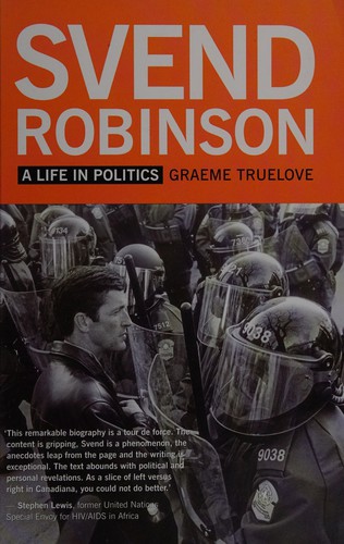
Svend Robinson : a life in politics
https://search.heritageburnaby.ca/link/museumlibrary6752
- Repository
- Burnaby Village Museum
- Author
- Truelove, Graeme, 1983-
- Publication Date
- 2013
- Call Number
- 971.0640 TRU
- Repository
- Burnaby Village Museum
- Collection
- Reference Collection
- Material Type
- Book
- ISBN
- 9781554200726
- Call Number
- 971.0640 TRU
- Author
- Truelove, Graeme, 1983-
- Place of Publication
- Vancouver
- Publisher
- New Star Books
- Publication Date
- 2013
- Printer
- Imprimerie Gauvin
- Physical Description
- 346 p. : ill. ; 23 cm.
- Library Subject (LOC)
- Canada. Parliament. House of Commons
- Gay politicians--Canada
- Politicians
- Politicians--British Columbia
- Politicians--Canada
- Politicians--Burnaby
- Biography
- Notes
- Includes bibliographical references (pages 306-326) and index.
Ten years in my first charge
https://search.heritageburnaby.ca/link/museumlibrary3115
- Repository
- Burnaby Village Museum
- Collection
- Special Collection
- Material Type
- Book
- Accession Code
- HV972.165.82
- Call Number
- 285.092 SCO
- Place of Publication
- Toronto, Ont.
- Publisher
- Hart & Company
- Publication Date
- 1891
- Physical Description
- xix, 357 p. ; 23 cm.
- Inscription
- "W 69" -- handwritten and crossed-out in pen on endpaper (front).
- "Mary Ann Urquhart's Book / Oct. 12th 1891 / Dunriegare P.a / Glengaray Cl Ont." -- handwritten in ink on endpaper (front).
- "F.J. M. Prat" -- handwriteen in pencil on endpaper (back).
- Library Subject (LOC)
- Presbyterian Church--Canada
- Presbyterian Church--Correspondence
- Biography
- Notes
- Includes index.
Thoughts and prayers for young communicants
https://search.heritageburnaby.ca/link/museumlibrary2709
- Repository
- Burnaby Village Museum
- Collection
- Special Collection
- Material Type
- Book
- Accession Code
- HV974.63.11
- Call Number
- 242 THO
- Contributor
- Tract Committee
- Place of Publication
- London
- Publisher
- Richard Clay and Sons
- Publication Date
- 1897
- Physical Description
- 1-4; 95 p.
- Inscription
- "C.S. Skyrme from Arthur Leigh-Lye Vicar, Kings Pyon" "Confirmation Day (March 5, 1900)"
- [Hand written, brown ink, inside front leaf.]
- Library Subject (LOC)
- Prayer
- Prayer--Christianity
- Object History
- Book belonged to donor's mother.
- Notes
- "Society for Promoting Christian Knowledge" Tp.
- "Published Under the Direction of the Tract Committee" Tp.
Touching incidents and remarkable answers to prayer
https://search.heritageburnaby.ca/link/museumlibrary1750
- Repository
- Burnaby Village Museum
- Edition
- Children's ed.
- Publication Date
- 1898
- Call Number
- 248.32 SHA
- Repository
- Burnaby Village Museum
- Collection
- Special Collection
- Material Type
- Book
- Accession Code
- HV984.21.141
- Call Number
- 248.32 SHA
- Edition
- Children's ed.
- Place of Publication
- Chicago, Ill.
- Publisher
- S. B. Shaw
- Publication Date
- 1898
- Physical Description
- 128 p. : ill. ; 20 cm.
- Library Subject (LOC)
- Prayer
- Prayer--Christianity
- Notes
- Includes photo of Mr. S.B. Shaw and Mrs. Etta Sadler Shaw
- Includes index.
The twentieth century speaker
https://search.heritageburnaby.ca/link/museumlibrary3443
- Repository
- Burnaby Village Museum
- Author
- Lumm, Emma Griffith
- Publication Date
- c1898
- Call Number
- 801 LUM
- Repository
- Burnaby Village Museum
- Collection
- Special Collection
- Material Type
- Book
- Accession Code
- BV994.13.4
- Call Number
- 801 LUM
- Author
- Lumm, Emma Griffith
- Place of Publication
- Chicago
- Publisher
- J. H. Moore & Co.
- Publication Date
- c1898
- Physical Description
- 432 p. : ill., ports. ; 25 cm.
- Library Subject (LOC)
- Recitations
- Notes
- "containing the best and noblest readings and orations that have been presented during the last one hundred years" --T.p. "including dramas, drills and tabeaux with old time costumes, also recent patriotic pieces, both pathetic and humorous, as well as selections appropriate for Christmas, New Year's, Easter, Thanksgiving, old settlers' gatherings, Labor Day, Arbor Days, etc., etc." --T.p. "complete for both private and pubic entertainment" --T.p.

Typewriter : the history, the machines, the writers
https://search.heritageburnaby.ca/link/museumlibrary6635
- Repository
- Burnaby Village Museum
- Author
- Allan, Tony, 1946-
- Publication Date
- c2015
- Call Number
- 681.6109 ALL
- Repository
- Burnaby Village Museum
- Collection
- Reference Collection
- Material Type
- Book
- ISBN
- 9781627950343
- Call Number
- 681.6109 ALL
- Author
- Allan, Tony, 1946-
- Contributor
- Polt, Richard F. H. 1964-
- Place of Publication
- New York
- Publisher
- Shelter Harbor Press
- Publication Date
- c2015
- Physical Description
- 96 p. : ill. (some col.) ; 15 x 21 cm
- Library Subject (LOC)
- Typewriters--History
- Typewriters
- Notes
- Includes index
- "Consultant : Richard Polt"
Vera's trust : a tale
https://search.heritageburnaby.ca/link/museumlibrary7011
- Repository
- Burnaby Village Museum
- Collection
- Special Collection
- Material Type
- Book
- Accession Code
- BV018.11.18
- Call Number
- 823.8 EVE
- Place of Publication
- London
- Publisher
- Thomas Nelson
- Publication Date
- 1899
- Physical Description
- 302 p. ; 19 cm.
- Inscription
- "A Prize given by / Mr. Allen / for Regular Attendance / Awarded to / Rhoda Lang, / she having attended / the whole 424 times / that the school was open during the past year / February 1st 1903" [note handwritten and glued onto front pastedown]
- Library Subject (LOC)
- Children's literature
- Fiction--19th century
- Object History
- Rhoda Lang was born in 1893 in Devon, England to William Henry Lang and Emla Wounacott. She and her first husband, Corp. Albert Edgar Exworthy had at least two children, W.A. Exworthy (William Albert / Bert) and Rosemary June Exworthy. After the death of her first husband in 1919, she married George Love in 1922. George adopted her children. Other accessioned items associated with Mr. Exworthy include: BV989.3.2, BV992.42.1, BV006.9.1, BV011.2, BV018.11.17, and BV018.11.19.
Victorian pharmacy : rediscovering forgotten remedies and recipes
https://search.heritageburnaby.ca/link/museumlibrary6758
- Repository
- Burnaby Village Museum
- Author
- Eastoe, Jane
- Publication Date
- 2010
- Call Number
- 615.1094 EAS
- Repository
- Burnaby Village Museum
- Collection
- Reference Collection
- Material Type
- Book
- Call Number
- 615.1094 EAS
- Author
- Eastoe, Jane
- Contributor
- Goodman, Ruth, 1963-
- Place of Publication
- London
- Publisher
- Pavilion
- Publication Date
- 2010
- Printer
- L.E.G.O. spa
- Physical Description
- 224 p. : ill. (chiefly col.), ports. ; 24 cm
- Library Subject (LOC)
- Traditional medicine
- Pharmacognosy
- Pharmaceutical industry
- Pharmacy
- Notes
- "As seen on BBC"--Cover
- "Foreword by Ruth Goodman".
- Includes bibliographical references (p. 206-207) and index.
- Summary: Follows the fascinating story of the emergence of high street healthcare in the form of the chemist's shop and the products on offer. Investigates which pills, potions, tonics and cures were available-- some effective, some deadly, and some still with us today.

Voices from Two Rivers : harnessing the power of the Peace and Columbia
https://search.heritageburnaby.ca/link/museumlibrary6429
- Repository
- Burnaby Village Museum
- Author
- Stanley, Meg, 1962-
- B.C. Hydro
- Publication Date
- c2010
- Call Number
- 333.793 STA
- Repository
- Burnaby Village Museum
- Collection
- Reference Collection
- Material Type
- Book
- ISBN
- 9781553654957
- Call Number
- 333.793 STA
- Author
- Stanley, Meg, 1962-
- B.C. Hydro
- Place of Publication
- Vancouver
- Publisher
- Douglas & McIntyre
- Publication Date
- c2010
- Physical Description
- vii, 312 p. : ill. (some col.), maps (some col.) ; 29 cm.
- Inscription
- Opposite of front end paper on the top half of page: "PRESENTED TO LISA COOD - CURATOR - BURNABY VILLAGE MUSEUM & CAROUSEL BY THE BC HYDRO POWER PIONEERS SEPT 29/12 HAPPY READING! PHIL HORTON - POWER PIONEER" [Printed in black ink]
- Library Subject (LOC)
- Hydroelectric power plants
- Notes
- Includes bibliographical references (p. 264-298) and index.
- "This book was commissioned by the BC Hydro Power Pioneers Association to recognize and celebrate the fiftieth anniversary of the BC Hydro and Power Authority."

Walhachin : birth of a legend
https://search.heritageburnaby.ca/link/museumlibrary6756
- Repository
- Burnaby Village Museum
- Author
- Jacobsen, Larry, 1928-
- Publication Date
- c2014
- Call Number
- 971.172 JAC
- Repository
- Burnaby Village Museum
- Collection
- Reference Collection
- Material Type
- Book
- ISBN
- 9780978164034
- Call Number
- 971.172 JAC
- Author
- Jacobsen, Larry, 1928-
- Place of Publication
- China
- Publication Date
- c2014
- Printer
- Prolong Press
- Physical Description
- 160 p., [30] p. : ill., maps ; 19 x 24 cm
- Inscription
- Title page (Lower right side) "Larry Jacobsen" [handwritten in black , author's signature]
- Library Subject (LOC)
- Walhachin (B.C.)
- Biography
- Notes
- Includes bibliographical references (page160).
- "Design and Layout by the author."
War in South Africa and the dark continent : from savagery to civilization
https://search.heritageburnaby.ca/link/museumlibrary2493
- Repository
- Burnaby Village Museum
- Author
- Harding, William
- Publication Date
- c1899
- Call Number
- 968.2 HAR
- Repository
- Burnaby Village Museum
- Collection
- Special Collection
- Material Type
- Book
- Accession Code
- HV975.30.6
- Call Number
- 968.2 HAR
- Author
- Harding, William
- Place of Publication
- Chicago
- Publisher
- Dominion
- Publication Date
- c1899
- Physical Description
- 11-550 p. : ill., ports. ; 25 cm.
- Library Subject (LOC)
- South African War, 1899-1902
- South Africa--History
- Notes
- "The strange story of a weird world from the earliest ages to the present, including the war with the Boers. Embracing the explorations and settlements, wars and conquests, peoples and governments, resources and produces, of this the least known, yet by nature endowed as the richest and most wonderful of continents, and a detailed history of the causes and events of the British-Boer War" --T.p.XXX "Superbly illustrated with half-tone engravings made from photographs taken expressly for this book" --T.p. Author's given name and dates: Harding, William Harry, 1941-
Webster's Dictionary
https://search.heritageburnaby.ca/link/museumlibrary2968
- Repository
- Burnaby Village Museum
- Author
- Webster, Noah, 1758-1843
- Edition
- Rev. and enl.
- Publication Date
- 1890
- Call Number
- 423 WEB
- Repository
- Burnaby Village Museum
- Collection
- Special Collection
- Material Type
- Book
- Accession Code
- HV972.117.7
- Call Number
- 423 WEB
- Edition
- Rev. and enl.
- Author
- Webster, Noah, 1758-1843
- Place of Publication
- New York
- Publisher
- Henry G. Allen
- Publication Date
- 1890
- Physical Description
- 1625 p. : ill. ; 27 cm.
- Library Subject (LOC)
- English language--Dictionaries
- Encyclopedias and dictionaries
- Notes
- Contributor's full name and dates: Goodrich, Chauncey A. (Chauncey Allen), 1790-1860
Where rivers, mountains and people meet : Sḵwx̱wú7mesh Lil'wat Cultural Centre
https://search.heritageburnaby.ca/link/museumlibrary7602
- Repository
- Burnaby Village Museum
- Collection
- Reference Collection
- Material Type
- Book
- Call Number
- 970.3 SQU
- Place of Publication
- Whistler, BC
- Publisher
- Spo7ez Cultural Centre & Community Society
- Publication Date
- 2010
- Physical Description
- 162 p. : ill. (chiefly col.) ; 26 cm.
- Subjects
- Indigenous peoples - British Columbia
- Indigenous peoples - British Columbia - Social life and customs
- Notes
- Text in Sḵwx̱wú7mesh, Lilwat7ul & English
The works of William Shakespeare : with life, glossary, etc.
https://search.heritageburnaby.ca/link/museumlibrary1884
- Repository
- Burnaby Village Museum
- Collection
- Special Collection
- Material Type
- Book
- Accession Code
- HV982.24.20
- Call Number
- 822.3 SHA
- Edition
- Universal ed.
- Place of Publication
- London
- Publisher
- Frederick Warne
- Publication Date
- 1893
- Printer
- Morrison and Gibb
- Physical Description
- vii, 1124 p. ; 19 cm.
- Inscription
- Title page: "Frank B. Street 6176 Walker Ave. Burnaby 1, B.C." [stamped in blue ink] verso of title page: "Pound." [written in pencil]
- Library Subject (LOC)
- English drama--Early modern and Elizabethan
- English poetry--Early modern
- Notes
- "carefully edited from the best texts and compared with recent commentators by the editor of the "Chandos" classics." -- t.p.