Narrow Results By
Decade
- 2020s
- 2010s 196
- 2000s 336
- 1990s 352
- 1980s 390
- 1970s 652
- 1960s 487
- 1950s
- 1940s 368
- 1930s 396
- 1920s 692
- 1910s 355
- 1900s 92
- 1890s
- 1880s 5
- 1870s 4
- 1860s 5
- 1850s 2
- 1840s 1
- 1830s 1
- 1820s 1
- 1810s 1
- 1800s 2
- 1790s 1
- 1780s 1
- 1770s 1
- 1760s 1
- 1750s 1
- 1740s 1
- 1730s 1
- 1720s 1
- 1710s 1
- 1700s 1
- 1690s 1
- 1680s 1
- 1670s 1
- 1660s 1
- 1650s 1
- 1640s 1
- 1630s 1
- 1620s 1
- 1610s 1
- 1600s 1
Subject
- Advertising Medium - Signs and Signboards 5
- Aerial Photographs 3
- Agriculture 1
- Agriculture - Farms 1
- Agriculture - Fruit and Berries 2
- Arts - Drawings 1
- Buildings - Civic - City Halls 10
- Buildings - Civic - Museums 1
- Buildings - Commercial 4
- Buildings - Commercial - Grocery Stores 4
- Buildings - Commercial - Malls 2
- Buildings - Commercial - Restaurants 3
Creator
- Adair, Neal G. 3
- Armstrong, Sophie 1
- Associated Factory Mutual Fire Insurance Cos 1
- Bateman, Caroline Mary Wettenhall 1
- B.C. Tree Fruits Limited 1
- Bergson, George 1
- Bingham, Alfred "Alf" 2
- British Columbia Electric Company 1
- Brown, Cice Chandler 1
- Burnaby Village Museum 5
- Capitol Hill Community Association 1
- Carter, David 1
Person / Organization
- Adams, John 1
- Bayntun, Charmaine "Sherrie" Yanko 3
- Bingham, Alfred "Alf" 5
- Bossort, Kathy 2
- Bradbury, Dr. Bettina 4
- British Columbia Electric Railway Company 1
- British Columbia Hydro and Power Authority 1
- Burnaby City Hall 10
- Burnaby General Hospital 1
- Burnaby Historical Society 1
- Burnaby Lawn Bowling Club 1
- Burnaby North High School 1
Burnaby Lake Neighbourhood
https://search.heritageburnaby.ca/link/landmark700
- Repository
- Burnaby Heritage Planning
- Associated Dates
- 1925-1954
- Heritage Value
- After World War I and the Great Depression of the 1930s, more homes were constructed and subdivisions created in the Burnaby Lake district. The area around Deer Lake gained a reputation for being an "artistic development of commodious homes with park-like grounds."
- Historic Neighbourhood
- Burnaby Lake (Historic Neighbourhood)
- Planning Study Area
- Burnaby Lake Area
Images
Burnaby North High School
https://search.heritageburnaby.ca/link/landmark745
- Repository
- Burnaby Heritage Planning
- Associated Dates
- 1923-1982
- Street View URL
- Google Maps Street View
- Repository
- Burnaby Heritage Planning
- Geographic Access
- Willingdon Avenue
- Associated Dates
- 1923-1982
- Heritage Value
- Burnaby North and Burnaby South were the first high schools built in the City. Before the high school opened, Burnaby students had to travel to Vancouver if they wished to pursue education beyond an elementary level. In 1921, arrangements were made to use the basement of the Presbyterian Church for instruction of local students. By 1922 the Burnaby North High School opened at its first permanent location (4375 Pandora Street - which is now Rosser Elementary). In 1945, the Willingdon Avenue site was built and was used until a new building was constructed in 1961 on Hammarskjold Drive. From 1962, the school was used as Burnaby Heights Junior High school, but it closed in 1982 and the junior high students went to the new Burnaby North on Hammarskjold.
- Historic Neighbourhood
- Capitol Hill (Historic Neighbourhood)
- Planning Study Area
- Capitol Hill Area
- Street Address
- 250 Willingdon Avenue
- Street View URL
- Google Maps Street View
Images
Edmonds Neighbourhood
https://search.heritageburnaby.ca/link/landmark704
- Repository
- Burnaby Heritage Planning
- Associated Dates
- 1925-1954
- Heritage Value
- The historic growth of Edmonds as a neighbourhood was based on its strategic location on the early interurban line between Vancouver and New Westminster. Even by 1980 when a survey of the residential neighbourhoods was conducted, a full 25% of homes in the area predated 1930. The 1950s was a period of strong housing development, with both single-family and multi-family units being constructed. Although Burnaby's City Hall was moved from Kingsway and Edmonds in the early 1950s, Edmonds remained an important centre in the community.
- Historic Neighbourhood
- Edmonds (Historic Neighbourhood)
- Planning Study Area
- Stride Avenue Area
Images
Jesse Love House
https://search.heritageburnaby.ca/link/landmark540
- Repository
- Burnaby Heritage Planning
- Description
- The Jesse Love House is a vernacular example of a late Victorian-era wood-frame farmhouse with later Arts and Crafts alterations and additions, that has been relocated to the Burnaby Village Museum. This two-storey house has an L-shaped plan, with a compound gabled roof, overhanging eaves and a lar…
- Associated Dates
- 1893
- Formal Recognition
- Heritage Designation, Community Heritage Register
- Other Names
- Jesse & Martha Love Farmhouse
- Street View URL
- Google Maps Street View
- Repository
- Burnaby Heritage Planning
- Other Names
- Jesse & Martha Love Farmhouse
- Geographic Access
- Deer Lake Avenue
- Associated Dates
- 1893
- Formal Recognition
- Heritage Designation, Community Heritage Register
- Enactment Type
- Bylaw No. 9807
- Enactment Date
- 23/11/1992
- Description
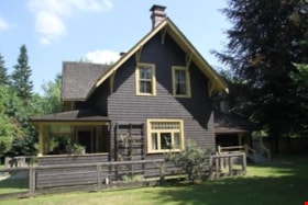
- The Jesse Love House is a vernacular example of a late Victorian-era wood-frame farmhouse with later Arts and Crafts alterations and additions, that has been relocated to the Burnaby Village Museum. This two-storey house has an L-shaped plan, with a compound gabled roof, overhanging eaves and a large wraparound verandah.
- Heritage Value
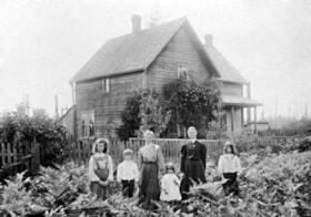
- The value of the Jesse Love House lies in its comprehensive representation of an early Burnaby farmhouse, and the typical additive growth of a home as the resident family prospered. Jesse Love (1849-1928) and his wife Martha Love (1858-1920) moved to Burnaby in 1893 with their family to start a fruit ranch and market garden on Cumberland Road in the East Burnaby district. Jesse Love was actively involved in community affairs, serving on the Burnaby School Board and also as a District Councillor in 1901 and from 1904-07. The original house was constructed by local builder George Salt and consisted of an entrance hall, dining room, lean-to kitchen, master bedroom and several rooms upstairs. As the family grew and prospered, additions were made to the house including a parlour, more bedrooms upstairs, and a large permanent kitchen. Jesse Love was actively involved in community affairs, and the kitchen became a local gathering spot for political discussion and civic organizations. The verandah, exterior shingle cladding, large windows, running water and electricity were eventually added as well. The heritage value for this house also lies in its interpretive value within the Burnaby Village Museum. The site is an important cultural feature for the interpretation of Burnaby’s heritage to the public. The house was moved to the Burnaby Village Museum in 1988 and both the interior and exterior were restored and interpreted to their 1925 period, including reproduction wallpaper.
- Defining Elements
- The character defining features of the Jesse Love House include its: - irregular form and massing - compound gable roof with cedar shingle cladding - Craftsman-style exterior features such as a shingled exterior and triangular eave brackets - multi-paned double-hung 2-over-2 wooden-sash windows; casement window assemblies with transoms in the Living Room - large wrap-around verandah - interior features such as pressed tin ceilings, original wallpapers and cedar panelled kitchen - reproduction Arts and Crafts parlour document wallpaper and border
- Locality
- Deer Lake Park
- Historic Neighbourhood
- Burnaby Lake (Historic Neighbourhood)
- Planning Study Area
- Morley-Buckingham Area
- Organization
- Burnaby Village Museum
- Builder
- George Salt
- Function
- Primary Current--Museum
- Primary Historic--Single Dwelling
- Community
- Burnaby
- Cadastral Identifier
- P.I.D. No. 011-030-356 Legal Description: Parcel 1, District Lot 79 and District Lot 85, Group 1, New Westminster District, Reference Plan 77594
- Boundaries
- Burnaby Village Museum is comprised of a single municipally-owned property located at 6501 Deer Lake Avenue, Burnaby.
- Area
- 38,488.63
- Contributing Resource
- Building
- Landscape Feature
- Structure
- Ownership
- Public (local)
- Documentation
- Heritage Site Files: PC77000 20. City of Burnaby Planning and Building Department, 4949 Canada Way, Burnaby, B.C., V5G 1M2
- Street Address
- 6501 Deer Lake Avenue
- Street View URL
- Google Maps Street View
Images
Morley Elementary School
https://search.heritageburnaby.ca/link/landmark835
- Repository
- Burnaby Heritage Planning
- Geographic Access
- Morley Street
- Associated Dates
- 1955
- Heritage Value
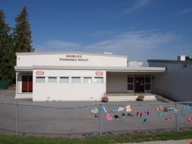
- In 1955 Morley Elementary School opened with 292 pupils, an indication of how quickly the residential areas around the Morley area were growing in the post-war period. Similar to other elementary schools built in Burnaby at the time, Morley was constructed on one level with classrooms in a line that could be added to as the need arose. Additions were made to the school in 1956, 1960 and 1969.
- Historic Neighbourhood
- Burnaby Lake (Historic Neighbourhood)
- Planning Study Area
- Morley-Buckingham Area
- Street Address
- 7355 Morley Street
- Street View URL
- Google Maps Street View
Images
Powerhouse
https://search.heritageburnaby.ca/link/landmark731
- Repository
- Burnaby Heritage Planning
- Geographic Access
- Griffiths Avenue
- Kingsway
- Associated Dates
- 1891
- Heritage Value
- Constructed in 1891 between Edmonds and Highland Park on the Central Park Interurban Line, the steam plant provided power to run the line, then operated by Westminster and Vancouver Tramway Company. The steam powerhouse was replaced in 1905 by a B.C. Electric substation which was put into operation to receive and distribute power from the B.C.E.R. Buntzen Lake power dam. Prior to Burnaby having its own Municipal Hall, Council meetings were often held at the boarding house adjacent to the powerhouse and in 1892, Burnaby’s first Council meeting was held at the boarding house in 1892.
- Historic Neighbourhood
- Edmonds (Historic Neighbourhood)
- Planning Study Area
- Kingsway-Beresford Area
Images
Royal Oak Hotel
https://search.heritageburnaby.ca/link/landmark726
- Repository
- Burnaby Heritage Planning
- Geographic Access
- Kingsway
- Associated Dates
- 1891
- Heritage Value
- One of the most notorious landmarks in Burnaby was the Royal Oak Hotel, constructed around 1891 at the present-day northeast corner of Kingsway and Royal Oak. Levis Morrison built the hotel, then sold out to Charles Cridland, whose poor hotel reputation prompted Burnaby council to hire its second police constable. The hotel continued to operate until 1973 when it was demolished to build a Safeway store.
- Historic Neighbourhood
- Central Park (Historic Neighbourhood)
- Planning Study Area
- Marlborough Area
- Street View URL
- Google Maps Street View
Images
1958 Schedule of Concrete Sidewalk Construction
https://search.heritageburnaby.ca/link/councilreport42580
- Repository
- City of Burnaby Archives
- Report ID
- 40713
- Meeting Date
- 25-Nov-1957
- Format
- Council - Mayor/Councillor/Staff Report
- Collection/Fonds
- City Council and Office of the City Clerk fonds
- Repository
- City of Burnaby Archives
- Report ID
- 40713
- Meeting Date
- 25-Nov-1957
- Format
- Council - Mayor/Councillor/Staff Report
- Collection/Fonds
- City Council and Office of the City Clerk fonds
Documents
1958 Schedule of Proposed Construction of Concrete Sidewalks
https://search.heritageburnaby.ca/link/councilreport42604
- Repository
- City of Burnaby Archives
- Report ID
- 40682
- Meeting Date
- 12-Nov-1957
- Format
- Council - Mayor/Councillor/Staff Report
- Collection/Fonds
- City Council and Office of the City Clerk fonds
- Repository
- City of Burnaby Archives
- Report ID
- 40682
- Meeting Date
- 12-Nov-1957
- Format
- Council - Mayor/Councillor/Staff Report
- Collection/Fonds
- City Council and Office of the City Clerk fonds
Documents
4674 Southlawn Drive construction
https://search.heritageburnaby.ca/link/archivedescription37872
- Repository
- City of Burnaby Archives
- Date
- [1954 or 1955] (date of original), copied 1991
- Collection/Fonds
- Burnaby Historical Society fonds
- Description Level
- Item
- Physical Description
- 1 photograph : b&w ; 2.8 x 2.8 cm print on contact sheet 20.1 x 26.7 cm
- Scope and Content
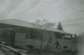
- Photograph of the begining construction of a house at 4674 Southlawn Drive.
- Repository
- City of Burnaby Archives
- Date
- [1954 or 1955] (date of original), copied 1991
- Collection/Fonds
- Burnaby Historical Society fonds
- Subseries
- Burnaby Image Bank subseries
- Physical Description
- 1 photograph : b&w ; 2.8 x 2.8 cm print on contact sheet 20.1 x 26.7 cm
- Description Level
- Item
- Record No.
- 370-460
- Access Restriction
- No restrictions
- Reproduction Restriction
- No restrictions
- Accession Number
- BHS1999-03
- Scope and Content
- Photograph of the begining construction of a house at 4674 Southlawn Drive.
- Subjects
- Construction
- Media Type
- Photograph
- Notes
- Title based on contents of photograph
- 1 b&w copy negative accompanying
- Negative has a pink cast
- Geographic Access
- Southlawn Drive
- Street Address
- 4674 Southlawn Drive
- Planning Study Area
- Brentwood Area
Images
5987 Malvern Avenue under construction
https://search.heritageburnaby.ca/link/archivedescription37587
- Repository
- City of Burnaby Archives
- Date
- April 1957 (date of original), copied 1991
- Collection/Fonds
- Burnaby Historical Society fonds
- Description Level
- Item
- Physical Description
- 1 photograph : b&w ; 3.1 x 4.6 cm print on contact sheet 20.2 x 25.3 cm
- Scope and Content
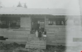
- Photograph of 5987 Malvern Avenue under construction in April, 1957. A women and two girls are standing on the front steps.
- Repository
- City of Burnaby Archives
- Date
- April 1957 (date of original), copied 1991
- Collection/Fonds
- Burnaby Historical Society fonds
- Subseries
- Burnaby Image Bank subseries
- Physical Description
- 1 photograph : b&w ; 3.1 x 4.6 cm print on contact sheet 20.2 x 25.3 cm
- Description Level
- Item
- Record No.
- 370-175
- Access Restriction
- No restrictions
- Reproduction Restriction
- No restrictions
- Accession Number
- BHS1999-03
- Scope and Content
- Photograph of 5987 Malvern Avenue under construction in April, 1957. A women and two girls are standing on the front steps.
- Media Type
- Photograph
- Notes
- Title based on contents of photograph
- 1 b&w copy negative accompanying
- Negative has a pink cast
- Geographic Access
- Malvern Avenue
- Street Address
- 5987 Malvern Avenue
- Historic Neighbourhood
- Burnaby Lake (Historic Neighbourhood)
- Planning Study Area
- Morley-Buckingham Area
Images
5987 Malvern Avenue under construction
https://search.heritageburnaby.ca/link/archivedescription37588
- Repository
- City of Burnaby Archives
- Date
- April 1957 (date of original), copied 1991
- Collection/Fonds
- Burnaby Historical Society fonds
- Description Level
- Item
- Physical Description
- 1 photograph : b&w ; 3.1 x 4.7 cm print on contact sheet 20.2 x 25.3 cm
- Scope and Content
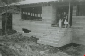
- Photograph of 5987 Malvern Avenue under construction in April, 1957. A women and two girls are standing on the front steps.
- Repository
- City of Burnaby Archives
- Date
- April 1957 (date of original), copied 1991
- Collection/Fonds
- Burnaby Historical Society fonds
- Subseries
- Burnaby Image Bank subseries
- Physical Description
- 1 photograph : b&w ; 3.1 x 4.7 cm print on contact sheet 20.2 x 25.3 cm
- Description Level
- Item
- Record No.
- 370-176
- Access Restriction
- No restrictions
- Reproduction Restriction
- No restrictions
- Accession Number
- BHS1999-03
- Scope and Content
- Photograph of 5987 Malvern Avenue under construction in April, 1957. A women and two girls are standing on the front steps.
- Media Type
- Photograph
- Notes
- Title based on contents of photograph
- 1 b&w copy negative accompanying
- Negative has a pink cast
- Geographic Access
- Malvern Avenue
- Street Address
- 5987 Malvern Avenue
- Historic Neighbourhood
- Burnaby Lake (Historic Neighbourhood)
- Planning Study Area
- Morley-Buckingham Area
Images
5987 Malvern Avenue under construction
https://search.heritageburnaby.ca/link/archivedescription37589
- Repository
- City of Burnaby Archives
- Date
- April 1957 (date of original), copied 1991
- Collection/Fonds
- Burnaby Historical Society fonds
- Description Level
- Item
- Physical Description
- 1 photograph : b&w ; 3.1 x 4.7 cm print on contact sheet 20.2 x 25.3 cm
- Scope and Content
- Photograph of 5987 Malvern Avenue under construction in April, 1957. A women and two girls are standing on the front steps.
- Repository
- City of Burnaby Archives
- Date
- April 1957 (date of original), copied 1991
- Collection/Fonds
- Burnaby Historical Society fonds
- Subseries
- Burnaby Image Bank subseries
- Physical Description
- 1 photograph : b&w ; 3.1 x 4.7 cm print on contact sheet 20.2 x 25.3 cm
- Description Level
- Item
- Record No.
- 370-177
- Access Restriction
- No restrictions
- Reproduction Restriction
- No restrictions
- Accession Number
- BHS1999-03
- Scope and Content
- Photograph of 5987 Malvern Avenue under construction in April, 1957. A women and two girls are standing on the front steps.
- Media Type
- Photograph
- Notes
- Title based on contents of photograph
- 1 b&w copy negative accompanying
- Negative has a pink cast
- Geographic Access
- Malvern Avenue
- Street Address
- 5987 Malvern Avenue
- Historic Neighbourhood
- Burnaby Lake (Historic Neighbourhood)
- Planning Study Area
- Morley-Buckingham Area
Images
Agreement between Burnaby and C.B. Riley Construction Co. Regarding the Sale of Lots in DL 122/123/124
https://search.heritageburnaby.ca/link/councilreport46227
- Repository
- City of Burnaby Archives
- Report ID
- 45808
- Meeting Date
- 8-Jun-1953
- Format
- Council - Mayor/Councillor/Staff Report
- Collection/Fonds
- City Council and Office of the City Clerk fonds
- Repository
- City of Burnaby Archives
- Report ID
- 45808
- Meeting Date
- 8-Jun-1953
- Format
- Council - Mayor/Councillor/Staff Report
- Collection/Fonds
- City Council and Office of the City Clerk fonds
Documents
Agreement between the Corporation and the BC Electric Company Limited in Respect to the Construction of a Water Main at 18th Avenue and 20th Street
https://search.heritageburnaby.ca/link/councilreport42489
- Repository
- City of Burnaby Archives
- Report ID
- 37995
- Meeting Date
- 13-Jan-1958
- Format
- Council - Mayor/Councillor/Staff Report
- Collection/Fonds
- City Council and Office of the City Clerk fonds
- Repository
- City of Burnaby Archives
- Report ID
- 37995
- Meeting Date
- 13-Jan-1958
- Format
- Council - Mayor/Councillor/Staff Report
- Collection/Fonds
- City Council and Office of the City Clerk fonds
Documents
Agreement Covering the Operation of the Stride Pit by the E.R. Taylor Construction Company
https://search.heritageburnaby.ca/link/councilreport47337
- Repository
- City of Burnaby Archives
- Report ID
- 47418
- Meeting Date
- 11-Dec-1950
- Format
- Council - Mayor/Councillor/Staff Report
- Collection/Fonds
- City Council and Office of the City Clerk fonds
- Repository
- City of Burnaby Archives
- Report ID
- 47418
- Meeting Date
- 11-Dec-1950
- Format
- Council - Mayor/Councillor/Staff Report
- Collection/Fonds
- City Council and Office of the City Clerk fonds
Documents
Agreement With BC Electric Railway Company Limited - Construction and Maintenance of an 8' Water Pipe (Dow Road and Sussex Avenue)
https://search.heritageburnaby.ca/link/councilreport42357
- Repository
- City of Burnaby Archives
- Report ID
- 38106
- Meeting Date
- 3-Mar-1958
- Format
- Council - Mayor/Councillor/Staff Report
- Collection/Fonds
- City Council and Office of the City Clerk fonds
- Repository
- City of Burnaby Archives
- Report ID
- 38106
- Meeting Date
- 3-Mar-1958
- Format
- Council - Mayor/Councillor/Staff Report
- Collection/Fonds
- City Council and Office of the City Clerk fonds
Documents
Agreement with C.B. Riley Construction Company in Respect of Property Purchased in Block 2, DL 73 and in DL 70
https://search.heritageburnaby.ca/link/councilreport46084
- Repository
- City of Burnaby Archives
- Report ID
- 45954
- Meeting Date
- 28-Sep-1953
- Format
- Council - Mayor/Councillor/Staff Report
- Collection/Fonds
- City Council and Office of the City Clerk fonds
- Repository
- City of Burnaby Archives
- Report ID
- 45954
- Meeting Date
- 28-Sep-1953
- Format
- Council - Mayor/Councillor/Staff Report
- Collection/Fonds
- City Council and Office of the City Clerk fonds
Documents
Agreement with the E.R. Taylor Construction Company for Supplying Gravel from Stride Avenue Pit
https://search.heritageburnaby.ca/link/councilreport47441
- Repository
- City of Burnaby Archives
- Report ID
- 47315
- Meeting Date
- 28-Aug-1950
- Format
- Council - Mayor/Councillor/Staff Report
- Collection/Fonds
- City Council and Office of the City Clerk fonds
- Repository
- City of Burnaby Archives
- Report ID
- 47315
- Meeting Date
- 28-Aug-1950
- Format
- Council - Mayor/Councillor/Staff Report
- Collection/Fonds
- City Council and Office of the City Clerk fonds
Documents
Apartment Construction on Lot 12, Block 42, DL 151/153
https://search.heritageburnaby.ca/link/councilreport44568
- Repository
- City of Burnaby Archives
- Report ID
- 44516
- Meeting Date
- 8-Aug-1955
- Format
- Council - Mayor/Councillor/Staff Report
- Collection/Fonds
- City Council and Office of the City Clerk fonds
- Repository
- City of Burnaby Archives
- Report ID
- 44516
- Meeting Date
- 8-Aug-1955
- Format
- Council - Mayor/Councillor/Staff Report
- Collection/Fonds
- City Council and Office of the City Clerk fonds



![4674 Southlawn Drive construction, [1954 or 1955] (date of original), copied 1991 thumbnail](/media/hpo/_Data/_Archives_Images/_Unrestricted/370/370-460.jpg?width=280)
