Narrow Results By
Decade
- 2020s 56
- 2010s 46
- 2000s
- 1990s 27
- 1980s 16
- 1970s 27
- 1960s 37
- 1950s 47
- 1940s
- 1930s 32
- 1920s 42
- 1910s 77
- 1900s 55
- 1890s
- 1880s 6
- 1870s 3
- 1860s 3
- 1850s 1
- 1840s 1
- 1830s 1
- 1820s 1
- 1810s 1
- 1800s 1
- 1790s 1
- 1780s 1
- 1770s 1
- 1760s 1
- 1750s 1
- 1740s 1
- 1730s 1
- 1720s 1
- 1710s 1
- 1700s 1
- 1690s 1
- 1680s 1
- 1670s 1
- 1660s 1
- 1650s 1
- 1640s 1
- 1630s 1
- 1620s 1
- 1610s 1
- 1600s 1
Subject
- Buildings - Heritage 1
- Buildings - Public - Detention Facilities 1
- Education 1
- Events - Competitions 1
- Events - May Day 1
- Events - Parades 1
- First Nations reserves - British Columbia 2
- Geographic Features - Mountains 1
- Housing 1
- Indigenous peoples - Indian Territory 2
- Performances 1
- Persons - South Asian Canadians 1
Creator
- British Columbia Electric Company 2
- British Columbia Underwriters' Association 4
- Burnaby Village Museum 6
- Burnaby Village Museum - City of Burnaby 2
- Burnett, David H. 1
- City of Burnaby 1
- Corsbie, Joseph Hardcastle-Cumberland "Joe" 1
- Digney, Andy 1
- Draper, William Nelson 1
- Frame, Norvie Leggett 1
- Garden, Hermon and Burwell 3
- Garden, Hermon & Burwell 1
Person / Organization
- British Columbia Electric Railway Company 3
- Burnaby Art Gallery 2
- Burnaby Lawn Bowling Club 1
- Burnaby Village Museum 5
- Canada Summer Games 1
- Codd, Lisa 1
- Corsbie, Joseph Hardcastle-Cumberland "Joe" 2
- C.W. Parker no. 119 Carousel 3
- Digney, Andy 1
- Digney Bowling Alley 1
- Digney Speedway 1
- Friends of Simon 1
Love and Leonard land records series
https://search.heritageburnaby.ca/link/museumdescription18838
- Repository
- Burnaby Village Museum
- Date
- 1893-1962
- Collection/Fonds
- Love family fonds
- Description Level
- Series
- Physical Description
- 5 plans + 8 cm of textual records
- Scope and Content
- Series consists of land deeds, land sale agreements, documents regarding payment and survey and subdivision plans. Records refer to the Love family property in District Lot 25, the Leonard family property in District Lot 352 and other lots in Burnaby.
- Repository
- Burnaby Village Museum
- Collection/Fonds
- Love family fonds
- Description Level
- Series
- Physical Description
- 5 plans + 8 cm of textual records
- Scope and Content
- Series consists of land deeds, land sale agreements, documents regarding payment and survey and subdivision plans. Records refer to the Love family property in District Lot 25, the Leonard family property in District Lot 352 and other lots in Burnaby.
- Accession Code
- BV992.26
- BV012.31
- Date
- 1893-1962
- Media Type
- Textual Record
- Cartographic Material
- Notes
- Title based on contents of series
Love family fonds
https://search.heritageburnaby.ca/link/museumdescription10098
- Repository
- Burnaby Village Museum
- Date
- 1881-1971
- Collection/Fonds
- Love family fonds
- Description Level
- Fonds
- Physical Description
- 11 cm of textual records + 44 photographs + 5 plans
- Scope and Content
- Fonds consists of family records including photographs, land sale records, agreements and plans as well as estate records, vital event documentation and correspondence. Records pertain to members of the Love family including the Parkers, Hughes and Leonards. Fonds has been arranged in the followin…
- Repository
- Burnaby Village Museum
- Collection/Fonds
- Love family fonds
- Description Level
- Fonds
- Physical Description
- 11 cm of textual records + 44 photographs + 5 plans
- Scope and Content
- Fonds consists of family records including photographs, land sale records, agreements and plans as well as estate records, vital event documentation and correspondence. Records pertain to members of the Love family including the Parkers, Hughes and Leonards. Fonds has been arranged in the following series: 1) Love and Leonard land records 2) Love family vital events and correspondence 3) Love family photographs
- History
- Jesse Love was born in Swindon, England in 1847 and left England to work on a dairy farm in the Toronto area. While working on the farm in Toronto, he met Martha Leonard who he married in 1879. Martha was born on February 3, 1858 in Bedfordshire, England and had come to Canada with her parents George and Ann Leonard. While living in Toronto, Jesse and Martha had two children, George born March 22, 1880 and Annie Elizabeth on August 24, 1881. About one year after Annie was born, the Love family moved to North Dakota to grow wheat. While living there, they had two more children, Henry who was born August 24, 1883 and Edith Minnie born October 9, 1885. The family decided to move further west after hearing about the fairer weather conditions from Martha’s father, George Leonard, who had settled in Vancouver in 1885. On May 23, 1887, Jesse, Martha and their four children arrived in Vancouver after travelling across Canada from Winnipeg on the first transcontinental train. The Loves made their home in Vancouver while Jesse helped clear land on Granville Street. Their fifth child, Thomas Robert was born on September 17, 1887 and soon after, the family moved to Lulu Island in Richmond where they lived growing vegetables and selling them to Vancouver hotels. While living and farming on Lulu island, the couple had two more girls, Martha (Dot or Dorothy) born on December 17, 1889 and Sarah Marie, born February 8, 1892. On October 6, 1893 an agreement was signed by Jesse Love to purchase 14.52 acres of land from Joseph C. Armstrong. The acreage covered the north east section of District Lot 25 within the newly incorporated District of the Municipality of Burnaby. It was here where the original Love house was built (between October 1893 and April 15, 1894) by Jesse Love with the help of local builder George Salt and father in law, George Leonard. The house consisted of an entrance hall, dining room, lean to kitchen, master bedroom and three bedrooms upstairs. A road was constructed and named Cumberland in 1905 and ran from District Lot 25 through to District Lot 11. The address for the Love home was 1390 Cumberland Road and in the early 1960’s the address was renumbered 7651 Cumberland Street. On the land surrounding the house, Jesse Love planted an orchard along with strawberries and raspberries which he sold at the Fraser Valley Market, T.S. Anandale’s Grocery Store in New Westminster and to hotels around Vancouver. Jesse Love served on the Burnaby School Board and also as a District Councillor in 1901 and from 1904-1907. While living in the house, Jesse and Martha had four more children, Phoebe Leonard, born April 15, 1894, Esther, born August 28, 1896, John Leonard, born June 7, 1899 and Hannah Victoria (also known as Girlie) who was born May 12, 1902. In 1918, at the age of 31 years, Thomas Robert Love fell ill due to an influenza epidemic and died on November 23, 1918. Following their son’s death, Martha Love became weak and on August 24, 1920, she passed away. By this time, Jesse had sold off a large percentage of his land and his youngest daughter, Girlie decided to stay on to live and care for him. Since the house was too large for just the two of them, Jesse invited any other children to return and share the residence. For a while his son, George and his wife joined them. In 1925 Jesse’s daughter Sarah Parker (nee Love), her husband William Michael Norton Parker and their three children, Albert “Bert” (1915-2011), William Charles “Bill” and Elsie Roberta moved from their home at 1319 Newcombe Street to join Jesse and Girlie in the Love family home on Cumberland. Jesse Love died in 1928 after which Sarah and William Parker purchased the Love family farmhouse and property. William Michael Parker, died in 1961 and Sarah Parker continued to live in the Love family farmhouse until 1966 when she sold it to her daughter Elsie and husband John Hughes. Elsie and John Hughes had four children, John Jr., Ann, Brent and Merle. The Hughes lived in the Love family house until August 1971. In 1988 the Love family farmhouse house was donated to the Burnaby Village Museum and moved to the site of Burnaby Village Museum. The interior of the main floor and exterior of the house went through an extensive restoration process. In 1997, restoration of the kitchen was completed and opened to the public. After the completion of the hallway, dining room, main floor bedroom and parlour, the Love farmhouse exhibit opened on November 29, 1998 with an open invitation to the public and extended members of the Love family.
- Responsibility
- Love Family
- Accession Code
- HV979.40
- BV985.3136
- BV988.45
- BV989.3
- BV992.15
- BV992.26
- BV992.34
- BV000.45
- BV008.20
- BV012.31
- BV019.3
- BV019.8
- Date
- 1881-1971
- Media Type
- Textual Record
- Photograph
- Cartographic Material
- Arrangement
- Fonds has been arranged by record type and original order provided by members of the Love family.
- Notes
- Title based on contents of fonds
- See also Burnaby Village Museum fonds - Jesse Love farmhouse series
Love farmhouse oral history project subseries
https://search.heritageburnaby.ca/link/museumdescription10392
- Repository
- Burnaby Village Museum
- Date
- 1925-1930 (interview content), interviewed between 1988 and 1991
- Collection/Fonds
- Burnaby Village Museum fonds
- Description Level
- Subseries
- Physical Description
- Textual records + 3 audio cassettes + 1 videocassette
- Scope and Content
- Subseries consists of records created and collected during research of the Love family and the Love family farmhouse and include oral history interviews in various formats. Interviews were conducted by Jim Wolf and Burnaby Village Museum curator Colin Stevens with members of the Love family includi…
- Repository
- Burnaby Village Museum
- Collection/Fonds
- Burnaby Village Museum fonds
- Series
- Jesse Love farmhouse series
- Description Level
- Subseries
- Physical Description
- Textual records + 3 audio cassettes + 1 videocassette
- Scope and Content
- Subseries consists of records created and collected during research of the Love family and the Love family farmhouse and include oral history interviews in various formats. Interviews were conducted by Jim Wolf and Burnaby Village Museum curator Colin Stevens with members of the Love family including; Annie Chamberlain, William Parker, Esther Stanley, Albert Parker and Elsie Hughes. Interviews were focused on the subject of the interior and exterior of the farmhouse from a first person perspective. The goal was to obtain as much information as possible from family members in order to accurately restore, furnish and exhibit the farmhouse back to it's original 1920s era.
- Accession Code
- BV018.41
- Access Restriction
- No restrictions
- Reproduction Restriction
- May be restricted by third party rights
- Date
- 1925-1930 (interview content), interviewed between 1988 and 1991
- Media Type
- Textual Record
- Sound Recording
- Moving Images
- Notes
- Title based on content of subseries
Many Voices Project Interviews subseries
https://search.heritageburnaby.ca/link/museumdescription19596
- Repository
- Burnaby Village Museum
- Date
- [1890-2023] (interview content), interviewed 2024
- Collection/Fonds
- Burnaby Village Museum fonds
- Description Level
- Subseries
- Physical Description
- 33 sound recordings (wav) + 3 video recordings (mp4) + 17 sound recordings (mp3) + 1 sound recording (m4a)
- Scope and Content
- Subseries consists of oral history interviews that were conducted as part of Burnaby Village Museum's Many Voices Project to capture and document diverse lives and stories of people connected to Burnaby. Interviews were conducted with Shirley Cohn; Ram Sarap Chandhal and members of Shri Ravidass S…
- Repository
- Burnaby Village Museum
- Collection/Fonds
- Burnaby Village Museum fonds
- Series
- Museum Oral Histories series
- Subseries
- Many Voices Project Interviews subseries
- Description Level
- Subseries
- Physical Description
- 33 sound recordings (wav) + 3 video recordings (mp4) + 17 sound recordings (mp3) + 1 sound recording (m4a)
- Material Details
- Digital master recordings (wav) were recorded onto separate audio tracks. Multiple tracks per interview were edited and merged together and converted to mp3 for access on Heritage Burnaby
- Some of the video recording (mp4) files were edited and saved as audio recording (wav) files
- Scope and Content
- Subseries consists of oral history interviews that were conducted as part of Burnaby Village Museum's Many Voices Project to capture and document diverse lives and stories of people connected to Burnaby. Interviews were conducted with Shirley Cohn; Ram Sarap Chandhal and members of Shri Ravidass Sabha gudawara; Lachman Singh Gill; Joanne Smith; Ellen and Bill Schwartz; Sadhu Binning and Sukhwant Hundal (founders of Vancouver Sath); Samuel Nalliah and Ruth (Angela) Nalliah; Jagandeep "Jag" Nagra; David Skulski; Kanwal Singh Neel; "The Bollywood Boyz" Harv Sihra and Gurvinder Sihra; Jenny Siormanolakis; Bill Gruenthal; Lama Tenzin Sherpa and Lama Sue Salter; Norman Dowad; Richard Liu; Shanaz Khan; Harry Toy; Lisette Pappas; Alex and Georgia Chronakis; Donna Wong and Jeffrey Wong.
- Accession Code
- BV023.16
- BV024.4
- Date
- [1890-2023] (interview content), interviewed 2024
- Media Type
- Sound Recording
- Moving Images
- Notes
- Title based on contents of subseries
- Some of the recordings within this subseries have access restrictions
- Further accruals are expected

Map of South Western Part of British Columbia
https://search.heritageburnaby.ca/link/museumdescription8688
- Repository
- Burnaby Village Museum
- Date
- 1897
- Collection/Fonds
- Burnaby Village Museum Map collection
- Description Level
- Item
- Physical Description
- 1 map : col. ink on paper ; 68 x 88 cm
- Scope and Content
- Item consists of a "MAP OF THE SOUTH-WESTERN PART OF BRITISH COLUMBIA”. Map identifies geographic land districts of New Westminster District; Coast District; Lillooet District; Yale District, Kamloops Division, Yale Division and districts on Vancouver Island. Map also includes the northern portions…
- Repository
- Burnaby Village Museum
- Collection/Fonds
- Burnaby Village Museum Map collection
- Description Level
- Item
- Physical Description
- 1 map : col. ink on paper ; 68 x 88 cm
- Material Details
- Scale [1:633600]
- Scope and Content
- Item consists of a "MAP OF THE SOUTH-WESTERN PART OF BRITISH COLUMBIA”. Map identifies geographic land districts of New Westminster District; Coast District; Lillooet District; Yale District, Kamloops Division, Yale Division and districts on Vancouver Island. Map also includes the northern portions of the State of Washington below the 49th parallel.
- Publisher
- The Colonist Litho Victoria B.C.
- Responsibility
- Martin, George Bohun
- Accession Code
- BV993.12.12
- Access Restriction
- No restrictions
- Reproduction Restriction
- No known restrictions
- Date
- 1897
- Media Type
- Cartographic Material
- Scan Resolution
- 600
- Scan Date
- 2023-08-17
- Notes
- Transcribed title
- Scale equals 1 inch to 10 miles
- "Compiled and drawn by direction of the Honouable G.B. Martin, Chief Commissioner of Lands and Works, Victoria, B.C."
- Signed by Surveyor General "Tom Kains"
Zoomable Images

![Municipality of Burnaby - Volume XV and Volume XVIII, 1927-[1940] thumbnail](/media/hpo/_Data/_BVM_Artifacts/1972/1972_0111_0004_003.jpg?width=280)
Municipality of Burnaby - Volume XV and Volume XVIII
https://search.heritageburnaby.ca/link/museumdescription8682
- Repository
- Burnaby Village Museum
- Date
- 1927-[1940]
- Collection/Fonds
- Burnaby Village Museum Map collection
- Description Level
- File
- Physical Description
- 4 plans on 4 sheets: col. lithographic prints ; 63.5 x 53.5 cm folded to 53 x 31.5 cm
- Scope and Content
- File consists of four pages of plans removed from a bound book containing a series of fire insurance plans of the Municipality of Burnaby. Plan "1518" and "1519" are from "GREATER VANCOUVER B.C. / VOLUME XV / Municipality of Burnaby / May, 1927". Plan "1518" covers District Lot 116 and Plan "1519"…
- Repository
- Burnaby Village Museum
- Collection/Fonds
- Burnaby Village Museum Map collection
- Description Level
- File
- Physical Description
- 4 plans on 4 sheets: col. lithographic prints ; 63.5 x 53.5 cm folded to 53 x 31.5 cm
- Material Details
- Scale [1:600]
- Scope and Content
- File consists of four pages of plans removed from a bound book containing a series of fire insurance plans of the Municipality of Burnaby. Plan "1518" and "1519" are from "GREATER VANCOUVER B.C. / VOLUME XV / Municipality of Burnaby / May, 1927". Plan "1518" covers District Lot 116 and Plan "1519" covers District Lot 121. Plan "1802" and plan "1803" are from "GREATER VANCOUVER B.C. / VOLUME XVIII / Municipality of Burnaby / May, 1927". Both plans "1802" and "1803" cover District Lot 153.
- Responsibility
- British Columbia Underwriters' Association
- Accession Code
- HV972.111.4
- Access Restriction
- No restrictions
- Reproduction Restriction
- May be restricted by third party rights
- Date
- 1927-[1940]
- Media Type
- Cartographic Material
- Historic Neighbourhood
- Vancouver Heights (Historic Neighbourhood)
- Central Park (Historic Neighbourhood)
- Planning Study Area
- Willingdon Heights Area
- Marlborough Area
- Scan Resolution
- 400
- Scan Date
- 2021-11-18
- Notes
- Title based on content of plans
- See also BV987.1.70d for revised versions of plans
- Scale is measured 1 inch = 50 feet
- Contact Burnaby Village Museum to access plans 1518 and 1519 (these plans have revisions on top - date of revisions is uncertain)
Images
![Municipality of Burnaby - Volume XV and Volume XVIII, 1927-[1940] thumbnail](/media/hpo/_Data/_BVM_Artifacts/1972/1972_0111_0004_003.jpg)

Museum exhibits series
https://search.heritageburnaby.ca/link/museumdescription16037
- Repository
- Burnaby Village Museum
- Date
- 1990-2021
- Collection/Fonds
- Burnaby Village Museum fonds
- Description Level
- Series
- Physical Description
- 1 digital illustration (pdf) + 1 painting (tiff) + 9 sound recordings (mp3) + 2 video recordings (mp4) + 6.5 cm of textual records
- Scope and Content
- Series consists of photographs, graphic materials and other records pertaining to Burnaby Village Museum temporary and permanent exhibits. A selection of temporary exihibits are described by title and year. Series have been arranged by exhibit title into the following subseries: 1) Burnaby's Best …
- Repository
- Burnaby Village Museum
- Collection/Fonds
- Burnaby Village Museum fonds
- Series
- Museum exhibits series
- Description Level
- Series
- Physical Description
- 1 digital illustration (pdf) + 1 painting (tiff) + 9 sound recordings (mp3) + 2 video recordings (mp4) + 6.5 cm of textual records
- Scope and Content
- Series consists of photographs, graphic materials and other records pertaining to Burnaby Village Museum temporary and permanent exhibits. A selection of temporary exihibits are described by title and year. Series have been arranged by exhibit title into the following subseries: 1) Burnaby's Best Baby contest subseries 2) Across the Pacific subseries 3) Agents of Change subseries 4) Museum materials for exhibits subseries
- Names
- Burnaby Village Museum
- Accession Code
- BV020.5
- BV019.36.1
- BV019.61.1
- BV020.42
- BV021.14
- Date
- 1990-2021
- Arrangement
- Series are arranged by subseries by exhibit title and year.
- Notes
- Title based on contents of series
- Further accruals expected
Museum film collection series
https://search.heritageburnaby.ca/link/museumdescription16032
- Repository
- Burnaby Village Museum
- Date
- 1990-2021 (date of originals), digitized in 2020
- Collection/Fonds
- Burnaby Village Museum fonds
- Description Level
- Series
- Physical Description
- 17 videocassettes + 3 video recordings (mp4)
- Scope and Content
- Series consists of a collection of promotional videos, documentary footage of special events, programs, restoration and construction projects, videos used for exhibits and research as well as copies of television news coverage about Burnaby Village Museum and a video recording of a book launch.
- Repository
- Burnaby Village Museum
- Collection/Fonds
- Burnaby Village Museum fonds
- Description Level
- Series
- Physical Description
- 17 videocassettes + 3 video recordings (mp4)
- Scope and Content
- Series consists of a collection of promotional videos, documentary footage of special events, programs, restoration and construction projects, videos used for exhibits and research as well as copies of television news coverage about Burnaby Village Museum and a video recording of a book launch.
- Names
- Burnaby Village Museum
- Accession Code
- X2294
- BV017.39
- BV019.18
- BV020.4
- BV020.5
- BV021.7.1
- Date
- 1990-2021 (date of originals), digitized in 2020
- Media Type
- Moving Images
- Notes
- Title based on contents of series
- Further accruals are expected
Museum Oral Histories series
https://search.heritageburnaby.ca/link/museumdescription18810
- Repository
- Burnaby Village Museum
- Date
- [1600-2023] (interview content), interviewed 2005-2023
- Collection/Fonds
- Burnaby Village Museum fonds
- Description Level
- Series
- Physical Description
- 52 sound recordings (wav) + 61 sound recordings (mp3) + 1 video recording (mp4) + 1 sound recording (m4a) + 51 video recordings (mov)
- Scope and Content
- Series consists of oral history interviews conducted by staff of Burnaby Village Museum for various projects. Series has been arranged into subseries: 1) Growing Up in Burnaby subseries 2) Museum research interviews subseries 3) Chinese Canadians in Burnaby subseries 4) South Asian Canadian Interv…
- Repository
- Burnaby Village Museum
- Collection/Fonds
- Burnaby Village Museum fonds
- Series
- Museum Oral Histories series
- Description Level
- Series
- Physical Description
- 52 sound recordings (wav) + 61 sound recordings (mp3) + 1 video recording (mp4) + 1 sound recording (m4a) + 51 video recordings (mov)
- Scope and Content
- Series consists of oral history interviews conducted by staff of Burnaby Village Museum for various projects. Series has been arranged into subseries: 1) Growing Up in Burnaby subseries 2) Museum research interviews subseries 3) Chinese Canadians in Burnaby subseries 4) South Asian Canadian Interviews subseries 5) Many Voices Project Interviews subseries
- Accession Code
- BV017.45
- BV018.18.1
- BV019.13.1
- BV019.14.1
- BV019.15.1
- BV020.6
- BV022.29
- BV023.1
- BV023.16
- BV024.4
- Date
- [1600-2023] (interview content), interviewed 2005-2023
- Media Type
- Sound Recording
- Moving Images
- Notes
- Title based on contents of series
- Further accruals expected
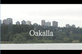
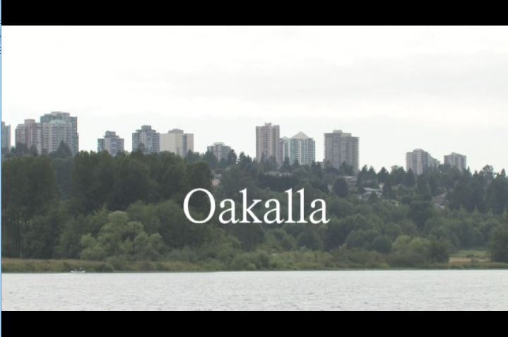
Oakalla
https://search.heritageburnaby.ca/link/museumlibrary1393
- Repository
- Burnaby Village Museum
- Author
- Jack, Ronald
- Publication Date
- c2009
- Call Number
- 365.9711 JAC VR
- Repository
- Burnaby Village Museum
- Collection
- Reference Collection
- Material Type
- Moving Images
- Accession Code
- BV020.5.1059
- Call Number
- 365.9711 JAC VR
- Author
- Jack, Ronald
- Place of Publication
- Vancouver, B.C.
- Publisher
- Runagate Pictures
- Publication Date
- c2009
- Physical Description
- 1 videodisc (9 min., 52 sec.) : sd., col. ; 4 3/4 in
- Library Subject (LOC)
- Lower Mainland Regional Corrections Centre--History
- Prisons--British Columbia
- Historic Neighbourhood
- Burnaby Lake (Historic Neighbourhood)
- Planning Study Area
- Oakalla Area
- Geographic Access
- Oakmount Crescent
- Street Address
- 5220 Oakmount Crescent
- Notes
- "A preview DVD" titled "Oakalla" compiled by Ronald Jack. Film footage consists of historic and contemporary images regarding Oakalla Prison Farm and includes commentaries from Burnaby Village Museum Curator, Tom Gooden; Oakalla Historian and Vancouver Police Officer, Earl Anderson and Burnaby Mayor, Derek Corrigan (former Oakalla prison guard). A collection of Oakalla artifacts are included in the film footage.
- Contact Burnaby Village Museum to view video content
Images

Okanagan Fishing Guide
https://search.heritageburnaby.ca/link/museumdescription11398
- Repository
- Burnaby Village Museum
- Date
- 1948
- Collection/Fonds
- Burnaby Village Museum Map collection
- Description Level
- Item
- Physical Description
- 1 map : col. ink on paper handcol. ; 24 x 35 cm
- Scope and Content
- Item consists of map titled "Okanagan Fishing Guide / Showing / Major Roads / and the / Best Fish Lakes". Hand drawn map compiled and drawn by W.C. Rueber, Kelowna B.C. of Okanagan Lake area. Advertisement at bottom of page indicates that it may have been produced by "OK USED FURNITURE STORE / 239 …
- Repository
- Burnaby Village Museum
- Collection/Fonds
- Burnaby Village Museum Map collection
- Description Level
- Item
- Physical Description
- 1 map : col. ink on paper handcol. ; 24 x 35 cm
- Scope and Content
- Item consists of map titled "Okanagan Fishing Guide / Showing / Major Roads / and the / Best Fish Lakes". Hand drawn map compiled and drawn by W.C. Rueber, Kelowna B.C. of Okanagan Lake area. Advertisement at bottom of page indicates that it may have been produced by "OK USED FURNITURE STORE / 239 BERNARD AVE., KELOWNA, B.C....". The map was copyrighted in Canada on July 20, 1948, No. 79416.
- Creator
- Rueber, W.C.
- Publisher
- OK Used Furniture Store
- Accession Code
- BV006.24.116
- Access Restriction
- No restrictions
- Reproduction Restriction
- May be restricted by third party rights
- Date
- 1948
- Media Type
- Cartographic Material
- Scan Resolution
- 600
- Scan Date
- 2021-11-23
- Notes
- Transcribed title
- Staining on map with creases from being folded and handcoloured markings with blue pencil
Images


Part of the New Westminster District shewing the Proposed New Municipality of Burnaby
https://search.heritageburnaby.ca/link/museumdescription17544
- Repository
- Burnaby Village Museum
- Date
- 1891 (date of original)
- Collection/Fonds
- Burnaby Village Museum Map collection
- Description Level
- Item
- Physical Description
- 1 map : blueline print with col. ; 59 x 96 cm
- Scope and Content
- Item consists of a map titled "Part of the New Westminster District shewing the Proposed New Municipality of Burnaby". The map shows boundaries of a proposed new municipality of Burnaby including all land outside of the "old" City of Vancouver between Burrard Inlet and the Fraser River and west of …
- Repository
- Burnaby Village Museum
- Collection/Fonds
- Burnaby Village Museum Map collection
- Description Level
- Item
- Physical Description
- 1 map : blueline print with col. ; 59 x 96 cm
- Material Details
- Scale approx. [1:31,680]
- Scope and Content
- Item consists of a map titled "Part of the New Westminster District shewing the Proposed New Municipality of Burnaby". The map shows boundaries of a proposed new municipality of Burnaby including all land outside of the "old" City of Vancouver between Burrard Inlet and the Fraser River and west of North Road. Map also shows the boundaries of the District Lots. Signed by Garden, Hermon and Burwell Provincial Land Surveyors, Vancouver, June 5, 1891. Blueline print is hand-coloured highlighting Burnaby.
- Creator
- Garden, Hermon and Burwell
- Accession Code
- BV994.29.1
- Access Restriction
- No restrictions
- Reproduction Restriction
- No known restrictions
- Date
- 1891 (date of original)
- Media Type
- Cartographic Material
- Scan Resolution
- 300
- Scan Date
- 2022-05-10
- Notes
- Transcribed title
Images

![Plot of Royal Engineers' Surveys - North Road, [1890] thumbnail](/media/hpo/_Data/_BVM_Cartographic_Material/2003/2003_0083_0034_002%20Web.jpg?width=280)
Plot of Royal Engineers' Surveys - North Road
https://search.heritageburnaby.ca/link/museumdescription11155
- Repository
- Burnaby Village Museum
- Date
- [1890]
- Collection/Fonds
- Ronald G. Scobbie collection
- Description Level
- Item
- Physical Description
- 1 survey plan : blueprint on paper ; 61 x 45 cm
- Scope and Content
- Survey plan of "Plot of Royal Engineers' Surveys," "North Road."
- Repository
- Burnaby Village Museum
- Collection/Fonds
- Ronald G. Scobbie collection
- Description Level
- Item
- Physical Description
- 1 survey plan : blueprint on paper ; 61 x 45 cm
- Material Details
- Scale 10 chains = 1 inch
- Scope and Content
- Survey plan of "Plot of Royal Engineers' Surveys," "North Road."
- Geographic Access
- North Road
- Accession Code
- BV003.83.34
- Access Restriction
- No restrictions
- Reproduction Restriction
- No known restrictions
- Date
- [1890]
- Media Type
- Cartographic Material
- Scan Resolution
- 440
- Scan Date
- December 2020
- Scale
- 100
- Notes
- Title based on contents of plan
- Handwritten notes on verso read: "Envelope 369", and mathematical calculat- ions
Images
![Plot of Royal Engineers' Surveys - North Road, [1890] thumbnail](/media/hpo/_Data/_BVM_Cartographic_Material/2003/2003_0083_0034_002%20Web.jpg)
Progress report
https://search.heritageburnaby.ca/link/museumlibrary7355
- Repository
- Burnaby Village Museum
- Collection
- Reference Collection
- Material Type
- Moving Images
- Call Number
- 388.46 BCH VR
- Contributor
- British Columbia Electric Company
- Place of Publication
- [British Columbia, Canada]
- Publisher
- BC Hydro
- Publication Date
- c1947
- Physical Description
- 1 videodisc (13 min.) : sd., b&w. ; 4 3/4 in.
- Library Subject (LOC)
- Natural gas industry
- Local transit
- Hydroelectric power plants
- Electric railroads
- Electric power-plants
- Transportation
- British Columbia--History
- Subjects
- Transportation
- Geographic Access
- Vancouver
- Notes
- Summary: Promotional film. The BC Electric Railway Company's $50 million post-war expansion and modernization program, to be completed by 1950. Includes: expansion of transit services, including start of the switch from streetcars to trolley buses; water gas plant; explanation of the Bridge River project, with footage of construction (including La Joie Falls storage dam); Lower Mainland power sub-stations. Various Vancouver street scenes, especially Fraser Street and downtown
- Credit note : sponsored/presented by: British Columbia Electric Company; producer: Lew M. Parry; producing agency/company: Trans-Canada Films Ltd.

RCAF Flying Log Book and navigation maps
https://search.heritageburnaby.ca/link/museumdescription20321
- Repository
- Burnaby Village Museum
- Date
- 1943-1945
- Collection/Fonds
- Joseph H.C. Corsbie fonds
- Description Level
- File
- Physical Description
- 1 book (hardcover) + 1 map : b&w lithograph on paper with annotations in col. ink ; 34.5 x 40.5 cm + 7 maps : b&w lithograph on paper with annotations in col. ink ; 41.5 x 33.5 cm
- Scope and Content
- File consists of a "Royal Canadian Air Force Flying Log Book for Aircrew other than Pilot" assigned to J.H. Corsbie along with eight aircraft navigation maps for flying at night titled; "Newcastle to Prague" and "Hull to Venice" with navigational markings created by Joseph H. Corsbie. Entries in lo…
- Repository
- Burnaby Village Museum
- Collection/Fonds
- Joseph H.C. Corsbie fonds
- Description Level
- File
- Physical Description
- 1 book (hardcover) + 1 map : b&w lithograph on paper with annotations in col. ink ; 34.5 x 40.5 cm + 7 maps : b&w lithograph on paper with annotations in col. ink ; 41.5 x 33.5 cm
- Material Details
- Scale : 1:2,890,000 (approx.)
- Scope and Content
- File consists of a "Royal Canadian Air Force Flying Log Book for Aircrew other than Pilot" assigned to J.H. Corsbie along with eight aircraft navigation maps for flying at night titled; "Newcastle to Prague" and "Hull to Venice" with navigational markings created by Joseph H. Corsbie. Entries in log book provide detailed records of Corsbie's training and flights undertaken on RCAF service aircraft between March 1943 and July 1945 along with units which Corsbie served as observer or air gunner and the aircraft in which he's flown (1943-1944).
- Other Title Information
- Full title of book "Royal Canadian Air Force Flying Log Book for aircrew other than Pilot"
- Responsibility
- Royal Canadian Air Force
- Accession Code
- BV020.31.44
- Access Restriction
- No restrictions
- Reproduction Restriction
- No known restrictions
- Date
- 1943-1945
- Media Type
- Textual Record
- Cartographic Material
- Scan Resolution
- 600
- Scan Date
- 19-09-2023
- Notes
- Title based on contents of file
- 7 maps titled "Hull to Venice / Heights in Feet" include identifier below bottom border reading: "O.R.1373 / Spot-Height Corrections, 1944"_"Compiled and drawn at H.Q./G.S.G.S.-1943"
- 1 map titled "Newcastle to Prague / Heights in Feet" include identifier below bottom border reading: "O.R.1373 / Spot-Height Corrections, 1944"_" H.Q./G.S.G.S.-1943"
Images

Documents
Ronald G. Scobbie collection
https://search.heritageburnaby.ca/link/museumdescription11914
- Repository
- Burnaby Village Museum
- Date
- [1890]-1932
- Collection/Fonds
- Ronald G. Scobbie collection
- Description Level
- Fonds
- Physical Description
- 55 plans + 2 architectural drawings + 1 map + graphic materials + 3 cm of textual records
- Scope and Content
- Fonds consists of survey and subdivision plans, a map and records created by Provincial Land Surveyors Albert J. Hill and Geoffrey K. Burnett and Donald Johnson McGugan and collected by Ronald G. Scobbie. Records include subdivision and survey plans in New Westminster District Group 1 including Dis…
- Repository
- Burnaby Village Museum
- Collection/Fonds
- Ronald G. Scobbie collection
- Description Level
- Fonds
- Physical Description
- 55 plans + 2 architectural drawings + 1 map + graphic materials + 3 cm of textual records
- Scope and Content
- Fonds consists of survey and subdivision plans, a map and records created by Provincial Land Surveyors Albert J. Hill and Geoffrey K. Burnett and Donald Johnson McGugan and collected by Ronald G. Scobbie. Records include subdivision and survey plans in New Westminster District Group 1 including District Lots in Burnaby along with various school sites and church plans; surveying records regarding North Road and a map of the Burnaby Municipality. Fonds is arranged into series: 1) Subdivision and survey plans series 2) School and church plans series 3) Map series
- History
- Ronald G. Scobbie was born in Scotland. After graduating from high school, he worked in the mines of Scotland which led to a career as a land surveyor. Ron immigrated to Canada in 1965 and settled in North Vancouver. In 1967 he became a partner in the surveying company of Hunter, Crockford & Scobbie in New Westminster, eventually owning it under the title Scobbie and Associates between 1980 and 1995. Ron sold the business in 1995 and retired as a BC Land Surveyor in December 2003. Ron was an active member of the B.C. Land Surveyors Association and an avid collector of surveying equipment and maps and plans that document the history of surveying in British Columbia. Upon retirement, Ron donated many historical maps and plans to various repositories located in different geographical regions throughout B.C.
- Scobbie & Associates land surveying company dates back to 1890 when Albert J. Hill first established his practice as a land surveyor in New Westminster. The company went through a series of Surveyors (owners) between 1890 and 1995:
- Albert James Hill (A.J. Hill) [1890] to 1912
- Hill & Burnett 1911 to 1912
- Geoffrey K. Burnett 1912
- Burnett & McGugan 1912 to 1947
- Burnett, McGugan & Hunter 1947 to 1959
- Burnett, Hunter & Douglas 1959 to 1960
- Hunter, Douglas & Crockford 1960 to 1964
- Hunter, Crockford & Associates 1964 to 1965
- Hunter, Crockford & Aplin 1965 to 1967
- Hunter, Crockford & Scobbie 1967 to 1973
- Crockford, Scobbie & Associates 1973-1980
- Scobbie & Associates 1980 to 1995
- Responsibility
- Scobbie, Ronald G.
- Accession Code
- HV984.57
- BV003.83
- Access Restriction
- No restrictions
- Reproduction Restriction
- No known restrictions
- Date
- [1890]-1932
- Related Material
- For other survey and subdivision plans created by land surveyors Albert J. Hill, Geoffery K. Burnett and Donald J. McGugan, see: Burnaby Village Museum Map collection - Survey and Subdivision plans series
- Notes
- Title based on contents of collection
Seaforth School fonds
https://search.heritageburnaby.ca/link/museumdescription18824
- Repository
- Burnaby Village Museum
- Date
- 1922-1972
- Collection/Fonds
- Seaforth School fonds
- Description Level
- Fonds
- Physical Description
- 1 survey plan + 4 cm of textual records
- Scope and Content
- Fonds consists of records from Seaforth School in Burnaby including a Register of Pupils (1922-1924); a Visitors' Book (1922-1972) and a survey plan from 1957.
- Repository
- Burnaby Village Museum
- Collection/Fonds
- Seaforth School fonds
- Description Level
- Fonds
- Physical Description
- 1 survey plan + 4 cm of textual records
- Scope and Content
- Fonds consists of records from Seaforth School in Burnaby including a Register of Pupils (1922-1924); a Visitors' Book (1922-1972) and a survey plan from 1957.
- History
- Seaforth school was built in 1922 in District Lot 42 on the corner of Piper and Goverment Streets in Burnaby. The school was named after its sponsor, the Seaforth Chapter of the Imperial Order of Daughters of the Empire. Bowman and Cullerne, the architects for the Burnaby School Board, designed the one room schoolhouse which was constructed by local contractor, Alphonse J. Toebaert. The school was moved to Burnaby Village Museum in 1983, and was opened to the public after extensive restoration in 1987.
- Creator
- Seaforth School
- Names
- Seaforth School
- Accession Code
- BV987.2
- Date
- 1922-1972
- Media Type
- Cartographic Material
- Textual Record
- Notes
- Title based on contents of fonds

Step Back in Time at the Burnaby Village Museum and Carousel
https://search.heritageburnaby.ca/link/museumdescription12339
- Repository
- Burnaby Village Museum
- Date
- 2000 (date of original), digitized in 2020
- Collection/Fonds
- Burnaby Village Museum fonds
- Description Level
- Item
- Physical Description
- 1 videocassette (29 min. , 59 sec.) : VHS, 29 fps, col., sd.
- Scope and Content
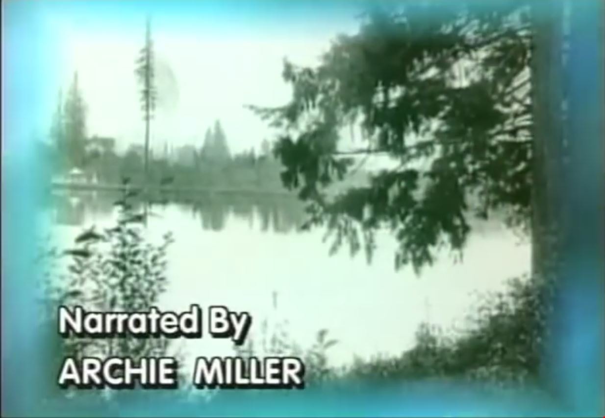
- Film titled “Step Back in Time at the Burnaby Village Museum & Carousel” includes narration by Archie Miller. The film opens with historical background regarding land settlement and development in Burnaby supported with historical images. The film then transverses into contemporary images and foota…
- Repository
- Burnaby Village Museum
- Collection/Fonds
- Burnaby Village Museum fonds
- Description Level
- Item
- Physical Description
- 1 videocassette (29 min. , 59 sec.) : VHS, 29 fps, col., sd.
- Material Details
- Sponsored in part by: The Burnaby Historical Society; Poetry Written by: Don Benson; Voices: Arlie Mason; Tom Worledge
- Scope and Content
- Film titled “Step Back in Time at the Burnaby Village Museum & Carousel” includes narration by Archie Miller. The film opens with historical background regarding land settlement and development in Burnaby supported with historical images. The film then transverses into contemporary images and footage of the Burnaby Village Museum which opened in Burnaby on November 19, 1971 in commemoration of British Columbia joining the confederation of Canada. The film’s title text, “Step Back / In Time / at the Burnaby Village / Museum & Carousel” appears a few minutes past the opening footage. Narration continues throughout the film along with interviews with various staff members and museum interpreters. The film is divided into various segments containing titles in order of appearance: “Deer Lake Park” provides glimpses of and information about Deer Lake Park, its heritage buildings and cultural facilities including The Burnaby Art Gallery, The Shadbolt Centre for the Arts and Burnaby Village Museum. “A Living Museum” takes you on a tour of some of the museum’s exhibits and programs through the museum’s interpreters. “The Magical Carousel” provides background on the historic C.W. Parker Carousel #119 that was restored and opened on the site in 1993. “Keeping History Alive” speaks to the interpretive, artifact and archival collection of the Burnaby Village Museum with information provided by Curator Colin Stevens, Assistant Curator Steve Turnbull and Assistant Director of Cultural Services, Denis Nokony. “A Step Back in Time” speaks to the various 1920s highlights and features that the museum has to offer. “Something Special / is Always Happening” tells of the annual events that the museum offers to capture the interests of visitors. “A Day at the / Burnaby Village / Museum & Carousel” includes Denis Nokony speaking about the importance of the museum and what it means to visitors and the community.
- Creator
- Burnaby Village Museum
- Publisher
- Voice of the Fraser Productions Inc. 2000
- Subjects
- Recreational Devices - Carousels
- Names
- Burnaby Village Museum
- Shadbolt Centre for the Arts
- Burnaby Art Gallery
- C.W. Parker no. 119 Carousel
- Responsibility
- Burnaby Village Museum - City of Burnaby
- Accession Code
- BV020.4.29b
- Access Restriction
- No restrictions
- Reproduction Restriction
- May be restricted by third party rights
- Date
- 2000 (date of original), digitized in 2020
- Media Type
- Moving Images
- Related Material
- See also: BV020.4.33; BV020.4.36; BV929.4.38
- Notes
- Transcribed title from film content
Images
Video
Step Back in Time at the Burnaby Village Museum and Carousel, 2000 (date of original), digitized in 2020
Step Back in Time at the Burnaby Village Museum and Carousel, 2000 (date of original), digitized in 2020
https://search.heritageburnaby.ca/media/hpo/_Data/_BVM_Moving_Images/2020_0004_0029b_001.mp4Subdivision and survey plans series
https://search.heritageburnaby.ca/link/museumdescription18948
- Repository
- Burnaby Village Museum
- Date
- [1890]-1932
- Collection/Fonds
- Ronald G. Scobbie collection
- Description Level
- Series
- Physical Description
- 25 plans + 2 cm of textual records
- Scope and Content
- Series consists of surveying and subdivision records created by Provincial Land Surveyors Albert J. Hill, Geoffrey K. Burnett and Donald Johnson McGugan. Records include subdivision and survey plans of areas in New Westminster District Group 1 along with surveying plans and correspondence regarding…
- Repository
- Burnaby Village Museum
- Collection/Fonds
- Ronald G. Scobbie collection
- Description Level
- Series
- Physical Description
- 25 plans + 2 cm of textual records
- Scope and Content
- Series consists of surveying and subdivision records created by Provincial Land Surveyors Albert J. Hill, Geoffrey K. Burnett and Donald Johnson McGugan. Records include subdivision and survey plans of areas in New Westminster District Group 1 along with surveying plans and correspondence regarding North Road and a survey plan of "Burnaby Park track".
- Accession Code
- HV984.57
- BV003.83
- Date
- [1890]-1932
- Media Type
- Cartographic Material
- Textual Record
- Notes
- Title based on contents of series
![Subdivision plans in New Westminster District Group 1 – Burnaby
, [1882-1910] thumbnail](/media/hpo/_Data/_BVM_Cartographic_Material/1977/1977_0093_0013a_001.jpg?width=280)
Subdivision plans in New Westminster District Group 1 – Burnaby
https://search.heritageburnaby.ca/link/museumdescription6982
- Repository
- Burnaby Village Museum
- Date
- [1882-1910]
- Collection/Fonds
- Burnaby Village Museum Map collection
- Description Level
- File
- Physical Description
- 4 plans : blueprint on paper mounted on 2 sides of cardboard 76 x 102 cm
- Scope and Content
- Item consists of a large board of two New Westminster District Gp 1 - subdivision plans mounted on one side and two New Westminster District Gp 1 - subdivision plans mounted on the other side. Side A: 1. Blueprint "Plan / of the / Subdivision / of / Lot 98 / G.1, N.W.D. / Scale 4 chs = 1 in. / …
- Repository
- Burnaby Village Museum
- Collection/Fonds
- Burnaby Village Museum Map collection
- Description Level
- File
- Physical Description
- 4 plans : blueprint on paper mounted on 2 sides of cardboard 76 x 102 cm
- Material Details
- Scales [between 1:1584 and 1:3168]
- Index number on edge of board reads: "13"
- Scope and Content
- Item consists of a large board of two New Westminster District Gp 1 - subdivision plans mounted on one side and two New Westminster District Gp 1 - subdivision plans mounted on the other side. Side A: 1. Blueprint "Plan / of the / Subdivision / of / Lot 98 / G.1, N.W.D. / Scale 4 chs = 1 in. / Map No 573" (Geographic location: Burnaby) 2. Blueprint "Plan / of Subdivision of / Lot 157 / Gr.1, New. West. Dist. / Scale 3 chs = 1 in. / Map No. 612". (Geographic location: Burnaby) Side B: 1. Blueprint "Plan / of Subdivision / of a Portion of / Lot 90 / Group One / New Westminster Dist. / Scale 2 chs = 1 in. / Map No. 555". Plan is signed by "Jno Strathern [sic]_P.L.S."n (Geographic location: Burnaby) 2. Blueprint "Subdivision of Lot 31, Group 1. / New Westminster District / As Amended by Order of Court / 1st Sept. 1882 and Numbered 847 / Scale 4 chs = 1in. / Map No 80" (Geographic location: Burnaby)
- Creator
- Stathern, John
- Accession Code
- HV977.93.13
- Access Restriction
- No restrictions
- Reproduction Restriction
- No known restrictions
- Date
- [1882-1910]
- Media Type
- Cartographic Material
- Historic Neighbourhood
- Alta Vista (Historic Neighbourhood)
- Planning Study Area
- Richmond Park Area
- Lakeview-Mayfield Area
- Scan Resolution
- 300
- Scale
- 72
- Notes
- Title based on contents of file
- Scale is measured in chains. (One chain equals 792 inches)
- The term "Lot" can also refer to a "District Lot”
Images
![Subdivision plans in New Westminster District Group 1 – Burnaby
, [1882-1910] thumbnail](/media/hpo/_Data/_BVM_Cartographic_Material/1977/1977_0093_0013a_001.jpg)
