Narrow Results By
Subject
- Buildings 1
- Buildings - Heritage 1
- Buildings - Recreational - Sports 1
- Buildings - Residential 2
- Buildings - Residential - Cabins 1
- Buildings - Residential - Townhouses 1
- Buildings - Schools 2
- Construction 2
- Geographic Features - Athletic Fields 1
- Geographic Features - Creeks 1
- Land - Land Surveying 2
- Natural Phenomena - Fires 1
Person / Organization
- Bonsor Recreation Complex 1
- Brown, Donald N. "Don" 1
- Burnaby Fire Department 1
- Burnaby Historical Society 1
- Burnaby Mountain Secondary School 1
- Burnaby Village Museum 3
- Carter, Earl 1
- The Columbian 1
- Friends of Interurban 1223 1
- Hawley, William "Bill" 1
- Lawson, Doreen A. 1
- Moscrop Secondary School 1
Convention of the Canadian Institute of Surveying
https://search.heritageburnaby.ca/link/councilreport28414
- Repository
- City of Burnaby Archives
- Report ID
- 20825
- Meeting Date
- 2-Apr-1973
- Format
- Council - Manager's Report
- Manager's Report No.
- 25
- Item No.
- 9
- Collection/Fonds
- City Council and Office of the City Clerk fonds
- Repository
- City of Burnaby Archives
- Report ID
- 20825
- Meeting Date
- 2-Apr-1973
- Format
- Council - Manager's Report
- Manager's Report No.
- 25
- Item No.
- 9
- Collection/Fonds
- City Council and Office of the City Clerk fonds
Documents
![Surveying for the construction of a log cabin, [1976] thumbnail](/media/hpo/_Data/_BVM_Images/2020/2020_0005_0888_001.jpg?width=280)
Surveying for the construction of a log cabin
https://search.heritageburnaby.ca/link/museumdescription13696
- Repository
- Burnaby Village Museum
- Date
- [1976]
- Collection/Fonds
- Century Park Museum Association fonds
- Description Level
- Item
- Physical Description
- 1 photograph : col. slide ; 35 mm
- Scope and Content
- Photograph of a group of men surveying for the construction of a log cabin. The man in the centre of the photogaph is using a level. In the summer of 1976, Heritage Village Museum offered a two day log cabin building course under the expert instruction of Earl Carter.
- Repository
- Burnaby Village Museum
- Collection/Fonds
- Century Park Museum Association fonds
- Description Level
- Item
- Physical Description
- 1 photograph : col. slide ; 35 mm
- Scope and Content
- Photograph of a group of men surveying for the construction of a log cabin. The man in the centre of the photogaph is using a level. In the summer of 1976, Heritage Village Museum offered a two day log cabin building course under the expert instruction of Earl Carter.
- Accession Code
- BV020.5.888
- Access Restriction
- No restrictions
- Reproduction Restriction
- No known restrictions
- Date
- [1976]
- Media Type
- Photograph
- Scan Resolution
- 2400
- Scan Date
- September 1, 2020
- Scale
- 100
- Notes
- Title based on contents of photograph
- See also BV020.5.709 for documentary film titled "Cabin" directed and produced by James (Jim) Bizzochi - documenting the construction of the log cabin in Heritage Village
Images
![Surveying for the construction of a log cabin, [1976] thumbnail](/media/hpo/_Data/_BVM_Images/2020/2020_0005_0888_001.jpg)

Burnaby property tax assessment ledger no date - pre 1898
https://search.heritageburnaby.ca/link/museumlibrary1118
- Repository
- Burnaby Village Museum
- Collection
- Reference Collection
- Material Type
- Textual Record
- Call Number
- 971.1 BUR
- Author
- J.D.B.
- Place of Publication
- Burnaby
- Publication Date
- 1977
- Physical Description
- 96 p. (typewritten) + title page
- Library Subject (LOC)
- Land titles
- Subjects
- Land - Land Surveying
- Taxes
- Object History
- Compiled July-August 1977, Heritage Village Archives
- Notes
- Unpublished research document: "Burnaby Property Tax Assessment Ledger / No Date --- Pre 1898 / Compiled July-August 1977 / Heritage Village Archives / Original Document No. / Copy #1 / J.D.B./77" -- title page
Images

Documents

Aliceville
https://search.heritageburnaby.ca/link/landmark721
- Repository
- Burnaby Heritage Planning
- Associated Dates
- 1886
- Heritage Value
- Shortly after the townsite of Port Moody was surveyed in the early 1880s, a resort community developed on the border of Burnaby and Port Moody that would come to be called Aliceville. Located near the north end of North Road, in 1886 the Canadian Pacific Railway established a flag station there and the settlement was named after Alice May Webster who, with her sister Mrs. Jenns, operated the Aliceville Hotel.
- Historic Neighbourhood
- Barnet (Historic Neighbourhood)
- Planning Study Area
- Burnaby Mountain Area
Images

Land of promise : Robert Burnaby's letters from colonial British Columbia, 1858-1863
https://search.heritageburnaby.ca/link/museumlibrary5465
- Repository
- Burnaby Village Museum
- Publication Date
- c2002
- Call Number
- 971.1 BUR COPY 3
to see if we could find coal. When we were at work
sinking some shafts in the vicinity of the north end of Bute Street,
� L a n d o f P r o m i s e 21
the surveying sloop of war, H.M.S. Plumper, commanded by Captain
Richards, R.N., came into the harbour and Captain Richards gave
the name of Coal Harbour
- Repository
- Burnaby Village Museum
- Collection
- Reference Collection
- Digital Reference Collection
- Material Type
- Book
- ISBN
- 0969282850
- 9780969282853
- Call Number
- 971.1 BUR COPY 3
- Place of Publication
- Burnaby, B.C.
- Publisher
- City of Burnaby
- Publication Date
- c2002
- Physical Description
- 199 p. : ill. ; 23 cm.
- Library Subject (LOC)
- Burnaby, Robert--Correspondence
- Merchants--British Columbia--Correspondence
- British Columbia--History--1849-1871
- Burnaby (B.C.)
- Biography
- Notes
- Includes bibliographical references (p. 190) and index.
- 3 copies held: copy 3.
Digital Books
In the shadow by the sea : recollections of Burnaby's Barnet Village
https://search.heritageburnaby.ca/link/museumlibrary5173
- Repository
- Burnaby Village Museum
- Collection
- Digital Reference Collection
- Reference Collection
- Material Type
- Book
- ISBN
- 0969282885
- Call Number
- 971.133 PRI Copy 2
- Contributor
- Wolf, Jim
- Pride, Harry, 1925-
- Place of Publication
- Burnaby, B.C.
- Publisher
- City of Burnaby
- Publication Date
- c2004
- Physical Description
- 246 p. : ill., maps, ports. ; 28 cm.
- Library Subject (LOC)
- Burnaby (B.C.)--History
- Industries--British Columbia--Burnaby--History
- Barnet Marine Park--Burnaby, B.C.
- Geographic Access
- Barnet Road
- Burrard Inlet
- Notes
- Includes bibliographical references (p. 246) and index.
- "edited by Harry Pride and Jim Wolf"
- Copy 2 of 2
Digital Books
Life with the Moores of Hart House : pioneer days on Burnaby's Deer Lake
https://search.heritageburnaby.ca/link/museumlibrary1179
- Repository
- Burnaby Village Museum
- Publication Date
- 2002
- Call Number
- 971.1 PRI COPY 1
is their
house., that was part of their property that went way back up the hill.
Joan continues: There was a chap my dad knew, Alexander Henderson, who had been
surveying here at the time Gilley Brothers were logging. He told us that this area had one of
the finest stands of timber in the lower mainland
- Repository
- Burnaby Village Museum
- Collection
- Digital Reference Collection
- Reference Collection
- Material Type
- Book
- ISBN
- 0969282877
- Call Number
- 971.1 PRI COPY 1
- Place of Publication
- Burnaby, B.C.
- Publisher
- City of Burnaby, Community Heritage Commission
- Publication Date
- 2002
- Physical Description
- iv, 92 p. : ill. (some col.) ; 28 cm.
- Inscription
- "To Burnaby Village Museum / Harry Pride", handwritten in ink on title page.
- Library Subject (LOC)
- Moore family
- Hart House (Burnaby, B.C.)--History
- Frontier and pioneer life
- Pioneers
- Historic buildings--British Columbia--Burnaby
- Biography
- Notes
- Includes bibliographical references (p. 87) and index.
- Signed by the author.
- 2 copies held : copy 1.
Digital Books
![Collision Plus Exclusive Auto Body fire, [2004] thumbnail](/media/hpo/_Data/_Archives_Images/_Unrestricted/535/535-1740.jpg?width=280)
Collision Plus Exclusive Auto Body fire
https://search.heritageburnaby.ca/link/archivedescription95989
- Repository
- City of Burnaby Archives
- Date
- [2004]
- Collection/Fonds
- Burnaby NewsLeader photograph collection
- Description Level
- Item
- Physical Description
- 1 photograph (tiff) : col.
- Scope and Content
- Photograph of Captain Mark Fletcher of the Burnaby Fire Department outside of the burned-out garage at the Collision Plus Exclusive Auto Body. An employee of the auto shop stands next to Fletcher and they are surveying the damage.
- Repository
- City of Burnaby Archives
- Date
- [2004]
- Collection/Fonds
- Burnaby NewsLeader photograph collection
- Physical Description
- 1 photograph (tiff) : col.
- Description Level
- Item
- Record No.
- 535-1740
- Access Restriction
- No restrictions
- Reproduction Restriction
- No restrictions
- Accession Number
- 2018-12
- Scope and Content
- Photograph of Captain Mark Fletcher of the Burnaby Fire Department outside of the burned-out garage at the Collision Plus Exclusive Auto Body. An employee of the auto shop stands next to Fletcher and they are surveying the damage.
- Names
- Burnaby Fire Department
- Media Type
- Photograph
- Photographer
- Bartel, Mario
- Notes
- Title based on caption
- Collected by editorial for use in a January 2004 issue of the Burnaby NewsLeader
- Caption from metadata: "Captain Mark Fletcher, of the Burnaby Fire Department, and Mickey Reale, the manager at Collision Plus Auto Body on Edmonds St., survey the damage after an early morning fire destroyed three cars in the shop garage."
- Geographic Access
- Edmonds Street
Images
![Collision Plus Exclusive Auto Body fire, [2004] thumbnail](/media/hpo/_Data/_Archives_Images/_Unrestricted/535/535-1740.jpg)
![Surveyor at Heritage Village, [1971] thumbnail](/media/hpo/_Data/_BVM_Images/2005/2005_0054_0431_001.jpg?width=280)
Surveyor at Heritage Village
https://search.heritageburnaby.ca/link/museumdescription2385
- Repository
- Burnaby Village Museum
- Date
- [1971]
- Collection/Fonds
- Donald Copan collection
- Description Level
- Item
- Physical Description
- 1 photograph : b&w ; 8.9 x 12.7 cm
- Scope and Content
- Photograph of an unidentified man using surveying equipment on Heritage Village site (now Burnaby Village Museum).
- Repository
- Burnaby Village Museum
- Collection/Fonds
- Donald Copan collection
- Series
- Copan album series
- Description Level
- Item
- Physical Description
- 1 photograph : b&w ; 8.9 x 12.7 cm
- Scope and Content
- Photograph of an unidentified man using surveying equipment on Heritage Village site (now Burnaby Village Museum).
- Subjects
- Occupations - Land Surveyors
- Names
- Burnaby Village Museum
- Accession Code
- BV005.54.431
- Access Restriction
- No restrictions
- Reproduction Restriction
- May be restricted by third party rights
- Date
- [1971]
- Media Type
- Photograph
- Historic Neighbourhood
- Burnaby Lake (Historic Neighbourhood)
- Planning Study Area
- Morley-Buckingham Area
- Scan Resolution
- 600
- Scan Date
- August 11, 2020
- Scale
- 100
- Notes
- Title based on contents of photograph
Images
![Surveyor at Heritage Village, [1971] thumbnail](/media/hpo/_Data/_BVM_Images/2005/2005_0054_0431_001.jpg)
![Surveyor at Heritage Village, [1971] thumbnail](/media/hpo/_Data/_BVM_Images/2005/2005_0054_0432_001.jpg?width=280)
Surveyor at Heritage Village
https://search.heritageburnaby.ca/link/museumdescription13557
- Repository
- Burnaby Village Museum
- Date
- [1971]
- Collection/Fonds
- Donald Copan collection
- Description Level
- Item
- Physical Description
- 1 photograph : b&w ; 8.9 x 12.7 cm
- Scope and Content
- Photograph of an unidentified man using surveying equipment on Heritage Village site (now Burnaby Village Museum).
- Repository
- Burnaby Village Museum
- Collection/Fonds
- Donald Copan collection
- Series
- Copan album series
- Description Level
- Item
- Physical Description
- 1 photograph : b&w ; 8.9 x 12.7 cm
- Scope and Content
- Photograph of an unidentified man using surveying equipment on Heritage Village site (now Burnaby Village Museum).
- Subjects
- Occupations - Land Surveyors
- Names
- Burnaby Village Museum
- Accession Code
- BV005.54.432
- Access Restriction
- No restrictions
- Reproduction Restriction
- May be restricted by third party rights
- Date
- [1971]
- Media Type
- Photograph
- Historic Neighbourhood
- Burnaby Lake (Historic Neighbourhood)
- Planning Study Area
- Morley-Buckingham Area
- Scan Resolution
- 600
- Scan Date
- August 11, 2020
- Scale
- 100
- Notes
- Title based on contents of photograph
Images
![Surveyor at Heritage Village, [1971] thumbnail](/media/hpo/_Data/_BVM_Images/2005/2005_0054_0432_001.jpg)
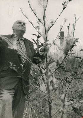
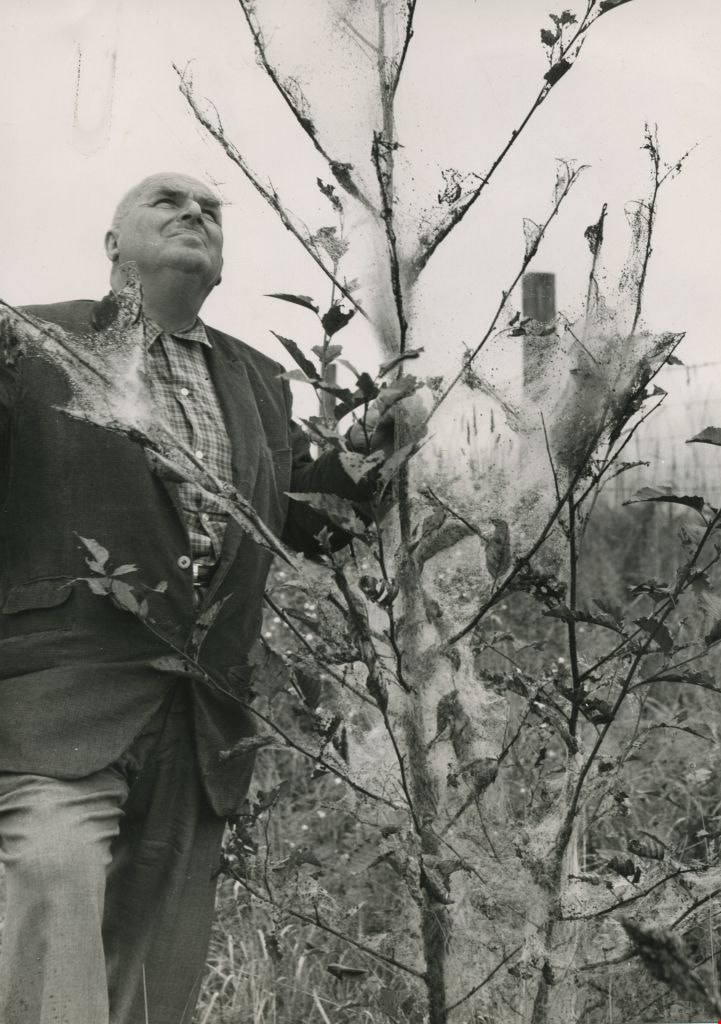
William Hawley surveys tree destruction
https://search.heritageburnaby.ca/link/archivedescription45198
- Repository
- City of Burnaby Archives
- Date
- 1962, published September 8, 1962
- Collection/Fonds
- Columbian Newspaper collection
- Description Level
- Item
- Physical Description
- 1 photograph : b&w ; 20 x 14 cm
- Scope and Content
- Photograph of Columbian farm and garden columnist William Hawley surveying tree destruction caused by tent caterpillars. He was the garden columnist for most of the 1960's, and prior to that he was a salesman and nutritionist for Brackman-Kerr feed store in New Westminster for 40 years. He and his …
- Repository
- City of Burnaby Archives
- Date
- 1962, published September 8, 1962
- Collection/Fonds
- Columbian Newspaper collection
- Physical Description
- 1 photograph : b&w ; 20 x 14 cm
- Description Level
- Item
- Record No.
- 480-094
- Access Restriction
- No restrictions
- Reproduction Restriction
- Reproduce for fair dealing purposes only
- Accession Number
- 2003-02
- Scope and Content
- Photograph of Columbian farm and garden columnist William Hawley surveying tree destruction caused by tent caterpillars. He was the garden columnist for most of the 1960's, and prior to that he was a salesman and nutritionist for Brackman-Kerr feed store in New Westminster for 40 years. He and his wife Doreen were married for 52 years.
- Subjects
- Occupations - Journalists
- Plants - Trees
- Media Type
- Photograph
- Notes
- Title based on contents of photograph
Images
![Survey and Subdivision plans in New Westminster District Group 1 – Burnaby, Port Moody, [1862-1908] thumbnail](/media/hpo/_Data/_BVM_Cartographic_Material/1977/1977_0093_0026a_001.jpg?width=280)
Survey and Subdivision plans in New Westminster District Group 1 – Burnaby, Port Moody
https://search.heritageburnaby.ca/link/museumdescription6995
- Repository
- Burnaby Village Museum
- Date
- [1862-1908]
- Collection/Fonds
- Burnaby Village Museum Map collection
- Description Level
- File
- Physical Description
- 9 plans : 6 plans : black ink on paper ; 57 x 36.5 cm or smaller + 1 plan : black ink and grahite on paper ; 46.5 x 49 cm + 1 plan : blueprint on paper ; 15.5 x 19.5 cm + cm + 1 plan : graphite on paper ; 25 x 17 cm ; mounted on both sides of board 76 x 102 cm
- Scope and Content
- Item consists of a large board of four New Westminster District subdivision plans mounted on one side and five New Westminster District subdivision plans mounted on the other side. Side A: 1. "Plan / of Subdivision / of a Portion / of / Lot 87 / Group One / New Westminster District / Scale 4 chs…
- Repository
- Burnaby Village Museum
- Collection/Fonds
- Burnaby Village Museum Map collection
- Description Level
- File
- Physical Description
- 9 plans : 6 plans : black ink on paper ; 57 x 36.5 cm or smaller + 1 plan : black ink and grahite on paper ; 46.5 x 49 cm + 1 plan : blueprint on paper ; 15.5 x 19.5 cm + cm + 1 plan : graphite on paper ; 25 x 17 cm ; mounted on both sides of board 76 x 102 cm
- Material Details
- Scales [between 1:792 and 1:3600]
- Index number on edge of board reads: "26"
- Scope and Content
- Item consists of a large board of four New Westminster District subdivision plans mounted on one side and five New Westminster District subdivision plans mounted on the other side. Side A: 1. "Plan / of Subdivision / of a Portion / of / Lot 87 / Group One / New Westminster District / Scale 4 chs = 1 in". Plan is stamped: "Albert J. Hill, Civil Engineer / and / Provincial Land Surveyor, / New Westminster, / B.C." and intialed by: "RB" [sic] (in blue pencil crayon). Names two of the subdivisons of District Lot 87 are identified as, "L.E. Sprott" and "John Ledger". (Geographic location: Burnaby) 2. "Plan of Subdivision / of / Portions of / Lot 136, 131 and Lots 44 and 78 Gr.1 / New Westminster District / Scale 300 ft = 1 inch". Annotation above title reads: "No. 901 / Deposited in Land Registry Office / New Westminster / Aug. 19th 1905 / Charles S. Keith D. Reg." Annotations and signatures at bottom of plan read: "I, William Nelson Draper, / W.H.R. Collister / Charles E. Perkins / E.B. Morgan / make / Surveys / correct / representation / upon / the / Land Registry Act / (sgd) W.N. Draper, P.L.S.". Plan includes a handwritten title: "Lots 136, 131, 44 & 78" and is initialed: "RB" [sic] (in blue pencil crayon) (Geographic location: Burnaby) 3. "Survey / of / a Portion / of / Lot 95, Gr.1 / Scale 1 ch = 1in." Plan is stamped: "Albert J. Hill, Civil Engineer / and / Provincial Land Surveyor, / New Westminster, / B.C." and is initialed : "RB" [sic] (in blue pencil crayon) (Geographic location: Burnaby) 4. Blueprint plan of "Lot 396. Group One." with Scale : 3 chs = 1 in. A two acre portion of District Lot 396 is filled in with red ink." Plan is signed by "Albert J. Hill / B.C.L.S." (Geographic location: Port Moody) Side B: 1. Plan titled "District Lot 92 / Burnaby / Municipality / for sale by / Mahon / McFarland & / Mahon Ltd. / Vancouver, B.C. / Scale : 4 chains to one inch". District Lot 92 is subdivided into 161 lots and identifies roads: Norwich Road, Pole Line Road, Oakland Road, Stanley Road, Burford Road, Dalhousie Road, Brantford Road, Colborne Road, Roberts Road, Vancouver & Westminster Road, B.C. Electric Railway, Gilley Stn. and Burnaby (Power House). The bottom of the plan reads: "G.S. Dawson, P.LS. Vancouver, B.C." (Geographic location: Burnaby) 2. "Plan / of Subdivision / of a Portion / of / Lot 29 / Group 1 / New Westminster District / Scale 2 chs = 1 in". Plan is stamped: "Albert J. Hill, Civil Engineer / and / Provincial Land Surveyor, / New Westminster, / B.C." and is initialed by: "RB" [sic] (in blue pencil crayon) (Geographic location: Burnaby) 3. Small handrawn plan (no title) identifying "Lot 84 / Hydes, Claim" at the centre surrounded by lots and features identified as: "Lot 85", "Lot 93", "Lot 94", "Lot 32", "Lot 82", "Lot 83", "Lot 79", "swamp" and a "Small Lake" (Burnaby Lake). Identifying marks in the right corner of the plan read: "Page 13 / Surveyed by G. Turner / May 62". Plan also includes surveyor's bearing measurements and trails to "Small Lake" (Burnaby Lake). (Geographic location: Burnaby) 4. Untitled plan showing District Lots west of North Road and north of Burnaby Lake including: Lots 2, 4, 6, 8, 15, 10, 56, 148, 57, 58, 40. and Lots 3, 5, 7 east of North Road (Coquitlam). Lots in Burnaby are identifed for timber including: "Heavily Timbered" (Lot 57), " "Some Fir and Cedar" (Lot 40), "Splendid Fir and Cedar" (Lot 143), "Heavy Fir etc" (Lots 143 and 148), " "Fine Cedar" (Lot 15), "Rough Light Timber" (Lot 56). Other features identified at the lower portion of the plan include "Burnaby Lake" and "Brunette River". (Geographic location: Burnaby) 5. Untitled plan drawn in graphite showing sections of District Lot 85 south of Burnaby Lake and north of Hazsard Road. Plan is signed: "Albert J. Hill / B.C.L.S." and dated "12/26/08". Plan is initialed by: "RB" [sic] (in blue pencil crayon) (Geographic location: Burnaby)
- Publisher
- Mahon, McFarland & Mahon Ltd
- Accession Code
- HV977.93.26
- Access Restriction
- No restrictions
- Reproduction Restriction
- No known restrictions
- Date
- [1862-1908]
- Media Type
- Cartographic Material
- Historic Neighbourhood
- Burnaby Lake (Historic Neighbourhood)
- Burquitlam (Historic Neighbourhood)
- Planning Study Area
- Burnaby Lake Area
- Scan Resolution
- 300
- Scale
- 72
- Notes
- Title based on contents of file
- Scale is measured in chains and feet. (One chain equals 792 inches)
- The term "Lot" can also refer to a "District Lot”
Images
![Survey and Subdivision plans in New Westminster District Group 1 – Burnaby, Port Moody, [1862-1908] thumbnail](/media/hpo/_Data/_BVM_Cartographic_Material/1977/1977_0093_0026a_001.jpg)


Burnaby's heritage : an inventory of buildings and structures
https://search.heritageburnaby.ca/link/museumlibrary5437
- Repository
- Burnaby Village Museum
- Author
- Luxton, Donald, 1954-
- Wolf, Jim
- Edition
- Rev.
- Publication Date
- 2011
- c2007
- Call Number
- 971.133 LUX COPY 1
- Repository
- Burnaby Village Museum
- Collection
- Digital Reference Collection
- Material Type
- Book
- ISBN
- 0969282893
- Call Number
- 971.133 LUX COPY 1
- Edition
- Rev.
- Author
- Luxton, Donald, 1954-
- Wolf, Jim
- Place of Publication
- Burnaby, B.C.
- Publisher
- City of Burnaby
- Publication Date
- 2011
- c2007
- Physical Description
- 157 p. : ill. ; 28 cm.
- Library Subject (LOC)
- Architecture
- Historic buildings
- Buildings
- Historic sites
- Subjects
- Buildings
- Buildings - Heritage
- Notes
- Includes bibliographical references and index.
- 2 copies held: copy 1.
Digital Books
Bygones of Burnaby : an anecdotal history
https://search.heritageburnaby.ca/link/museumlibrary5462
- Repository
- Burnaby Village Museum
- Author
- McGeachie, Pixie, 1921-
- Publication Date
- 1976
- c1975
- Call Number
- 971.133 MCG COPY 4
- Repository
- Burnaby Village Museum
- Collection
- Digital Reference Collection
- Material Type
- Book
- Call Number
- 971.133 MCG COPY 4
- Author
- McGeachie, Pixie, 1921-
- Place of Publication
- Burnaby, B.C.
- Publisher
- Century Park Museum Association
- Publication Date
- 1976
- c1975
- Physical Description
- 108 p. : ill. ; 23 cm.
- Library Subject (LOC)
- Burnaby (B.C.)--History
- Notes
- 4 copies held: copy 4.
Digital Books
Municipal survey / Horace L. Brittain
https://search.heritageburnaby.ca/link/archivedescription1689
- Repository
- City of Burnaby Archives
- Date
- 1932-1962
- Collection/Fonds
- City Council and Office of the City Clerk fonds
- Description Level
- File
- Physical Description
- Textual record
- Scope and Content
- File includes records regarding a "municipal survey" by Horace L. Brittain
- Repository
- City of Burnaby Archives
- Date
- 1932-1962
- Collection/Fonds
- City Council and Office of the City Clerk fonds
- Physical Description
- Textual record
- Description Level
- File
- Record No.
- 3509
- Accession Number
- 2001-02
- Scope and Content
- File includes records regarding a "municipal survey" by Horace L. Brittain
- Media Type
- Textual Record
![Survey and Subdivision plans in New Westminster District Group 1 – Burnaby
, [1861]-[1910] thumbnail](/media/hpo/_Data/_BVM_Cartographic_Material/1977/1977_0093_0019a_001.jpg?width=280)
Survey and Subdivision plans in New Westminster District Group 1 – Burnaby
https://search.heritageburnaby.ca/link/museumdescription6988
- Repository
- Burnaby Village Museum
- Date
- [1861]-[1910]
- Collection/Fonds
- Burnaby Village Museum Map collection
- Description Level
- File
- Physical Description
- 14 plans : 3 plans : black ink on paper hand col. + 7 plans : black ink on paper + 4 plans : graphite on paper mounted on 2 sides of cardboard 76 x 102 cm
- Scope and Content
- Item consists of a large board of four New Westminster District Gp 1 - subdivision plans mounted on one side and ten New Westminster District Gp 1 - subdivision plans mounted on the other side. Side A: 1. "Plan /of / Lots 166A, 166 and 167 /, Gr.1, N.W.D. / Showing Misconstructed Roads in Gree…
- Repository
- Burnaby Village Museum
- Collection/Fonds
- Burnaby Village Museum Map collection
- Description Level
- File
- Physical Description
- 14 plans : 3 plans : black ink on paper hand col. + 7 plans : black ink on paper + 4 plans : graphite on paper mounted on 2 sides of cardboard 76 x 102 cm
- Material Details
- Scales [between 1:2376 and 1:7920]
- Index number on edge of board reads: "19"
- Scope and Content
- Item consists of a large board of four New Westminster District Gp 1 - subdivision plans mounted on one side and ten New Westminster District Gp 1 - subdivision plans mounted on the other side. Side A: 1. "Plan /of / Lots 166A, 166 and 167 /, Gr.1, N.W.D. / Showing Misconstructed Roads in Green / 5 chs = 1 in.". (plan is drawn in black ink and hand coloured in red, green and orange ink). A section in the centre of the plan is coloured in red ink and identified as "C.S. Richmond" running from the North Arm of Fraser River to Wiggins Road and divided by "New Wiggins Rd. (as gazetted)" (coloured in orange ink) and two"Constructed Road(s)" (coloured in green ink). Plan is initialed by: "RB" [sic] (in blue pencil crayon) 2. Plan of / Subdivision of / Lot 166 / Group One / New Westminster District / Scale 4 chs = 1 in. / Map No 524". Plan is drawn in graphite and signed by "Surrig [sic] Welhams [sic] / P.L.S." Plan is initialed by: "RB" [sic] (in blue pencil crayon) 3. Plan of "Survey / of Highway / For / Burnaby Council / in / Lots 13 _14 / Group One / Scale 4 chs = 1 in." Signed by "Albert J. Hill, P.L.S." Caribou Street and Caribou Road run through the centre of the plan. Plan is stamped: "Albert J. Hill, Civil Engineer / and / Provincial Land Surveyor, / New Westminster, / B.C.". Plan is initialed by: "RB" [sic] (in blue pencil crayon) 4. A Plan of Lots 166A, 166 and 167, Group One, New Westminster District (drawn in graphite). A section in the centre of the plan is identified as "C.S. Richmond" running from the North Arm of Fraser River and divided by "New Wiggins Rd. (as gazetted)" and two "Constructed Road(s)". Plan is initialed by: "RB" [sic] (in blue pencil crayon) Side B: 1. Small plan drawn in black ink (no title) identifying lots north of the "North Arm" of the Fraser River. Lots identified include: Lot 99, Lot 98, Lot 157, Lot 158, Lot 163, Lot 162, Lot 159, Lot 163, Lot 162, Lot 165, Lot 166A, Lot 155B, Lot 155A and Lot 159. "Scale 40 chains to one inch" . Plan is initialed by: "RB" [sic] (in blue pencil crayon) (Geographic location: Burnaby) 2. Small plan drawn in black ink (no title) identifying lots north of the North Arm of the Fraser River as "Lots 155, 155A, 155B, 155C, 162, 163, 164, 165, 166A and 167". Plan is initialed by: "RB" [sic] (in blue pencil crayon) (Geographic location: Burnaby) 3. Small plan drawn in black ink (no title) which identifies "Lot 151 / Reserve/ for / Race Course"; "Reserve / 64 A / L. 152 G.1"; and other Lots: 32, 33, 34, 35, 36, 38, 39. The plan is signed "Surveyor G.Turn [sic] July / 61 / from Vol 40 R.L. notes [sic]" Plan is stamped: "Albert J. Hill, Civil Engineer / and / Provincial Land Surveyor, / New Westminster, / B.C." Plan is initialed by: "RB" [sic] (in blue pencil crayon) (Geographic location: Burnaby) 4. Small plan drawn in black in with faded red colouring on centre lot identified as "Lot 34" running north from "Vancouver Road" . Plan is stamped: "Albert J. Hill, Civil Engineer / and / Provincial Land Surveyor, / New Westminster, / B.C." Plan is initialed by: "RB" [sic] (in blue pencil crayon) (Geographic location: Burnaby) 5. Plan drawn in graphite and identified as "Lot 98, Gr.1," along with the intials "RB" [sic] (both are handwritten in blue crayon pencil on top of plan) The B.C.E.Railway is identified running through the plan along with Jubilee Road and Royal Oak Road. The plan is signed with the name "Wm. Murray" and the Plan is stamped: "Albert J. Hill, Civil Engineer / and / Provincial Land Surveyor, / New Westminster, / B.C.". (Geographic location: Burnaby) 6. Plan drawn in graphite identified as "Port Lot 13, Gr.1" along with the intials "RB" [sic] (both are handwritten in blue crayon pencil on top of plan) Plan is stamped: "Albert J. Hill, Civil Engineer / and / Provincial Land Surveyor, / New Westminster, / B.C.". (Geographic location: Burnaby) 7.Plan drawn in black ink and identified as "Lot 98 G.1" along with the intials "RB" [sic] (both are handwritten in blue crayon pencil on top of plan). A "Road Reservation" is identified running north between "Electric Tramway" and connecting with "Royal Oak Road". Plan is stamped: "Albert J. Hill, Civil Engineer / and / Provincial Land Surveyor, / New Westminster, / B.C." (Geographic location: Burnaby) 8. Plan drawn in black ink and divided into two sections, the upper plan is identified as "Portion / Lots 100 / area / 101, Gr.1" and the lower plan is identified as "Portion L. 3 G. 1" along with the intials "RB" [sic] (these identifiers are handwritten in blue crayon pencil on top of the plan). Portions of Lot 100 and Lot 101 are each divided into 6 sections and the Portion of Lot 3 plan is divided into 24 sections. The plan includes a note in black ink that reads: " Received from Wm Fromme [sic] / from Wm. Trapp / Nov. 28, 1895 / A. J. T...[sic]". (Geographic location: Burnaby) 9. Plan drawn in black ink (no title) identifying soil, buildings and geographic features in southern Burnaby. The plan is bordered by "New Westminster City" (Tenth Avenue and DL 172) to the south east and DL 173 to the south, DL 158 to the west and the B.C.E. Tramway to the north. Plan includes District Lots: 155A, 158, 159, 171, 160, 53 and 95 and identifies soil, marshland and ravines throughout. Plan identifies the following features: a "Team Road" running through Lots 158 and 159 along with "Fair Orchard Soil / Even Surface Throughout / No Ravines", "Gravel and Shingle" (bottom of Lot 158), "North Arm Road" crossing "Byrne Road" and connecting with "Power House Road" which runs north to connect with "Highland Park Station" and the B.C.E. Tramway, "Power Ho" in the northeast corner of DL 160, a "Brook" connected with a "Deep Ravine" running between DL 53, DL 95 and DL 160 along with "Good Soil" and "Fair Orchard Soil" identified nearby in DL 95. Scale is identified as "10 chs = 1 in." Plan is stamped: "Albert J. Hill, Civil Engineer / and / Provincial Land Surveyor, / New Westminster, / B.C." Plan is initialed by: "RB" [sic] (in blue pencil crayon) (Geographic location: Burnaby) 10. Plan drawn in black ink (no title) with Burnaby Lake and Deer Lake at the centre. The plan is bordered by the following District Lots identified as: 117, 118 and 68 to the west, Lots 80, 79 and 85 to the southwest, Lots 11, 13, and 1 (City of New Westminster) to the south east, the North Road boundary to the east and Lots 8, 56, 57, 59, and 136 to the North. The lower right hand corner of the plan has a small inset which reads: "Burnaby Lake" and "Page 19 R.B. Notes". Plan is initialed by: "RB" [sic] (in blue pencil crayon) (Geographic location: Burnaby)
- Creator
- Hill, Albert James
- Accession Code
- HV977.93.19
- Access Restriction
- No restrictions
- Reproduction Restriction
- No known restrictions
- Date
- [1861]-[1910]
- Media Type
- Cartographic Material
- Scan Resolution
- 300
- Scale
- 72
- Notes
- Title based on contents of file
- Scale is measured in chains. (One chain equals 792 inches)
- The term "Lot" can also refer to a "District Lot”
- Some plans are stamped: "Albert J. Hill, Civil Engineer / and / Provincial Land Surveyor, / New Westminster, / B.C." and intialed: "RB" [sic]
Images
![Survey and Subdivision plans in New Westminster District Group 1 – Burnaby
, [1861]-[1910] thumbnail](/media/hpo/_Data/_BVM_Cartographic_Material/1977/1977_0093_0019a_001.jpg)


Survey made by Albert J. Hill
https://search.heritageburnaby.ca/link/museumdescription11149
- Repository
- Burnaby Village Museum
- Date
- 1885
- Collection/Fonds
- Ronald G. Scobbie collection
- Description Level
- Item
- Physical Description
- 1 survey plan : blueprint ; 43 x 30 cm
- Scope and Content
- Item consists of a "Survey" / Made by Albert J. Hill" re the north boundary of district lots 9 and 107 on the east side of North Road.
- Repository
- Burnaby Village Museum
- Collection/Fonds
- Ronald G. Scobbie collection
- Description Level
- Item
- Physical Description
- 1 survey plan : blueprint ; 43 x 30 cm
- Scope and Content
- Item consists of a "Survey" / Made by Albert J. Hill" re the north boundary of district lots 9 and 107 on the east side of North Road.
- Creator
- Hill, Albert James
- Geographic Access
- North Road
- Accession Code
- BV003.83.28
- Access Restriction
- No restrictions
- Reproduction Restriction
- No known restrictions
- Date
- 1885
- Media Type
- Cartographic Material
- Scan Resolution
- 600
- Scan Date
- 15-Jan-2021
- Scale
- 100
- Notes
- Transcribed title
- Handwritten note pasted in upper right corner reads: "This is the blue print referred to in the letter" "dated. 13. December - 1910, sent by order of the Board to Messrs W.N. Draper & Albert J. Hill" "Re: North Boundary. Lots. 9 & 107." "New Westminster District" "Corp. B.C.L. Surveyors" "Victoria. B.C." "-- Roberts" "Sec Treas & Registrar"
- Note in pencil on verso reads: “North / Road”
- Note in red crayon on verso reads: “001607”
Images

Aerial photograph teaching aids
https://search.heritageburnaby.ca/link/archivedescription84879
- Repository
- City of Burnaby Archives
- Date
- 1960-1964
- Collection/Fonds
- Allan Amundsen collection
- Description Level
- File
- Physical Description
- 1 photograph : b&w (lasercopy) + 1 p. of textual records.
- Scope and Content
- File consists of one laser copy of an aerial photograph of Vancouver including Stanely Park, Downtown Vancouver and the North Shore and one B.C. Hydro Aerial Thermography Survey pamphlet. Both of these resources were used as teaching aids for a Geography 12 class at Burnaby North Secondary School.
- Repository
- City of Burnaby Archives
- Date
- 1960-1964
- Collection/Fonds
- Allan Amundsen collection
- Physical Description
- 1 photograph : b&w (lasercopy) + 1 p. of textual records.
- Description Level
- File
- Record No.
- MSS178-001
- Access Restriction
- In Archives only
- Reproduction Restriction
- No reproduction permitted
- Accession Number
- 2014-08
- Scope and Content
- File consists of one laser copy of an aerial photograph of Vancouver including Stanely Park, Downtown Vancouver and the North Shore and one B.C. Hydro Aerial Thermography Survey pamphlet. Both of these resources were used as teaching aids for a Geography 12 class at Burnaby North Secondary School.
- Media Type
- Textual Record
- Photograph
- Notes
- Title based on contents of file
Burnaby Arts Centre - Facility Survey and Long Range Plans
https://search.heritageburnaby.ca/link/archivedescription56617
- Repository
- City of Burnaby Archives
- Date
- 1975-1985
- Collection/Fonds
- Burnaby Historical Society fonds
- Description Level
- File
- Physical Description
- Textual record
- Repository
- City of Burnaby Archives
- Date
- 1975-1985
- Collection/Fonds
- Burnaby Historical Society fonds
- Subseries
- Burnaby Arts Council subseries
- Physical Description
- Textual record
- Description Level
- File
- Record No.
- 40045
- Accession Number
- BHS1998-06
- Media Type
- Textual Record
Burnaby Arts Council - Cultural Survey
https://search.heritageburnaby.ca/link/archivedescription56202
- Repository
- City of Burnaby Archives
- Date
- 1975-1977
- Collection/Fonds
- Burnaby Historical Society fonds
- Description Level
- File
- Physical Description
- Textual record
- Repository
- City of Burnaby Archives
- Date
- 1975-1977
- Collection/Fonds
- Burnaby Historical Society fonds
- Subseries
- Burnaby Arts Council subseries
- Physical Description
- Textual record
- Description Level
- File
- Record No.
- 39629
- Accession Number
- BHS1998-06
- Media Type
- Textual Record