More like 'Alfred Bingham's writings - Track 2'
Narrow Results By
Walker family property
https://search.heritageburnaby.ca/link/archivedescription78744
- Repository
- City of Burnaby Archives
- Date
- [1948] (date of original); 2013 (date of duplication)
- Collection/Fonds
- Walker family fonds
- Description Level
- Item
- Physical Description
- 1 photograph (jpeg) : b&w ; 300 dpi
- Scope and Content
- Photograph of the Scotty and Elizabeth Walker family property at Twelfth Avenue in Burnaby. This photograph was taken looking towards the Lady of Mercy Church.
- Repository
- City of Burnaby Archives
- Date
- [1948] (date of original); 2013 (date of duplication)
- Collection/Fonds
- Walker family fonds
- Physical Description
- 1 photograph (jpeg) : b&w ; 300 dpi
- Description Level
- Item
- Record No.
- 557-008
- Access Restriction
- No restrictions
- Reproduction Restriction
- No known restrictions
- Accession Number
- 2013-15
- Scope and Content
- Photograph of the Scotty and Elizabeth Walker family property at Twelfth Avenue in Burnaby. This photograph was taken looking towards the Lady of Mercy Church.
- Subjects
- Land Clearing
- Media Type
- Photograph
- Notes
- Title based on contents of photograph
- Geographic Access
- 12th Avenue
- Historic Neighbourhood
- Edmonds (Historic Neighbourhood)
- Planning Study Area
- Edmonds Area
Images
Walker family property
https://search.heritageburnaby.ca/link/archivedescription78746
- Repository
- City of Burnaby Archives
- Date
- [1948] (date of original); 2013 (date of duplication)
- Collection/Fonds
- Walker family fonds
- Description Level
- Item
- Physical Description
- 1 photograph (jpeg) : b&w ; 300 dpi
- Scope and Content
- Photograph of the Scotty and Elizabeth Walker family property at Twelfth Avenue in Burnaby. This photograph was taken looking towards the Lady of Mercy Church.
- Repository
- City of Burnaby Archives
- Date
- [1948] (date of original); 2013 (date of duplication)
- Collection/Fonds
- Walker family fonds
- Physical Description
- 1 photograph (jpeg) : b&w ; 300 dpi
- Description Level
- Item
- Record No.
- 557-009
- Access Restriction
- No restrictions
- Reproduction Restriction
- No known restrictions
- Accession Number
- 2013-15
- Scope and Content
- Photograph of the Scotty and Elizabeth Walker family property at Twelfth Avenue in Burnaby. This photograph was taken looking towards the Lady of Mercy Church.
- Subjects
- Land Clearing
- Media Type
- Photograph
- Notes
- Title based on contents of photograph
- Geographic Access
- 12th Avenue
- Historic Neighbourhood
- Edmonds (Historic Neighbourhood)
- Planning Study Area
- Edmonds Area
Images
Walker family property
https://search.heritageburnaby.ca/link/archivedescription78747
- Repository
- City of Burnaby Archives
- Date
- [1948] (date of original); 2013 (date of duplication)
- Collection/Fonds
- Walker family fonds
- Description Level
- Item
- Physical Description
- 1 photograph (jpeg) : b&w ; 300 dpi
- Scope and Content
- Photograph of the Scotty and Elizabeth Walker family property at 12th Avenue in Burnaby. This photograph was taken looking towards billboards and a gas station on 12th Street.
- Repository
- City of Burnaby Archives
- Date
- [1948] (date of original); 2013 (date of duplication)
- Collection/Fonds
- Walker family fonds
- Physical Description
- 1 photograph (jpeg) : b&w ; 300 dpi
- Description Level
- Item
- Record No.
- 557-010
- Access Restriction
- No restrictions
- Reproduction Restriction
- No known restrictions
- Accession Number
- 2013-15
- Scope and Content
- Photograph of the Scotty and Elizabeth Walker family property at 12th Avenue in Burnaby. This photograph was taken looking towards billboards and a gas station on 12th Street.
- Subjects
- Land Clearing
- Media Type
- Photograph
- Notes
- Title based on contents of photograph
- Geographic Access
- 12th Avenue
- Historic Neighbourhood
- Edmonds (Historic Neighbourhood)
- Planning Study Area
- Edmonds Area
Images
Walker family property
https://search.heritageburnaby.ca/link/archivedescription78749
- Repository
- City of Burnaby Archives
- Date
- [1948] (date of original); 2013 (date of duplication)
- Collection/Fonds
- Walker family fonds
- Description Level
- Item
- Physical Description
- 1 photograph (jpeg) : b&w ; 200 dpi
- Scope and Content
- Photograph of Scotty Walker and working with one of his sons to clear their property at Twelfth Avenue in Burnaby.
- Repository
- City of Burnaby Archives
- Date
- [1948] (date of original); 2013 (date of duplication)
- Collection/Fonds
- Walker family fonds
- Physical Description
- 1 photograph (jpeg) : b&w ; 200 dpi
- Description Level
- Item
- Record No.
- 557-011
- Access Restriction
- No restrictions
- Reproduction Restriction
- No known restrictions
- Accession Number
- 2013-15
- Scope and Content
- Photograph of Scotty Walker and working with one of his sons to clear their property at Twelfth Avenue in Burnaby.
- Subjects
- Land Clearing
- Names
- Walker, Scotty
- Media Type
- Photograph
- Notes
- Title based on contents of photograph
- Geographic Access
- 12th Avenue
- Historic Neighbourhood
- Edmonds (Historic Neighbourhood)
- Planning Study Area
- Edmonds Area
Images
Mainland Clay Brick Plant
https://search.heritageburnaby.ca/link/archivedescription37421
- Repository
- City of Burnaby Archives
- Date
- [194-] (date of original), copied 1991
- Collection/Fonds
- Burnaby Historical Society fonds
- Description Level
- Item
- Physical Description
- 1 photograph : b&w ; 3.3 x 5.4 cm print on contact sheet 20.2 x 25.4 cm
- Scope and Content
- Photograph of the exterior of Mainland Clay Brick Plant. Clay was discovered after William "Bill" Kask, Sr., shaved off the top of a hill for aesthetic reasons.
- Repository
- City of Burnaby Archives
- Date
- [194-] (date of original), copied 1991
- Collection/Fonds
- Burnaby Historical Society fonds
- Subseries
- Burnaby Image Bank subseries
- Physical Description
- 1 photograph : b&w ; 3.3 x 5.4 cm print on contact sheet 20.2 x 25.4 cm
- Description Level
- Item
- Record No.
- 370-009
- Access Restriction
- No restrictions
- Reproduction Restriction
- Reproduce for fair dealing purposes only
- Accession Number
- BHS1999-03
- Scope and Content
- Photograph of the exterior of Mainland Clay Brick Plant. Clay was discovered after William "Bill" Kask, Sr., shaved off the top of a hill for aesthetic reasons.
- Subjects
- Buildings - Industrial - Factories
- Media Type
- Photograph
- Notes
- Title based on contents of photograph
- 1 b&w copy negative accompanying
- Geographic Access
- Barnet Road
- Historic Neighbourhood
- Barnet (Historic Neighbourhood)
- Planning Study Area
- Burnaby Mountain Area
Images
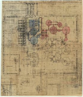
Nichols Chemical Co. Ltd. - Drawing No. 6381
https://search.heritageburnaby.ca/link/museumdescription11395
- Repository
- Burnaby Village Museum
- Date
- 27 Jun. 1946
- Collection/Fonds
- Nichols Chemical Company fonds
- Description Level
- Item
- Physical Description
- 1 technical drawing : blackline print with col. annotations ; 52.5 x 45 cm
- Scope and Content
- Item consists of technical "Drwg 6381" Nichols Chemical Company Limited, with details of equipment installation and dismantling.
- Repository
- Burnaby Village Museum
- Collection/Fonds
- Nichols Chemical Company fonds
- Description Level
- Item
- Physical Description
- 1 technical drawing : blackline print with col. annotations ; 52.5 x 45 cm
- Material Details
- Scale 1:.25
- Scope and Content
- Item consists of technical "Drwg 6381" Nichols Chemical Company Limited, with details of equipment installation and dismantling.
- Subjects
- Buildings - Industrial - Factories
- Responsibility
- General Chemical Company
- Geographic Access
- Barnet Road
- Street Address
- 8655 Barnet Road
- Accession Code
- BV998.23.17
- Access Restriction
- No restrictions
- Reproduction Restriction
- No known restrictions
- Date
- 27 Jun. 1946
- Media Type
- Technical Drawing
- Historic Neighbourhood
- Barnet (Historic Neighbourhood)
- Planning Study Area
- Burnaby Mountain Area
- Scan Resolution
- 300
- Scan Date
- 2022-05-10
- Notes
- Title based on contents of item
- "Scale 1/4" = 1'
- Stamp in lower left corner reads: "Private Design", "This Property Exclusively of General Chemical Company"
- 'Received' stamp on lower right corner, "Jul 9 1946"
Images
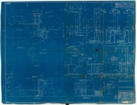
Nichols Chemical Co. Ltd. - Drawing No. 52499
https://search.heritageburnaby.ca/link/museumdescription11390
- Repository
- Burnaby Village Museum
- Date
- 28 Jan. 1947
- Collection/Fonds
- Nichols Chemical Company fonds
- Description Level
- Item
- Physical Description
- 1 technical drawing : blueprint ; 86 x 111 cm
- Scope and Content
- Item consists of technical drawing "Various Plans and Elevations", "Nichols Chemical Company"; drawing "No. 52499".
- Repository
- Burnaby Village Museum
- Collection/Fonds
- Nichols Chemical Company fonds
- Description Level
- Item
- Physical Description
- 1 technical drawing : blueprint ; 86 x 111 cm
- Material Details
- Scale 1:.25
- Scope and Content
- Item consists of technical drawing "Various Plans and Elevations", "Nichols Chemical Company"; drawing "No. 52499".
- Subjects
- Buildings - Industrial - Factories
- Responsibility
- General Chemical Company
- Geographic Access
- Barnet Road
- Street Address
- 8655 Barnet Road
- Accession Code
- BV998.23.12
- Access Restriction
- No restrictions
- Reproduction Restriction
- No known restrictions
- Date
- 28 Jan. 1947
- Media Type
- Technical Drawing
- Historic Neighbourhood
- Barnet (Historic Neighbourhood)
- Planning Study Area
- Burnaby Mountain Area
- Scan Resolution
- 300
- Scan Date
- 2022-05-10
- Notes
- Title based on contents of item
- Stamp on verso reads: "Private Design", "The Property Exclusively of General Chemical Company"; in upper left corner is red circular 'Received' stamp, dated Feb (?) 1947
- "Scale 1/4" = 1'
- "DRAWN_LEIBRICK / CHECKED_L.C.PRAY"
Images
First house on Twelfth Avenue
https://search.heritageburnaby.ca/link/archivedescription38195
- Repository
- City of Burnaby Archives
- Date
- [194-?] (date of original), copied 1991
- Collection/Fonds
- Burnaby Historical Society fonds
- Description Level
- Item
- Physical Description
- 1 photograph : b&w ; 3.3 x 5.1 cm print on contact sheet 20.3 x 26.6 cm
- Scope and Content
- Photograph of the first house on 12th Avenue, at 160 12th Avenue (later renumbered 8142 12th Avenue).
- Repository
- City of Burnaby Archives
- Date
- [194-?] (date of original), copied 1991
- Collection/Fonds
- Burnaby Historical Society fonds
- Subseries
- Burnaby Image Bank subseries
- Physical Description
- 1 photograph : b&w ; 3.3 x 5.1 cm print on contact sheet 20.3 x 26.6 cm
- Description Level
- Item
- Record No.
- 370-782
- Access Restriction
- No restrictions
- Reproduction Restriction
- Reproduce for fair dealing purposes only
- Accession Number
- BHS1999-03
- Scope and Content
- Photograph of the first house on 12th Avenue, at 160 12th Avenue (later renumbered 8142 12th Avenue).
- Subjects
- Buildings - Residential - Houses
- Media Type
- Photograph
- Notes
- Title based on contents of photograph
- 1 b&w copy negative accompanying
- Geographic Access
- 12th Avenue
- Street Address
- 8142 12th Avenue
- Historic Neighbourhood
- East Burnaby (Historic Neighbourhood)
- Planning Study Area
- Second Street Area
Images
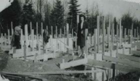
House construction on 12th Avenue
https://search.heritageburnaby.ca/link/archivedescription38201
- Repository
- City of Burnaby Archives
- Date
- 1946 (date of original), copied 1991
- Collection/Fonds
- Burnaby Historical Society fonds
- Description Level
- Item
- Physical Description
- 1 photograph : b&w ; 2.9 x 4.9 cm print on contact sheet 20.3 x 26.6 cm
- Scope and Content
- Photograph of the forms for a house under construction at 12th Avenue and 1st Street. A woman is standing at the centre, and a man is at the back left.
- Repository
- City of Burnaby Archives
- Date
- 1946 (date of original), copied 1991
- Collection/Fonds
- Burnaby Historical Society fonds
- Subseries
- Burnaby Image Bank subseries
- Physical Description
- 1 photograph : b&w ; 2.9 x 4.9 cm print on contact sheet 20.3 x 26.6 cm
- Description Level
- Item
- Record No.
- 370-788
- Access Restriction
- No restrictions
- Reproduction Restriction
- No known restrictions
- Accession Number
- BHS1999-03
- Scope and Content
- Photograph of the forms for a house under construction at 12th Avenue and 1st Street. A woman is standing at the centre, and a man is at the back left.
- Media Type
- Photograph
- Notes
- Title based on contents of photograph
- 1 b&w copy negative accompanying
- Geographic Access
- 12th Avenue
- 1st Street
- Historic Neighbourhood
- East Burnaby (Historic Neighbourhood)
- Planning Study Area
- Second Street Area
Images
Jack Kask at Kask Filling Station
https://search.heritageburnaby.ca/link/archivedescription37415
- Repository
- City of Burnaby Archives
- Date
- [1939 or 1940] (date of original), copied 1991
- Collection/Fonds
- Burnaby Historical Society fonds
- Description Level
- Item
- Physical Description
- 1 photograph : b&w ; 4.8 x 2.9 cm print on contact sheet 20.2 x 25.4 cm
- Scope and Content
- Photograph of Jack Kask at 10 years old, standing in front of Kask Filling Station at Kask Camp, Barnet Road. He is standing beside a "Signal" gas pump.
- Repository
- City of Burnaby Archives
- Date
- [1939 or 1940] (date of original), copied 1991
- Collection/Fonds
- Burnaby Historical Society fonds
- Subseries
- Burnaby Image Bank subseries
- Physical Description
- 1 photograph : b&w ; 4.8 x 2.9 cm print on contact sheet 20.2 x 25.4 cm
- Description Level
- Item
- Record No.
- 370-003
- Access Restriction
- No restrictions
- Reproduction Restriction
- No known restrictions
- Accession Number
- BHS1999-03
- Scope and Content
- Photograph of Jack Kask at 10 years old, standing in front of Kask Filling Station at Kask Camp, Barnet Road. He is standing beside a "Signal" gas pump.
- Names
- Kask, John "Jack"
- Media Type
- Photograph
- Notes
- Title based on contents of photograph
- 1 b&w copy negative accompanying
- Geographic Access
- Barnet Road
- Street Address
- 7501 Barnet Road
- Historic Neighbourhood
- Barnet (Historic Neighbourhood)
- Planning Study Area
- Burnaby Mountain Area
Images
John Burton family home
https://search.heritageburnaby.ca/link/archivedescription36068
- Repository
- City of Burnaby Archives
- Date
- [between 1940 and 1949]
- Collection/Fonds
- Burnaby Historical Society fonds
- Description Level
- Item
- Physical Description
- 1 photograph : col. ; 7.5 x 12.5 cm print
- Scope and Content
- Photograph of the John Burton family home at 661 12th Avenue. It has been renamed 7835 12th Avenue.
- Repository
- City of Burnaby Archives
- Date
- [between 1940 and 1949]
- Collection/Fonds
- Burnaby Historical Society fonds
- Subseries
- John Burton subseries
- Physical Description
- 1 photograph : col. ; 7.5 x 12.5 cm print
- Description Level
- Item
- Record No.
- 216-002
- Access Restriction
- No restrictions
- Reproduction Restriction
- No known restrictions
- Accession Number
- BHS1989-05
- Scope and Content
- Photograph of the John Burton family home at 661 12th Avenue. It has been renamed 7835 12th Avenue.
- Subjects
- Buildings - Residential - Houses
- Media Type
- Photograph
- Notes
- Title based on contents of photograph
- 1 col. copy negative accompanying
- Accompanying materials state that item no. 216-001 and no. 397-001 are of the same address as this item
- Geographic Access
- 12th Avenue
- Street Address
- 7835 12th Avenue
- Historic Neighbourhood
- Edmonds (Historic Neighbourhood)
- Planning Study Area
- Edmonds Area
Images
Walker family property
https://search.heritageburnaby.ca/link/archivedescription78784
- Repository
- City of Burnaby Archives
- Date
- [1948] (date of original); 2013 (date of duplication)
- Collection/Fonds
- Walker family fonds
- Description Level
- Item
- Physical Description
- 1 photograph (jpeg) : b&w ; 200 dpi
- Scope and Content
- Photograph of two unidentified buildings believed to be on the Scotty and Elizabeth Walker family property.
- Repository
- City of Burnaby Archives
- Date
- [1948] (date of original); 2013 (date of duplication)
- Collection/Fonds
- Walker family fonds
- Physical Description
- 1 photograph (jpeg) : b&w ; 200 dpi
- Description Level
- Item
- Record No.
- 557-034
- Access Restriction
- No restrictions
- Reproduction Restriction
- No known restrictions
- Accession Number
- 2013-15
- Scope and Content
- Photograph of two unidentified buildings believed to be on the Scotty and Elizabeth Walker family property.
- Subjects
- Buildings
- Media Type
- Photograph
- Notes
- Title based on contents of photograph
- Geographic Access
- 12th Avenue
- Historic Neighbourhood
- Edmonds (Historic Neighbourhood)
- Planning Study Area
- Edmonds Area
![Walker family property, [1948] (date of original); 2013 (date of duplication) thumbnail](/media/hpo/_Data/_Archives_Images/_Unrestricted/550/557-008.jpg?width=280)
![Walker family property, [1948] (date of original); 2013 (date of duplication) thumbnail](/media/hpo/_Data/_Archives_Images/_Unrestricted/550/557-009.jpg?width=280)
![Walker family property, [1948] (date of original); 2013 (date of duplication) thumbnail](/media/hpo/_Data/_Archives_Images/_Unrestricted/550/557-010.jpg?width=280)
![Walker family property, [1948] (date of original); 2013 (date of duplication) thumbnail](/media/hpo/_Data/_Archives_Images/_Unrestricted/550/557-011.jpg?width=280)
![Mainland Clay Brick Plant, [194-] (date of original), copied 1991 thumbnail](/media/hpo/_Data/_Archives_Images/_Unrestricted/370/370-009.jpg?width=280)


![First house on Twelfth Avenue, [194-?] (date of original), copied 1991 thumbnail](/media/hpo/_Data/_Archives_Images/_Unrestricted/370/370-782.jpg?width=280)

![Jack Kask at Kask Filling Station, [1939 or 1940] (date of original), copied 1991 thumbnail](/media/hpo/_Data/_Archives_Images/_Unrestricted/370/370-003.jpg?width=280)
![John Burton family home, [between 1940 and 1949] thumbnail](/media/hpo/_Data/_Archives_Images/_Unrestricted/205/216-002.jpg?width=280)
![Walker family property, [1948] (date of original); 2013 (date of duplication) thumbnail](/media/hpo/_Data/_Archives_Images/_Unrestricted/550/557-034.jpg?width=280)