Narrow Results By
Decade
- 2020s 56
- 2010s 46
- 2000s
- 1990s
- 1980s 16
- 1970s
- 1960s 37
- 1950s 47
- 1940s
- 1930s 32
- 1920s 42
- 1910s 77
- 1900s 55
- 1890s 22
- 1880s
- 1870s 3
- 1860s 3
- 1850s 1
- 1840s 1
- 1830s 1
- 1820s 1
- 1810s 1
- 1800s 1
- 1790s 1
- 1780s 1
- 1770s 1
- 1760s 1
- 1750s 1
- 1740s 1
- 1730s 1
- 1720s 1
- 1710s 1
- 1700s 1
- 1690s 1
- 1680s 1
- 1670s 1
- 1660s 1
- 1650s 1
- 1640s 1
- 1630s 1
- 1620s 1
- 1610s 1
- 1600s 1
Subject
- Animals - Horses 1
- Buildings - Commercial 1
- Buildings - Commercial - Grocery Stores 1
- Buildings - Commercial - Hardware Stores 1
- Buildings - Heritage 1
- Buildings - Public - Detention Facilities 1
- Buildings - Recreational - Bowling Alleys 1
- Buildings - Residential - Cabins 1
- Construction 1
- Construction Tools and Equipment 1
- Education 1
- Events - Competitions 1
Creator
- Adams, John 2
- British Columbia Department of Education 1
- British Columbia Electric Company 2
- British Columbia Underwriters' Association 4
- Burnaby Centennial '71 Committee 1
- Burnaby Village Museum 10
- Burnaby Village Museum - City of Burnaby 2
- Canadian Broadcasting Corporation 2
- Century Park Museum Association 1
- Chenatte, Jeff 1
- City of Burnaby 1
- Corsbie, Joseph Hardcastle-Cumberland "Joe" 1
Love farmhouse oral history project subseries
https://search.heritageburnaby.ca/link/museumdescription10392
- Repository
- Burnaby Village Museum
- Date
- 1925-1930 (interview content), interviewed between 1988 and 1991
- Collection/Fonds
- Burnaby Village Museum fonds
- Description Level
- Subseries
- Physical Description
- Textual records + 3 audio cassettes + 1 videocassette
- Scope and Content
- Subseries consists of records created and collected during research of the Love family and the Love family farmhouse and include oral history interviews in various formats. Interviews were conducted by Jim Wolf and Burnaby Village Museum curator Colin Stevens with members of the Love family includi…
- Repository
- Burnaby Village Museum
- Collection/Fonds
- Burnaby Village Museum fonds
- Series
- Jesse Love farmhouse series
- Description Level
- Subseries
- Physical Description
- Textual records + 3 audio cassettes + 1 videocassette
- Scope and Content
- Subseries consists of records created and collected during research of the Love family and the Love family farmhouse and include oral history interviews in various formats. Interviews were conducted by Jim Wolf and Burnaby Village Museum curator Colin Stevens with members of the Love family including; Annie Chamberlain, William Parker, Esther Stanley, Albert Parker and Elsie Hughes. Interviews were focused on the subject of the interior and exterior of the farmhouse from a first person perspective. The goal was to obtain as much information as possible from family members in order to accurately restore, furnish and exhibit the farmhouse back to it's original 1920s era.
- Accession Code
- BV018.41
- Access Restriction
- No restrictions
- Reproduction Restriction
- May be restricted by third party rights
- Date
- 1925-1930 (interview content), interviewed between 1988 and 1991
- Media Type
- Textual Record
- Sound Recording
- Moving Images
- Notes
- Title based on content of subseries
Many Voices Project Interviews subseries
https://search.heritageburnaby.ca/link/museumdescription19596
- Repository
- Burnaby Village Museum
- Date
- [1890-2023] (interview content), interviewed 2024
- Collection/Fonds
- Burnaby Village Museum fonds
- Description Level
- Subseries
- Physical Description
- 33 sound recordings (wav) + 3 video recordings (mp4) + 17 sound recordings (mp3) + 1 sound recording (m4a)
- Scope and Content
- Subseries consists of oral history interviews that were conducted as part of Burnaby Village Museum's Many Voices Project to capture and document diverse lives and stories of people connected to Burnaby. Interviews were conducted with Shirley Cohn; Ram Sarap Chandhal and members of Shri Ravidass S…
- Repository
- Burnaby Village Museum
- Collection/Fonds
- Burnaby Village Museum fonds
- Series
- Museum Oral Histories series
- Subseries
- Many Voices Project Interviews subseries
- Description Level
- Subseries
- Physical Description
- 33 sound recordings (wav) + 3 video recordings (mp4) + 17 sound recordings (mp3) + 1 sound recording (m4a)
- Material Details
- Digital master recordings (wav) were recorded onto separate audio tracks. Multiple tracks per interview were edited and merged together and converted to mp3 for access on Heritage Burnaby
- Some of the video recording (mp4) files were edited and saved as audio recording (wav) files
- Scope and Content
- Subseries consists of oral history interviews that were conducted as part of Burnaby Village Museum's Many Voices Project to capture and document diverse lives and stories of people connected to Burnaby. Interviews were conducted with Shirley Cohn; Ram Sarap Chandhal and members of Shri Ravidass Sabha gudawara; Lachman Singh Gill; Joanne Smith; Ellen and Bill Schwartz; Sadhu Binning and Sukhwant Hundal (founders of Vancouver Sath); Samuel Nalliah and Ruth (Angela) Nalliah; Jagandeep "Jag" Nagra; David Skulski; Kanwal Singh Neel; "The Bollywood Boyz" Harv Sihra and Gurvinder Sihra; Jenny Siormanolakis; Bill Gruenthal; Lama Tenzin Sherpa and Lama Sue Salter; Norman Dowad; Richard Liu; Shanaz Khan; Harry Toy; Lisette Pappas; Alex and Georgia Chronakis; Donna Wong and Jeffrey Wong.
- Accession Code
- BV023.16
- BV024.4
- Date
- [1890-2023] (interview content), interviewed 2024
- Media Type
- Sound Recording
- Moving Images
- Notes
- Title based on contents of subseries
- Some of the recordings within this subseries have access restrictions
- Further accruals are expected
![Municipality of Burnaby - Volume XV and Volume XVIII, 1927-[1940] thumbnail](/media/hpo/_Data/_BVM_Artifacts/1972/1972_0111_0004_003.jpg?width=280)
Municipality of Burnaby - Volume XV and Volume XVIII
https://search.heritageburnaby.ca/link/museumdescription8682
- Repository
- Burnaby Village Museum
- Date
- 1927-[1940]
- Collection/Fonds
- Burnaby Village Museum Map collection
- Description Level
- File
- Physical Description
- 4 plans on 4 sheets: col. lithographic prints ; 63.5 x 53.5 cm folded to 53 x 31.5 cm
- Scope and Content
- File consists of four pages of plans removed from a bound book containing a series of fire insurance plans of the Municipality of Burnaby. Plan "1518" and "1519" are from "GREATER VANCOUVER B.C. / VOLUME XV / Municipality of Burnaby / May, 1927". Plan "1518" covers District Lot 116 and Plan "1519"…
- Repository
- Burnaby Village Museum
- Collection/Fonds
- Burnaby Village Museum Map collection
- Description Level
- File
- Physical Description
- 4 plans on 4 sheets: col. lithographic prints ; 63.5 x 53.5 cm folded to 53 x 31.5 cm
- Material Details
- Scale [1:600]
- Scope and Content
- File consists of four pages of plans removed from a bound book containing a series of fire insurance plans of the Municipality of Burnaby. Plan "1518" and "1519" are from "GREATER VANCOUVER B.C. / VOLUME XV / Municipality of Burnaby / May, 1927". Plan "1518" covers District Lot 116 and Plan "1519" covers District Lot 121. Plan "1802" and plan "1803" are from "GREATER VANCOUVER B.C. / VOLUME XVIII / Municipality of Burnaby / May, 1927". Both plans "1802" and "1803" cover District Lot 153.
- Responsibility
- British Columbia Underwriters' Association
- Accession Code
- HV972.111.4
- Access Restriction
- No restrictions
- Reproduction Restriction
- May be restricted by third party rights
- Date
- 1927-[1940]
- Media Type
- Cartographic Material
- Historic Neighbourhood
- Vancouver Heights (Historic Neighbourhood)
- Central Park (Historic Neighbourhood)
- Planning Study Area
- Willingdon Heights Area
- Marlborough Area
- Scan Resolution
- 400
- Scan Date
- 2021-11-18
- Notes
- Title based on content of plans
- See also BV987.1.70d for revised versions of plans
- Scale is measured 1 inch = 50 feet
- Contact Burnaby Village Museum to access plans 1518 and 1519 (these plans have revisions on top - date of revisions is uncertain)
Images
![Municipality of Burnaby - Volume XV and Volume XVIII, 1927-[1940] thumbnail](/media/hpo/_Data/_BVM_Artifacts/1972/1972_0111_0004_003.jpg)

Museum exhibits series
https://search.heritageburnaby.ca/link/museumdescription16037
- Repository
- Burnaby Village Museum
- Date
- 1990-2021
- Collection/Fonds
- Burnaby Village Museum fonds
- Description Level
- Series
- Physical Description
- 1 digital illustration (pdf) + 1 painting (tiff) + 9 sound recordings (mp3) + 2 video recordings (mp4) + 6.5 cm of textual records
- Scope and Content
- Series consists of photographs, graphic materials and other records pertaining to Burnaby Village Museum temporary and permanent exhibits. A selection of temporary exihibits are described by title and year. Series have been arranged by exhibit title into the following subseries: 1) Burnaby's Best …
- Repository
- Burnaby Village Museum
- Collection/Fonds
- Burnaby Village Museum fonds
- Series
- Museum exhibits series
- Description Level
- Series
- Physical Description
- 1 digital illustration (pdf) + 1 painting (tiff) + 9 sound recordings (mp3) + 2 video recordings (mp4) + 6.5 cm of textual records
- Scope and Content
- Series consists of photographs, graphic materials and other records pertaining to Burnaby Village Museum temporary and permanent exhibits. A selection of temporary exihibits are described by title and year. Series have been arranged by exhibit title into the following subseries: 1) Burnaby's Best Baby contest subseries 2) Across the Pacific subseries 3) Agents of Change subseries 4) Museum materials for exhibits subseries
- Names
- Burnaby Village Museum
- Accession Code
- BV020.5
- BV019.36.1
- BV019.61.1
- BV020.42
- BV021.14
- Date
- 1990-2021
- Arrangement
- Series are arranged by subseries by exhibit title and year.
- Notes
- Title based on contents of series
- Further accruals expected
Museum film collection series
https://search.heritageburnaby.ca/link/museumdescription16032
- Repository
- Burnaby Village Museum
- Date
- 1990-2021 (date of originals), digitized in 2020
- Collection/Fonds
- Burnaby Village Museum fonds
- Description Level
- Series
- Physical Description
- 17 videocassettes + 3 video recordings (mp4)
- Scope and Content
- Series consists of a collection of promotional videos, documentary footage of special events, programs, restoration and construction projects, videos used for exhibits and research as well as copies of television news coverage about Burnaby Village Museum and a video recording of a book launch.
- Repository
- Burnaby Village Museum
- Collection/Fonds
- Burnaby Village Museum fonds
- Description Level
- Series
- Physical Description
- 17 videocassettes + 3 video recordings (mp4)
- Scope and Content
- Series consists of a collection of promotional videos, documentary footage of special events, programs, restoration and construction projects, videos used for exhibits and research as well as copies of television news coverage about Burnaby Village Museum and a video recording of a book launch.
- Names
- Burnaby Village Museum
- Accession Code
- X2294
- BV017.39
- BV019.18
- BV020.4
- BV020.5
- BV021.7.1
- Date
- 1990-2021 (date of originals), digitized in 2020
- Media Type
- Moving Images
- Notes
- Title based on contents of series
- Further accruals are expected
Museum Oral Histories series
https://search.heritageburnaby.ca/link/museumdescription18810
- Repository
- Burnaby Village Museum
- Date
- [1600-2023] (interview content), interviewed 2005-2023
- Collection/Fonds
- Burnaby Village Museum fonds
- Description Level
- Series
- Physical Description
- 52 sound recordings (wav) + 61 sound recordings (mp3) + 1 video recording (mp4) + 1 sound recording (m4a) + 51 video recordings (mov)
- Scope and Content
- Series consists of oral history interviews conducted by staff of Burnaby Village Museum for various projects. Series has been arranged into subseries: 1) Growing Up in Burnaby subseries 2) Museum research interviews subseries 3) Chinese Canadians in Burnaby subseries 4) South Asian Canadian Interv…
- Repository
- Burnaby Village Museum
- Collection/Fonds
- Burnaby Village Museum fonds
- Series
- Museum Oral Histories series
- Description Level
- Series
- Physical Description
- 52 sound recordings (wav) + 61 sound recordings (mp3) + 1 video recording (mp4) + 1 sound recording (m4a) + 51 video recordings (mov)
- Scope and Content
- Series consists of oral history interviews conducted by staff of Burnaby Village Museum for various projects. Series has been arranged into subseries: 1) Growing Up in Burnaby subseries 2) Museum research interviews subseries 3) Chinese Canadians in Burnaby subseries 4) South Asian Canadian Interviews subseries 5) Many Voices Project Interviews subseries
- Accession Code
- BV017.45
- BV018.18.1
- BV019.13.1
- BV019.14.1
- BV019.15.1
- BV020.6
- BV022.29
- BV023.1
- BV023.16
- BV024.4
- Date
- [1600-2023] (interview content), interviewed 2005-2023
- Media Type
- Sound Recording
- Moving Images
- Notes
- Title based on contents of series
- Further accruals expected
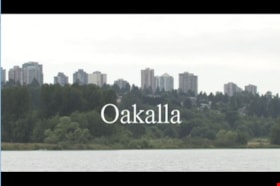
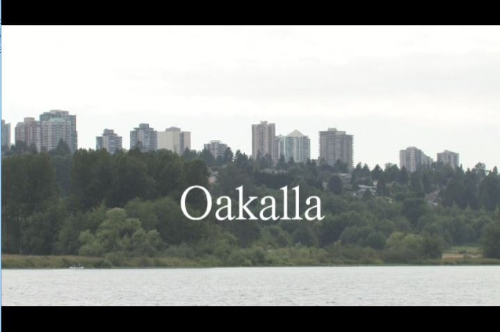
Oakalla
https://search.heritageburnaby.ca/link/museumlibrary1393
- Repository
- Burnaby Village Museum
- Author
- Jack, Ronald
- Publication Date
- c2009
- Call Number
- 365.9711 JAC VR
- Repository
- Burnaby Village Museum
- Collection
- Reference Collection
- Material Type
- Moving Images
- Accession Code
- BV020.5.1059
- Call Number
- 365.9711 JAC VR
- Author
- Jack, Ronald
- Place of Publication
- Vancouver, B.C.
- Publisher
- Runagate Pictures
- Publication Date
- c2009
- Physical Description
- 1 videodisc (9 min., 52 sec.) : sd., col. ; 4 3/4 in
- Library Subject (LOC)
- Lower Mainland Regional Corrections Centre--History
- Prisons--British Columbia
- Historic Neighbourhood
- Burnaby Lake (Historic Neighbourhood)
- Planning Study Area
- Oakalla Area
- Geographic Access
- Oakmount Crescent
- Street Address
- 5220 Oakmount Crescent
- Notes
- "A preview DVD" titled "Oakalla" compiled by Ronald Jack. Film footage consists of historic and contemporary images regarding Oakalla Prison Farm and includes commentaries from Burnaby Village Museum Curator, Tom Gooden; Oakalla Historian and Vancouver Police Officer, Earl Anderson and Burnaby Mayor, Derek Corrigan (former Oakalla prison guard). A collection of Oakalla artifacts are included in the film footage.
- Contact Burnaby Village Museum to view video content
Images
Oakalla documentary photographs and video series
https://search.heritageburnaby.ca/link/museumdescription18953
- Repository
- Burnaby Village Museum
- Date
- 1991
- Collection/Fonds
- Oakalla Prison collection
- Description Level
- Series
- Physical Description
- 101 photographs + 1 videocassette
- Scope and Content
- Series consists of documentary photographs and video footage taken of the interior and exterior of site and buildings by Burnaby Village Museum curator, Colin Stevens after it was closed. Includes photographs of the Open House event and photographs taken while touring the interior and exterior of t…
- Repository
- Burnaby Village Museum
- Collection/Fonds
- Oakalla Prison collection
- Description Level
- Series
- Physical Description
- 101 photographs + 1 videocassette
- Scope and Content
- Series consists of documentary photographs and video footage taken of the interior and exterior of site and buildings by Burnaby Village Museum curator, Colin Stevens after it was closed. Includes photographs of the Open House event and photographs taken while touring the interior and exterior of the buildings on site along with a video that was taken of the Death Row cell block.
- Accession Code
- BV991.45
- Date
- 1991
- Media Type
- Photograph
- Moving Images
- Notes
- Title based on contents of series
Oakalla Prison collection
https://search.heritageburnaby.ca/link/museumdescription16696
- Repository
- Burnaby Village Museum
- Date
- [1974]-1991
- Collection/Fonds
- Oakalla Prison collection
- Description Level
- Fonds
- Physical Description
- 37.5 cm of textual records + 125 photographs + 1 videocassette
- Scope and Content
- Collection consists of a selection of Oakalla correctional facility records including reports, correspondence, photographs and a video tour of the death row incarceration cells inside Oakalla Prison taken by Burnaby Village Museum curator after the facility was closed. Most of the photographs docum…
- Repository
- Burnaby Village Museum
- Collection/Fonds
- Oakalla Prison collection
- Description Level
- Fonds
- Physical Description
- 37.5 cm of textual records + 125 photographs + 1 videocassette
- Scope and Content
- Collection consists of a selection of Oakalla correctional facility records including reports, correspondence, photographs and a video tour of the death row incarceration cells inside Oakalla Prison taken by Burnaby Village Museum curator after the facility was closed. Most of the photographs document Oakalla Prison in 1991 and were taken during the Open House event or when Burnaby Village Museum staff were granted access to retreive items prior to demolition. A small selection of facility photographs of site and staff are also included.
- Records are arranged into series:
- 1) Oakalla correctional facility records series
- 2) Oakalla correctional facility photographs series
- 3) Oakalla documentary photographs and video series
- History
- The Oakalla Prison Farm (also known as the Lower Mainland Regional Correctional Centre) was a model prison farm on 185 acres of land next to Deer Lake in Burnaby. The Oakalla Prison Farm opened in 1912 and was initially designed to hold 150 men and 50 women. By the 1950s, the population was well over one thousand. The prison included a working farm which included a dairy, vegetable gardens and livestock. In 1959 the last execution in British Columbia took place at Oakalla. Following a riot and mass escape in the late 1980s, poor conditions, and public outcry, Oakalla closed down in 1991. In the fall of 1991, the prison was opened up to the public whereby tours were conducted of the site. Not long after, buildings were demolished and a residential housing development took it's place. A playground now sits on the former site of the main building. In 1991, staff from Burnaby Village Museum were granted access, documenting the site prior to it's demolition. Many Oakalla artifacts and records were salvaged and accessioned into the Burnaby Village Museum's permanent collection.
- Responsibility
- Oakalla Prison Farm
- Accession Code
- BV991.45
- Date
- [1974]-1991
- Media Type
- Photograph
- Textual Record
- Moving Images
- Related Material
- See also Oakalla artifacts - BV991.45
- Arrangement
- Arrangement of records and series of this collection is based on record creators and subject that. Facility records and photographs were created and collected by Oakalla correctional facility staff and documentary photographs and a video from 1991 were created by Burnaby Village Museum staff.
- Notes
- Title based on content of collection
- Some records within this collection are closed. Contact Burnaby Village Museum for access.
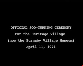
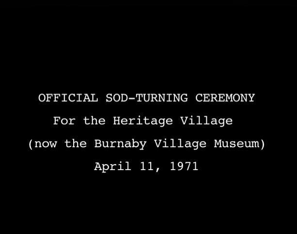
Official Sod Turning Ceremony for Heritage Village
https://search.heritageburnaby.ca/link/museumdescription9776
- Repository
- Burnaby Village Museum
- Date
- April 11 1971 (date of original), digitized in 2011
- Collection/Fonds
- Burnaby Centennial '71 Committee collection
- Description Level
- Item
- Physical Description
- 1 video recording (mp4) (3 min., 11 sec.) : digital, 29 fps, b&w, sd., stereo
- Scope and Content
- Film of Vintage car parade ending with the sod turning ceremony at Heritage Park Museum. CBC news item April 11, 1971.
- Repository
- Burnaby Village Museum
- Collection/Fonds
- Burnaby Centennial '71 Committee collection
- Description Level
- Item
- Physical Description
- 1 video recording (mp4) (3 min., 11 sec.) : digital, 29 fps, b&w, sd., stereo
- Material Details
- Script read by Mike Dobson
- Film footage was edited and digitized by Oliver Glaser at Newsreel Productions
- Audio production by emBall Productions
- Scope and Content
- Film of Vintage car parade ending with the sod turning ceremony at Heritage Park Museum. CBC news item April 11, 1971.
- History
- This footage was originally shot in 16 mm, on Sunday, April 11, 1971, and broadcast on CBC television. The original footage was silent: when it was broadcast, a news announcer read from a script to describe the events. In 2011, the footage was digitized. The original script was read by an actor, recorded, and added to the digitized footage to create this film.
- Subjects
- Events - Parades
- Names
- Burnaby Village Museum
- Responsibility
- Canadian Broadcasting Corporation
- Geographic Access
- Deer Lake Avenue
- Accession Code
- BV018.42.1
- Access Restriction
- No restrictions
- Reproduction Restriction
- May be restricted by third party rights
- Date
- April 11 1971 (date of original), digitized in 2011
- Media Type
- Moving Images
- Historic Neighbourhood
- Burnaby Lake (Historic Neighbourhood)
- Planning Study Area
- Burnaby Lake Area
- Notes
- Transcribed title
- BV020.5.708 is the original 16mm silent film that this film was created from
Images
Video
Official Sod Turning Ceremony for Heritage Village, April 11 1971 (date of original), digitized in 2011
Official Sod Turning Ceremony for Heritage Village, April 11 1971 (date of original), digitized in 2011
https://search.heritageburnaby.ca/media/hpo/_Data/_BVM_Moving_Images/2018_0042_0001_001.mp4
Okanagan Fishing Guide
https://search.heritageburnaby.ca/link/museumdescription11398
- Repository
- Burnaby Village Museum
- Date
- 1948
- Collection/Fonds
- Burnaby Village Museum Map collection
- Description Level
- Item
- Physical Description
- 1 map : col. ink on paper handcol. ; 24 x 35 cm
- Scope and Content
- Item consists of map titled "Okanagan Fishing Guide / Showing / Major Roads / and the / Best Fish Lakes". Hand drawn map compiled and drawn by W.C. Rueber, Kelowna B.C. of Okanagan Lake area. Advertisement at bottom of page indicates that it may have been produced by "OK USED FURNITURE STORE / 239 …
- Repository
- Burnaby Village Museum
- Collection/Fonds
- Burnaby Village Museum Map collection
- Description Level
- Item
- Physical Description
- 1 map : col. ink on paper handcol. ; 24 x 35 cm
- Scope and Content
- Item consists of map titled "Okanagan Fishing Guide / Showing / Major Roads / and the / Best Fish Lakes". Hand drawn map compiled and drawn by W.C. Rueber, Kelowna B.C. of Okanagan Lake area. Advertisement at bottom of page indicates that it may have been produced by "OK USED FURNITURE STORE / 239 BERNARD AVE., KELOWNA, B.C....". The map was copyrighted in Canada on July 20, 1948, No. 79416.
- Creator
- Rueber, W.C.
- Publisher
- OK Used Furniture Store
- Accession Code
- BV006.24.116
- Access Restriction
- No restrictions
- Reproduction Restriction
- May be restricted by third party rights
- Date
- 1948
- Media Type
- Cartographic Material
- Scan Resolution
- 600
- Scan Date
- 2021-11-23
- Notes
- Transcribed title
- Staining on map with creases from being folded and handcoloured markings with blue pencil
Images

Progress report
https://search.heritageburnaby.ca/link/museumlibrary7355
- Repository
- Burnaby Village Museum
- Collection
- Reference Collection
- Material Type
- Moving Images
- Call Number
- 388.46 BCH VR
- Contributor
- British Columbia Electric Company
- Place of Publication
- [British Columbia, Canada]
- Publisher
- BC Hydro
- Publication Date
- c1947
- Physical Description
- 1 videodisc (13 min.) : sd., b&w. ; 4 3/4 in.
- Library Subject (LOC)
- Natural gas industry
- Local transit
- Hydroelectric power plants
- Electric railroads
- Electric power-plants
- Transportation
- British Columbia--History
- Subjects
- Transportation
- Geographic Access
- Vancouver
- Notes
- Summary: Promotional film. The BC Electric Railway Company's $50 million post-war expansion and modernization program, to be completed by 1950. Includes: expansion of transit services, including start of the switch from streetcars to trolley buses; water gas plant; explanation of the Bridge River project, with footage of construction (including La Joie Falls storage dam); Lower Mainland power sub-stations. Various Vancouver street scenes, especially Fraser Street and downtown
- Credit note : sponsored/presented by: British Columbia Electric Company; producer: Lew M. Parry; producing agency/company: Trans-Canada Films Ltd.

RCAF Flying Log Book and navigation maps
https://search.heritageburnaby.ca/link/museumdescription20321
- Repository
- Burnaby Village Museum
- Date
- 1943-1945
- Collection/Fonds
- Joseph H.C. Corsbie fonds
- Description Level
- File
- Physical Description
- 1 book (hardcover) + 1 map : b&w lithograph on paper with annotations in col. ink ; 34.5 x 40.5 cm + 7 maps : b&w lithograph on paper with annotations in col. ink ; 41.5 x 33.5 cm
- Scope and Content
- File consists of a "Royal Canadian Air Force Flying Log Book for Aircrew other than Pilot" assigned to J.H. Corsbie along with eight aircraft navigation maps for flying at night titled; "Newcastle to Prague" and "Hull to Venice" with navigational markings created by Joseph H. Corsbie. Entries in lo…
- Repository
- Burnaby Village Museum
- Collection/Fonds
- Joseph H.C. Corsbie fonds
- Description Level
- File
- Physical Description
- 1 book (hardcover) + 1 map : b&w lithograph on paper with annotations in col. ink ; 34.5 x 40.5 cm + 7 maps : b&w lithograph on paper with annotations in col. ink ; 41.5 x 33.5 cm
- Material Details
- Scale : 1:2,890,000 (approx.)
- Scope and Content
- File consists of a "Royal Canadian Air Force Flying Log Book for Aircrew other than Pilot" assigned to J.H. Corsbie along with eight aircraft navigation maps for flying at night titled; "Newcastle to Prague" and "Hull to Venice" with navigational markings created by Joseph H. Corsbie. Entries in log book provide detailed records of Corsbie's training and flights undertaken on RCAF service aircraft between March 1943 and July 1945 along with units which Corsbie served as observer or air gunner and the aircraft in which he's flown (1943-1944).
- Other Title Information
- Full title of book "Royal Canadian Air Force Flying Log Book for aircrew other than Pilot"
- Responsibility
- Royal Canadian Air Force
- Accession Code
- BV020.31.44
- Access Restriction
- No restrictions
- Reproduction Restriction
- No known restrictions
- Date
- 1943-1945
- Media Type
- Textual Record
- Cartographic Material
- Scan Resolution
- 600
- Scan Date
- 19-09-2023
- Notes
- Title based on contents of file
- 7 maps titled "Hull to Venice / Heights in Feet" include identifier below bottom border reading: "O.R.1373 / Spot-Height Corrections, 1944"_"Compiled and drawn at H.Q./G.S.G.S.-1943"
- 1 map titled "Newcastle to Prague / Heights in Feet" include identifier below bottom border reading: "O.R.1373 / Spot-Height Corrections, 1944"_" H.Q./G.S.G.S.-1943"
Images

Documents
Seaforth School fonds
https://search.heritageburnaby.ca/link/museumdescription18824
- Repository
- Burnaby Village Museum
- Date
- 1922-1972
- Collection/Fonds
- Seaforth School fonds
- Description Level
- Fonds
- Physical Description
- 1 survey plan + 4 cm of textual records
- Scope and Content
- Fonds consists of records from Seaforth School in Burnaby including a Register of Pupils (1922-1924); a Visitors' Book (1922-1972) and a survey plan from 1957.
- Repository
- Burnaby Village Museum
- Collection/Fonds
- Seaforth School fonds
- Description Level
- Fonds
- Physical Description
- 1 survey plan + 4 cm of textual records
- Scope and Content
- Fonds consists of records from Seaforth School in Burnaby including a Register of Pupils (1922-1924); a Visitors' Book (1922-1972) and a survey plan from 1957.
- History
- Seaforth school was built in 1922 in District Lot 42 on the corner of Piper and Goverment Streets in Burnaby. The school was named after its sponsor, the Seaforth Chapter of the Imperial Order of Daughters of the Empire. Bowman and Cullerne, the architects for the Burnaby School Board, designed the one room schoolhouse which was constructed by local contractor, Alphonse J. Toebaert. The school was moved to Burnaby Village Museum in 1983, and was opened to the public after extensive restoration in 1987.
- Creator
- Seaforth School
- Names
- Seaforth School
- Accession Code
- BV987.2
- Date
- 1922-1972
- Media Type
- Cartographic Material
- Textual Record
- Notes
- Title based on contents of fonds

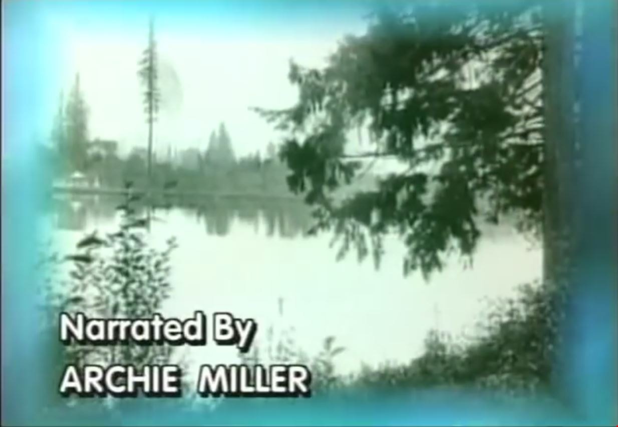
Step Back in Time at the Burnaby Village Museum and Carousel
https://search.heritageburnaby.ca/link/museumdescription12339
- Repository
- Burnaby Village Museum
- Date
- 2000 (date of original), digitized in 2020
- Collection/Fonds
- Burnaby Village Museum fonds
- Description Level
- Item
- Physical Description
- 1 videocassette (29 min. , 59 sec.) : VHS, 29 fps, col., sd.
- Scope and Content
- Film titled “Step Back in Time at the Burnaby Village Museum & Carousel” includes narration by Archie Miller. The film opens with historical background regarding land settlement and development in Burnaby supported with historical images. The film then transverses into contemporary images and foota…
- Repository
- Burnaby Village Museum
- Collection/Fonds
- Burnaby Village Museum fonds
- Description Level
- Item
- Physical Description
- 1 videocassette (29 min. , 59 sec.) : VHS, 29 fps, col., sd.
- Material Details
- Sponsored in part by: The Burnaby Historical Society; Poetry Written by: Don Benson; Voices: Arlie Mason; Tom Worledge
- Scope and Content
- Film titled “Step Back in Time at the Burnaby Village Museum & Carousel” includes narration by Archie Miller. The film opens with historical background regarding land settlement and development in Burnaby supported with historical images. The film then transverses into contemporary images and footage of the Burnaby Village Museum which opened in Burnaby on November 19, 1971 in commemoration of British Columbia joining the confederation of Canada. The film’s title text, “Step Back / In Time / at the Burnaby Village / Museum & Carousel” appears a few minutes past the opening footage. Narration continues throughout the film along with interviews with various staff members and museum interpreters. The film is divided into various segments containing titles in order of appearance: “Deer Lake Park” provides glimpses of and information about Deer Lake Park, its heritage buildings and cultural facilities including The Burnaby Art Gallery, The Shadbolt Centre for the Arts and Burnaby Village Museum. “A Living Museum” takes you on a tour of some of the museum’s exhibits and programs through the museum’s interpreters. “The Magical Carousel” provides background on the historic C.W. Parker Carousel #119 that was restored and opened on the site in 1993. “Keeping History Alive” speaks to the interpretive, artifact and archival collection of the Burnaby Village Museum with information provided by Curator Colin Stevens, Assistant Curator Steve Turnbull and Assistant Director of Cultural Services, Denis Nokony. “A Step Back in Time” speaks to the various 1920s highlights and features that the museum has to offer. “Something Special / is Always Happening” tells of the annual events that the museum offers to capture the interests of visitors. “A Day at the / Burnaby Village / Museum & Carousel” includes Denis Nokony speaking about the importance of the museum and what it means to visitors and the community.
- Creator
- Burnaby Village Museum
- Publisher
- Voice of the Fraser Productions Inc. 2000
- Subjects
- Recreational Devices - Carousels
- Names
- Burnaby Village Museum
- Shadbolt Centre for the Arts
- Burnaby Art Gallery
- C.W. Parker no. 119 Carousel
- Responsibility
- Burnaby Village Museum - City of Burnaby
- Accession Code
- BV020.4.29b
- Access Restriction
- No restrictions
- Reproduction Restriction
- May be restricted by third party rights
- Date
- 2000 (date of original), digitized in 2020
- Media Type
- Moving Images
- Related Material
- See also: BV020.4.33; BV020.4.36; BV929.4.38
- Notes
- Transcribed title from film content
Images
Video
Step Back in Time at the Burnaby Village Museum and Carousel, 2000 (date of original), digitized in 2020
Step Back in Time at the Burnaby Village Museum and Carousel, 2000 (date of original), digitized in 2020
https://search.heritageburnaby.ca/media/hpo/_Data/_BVM_Moving_Images/2020_0004_0029b_001.mp4![Subdivision plans in New Westminster District Group 1 – Burnaby
, [1882-1910] thumbnail](/media/hpo/_Data/_BVM_Cartographic_Material/1977/1977_0093_0013a_001.jpg?width=280)
Subdivision plans in New Westminster District Group 1 – Burnaby
https://search.heritageburnaby.ca/link/museumdescription6982
- Repository
- Burnaby Village Museum
- Date
- [1882-1910]
- Collection/Fonds
- Burnaby Village Museum Map collection
- Description Level
- File
- Physical Description
- 4 plans : blueprint on paper mounted on 2 sides of cardboard 76 x 102 cm
- Scope and Content
- Item consists of a large board of two New Westminster District Gp 1 - subdivision plans mounted on one side and two New Westminster District Gp 1 - subdivision plans mounted on the other side. Side A: 1. Blueprint "Plan / of the / Subdivision / of / Lot 98 / G.1, N.W.D. / Scale 4 chs = 1 in. / …
- Repository
- Burnaby Village Museum
- Collection/Fonds
- Burnaby Village Museum Map collection
- Description Level
- File
- Physical Description
- 4 plans : blueprint on paper mounted on 2 sides of cardboard 76 x 102 cm
- Material Details
- Scales [between 1:1584 and 1:3168]
- Index number on edge of board reads: "13"
- Scope and Content
- Item consists of a large board of two New Westminster District Gp 1 - subdivision plans mounted on one side and two New Westminster District Gp 1 - subdivision plans mounted on the other side. Side A: 1. Blueprint "Plan / of the / Subdivision / of / Lot 98 / G.1, N.W.D. / Scale 4 chs = 1 in. / Map No 573" (Geographic location: Burnaby) 2. Blueprint "Plan / of Subdivision of / Lot 157 / Gr.1, New. West. Dist. / Scale 3 chs = 1 in. / Map No. 612". (Geographic location: Burnaby) Side B: 1. Blueprint "Plan / of Subdivision / of a Portion of / Lot 90 / Group One / New Westminster Dist. / Scale 2 chs = 1 in. / Map No. 555". Plan is signed by "Jno Strathern [sic]_P.L.S."n (Geographic location: Burnaby) 2. Blueprint "Subdivision of Lot 31, Group 1. / New Westminster District / As Amended by Order of Court / 1st Sept. 1882 and Numbered 847 / Scale 4 chs = 1in. / Map No 80" (Geographic location: Burnaby)
- Creator
- Stathern, John
- Accession Code
- HV977.93.13
- Access Restriction
- No restrictions
- Reproduction Restriction
- No known restrictions
- Date
- [1882-1910]
- Media Type
- Cartographic Material
- Historic Neighbourhood
- Alta Vista (Historic Neighbourhood)
- Planning Study Area
- Richmond Park Area
- Lakeview-Mayfield Area
- Scan Resolution
- 300
- Scale
- 72
- Notes
- Title based on contents of file
- Scale is measured in chains. (One chain equals 792 inches)
- The term "Lot" can also refer to a "District Lot”
Images
![Subdivision plans in New Westminster District Group 1 – Burnaby
, [1882-1910] thumbnail](/media/hpo/_Data/_BVM_Cartographic_Material/1977/1977_0093_0013a_001.jpg)

![Survey and Subdivision plans in New Westminster District Group 1 – Burnaby
, [1861]-[1910] thumbnail](/media/hpo/_Data/_BVM_Cartographic_Material/1977/1977_0093_0019a_001.jpg?width=280)
Survey and Subdivision plans in New Westminster District Group 1 – Burnaby
https://search.heritageburnaby.ca/link/museumdescription6988
- Repository
- Burnaby Village Museum
- Date
- [1861]-[1910]
- Collection/Fonds
- Burnaby Village Museum Map collection
- Description Level
- File
- Physical Description
- 14 plans : 3 plans : black ink on paper hand col. + 7 plans : black ink on paper + 4 plans : graphite on paper mounted on 2 sides of cardboard 76 x 102 cm
- Scope and Content
- Item consists of a large board of four New Westminster District Gp 1 - subdivision plans mounted on one side and ten New Westminster District Gp 1 - subdivision plans mounted on the other side. Side A: 1. "Plan /of / Lots 166A, 166 and 167 /, Gr.1, N.W.D. / Showing Misconstructed Roads in Gree…
- Repository
- Burnaby Village Museum
- Collection/Fonds
- Burnaby Village Museum Map collection
- Description Level
- File
- Physical Description
- 14 plans : 3 plans : black ink on paper hand col. + 7 plans : black ink on paper + 4 plans : graphite on paper mounted on 2 sides of cardboard 76 x 102 cm
- Material Details
- Scales [between 1:2376 and 1:7920]
- Index number on edge of board reads: "19"
- Scope and Content
- Item consists of a large board of four New Westminster District Gp 1 - subdivision plans mounted on one side and ten New Westminster District Gp 1 - subdivision plans mounted on the other side. Side A: 1. "Plan /of / Lots 166A, 166 and 167 /, Gr.1, N.W.D. / Showing Misconstructed Roads in Green / 5 chs = 1 in.". (plan is drawn in black ink and hand coloured in red, green and orange ink). A section in the centre of the plan is coloured in red ink and identified as "C.S. Richmond" running from the North Arm of Fraser River to Wiggins Road and divided by "New Wiggins Rd. (as gazetted)" (coloured in orange ink) and two"Constructed Road(s)" (coloured in green ink). Plan is initialed by: "RB" [sic] (in blue pencil crayon) 2. Plan of / Subdivision of / Lot 166 / Group One / New Westminster District / Scale 4 chs = 1 in. / Map No 524". Plan is drawn in graphite and signed by "Surrig [sic] Welhams [sic] / P.L.S." Plan is initialed by: "RB" [sic] (in blue pencil crayon) 3. Plan of "Survey / of Highway / For / Burnaby Council / in / Lots 13 _14 / Group One / Scale 4 chs = 1 in." Signed by "Albert J. Hill, P.L.S." Caribou Street and Caribou Road run through the centre of the plan. Plan is stamped: "Albert J. Hill, Civil Engineer / and / Provincial Land Surveyor, / New Westminster, / B.C.". Plan is initialed by: "RB" [sic] (in blue pencil crayon) 4. A Plan of Lots 166A, 166 and 167, Group One, New Westminster District (drawn in graphite). A section in the centre of the plan is identified as "C.S. Richmond" running from the North Arm of Fraser River and divided by "New Wiggins Rd. (as gazetted)" and two "Constructed Road(s)". Plan is initialed by: "RB" [sic] (in blue pencil crayon) Side B: 1. Small plan drawn in black ink (no title) identifying lots north of the "North Arm" of the Fraser River. Lots identified include: Lot 99, Lot 98, Lot 157, Lot 158, Lot 163, Lot 162, Lot 159, Lot 163, Lot 162, Lot 165, Lot 166A, Lot 155B, Lot 155A and Lot 159. "Scale 40 chains to one inch" . Plan is initialed by: "RB" [sic] (in blue pencil crayon) (Geographic location: Burnaby) 2. Small plan drawn in black ink (no title) identifying lots north of the North Arm of the Fraser River as "Lots 155, 155A, 155B, 155C, 162, 163, 164, 165, 166A and 167". Plan is initialed by: "RB" [sic] (in blue pencil crayon) (Geographic location: Burnaby) 3. Small plan drawn in black ink (no title) which identifies "Lot 151 / Reserve/ for / Race Course"; "Reserve / 64 A / L. 152 G.1"; and other Lots: 32, 33, 34, 35, 36, 38, 39. The plan is signed "Surveyor G.Turn [sic] July / 61 / from Vol 40 R.L. notes [sic]" Plan is stamped: "Albert J. Hill, Civil Engineer / and / Provincial Land Surveyor, / New Westminster, / B.C." Plan is initialed by: "RB" [sic] (in blue pencil crayon) (Geographic location: Burnaby) 4. Small plan drawn in black in with faded red colouring on centre lot identified as "Lot 34" running north from "Vancouver Road" . Plan is stamped: "Albert J. Hill, Civil Engineer / and / Provincial Land Surveyor, / New Westminster, / B.C." Plan is initialed by: "RB" [sic] (in blue pencil crayon) (Geographic location: Burnaby) 5. Plan drawn in graphite and identified as "Lot 98, Gr.1," along with the intials "RB" [sic] (both are handwritten in blue crayon pencil on top of plan) The B.C.E.Railway is identified running through the plan along with Jubilee Road and Royal Oak Road. The plan is signed with the name "Wm. Murray" and the Plan is stamped: "Albert J. Hill, Civil Engineer / and / Provincial Land Surveyor, / New Westminster, / B.C.". (Geographic location: Burnaby) 6. Plan drawn in graphite identified as "Port Lot 13, Gr.1" along with the intials "RB" [sic] (both are handwritten in blue crayon pencil on top of plan) Plan is stamped: "Albert J. Hill, Civil Engineer / and / Provincial Land Surveyor, / New Westminster, / B.C.". (Geographic location: Burnaby) 7.Plan drawn in black ink and identified as "Lot 98 G.1" along with the intials "RB" [sic] (both are handwritten in blue crayon pencil on top of plan). A "Road Reservation" is identified running north between "Electric Tramway" and connecting with "Royal Oak Road". Plan is stamped: "Albert J. Hill, Civil Engineer / and / Provincial Land Surveyor, / New Westminster, / B.C." (Geographic location: Burnaby) 8. Plan drawn in black ink and divided into two sections, the upper plan is identified as "Portion / Lots 100 / area / 101, Gr.1" and the lower plan is identified as "Portion L. 3 G. 1" along with the intials "RB" [sic] (these identifiers are handwritten in blue crayon pencil on top of the plan). Portions of Lot 100 and Lot 101 are each divided into 6 sections and the Portion of Lot 3 plan is divided into 24 sections. The plan includes a note in black ink that reads: " Received from Wm Fromme [sic] / from Wm. Trapp / Nov. 28, 1895 / A. J. T...[sic]". (Geographic location: Burnaby) 9. Plan drawn in black ink (no title) identifying soil, buildings and geographic features in southern Burnaby. The plan is bordered by "New Westminster City" (Tenth Avenue and DL 172) to the south east and DL 173 to the south, DL 158 to the west and the B.C.E. Tramway to the north. Plan includes District Lots: 155A, 158, 159, 171, 160, 53 and 95 and identifies soil, marshland and ravines throughout. Plan identifies the following features: a "Team Road" running through Lots 158 and 159 along with "Fair Orchard Soil / Even Surface Throughout / No Ravines", "Gravel and Shingle" (bottom of Lot 158), "North Arm Road" crossing "Byrne Road" and connecting with "Power House Road" which runs north to connect with "Highland Park Station" and the B.C.E. Tramway, "Power Ho" in the northeast corner of DL 160, a "Brook" connected with a "Deep Ravine" running between DL 53, DL 95 and DL 160 along with "Good Soil" and "Fair Orchard Soil" identified nearby in DL 95. Scale is identified as "10 chs = 1 in." Plan is stamped: "Albert J. Hill, Civil Engineer / and / Provincial Land Surveyor, / New Westminster, / B.C." Plan is initialed by: "RB" [sic] (in blue pencil crayon) (Geographic location: Burnaby) 10. Plan drawn in black ink (no title) with Burnaby Lake and Deer Lake at the centre. The plan is bordered by the following District Lots identified as: 117, 118 and 68 to the west, Lots 80, 79 and 85 to the southwest, Lots 11, 13, and 1 (City of New Westminster) to the south east, the North Road boundary to the east and Lots 8, 56, 57, 59, and 136 to the North. The lower right hand corner of the plan has a small inset which reads: "Burnaby Lake" and "Page 19 R.B. Notes". Plan is initialed by: "RB" [sic] (in blue pencil crayon) (Geographic location: Burnaby)
- Creator
- Hill, Albert James
- Accession Code
- HV977.93.19
- Access Restriction
- No restrictions
- Reproduction Restriction
- No known restrictions
- Date
- [1861]-[1910]
- Media Type
- Cartographic Material
- Scan Resolution
- 300
- Scale
- 72
- Notes
- Title based on contents of file
- Scale is measured in chains. (One chain equals 792 inches)
- The term "Lot" can also refer to a "District Lot”
- Some plans are stamped: "Albert J. Hill, Civil Engineer / and / Provincial Land Surveyor, / New Westminster, / B.C." and intialed: "RB" [sic]
Images
![Survey and Subdivision plans in New Westminster District Group 1 – Burnaby
, [1861]-[1910] thumbnail](/media/hpo/_Data/_BVM_Cartographic_Material/1977/1977_0093_0019a_001.jpg)

![Survey and Subdivision plans in New Westminster District Group 1 – Burnaby, Port Moody, [1862-1908] thumbnail](/media/hpo/_Data/_BVM_Cartographic_Material/1977/1977_0093_0026a_001.jpg?width=280)
Survey and Subdivision plans in New Westminster District Group 1 – Burnaby, Port Moody
https://search.heritageburnaby.ca/link/museumdescription6995
- Repository
- Burnaby Village Museum
- Date
- [1862-1908]
- Collection/Fonds
- Burnaby Village Museum Map collection
- Description Level
- File
- Physical Description
- 9 plans : 6 plans : black ink on paper ; 57 x 36.5 cm or smaller + 1 plan : black ink and grahite on paper ; 46.5 x 49 cm + 1 plan : blueprint on paper ; 15.5 x 19.5 cm + cm + 1 plan : graphite on paper ; 25 x 17 cm ; mounted on both sides of board 76 x 102 cm
- Scope and Content
- Item consists of a large board of four New Westminster District subdivision plans mounted on one side and five New Westminster District subdivision plans mounted on the other side. Side A: 1. "Plan / of Subdivision / of a Portion / of / Lot 87 / Group One / New Westminster District / Scale 4 chs…
- Repository
- Burnaby Village Museum
- Collection/Fonds
- Burnaby Village Museum Map collection
- Description Level
- File
- Physical Description
- 9 plans : 6 plans : black ink on paper ; 57 x 36.5 cm or smaller + 1 plan : black ink and grahite on paper ; 46.5 x 49 cm + 1 plan : blueprint on paper ; 15.5 x 19.5 cm + cm + 1 plan : graphite on paper ; 25 x 17 cm ; mounted on both sides of board 76 x 102 cm
- Material Details
- Scales [between 1:792 and 1:3600]
- Index number on edge of board reads: "26"
- Scope and Content
- Item consists of a large board of four New Westminster District subdivision plans mounted on one side and five New Westminster District subdivision plans mounted on the other side. Side A: 1. "Plan / of Subdivision / of a Portion / of / Lot 87 / Group One / New Westminster District / Scale 4 chs = 1 in". Plan is stamped: "Albert J. Hill, Civil Engineer / and / Provincial Land Surveyor, / New Westminster, / B.C." and intialed by: "RB" [sic] (in blue pencil crayon). Names two of the subdivisons of District Lot 87 are identified as, "L.E. Sprott" and "John Ledger". (Geographic location: Burnaby) 2. "Plan of Subdivision / of / Portions of / Lot 136, 131 and Lots 44 and 78 Gr.1 / New Westminster District / Scale 300 ft = 1 inch". Annotation above title reads: "No. 901 / Deposited in Land Registry Office / New Westminster / Aug. 19th 1905 / Charles S. Keith D. Reg." Annotations and signatures at bottom of plan read: "I, William Nelson Draper, / W.H.R. Collister / Charles E. Perkins / E.B. Morgan / make / Surveys / correct / representation / upon / the / Land Registry Act / (sgd) W.N. Draper, P.L.S.". Plan includes a handwritten title: "Lots 136, 131, 44 & 78" and is initialed: "RB" [sic] (in blue pencil crayon) (Geographic location: Burnaby) 3. "Survey / of / a Portion / of / Lot 95, Gr.1 / Scale 1 ch = 1in." Plan is stamped: "Albert J. Hill, Civil Engineer / and / Provincial Land Surveyor, / New Westminster, / B.C." and is initialed : "RB" [sic] (in blue pencil crayon) (Geographic location: Burnaby) 4. Blueprint plan of "Lot 396. Group One." with Scale : 3 chs = 1 in. A two acre portion of District Lot 396 is filled in with red ink." Plan is signed by "Albert J. Hill / B.C.L.S." (Geographic location: Port Moody) Side B: 1. Plan titled "District Lot 92 / Burnaby / Municipality / for sale by / Mahon / McFarland & / Mahon Ltd. / Vancouver, B.C. / Scale : 4 chains to one inch". District Lot 92 is subdivided into 161 lots and identifies roads: Norwich Road, Pole Line Road, Oakland Road, Stanley Road, Burford Road, Dalhousie Road, Brantford Road, Colborne Road, Roberts Road, Vancouver & Westminster Road, B.C. Electric Railway, Gilley Stn. and Burnaby (Power House). The bottom of the plan reads: "G.S. Dawson, P.LS. Vancouver, B.C." (Geographic location: Burnaby) 2. "Plan / of Subdivision / of a Portion / of / Lot 29 / Group 1 / New Westminster District / Scale 2 chs = 1 in". Plan is stamped: "Albert J. Hill, Civil Engineer / and / Provincial Land Surveyor, / New Westminster, / B.C." and is initialed by: "RB" [sic] (in blue pencil crayon) (Geographic location: Burnaby) 3. Small handrawn plan (no title) identifying "Lot 84 / Hydes, Claim" at the centre surrounded by lots and features identified as: "Lot 85", "Lot 93", "Lot 94", "Lot 32", "Lot 82", "Lot 83", "Lot 79", "swamp" and a "Small Lake" (Burnaby Lake). Identifying marks in the right corner of the plan read: "Page 13 / Surveyed by G. Turner / May 62". Plan also includes surveyor's bearing measurements and trails to "Small Lake" (Burnaby Lake). (Geographic location: Burnaby) 4. Untitled plan showing District Lots west of North Road and north of Burnaby Lake including: Lots 2, 4, 6, 8, 15, 10, 56, 148, 57, 58, 40. and Lots 3, 5, 7 east of North Road (Coquitlam). Lots in Burnaby are identifed for timber including: "Heavily Timbered" (Lot 57), " "Some Fir and Cedar" (Lot 40), "Splendid Fir and Cedar" (Lot 143), "Heavy Fir etc" (Lots 143 and 148), " "Fine Cedar" (Lot 15), "Rough Light Timber" (Lot 56). Other features identified at the lower portion of the plan include "Burnaby Lake" and "Brunette River". (Geographic location: Burnaby) 5. Untitled plan drawn in graphite showing sections of District Lot 85 south of Burnaby Lake and north of Hazsard Road. Plan is signed: "Albert J. Hill / B.C.L.S." and dated "12/26/08". Plan is initialed by: "RB" [sic] (in blue pencil crayon) (Geographic location: Burnaby)
- Publisher
- Mahon, McFarland & Mahon Ltd
- Accession Code
- HV977.93.26
- Access Restriction
- No restrictions
- Reproduction Restriction
- No known restrictions
- Date
- [1862-1908]
- Media Type
- Cartographic Material
- Historic Neighbourhood
- Burnaby Lake (Historic Neighbourhood)
- Burquitlam (Historic Neighbourhood)
- Planning Study Area
- Burnaby Lake Area
- Scan Resolution
- 300
- Scale
- 72
- Notes
- Title based on contents of file
- Scale is measured in chains and feet. (One chain equals 792 inches)
- The term "Lot" can also refer to a "District Lot”
Images
![Survey and Subdivision plans in New Westminster District Group 1 – Burnaby, Port Moody, [1862-1908] thumbnail](/media/hpo/_Data/_BVM_Cartographic_Material/1977/1977_0093_0026a_001.jpg)


Survey made by Albert J. Hill
https://search.heritageburnaby.ca/link/museumdescription11149
- Repository
- Burnaby Village Museum
- Date
- 1885
- Collection/Fonds
- Ronald G. Scobbie collection
- Description Level
- Item
- Physical Description
- 1 survey plan : blueprint ; 43 x 30 cm
- Scope and Content
- Item consists of a "Survey" / Made by Albert J. Hill" re the north boundary of district lots 9 and 107 on the east side of North Road.
- Repository
- Burnaby Village Museum
- Collection/Fonds
- Ronald G. Scobbie collection
- Description Level
- Item
- Physical Description
- 1 survey plan : blueprint ; 43 x 30 cm
- Scope and Content
- Item consists of a "Survey" / Made by Albert J. Hill" re the north boundary of district lots 9 and 107 on the east side of North Road.
- Creator
- Hill, Albert James
- Geographic Access
- North Road
- Accession Code
- BV003.83.28
- Access Restriction
- No restrictions
- Reproduction Restriction
- No known restrictions
- Date
- 1885
- Media Type
- Cartographic Material
- Scan Resolution
- 600
- Scan Date
- 15-Jan-2021
- Scale
- 100
- Notes
- Transcribed title
- Handwritten note pasted in upper right corner reads: "This is the blue print referred to in the letter" "dated. 13. December - 1910, sent by order of the Board to Messrs W.N. Draper & Albert J. Hill" "Re: North Boundary. Lots. 9 & 107." "New Westminster District" "Corp. B.C.L. Surveyors" "Victoria. B.C." "-- Roberts" "Sec Treas & Registrar"
- Note in pencil on verso reads: “North / Road”
- Note in red crayon on verso reads: “001607”
Images

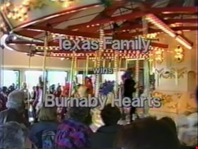
Texas Family wins Burnaby Hearts
https://search.heritageburnaby.ca/link/museumdescription9989
- Repository
- Burnaby Village Museum
- Date
- 1993
- Collection/Fonds
- Fred K. Leggett family fonds
- Description Level
- Item
- Physical Description
- 1 videocassette (29 min., 16 sec.) : VHS, 29 fps, col., sd., stereo
- Scope and Content
- Film compilation of the official opening and dedication of Parker Carousel no. 119 carousel at the Burnaby Village Museum, Don Wrigley Pavilion on March 27, 1993. Edited film footage of the ceremony is compiled with footage of the descendants of the carousel’s first owner, Fred K. Leggett during th…
- Repository
- Burnaby Village Museum
- Collection/Fonds
- Fred K. Leggett family fonds
- Description Level
- Item
- Physical Description
- 1 videocassette (29 min., 16 sec.) : VHS, 29 fps, col., sd., stereo
- Scope and Content
- Film compilation of the official opening and dedication of Parker Carousel no. 119 carousel at the Burnaby Village Museum, Don Wrigley Pavilion on March 27, 1993. Edited film footage of the ceremony is compiled with footage of the descendants of the carousel’s first owner, Fred K. Leggett during their visit to Vancouver to attend the opening of the newly restored carousel. They are shown being interviewed, sightseeing, and being presented with a copy of the film “The Story of Parker no. 119”. BCTV news coverage of the opening ceremony is included along with clips of volunteers restoring and working on the carousel. Film locations include Burnaby, the Burnaby Village Museum and Vancouver. The film was dedicated to the hundreds of volunteers of the Friends of the Carousel.
- Creator
- Wilson, Nelda
- Subjects
- Recreational Devices - Carousels
- Names
- Brown, Donald N. "Don"
- Brunson, Bebe
- Brunson, Bryant
- Copeland, William J.
- Cosgrove, Ed
- C.W. Parker no. 119 Carousel
- Frame, Norvie Leggett
- Hope, Deborah
- Ironside, Gordon
- Jamieson, Keith
- Johnston, Dan
- Lower Mainland Association of the Friends of the Vancouver Carousel
- Rippy, Jane
- Robinson, Red
- Robinson, Svend
- Sawicki, Joan
- Stevens, Colin
- Sumner, Harry
- McIlhiney, Marie
- Morgan, Brian
- Wilson, Nelda
- Wrigley, Donald "Don"
- Accession Code
- BV004.94.1
- Access Restriction
- Restricted access
- Reproduction Restriction
- May be restricted by third party rights
- Date
- 1993
- Media Type
- Moving Images
- Notes
- Title based on content of file
- Contact Burnaby Village Museum to view film content. Reproductions are restricted by copyright holder
- Opening credits: "Starring / Norvie Frame / Janet Rippy / Nelda Wilson / Bebe Brunson / Bryant Brunson / and / Venus Solano / Supporting Cast / Many Friends / of the / Carousel"
- Label on videocassette reads: "Mrs Novie Frame / & Family Visit to / Carousel Opening / Uncut - 29 Min / March 26/27 1993"
Images
