Narrow Results By
Decade
- 2020s 26
- 2010s 13
- 2000s
- 1990s 17
- 1980s 21
- 1970s 44
- 1960s 29
- 1950s 36
- 1940s 62
- 1930s 30
- 1920s 113
- 1910s 84
- 1900s 60
- 1890s
- 1880s 7
- 1870s 5
- 1860s
- 1850s 4
- 1840s 2
- 1830s 1
- 1820s 1
- 1810s 1
- 1800s 1
- 1790s 2
- 1780s 1
- 1770s 1
- 1760s 1
- 1750s 1
- 1740s 1
- 1730s 1
- 1720s 1
- 1710s 1
- 1700s 1
- 1690s 1
- 1680s 1
- 1670s 1
- 1660s 1
- 1650s 1
- 1640s 1
- 1630s 1
- 1620s 1
- 1610s 1
- 1600s 1
Subject
- Buildings 1
- Buildings - Commercial - Grocery Stores 1
- Buildings - Commercial - Restaurants 1
- Buildings - Commercial - Service Stations 1
- Buildings - Heritage 1
- Buildings - Industrial - Factories 1
- Buildings - Industrial - Saw Mills 2
- Clothing 1
- Crafts 1
- Education 3
- Employment 2
- Environmental Issues 1
Creator
- Burnaby Community Heritage Commission 1
- Burnaby, Robert, 1828-1878 1
- Burnaby Village Museum 7
- Burnaby Village Museum - City of Burnaby 1
- Burnett, David H. 1
- Damer, Eric 1
- Draper, William Nelson 1
- Ehlers, Edith "Edie" Fleming 1
- Fleming, Frances "Fanny" Waplington 1
- Friends of Interurban 1223 1
- Garden, Hermon and Burwell 3
- Garden, Hermon & Burwell 1
Person / Organization
- Black, George 1
- Bobic, Janice 1
- British Columbia Electric Railway Company 1
- British Columbia Hydro and Power Authority 1
- Burnaby Art Gallery 1
- Burnaby South High School 1
- Burnaby Village Museum 1
- Canada Summer Games 1
- Chronakis, Alex 1
- Chronakis, Georgia Giannias 1
- Chronakis, Ilias "Louis" 1
- City of Burnaby 1
Agreement for sale of land between Joseph C. Armstrong and Jesse Love re District Lot 25
https://search.heritageburnaby.ca/link/museumdescription18788
- Repository
- Burnaby Village Museum
- Date
- 6 Oct. 1893
- Collection/Fonds
- Love family fonds
- Description Level
- Item
- Physical Description
- 1 p. of textual records + 1 plan : red and black ink on linen ; 16 x 8.5 cm
- Scope and Content
- Item consists of an Agreement for Sale of Land dated October 6, 1893 between Joseph C. Armstrong and Jesse Love for District Lot 25, Group one, New Westminster District and a small hand drawn plan showing District Lot 25, Cumberland Road and location of building. Land Agreement was registered Febru…
- Repository
- Burnaby Village Museum
- Collection/Fonds
- Love family fonds
- Description Level
- Item
- Physical Description
- 1 p. of textual records + 1 plan : red and black ink on linen ; 16 x 8.5 cm
- Scope and Content
- Item consists of an Agreement for Sale of Land dated October 6, 1893 between Joseph C. Armstrong and Jesse Love for District Lot 25, Group one, New Westminster District and a small hand drawn plan showing District Lot 25, Cumberland Road and location of building. Land Agreement was registered February 13, 1894.
- Accession Code
- BV992.26.8
- Access Restriction
- No restrictions
- Reproduction Restriction
- No known restrictions
- Date
- 6 Oct. 1893
- Media Type
- Textual Record
- Cartographic Material
- Notes
- Title based on contents of item
- Document dated Oct 6 1893; "ARTICLES OF AGREEMENT" between Joseph C. Armstrong and Jesse Love; one page, folded on buff, legal-sized paper with pink borders; black print; handwritten in faded brown ink; for a parcel of land in the New Westminster District, all that portion of Lot 25, Group I, from a point on the Easterly side 20 chains from the South Easterly corner, then from the South Easterly corner, then northerly and parallel with the Cumberland Road for 10 chains and 52 links, then southerly 10 chains, then Easterly 14 chains and 52 links, total 14 acres and 52/100; for $1161 in 17 instalments at 6% interest; signed by Jesse Love and J.C. Armstrong, witnessed by H.A. Eastman; two seals are missing, pink stains on paper; addition May 1900 signed by Jesse Love and H.A. Eastman; folds twice; when folded, panel showing is "AGREEMENT for Sale of Land." "on Cumberland road in Lot 25 Group I"; handwritten "H.A. Eastman" over printed "E.H. PORT & CO.", "REAL ESTATE BROKERS" "NEW WESTMINSTER BRITISH COLUMBIA"; back panel has blue stamping and pink additions, giving No. 546C, registered February 13, 1894, Charge Book Vol. 13, Folio 51, signed C.S. Corrigan? District Registrar; with hand-drawn plan on stained linen, pink ink with black additions, shows Cumberland Road and city limits.
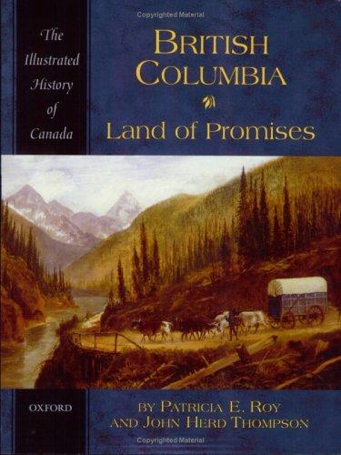
British Columbia : land of promises
https://search.heritageburnaby.ca/link/museumlibrary1422
- Repository
- Burnaby Village Museum
- Collection
- Reference Collection
- Material Type
- Book
- ISBN
- 0195410483
- Call Number
- 971.1 ROY
- Place of Publication
- Toronto
- Publisher
- Oxford University Press
- Publication Date
- 2005
- Physical Description
- 216 p., [10] p. of plates : ill. (some col.), maps (some col.), ports. (some col.) ; 24 cm.
- Library Subject (LOC)
- British Columbia--History
- British Columbia--History--Pictorial works
- Notes
- Includes bibliographical references (p. [206]-211) and index.
Deed of Land Sale - fragment
https://search.heritageburnaby.ca/link/museumdescription10089
- Repository
- Burnaby Village Museum
- Date
- [1893]
- Collection/Fonds
- Love family fonds
- Description Level
- Item
- Physical Description
- 1 p. of textual records
- Scope and Content
- Item consists of the bottom portion of a Deed of Land Sale. It contains a hand written, legal description of property which reads: "Cumberland Road in Lot 25, G. 1, N.W. Dist the / same being distant 14.18 Chs. S. 63.30 (degrees) E, from / the Northeast corner of said Lot 25; thense S. 63.30 E....a…
- Repository
- Burnaby Village Museum
- Collection/Fonds
- Love family fonds
- Description Level
- Item
- Physical Description
- 1 p. of textual records
- Scope and Content
- Item consists of the bottom portion of a Deed of Land Sale. It contains a hand written, legal description of property which reads: "Cumberland Road in Lot 25, G. 1, N.W. Dist the / same being distant 14.18 Chs. S. 63.30 (degrees) E, from / the Northeast corner of said Lot 25; thense S. 63.30 E....and containing by estimaton ten (10) acres...".
- History
- See extensive history of Love Family and Love farmhouse located at Burnaby Village Museum.
- Accession Code
- BV012.31.21
- Access Restriction
- No restrictions
- Reproduction Restriction
- No known restrictions
- Date
- [1893]
- Media Type
- Textual Record
- Notes
- Title based on content of file
Land of promise : Robert Burnaby's letters from colonial British Columbia, 1858-1863
https://search.heritageburnaby.ca/link/museumlibrary5465
- Repository
- Burnaby Village Museum
- Publication Date
- c2002
- Call Number
- 971.1 BUR COPY 3
Burnaby, Numbers: 24, 29, 39 and 40 reproduced with permission of
Pat Burnaby and Meg Kennedy Shaw.
ALL RIGHTS RESERVED
National Library of Canada Cataloguing in Publication Data
Burnaby, Robert, 1828-1878
Land of Promise
Includes biographical references and index.
ISBN 0-9692828-5-0
1.Burnaby, Robert
- Repository
- Burnaby Village Museum
- Collection
- Reference Collection
- Digital Reference Collection
- Material Type
- Book
- ISBN
- 0969282850
- 9780969282853
- Call Number
- 971.1 BUR COPY 3
- Place of Publication
- Burnaby, B.C.
- Publisher
- City of Burnaby
- Publication Date
- c2002
- Physical Description
- 199 p. : ill. ; 23 cm.
- Library Subject (LOC)
- Burnaby, Robert--Correspondence
- Merchants--British Columbia--Correspondence
- British Columbia--History--1849-1871
- Burnaby (B.C.)
- Biography
- Notes
- Includes bibliographical references (p. 190) and index.
- 3 copies held: copy 3.
Digital Books
Love and Leonard land records series
https://search.heritageburnaby.ca/link/museumdescription18838
- Repository
- Burnaby Village Museum
- Date
- 1893-1962
- Collection/Fonds
- Love family fonds
- Description Level
- Series
- Physical Description
- 5 plans + 8 cm of textual records
- Scope and Content
- Series consists of land deeds, land sale agreements, documents regarding payment and survey and subdivision plans. Records refer to the Love family property in District Lot 25, the Leonard family property in District Lot 352 and other lots in Burnaby.
- Repository
- Burnaby Village Museum
- Collection/Fonds
- Love family fonds
- Description Level
- Series
- Physical Description
- 5 plans + 8 cm of textual records
- Scope and Content
- Series consists of land deeds, land sale agreements, documents regarding payment and survey and subdivision plans. Records refer to the Love family property in District Lot 25, the Leonard family property in District Lot 352 and other lots in Burnaby.
- Accession Code
- BV992.26
- BV012.31
- Date
- 1893-1962
- Media Type
- Textual Record
- Cartographic Material
- Notes
- Title based on contents of series
Love farmhouse land and tax records
https://search.heritageburnaby.ca/link/museumdescription10022
- Repository
- Burnaby Village Museum
- Date
- 1891-1982 (date of originals), copied [ca.1988]
- Collection/Fonds
- Burnaby Village Museum fonds
- Description Level
- File
- Physical Description
- 1 folder of textual records
- Scope and Content
- File consists of photocopies and notes of historical information regarding the land ownership of the Jesse Love farmhouse and title of Block 1 and Lots 53 and 54 of District Lot 25 in Burnaby. Records include copies from a land title search done through the New Westminster Land Title Office in 1988…
- Repository
- Burnaby Village Museum
- Collection/Fonds
- Burnaby Village Museum fonds
- Series
- Jesse Love farmhouse series
- Subseries
- Love farmhouse research files subseries
- Description Level
- File
- Physical Description
- 1 folder of textual records
- Scope and Content
- File consists of photocopies and notes of historical information regarding the land ownership of the Jesse Love farmhouse and title of Block 1 and Lots 53 and 54 of District Lot 25 in Burnaby. Records include copies from a land title search done through the New Westminster Land Title Office in 1988 which covers ownership between 1928-1988; copy of Corporation of District of Burnaby By-Law 217 (1916) - "To confirm the purchase of and to reconvey a portion of District Lots 25 and 88..." ; copies of pages from Assessment Rolls between 1892 to 1904 ; copy of Land Sale Agreement from J.C Armstrong to Jesse Love, Oct. 6th, 1893; copies of notes from "Charge Book" Feb. 10, 1894 as well as copies of subdivision plans of DL 25.
- Accession Code
- BV018.41.1116
- Access Restriction
- Subject to FIPPA
- Reproduction Restriction
- Reproductions subject to FIPPA
- Date
- 1891-1982 (date of originals), copied [ca.1988]
- Media Type
- Textual Record
- Notes
- Title based on content of file
Surveyor's tables : being the tables from the Manual of land surveying
https://search.heritageburnaby.ca/link/museumlibrary1758
- Repository
- Burnaby Village Museum
- Author
- Hodgman, F., 1839-1907
- Publication Date
- 1897
- Call Number
- 526.9 HOD
- Repository
- Burnaby Village Museum
- Collection
- Special Collection
- Material Type
- Book
- Accession Code
- BV984.58.33
- Call Number
- 526.9 HOD
- Author
- Hodgman, F., 1839-1907
- Place of Publication
- Michigan
- Publisher
- F. Hodgman
- Publication Date
- 1897
- Physical Description
- i-vi; 127 p. : tables ; 15 cm.
- Inscription
- "W.J.H. Holmes" "1.50" inside back pages have handwritten notes
- Library Subject (LOC)
- Surveying
- Notes
- Author's given name and dates: Hodgman, F. (Francis), 1839-1907.
![Douglas Road, [1897] (date of original), copied 1978 thumbnail](/media/hpo/_Data/_BVM_Images/1978/1978_0001_0001_001.jpg?width=280)
Douglas Road
https://search.heritageburnaby.ca/link/museumdescription447
- Repository
- Burnaby Village Museum
- Date
- [1897] (date of original), copied 1978
- Collection/Fonds
- Burnaby Village Museum Photograph collection
- Description Level
- Item
- Physical Description
- 1 photograph : b&w ; 20.2 x 25.2 cm print
- Scope and Content
- Photograph of Douglas Road (later renamed in part Canada Way), near Stanley Street. To the right is the Sprott family property, where a few wooden buildings are visible in the cleared area. Charles Sprott, head of the Sprott family, was an important Burnaby politician who was continuously elected t…
- Repository
- Burnaby Village Museum
- Collection/Fonds
- Burnaby Village Museum Photograph collection
- Description Level
- Item
- Physical Description
- 1 photograph : b&w ; 20.2 x 25.2 cm print
- Scope and Content
- Photograph of Douglas Road (later renamed in part Canada Way), near Stanley Street. To the right is the Sprott family property, where a few wooden buildings are visible in the cleared area. Charles Sprott, head of the Sprott family, was an important Burnaby politician who was continuously elected to serve in the municiality as councillor from 1895 to 1903 and as Reeve from 1904 to 1905.
- Subjects
- Geographic Features - Roads
- Land Clearing
- Geographic Access
- Douglas Road
- Canada Way
- Stanley Street
- Accession Code
- HV978.1.1
- Access Restriction
- No restrictions
- Reproduction Restriction
- No known restrictions
- Date
- [1897] (date of original), copied 1978
- Media Type
- Photograph
- Historic Neighbourhood
- Burnaby Lake (Historic Neighbourhood)
- Planning Study Area
- Lakeview-Mayfield Area
- Scan Resolution
- 600
- Scan Date
- 2023-07-25
- Notes
- Title based on contents of photograph
Images
![Douglas Road, [1897] (date of original), copied 1978 thumbnail](/media/hpo/_Data/_BVM_Images/1978/1978_0001_0001_001.jpg)
Affidavit certificate re H.A. Eastman, Jessie Love and J.E. Armstrong
https://search.heritageburnaby.ca/link/museumdescription18802
- Repository
- Burnaby Village Museum
- Date
- 9 Feb. 1894
- Collection/Fonds
- Love family fonds
- Description Level
- Item
- Physical Description
- 1 p. of textual records
- Scope and Content
- Item consists of an affidavit certificate re H.A. Eastman, Jesse Love and J.C. Armstrong signed by Commissioner for taking affidavits to be used in the Supreme Court of British Columbia.
- Repository
- Burnaby Village Museum
- Collection/Fonds
- Love family fonds
- Description Level
- Item
- Physical Description
- 1 p. of textual records
- Scope and Content
- Item consists of an affidavit certificate re H.A. Eastman, Jesse Love and J.C. Armstrong signed by Commissioner for taking affidavits to be used in the Supreme Court of British Columbia.
- Accession Code
- BV992.26.22
- Access Restriction
- No restrictions
- Reproduction Restriction
- No known restrictions
- Date
- 9 Feb. 1894
- Media Type
- Textual Record
- Notes
- Title based on contents of item
- Certificate, blue paper with black print, blank areas filled in with handwriting in brown ink; "I hereby certify that" "H.A. Eastman" "personally known to me, appeared before me and acknowledged to me that" "he" "the person whose name is subscribed to the annexed Instrument as Witness, and having been duly sworn by me, did prove to me that" "Jesse Love & J.C. Armstrong" "did execute the same in his presence voluntarily." "IN TESTIMONY whereof, I have hereto set my Hand and Seal of Office, at" "New Westminster" ", British Columbia, this" "9th" "day of" "February" "in the year of Our Lord one thousand eight hundred and ninety-" "four"; signed in black ink, "J. Brisere Cheny"?; stamped purple "A Commissioner for taking affidavits to be used in the Supreme Court of British Columbia".
Description of Mr. Love's Property
https://search.heritageburnaby.ca/link/museumdescription18804
- Repository
- Burnaby Village Museum
- Date
- [1894]
- Collection/Fonds
- Love family fonds
- Description Level
- Item
- Physical Description
- 1 p. of textual records
- Scope and Content
- Item consists of a document titled "Description of Mr. Love's Property". The document describes Jesse Love's property located at the north east corner of District Lot 25 located on Cumberland Road in Burnaby.
- Repository
- Burnaby Village Museum
- Collection/Fonds
- Love family fonds
- Description Level
- Item
- Physical Description
- 1 p. of textual records
- Scope and Content
- Item consists of a document titled "Description of Mr. Love's Property". The document describes Jesse Love's property located at the north east corner of District Lot 25 located on Cumberland Road in Burnaby.
- Accession Code
- BV992.26.24
- Access Restriction
- No restrictions
- Reproduction Restriction
- No known restrictions
- Date
- [1894]
- Media Type
- Textual Record
- Notes
- Transcribed title
- Document, buff paper, legal-sized, typed in black carbon; "DESCRIPTION OF MR. LOVE'S PROPERTY" at top, underlined; "Commencing at a post at the north-east corner of lot twenty-five (25); thence southerly along the westerly line of the Cumberland Road thirty-four (34) chains and eighty-four (84) links; thence westerly and parallel with the line between/ district lots twenty-five (25) and eighty-eight (88) fourteen (14) chains and fifty (50) links thence northerly and parallel with the Cumberland Road thirty-four (34) chains and eighty-four (84) links thence eatserly along the line between said lots twenty-five and eighty eight (88) to point of commencement containing fifty and five hundred and eighteen thousandths (50.518) acres more or less" [NOTE "eatserly" is as written on document]
- watermark "WESTMINSTER BOND"; pencilled on reverse, "63 - 00", line, "31 1-0" and six short marks like checks
In the shadow by the sea : recollections of Burnaby's Barnet Village
https://search.heritageburnaby.ca/link/museumlibrary5173
- Repository
- Burnaby Village Museum
- Publication Date
- c2004
- Call Number
- 971.133 PRI Copy 2
of Halkomelem speaking Central
Coast Salish First Nations. The Saleelwat peoples whose permanent village site was
at "Tetimexwten" (Belcarra) was one historic group that would have used the land
and shoreline of Barnet to gather food and other resources. The life of aboriginal
peoples here was organized around
- Repository
- Burnaby Village Museum
- Collection
- Digital Reference Collection
- Reference Collection
- Material Type
- Book
- ISBN
- 0969282885
- Call Number
- 971.133 PRI Copy 2
- Contributor
- Wolf, Jim
- Pride, Harry, 1925-
- Place of Publication
- Burnaby, B.C.
- Publisher
- City of Burnaby
- Publication Date
- c2004
- Physical Description
- 246 p. : ill., maps, ports. ; 28 cm.
- Library Subject (LOC)
- Burnaby (B.C.)--History
- Industries--British Columbia--Burnaby--History
- Barnet Marine Park--Burnaby, B.C.
- Geographic Access
- Barnet Road
- Burrard Inlet
- Notes
- Includes bibliographical references (p. 246) and index.
- "edited by Harry Pride and Jim Wolf"
- Copy 2 of 2
Digital Books
Burnaby's heritage : an inventory of buildings and structures
https://search.heritageburnaby.ca/link/museumlibrary5437
- Repository
- Burnaby Village Museum
- Author
- Luxton, Donald, 1954-
- Wolf, Jim
- Edition
- Rev.
- Publication Date
- 2011
- c2007
- Call Number
- 971.133 LUX COPY 1
at Edmonds, Lougheed and Brentwood,
creating focus for commercial and residential
redevelopment. In South Burnaby growth was
accelerated by the introduction of SkyTrain in 1986.
This new tax base has enabled the community to
rapidly expand public services and acquire park
land, illustrated by the creation
- Repository
- Burnaby Village Museum
- Collection
- Digital Reference Collection
- Material Type
- Book
- ISBN
- 0969282893
- Call Number
- 971.133 LUX COPY 1
- Edition
- Rev.
- Author
- Luxton, Donald, 1954-
- Wolf, Jim
- Place of Publication
- Burnaby, B.C.
- Publisher
- City of Burnaby
- Publication Date
- 2011
- c2007
- Physical Description
- 157 p. : ill. ; 28 cm.
- Library Subject (LOC)
- Architecture
- Historic buildings
- Buildings
- Historic sites
- Subjects
- Buildings
- Buildings - Heritage
- Notes
- Includes bibliographical references and index.
- 2 copies held: copy 1.
Digital Books
Life with the Moores of Hart House : pioneer days on Burnaby's Deer Lake
https://search.heritageburnaby.ca/link/museumlibrary1179
- Repository
- Burnaby Village Museum
- Publication Date
- 2002
- Call Number
- 971.1 PRI COPY 1
E D A T D E E R L A K E
The region around Burnaby's Deer Lake was originally of interest to lower mainland
entrepreneurs as an area to be logged off. Later on, its excellent soil and rolling land attracted
agricultural settlers and market gardeners. Others saw its proximity to Vancouver
- Repository
- Burnaby Village Museum
- Collection
- Digital Reference Collection
- Reference Collection
- Material Type
- Book
- ISBN
- 0969282877
- Call Number
- 971.1 PRI COPY 1
- Place of Publication
- Burnaby, B.C.
- Publisher
- City of Burnaby, Community Heritage Commission
- Publication Date
- 2002
- Physical Description
- iv, 92 p. : ill. (some col.) ; 28 cm.
- Inscription
- "To Burnaby Village Museum / Harry Pride", handwritten in ink on title page.
- Library Subject (LOC)
- Moore family
- Hart House (Burnaby, B.C.)--History
- Frontier and pioneer life
- Pioneers
- Historic buildings--British Columbia--Burnaby
- Biography
- Notes
- Includes bibliographical references (p. 87) and index.
- Signed by the author.
- 2 copies held : copy 1.
Digital Books
William Holmes fonds
https://search.heritageburnaby.ca/link/museumdescription10416
- Repository
- Burnaby Village Museum
- Date
- [1841]-1994
- Collection/Fonds
- William Holmes fonds
- Description Level
- Fonds
- Physical Description
- 2 photographs (calotype) + 1 photograph : b&w + 6 photographs : col. + 5 p. textual records + 1 newspaper clipping
- Scope and Content
- Fonds consists of photographs pertaining to the William Holmes family, family grave markers in cemetery in Ireland along with original correspondence, land title certificates and a newspaper clipping. Fonds is arranged in series: 1) William Holmes family photographs series 2) William Holmes family…
- Repository
- Burnaby Village Museum
- Collection/Fonds
- William Holmes fonds
- Description Level
- Fonds
- Physical Description
- 2 photographs (calotype) + 1 photograph : b&w + 6 photographs : col. + 5 p. textual records + 1 newspaper clipping
- Scope and Content
- Fonds consists of photographs pertaining to the William Holmes family, family grave markers in cemetery in Ireland along with original correspondence, land title certificates and a newspaper clipping. Fonds is arranged in series: 1) William Holmes family photographs series 2) William Holmes family records series 3) Holmes family cemetery photographs series
- History
- William Holmes was the first non-Indigenous resident of Burnaby and was born in Kilkenny Ireland January 4, 1812. In 1833, at the age of 20 yrs, William Holmes immigrated to Canada from Ireland in with his parents, Joseph and Jane (McCullough) Holmes and ten other family members including two of his married brothers and their wives, two sisters with their husbands and two unmarried brothers. This was the first group of thirteen to leave Ireland and set up homesteads in Canada near the shores of Lake Huron. The family settled on land concessions in Huron County, Ontario about 14 km southeast of Goderich. The area in Huron County was first founded in 1832 by John and Samuel Holmes and the community was known as Holmes Hill before becoming Holmesville [ca. 1850]. In 1837, William Holmes is noted as owning Lot 23, Concession IX, Goderich Twp. Much of the village of Holmesville grew up around the five road concession near the border of his brother’s farm so William decided to open a store. The Holmesville post office opened on March 1, 1855 and William was appointed the first post master which he operated until May 1857. William met and married Mary Richardson in 1841 and the couple had three daughters: Jane (1844-1926) (married Charles Studdert Finlaison in New Westminster in 1863); Anne Maria (Annie) (1846-192?) (married John Gunther Jennings in New Westminster in 1865 and married Robert Johnson in New Westminster in 1877) and Elizabeth (1848-1934) (married Thomas Carrington of Lakes District in 1867). William’s wife, Mary (Richardson) Holmes died in Holmesville sometime between 1848 and 1853. Following the death of his first wife, Mary, William married Charlotte McCullough (McCulloch). The couple had four daughters; Arabella Charlotte Amelia (1854-1943) (married Arthur Robert Green in 1887); Laura (1855-1867); Arabella Henrietta (1857-1929) (married Clark Wesley Gillanders in 1880) and Mary (1863-1864). During the late 1850s, William became aware of the gold rush and opportunities opening up in British Columbia so left for the west coast in 1858 at the age of 46 yrs. In preparation for his move to the west coast of Canada, William obtained a letter of introduction from top government officials of Canada. William Holmes arrived in British Columbia in 1859. Upon arriving, he first worked running pack trains from Harrison Mills to Lillooet. After earning some money, he decided to re-invest it in land. His first pre-emption of land occurred on January 21, 1860 for 160 acres situated on North Road from the Military Camp to Burrard Inlet and distancing 25 chains south of the Brunette River and 20 chains south of the river with the land extending in a westerly direction. On March 17, 1860, Holmes received a Crown Grant for this and other land in the immediate area totalling 415 acres of which was known as Lot No. 1, Group 1, Rural Land, New Westminster District. The balance of land was situated on the east side of the Brunette River – Lot 13, with 344 2/3 acres of which he made an application to purchase on June 26, 1860, and a Crown Grant dated March 16, 1861 covering 86 acres. Holmes also pre-empted land in Port Moody and Pitt Meadows in 1860 and 1861. The name of “Brunette River” is officially attributed to William Holmes who referred to the river as “Brunette” due to it’s dark colour originating from the peat lands above the lake. Following his purchase of property, he sent for his wife Charlotte, their three daughters and her three step daughters (from William’s first marriage). Charlotte and the six children made the long trip to B.C. by ship and rail, crossing the Isthmus of Darien at Panama. They arrived in B.C. in October 1861 and moved into a one room log cabin built by William. The cabin stood on the North Road at the foot of Sapperton, on a bluff overlooking the Brunette River. Eventually the family moved to a larger dwelling but the original cabin remained on the site until the 1890s when it was burned after being used as a sick house. Mr. Holmes was instrumental in organizing the first Orange Lodge in British Columbia. He was a prominent Orangeman who joined the order in 1840 and was the first master in the order of the City of New Westminster when the Lodge No. 1150 was established there. Charlotte Holmes died in New Westminster in 1893 at the age of 70 years and William Holmes died in New Westminster September 11, 1907 at the age of 95 years.
- Responsibility
- Holmes, William
- Accession Code
- HV971.46
- BV997.50
- Date
- [1841]-1994
- Media Type
- Photograph
- Textual Record
- Related Material
- See also: Reference file: Persons - Holmes, William
- Notes
- Title based on contents of fonds
![Survey and Subdivision plans in New Westminster District Group 1 – Burnaby
, [1861]-[1910] thumbnail](/media/hpo/_Data/_BVM_Cartographic_Material/1977/1977_0093_0019a_001.jpg?width=280)
Survey and Subdivision plans in New Westminster District Group 1 – Burnaby
https://search.heritageburnaby.ca/link/museumdescription6988
- Repository
- Burnaby Village Museum
- Date
- [1861]-[1910]
- Collection/Fonds
- Burnaby Village Museum Map collection
- Description Level
- File
- Physical Description
- 14 plans : 3 plans : black ink on paper hand col. + 7 plans : black ink on paper + 4 plans : graphite on paper mounted on 2 sides of cardboard 76 x 102 cm
- Scope and Content
- Item consists of a large board of four New Westminster District Gp 1 - subdivision plans mounted on one side and ten New Westminster District Gp 1 - subdivision plans mounted on the other side. Side A: 1. "Plan /of / Lots 166A, 166 and 167 /, Gr.1, N.W.D. / Showing Misconstructed Roads in Gree…
- Repository
- Burnaby Village Museum
- Collection/Fonds
- Burnaby Village Museum Map collection
- Description Level
- File
- Physical Description
- 14 plans : 3 plans : black ink on paper hand col. + 7 plans : black ink on paper + 4 plans : graphite on paper mounted on 2 sides of cardboard 76 x 102 cm
- Material Details
- Scales [between 1:2376 and 1:7920]
- Index number on edge of board reads: "19"
- Scope and Content
- Item consists of a large board of four New Westminster District Gp 1 - subdivision plans mounted on one side and ten New Westminster District Gp 1 - subdivision plans mounted on the other side. Side A: 1. "Plan /of / Lots 166A, 166 and 167 /, Gr.1, N.W.D. / Showing Misconstructed Roads in Green / 5 chs = 1 in.". (plan is drawn in black ink and hand coloured in red, green and orange ink). A section in the centre of the plan is coloured in red ink and identified as "C.S. Richmond" running from the North Arm of Fraser River to Wiggins Road and divided by "New Wiggins Rd. (as gazetted)" (coloured in orange ink) and two"Constructed Road(s)" (coloured in green ink). Plan is initialed by: "RB" [sic] (in blue pencil crayon) 2. Plan of / Subdivision of / Lot 166 / Group One / New Westminster District / Scale 4 chs = 1 in. / Map No 524". Plan is drawn in graphite and signed by "Surrig [sic] Welhams [sic] / P.L.S." Plan is initialed by: "RB" [sic] (in blue pencil crayon) 3. Plan of "Survey / of Highway / For / Burnaby Council / in / Lots 13 _14 / Group One / Scale 4 chs = 1 in." Signed by "Albert J. Hill, P.L.S." Caribou Street and Caribou Road run through the centre of the plan. Plan is stamped: "Albert J. Hill, Civil Engineer / and / Provincial Land Surveyor, / New Westminster, / B.C.". Plan is initialed by: "RB" [sic] (in blue pencil crayon) 4. A Plan of Lots 166A, 166 and 167, Group One, New Westminster District (drawn in graphite). A section in the centre of the plan is identified as "C.S. Richmond" running from the North Arm of Fraser River and divided by "New Wiggins Rd. (as gazetted)" and two "Constructed Road(s)". Plan is initialed by: "RB" [sic] (in blue pencil crayon) Side B: 1. Small plan drawn in black ink (no title) identifying lots north of the "North Arm" of the Fraser River. Lots identified include: Lot 99, Lot 98, Lot 157, Lot 158, Lot 163, Lot 162, Lot 159, Lot 163, Lot 162, Lot 165, Lot 166A, Lot 155B, Lot 155A and Lot 159. "Scale 40 chains to one inch" . Plan is initialed by: "RB" [sic] (in blue pencil crayon) (Geographic location: Burnaby) 2. Small plan drawn in black ink (no title) identifying lots north of the North Arm of the Fraser River as "Lots 155, 155A, 155B, 155C, 162, 163, 164, 165, 166A and 167". Plan is initialed by: "RB" [sic] (in blue pencil crayon) (Geographic location: Burnaby) 3. Small plan drawn in black ink (no title) which identifies "Lot 151 / Reserve/ for / Race Course"; "Reserve / 64 A / L. 152 G.1"; and other Lots: 32, 33, 34, 35, 36, 38, 39. The plan is signed "Surveyor G.Turn [sic] July / 61 / from Vol 40 R.L. notes [sic]" Plan is stamped: "Albert J. Hill, Civil Engineer / and / Provincial Land Surveyor, / New Westminster, / B.C." Plan is initialed by: "RB" [sic] (in blue pencil crayon) (Geographic location: Burnaby) 4. Small plan drawn in black in with faded red colouring on centre lot identified as "Lot 34" running north from "Vancouver Road" . Plan is stamped: "Albert J. Hill, Civil Engineer / and / Provincial Land Surveyor, / New Westminster, / B.C." Plan is initialed by: "RB" [sic] (in blue pencil crayon) (Geographic location: Burnaby) 5. Plan drawn in graphite and identified as "Lot 98, Gr.1," along with the intials "RB" [sic] (both are handwritten in blue crayon pencil on top of plan) The B.C.E.Railway is identified running through the plan along with Jubilee Road and Royal Oak Road. The plan is signed with the name "Wm. Murray" and the Plan is stamped: "Albert J. Hill, Civil Engineer / and / Provincial Land Surveyor, / New Westminster, / B.C.". (Geographic location: Burnaby) 6. Plan drawn in graphite identified as "Port Lot 13, Gr.1" along with the intials "RB" [sic] (both are handwritten in blue crayon pencil on top of plan) Plan is stamped: "Albert J. Hill, Civil Engineer / and / Provincial Land Surveyor, / New Westminster, / B.C.". (Geographic location: Burnaby) 7.Plan drawn in black ink and identified as "Lot 98 G.1" along with the intials "RB" [sic] (both are handwritten in blue crayon pencil on top of plan). A "Road Reservation" is identified running north between "Electric Tramway" and connecting with "Royal Oak Road". Plan is stamped: "Albert J. Hill, Civil Engineer / and / Provincial Land Surveyor, / New Westminster, / B.C." (Geographic location: Burnaby) 8. Plan drawn in black ink and divided into two sections, the upper plan is identified as "Portion / Lots 100 / area / 101, Gr.1" and the lower plan is identified as "Portion L. 3 G. 1" along with the intials "RB" [sic] (these identifiers are handwritten in blue crayon pencil on top of the plan). Portions of Lot 100 and Lot 101 are each divided into 6 sections and the Portion of Lot 3 plan is divided into 24 sections. The plan includes a note in black ink that reads: " Received from Wm Fromme [sic] / from Wm. Trapp / Nov. 28, 1895 / A. J. T...[sic]". (Geographic location: Burnaby) 9. Plan drawn in black ink (no title) identifying soil, buildings and geographic features in southern Burnaby. The plan is bordered by "New Westminster City" (Tenth Avenue and DL 172) to the south east and DL 173 to the south, DL 158 to the west and the B.C.E. Tramway to the north. Plan includes District Lots: 155A, 158, 159, 171, 160, 53 and 95 and identifies soil, marshland and ravines throughout. Plan identifies the following features: a "Team Road" running through Lots 158 and 159 along with "Fair Orchard Soil / Even Surface Throughout / No Ravines", "Gravel and Shingle" (bottom of Lot 158), "North Arm Road" crossing "Byrne Road" and connecting with "Power House Road" which runs north to connect with "Highland Park Station" and the B.C.E. Tramway, "Power Ho" in the northeast corner of DL 160, a "Brook" connected with a "Deep Ravine" running between DL 53, DL 95 and DL 160 along with "Good Soil" and "Fair Orchard Soil" identified nearby in DL 95. Scale is identified as "10 chs = 1 in." Plan is stamped: "Albert J. Hill, Civil Engineer / and / Provincial Land Surveyor, / New Westminster, / B.C." Plan is initialed by: "RB" [sic] (in blue pencil crayon) (Geographic location: Burnaby) 10. Plan drawn in black ink (no title) with Burnaby Lake and Deer Lake at the centre. The plan is bordered by the following District Lots identified as: 117, 118 and 68 to the west, Lots 80, 79 and 85 to the southwest, Lots 11, 13, and 1 (City of New Westminster) to the south east, the North Road boundary to the east and Lots 8, 56, 57, 59, and 136 to the North. The lower right hand corner of the plan has a small inset which reads: "Burnaby Lake" and "Page 19 R.B. Notes". Plan is initialed by: "RB" [sic] (in blue pencil crayon) (Geographic location: Burnaby)
- Creator
- Hill, Albert James
- Accession Code
- HV977.93.19
- Access Restriction
- No restrictions
- Reproduction Restriction
- No known restrictions
- Date
- [1861]-[1910]
- Media Type
- Cartographic Material
- Scan Resolution
- 300
- Scale
- 72
- Notes
- Title based on contents of file
- Scale is measured in chains. (One chain equals 792 inches)
- The term "Lot" can also refer to a "District Lot”
- Some plans are stamped: "Albert J. Hill, Civil Engineer / and / Provincial Land Surveyor, / New Westminster, / B.C." and intialed: "RB" [sic]
Images
![Survey and Subdivision plans in New Westminster District Group 1 – Burnaby
, [1861]-[1910] thumbnail](/media/hpo/_Data/_BVM_Cartographic_Material/1977/1977_0093_0019a_001.jpg)

Ronald G. Scobbie collection
https://search.heritageburnaby.ca/link/museumdescription11914
- Repository
- Burnaby Village Museum
- Date
- [1890]-1932
- Collection/Fonds
- Ronald G. Scobbie collection
- Description Level
- Fonds
- Physical Description
- 55 plans + 2 architectural drawings + 1 map + graphic materials + 3 cm of textual records
- Scope and Content
- Fonds consists of survey and subdivision plans, a map and records created by Provincial Land Surveyors Albert J. Hill and Geoffrey K. Burnett and Donald Johnson McGugan and collected by Ronald G. Scobbie. Records include subdivision and survey plans in New Westminster District Group 1 including Dis…
- Repository
- Burnaby Village Museum
- Collection/Fonds
- Ronald G. Scobbie collection
- Description Level
- Fonds
- Physical Description
- 55 plans + 2 architectural drawings + 1 map + graphic materials + 3 cm of textual records
- Scope and Content
- Fonds consists of survey and subdivision plans, a map and records created by Provincial Land Surveyors Albert J. Hill and Geoffrey K. Burnett and Donald Johnson McGugan and collected by Ronald G. Scobbie. Records include subdivision and survey plans in New Westminster District Group 1 including District Lots in Burnaby along with various school sites and church plans; surveying records regarding North Road and a map of the Burnaby Municipality. Fonds is arranged into series: 1) Subdivision and survey plans series 2) School and church plans series 3) Map series
- History
- Ronald G. Scobbie was born in Scotland. After graduating from high school, he worked in the mines of Scotland which led to a career as a land surveyor. Ron immigrated to Canada in 1965 and settled in North Vancouver. In 1967 he became a partner in the surveying company of Hunter, Crockford & Scobbie in New Westminster, eventually owning it under the title Scobbie and Associates between 1980 and 1995. Ron sold the business in 1995 and retired as a BC Land Surveyor in December 2003. Ron was an active member of the B.C. Land Surveyors Association and an avid collector of surveying equipment and maps and plans that document the history of surveying in British Columbia. Upon retirement, Ron donated many historical maps and plans to various repositories located in different geographical regions throughout B.C.
- Scobbie & Associates land surveying company dates back to 1890 when Albert J. Hill first established his practice as a land surveyor in New Westminster. The company went through a series of Surveyors (owners) between 1890 and 1995:
- Albert James Hill (A.J. Hill) [1890] to 1912
- Hill & Burnett 1911 to 1912
- Geoffrey K. Burnett 1912
- Burnett & McGugan 1912 to 1947
- Burnett, McGugan & Hunter 1947 to 1959
- Burnett, Hunter & Douglas 1959 to 1960
- Hunter, Douglas & Crockford 1960 to 1964
- Hunter, Crockford & Associates 1964 to 1965
- Hunter, Crockford & Aplin 1965 to 1967
- Hunter, Crockford & Scobbie 1967 to 1973
- Crockford, Scobbie & Associates 1973-1980
- Scobbie & Associates 1980 to 1995
- Responsibility
- Scobbie, Ronald G.
- Accession Code
- HV984.57
- BV003.83
- Access Restriction
- No restrictions
- Reproduction Restriction
- No known restrictions
- Date
- [1890]-1932
- Related Material
- For other survey and subdivision plans created by land surveyors Albert J. Hill, Geoffery K. Burnett and Donald J. McGugan, see: Burnaby Village Museum Map collection - Survey and Subdivision plans series
- Notes
- Title based on contents of collection
![Survey and Subdivision plans in New Westminster District Group 1 – Burnaby
, [1892-1908] thumbnail](/media/hpo/_Data/_BVM_Cartographic_Material/1977/1977_0093_0020a_001.jpg?width=280)
Survey and Subdivision plans in New Westminster District Group 1 – Burnaby
https://search.heritageburnaby.ca/link/museumdescription6989
- Repository
- Burnaby Village Museum
- Date
- [1892-1908]
- Collection/Fonds
- Burnaby Village Museum Map collection
- Description Level
- File
- Physical Description
- 12 plans : 6 plans : black ink on paper + 6 plans : graphite on paper mounted on 2 sides of cardboard 76 x 102 cm
- Scope and Content
- Item consists of a large board of six New Westminster District Gp 1 - subdivision plans mounted on one side and three New Westminster District Gp 1 - subdivision plans mounted on the other side. Side A: 1. Plan drawn in graphite with markings "Plan 535" "Scale 3 chs = 1 in." Plan appears to ext…
- Repository
- Burnaby Village Museum
- Collection/Fonds
- Burnaby Village Museum Map collection
- Description Level
- File
- Physical Description
- 12 plans : 6 plans : black ink on paper + 6 plans : graphite on paper mounted on 2 sides of cardboard 76 x 102 cm
- Material Details
- Scales [between 1:240 and 1:7920]
- Index number on edge of board reads: "20"
- Scope and Content
- Item consists of a large board of six New Westminster District Gp 1 - subdivision plans mounted on one side and three New Westminster District Gp 1 - subdivision plans mounted on the other side. Side A: 1. Plan drawn in graphite with markings "Plan 535" "Scale 3 chs = 1 in." Plan appears to extend onto another piece of paper with a title "Lo [sic] 506" ans "Scale 2 chs = 1 in." Plan is stamped: "Albert J. Hill, Civil Engineer / and / Provincial Land Surveyor, / New Westminster, / B.C." (Geographic location: Burnaby) 2. Plan of "Douglas Road" (written at top in blue pencil) and "Plan 642 / Reg. Apr. 8 1892 / ....Lots / 3 & 4 Bl. I...[sic]" (written in graphite). Road runs through Lots 29, 28, 30, 90 and 91. Note in red ink at bottom of plan reads: "Sketch plans as sent to Council / Aug. 28_1893 / ..." Plan is stamped: "Albert J. Hill, Civil Engineer / and / Provincial Land Surveyor, / New Westminster, / B.C." (Geographic location: Burnaby) 3. Plan drawn in graphite identified with markings "L.9 in / L. 88" "Scale 3 chs = 1 in. / Albert J. Hill / B.C.L.S. / 11/3/08" (Geographic location: Burnaby) 4. Plan in black ink identified as "No.2" / Lot 101 & 100 / Gr.1" / Lot 3 Gr. 1" (handwritten in blue pencil) with "Scale : 2 Inches = 1 Mile". Plan is stamped: "Albert J. Hill, Civil Engineer / and / Provincial Land Surveyor, / New Westminster, / B.C." (Geographic location: Burnaby) 5. Plan in black ink identified as "Sub. L. 28 and 29 of / Lot 35, G - 1" (handwritten in blue pencil) "Scale 100' = 1 in." (Geographic location: Burnaby) 6. Plan drawn in graphite with markings "Lot 165 Gr.1" (handwritten in blue pencil) "Scale 10 chs = 1 in. / Albert J. Hill / B.C.L.S." (Geographic location: Burnaby) 7. "Plan / of Subdivision / of / Subdivision of Lot 10 [sic] / of Lot 53 / Group One / New Westminster Dist. / Scale 1 chs = 1 inc." (drawn and written in graphite) Plan is stamped: "Albert J. Hill, Civil Engineer / and / Provincial Land Surveyor, / New Westminster, / B.C." (Geographic location: Burnaby) Side B: 1. "Plan / of Subdivision / of / Lots 10 and 11, / in the Subdivision / of / Lot 156 Gr.1 / New Westminster District / Scale 100' = 1 "" (drawn and written in graphite) (Geographic location: Burnaby) 2. "Plan / of Subdivision / of a Portion / of / Lot 95 / Group One / New Westminster District / Scale 3 chs = 1 in." (drawn in graphite and black ink) Plan is stamped: "Albert J. Hill, Civil Engineer / and / Provincial Land Surveyor, / New Westminster, / B.C." (Geographic location: Burnaby) 3. Plan drawn in graphite and identified as "Lot 98, Gr.1" (handwritten in blue pencil). Plan identifies a "Road Reservation", "Royal Oak Road" and "Electric Tramway" and "Lot 94" to the north of "Lot 98" (Geographic location: Burnaby) 4. Plan drawn in graphite and identified as "Lot 25, Gr.1" (handwritten in blue pencil) Lot 25 is identified as "Love" "Scale 7 chs = 1 in. / Albert J. Hill B.C.L.S." Plan is dated "24/7/07" Plan is stamped: "Albert J. Hill, Civil Engineer / and / Provincial Land Surveyor, / New Westminster, / B.C." (Geographic location: Burnaby) 5. Profile plan in black ink with marking "Douglas Road" and intials "RGS" [sic] (handwritten in blue pencil) "City Boundary / Hastings Road / Scale Hor 200' = 1" / Vert 20' = 1"" Plan is also marked in red pencil and reads: "Please / See other side". Plan is stamped: "Albert J. Hill, Civil Engineer / and / Provincial Land Surveyor, / New Westminster, / B.C." (Geographic location: Burnaby) 6. Plan of "Profile / on Tramway Track / New Vancouver Road / Scales Hor 200 ft = 1 inch / Vert 20 ft = 1 inch" (Geographic location: Burnaby)
- Creator
- Hill, Albert James
- Accession Code
- HV977.93.20
- Access Restriction
- No restrictions
- Reproduction Restriction
- No known restrictions
- Date
- [1892-1908]
- Media Type
- Cartographic Material
- Scan Resolution
- 300
- Scale
- 72
- Notes
- Title based on contents of file
- Scale is measured in chains and feet. (One chain equals 792 inches)
- The term "Lot" can also refer to a "District Lot”
Images
![Survey and Subdivision plans in New Westminster District Group 1 – Burnaby
, [1892-1908] thumbnail](/media/hpo/_Data/_BVM_Cartographic_Material/1977/1977_0093_0020a_001.jpg)

Love family fonds
https://search.heritageburnaby.ca/link/museumdescription10098
- Repository
- Burnaby Village Museum
- Date
- 1881-1971
- Collection/Fonds
- Love family fonds
- Description Level
- Fonds
- Physical Description
- 11 cm of textual records + 44 photographs + 5 plans
- Scope and Content
- Fonds consists of family records including photographs, land sale records, agreements and plans as well as estate records, vital event documentation and correspondence. Records pertain to members of the Love family including the Parkers, Hughes and Leonards. Fonds has been arranged in the followin…
- Repository
- Burnaby Village Museum
- Collection/Fonds
- Love family fonds
- Description Level
- Fonds
- Physical Description
- 11 cm of textual records + 44 photographs + 5 plans
- Scope and Content
- Fonds consists of family records including photographs, land sale records, agreements and plans as well as estate records, vital event documentation and correspondence. Records pertain to members of the Love family including the Parkers, Hughes and Leonards. Fonds has been arranged in the following series: 1) Love and Leonard land records 2) Love family vital events and correspondence 3) Love family photographs
- History
- Jesse Love was born in Swindon, England in 1847 and left England to work on a dairy farm in the Toronto area. While working on the farm in Toronto, he met Martha Leonard who he married in 1879. Martha was born on February 3, 1858 in Bedfordshire, England and had come to Canada with her parents George and Ann Leonard. While living in Toronto, Jesse and Martha had two children, George born March 22, 1880 and Annie Elizabeth on August 24, 1881. About one year after Annie was born, the Love family moved to North Dakota to grow wheat. While living there, they had two more children, Henry who was born August 24, 1883 and Edith Minnie born October 9, 1885. The family decided to move further west after hearing about the fairer weather conditions from Martha’s father, George Leonard, who had settled in Vancouver in 1885. On May 23, 1887, Jesse, Martha and their four children arrived in Vancouver after travelling across Canada from Winnipeg on the first transcontinental train. The Loves made their home in Vancouver while Jesse helped clear land on Granville Street. Their fifth child, Thomas Robert was born on September 17, 1887 and soon after, the family moved to Lulu Island in Richmond where they lived growing vegetables and selling them to Vancouver hotels. While living and farming on Lulu island, the couple had two more girls, Martha (Dot or Dorothy) born on December 17, 1889 and Sarah Marie, born February 8, 1892. On October 6, 1893 an agreement was signed by Jesse Love to purchase 14.52 acres of land from Joseph C. Armstrong. The acreage covered the north east section of District Lot 25 within the newly incorporated District of the Municipality of Burnaby. It was here where the original Love house was built (between October 1893 and April 15, 1894) by Jesse Love with the help of local builder George Salt and father in law, George Leonard. The house consisted of an entrance hall, dining room, lean to kitchen, master bedroom and three bedrooms upstairs. A road was constructed and named Cumberland in 1905 and ran from District Lot 25 through to District Lot 11. The address for the Love home was 1390 Cumberland Road and in the early 1960’s the address was renumbered 7651 Cumberland Street. On the land surrounding the house, Jesse Love planted an orchard along with strawberries and raspberries which he sold at the Fraser Valley Market, T.S. Anandale’s Grocery Store in New Westminster and to hotels around Vancouver. Jesse Love served on the Burnaby School Board and also as a District Councillor in 1901 and from 1904-1907. While living in the house, Jesse and Martha had four more children, Phoebe Leonard, born April 15, 1894, Esther, born August 28, 1896, John Leonard, born June 7, 1899 and Hannah Victoria (also known as Girlie) who was born May 12, 1902. In 1918, at the age of 31 years, Thomas Robert Love fell ill due to an influenza epidemic and died on November 23, 1918. Following their son’s death, Martha Love became weak and on August 24, 1920, she passed away. By this time, Jesse had sold off a large percentage of his land and his youngest daughter, Girlie decided to stay on to live and care for him. Since the house was too large for just the two of them, Jesse invited any other children to return and share the residence. For a while his son, George and his wife joined them. In 1925 Jesse’s daughter Sarah Parker (nee Love), her husband William Michael Norton Parker and their three children, Albert “Bert” (1915-2011), William Charles “Bill” and Elsie Roberta moved from their home at 1319 Newcombe Street to join Jesse and Girlie in the Love family home on Cumberland. Jesse Love died in 1928 after which Sarah and William Parker purchased the Love family farmhouse and property. William Michael Parker, died in 1961 and Sarah Parker continued to live in the Love family farmhouse until 1966 when she sold it to her daughter Elsie and husband John Hughes. Elsie and John Hughes had four children, John Jr., Ann, Brent and Merle. The Hughes lived in the Love family house until August 1971. In 1988 the Love family farmhouse house was donated to the Burnaby Village Museum and moved to the site of Burnaby Village Museum. The interior of the main floor and exterior of the house went through an extensive restoration process. In 1997, restoration of the kitchen was completed and opened to the public. After the completion of the hallway, dining room, main floor bedroom and parlour, the Love farmhouse exhibit opened on November 29, 1998 with an open invitation to the public and extended members of the Love family.
- Responsibility
- Love Family
- Accession Code
- HV979.40
- BV985.3136
- BV988.45
- BV989.3
- BV992.15
- BV992.26
- BV992.34
- BV000.45
- BV008.20
- BV012.31
- BV019.3
- BV019.8
- Date
- 1881-1971
- Media Type
- Textual Record
- Photograph
- Cartographic Material
- Arrangement
- Fonds has been arranged by record type and original order provided by members of the Love family.
- Notes
- Title based on contents of fonds
- See also Burnaby Village Museum fonds - Jesse Love farmhouse series
![Interview with Ellen and Bill Schwartz, [1969-2023] (interview content), interviewed 15 May 2023 thumbnail](/media/hpo/_Data/_BVM_Sound_Recordings/Oral_Histories/2023_0016_0006_001.jpg?width=280)
Interview with Ellen and Bill Schwartz
https://search.heritageburnaby.ca/link/museumdescription19602
- Repository
- Burnaby Village Museum
- Date
- [1969-2023] (interview content), interviewed 15 May 2023
- Collection/Fonds
- Burnaby Village Museum fonds
- Description Level
- Item
- Physical Description
- 2 sound recordings (wav) (68 min., 52 sec.) + 1 sound recording (mp3) (68 min., 53 sec.)
- Scope and Content
- Item consists of a recording of an oral history interview with Ellen and Bill Schwartz conducted by Burnaby Village Museum Registrar and Researcher, Eric Damer. 00:00-16:47 Bill and Ellen share where they were born, grew up and went to school as citizens of the United States and how they met in Pe…
- Repository
- Burnaby Village Museum
- Collection/Fonds
- Burnaby Village Museum fonds
- Series
- Museum Oral Histories series
- Subseries
- Many Voices Project Interviews subseries
- Description Level
- Item
- Physical Description
- 2 sound recordings (wav) (68 min., 52 sec.) + 1 sound recording (mp3) (68 min., 53 sec.)
- Material Details
- Interviewer: Eric Damer Interviewees: Ellen and Bill Schwartz Location of Interview: Burnaby Village Museum Interview Date: May 15, 2023 Total Number of tracks: 2 Total Length of all Tracks: 01:08:52 Digital master recordings (wav) were recorded onto two separate audio tracks, edited and merged together and converted to mp3 for access on Heritage Burnaby Photograph information: Bill and Ellen Schwartz.
- Scope and Content
- Item consists of a recording of an oral history interview with Ellen and Bill Schwartz conducted by Burnaby Village Museum Registrar and Researcher, Eric Damer. 00:00-16:47 Bill and Ellen share where they were born, grew up and went to school as citizens of the United States and how they met in Pennsylvania the 1970s. Bill and Ellen explain how in the 1970s, they were discouraged about the current politics in the United States under the Nixon administration and how they were inspired by the “back to the land” ideals, rejecting materialism and wanting an alternative lifestyle. With these ideals in mind, they recall how in 1972 they and a few other friends decided to leave the United States, move to British Columbia with the goal of buying land in the Okanagan or Kootenay region and starting a new lifestyle for themselves. Bill and Ellen recollect how they purchased 20 acres of land in Galena Bay in the Kootenays and how they lived in the area off and on until the early 1980s. They describe how they cleared three acres of land, built a cabin, put in a garden, chicken coop and honey bees. With the challenges of the isolated location and no access to electricity they explain how they decided that they had to live elsewhere in order to make a living. Ellen talks about working as a special education teacher in Revelstoke and Slocan and how Bill obtained his teaching certificate while they lived in Nelson. Bill and Ellen describe themselves as environmentalists and of how they both became active Provincial environmentalists during the construction of the Revelstoke Dam. Bill talks about getting work with the “Energy Van” program talking about energy conservation, renewable energy and recycling. They explain how after their first child was born in 1980, they returned to Galena Bay for about a year and a half until Bill was offered a job with the Department of Energy Conservation which lead them to move to Vancouver. 16:48 – 22:46 Bill and Ellen describe their first few years of living in Vancouver and at University of British Columbia while Ellen completed her master’s degree in creative writing. During this time, they had their second child. They recall how in 1988 how they purchased a house in Burnaby, selecting to live in the Deer Lake neighbourhood. They talk about the benefits of the neighbourhood including; a French immersion school for their children, proximity to the trails around Deer Lake and having transit close by. 22:47 – 33:55 Bill and Ellen talk about their consulting business “Polestar Communications”. A Burnaby based communications consulting firm composed of three people, Ellen and Bill and colleague Richard Banner. They describe how their business got started and some of the projects that they’ve worked on including; BC Hydro’s Power Smart Program, financial literacy curriculum that was introduced in B.C. schools and reports for the Province of British Columbia. Ellen and Bill convey how Bill has been a very active member with the City of Burnaby Environment Committee, the Steering Committee to develop a sustainable environmental strategy for Burnaby, how he’s been awarded for his contributions in coaching youth sports and other areas in which they have both volunteered. 33:56 – 43:07 Ellen describes how she got started in writing educational resources about the environment and how since she completed grad school in 1984, she’s published nineteen books. Ellen conveys how her first book was published and sold to the Province of British Columbia as part of the B.C. educational curriculum on the environment. Ellen talks about some of the children’s books that she’s written and published with themes including; social justice, the labour movement and racism in sports. Ellen describes some of her books and the research that she’s done. 43:08 – 51:04 Ellen and Bill Schwartz reflect on what they like about living in Burnaby. They talk about the benefits of their neighbourhood including; performances at the Shadbolt Centre for the Arts, the Burnaby Blues and Roots Festival, the Burnaby Art Gallery and Deer Lake as well as having access to parks and community centres in Burnaby. 51:05-56:36 Bill and Ellen reflect on their involvement in the Jewish community, considering themselves non-secular Jews. Ellen talks about how they were involved with “Burquest” a Jewish Community Association and how they often observe some of the Jewish holidays including Hanukah and traditions including the Jewish coming of age ritual, bar mitzvah (masc.) and bat mistvah (fem.). Ellen mentions her involvement with the “Jone Betty Stuchner Oy Vey! Funniest Children’s book Award” where she acts a judge and her involvement with the Jewish Book festival and that she is a recipient of the Jewish Book award. 56:37 – 1:08:53 Bill and Ellen reflect on their 35 years living in Burnaby and how they’ve seen it change. They talk about the increased development and density in the city, how they are troubled by a lack of low income housing, the benefits and importance of public transportation and preservation of green space including Burnaby parks.
- History
- Interviewees' biographies: Ellen Schwartz was born in Washington, DC, (1950) but grew up in New Jersey. She attended the Universities of Chicago and Wisconsin before moving to a farm in Pennsylvania, where she met her future husband Bill Schwartz. Bill Schwartz grew up in and around Philadelphia (b. 1947), and attended Pennsylvania State University. After travelling, and discouraged with life in eastern America, he and Ellen decided that British Columbia held better prospects. Bill and Ellen quit their jobs in 1972 and moved to the Kootenay region where they adopted a “back to the land” lifestyle, a very new experience for both of them. After eight years of modest success, and occasional work in nearby towns, they opted to return to Vancouver where Bill had work and where they could raise a family more easily. They rented in Vancouver for a few years before moving to family housing at UBC, while Ellen studied creative writing. Bill founded a communications and writing company, and in 1988 they purchased a home in Burnaby. Ellen launched a new career as a writer, mainly for children young adults. Both were active in their careers, raising a family, and participating in local social and political activities. Interviewer biography: Eric Damer is a Burnaby Village Museum Interpreter, Museum Registrar, Researcher and Blacksmith. Eric pounded hot steel for the first time in 1977 in junior high. Fifteen years later, he joined Burnaby Village Museum where he has smithed for three decades. He also provides historical research for museum exhibits and special projects. Outside the museum, Eric is a social historian with a special interest in educational history.
- Creator
- Burnaby Village Museum
- Subjects
- Education
- Environmental Issues
- Environmental Issues - Environmental Protection
- Geographic Features
- Geographic Features - Parks
- Housing
- Occupations
- Occupations - Entrepreneurs
- Occupations - Writers
- Persons - Volunteers
- Persons - Jewish Canadians
- Social Issues
- Social Issues - Racism
- Religions
- Religions - Judaism
- Names
- Schwartz, William "Bill"
- Schwartz, Ellen
- City of Burnaby
- Polestar Communications
- British Columbia Hydro and Power Authority
- Responsibility
- Damer, Eric
- Accession Code
- BV023.16.6
- Access Restriction
- No restrictions
- Reproduction Restriction
- No known restrictions
- Date
- [1969-2023] (interview content), interviewed 15 May 2023
- Media Type
- Sound Recording
- Historic Neighbourhood
- Burnaby Lake (Historic Neighbourhood)
- Planning Study Area
- Burnaby Lake Area
- Notes
- Title based on contents of item
- Transcription available on Heritage Burnaby
Images
![Interview with Ellen and Bill Schwartz, [1969-2023] (interview content), interviewed 15 May 2023 thumbnail](/media/hpo/_Data/_BVM_Sound_Recordings/Oral_Histories/2023_0016_0006_001.jpg)
Documents
Audio Tracks
Interview with Ellen and Bill Schwartz, [1969-2023] (interview content), interviewed 15 May 2023
Interview with Ellen and Bill Schwartz, [1969-2023] (interview content), interviewed 15 May 2023
https://search.heritageburnaby.ca/media/hpo/_Data/_BVM_Sound_Recordings/Oral_Histories/2023_0016_0006_003.mp3![Survey and Subdivision plans in New Westminster District Group 1 – Burnaby, Port Moody, [1862-1908] thumbnail](/media/hpo/_Data/_BVM_Cartographic_Material/1977/1977_0093_0026a_001.jpg?width=280)
Survey and Subdivision plans in New Westminster District Group 1 – Burnaby, Port Moody
https://search.heritageburnaby.ca/link/museumdescription6995
- Repository
- Burnaby Village Museum
- Date
- [1862-1908]
- Collection/Fonds
- Burnaby Village Museum Map collection
- Description Level
- File
- Physical Description
- 9 plans : 6 plans : black ink on paper ; 57 x 36.5 cm or smaller + 1 plan : black ink and grahite on paper ; 46.5 x 49 cm + 1 plan : blueprint on paper ; 15.5 x 19.5 cm + cm + 1 plan : graphite on paper ; 25 x 17 cm ; mounted on both sides of board 76 x 102 cm
- Scope and Content
- Item consists of a large board of four New Westminster District subdivision plans mounted on one side and five New Westminster District subdivision plans mounted on the other side. Side A: 1. "Plan / of Subdivision / of a Portion / of / Lot 87 / Group One / New Westminster District / Scale 4 chs…
- Repository
- Burnaby Village Museum
- Collection/Fonds
- Burnaby Village Museum Map collection
- Description Level
- File
- Physical Description
- 9 plans : 6 plans : black ink on paper ; 57 x 36.5 cm or smaller + 1 plan : black ink and grahite on paper ; 46.5 x 49 cm + 1 plan : blueprint on paper ; 15.5 x 19.5 cm + cm + 1 plan : graphite on paper ; 25 x 17 cm ; mounted on both sides of board 76 x 102 cm
- Material Details
- Scales [between 1:792 and 1:3600]
- Index number on edge of board reads: "26"
- Scope and Content
- Item consists of a large board of four New Westminster District subdivision plans mounted on one side and five New Westminster District subdivision plans mounted on the other side. Side A: 1. "Plan / of Subdivision / of a Portion / of / Lot 87 / Group One / New Westminster District / Scale 4 chs = 1 in". Plan is stamped: "Albert J. Hill, Civil Engineer / and / Provincial Land Surveyor, / New Westminster, / B.C." and intialed by: "RB" [sic] (in blue pencil crayon). Names two of the subdivisons of District Lot 87 are identified as, "L.E. Sprott" and "John Ledger". (Geographic location: Burnaby) 2. "Plan of Subdivision / of / Portions of / Lot 136, 131 and Lots 44 and 78 Gr.1 / New Westminster District / Scale 300 ft = 1 inch". Annotation above title reads: "No. 901 / Deposited in Land Registry Office / New Westminster / Aug. 19th 1905 / Charles S. Keith D. Reg." Annotations and signatures at bottom of plan read: "I, William Nelson Draper, / W.H.R. Collister / Charles E. Perkins / E.B. Morgan / make / Surveys / correct / representation / upon / the / Land Registry Act / (sgd) W.N. Draper, P.L.S.". Plan includes a handwritten title: "Lots 136, 131, 44 & 78" and is initialed: "RB" [sic] (in blue pencil crayon) (Geographic location: Burnaby) 3. "Survey / of / a Portion / of / Lot 95, Gr.1 / Scale 1 ch = 1in." Plan is stamped: "Albert J. Hill, Civil Engineer / and / Provincial Land Surveyor, / New Westminster, / B.C." and is initialed : "RB" [sic] (in blue pencil crayon) (Geographic location: Burnaby) 4. Blueprint plan of "Lot 396. Group One." with Scale : 3 chs = 1 in. A two acre portion of District Lot 396 is filled in with red ink." Plan is signed by "Albert J. Hill / B.C.L.S." (Geographic location: Port Moody) Side B: 1. Plan titled "District Lot 92 / Burnaby / Municipality / for sale by / Mahon / McFarland & / Mahon Ltd. / Vancouver, B.C. / Scale : 4 chains to one inch". District Lot 92 is subdivided into 161 lots and identifies roads: Norwich Road, Pole Line Road, Oakland Road, Stanley Road, Burford Road, Dalhousie Road, Brantford Road, Colborne Road, Roberts Road, Vancouver & Westminster Road, B.C. Electric Railway, Gilley Stn. and Burnaby (Power House). The bottom of the plan reads: "G.S. Dawson, P.LS. Vancouver, B.C." (Geographic location: Burnaby) 2. "Plan / of Subdivision / of a Portion / of / Lot 29 / Group 1 / New Westminster District / Scale 2 chs = 1 in". Plan is stamped: "Albert J. Hill, Civil Engineer / and / Provincial Land Surveyor, / New Westminster, / B.C." and is initialed by: "RB" [sic] (in blue pencil crayon) (Geographic location: Burnaby) 3. Small handrawn plan (no title) identifying "Lot 84 / Hydes, Claim" at the centre surrounded by lots and features identified as: "Lot 85", "Lot 93", "Lot 94", "Lot 32", "Lot 82", "Lot 83", "Lot 79", "swamp" and a "Small Lake" (Burnaby Lake). Identifying marks in the right corner of the plan read: "Page 13 / Surveyed by G. Turner / May 62". Plan also includes surveyor's bearing measurements and trails to "Small Lake" (Burnaby Lake). (Geographic location: Burnaby) 4. Untitled plan showing District Lots west of North Road and north of Burnaby Lake including: Lots 2, 4, 6, 8, 15, 10, 56, 148, 57, 58, 40. and Lots 3, 5, 7 east of North Road (Coquitlam). Lots in Burnaby are identifed for timber including: "Heavily Timbered" (Lot 57), " "Some Fir and Cedar" (Lot 40), "Splendid Fir and Cedar" (Lot 143), "Heavy Fir etc" (Lots 143 and 148), " "Fine Cedar" (Lot 15), "Rough Light Timber" (Lot 56). Other features identified at the lower portion of the plan include "Burnaby Lake" and "Brunette River". (Geographic location: Burnaby) 5. Untitled plan drawn in graphite showing sections of District Lot 85 south of Burnaby Lake and north of Hazsard Road. Plan is signed: "Albert J. Hill / B.C.L.S." and dated "12/26/08". Plan is initialed by: "RB" [sic] (in blue pencil crayon) (Geographic location: Burnaby)
- Publisher
- Mahon, McFarland & Mahon Ltd
- Accession Code
- HV977.93.26
- Access Restriction
- No restrictions
- Reproduction Restriction
- No known restrictions
- Date
- [1862-1908]
- Media Type
- Cartographic Material
- Historic Neighbourhood
- Burnaby Lake (Historic Neighbourhood)
- Burquitlam (Historic Neighbourhood)
- Planning Study Area
- Burnaby Lake Area
- Scan Resolution
- 300
- Scale
- 72
- Notes
- Title based on contents of file
- Scale is measured in chains and feet. (One chain equals 792 inches)
- The term "Lot" can also refer to a "District Lot”
Images
![Survey and Subdivision plans in New Westminster District Group 1 – Burnaby, Port Moody, [1862-1908] thumbnail](/media/hpo/_Data/_BVM_Cartographic_Material/1977/1977_0093_0026a_001.jpg)

