Narrow Results By
![Home of Richard and Clara Thorpe, [1911] thumbnail](/media/hpo/_Data/_BVM_Images/1990/199900610001.jpg?width=280)
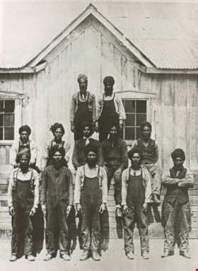
Home of Richard and Clara Thorpe
https://search.heritageburnaby.ca/link/museumdescription1507
- Repository
- Burnaby Village Museum
- Date
- [1911]
- Collection/Fonds
- Burnaby Village Museum Photograph collection
- Description Level
- Item
- Physical Description
- 1 photograph : b&w ; 10x 14 cm, mounted on card 15 x 22.5 cm
- Scope and Content
- Photograph of the home of Richard and Clara Thorpe. Nancy Davis Allard is standing, holding baby Dorothy Thorp (later Spain) upright in a buggy at the foot of the stairs. Two unidentified woman are also visible sitting at the top of the stairs.
- Repository
- Burnaby Village Museum
- Collection/Fonds
- Burnaby Village Museum Photograph collection
- Description Level
- Item
- Physical Description
- 1 photograph : b&w ; 10x 14 cm, mounted on card 15 x 22.5 cm
- Scope and Content
- Photograph of the home of Richard and Clara Thorpe. Nancy Davis Allard is standing, holding baby Dorothy Thorp (later Spain) upright in a buggy at the foot of the stairs. Two unidentified woman are also visible sitting at the top of the stairs.
- Subjects
- Buildings - Residential - Houses
- Geographic Access
- Boundary Road
- Burke Street
- Accession Code
- BV999.61.1
- Access Restriction
- No restrictions
- Date
- [1911]
- Media Type
- Photograph
- Historic Neighbourhood
- Central Park (Historic Neighbourhood)
- Planning Study Area
- Garden Village Area
- Scan Resolution
- 600
- Scan Date
- 09-Jun-09
- Scale
- 100
- Notes
- Title based on contents of photograph
- Note in blue ink on verso of photograph reads: "Home of Richard and/ Clara Thorp - about 1911./ Built in 1907. Boundary/ & Burke St. - Burnaby/ I'm in the buggy, held upright by my/ dear friend Nance -"
Images
![Home of Richard and Clara Thorpe, [1911] thumbnail](/media/hpo/_Data/_BVM_Images/1990/199900610001.jpg)
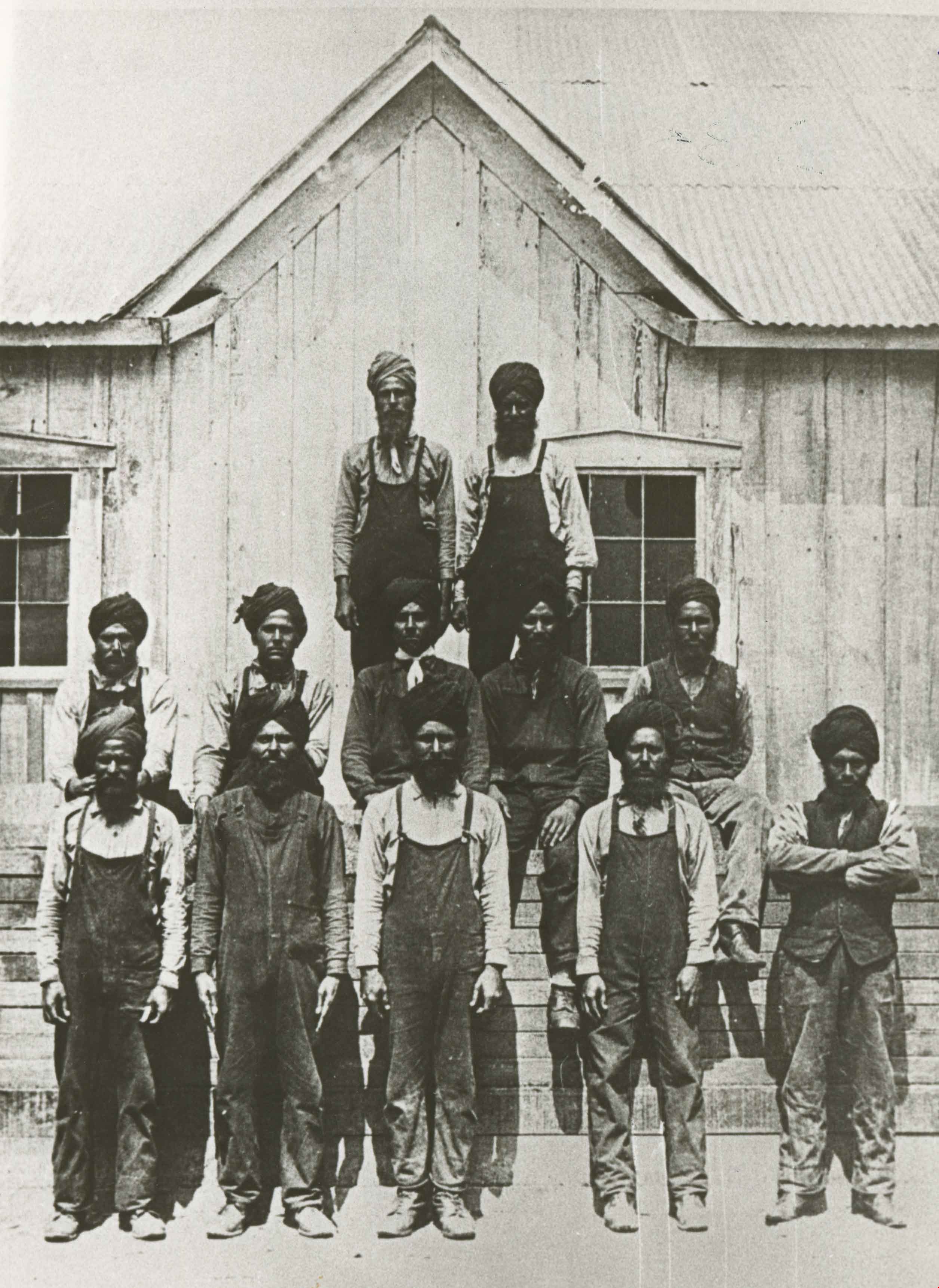
Labourers
https://search.heritageburnaby.ca/link/archivedescription35899
- Repository
- City of Burnaby Archives
- Date
- 1910 (date of original), copied 1986
- Collection/Fonds
- Burnaby Historical Society fonds
- Description Level
- Item
- Physical Description
- 1 photograph : b&w ; 12.7 x 17.8 cm print
- Scope and Content
- Photograph of twelve Indo-Canadian men wearing work clothes and turbans posed in front of a building of board and batten construction. Two men are standing on a stack of lumber, five are sitting on the stack, and five are standing on the ground in front of them. According to the accompanying note p…
- Repository
- City of Burnaby Archives
- Date
- 1910 (date of original), copied 1986
- Collection/Fonds
- Burnaby Historical Society fonds
- Subseries
- Pioneer Tales subseries
- Physical Description
- 1 photograph : b&w ; 12.7 x 17.8 cm print
- Description Level
- Item
- Record No.
- 204-758
- Access Restriction
- No restrictions
- Reproduction Restriction
- No known restrictions
- Accession Number
- BHS1988-03
- Scope and Content
- Photograph of twelve Indo-Canadian men wearing work clothes and turbans posed in front of a building of board and batten construction. Two men are standing on a stack of lumber, five are sitting on the stack, and five are standing on the ground in front of them. According to the accompanying note prepared by Burnaby Village Museum, the labourers are at the North Pacific Lumber Company mill at Barnet, which operated from 1899 to 1929 and completely closed out in 1931.
- Subjects
- Occupations - Labourers
- Names
- Barnet Mill
- Media Type
- Photograph
- Notes
- Title based on contents of photograph
- Geographic Access
- Barnet Village
- Texaco Drive
- Street Address
- 8059 Texaco Drive
- Historic Neighbourhood
- Barnet (Historic Neighbourhood)
- Planning Study Area
- Burnaby Mountain Area
Images
![Survey and Subdivision plans in New Westminster District Group 1 – Burnaby, [1905-1917] thumbnail](/media/hpo/_Data/_BVM_Cartographic_Material/1977/1977_0093_0022a_001.jpg?width=280)
Survey and Subdivision plans in New Westminster District Group 1 – Burnaby
https://search.heritageburnaby.ca/link/museumdescription6991
- Repository
- Burnaby Village Museum
- Date
- [1905-1917]
- Collection/Fonds
- Burnaby Village Museum Map collection
- Description Level
- File
- Physical Description
- 12 plans : 6 black ink on paper + 2 black & col. ink on paper + 4 graphite on paper
- Scope and Content
- Item consists of a large board of six New Westminster District subdivision plans mounted on one side and six New Westminster District subdivision plans mounted on the other side. Side A: 1. Plan drawn in graphite with markings in black ink "Surveyed for Mr. W. Wilson / Paterson Stat. B.C.E.R." . …
- Repository
- Burnaby Village Museum
- Collection/Fonds
- Burnaby Village Museum Map collection
- Description Level
- File
- Physical Description
- 12 plans : 6 black ink on paper + 2 black & col. ink on paper + 4 graphite on paper
- Material Details
- Scales [between 1:360 and 1:3168]
- Index number on edge of board reads: "22"
- Scope and Content
- Item consists of a large board of six New Westminster District subdivision plans mounted on one side and six New Westminster District subdivision plans mounted on the other side. Side A: 1. Plan drawn in graphite with markings in black ink "Surveyed for Mr. W. Wilson / Paterson Stat. B.C.E.R." . Plan includes subdivision of lots situated between B.C.E. Railway and Vancouver Road (Kingsway). (Geographic location: Burnaby) 2. Subdivision plan (no title) drawn in black ink with annotations in graphite. Plan covers District Lots 2, 4 and 6, west of North Road. Plan is stamped: "Albert J. Hill, Civil Engineer / and / Provincial Land Surveyor, / New Westminster, / B.C. (Geographic location: Burnaby) 3. Plan of "Portion of Municipality" with intials "RB" [sic] (handwritten in blue crayon). Plan covers the area north east of the City of New Westminster including District Lots 11, 13, 14, 12, 1 and 2. Plan is stamped: "Albert J. Hill, Civil Engineer / and / Provincial Land Surveyor, / New Westminster, / B.C. (Geographic location: Burnaby) 4."Plan / of Subdivision of / N.W.1/4 Lot 175 / Group 1 New West. Dist. / B.C. / Scale 4 chs = 1 in. " Plan is stamped: "Albert J. Hill, Civil Engineer / and / Provincial Land Surveyor, / New Westminster, / B.C. and initialed : "RB" [sic] (in blue pencil crayon) (Geographic location: Burnaby) 5. "Subdivision / of a Portion of / Lot 15 Group 1 / New Westminster Dist. / Scale 4 chs = 1 in". Plan provides numbered sudivisions - Lots 1 to 15 of District Lot 15 in red ink. (Geographic location: Burnaby) 6. Plan of "Central Park & / Vicinity" Plan includes subdivisions of District Lot 153 east of Central Park District Lot 151 and subdivision of District Lot 36 and 49 west of Boundary Road (Vancouver). Plan is stamped: "Albert J. Hill, Civil Engineer / and / Provincial Land Surveyor, / New Westminster, / B.C. and initialed : "RB" [sic] (in blue pencil crayon). (Geographic location: Burnaby) Side B: 1. Subdivision plan (no title) drawn in black ink. Plan identifies lots between Vancouver Road (Yale Road is crossed out and replaced with Vancouver Road) and B.C.E. Railway. "Scale 2 chs = 1 in" (Geographic location: Burnaby) 2. Plan of "Subdivision Lot 1 / Lot 69 Gr. 1 / Scale 30' = 1 " " Plan identifies Boundary Road, Still Creek and a Road Allowance between District Lot 118 and District Lot 69. Plan was "Surveyed for Burnaby Mun. Council / March 11th 1908 / G.K.B." (Geographic location: Burnaby) 3. Plan drawn in black ink (no title) showing a subdivision in Lot 25 with names "Newcomb", "Debeck" and "Armstrong" along with roads identified as Third Street, Cumberland Street, Armstrong Street and Cariboo [sic] Street and including Lots 27, 11 and 13.Plan is stamped: "Albert J. Hill, Civil Engineer / and / Provincial Land Surveyor, / New Westminster, / B.C. and initialed : "RB" [sic] (in blue pencil crayon). (Geographic location: Burnaby) 4. Handrawn subdivision plan in graphite titled: "Lot 13, Gr.1" with intials "RB" [sic] (handwritten in blue crayon). Plan is bordered by Armstrong Street (Lot 11, G.1), Cumberland St. (Lot 25, G.1) and Tenth Avenue (City Boundary). The plan is singed by "Albert J. Hill / P.L.S." and one of the subdivided lots is identified with the name: "W. Karrymann". (Geographic location: Burnaby) 5. Handrawn sketch in graphite titled: "Lot 88, Gr.1" with intials "RB" [sic] (handwritten in blue crayon). Plan appears to be a draft of a subdivision plan of a portion of District Lot 88 along Cumberland Road. The plan is signed: "16/7/17 _W.F. Draper [sic] / B.C.L.S." (Geographic location: Burnaby) 6. "Plan / of Subdivision / of Blocks 61, 62 and 2 / Lot 30 / Group 1 / N.W. Dist. / Scale 1ch = 1 in". Plan is intialed by: "PB" with a note: "Also see board 2 / for duplicate" (handwritten in blue crayon). (Geographic location: Burnaby)
- Creator
- Hill, Albert James
- Geographic Access
- Boundary Road
- Kingsway
- Cumberland Street
- Accession Code
- HV977.93.22
- Access Restriction
- No restrictions
- Reproduction Restriction
- No known restrictions
- Date
- [1905-1917]
- Media Type
- Cartographic Material
- Historic Neighbourhood
- Central Park (Historic Neighbourhood)
- Scan Resolution
- 300
- Scale
- 100
- Notes
- Title based on contents of file
- Scale is measured in chains and feet. (One chain equals 792 inches)
- The term "Lot" can also refer to a "District Lot”
- Some plans are stamped: "Albert J. Hill, Civil Engineer / and / Provincial Land Surveyor, / New Westminster, / B.C." and intialed: "RB" [sic]
Images
![Survey and Subdivision plans in New Westminster District Group 1 – Burnaby, [1905-1917] thumbnail](/media/hpo/_Data/_BVM_Cartographic_Material/1977/1977_0093_0022a_001.jpg)
