Narrow Results By
Digney Film 3 - Construction and opening of Digney bowling Alley, visit to Stanley Park and summer vacations
https://search.heritageburnaby.ca/link/museumdescription10678
- Repository
- Burnaby Village Museum
- Date
- [between 1955 and 1979] (date of original), copied 2019
- Collection/Fonds
- Digney Family fonds
- Description Level
- File
- Physical Description
- 1 video recording (mp4) (20 min., 30 sec.) : digital, 16 fps, col., si.
- Scope and Content
- File consists of a film compliation of short clips created by Andy Digney and his son Ernest "Dig" Digney. Film compilation documents the construction, opening and a tournament of the Digney Bowling Alley located at 6521 Bonsor Avenue in Burnaby along with Digney family outings at Stanley Park in V…
- Repository
- Burnaby Village Museum
- Collection/Fonds
- Digney Family fonds
- Description Level
- File
- Physical Description
- 1 video recording (mp4) (20 min., 30 sec.) : digital, 16 fps, col., si.
- Scope and Content
- File consists of a film compliation of short clips created by Andy Digney and his son Ernest "Dig" Digney. Film compilation documents the construction, opening and a tournament of the Digney Bowling Alley located at 6521 Bonsor Avenue in Burnaby along with Digney family outings at Stanley Park in Vancouver and vacations at Birch Bay, Washington State and Okanagan Lake.
- Creator
- Digney, Andy
- Names
- Digney, Andy
- Swan, Sydney
- Digney Bowling Alley
- Digney, Drew
- Digney, Joyce
- Digney, Bruce
- Digney, Paul
- Geographic Access
- Bonsor Avenue
- Street Address
- 6521 Bonsor Avenue
- Accession Code
- BV019.18.5
- Access Restriction
- No restrictions
- Reproduction Restriction
- No known restrictions
- Date
- [between 1955 and 1979] (date of original), copied 2019
- Media Type
- Moving Images
- Historic Neighbourhood
- Central Park (Historic Neighbourhood)
- Planning Study Area
- Maywood Area
- Notes
- Title based on contents of film compilation
- 4 film segments from this compilation are described at item level and available for viewing on Heritage Burnaby.
- Contact Burnaby Village Museum to view entire content
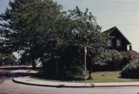
Exterior of Love farmhouse
https://search.heritageburnaby.ca/link/museumdescription1131
- Repository
- Burnaby Village Museum
- Date
- 1971 (date of original), copied 1990
- Collection/Fonds
- Love family fonds
- Description Level
- Item
- Physical Description
- 1 photograph : col. ; 10 x 15 cm print
- Scope and Content
- Photograph of the exterior of the Love farmhouse taken from the corner of Fourteenth Avenue and Cumberland Street while Elsie (nee Love) Hughes, her husband John and son Brent lived in the house. The house was located at 7651 Cumberland Street (Address pre 1960: 1390 Cumberland Road) and was moved …
- Repository
- Burnaby Village Museum
- Collection/Fonds
- Love family fonds
- Description Level
- Item
- Physical Description
- 1 photograph : col. ; 10 x 15 cm print
- Material Details
- Copy print was made from re-photographing an original colour slide
- Scope and Content
- Photograph of the exterior of the Love farmhouse taken from the corner of Fourteenth Avenue and Cumberland Street while Elsie (nee Love) Hughes, her husband John and son Brent lived in the house. The house was located at 7651 Cumberland Street (Address pre 1960: 1390 Cumberland Road) and was moved from its original site to the Burnaby Village Museum in 1988 and designated a Municipal Heritage Landmark in 1992.
- Geographic Access
- Cumberland Street
- 14th Avenue
- Street Address
- 7651 Cumberland Street
- Accession Code
- BV992.15.12
- Access Restriction
- Restricted access
- Reproduction Restriction
- May be restricted by third party rights
- Date
- 1971 (date of original), copied 1990
- Media Type
- Photograph
- Historic Neighbourhood
- East Burnaby (Historic Neighbourhood)
- Planning Study Area
- Cariboo-Armstrong Area
- Scan Resolution
- 600
- Scan Date
- 01-Jun-09
- Scale
- 100
- Photographer
- Parker, Albert "Bert"
- Notes
- Title based on contents of photograph
