Narrow Results By
Format
- Architectural Drawing 211
- Book 226
- Bylaws - Adopted 1884
- Bylaws - Repealed 149
- Cartographic Material
- Council - Committee Report 2227
- Council - Manager's Report 3429
- Council - Mayor/Councillor/Staff Report 2707
- Council - Public Hearing Minutes 116
- Council - Regular Council Minutes 768
- Graphic Material 23
- Landmark Description 78
Decade
- 2020s 56
- 2010s 52
- 2000s
- 1990s 56
- 1980s 31
- 1970s 53
- 1960s 79
- 1950s 79
- 1940s
- 1930s 78
- 1920s 78
- 1910s 164
- 1900s 76
- 1890s 25
- 1880s 6
- 1870s 3
- 1860s 3
- 1850s 1
- 1840s 1
- 1830s 1
- 1820s 1
- 1810s 1
- 1800s 1
- 1790s 1
- 1780s
- 1770s 1
- 1760s 1
- 1750s 1
- 1740s 1
- 1730s 1
- 1720s 1
- 1710s 1
- 1700s 1
- 1690s 1
- 1680s 1
- 1670s 1
- 1660s 1
- 1650s 1
- 1640s 1
- 1630s 1
- 1620s 1
- 1610s 1
- 1600s 1
Creator
- Bancroft, Rose 1
- British Columbia Electric Company 2
- British Columbia Underwriters' Association 4
- Brown, Donald N. "Don" 1
- Bureau of Post War Rehabilitation and Reconstruction Regional Planning Division 1
- Burnaby School Board 1
- Burnaby Village Museum 6
- Burnaby Village Museum - City of Burnaby 2
- City of Burnaby 4
- Corsbie, Joseph Hardcastle-Cumberland "Joe" 1
- Digney, Andy 11
- Digney family 1
Person / Organization
- British Columbia Electric Railway Company 3
- Burnaby Art Gallery 2
- Burnaby Lawn Bowling Club 1
- Burnaby School Board 1
- Burnaby Village Museum 5
- Canada Summer Games 1
- Codd, Lisa 1
- Corsbie, Joseph Hardcastle-Cumberland "Joe" 2
- C.W. Parker no. 119 Carousel 3
- Digney, Alice 5
- Digney, Andy 10
- Digney Bowling Alley 1
Love and Leonard land records series
https://search.heritageburnaby.ca/link/museumdescription18838
- Repository
- Burnaby Village Museum
- Date
- 1893-1962
- Collection/Fonds
- Love family fonds
- Description Level
- Series
- Physical Description
- 5 plans + 8 cm of textual records
- Scope and Content
- Series consists of land deeds, land sale agreements, documents regarding payment and survey and subdivision plans. Records refer to the Love family property in District Lot 25, the Leonard family property in District Lot 352 and other lots in Burnaby.
- Repository
- Burnaby Village Museum
- Collection/Fonds
- Love family fonds
- Description Level
- Series
- Physical Description
- 5 plans + 8 cm of textual records
- Scope and Content
- Series consists of land deeds, land sale agreements, documents regarding payment and survey and subdivision plans. Records refer to the Love family property in District Lot 25, the Leonard family property in District Lot 352 and other lots in Burnaby.
- Accession Code
- BV992.26
- BV012.31
- Date
- 1893-1962
- Media Type
- Textual Record
- Cartographic Material
- Notes
- Title based on contents of series
Love family fonds
https://search.heritageburnaby.ca/link/museumdescription10098
- Repository
- Burnaby Village Museum
- Date
- 1881-1971
- Collection/Fonds
- Love family fonds
- Description Level
- Fonds
- Physical Description
- 11 cm of textual records + 44 photographs + 5 plans
- Scope and Content
- Fonds consists of family records including photographs, land sale records, agreements and plans as well as estate records, vital event documentation and correspondence. Records pertain to members of the Love family including the Parkers, Hughes and Leonards. Fonds has been arranged in the followin…
- Repository
- Burnaby Village Museum
- Collection/Fonds
- Love family fonds
- Description Level
- Fonds
- Physical Description
- 11 cm of textual records + 44 photographs + 5 plans
- Scope and Content
- Fonds consists of family records including photographs, land sale records, agreements and plans as well as estate records, vital event documentation and correspondence. Records pertain to members of the Love family including the Parkers, Hughes and Leonards. Fonds has been arranged in the following series: 1) Love and Leonard land records 2) Love family vital events and correspondence 3) Love family photographs
- History
- Jesse Love was born in Swindon, England in 1847 and left England to work on a dairy farm in the Toronto area. While working on the farm in Toronto, he met Martha Leonard who he married in 1879. Martha was born on February 3, 1858 in Bedfordshire, England and had come to Canada with her parents George and Ann Leonard. While living in Toronto, Jesse and Martha had two children, George born March 22, 1880 and Annie Elizabeth on August 24, 1881. About one year after Annie was born, the Love family moved to North Dakota to grow wheat. While living there, they had two more children, Henry who was born August 24, 1883 and Edith Minnie born October 9, 1885. The family decided to move further west after hearing about the fairer weather conditions from Martha’s father, George Leonard, who had settled in Vancouver in 1885. On May 23, 1887, Jesse, Martha and their four children arrived in Vancouver after travelling across Canada from Winnipeg on the first transcontinental train. The Loves made their home in Vancouver while Jesse helped clear land on Granville Street. Their fifth child, Thomas Robert was born on September 17, 1887 and soon after, the family moved to Lulu Island in Richmond where they lived growing vegetables and selling them to Vancouver hotels. While living and farming on Lulu island, the couple had two more girls, Martha (Dot or Dorothy) born on December 17, 1889 and Sarah Marie, born February 8, 1892. On October 6, 1893 an agreement was signed by Jesse Love to purchase 14.52 acres of land from Joseph C. Armstrong. The acreage covered the north east section of District Lot 25 within the newly incorporated District of the Municipality of Burnaby. It was here where the original Love house was built (between October 1893 and April 15, 1894) by Jesse Love with the help of local builder George Salt and father in law, George Leonard. The house consisted of an entrance hall, dining room, lean to kitchen, master bedroom and three bedrooms upstairs. A road was constructed and named Cumberland in 1905 and ran from District Lot 25 through to District Lot 11. The address for the Love home was 1390 Cumberland Road and in the early 1960’s the address was renumbered 7651 Cumberland Street. On the land surrounding the house, Jesse Love planted an orchard along with strawberries and raspberries which he sold at the Fraser Valley Market, T.S. Anandale’s Grocery Store in New Westminster and to hotels around Vancouver. Jesse Love served on the Burnaby School Board and also as a District Councillor in 1901 and from 1904-1907. While living in the house, Jesse and Martha had four more children, Phoebe Leonard, born April 15, 1894, Esther, born August 28, 1896, John Leonard, born June 7, 1899 and Hannah Victoria (also known as Girlie) who was born May 12, 1902. In 1918, at the age of 31 years, Thomas Robert Love fell ill due to an influenza epidemic and died on November 23, 1918. Following their son’s death, Martha Love became weak and on August 24, 1920, she passed away. By this time, Jesse had sold off a large percentage of his land and his youngest daughter, Girlie decided to stay on to live and care for him. Since the house was too large for just the two of them, Jesse invited any other children to return and share the residence. For a while his son, George and his wife joined them. In 1925 Jesse’s daughter Sarah Parker (nee Love), her husband William Michael Norton Parker and their three children, Albert “Bert” (1915-2011), William Charles “Bill” and Elsie Roberta moved from their home at 1319 Newcombe Street to join Jesse and Girlie in the Love family home on Cumberland. Jesse Love died in 1928 after which Sarah and William Parker purchased the Love family farmhouse and property. William Michael Parker, died in 1961 and Sarah Parker continued to live in the Love family farmhouse until 1966 when she sold it to her daughter Elsie and husband John Hughes. Elsie and John Hughes had four children, John Jr., Ann, Brent and Merle. The Hughes lived in the Love family house until August 1971. In 1988 the Love family farmhouse house was donated to the Burnaby Village Museum and moved to the site of Burnaby Village Museum. The interior of the main floor and exterior of the house went through an extensive restoration process. In 1997, restoration of the kitchen was completed and opened to the public. After the completion of the hallway, dining room, main floor bedroom and parlour, the Love farmhouse exhibit opened on November 29, 1998 with an open invitation to the public and extended members of the Love family.
- Responsibility
- Love Family
- Accession Code
- HV979.40
- BV985.3136
- BV988.45
- BV989.3
- BV992.15
- BV992.26
- BV992.34
- BV000.45
- BV008.20
- BV012.31
- BV019.3
- BV019.8
- Date
- 1881-1971
- Media Type
- Textual Record
- Photograph
- Cartographic Material
- Arrangement
- Fonds has been arranged by record type and original order provided by members of the Love family.
- Notes
- Title based on contents of fonds
- See also Burnaby Village Museum fonds - Jesse Love farmhouse series
Love farmhouse oral history project subseries
https://search.heritageburnaby.ca/link/museumdescription10392
- Repository
- Burnaby Village Museum
- Date
- 1925-1930 (interview content), interviewed between 1988 and 1991
- Collection/Fonds
- Burnaby Village Museum fonds
- Description Level
- Subseries
- Physical Description
- Textual records + 3 audio cassettes + 1 videocassette
- Scope and Content
- Subseries consists of records created and collected during research of the Love family and the Love family farmhouse and include oral history interviews in various formats. Interviews were conducted by Jim Wolf and Burnaby Village Museum curator Colin Stevens with members of the Love family includi…
- Repository
- Burnaby Village Museum
- Collection/Fonds
- Burnaby Village Museum fonds
- Series
- Jesse Love farmhouse series
- Description Level
- Subseries
- Physical Description
- Textual records + 3 audio cassettes + 1 videocassette
- Scope and Content
- Subseries consists of records created and collected during research of the Love family and the Love family farmhouse and include oral history interviews in various formats. Interviews were conducted by Jim Wolf and Burnaby Village Museum curator Colin Stevens with members of the Love family including; Annie Chamberlain, William Parker, Esther Stanley, Albert Parker and Elsie Hughes. Interviews were focused on the subject of the interior and exterior of the farmhouse from a first person perspective. The goal was to obtain as much information as possible from family members in order to accurately restore, furnish and exhibit the farmhouse back to it's original 1920s era.
- Accession Code
- BV018.41
- Access Restriction
- No restrictions
- Reproduction Restriction
- May be restricted by third party rights
- Date
- 1925-1930 (interview content), interviewed between 1988 and 1991
- Media Type
- Textual Record
- Sound Recording
- Moving Images
- Notes
- Title based on content of subseries
Lower Mainland Regional Plan
https://search.heritageburnaby.ca/link/archivedescription90139
- Repository
- City of Burnaby Archives
- Date
- 1945
- Collection/Fonds
- Planning Department fonds
- Description Level
- Item
- Physical Description
- 7 maps : col. ; 22.5 x 53.5 cm on sheets 42 x 65 cm
- Scope and Content
- A collection of seven maps titled "Lower Mainland Regional Plan". Maps are numbered and subtitled as: "Light and Power Distribution / Map No. 5"; "Harbour Areas" / Map No. 8"; "Land Use" / Map No. 2"; "Water Supply" / Map No. 6"; "Dykes" / Map No. 7"; "Population Distribution / Map_No._1". All maps…
- Repository
- City of Burnaby Archives
- Date
- 1945
- Collection/Fonds
- Planning Department fonds
- Series
- Planning General series
- Physical Description
- 7 maps : col. ; 22.5 x 53.5 cm on sheets 42 x 65 cm
- Material Details
- Scale : in miles
- Map no. 4 is missing
- Description Level
- Item
- Record No.
- 59929
- Access Restriction
- Open access
- Accession Number
- 2016-09
- Scope and Content
- A collection of seven maps titled "Lower Mainland Regional Plan". Maps are numbered and subtitled as: "Light and Power Distribution / Map No. 5"; "Harbour Areas" / Map No. 8"; "Land Use" / Map No. 2"; "Water Supply" / Map No. 6"; "Dykes" / Map No. 7"; "Population Distribution / Map_No._1". All maps have are marked with boundaries, and landmarks including Historical Monuments, Custom Ports, Airports and Railways.
- Media Type
- Cartographic Material
- Notes
- Transcribed title
- Credit on maps read as: "Bureau_of_Post_War / Rehabilitation_and_Reconstruction / Regional_Planning_Design / Parliament_Buildings_Victoria_BC / Date_Sept_1st_1945 / (signed by ) [A.G._Graham]"
Many Voices Project Interviews subseries
https://search.heritageburnaby.ca/link/museumdescription19596
- Repository
- Burnaby Village Museum
- Date
- [1890-2023] (interview content), interviewed 2024
- Collection/Fonds
- Burnaby Village Museum fonds
- Description Level
- Subseries
- Physical Description
- 33 sound recordings (wav) + 3 video recordings (mp4) + 17 sound recordings (mp3) + 1 sound recording (m4a)
- Scope and Content
- Subseries consists of oral history interviews that were conducted as part of Burnaby Village Museum's Many Voices Project to capture and document diverse lives and stories of people connected to Burnaby. Interviews were conducted with Shirley Cohn; Ram Sarap Chandhal and members of Shri Ravidass S…
- Repository
- Burnaby Village Museum
- Collection/Fonds
- Burnaby Village Museum fonds
- Series
- Museum Oral Histories series
- Subseries
- Many Voices Project Interviews subseries
- Description Level
- Subseries
- Physical Description
- 33 sound recordings (wav) + 3 video recordings (mp4) + 17 sound recordings (mp3) + 1 sound recording (m4a)
- Material Details
- Digital master recordings (wav) were recorded onto separate audio tracks. Multiple tracks per interview were edited and merged together and converted to mp3 for access on Heritage Burnaby
- Some of the video recording (mp4) files were edited and saved as audio recording (wav) files
- Scope and Content
- Subseries consists of oral history interviews that were conducted as part of Burnaby Village Museum's Many Voices Project to capture and document diverse lives and stories of people connected to Burnaby. Interviews were conducted with Shirley Cohn; Ram Sarap Chandhal and members of Shri Ravidass Sabha gudawara; Lachman Singh Gill; Joanne Smith; Ellen and Bill Schwartz; Sadhu Binning and Sukhwant Hundal (founders of Vancouver Sath); Samuel Nalliah and Ruth (Angela) Nalliah; Jagandeep "Jag" Nagra; David Skulski; Kanwal Singh Neel; "The Bollywood Boyz" Harv Sihra and Gurvinder Sihra; Jenny Siormanolakis; Bill Gruenthal; Lama Tenzin Sherpa and Lama Sue Salter; Norman Dowad; Richard Liu; Shanaz Khan; Harry Toy; Lisette Pappas; Alex and Georgia Chronakis; Donna Wong and Jeffrey Wong.
- Accession Code
- BV023.16
- BV024.4
- Date
- [1890-2023] (interview content), interviewed 2024
- Media Type
- Sound Recording
- Moving Images
- Notes
- Title based on contents of subseries
- Some of the recordings within this subseries have access restrictions
- Further accruals are expected
Mary Forsyth fonds
https://search.heritageburnaby.ca/link/archivedescription87823
- Repository
- City of Burnaby Archives
- Date
- [1893] (date of original) -2004
- Collection/Fonds
- Mary Forsyth fonds
- Description Level
- Fonds
- Physical Description
- Textual records, graphic material and cartographic material
- Scope and Content
- Records consist of material created and collected by Mary Forsyth. Records include correspondence, photographs, a map, presentation notes, and reviews along with research for historical and biographical essays pertaining to pioneering families, organizations, and the geographical area of South Burn…
- Repository
- City of Burnaby Archives
- Date
- [1893] (date of original) -2004
- Collection/Fonds
- Mary Forsyth fonds
- Physical Description
- Textual records, graphic material and cartographic material
- Description Level
- Fonds
- Reproduction Restriction
- May be restricted by third party rights
- Accession Number
- 2014-27
- Scope and Content
- Records consist of material created and collected by Mary Forsyth. Records include correspondence, photographs, a map, presentation notes, and reviews along with research for historical and biographical essays pertaining to pioneering families, organizations, and the geographical area of South Burnaby. One of her major research projects consists of "A Walking Environment for South Burnaby," which also became a proposal to The Corporation of the District of Burnaby. Historical information and photographs pertaining to South Burnaby pioneer families and organizations were compiled from interviews with the intention of publishing a book.
- History
- Mary Gertrude (Bolton) Forsyth was born at her parents' home in Burnaby on March 5, 1923, and was the daughter of Richard Bolton and Gertrude (nee Hern). Mary's father, Richard, immigrated to Canada from Sunderland, England, in 1911. He lived with his brother George in New Westminster prior to purchasing property in South Burnaby in 1916 and built a bungalow located at 859 Marine Drive. Richard Bolton was employed as the municipal treasurer for the Corporation of the District of Burnaby and, in 1919, he returned to Sunderland with three months leave of absence to marry Mary Gertrude Hern, daughter of Captain and Mrs. John Hern. Mary grew up with her parents and sister Nancy in the house that her father built on Marine Drive. She married Lloyd Forsyth in 1946 and they had two children, Diane and Robert. Mary and her husband raised their family in Burnaby and built a house at 855 Marine Drive, on the lot originally purchased by her father, and moved later to a house located at 6457 Marine Drive. In 1964, after her children were grown, Mary completed her teaching degree at Simon Fraser University and went on to teach kindergarten at Nelson Elementary School. While a teacher within the Burnaby School District, Mary was instrumental in adopting ballet as part of the school curriculum. Mary was an active member of the Burnaby Historical Society, participating and leading local events and seminars. She was inspired by the idea of the 'Housewives Holiday', originally initiated by the Vancouver "Y’ S". In February 1960, she was integral in forming a committee in South Burnaby, working alongside Ruth Turner, Faye Treagh, and Dorothy Turnbull. The "Housewives Holiday" committee (a branch of the Clinton-Glenwood Recreation Association) planned several events at Bonsor Hall for Burnaby housewives from October 6 to December 8, 1960. After her retirement from teaching, Mary returned to Simon Fraser University to do further studies and, in 1983, she wrote an essay for an Environmental Education course, titled "A Walking Environment for South Burnaby". The essay was conducted as a feasibility study to provide a walking environment in her community and included a formal essay, a media book, a map, and a slide presentation which was presented to a variety of local community groups. In 1984, Mary was the recipient of the North Fraser Harbour Commission Award to further her work on this project. In October 1986, her essay was adapted as a proposal to The Corporation of the District of Burnaby for a walking and cycling trail system for South Burnaby. Her proposal was taken into consideration by council and was later adopted by the Parks and Recreation Commission. Mary was very much interested in the history of South Burnaby and spent time between 1990 to 2004 conducting research through the Burnaby Historical Society, The City of Burnaby Archives, and several pioneering families who agreed to share their family records and be interviewed. Mary compiled her research into short historical and biographical essays by geographical area, family name, and organization. Mary (Bolton) Forsyth lived her whole life in South Burnaby and was an active and committed member of her community. She died on November 10, 2010.
- Media Type
- Textual Record
- Photograph
- Cartographic Material
- Creator
- Forsyth, Mary
- Notes
- Title based on contents of fonds
- Photo catalogue 572, MSS185
Maurice Phillips collection
https://search.heritageburnaby.ca/link/archivedescription66716
- Repository
- City of Burnaby Archives
- Date
- 1930-1950
- Collection/Fonds
- Maurice Phillips collection
- Description Level
- Fonds
- Physical Description
- 3 maps + 1 brochure
- Scope and Content
- Collection consists of three maps; 1936 Burnaby lot map, 1950 map of the Fraser Valley, 1950s map of the Fraser Canyon and one brochure entitled "Corporation of Burnaby Attractively Priced Lands."
- Repository
- City of Burnaby Archives
- Date
- 1930-1950
- Collection/Fonds
- Maurice Phillips collection
- Physical Description
- 3 maps + 1 brochure
- Description Level
- Fonds
- Accession Number
- 2011-13
- Scope and Content
- Collection consists of three maps; 1936 Burnaby lot map, 1950 map of the Fraser Valley, 1950s map of the Fraser Canyon and one brochure entitled "Corporation of Burnaby Attractively Priced Lands."
- History
- Maurice Phillips was born in Victoria in 1919 and moved to East Pender Street in Vancouver during the 1930s. As a young man, he served as a cadet in the Seaforth Armory. When World War II broke out, Maurice was sent overseas with the First Battalion Seaforth Highlanders. This is where he met his future wife, Betty Joyce Thomas, who was herself serving as a member of the British Woman's Land Army (WLA). Maurice and Betty were married in Brighton, Sussex, in 1943. Betty (Thomas) Phillips travelled to Canada via the Queen Mary and stayed with Maurice's sisters and mother in Vancouver so that her daughter, Judith Phillips, would be born in Canada in 1944. Maurice was in Europe until 1945 and ended up as a Captain in the army. After the war, Maurice returned to work at Woodwards but, through his army contacts, went to work at Barber-Ellis, a wholesale paper and envelope manufacturer. He and his wife and daughter moved to Burnaby in 1948 or 1949, first on Royal Oak and then to a house on Waltham. This is where their son, William George Phillips, was born in 1950 and their second daughter, Susan Maureen Phillips, was born in 1953. The Phillips family often took trips to the Okanagan after the Hope-Princeton highway opened. Maurice also took William to Sḵwx̱wú7mesh along the "new" highway when it first opened. The Phillips family lived in Burnaby until Maurice was transferred east in 1960.
- Media Type
- Textual Record
- Cartographic Material
- Creator
- Phillips, Maurice
- Notes
- Title based on contents of fonds
- MSS158
![Municipality of Burnaby - Volume XV and Volume XVIII, 1927-[1940] thumbnail](/media/hpo/_Data/_BVM_Artifacts/1972/1972_0111_0004_003.jpg?width=280)
Municipality of Burnaby - Volume XV and Volume XVIII
https://search.heritageburnaby.ca/link/museumdescription8682
- Repository
- Burnaby Village Museum
- Date
- 1927-[1940]
- Collection/Fonds
- Burnaby Village Museum Map collection
- Description Level
- File
- Physical Description
- 4 plans on 4 sheets: col. lithographic prints ; 63.5 x 53.5 cm folded to 53 x 31.5 cm
- Scope and Content
- File consists of four pages of plans removed from a bound book containing a series of fire insurance plans of the Municipality of Burnaby. Plan "1518" and "1519" are from "GREATER VANCOUVER B.C. / VOLUME XV / Municipality of Burnaby / May, 1927". Plan "1518" covers District Lot 116 and Plan "1519"…
- Repository
- Burnaby Village Museum
- Collection/Fonds
- Burnaby Village Museum Map collection
- Description Level
- File
- Physical Description
- 4 plans on 4 sheets: col. lithographic prints ; 63.5 x 53.5 cm folded to 53 x 31.5 cm
- Material Details
- Scale [1:600]
- Scope and Content
- File consists of four pages of plans removed from a bound book containing a series of fire insurance plans of the Municipality of Burnaby. Plan "1518" and "1519" are from "GREATER VANCOUVER B.C. / VOLUME XV / Municipality of Burnaby / May, 1927". Plan "1518" covers District Lot 116 and Plan "1519" covers District Lot 121. Plan "1802" and plan "1803" are from "GREATER VANCOUVER B.C. / VOLUME XVIII / Municipality of Burnaby / May, 1927". Both plans "1802" and "1803" cover District Lot 153.
- Responsibility
- British Columbia Underwriters' Association
- Accession Code
- HV972.111.4
- Access Restriction
- No restrictions
- Reproduction Restriction
- May be restricted by third party rights
- Date
- 1927-[1940]
- Media Type
- Cartographic Material
- Historic Neighbourhood
- Vancouver Heights (Historic Neighbourhood)
- Central Park (Historic Neighbourhood)
- Planning Study Area
- Willingdon Heights Area
- Marlborough Area
- Scan Resolution
- 400
- Scan Date
- 2021-11-18
- Notes
- Title based on content of plans
- See also BV987.1.70d for revised versions of plans
- Scale is measured 1 inch = 50 feet
- Contact Burnaby Village Museum to access plans 1518 and 1519 (these plans have revisions on top - date of revisions is uncertain)
Images
![Municipality of Burnaby - Volume XV and Volume XVIII, 1927-[1940] thumbnail](/media/hpo/_Data/_BVM_Artifacts/1972/1972_0111_0004_003.jpg)

Museum exhibits series
https://search.heritageburnaby.ca/link/museumdescription16037
- Repository
- Burnaby Village Museum
- Date
- 1990-2021
- Collection/Fonds
- Burnaby Village Museum fonds
- Description Level
- Series
- Physical Description
- 1 digital illustration (pdf) + 1 painting (tiff) + 9 sound recordings (mp3) + 2 video recordings (mp4) + 6.5 cm of textual records
- Scope and Content
- Series consists of photographs, graphic materials and other records pertaining to Burnaby Village Museum temporary and permanent exhibits. A selection of temporary exihibits are described by title and year. Series have been arranged by exhibit title into the following subseries: 1) Burnaby's Best …
- Repository
- Burnaby Village Museum
- Collection/Fonds
- Burnaby Village Museum fonds
- Series
- Museum exhibits series
- Description Level
- Series
- Physical Description
- 1 digital illustration (pdf) + 1 painting (tiff) + 9 sound recordings (mp3) + 2 video recordings (mp4) + 6.5 cm of textual records
- Scope and Content
- Series consists of photographs, graphic materials and other records pertaining to Burnaby Village Museum temporary and permanent exhibits. A selection of temporary exihibits are described by title and year. Series have been arranged by exhibit title into the following subseries: 1) Burnaby's Best Baby contest subseries 2) Across the Pacific subseries 3) Agents of Change subseries 4) Museum materials for exhibits subseries
- Names
- Burnaby Village Museum
- Accession Code
- BV020.5
- BV019.36.1
- BV019.61.1
- BV020.42
- BV021.14
- Date
- 1990-2021
- Arrangement
- Series are arranged by subseries by exhibit title and year.
- Notes
- Title based on contents of series
- Further accruals expected
Museum film collection series
https://search.heritageburnaby.ca/link/museumdescription16032
- Repository
- Burnaby Village Museum
- Date
- 1990-2021 (date of originals), digitized in 2020
- Collection/Fonds
- Burnaby Village Museum fonds
- Description Level
- Series
- Physical Description
- 17 videocassettes + 3 video recordings (mp4)
- Scope and Content
- Series consists of a collection of promotional videos, documentary footage of special events, programs, restoration and construction projects, videos used for exhibits and research as well as copies of television news coverage about Burnaby Village Museum and a video recording of a book launch.
- Repository
- Burnaby Village Museum
- Collection/Fonds
- Burnaby Village Museum fonds
- Description Level
- Series
- Physical Description
- 17 videocassettes + 3 video recordings (mp4)
- Scope and Content
- Series consists of a collection of promotional videos, documentary footage of special events, programs, restoration and construction projects, videos used for exhibits and research as well as copies of television news coverage about Burnaby Village Museum and a video recording of a book launch.
- Names
- Burnaby Village Museum
- Accession Code
- X2294
- BV017.39
- BV019.18
- BV020.4
- BV020.5
- BV021.7.1
- Date
- 1990-2021 (date of originals), digitized in 2020
- Media Type
- Moving Images
- Notes
- Title based on contents of series
- Further accruals are expected
Museum Oral Histories series
https://search.heritageburnaby.ca/link/museumdescription18810
- Repository
- Burnaby Village Museum
- Date
- [1600-2023] (interview content), interviewed 2005-2023
- Collection/Fonds
- Burnaby Village Museum fonds
- Description Level
- Series
- Physical Description
- 52 sound recordings (wav) + 61 sound recordings (mp3) + 1 video recording (mp4) + 1 sound recording (m4a) + 51 video recordings (mov)
- Scope and Content
- Series consists of oral history interviews conducted by staff of Burnaby Village Museum for various projects. Series has been arranged into subseries: 1) Growing Up in Burnaby subseries 2) Museum research interviews subseries 3) Chinese Canadians in Burnaby subseries 4) South Asian Canadian Interv…
- Repository
- Burnaby Village Museum
- Collection/Fonds
- Burnaby Village Museum fonds
- Series
- Museum Oral Histories series
- Description Level
- Series
- Physical Description
- 52 sound recordings (wav) + 61 sound recordings (mp3) + 1 video recording (mp4) + 1 sound recording (m4a) + 51 video recordings (mov)
- Scope and Content
- Series consists of oral history interviews conducted by staff of Burnaby Village Museum for various projects. Series has been arranged into subseries: 1) Growing Up in Burnaby subseries 2) Museum research interviews subseries 3) Chinese Canadians in Burnaby subseries 4) South Asian Canadian Interviews subseries 5) Many Voices Project Interviews subseries
- Accession Code
- BV017.45
- BV018.18.1
- BV019.13.1
- BV019.14.1
- BV019.15.1
- BV020.6
- BV022.29
- BV023.1
- BV023.16
- BV024.4
- Date
- [1600-2023] (interview content), interviewed 2005-2023
- Media Type
- Sound Recording
- Moving Images
- Notes
- Title based on contents of series
- Further accruals expected
Norm Henderson collection
https://search.heritageburnaby.ca/link/archivedescription85186
- Repository
- City of Burnaby Archives
- Date
- 1945-1946
- Collection/Fonds
- Norm Henderson collection
- Description Level
- Fonds
- Physical Description
- 1 film reel [19 min, 37 sec] : kodak kodachrome, col., sd.; 16mm
- Scope and Content
- Fonds comprises one film entitled "Investment in Youth." The film was produced for the Burnaby School Board and Norm Henderson participated as a student assistant and was present for all of the filming and much of the sound work.
- Repository
- City of Burnaby Archives
- Date
- 1945-1946
- Collection/Fonds
- Norm Henderson collection
- Physical Description
- 1 film reel [19 min, 37 sec] : kodak kodachrome, col., sd.; 16mm
- Description Level
- Fonds
- Access Restriction
- No restrictions
- Reproduction Restriction
- May be restricted by third party rights
- Accession Number
- 2013-33
- Scope and Content
- Fonds comprises one film entitled "Investment in Youth." The film was produced for the Burnaby School Board and Norm Henderson participated as a student assistant and was present for all of the filming and much of the sound work.
- History
- Norm Henderson came from Saskatchewan to Burnaby with his parents in December of 1940 to visit his grandmothers. Norm and his parents stayed on and bought the Old Orchard Auto Park on the corner of Kingsway and Willingdon Avenue, which they ran until 1944. Norm attended Burnaby South High School from 1941 to 1947, during which time he was involved in the production of the Burnaby School Board film, “Investment in Youth." In 1945, Norm got a part-time job at Woodward’s Department Store in Vancouver where he worked until he went into teacher training at Vancouver Normal School in the early 1950s. Kathleen MacFarlane (later Henderson) was born in 1929 and grew up in Vancouver. Kathleen also went through teacher training at Vancouver Normal School. Norm and Kathleen (MacFarlane) Henderson were married in 1953 and moved to a small suite at Patterson Avenue and Kingsway. Norm was a teacher at Gilmore Avenue School and Kathleen taught at Nelson Avenue Elementary School. Norm was a member of West Burnaby United Church from 1941 until he and Kathleen moved to Richmond in 1959.
- Media Type
- Moving Images
- Creator
- Henderson, Norman "Norm"
- Notes
- Title based on contents of collection.
- Photo/MI catalogue 565
North Fraser Harbour Board - Financial statements, reports, bylaws
https://search.heritageburnaby.ca/link/archivedescription1390
- Repository
- City of Burnaby Archives
- Date
- 1926-1958
- Collection/Fonds
- City Council and Office of the City Clerk fonds
- Description Level
- File
- Physical Description
- 2 folders textual records and cartographic material
- Scope and Content
- File includes blueprint plan regarding foreshore application fronting.
- Repository
- City of Burnaby Archives
- Date
- 1926-1958
- Collection/Fonds
- City Council and Office of the City Clerk fonds
- Physical Description
- 2 folders textual records and cartographic material
- Description Level
- File
- Record No.
- 3198
- Accession Number
- 2001-02
- Scope and Content
- File includes blueprint plan regarding foreshore application fronting.
- Media Type
- Textual Record
- Cartographic Material
- Notes
- Plans/maps are located in file and have not been moved to map case.
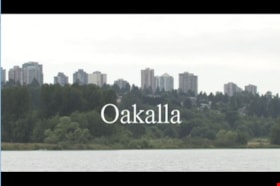
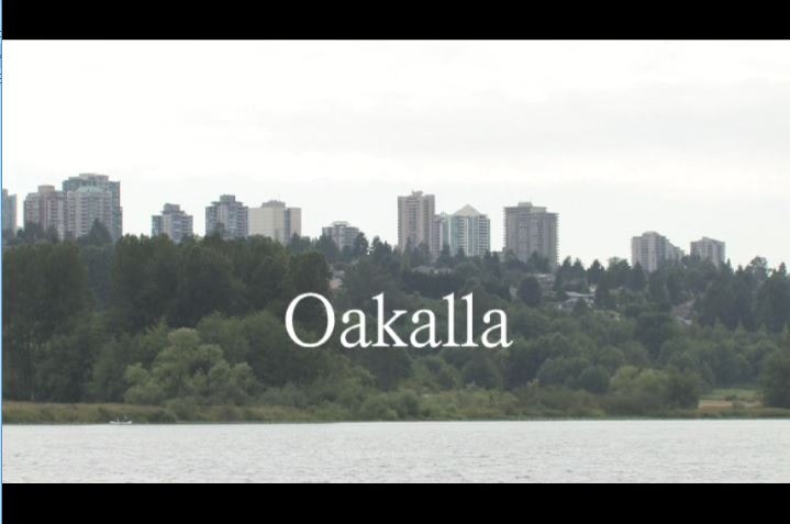
Oakalla
https://search.heritageburnaby.ca/link/museumlibrary1393
- Repository
- Burnaby Village Museum
- Author
- Jack, Ronald
- Publication Date
- c2009
- Call Number
- 365.9711 JAC VR
- Repository
- Burnaby Village Museum
- Collection
- Reference Collection
- Material Type
- Moving Images
- Accession Code
- BV020.5.1059
- Call Number
- 365.9711 JAC VR
- Author
- Jack, Ronald
- Place of Publication
- Vancouver, B.C.
- Publisher
- Runagate Pictures
- Publication Date
- c2009
- Physical Description
- 1 videodisc (9 min., 52 sec.) : sd., col. ; 4 3/4 in
- Library Subject (LOC)
- Lower Mainland Regional Corrections Centre--History
- Prisons--British Columbia
- Historic Neighbourhood
- Burnaby Lake (Historic Neighbourhood)
- Planning Study Area
- Oakalla Area
- Geographic Access
- Oakmount Crescent
- Street Address
- 5220 Oakmount Crescent
- Notes
- "A preview DVD" titled "Oakalla" compiled by Ronald Jack. Film footage consists of historic and contemporary images regarding Oakalla Prison Farm and includes commentaries from Burnaby Village Museum Curator, Tom Gooden; Oakalla Historian and Vancouver Police Officer, Earl Anderson and Burnaby Mayor, Derek Corrigan (former Oakalla prison guard). A collection of Oakalla artifacts are included in the film footage.
- Contact Burnaby Village Museum to view video content
Images

Okanagan Fishing Guide
https://search.heritageburnaby.ca/link/museumdescription11398
- Repository
- Burnaby Village Museum
- Date
- 1948
- Collection/Fonds
- Burnaby Village Museum Map collection
- Description Level
- Item
- Physical Description
- 1 map : col. ink on paper handcol. ; 24 x 35 cm
- Scope and Content
- Item consists of map titled "Okanagan Fishing Guide / Showing / Major Roads / and the / Best Fish Lakes". Hand drawn map compiled and drawn by W.C. Rueber, Kelowna B.C. of Okanagan Lake area. Advertisement at bottom of page indicates that it may have been produced by "OK USED FURNITURE STORE / 239 …
- Repository
- Burnaby Village Museum
- Collection/Fonds
- Burnaby Village Museum Map collection
- Description Level
- Item
- Physical Description
- 1 map : col. ink on paper handcol. ; 24 x 35 cm
- Scope and Content
- Item consists of map titled "Okanagan Fishing Guide / Showing / Major Roads / and the / Best Fish Lakes". Hand drawn map compiled and drawn by W.C. Rueber, Kelowna B.C. of Okanagan Lake area. Advertisement at bottom of page indicates that it may have been produced by "OK USED FURNITURE STORE / 239 BERNARD AVE., KELOWNA, B.C....". The map was copyrighted in Canada on July 20, 1948, No. 79416.
- Creator
- Rueber, W.C.
- Publisher
- OK Used Furniture Store
- Accession Code
- BV006.24.116
- Access Restriction
- No restrictions
- Reproduction Restriction
- May be restricted by third party rights
- Date
- 1948
- Media Type
- Cartographic Material
- Scan Resolution
- 600
- Scan Date
- 2021-11-23
- Notes
- Transcribed title
- Staining on map with creases from being folded and handcoloured markings with blue pencil
Images

Orders of Board of Railway Commission - Gilmore Avenue crossing
https://search.heritageburnaby.ca/link/archivedescription1485
- Repository
- City of Burnaby Archives
- Date
- 1928-1958
- Collection/Fonds
- City Council and Office of the City Clerk fonds
- Description Level
- File
- Physical Description
- 2 folders textual records and cartographic material
- Scope and Content
- Files contains white linen plan that accompanies railway application for highway crossing at Gilmore Avenue (1929) and 2 blueprint plans - one of the railway highway crossing protection at Bell and Sperling Avenue (1952) and the other at Bell and Douglas Avenue (1947).
- Repository
- City of Burnaby Archives
- Date
- 1928-1958
- Collection/Fonds
- City Council and Office of the City Clerk fonds
- Physical Description
- 2 folders textual records and cartographic material
- Description Level
- File
- Record No.
- 3296
- Accession Number
- 2001-02
- Scope and Content
- Files contains white linen plan that accompanies railway application for highway crossing at Gilmore Avenue (1929) and 2 blueprint plans - one of the railway highway crossing protection at Bell and Sperling Avenue (1952) and the other at Bell and Douglas Avenue (1947).
- Media Type
- Textual Record
- Cartographic Material
- Notes
- Plans/maps are located in file and have not been moved to map case.
![Parades, [between 1936 and 1948] thumbnail](/media/Hpo/_Data/_Archives_Moving_Images/_Unrestricted/562-003-11.jpg?width=280)
Parades
https://search.heritageburnaby.ca/link/archivedescription85248
- Repository
- City of Burnaby Archives
- Date
- [between 1936 and 1948]
- Collection/Fonds
- Digney Family fonds
- Description Level
- Item
- Physical Description
- 1 film clip (11 min., 17sec.) :digital, b&w, col., si.
- Scope and Content
- Item is a digitized silent colour film segment identified as Reel 11. Film opens with colour footage of the Tacoma Daffodil Parade and switches to some black and white and colour footage of the Vancouver Diamond Jubilee Parade starting from the Toronto Dominion Bank located at Hastings Street and C…
- Repository
- City of Burnaby Archives
- Date
- [between 1936 and 1948]
- Collection/Fonds
- Digney Family fonds
- Physical Description
- 1 film clip (11 min., 17sec.) :digital, b&w, col., si.
- Description Level
- Item
- Record No.
- 562-003-11
- Access Restriction
- No restrictions
- Reproduction Restriction
- May be restricted by third party rights
- Accession Number
- 2014-04
- Scope and Content
- Item is a digitized silent colour film segment identified as Reel 11. Film opens with colour footage of the Tacoma Daffodil Parade and switches to some black and white and colour footage of the Vancouver Diamond Jubilee Parade starting from the Toronto Dominion Bank located at Hastings Street and Cambie Street. The Queen appears in a calvicade at the beginning of the parade. The footage soon switches to the Vancouver PNC Parade in 1946 celebrating 50 years of progress.
- Subjects
- Events - Parades
- Media Type
- Moving Images
- Photographer
- Digney, Andy
- Creator
- Digney, Andy
- Notes
- Title based on contents of film
Images
![Parades, [between 1936 and 1948] thumbnail](/media/Hpo/_Data/_Archives_Moving_Images/_Unrestricted/562-003-11.jpg)
Video
Parades, [between 1936 and 1948]
Parades, [between 1936 and 1948]
https://search.heritageburnaby.ca/media/hpo/_Data/_Archives_Moving_Images/_Unrestricted/562-003-11.m4v![Paul Digney and family, [between 1948 and 1949] thumbnail](/media/Hpo/_Data/_Archives_Moving_Images/_Unrestricted/562-003-13.jpg?width=280)
Paul Digney and family
https://search.heritageburnaby.ca/link/archivedescription85250
- Repository
- City of Burnaby Archives
- Date
- [between 1948 and 1949]
- Collection/Fonds
- Digney Family fonds
- Description Level
- Item
- Physical Description
- 1 film clip (10 min., 21 sec.) : digital, col., si.
- Scope and Content
- Item is a digitized silent colour film segment identified as Reel 13. Film provides footage of Paul Digney as a young child as he interacts with family members and pet dogs at the Digney family home on Bonsor Avenue in Burnaby. The film contains views of the Digney family home, yard and neighborhoo…
- Repository
- City of Burnaby Archives
- Date
- [between 1948 and 1949]
- Collection/Fonds
- Digney Family fonds
- Physical Description
- 1 film clip (10 min., 21 sec.) : digital, col., si.
- Description Level
- Item
- Record No.
- 562-003-13
- Access Restriction
- No restrictions
- Reproduction Restriction
- May be restricted by third party rights
- Accession Number
- 2014-04
- Scope and Content
- Item is a digitized silent colour film segment identified as Reel 13. Film provides footage of Paul Digney as a young child as he interacts with family members and pet dogs at the Digney family home on Bonsor Avenue in Burnaby. The film contains views of the Digney family home, yard and neighborhood in summer and winter time. Some of the footage shows some wear.
- Media Type
- Moving Images
- Photographer
- Digney, Andy
- Creator
- Digney, Andy
- Notes
- Title based on contents of film
- Geographic Access
- Bonsor Avenue
- Historic Neighbourhood
- Central Park (Historic Neighbourhood)
- Planning Study Area
- Maywood Area
Images
![Paul Digney and family, [between 1948 and 1949] thumbnail](/media/Hpo/_Data/_Archives_Moving_Images/_Unrestricted/562-003-13.jpg)
Video
Paul Digney and family, [between 1948 and 1949]
Paul Digney and family, [between 1948 and 1949]
https://search.heritageburnaby.ca/media/hpo/_Data/_Archives_Moving_Images/_Unrestricted/562-003-13.m4vPlanning Department fonds
https://search.heritageburnaby.ca/link/archivedescription102
- Repository
- City of Burnaby Archives
- Date
- 1940-2016
- Collection/Fonds
- Planning Department fonds
- Description Level
- Fonds
- Physical Description
- 80 m of textual records and other material
- Scope and Content
- Fonds consists of those records created during the regular conduct of business by the Planning Department and its predecessor agencies according to their mandate of providing professional and technical advice to Council on the current and future uses of City land and resources.
- Repository
- City of Burnaby Archives
- Date
- 1940-2016
- Collection/Fonds
- Planning Department fonds
- Physical Description
- 80 m of textual records and other material
- Description Level
- Fonds
- File Class
- 71000 10 (add. 2020)
- 71000 20 (add. 2020)
- 71000 30 (add. 2020)
- 71000 40 (add. 2020)
- Access Restriction
- Subject to FOIPPA
- Reproduction Restriction
- Reproductions subject to FOIPPA.
- Scope and Content
- Fonds consists of those records created during the regular conduct of business by the Planning Department and its predecessor agencies according to their mandate of providing professional and technical advice to Council on the current and future uses of City land and resources.
- History
- The City of Burnaby Planning Department was established on October 9, 1956, when the City Council unanimously carried the motion to create a distinct department to deal with planning issues within the City and appointed Mr. William John Blakely as its head. This decision followed a report and recommendation made by the City’s Chief Administrative Officer which indicated that the role of the Planning Engineer and his staff had quickly expanded to become a separate division within the Engineering Department and that they were functioning as an independent unit in all but name. The proposed separation of the Engineering and Planning departments had been in the works since the early part of 1956 when staff changes and restructuring within the Engineering Department’s Planning Division illustrated the undermanned condition of the Planning Engineer’s office. As a result, Council asked the Chief Administrative Officer to undertake a study examining the feasibility of creating a distinct Planning Department. This report was delivered to Council on July 3, 1956, but was laid over until a Committee of the Council had the opportunity to study the functions of the Planning department to determine the necessity of the proposal. The Committee’s findings were in line with the initial report and the Planning Department was established with a staff of nine (the head Planning Engineer, an Administrative Planner, three Research Planning Assistants, a Draughtsman, a Subdivision Control Clerk, a department Clerk and a Clerk Stenographer). This new department was to offer advice and carry out the work intensive in matters such as zoning and rezoning applications, subdivision control, traffic and transportation planning, and general City planning schemes. Prior to the creation of the Planning Department, a number of bodies within the City had been responsible for fulfilling the functions carried out by this new unit. In the earliest years of the City, the members of Council were responsible for matters of planning and were assisted in their job by the City’s Engineer or any number of hired consultants (e.g. surveyors, cartographers). By 1906, however, the provincial laws surrounding the subdivision process had changed, and local governments were charged with the task of approving all private subdivision plans in their respective Municipalities. In Burnaby, the City Council passed a bylaw decreeing that all subdivision plans were to be submitted to Council for review and the City Engineer was responsible for ensuring compliance with the law. After the first Town Planning Bylaw in 1924 which restricted the type and size of construction that could occur in certain City areas, the Engineering and Building departments were to work together to oversee the enforcement of the Bylaw and the development of City plans. The scope and competence required to carry out this work grew as Burnaby’s population expanded, and in 1930 Council passed the Town Planning Commission Bylaw (No. 1028) that saw the creation of a permanent body – the Town Planning Commission – which was to serve as an advisory body to help direct the planning activities in the City while the actual work continued to be carried out by the Engineering Department. This body was comprised of the Reeve, the Chairman of the School Board, the Chairman of the Park Committee (later, the Board of Parks Commissioners), and six appointed citizens who served three-year terms. Council referred all matters of subdivisions, transportation planning, and rezoning to this Commission, which was later supported in its work by several other special or standing committees such as the Subdivision Committee, the Apartment Committee, the Transportation Committee or the Town Planning Board of Appeal. By 1953, it had become apparent that the advisory committees that were dedicated to these planning issues needed a permanent staff to carry out the work intensive, so a restructuring of the Engineering department resulted in a permanent Planning Engineer’s office being created. The Town Planning Commission continued in its advisory capacity even after the determination came in 1956 to create a separate Planning Department. When Bylaw No. 4473 was passed in 1963, the Town Planning Commission was disbanded in favour of a new Advisory Planning Commission that would turn over all routine matters such as subdivision and rezoning applications to the Planning Department but would offer advice and community input into the more complex planning schemes within the City and act as an intermediary in cases where Council and Planning staff were in disagreement. A new Advisory Planning Commission Bylaw (No. 7600) was adopted in 1980 which allowed for even greater community participation in the planning process. The Planning Department was initially responsible to report directly to Council, but in 1957, the administrative structure of Municipal staff changed with the introduction of the Burnaby Municipal Manager Bylaw (No. 3859) and from that point on, the head of the Planning Department held a direct reporting relationship to the Municipal Manager, who in turn was responsible for reporting the activities of the Department to the City Council. Over the years, the internal structure and the scope of responsibilities of the Department have changed during periods of staff reorganizations. Under the larger umbrella of the Planning and Building Department, Planning has come to be comprised of two divisions: the Current Planning Division and the Long Range Planning Division. The functions of the Current Planning Division include rezoning, subdivision, development plan areas, preliminary plan approvals, urban design, heritage planning, and urban trails and bicycle routes. The Long Range Planning Division is responsible for environmental planning concerns, transportation planning, housing, neighbourhood area planning, social planning and planning information services. In 2022, the Planning and Building Department was reorganized to better align functions with delivery of services. The Climate Action and Engery Division moved from Corporate Services to the Planning and Building Department, while Indigenous Relations and Facilities Management moved to Corporate Services and Lands and Facilities, respectively. The position of Director of Planning and Building was changed to General Manager, Planning and Development. The following individuals have served as Planning Engineer and/or Director of the Planning Department and/or General Manager, Planning and Development for the City of Burnaby: William John Blakely 1954-1956 (as Planning Engineer) 1956-1963 (as Head of the Department) Anthony P. Parr 1964-1993 Don G. Stenson 1993-2001 Jack S. Belhouse 2001-2006 Basil Luksun 2006-2012 Lou Pelletier 2012-2019 Edward Kozak 2019-present
- Formats
- Microforms exist for some records. See series descriptions.
- Media Type
- Textual Record
- Photograph
- Moving Images
- Creator
- City of Burnaby
- Notes
- Title based on contents of fonds
Progress report
https://search.heritageburnaby.ca/link/museumlibrary7355
- Repository
- Burnaby Village Museum
- Collection
- Reference Collection
- Material Type
- Moving Images
- Call Number
- 388.46 BCH VR
- Contributor
- British Columbia Electric Company
- Place of Publication
- [British Columbia, Canada]
- Publisher
- BC Hydro
- Publication Date
- c1947
- Physical Description
- 1 videodisc (13 min.) : sd., b&w. ; 4 3/4 in.
- Library Subject (LOC)
- Natural gas industry
- Local transit
- Hydroelectric power plants
- Electric railroads
- Electric power-plants
- Transportation
- British Columbia--History
- Subjects
- Transportation
- Geographic Access
- Vancouver
- Notes
- Summary: Promotional film. The BC Electric Railway Company's $50 million post-war expansion and modernization program, to be completed by 1950. Includes: expansion of transit services, including start of the switch from streetcars to trolley buses; water gas plant; explanation of the Bridge River project, with footage of construction (including La Joie Falls storage dam); Lower Mainland power sub-stations. Various Vancouver street scenes, especially Fraser Street and downtown
- Credit note : sponsored/presented by: British Columbia Electric Company; producer: Lew M. Parry; producing agency/company: Trans-Canada Films Ltd.