Narrow Results By
Format
- Architectural Drawing 220
- Book 761
- Bylaws - Adopted 2783
- Bylaws - Other 19
- Bylaws - Repealed 242
- Cartographic Material
- Catalogue 1
- Council - Committee Report 5352
- Council - Manager's Report 6047
- Council - Mayor/Councillor/Staff Report 2387
- Council - Public Hearing Minutes 216
- Council - Regular Council Minutes 1008
Creator
- Bancroft, Rose 1
- Burnett and McGugan B.C. Land Surveyors, New Westminster 5
- Burnett, David H. 1
- Burnett, Geoffrey K. 5
- Burnett & McGugan, Engineers and Surveyors 21
- City of Burnaby 2
- Coast Map and Blue Print Co. 1
- Forsyth, Mary 1
- Garden, Hermon and Burwell 2
- Gauvreau, Narcisse B. 1
- Geoffrey K. Burnett 1
- Government of Canada - Department of the Interior 1
Person / Organization
- All Saints Anglican Church 1
- Armstrong Avenue School 1
- Barnet School 1
- Broadview Presbyterian Church 1
- Burnett, Geoffrey K. 2
- Douglas Road School 1
- Dundonald United Church 1
- Edmonds Community School 2
- Gilmore Avenue School 1
- Gordon Presbyterian Church 1
- Hamilton Road School 1
- Hill, Louis Claude "Claude" 1
North Burnaby Auxiliary minute book
https://search.heritageburnaby.ca/link/archivedescription65050
- Repository
- City of Burnaby Archives
- Date
- 1913-1924
- Collection/Fonds
- Victorian Order of Nurses fonds
- Description Level
- Item
- Physical Description
- 1 notebook (hardcover) + 1 map
- Scope and Content
- Item is a Victorian Order of Nurses (VON) North Burnaby Auxiliary minute book. Included in the minute book is a white linen early street map depicting East Burnaby and New Westminster.
- Repository
- City of Burnaby Archives
- Date
- 1913-1924
- Collection/Fonds
- Victorian Order of Nurses fonds
- Physical Description
- 1 notebook (hardcover) + 1 map
- Description Level
- Item
- Record No.
- MSS021-004
- Accession Number
- 2010-09
- Scope and Content
- Item is a Victorian Order of Nurses (VON) North Burnaby Auxiliary minute book. Included in the minute book is a white linen early street map depicting East Burnaby and New Westminster.
- Media Type
- Textual Record
- Cartographic Material
North Burnaby Incorporation
https://search.heritageburnaby.ca/link/archivedescription788
- Repository
- City of Burnaby Archives
- Date
- 1912
- Collection/Fonds
- City Council and Office of the City Clerk fonds
- Description Level
- File
- Physical Description
- Textual record and cartographic material
- Scope and Content
- File contains correspondence, road and bridge expenditures statements, and reports pertaining to the incorporation of North Burnaby. File also includes 1911 Burnaby Annual Report.
- Repository
- City of Burnaby Archives
- Date
- 1912
- Collection/Fonds
- City Council and Office of the City Clerk fonds
- Physical Description
- Textual record and cartographic material
- Description Level
- File
- Record No.
- 2538
- Accession Number
- 2001-02
- Scope and Content
- File contains correspondence, road and bridge expenditures statements, and reports pertaining to the incorporation of North Burnaby. File also includes 1911 Burnaby Annual Report.
- Media Type
- Textual Record
- Cartographic Material
- Notes
- A Municipality of Burnaby Map is in map case.
North Road crossing
https://search.heritageburnaby.ca/link/archivedescription656
- Repository
- City of Burnaby Archives
- Date
- 1903-1915
- Collection/Fonds
- City Council and Office of the City Clerk fonds
- Description Level
- File
- Physical Description
- Textual record and cartographic material
- Scope and Content
- File contains minutes from the Board of Railway Commissioners for Canada meetings, correspondence, and copies of the Board of Railway Commissioners Railway Act, 1903 regarding a bridge and crossing over the Brunette River. File also includes white linen plans of proposed bridge and crossing.
- Repository
- City of Burnaby Archives
- Date
- 1903-1915
- Collection/Fonds
- City Council and Office of the City Clerk fonds
- Physical Description
- Textual record and cartographic material
- Description Level
- File
- Record No.
- 2381
- Accession Number
- 2001-02
- Scope and Content
- File contains minutes from the Board of Railway Commissioners for Canada meetings, correspondence, and copies of the Board of Railway Commissioners Railway Act, 1903 regarding a bridge and crossing over the Brunette River. File also includes white linen plans of proposed bridge and crossing.
- Media Type
- Textual Record
- Cartographic Material
- Notes
- Plans/maps are located in file and have not been moved to map case.
North Road - Vancouver, Victoria and Eastern Railway and Navigation Co.
https://search.heritageburnaby.ca/link/archivedescription817
- Repository
- City of Burnaby Archives
- Date
- 1912-1918
- Collection/Fonds
- City Council and Office of the City Clerk fonds
- Description Level
- File
- Physical Description
- 4 folders textual records and graphic material and cartographic material.
- Scope and Content
- File contains correspondence, reports, notices, Council minutes and other documents created as a result of the applications made by the Vancouver, Victoria and Eastern Railway and Navigation Co. to do work on North Road, such as constructing crossings, bridges, and tunnels through the inter-munici…
- Repository
- City of Burnaby Archives
- Date
- 1912-1918
- Collection/Fonds
- City Council and Office of the City Clerk fonds
- Physical Description
- 4 folders textual records and graphic material and cartographic material.
- Description Level
- File
- Record No.
- 2570
- Accession Number
- 2001-02
- Scope and Content
- File contains correspondence, reports, notices, Council minutes and other documents created as a result of the applications made by the Vancouver, Victoria and Eastern Railway and Navigation Co. to do work on North Road, such as constructing crossings, bridges, and tunnels through the inter-municipal highway between Burnaby and Coquitlam.
- Media Type
- Textual Record
- Cartographic Material
- Notes
- 3 blueprint plans of a proposed bridge and tunnel : M9-B-1-14; M9-B-1-15; and M9-B-3-14. 2 black and white photographs [not found as of May 8, 2003]
Parks
https://search.heritageburnaby.ca/link/archivedescription390
- Repository
- City of Burnaby Archives
- Date
- 1910-1913
- Collection/Fonds
- City Council and Office of the City Clerk fonds
- Description Level
- File
- Physical Description
- Textual record and cartographic material
- Scope and Content
- File includes a plan of a Subdivision of the Southwestern portion Holmes Estate, Lot 1, Group 1 (Brunette Creek), a blueprint plan of proposed subdivision of part of DL 79, hand drawn sketch plan of portion of east 1/2 of southwest 1/4 DL 159, and a hand drawn sketch plan of southwest portion of DL…
- Repository
- City of Burnaby Archives
- Date
- 1910-1913
- Collection/Fonds
- City Council and Office of the City Clerk fonds
- Physical Description
- Textual record and cartographic material
- Description Level
- File
- Record No.
- 2083
- Accession Number
- 2001-02
- Scope and Content
- File includes a plan of a Subdivision of the Southwestern portion Holmes Estate, Lot 1, Group 1 (Brunette Creek), a blueprint plan of proposed subdivision of part of DL 79, hand drawn sketch plan of portion of east 1/2 of southwest 1/4 DL 159, and a hand drawn sketch plan of southwest portion of DL 158. The plans were used during the purchase of land for proposed parks.
- Media Type
- Textual Record
- Cartographic Material
- Notes
- Plans/maps are located in file and have not been moved to map case.
Petition (Lefurgey) - Cancellation of plans, map 1521
https://search.heritageburnaby.ca/link/archivedescription727
- Repository
- City of Burnaby Archives
- Date
- [ between 1909 - 1912 ]
- Collection/Fonds
- City Council and Office of the City Clerk fonds
- Description Level
- File
- Physical Description
- Textual record and cartographic material
- Scope and Content
- File contains correspondence and Council minutes regarding the petition made by Alfred Lefurgey to have Map No. 1521 cancelled. File also includes the petition made by Lefurgey to the County Court of Westminster and two oversized blueprint plans for DL 10 (1909) and for the NE portion of DL 10 (19…
- Repository
- City of Burnaby Archives
- Date
- [ between 1909 - 1912 ]
- Collection/Fonds
- City Council and Office of the City Clerk fonds
- Physical Description
- Textual record and cartographic material
- Description Level
- File
- Record No.
- 2454
- Accession Number
- 2001-02
- Scope and Content
- File contains correspondence and Council minutes regarding the petition made by Alfred Lefurgey to have Map No. 1521 cancelled. File also includes the petition made by Lefurgey to the County Court of Westminster and two oversized blueprint plans for DL 10 (1909) and for the NE portion of DL 10 (1911).
- Media Type
- Textual Record
- Cartographic Material
- Notes
- 2 plans of subdivision of NE Portion of DL 10, group 1, NWD : M9-A-8-14; M9-A-8-15
Plan - Block 6, DL 91 (Mark and Tigar)
https://search.heritageburnaby.ca/link/archivedescription603
- Repository
- City of Burnaby Archives
- Date
- 1912-1913
- Collection/Fonds
- City Council and Office of the City Clerk fonds
- Description Level
- File
- Physical Description
- Textual record and cartographic material
- Scope and Content
- File contains correspondence and a declaration regarding expropriation and subdivision of Block 6, DL 91, owned by Mr. Mark and Mr. Tigar. File also includes 1 white linen plan of the land to be expropriated.
- Repository
- City of Burnaby Archives
- Date
- 1912-1913
- Collection/Fonds
- City Council and Office of the City Clerk fonds
- Physical Description
- Textual record and cartographic material
- Description Level
- File
- Record No.
- 2316
- Accession Number
- 2001-02
- Scope and Content
- File contains correspondence and a declaration regarding expropriation and subdivision of Block 6, DL 91, owned by Mr. Mark and Mr. Tigar. File also includes 1 white linen plan of the land to be expropriated.
- Media Type
- Textual Record
- Cartographic Material
- Notes
- Plans/maps are located in file and have not been moved to map case.
Plan of Subdivision of Block F Lot 1, D.L. 25 Group 1
https://search.heritageburnaby.ca/link/museumdescription18808
- Repository
- Burnaby Village Museum
- Date
- 17 Apr. 1912
- Collection/Fonds
- Love family fonds
- Description Level
- Item
- Physical Description
- 1 plan : black and red ink on linen ; 36 x 28.5 cm
- Scope and Content
- Item consists of Plan of Subdivision of Block F Lot 1, D.L. 25 Group 1 New Westminster District created by Provincial Land Surveyor Geoffrey K. Burnett.
- Repository
- Burnaby Village Museum
- Collection/Fonds
- Love family fonds
- Description Level
- Item
- Physical Description
- 1 plan : black and red ink on linen ; 36 x 28.5 cm
- Material Details
- Scale [1:1200]
- Scope and Content
- Item consists of Plan of Subdivision of Block F Lot 1, D.L. 25 Group 1 New Westminster District created by Provincial Land Surveyor Geoffrey K. Burnett.
- Creator
- Burnett, Geoffrey K.
- Names
- Burnett, Geoffrey K.
- Geographic Access
- Cumberland Street
- Accession Code
- BV992.26.28
- Access Restriction
- No restrictions
- Reproduction Restriction
- No known restrictions
- Date
- 17 Apr. 1912
- Media Type
- Cartographic Material
- Historic Neighbourhood
- East Burnaby (Historic Neighbourhood)
- Planning Study Area
- Cariboo-Armstrong Area
- Scan Resolution
- 600
- Scan Date
- 2022-07-11
- Scale
- 100
- Notes
- Title based on contents of item
- Scale is measured "100 FT = 1 INCH"
- "PLAN OF SUBDIVISION OF BLOCK "F" OF LOT 1, D.L. 25 GROUP 1. NEW WESTMINSTER DISTRICT"; Wright St., Sixth Ave., Fifth Ave., Cumberland St., L.1-8, 11-16; signature of Jesse Love, owner, witness S.P. King?; Geoffrey K. Burnett, P.L.S.; Fred A. Macpherson, Municipal Clerk, April 17, 1912; taxes paid to Dec. 31 1911, signed April 17 1912 by W.H. Griffin, collector"
Images
Plan of Subdivision of Block F Lot 1, D.L. 25 Group 1
https://search.heritageburnaby.ca/link/museumdescription18809
- Repository
- Burnaby Village Museum
- Date
- 17 Apr. 1912
- Collection/Fonds
- Love family fonds
- Description Level
- Item
- Physical Description
- 1 plan : black and red ink on linen ; 36 x 28.5 cm
- Scope and Content
- Item consists of Plan of Subdivision of Block F Lot 1, D.L. 25 Group 1 New Westminster District created by Provincial Land Surveyor Geoffrey K. Burnett.
- Repository
- Burnaby Village Museum
- Collection/Fonds
- Love family fonds
- Description Level
- Item
- Physical Description
- 1 plan : black and red ink on linen ; 36 x 28.5 cm
- Material Details
- Scale [1:1200]
- Scope and Content
- Item consists of Plan of Subdivision of Block F Lot 1, D.L. 25 Group 1 New Westminster District created by Provincial Land Surveyor Geoffrey K. Burnett.
- Creator
- Burnett, Geoffrey K.
- Names
- Burnett, Geoffrey K.
- Geographic Access
- Cumberland Street
- Accession Code
- BV992.26.29
- Access Restriction
- No restrictions
- Reproduction Restriction
- No known restrictions
- Date
- 17 Apr. 1912
- Media Type
- Cartographic Material
- Historic Neighbourhood
- East Burnaby (Historic Neighbourhood)
- Planning Study Area
- Cariboo-Armstrong Area
- Scan Resolution
- 600
- Scan Date
- 2022-07-11
- Scale
- 100
- Notes
- Title based on contents of item
- Scale is measured "100 FT = 1 INCH"
- "PLAN OF SUBDIVISION OF BLOCK "F" OF LOT 1, D.L. 25 GROUP 1. NEW WESTMINSTER DISTRICT"; Wright St., Sixth Ave., Fifth Ave., Cumberland St., L.1-8, 11-16; signature of Jesse Love, owner, witness S.P. King?; Geoffrey K. Burnett, P.L.S.; Fred A. Macpherson, Municipal Clerk, April 17, 1912; taxes paid to Dec. 31 1911, signed April 17 1912 by W.H. Griffin, collector"
Images
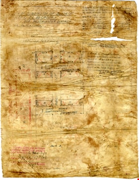
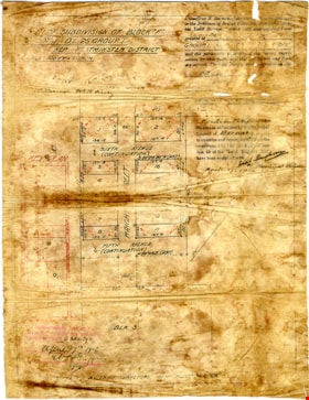
Plan of Subdivision of Blocks 1,2.3,6,21 and 23 of District Lot 211
https://search.heritageburnaby.ca/link/museumdescription11111
- Repository
- Burnaby Village Museum
- Date
- [between 1911 and 1912]
- Collection/Fonds
- Ronald G. Scobbie collection
- Description Level
- Item
- Physical Description
- 1 plan : ink on waxed linen ; 60 x 52.5 cm
- Scope and Content
- Item consists of a "Plan of Subdivision of Blocks 1,2.3,6,21 and 23 / of District Lot 211. Group 1 N.W.D. / Burnaby Municipality"
- Repository
- Burnaby Village Museum
- Collection/Fonds
- Ronald G. Scobbie collection
- Description Level
- Item
- Physical Description
- 1 plan : ink on waxed linen ; 60 x 52.5 cm
- Material Details
- Scale [1:1200]
- Scope and Content
- Item consists of a "Plan of Subdivision of Blocks 1,2.3,6,21 and 23 / of District Lot 211. Group 1 N.W.D. / Burnaby Municipality"
- Creator
- Hill & Burnett
- Accession Code
- HV984.57.4
- Access Restriction
- No restrictions
- Reproduction Restriction
- No known restrictions
- Date
- [between 1911 and 1912]
- Media Type
- Cartographic Material
- Planning Study Area
- Burnaby Mountain Area
- Scan Resolution
- 400
- Scan Date
- Dec. 22, 2020
- Scale
- 100
- Notes
- Transcribed title
- Scale is measured "100 feet to one inch"
- Credit on plan reads: "Hill & Burnett_BC_Land Surveyors_Civil Engineers_New Westminster_B.C."
Zoomable Images
![Plan of Subdivision of Blocks 1,2.3,6,21 and 23 of District Lot 211, [between 1911 and 1912] thumbnail](/media/hpo/_Data/_BVM_Cartographic_Material/1984/1984_0057_0004_001_seadragon/1984_0057_0004_001.jpg?w=280)
Plan of Subdivision of Blocks 1,2.3,6,21 and 23 of District Lot 211, [between 1911 and 1912]
Zoom into ImagePlan of Subdivision of Blocks 1,2,3,6,21 and 23 of District Lot 211
https://search.heritageburnaby.ca/link/museumdescription11212
- Repository
- Burnaby Village Museum
- Date
- [between 1911 and 1912]
- Collection/Fonds
- Ronald G. Scobbie collection
- Description Level
- Item
- Physical Description
- 1 plan : ink on waxed linen ; 77 x 53 cm
- Scope and Content
- "Plan of Subdivision of Blks 1,2.3.6.21. and 23 / of District Lot 211, Group ;1 , N.W.D./ Burnaby Municipality"
- Repository
- Burnaby Village Museum
- Collection/Fonds
- Ronald G. Scobbie collection
- Description Level
- Item
- Physical Description
- 1 plan : ink on waxed linen ; 77 x 53 cm
- Scope and Content
- "Plan of Subdivision of Blks 1,2.3.6.21. and 23 / of District Lot 211, Group ;1 , N.W.D./ Burnaby Municipality"
- Creator
- Hill & Burnett
- Accession Code
- HV984.57.5
- Access Restriction
- No restrictions
- Reproduction Restriction
- No known restrictions
- Date
- [between 1911 and 1912]
- Media Type
- Cartographic Material
- Planning Study Area
- Burnaby Mountain Area
- Scan Resolution
- 400
- Scan Date
- Dec. 22, 2020
- Scale
- 100
- Notes
- Transcribed title
- Scale is measured "100 feet to one inch"
- Credit on plan reads: "Hill & Burnett_BC_Land Surveyors_Civil Engineers_New Westminster_B.C."
Zoomable Images
![Plan of Subdivision of Blocks 1,2,3,6,21 and 23 of District Lot 211, [between 1911 and 1912] thumbnail](/media/hpo/_Data/_BVM_Cartographic_Material/1984/1984_0057_0005_001_seadragon/1984_0057_0005_001.jpg?w=280)
Plan of Subdivision of Blocks 1,2,3,6,21 and 23 of District Lot 211, [between 1911 and 1912]
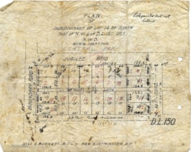
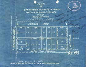
Zoom into ImagePlan of Subdivision of Lot 14 of North part of NW 1/4 of D.L. 150 GR.1 N.W.D
https://search.heritageburnaby.ca/link/museumdescription11117
- Repository
- Burnaby Village Museum
- Date
- 1912
- Collection/Fonds
- Ronald G. Scobbie collection
- Description Level
- Item
- Physical Description
- 2 plans : ink on linen + blueprint ; 21.5 x 27.5 cm
- Scope and Content
- File consists of "Plan of Subdivision of Lot 14 of North / Part of N.W. 1/4 of D.L. 150, GR.1. / N.W.D." and blueprint of same.
- Repository
- Burnaby Village Museum
- Collection/Fonds
- Ronald G. Scobbie collection
- Description Level
- Item
- Physical Description
- 2 plans : ink on linen + blueprint ; 21.5 x 27.5 cm
- Material Details
- Scale [1:1200]
- Scope and Content
- File consists of "Plan of Subdivision of Lot 14 of North / Part of N.W. 1/4 of D.L. 150, GR.1. / N.W.D." and blueprint of same.
- Creator
- Hill & Burnett
- Geographic Access
- Jubilee Avenue
- Accession Code
- HV984.57.10
- Access Restriction
- No restrictions
- Reproduction Restriction
- No known restrictions
- Date
- 1912
- Media Type
- Cartographic Material
- Planning Study Area
- Suncrest Area
- Scan Resolution
- 600
- Scan Date
- 2-Oct-19
- Scale
- 100
- Notes
- Transcribed title
- Notes in red crayon on verso of both plans read: "00079"
- Oval shaped stamp in blue ink on front of blueprint plan reads: "Corporation of Burnaby / Feb. 2 1912 / Engineering Department"
- Stamp in red ink on verso of Blueprint plan reads: "Hill & Burnett / Civil Engineers / B.C. Land Surveyors / New Westminster B.C."
- Handwritten note on front of blueprint plan reads: "T... [sic] approved / subject to 20' Laws [sic] / being given. / Fred L. Macpherson / Engineer / Feb. 6th 1912"
Images
Plan Showing Proposed Road DL 212
https://search.heritageburnaby.ca/link/archivedescription8036
- Repository
- City of Burnaby Archives
- Date
- [191-?]
- Collection/Fonds
- City Council and Office of the City Clerk fonds
- Description Level
- Item
- Physical Description
- 1 map
- Scope and Content
- White linen plan with Burrard Inlet to the north and Barnet Road to the South. A proposed crossing for the Canadian Pacific Railway is outlined in red and the Bestwood Shingle Mill and Nichol's Chemical operation are identified in black.
- Repository
- City of Burnaby Archives
- Date
- [191-?]
- Collection/Fonds
- City Council and Office of the City Clerk fonds
- Physical Description
- 1 map
- Description Level
- Item
- Record No.
- 10990
- Accession Number
- 2001-02
- Scope and Content
- White linen plan with Burrard Inlet to the north and Barnet Road to the South. A proposed crossing for the Canadian Pacific Railway is outlined in red and the Bestwood Shingle Mill and Nichol's Chemical operation are identified in black.
- Media Type
- Cartographic Material
- Notes
- Located in map case.
Portion of New Westminster District with Adjacent Islands and Part of Vancouver Island
https://search.heritageburnaby.ca/link/museumdescription8690
- Repository
- Burnaby Village Museum
- Date
- 1910
- Collection/Fonds
- Burnaby Village Museum Map collection
- Description Level
- Item
- Physical Description
- 1 map : col. ink on canvas ; 68 x 90 cm on canvas 70 x 95 cm
- Scope and Content
- "Map of Portion of New Westminster District with Adjacent Islands and Part of Vancouver Island / Drawn at the Lands and Works Department. Victoria, B.C."
- Repository
- Burnaby Village Museum
- Collection/Fonds
- Burnaby Village Museum Map collection
- Description Level
- Item
- Physical Description
- 1 map : col. ink on canvas ; 68 x 90 cm on canvas 70 x 95 cm
- Material Details
- Scale 1/4 inch = 80 chains
- Scope and Content
- "Map of Portion of New Westminster District with Adjacent Islands and Part of Vancouver Island / Drawn at the Lands and Works Department. Victoria, B.C."
- Geographic Access
- Vancouver
- Accession Code
- BV994.11.9
- Access Restriction
- No restrictions
- Reproduction Restriction
- No known restrictions
- Date
- 1910
- Media Type
- Cartographic Material
- Notes
- Title based on contents of map
- Cleaned by conservator Dec 2009
Price list and plan of subdivision west half Lot 117 - Buckingham
https://search.heritageburnaby.ca/link/museumdescription13094
- Repository
- Burnaby Village Museum
- Date
- [ca. 1913]
- Collection/Fonds
- Burnaby Village Museum Map collection
- Description Level
- Item
- Physical Description
- 1 map : col. lithographic print ; both sides ; 40 x 43.5 cm, folded to 40 x 22 cm
- Scope and Content
- Folded price list and plan of Subdivision of West Half of District Lot 117, Ward V, New Westiminster District "Buckingham". Subdivision is bordered by Boundary Road to the west, John Street to the east, Halifax Street to the south and Amherst Street to the north.
- Repository
- Burnaby Village Museum
- Collection/Fonds
- Burnaby Village Museum Map collection
- Description Level
- Item
- Physical Description
- 1 map : col. lithographic print ; both sides ; 40 x 43.5 cm, folded to 40 x 22 cm
- Material Details
- Scale 1 inch = 200 feet
- Scope and Content
- Folded price list and plan of Subdivision of West Half of District Lot 117, Ward V, New Westiminster District "Buckingham". Subdivision is bordered by Boundary Road to the west, John Street to the east, Halifax Street to the south and Amherst Street to the north.
- Accession Code
- HV976.158.8
- Access Restriction
- No restrictions
- Reproduction Restriction
- No known restrictions
- Date
- [ca. 1913]
- Media Type
- Cartographic Material
- Historic Neighbourhood
- Vancouver Heights (Historic Neighbourhood)
- Planning Study Area
- Burnaby Heights Area
- Scan Resolution
- 96 dpi
- Scan Date
- 4-Jun-20
- Scale
- 100
- Notes
- Title based on content of map
- Title on plan reads: "BUCKINGHAM / W1/2 OF LOT 117, WARD V N.W.D. B.C. / AT THE JUNCTION OF THE BOUNDARY & N. WEST'R ROADS"
- Text on verso of plan reads: "BUCKINGHAM" / FOR SURE ADVANCE / AND QUICK TURN OVER"
- Image link shows side one of price list and plan
Images
Proposed subdivision of D.L. 150, Grp. 1
https://search.heritageburnaby.ca/link/museumdescription11118
- Repository
- Burnaby Village Museum
- Date
- [1912]
- Collection/Fonds
- Ronald G. Scobbie collection
- Description Level
- Item
- Physical Description
- 1 plan : pencil and ink on paper ; 34 x 21 cm
- Scope and Content
- Item consists of a handrawn draft subdivision plan for District Lot 150, Group 1. Plan identifies streets running east off Boundary Road including Dubois; Hurst; Victory and Cade
- Repository
- Burnaby Village Museum
- Collection/Fonds
- Ronald G. Scobbie collection
- Description Level
- Item
- Physical Description
- 1 plan : pencil and ink on paper ; 34 x 21 cm
- Scope and Content
- Item consists of a handrawn draft subdivision plan for District Lot 150, Group 1. Plan identifies streets running east off Boundary Road including Dubois; Hurst; Victory and Cade
- Accession Code
- HV984.57.11
- Access Restriction
- No restrictions
- Reproduction Restriction
- No known restrictions
- Date
- [1912]
- Media Type
- Cartographic Material
- Planning Study Area
- Suncrest Area
- Scan Resolution
- 600
- Scan Date
- April 14, 2021
- Scale
- 100
- Notes
- Title based on contents of plan
Images
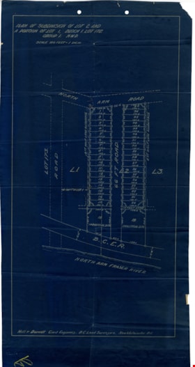
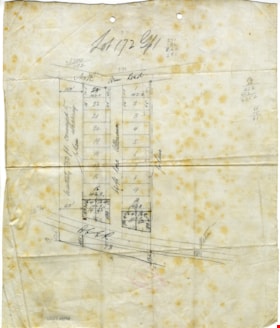
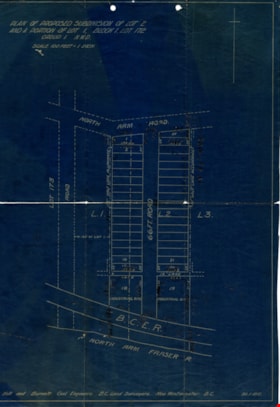
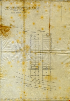
Proposed subdivision plans of D.L. 172
https://search.heritageburnaby.ca/link/museumdescription11119
- Repository
- Burnaby Village Museum
- Date
- 1912
- Collection/Fonds
- Ronald G. Scobbie collection
- Description Level
- File
- Physical Description
- 11 plans : blueprints + ink and graphite on waxed linen + ink and graphite on paper + graphite on paper; 53.5 x 31 cm and smaller + textual records
- Scope and Content
- File consists of proposed subdivision plans and field notes pertaining to District Lot 172 Group 1, New Westminster District, Lots 1 & 2, Block 1.
- Repository
- Burnaby Village Museum
- Collection/Fonds
- Ronald G. Scobbie collection
- Description Level
- File
- Physical Description
- 11 plans : blueprints + ink and graphite on waxed linen + ink and graphite on paper + graphite on paper; 53.5 x 31 cm and smaller + textual records
- Scope and Content
- File consists of proposed subdivision plans and field notes pertaining to District Lot 172 Group 1, New Westminster District, Lots 1 & 2, Block 1.
- Creator
- Hill & Burnett
- Accession Code
- HV984.57.12
- Access Restriction
- No restrictions
- Reproduction Restriction
- No known restrictions
- Date
- 1912
- Media Type
- Cartographic Material
- Scan Resolution
- 600
- Scan Date
- 15-Jan-2021
- Scale
- 100
- Notes
- Title based on contents of file
- Credit on plan reads: "Hill & Burnett_Civil Engineers_BC_Land Surveyors_New Westminster_B.C."
Images
Proposed Tramline North of Burnaby Lake
https://search.heritageburnaby.ca/link/archivedescription659
- Repository
- City of Burnaby Archives
- Date
- [190-?]
- Collection/Fonds
- City Council and Office of the City Clerk fonds
- Description Level
- File
- Physical Description
- Textual record and cartographic material
- Scope and Content
- File contains one blueprint plan [190?] of the proposed site.
- Repository
- City of Burnaby Archives
- Date
- [190-?]
- Collection/Fonds
- City Council and Office of the City Clerk fonds
- Physical Description
- Textual record and cartographic material
- Description Level
- File
- Record No.
- 2384
- Accession Number
- 2001-02
- Scope and Content
- File contains one blueprint plan [190?] of the proposed site.
- Media Type
- Textual Record
- Cartographic Material
- Notes
- Plans/maps are located in file and have not been moved to map case.
Queen's Avenue wharf
https://search.heritageburnaby.ca/link/archivedescription599
- Repository
- City of Burnaby Archives
- Date
- 1912-1925
- Collection/Fonds
- City Council and Office of the City Clerk fonds
- Description Level
- File
- Physical Description
- 3 folders textual records and cartographic material
- Scope and Content
- File contains petition, correspondence, and agreements with the Burrard Lumber Co. Ltd., the Bowness Lumber Co., Ltd., and the Pacific Lumber & Trading Co., Ltd., regarding the maintenance and construction of Queen's Avenue and Queen's Avenue Wharf. File also includes 2 white linen plans: "works o…
- Repository
- City of Burnaby Archives
- Date
- 1912-1925
- Collection/Fonds
- City Council and Office of the City Clerk fonds
- Physical Description
- 3 folders textual records and cartographic material
- Description Level
- File
- Record No.
- 2310
- Accession Number
- 2001-02
- Scope and Content
- File contains petition, correspondence, and agreements with the Burrard Lumber Co. Ltd., the Bowness Lumber Co., Ltd., and the Pacific Lumber & Trading Co., Ltd., regarding the maintenance and construction of Queen's Avenue and Queen's Avenue Wharf. File also includes 2 white linen plans: "works on Foreshore adjoining the North end of Queen's Avenue, Burnaby, "
- Media Type
- Textual Record
- Cartographic Material
- Notes
- Plans/maps are located in file and have not been moved to map case.
Resurvey of the Municipality of Burnaby - Correspondence (H-L)
https://search.heritageburnaby.ca/link/archivedescription741
- Repository
- City of Burnaby Archives
- Date
- 1914-1942
- Collection/Fonds
- City Council and Office of the City Clerk fonds
- Description Level
- File
- Physical Description
- 2 folders textual records and cartographic material
- Scope and Content
- File contains correspondence regarding the re-survey of the Municipality of Burnaby. File also contains blueprint plan of lots 1-3 and 34 of lots 61 and 62, DL 30.
- Repository
- City of Burnaby Archives
- Date
- 1914-1942
- Collection/Fonds
- City Council and Office of the City Clerk fonds
- Physical Description
- 2 folders textual records and cartographic material
- Description Level
- File
- Record No.
- 2470
- Accession Number
- 2001-02
- Scope and Content
- File contains correspondence regarding the re-survey of the Municipality of Burnaby. File also contains blueprint plan of lots 1-3 and 34 of lots 61 and 62, DL 30.
- Media Type
- Textual Record
- Cartographic Material
- Notes
- For related records see also 7-2-4-14 and 7-2-5-1 to 7-2-5-3. Plans/maps are located in file and have not been moved to map case.
![Plan of Subdivision of Blocks 1,2.3,6,21 and 23 of District Lot 211, [between 1911 and 1912] thumbnail](/media/hpo/_Data/_BVM_Cartographic_Material/1984/1984_0057_0004_002%20Web.jpg?width=280)
![Plan of Subdivision of Blocks 1,2,3,6,21 and 23 of District Lot 211, [between 1911 and 1912] thumbnail](/media/hpo/_Data/_BVM_Cartographic_Material/1984/1984_0057_0005_002%20Web.jpg?width=280)
![Price list and plan of subdivision west half Lot 117 - Buckingham, [ca. 1913] thumbnail](/media/hpo/_Data/_BVM_Cartographic_Material/1976/1976_0158_0008_001.jpg?width=280)
![Proposed subdivision of D.L. 150, Grp. 1, [1912] thumbnail](/media/hpo/_Data/_BVM_Cartographic_Material/1984/1984_0057_0011_001.jpg?width=280)
