Narrow Results By
Format
- Architectural Drawing 31
- Book 742
- Bylaws - Adopted 1280
- Bylaws - Other 19
- Bylaws - Repealed 210
- Cartographic Material
- Catalogue 1
- Council - Committee Report 3956
- Council - Manager's Report 6393
- Council - Mayor/Councillor/Staff Report 2328
- Council - Public Hearing Minutes 61
- Council - Regular Council Minutes 928
Decade
- 2020s 56
- 2010s 52
- 2000s 24
- 1990s 56
- 1980s 31
- 1970s 53
- 1960s
- 1950s 79
- 1940s 59
- 1930s 78
- 1920s 78
- 1910s
- 1900s 76
- 1890s 25
- 1880s 6
- 1870s 3
- 1860s 3
- 1850s 1
- 1840s 1
- 1830s 1
- 1820s 1
- 1810s 1
- 1800s 1
- 1790s 1
- 1780s 1
- 1770s 1
- 1760s 1
- 1750s 1
- 1740s 1
- 1730s 1
- 1720s 1
- 1710s 1
- 1700s 1
- 1690s 1
- 1680s 1
- 1670s 1
- 1660s 1
- 1650s
- 1640s 1
- 1630s 1
- 1620s 1
- 1610s 1
- 1600s 1
Creator
- Bancroft, Rose 1
- Brown, Donald N. "Don" 1
- Burnaby Village Museum 1
- Burnett and McGugan B.C. Land Surveyors, New Westminster 5
- Burnett, David H. 1
- Burnett, Geoffrey K. 5
- Burnett & McGugan, Engineers and Surveyors 21
- City of Burnaby 3
- Coast Map and Blue Print Co. 1
- Corsbie, Joseph Hardcastle-Cumberland "Joe" 1
- Digney, Andy 21
- Digney, Ernest Frank "Dig" 14
6th Street continuation north
https://search.heritageburnaby.ca/link/archivedescription499
- Repository
- City of Burnaby Archives
- Date
- 1911-1913
- Collection/Fonds
- City Council and Office of the City Clerk fonds
- Description Level
- File
- Physical Description
- Textual record and cartographic material
- Scope and Content
- File contains correspondence and reports pertaining to the extension of 6th Street subdivision and road. File also includes blueprint plans of Lot 11 in south part of DL 28, group 1, NWD.
- Repository
- City of Burnaby Archives
- Date
- 1911-1913
- Collection/Fonds
- City Council and Office of the City Clerk fonds
- Physical Description
- Textual record and cartographic material
- Description Level
- File
- Record No.
- 2206
- Accession Number
- 2001-02
- Scope and Content
- File contains correspondence and reports pertaining to the extension of 6th Street subdivision and road. File also includes blueprint plans of Lot 11 in south part of DL 28, group 1, NWD.
- Media Type
- Textual Record
- Cartographic Material
- Notes
- Plans/maps are located in file and have not been moved to map case.
Allman Road - DL 87
https://search.heritageburnaby.ca/link/archivedescription489
- Repository
- City of Burnaby Archives
- Date
- 1911
- Collection/Fonds
- City Council and Office of the City Clerk fonds
- Description Level
- File
- Physical Description
- Textual record and cartographic material
- Scope and Content
- File contains correspondence pertaining to the construction of a road in DL 87. File includes a pamphlet with an advertisement for land auction and plan of subdivision of lots 1, 2 and 5 of Lot 87 and a 20 1/2 acre part in the northwest section of Lot 87.
- Repository
- City of Burnaby Archives
- Date
- 1911
- Collection/Fonds
- City Council and Office of the City Clerk fonds
- Physical Description
- Textual record and cartographic material
- Description Level
- File
- Record No.
- 2196
- Accession Number
- 2001-02
- Scope and Content
- File contains correspondence pertaining to the construction of a road in DL 87. File includes a pamphlet with an advertisement for land auction and plan of subdivision of lots 1, 2 and 5 of Lot 87 and a 20 1/2 acre part in the northwest section of Lot 87.
- Media Type
- Textual Record
- Cartographic Material
- Notes
- Plans/maps are located in file and have not been moved to map case.
![All Saints Church, [ca.1910] thumbnail](/media/hpo/_Data/_BVM_Cartographic_Material/2003/2003_0083_0046_001.jpg?width=280)
All Saints Church
https://search.heritageburnaby.ca/link/museumdescription11924
- Repository
- Burnaby Village Museum
- Date
- [ca.1910]
- Collection/Fonds
- Ronald G. Scobbie collection
- Description Level
- Item
- Physical Description
- 1 plan : black ink and watercol. on paper ; 30.45 x 30.5 cm
- Scope and Content
- Item consists of building insurance plan of "All Saints Church / Lot "A" BK 29 DL 98 GP1 N.W.D.". Watling Street is idenfied to the north of the church building and Royal Oak Avenue to the west.
- Repository
- Burnaby Village Museum
- Collection/Fonds
- Ronald G. Scobbie collection
- Description Level
- Item
- Physical Description
- 1 plan : black ink and watercol. on paper ; 30.45 x 30.5 cm
- Material Details
- Scale 1 inch = 20 feet
- Scope and Content
- Item consists of building insurance plan of "All Saints Church / Lot "A" BK 29 DL 98 GP1 N.W.D.". Watling Street is idenfied to the north of the church building and Royal Oak Avenue to the west.
- Subjects
- Buildings - Religious - Churches
- Accession Code
- BV003.83.46
- Access Restriction
- No restrictions
- Reproduction Restriction
- No known restrictions
- Date
- [ca.1910]
- Media Type
- Cartographic Material
- Scan Resolution
- 600
- Scan Date
- 15-Jan-2021
- Scale
- 100
- Notes
- Transcribed title
- Note in pencil on verso reads: ""All Saints Church / Lot "A" BK 29 DL 98 / Scale 1 inch = 20 feet"
- Note in balck in on verso reads: "3704"
Images
![All Saints Church, [ca.1910] thumbnail](/media/hpo/_Data/_BVM_Cartographic_Material/2003/2003_0083_0046_001.jpg)
Andy Digney Film
https://search.heritageburnaby.ca/link/archivedescription85335
- Repository
- City of Burnaby Archives
- Date
- [between 1934 and 1961]
- Collection/Fonds
- Digney Family fonds
- Description Level
- Item
- Physical Description
- 2 optical discs (approx. 2 hrs, 40 min) : digital, b&w, col., si.
- Scope and Content
- Item is a collection of 18 short films on DVD. These films were created by Andy Digney using his 8 mm camera and provide views of the Digney family gatherings, trips, vacations at home and abroad. They also provide glimpses of Burnaby parades, celebrations and the Digney Speedway. The 18 segments h…
- Repository
- City of Burnaby Archives
- Date
- [between 1934 and 1961]
- Collection/Fonds
- Digney Family fonds
- Physical Description
- 2 optical discs (approx. 2 hrs, 40 min) : digital, b&w, col., si.
- Description Level
- Item
- Record No.
- 562-003
- Access Restriction
- No restrictions
- Reproduction Restriction
- May be restricted by third party rights
- Accession Number
- 2014-04
- Scope and Content
- Item is a collection of 18 short films on DVD. These films were created by Andy Digney using his 8 mm camera and provide views of the Digney family gatherings, trips, vacations at home and abroad. They also provide glimpses of Burnaby parades, celebrations and the Digney Speedway. The 18 segments have all been described at item level.
- Subjects
- Animals - Dogs
- Recreational Activities - Fishing
- Recreational Activities - Camping
- Recreational Activities - Picnics
- Geographic Features - Rivers
- Events - Parades
- Media Type
- Moving Images
- Photographer
- Digney, Andy
- Creator
- Digney, Andy
- Notes
- Title based on contents of film
- The original 8mm film footage was digitized and broken down into 18 segments, reflecting the original order. Items are described as 562-003-1 : 562-003-18
![Anglican Church, [ca.1910] thumbnail](/media/hpo/_Data/_BVM_Cartographic_Material/2003/2003_0083_0043_001.jpg?width=280)
Anglican Church
https://search.heritageburnaby.ca/link/museumdescription11921
- Repository
- Burnaby Village Museum
- Date
- [ca.1910]
- Collection/Fonds
- Ronald G. Scobbie collection
- Description Level
- Item
- Physical Description
- 1 plan : black ink and watercol. on paper ; 30.45 x 30.5 cm
- Scope and Content
- Item consists of building insurance plan of "Anglican Church / Lot 2 BK 37 DL69, GP.1, N.W.D. (15th Ave. (Dominion) is identified to the north of Lots 1, 2 and 3).
- Repository
- Burnaby Village Museum
- Collection/Fonds
- Ronald G. Scobbie collection
- Description Level
- Item
- Physical Description
- 1 plan : black ink and watercol. on paper ; 30.45 x 30.5 cm
- Material Details
- Scale 1 inch = 20 feet
- Scope and Content
- Item consists of building insurance plan of "Anglican Church / Lot 2 BK 37 DL69, GP.1, N.W.D. (15th Ave. (Dominion) is identified to the north of Lots 1, 2 and 3).
- Subjects
- Buildings - Religious - Churches
- Accession Code
- BV003.83.43
- Access Restriction
- No restrictions
- Reproduction Restriction
- No known restrictions
- Date
- [ca.1910]
- Media Type
- Cartographic Material
- Scan Resolution
- 600
- Scan Date
- 15-Jan-2021
- Scale
- 100
- Notes
- Transcribed title
- Note in pencil on verso reads: "Anglican Church / Lot 2 Bk 37 DL69 / 1"=20' "
- Note in balck in on verso reads: "3704"
Images
![Anglican Church, [ca.1910] thumbnail](/media/hpo/_Data/_BVM_Cartographic_Material/2003/2003_0083_0043_001.jpg)

Armstrong Street School site
https://search.heritageburnaby.ca/link/museumdescription11133
- Repository
- Burnaby Village Museum
- Date
- 1915
- Collection/Fonds
- Ronald G. Scobbie collection
- Description Level
- Item
- Physical Description
- 1 survey plan : blueprint on paper ; 56 x 54 cm
- Scope and Content
- Survey plan of "Armstrong Street School Site / Burnaby Municipality" "Being a 2 acre portion of Lot 13 Group 1, & according to map 1722 which shows this as Lot E. Block 2 of subdivision of a portion, of Lot 13, Group 1, New Westminster District".
- Repository
- Burnaby Village Museum
- Collection/Fonds
- Ronald G. Scobbie collection
- Description Level
- Item
- Physical Description
- 1 survey plan : blueprint on paper ; 56 x 54 cm
- Material Details
- Scale 40 feet = 1 inch
- Scope and Content
- Survey plan of "Armstrong Street School Site / Burnaby Municipality" "Being a 2 acre portion of Lot 13 Group 1, & according to map 1722 which shows this as Lot E. Block 2 of subdivision of a portion, of Lot 13, Group 1, New Westminster District".
- Creator
- Burnett, Geoffrey K.
- Subjects
- Buildings - Schools
- Names
- Armstrong Avenue School
- Responsibility
- Burnett & McGugan, Engineers and Surveyors
- Geographic Access
- Armstrong Avenue
- Street Address
- 8757 Armstrong Avenue
- Accession Code
- BV003.83.12
- Access Restriction
- No restrictions
- Reproduction Restriction
- No known restrictions
- Date
- 1915
- Media Type
- Cartographic Material
- Historic Neighbourhood
- East Burnaby (Historic Neighbourhood)
- Planning Study Area
- Cariboo-Armstrong Area
- Scan Resolution
- 440
- Scan Date
- 22-Dec-2020
- Scale
- 100
- Notes
- Title based on contents of plan
- Note in black ink on verso of plan reads: "1746"
- Oath on plan reads: "I, Geoffrey K. Burnett...and did personally superintend the survey represented..." "Completed on the 18th day of March 1915"; signed by Geoffrey K. Burnett and notarized by "K.A. Eastman", sworn "...19th day of April 1915"; "Burnett and McGugan., B.C. Land Surveyors. Etc.. New Westminster, B.C.."
Zoomable Images

Assessment roll - Court of Revision
https://search.heritageburnaby.ca/link/archivedescription497
- Repository
- City of Burnaby Archives
- Date
- 1911
- Collection/Fonds
- City Council and Office of the City Clerk fonds
- Description Level
- File
- Physical Description
- Textual record and cartographic material
- Scope and Content
- File contains tax assessment records and also includes plan of DL 34.
- Repository
- City of Burnaby Archives
- Date
- 1911
- Collection/Fonds
- City Council and Office of the City Clerk fonds
- Physical Description
- Textual record and cartographic material
- Description Level
- File
- Record No.
- 2204
- Accession Number
- 2001-02
- Scope and Content
- File contains tax assessment records and also includes plan of DL 34.
- Media Type
- Textual Record
- Cartographic Material
- Notes
- Plans/maps are located in file and have not been moved to map case.
Baby Teresa
https://search.heritageburnaby.ca/link/archivedescription85421
- Repository
- City of Burnaby Archives
- Date
- 1963
- Collection/Fonds
- George H.F. McLean fonds
- Description Level
- Item
- Physical Description
- 1 digital file ( 4 min., 15 sec ) : digital , col., si.
- Scope and Content
- Item consists of one silent, colour film segment providing glimpses of baby Teresa and family members at play inside their house and outside in their yard at 4378 Halley Avenue South. Baby Teresa can be seen walking and playing with her brothers as they push her in a cardboard box and pull her in a…
- Repository
- City of Burnaby Archives
- Date
- 1963
- Collection/Fonds
- George H.F. McLean fonds
- Physical Description
- 1 digital file ( 4 min., 15 sec ) : digital , col., si.
- Description Level
- Item
- Record No.
- 567-001-6
- Access Restriction
- No restrictions
- Reproduction Restriction
- May be restricted by third party rights
- Accession Number
- 2014-03
- Scope and Content
- Item consists of one silent, colour film segment providing glimpses of baby Teresa and family members at play inside their house and outside in their yard at 4378 Halley Avenue South. Baby Teresa can be seen walking and playing with her brothers as they push her in a cardboard box and pull her in a wagon and play outside in the garden, pool and sprinkler. The film closes with her seated on a table with her mother supporting her from behind as she celebrates her first birthday with a cake.
- Media Type
- Moving Images
- Photographer
- McLean, George H.F.
- Notes
- Title based on content of film
- Films originated in an 8mm format and were digitized by George McLean before being donated to the CBA
- Street Address
- 4378 Halley Avenue
- Historic Neighbourhood
- Broadview (Historic Neighbourhood)
- Planning Study Area
- Cascade-Schou Area
Images

Video
Baby Teresa, 1963
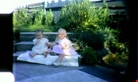
![Baby Teresa and McLean boy's birthday, [Between 1962 -1963] thumbnail](/media/Hpo/_Data/_Archives_Moving_Images/_Unrestricted/567-001-12.jpg?width=280)
Baby Teresa and McLean boy's birthday
https://search.heritageburnaby.ca/link/archivedescription85427
- Repository
- City of Burnaby Archives
- Date
- [Between 1962 -1963]
- Collection/Fonds
- George H.F. McLean fonds
- Description Level
- Item
- Physical Description
- 1 digital file ( 4 min., 18 sec ) : digital , col., si.
- Scope and Content
- Item consists of one colour film and opens with George McLean playing with his daughter Teresa, the McLean boys playing in a bedroom and brother Brad playing with Teresa while she sits in her highchair. The film continues with Teresa in a crib and being bathed in a small bathtub by her father, Geo…
- Repository
- City of Burnaby Archives
- Date
- [Between 1962 -1963]
- Collection/Fonds
- George H.F. McLean fonds
- Physical Description
- 1 digital file ( 4 min., 18 sec ) : digital , col., si.
- Description Level
- Item
- Record No.
- 567-001-12
- Access Restriction
- No restrictions
- Reproduction Restriction
- May be restricted by third party rights
- Accession Number
- 2014-03
- Scope and Content
- Item consists of one colour film and opens with George McLean playing with his daughter Teresa, the McLean boys playing in a bedroom and brother Brad playing with Teresa while she sits in her highchair. The film continues with Teresa in a crib and being bathed in a small bathtub by her father, George and closes with a McLean boy's birthday party with a Christmas tree in the background.
- Media Type
- Moving Images
- Photographer
- McLean, George H.F.
- Notes
- Title based on content of film
- Films originated in an 8mm format and were digitized by George McLean before being donated to the CBA
- Street Address
- 4378 Halley Avenue
- Historic Neighbourhood
- Broadview (Historic Neighbourhood)
- Planning Study Area
- Cascade-Schou Area
Images
![Baby Teresa and McLean boy's birthday, [Between 1962 -1963] thumbnail](/media/Hpo/_Data/_Archives_Moving_Images/_Unrestricted/567-001-12.jpg)
Video
Baby Teresa and McLean boy's birthday, [Between 1962 -1963]
Baby Teresa and McLean boy's birthday, [Between 1962 -1963]
https://search.heritageburnaby.ca/media/hpo/_Data/_Archives_Moving_Images/_Unrestricted/567-001-12.m4vBancroft family subseries
https://search.heritageburnaby.ca/link/archivedescription63795
- Repository
- City of Burnaby Archives
- Date
- [1900]-1979
- Collection/Fonds
- Burnaby Historical Society fonds
- Description Level
- Subseries
- Physical Description
- Textual records and other materials
- Scope and Content
- Subseries consists of publications, correspondence and other miscellaneous papers relating to the Bancroft family's interests and work history. Topics include gardening, raising poultry, the Liberal government and the Royal Canadian Air Force. Also included in the subseries are photographs of the…
- Repository
- City of Burnaby Archives
- Date
- [1900]-1979
- Collection/Fonds
- Burnaby Historical Society fonds
- Subseries
- Bancroft family subseries
- Physical Description
- Textual records and other materials
- Description Level
- Subseries
- Accession Number
- BHS1986-44
- BHS2004-06
- Scope and Content
- Subseries consists of publications, correspondence and other miscellaneous papers relating to the Bancroft family's interests and work history. Topics include gardening, raising poultry, the Liberal government and the Royal Canadian Air Force. Also included in the subseries are photographs of the Bancroft family and friends and ephemera pertaining to agricultural farming and the air force.
- History
- Rose Croucher was born to Ann Eliza "Annie" (b. August 1861, d. 1962) and R. Coucher in January 1895. In 1907, the Croucher family moved to British Columbia. As a student, Rose studied geometrical drawing using Blair’s Canadian Drawing Series workbooks. On on February 21, 1914, Rose married James Oakes Bancroft in Vancouver, BC. Together they had three children: James A. (b. 1916 or 1917), Rosie (date unknown), and George E. (b. August 1927). The Bancroft family were poultry farmers throughout the early 1900s, transporting their farmed eggs from Burnaby to the Hudson’s Bay Company Vancouver using the British Columbia Electric Railway system. Rose Bancroft also served as Secretary-Treasurer of the Central Park Poultry Co-op Association in the 1920s until her husband's death in 1930 at the age of 42. In the late thirties and early forties, while James A. Bancroft was stationed in Calgary with the Royal Canadian Air Force, his younger siblings lived together with their mother and grandmother at 1963 21st Avenue in Burnaby. Rosie Bancroft studied French and English history in Social Studies in 1937; her brother George studied the seasons in General Science II in 1942. Rose died in 1965 at the age of 76.
- Media Type
- Textual Record
- Photograph
- Cartographic Material
- Creator
- Bancroft, Rose
- Notes
- MSS030, PC490, PC507, and MSS110
- Title based on creator and contents of subseries
Barnet Road
https://search.heritageburnaby.ca/link/archivedescription245
- Repository
- City of Burnaby Archives
- Date
- 1911-1914
- Collection/Fonds
- City Council and Office of the City Clerk fonds
- Description Level
- File
- Physical Description
- Textual record and cartographic material
- Scope and Content
- File includes a copy of a 1908 blueprint plan.
- Repository
- City of Burnaby Archives
- Date
- 1911-1914
- Collection/Fonds
- City Council and Office of the City Clerk fonds
- Physical Description
- Textual record and cartographic material
- Description Level
- File
- Record No.
- 1934
- Accession Number
- 2001-02
- Scope and Content
- File includes a copy of a 1908 blueprint plan.
- Media Type
- Textual Record
- Cartographic Material
- Notes
- Plans/maps are located in file and have not been moved to map case.

Barnet School site
https://search.heritageburnaby.ca/link/museumdescription11140
- Repository
- Burnaby Village Museum
- Date
- May 27, 1915
- Collection/Fonds
- Ronald G. Scobbie collection
- Description Level
- Item
- Physical Description
- 1 survey plan : blueprint on paper ; 56 x 54 cm
- Scope and Content
- Survey plan of "Barnet School Site / Burnaby Municipality" "Being a portion of the west half of lot / 214, Group 1 / New Westminster District”.
- Repository
- Burnaby Village Museum
- Collection/Fonds
- Ronald G. Scobbie collection
- Description Level
- Item
- Physical Description
- 1 survey plan : blueprint on paper ; 56 x 54 cm
- Material Details
- Scale 40 feet = 1 inch
- Scope and Content
- Survey plan of "Barnet School Site / Burnaby Municipality" "Being a portion of the west half of lot / 214, Group 1 / New Westminster District”.
- Creator
- McGugan, Donald Johnston
- Subjects
- Buildings - Schools
- Names
- Barnet School
- Responsibility
- Burnett & McGugan, Engineers and Surveyors
- Geographic Access
- Barnet Road
- Street Address
- 7820 Barnet Road
- Accession Code
- BV003.83.19
- Access Restriction
- No restrictions
- Reproduction Restriction
- No known restrictions
- Date
- May 27, 1915
- Media Type
- Cartographic Material
- Historic Neighbourhood
- Barnet (Historic Neighbourhood)
- Planning Study Area
- Burnaby Mountain Area
- Scan Resolution
- 440
- Scan Date
- 22-Dec-2020
- Scale
- 100
- Notes
- Title based on contents of plan
- handwritten on back "Burnaby Schools" "23R" twice, "1783"
- Oath on plan reads: "I, D.J. McGugan...and did personally superintend the survey..." "completed on the 27th day of May 1915"; signed by D.J. McGugan, notarized by "Walter Edmonds" "sworn "...29th day of May 1915" "Burnett and McGugan" "B.C. Land Surveyors Etc. New Westminster, B.C.";
Zoomable Images

B.C. Electric Railway cutoff - Highland Park
https://search.heritageburnaby.ca/link/archivedescription751
- Repository
- City of Burnaby Archives
- Date
- 1912-1951
- Collection/Fonds
- City Council and Office of the City Clerk fonds
- Description Level
- File
- Physical Description
- 3 folders textual records and cartographic material
- Scope and Content
- File contains correspondence, reports, Council minutes, and agreements between the Corporation of the District of Burnaby and the B.C. Electric Co. regarding the construction of the Highland Park Cut-off. File also includes 1912 blueprint "Plan of Portion of 20th Street in DL171 and 53, Gp. 1, NWD…
- Repository
- City of Burnaby Archives
- Date
- 1912-1951
- Collection/Fonds
- City Council and Office of the City Clerk fonds
- Physical Description
- 3 folders textual records and cartographic material
- Description Level
- File
- Record No.
- 2489
- Accession Number
- 2001-02
- Scope and Content
- File contains correspondence, reports, Council minutes, and agreements between the Corporation of the District of Burnaby and the B.C. Electric Co. regarding the construction of the Highland Park Cut-off. File also includes 1912 blueprint "Plan of Portion of 20th Street in DL171 and 53, Gp. 1, NWD, Bby."
- Media Type
- Textual Record
- Cartographic Material
- Notes
- Plans/maps are located in file and have not been moved to map case.
B.C. Electric Railway - Stride Avenue crossing and Highland Park cut-off
https://search.heritageburnaby.ca/link/archivedescription959
- Repository
- City of Burnaby Archives
- Date
- 1914-1915
- Collection/Fonds
- City Council and Office of the City Clerk fonds
- Description Level
- File
- Physical Description
- Textual record and cartographic material
- Scope and Content
- File contains correspondence, reports, and an agreement made between the Corporation of the District of Burnaby and the B.C. Electric Railway Co. for work to be done in connection with the Company's Highland Park cut-off. File also contains correspondence and reports regarding a crossing at Stride…
- Repository
- City of Burnaby Archives
- Date
- 1914-1915
- Collection/Fonds
- City Council and Office of the City Clerk fonds
- Physical Description
- Textual record and cartographic material
- Description Level
- File
- Record No.
- 2732
- Accession Number
- 2001-02
- Scope and Content
- File contains correspondence, reports, and an agreement made between the Corporation of the District of Burnaby and the B.C. Electric Railway Co. for work to be done in connection with the Company's Highland Park cut-off. File also contains correspondence and reports regarding a crossing at Stride Avenue.
- Media Type
- Textual Record
- Cartographic Material
- Notes
- A sketch plan and profile of proposed overhead driveway, 17th and 20th Streets., May 17, 1914 : M9-B-3-15
![Bird's eye view of New Westminster, Burnaby and Vancouver, [ca. 1911] thumbnail](/media/hpo/_Data/_BVM_Cartographic_Material/1983/1983_0012_0001_002%20Web.jpg?width=280)
Bird's eye view of New Westminster, Burnaby and Vancouver
https://search.heritageburnaby.ca/link/museumdescription8199
- Repository
- Burnaby Village Museum
- Date
- [ca. 1911]
- Collection/Fonds
- Burnaby Village Museum Map collection
- Description Level
- Item
- Physical Description
- 1 map : hand painted ; 65.5 x 99 cm
- Scope and Content
- An untitled monochromatic grayscale map of a developer's bird's eye view looking north west from Burnaby Mountain. View includes Burnaby, New Westminster, Vancouver with the North shore in the distance. Burnaby neighbourhood subdivisions of "Burnaby Heights" and "Buena Vista" are featured near the…
- Repository
- Burnaby Village Museum
- Collection/Fonds
- Burnaby Village Museum Map collection
- Description Level
- Item
- Physical Description
- 1 map : hand painted ; 65.5 x 99 cm
- Scope and Content
- An untitled monochromatic grayscale map of a developer's bird's eye view looking north west from Burnaby Mountain. View includes Burnaby, New Westminster, Vancouver with the North shore in the distance. Burnaby neighbourhood subdivisions of "Burnaby Heights" and "Buena Vista" are featured near the centre of the map. These neighbourhood subdivisions were marketed by Real Estate Agents Liebly & Blumer in 1911. Roads, buildings, factories, railways and bridges are identified on the map.
- Subjects
- Businesses - Real Estate Agencies
- Responsibility
- Leibly & Blumer Realty Co. Incorporated
- Accession Code
- HV983.12.1
- Access Restriction
- No restrictions
- Reproduction Restriction
- No known restrictions
- Date
- [ca. 1911]
- Media Type
- Cartographic Material
- Historic Neighbourhood
- East Burnaby (Historic Neighbourhood)
- Vancouver Heights (Historic Neighbourhood)
- Planning Study Area
- Cariboo-Armstrong Area
- Burnaby Heights Area
- Scan Resolution
- 300
- Scan Date
- December 2020
- Scale
- 100
- Notes
- Title based on contents of map
- Note in pencil on verso of photograph reads: "Make tint block of Buena Vista / Blocks only as shown in lots"
Zoomable Images
![Bird's eye view of New Westminster, Burnaby and Vancouver, [ca. 1911] thumbnail](/media/hpo/_Data/_BVM_Cartographic_Material/1983/1983_0012_0001_001_seadragon/1983_0012_0001_001.jpg?w=280)
Board of Railway Commissioners
https://search.heritageburnaby.ca/link/archivedescription396
- Repository
- City of Burnaby Archives
- Date
- 1909-1912
- Collection/Fonds
- City Council and Office of the City Clerk fonds
- Description Level
- File
- Physical Description
- Textual record, cartographic material, and architectural drawings
- Scope and Content
- File contains correspondence and reports related to the activities of the Board of Railway Commissioners such as the movement of stations, culvert work, and the maintenance of crossings. File also includes white linen plan and blueprint plans (4) of culverts at Cariboo Road and V.W. and Y.Rlwy Jun…
- Repository
- City of Burnaby Archives
- Date
- 1909-1912
- Collection/Fonds
- City Council and Office of the City Clerk fonds
- Physical Description
- Textual record, cartographic material, and architectural drawings
- Description Level
- File
- Record No.
- 2096
- Accession Number
- 2001-02
- Scope and Content
- File contains correspondence and reports related to the activities of the Board of Railway Commissioners such as the movement of stations, culvert work, and the maintenance of crossings. File also includes white linen plan and blueprint plans (4) of culverts at Cariboo Road and V.W. and Y.Rlwy Junction, 1911.
- Notes
- Plans/maps are located in file and have not been moved to map case.
![Broadview Presbyterian Church, [ca.1910] thumbnail](/media/hpo/_Data/_BVM_Cartographic_Material/2003/2003_0083_0049_001.jpg?width=280)
Broadview Presbyterian Church
https://search.heritageburnaby.ca/link/museumdescription11927
- Repository
- Burnaby Village Museum
- Date
- [ca.1910]
- Collection/Fonds
- Ronald G. Scobbie collection
- Description Level
- Item
- Physical Description
- 1 plan : black ink and watercol. on paper ; 30.45 x 30.5 cm
- Scope and Content
- Item consists of building insurance plan of "Broadview Presbyterian Church / Lot 6, BK 31, DL 69 / GP1 N.W.D." . Fourteenth Avenue (Manor) is identified to the north and Douglas Ave. to the east.
- Repository
- Burnaby Village Museum
- Collection/Fonds
- Ronald G. Scobbie collection
- Description Level
- Item
- Physical Description
- 1 plan : black ink and watercol. on paper ; 30.45 x 30.5 cm
- Material Details
- Scale 1 inch = 20 feet
- Scope and Content
- Item consists of building insurance plan of "Broadview Presbyterian Church / Lot 6, BK 31, DL 69 / GP1 N.W.D." . Fourteenth Avenue (Manor) is identified to the north and Douglas Ave. to the east.
- Subjects
- Buildings - Religious - Churches
- Accession Code
- BV003.83.49
- Access Restriction
- No restrictions
- Reproduction Restriction
- No known restrictions
- Date
- [ca.1910]
- Media Type
- Cartographic Material
- Scan Resolution
- 600
- Scan Date
- 15-Jan-2021
- Scale
- 100
- Notes
- Transcribed title
- Note in pencil on verso reads: "Broadview Presbyterian Church / Lot 6, BK 31, DL 69 / 1" = 20' "
- Note in balck in on verso reads: "3704"
Images
![Broadview Presbyterian Church, [ca.1910] thumbnail](/media/hpo/_Data/_BVM_Cartographic_Material/2003/2003_0083_0049_001.jpg)
Burnaby historical reference collection series
https://search.heritageburnaby.ca/link/museumdescription18928
- Repository
- Burnaby Village Museum
- Date
- 1950-1992, predominant 1950-1973
- Collection/Fonds
- Burnaby Village Museum Film and Video collection
- Description Level
- Series
- Physical Description
- 3 film reels + 20 videocassettes + 1 avi
- Scope and Content
- Series consists of a reference collection of films relating to the history of Burnaby. Films include CBUT News footage "Burnaby Mountain Sod Turning"; a documentary film "Cabin" about the building of a log cabin at Burnaby Village Museum; a documentary film "A Friend at the Door" about the work of …
- Repository
- Burnaby Village Museum
- Collection/Fonds
- Burnaby Village Museum Film and Video collection
- Description Level
- Series
- Physical Description
- 3 film reels + 20 videocassettes + 1 avi
- Scope and Content
- Series consists of a reference collection of films relating to the history of Burnaby. Films include CBUT News footage "Burnaby Mountain Sod Turning"; a documentary film "Cabin" about the building of a log cabin at Burnaby Village Museum; a documentary film "A Friend at the Door" about the work of rural social workers in British Columbia; historical film footage from B.C. Transit Centennial of the B.C. Electric Lower Mainland trams and home movie footage created by the Handel family.
- Accession Code
- HV971.30
- BV005.8
- BV005.48
- BV012.37
- BV014.39
- BV016.37
- BV017.11
- BV020.5
- Date
- 1950-1992, predominant 1950-1973
- Media Type
- Moving Images
- Notes
- Title based on contents of series
Burnaby Image Bank subseries
https://search.heritageburnaby.ca/link/archivedescription64462
- Repository
- City of Burnaby Archives
- Date
- [1910] (date of original) -1993
- Collection/Fonds
- Burnaby Historical Society fonds
- Description Level
- Subseries
- Physical Description
- Photographs and other material
- Scope and Content
- Subseries consists of the SFU/Burnaby Centennial Committee's Image Bank project records. Records include: Image Bank database and backups in a variety of formats; 813 photographs collected by Simon Fraser University Archives staff; eleven screened negatives from the Burnaby Image Bank that were us…
- Repository
- City of Burnaby Archives
- Date
- [1910] (date of original) -1993
- Collection/Fonds
- Burnaby Historical Society fonds
- Subseries
- Burnaby Image Bank subseries
- Physical Description
- Photographs and other material
- Description Level
- Subseries
- Access Restriction
- Open Access
- Accession Number
- BHS1999-03
- BHS2004-13
- BHS2001-15
- Scope and Content
- Subseries consists of the SFU/Burnaby Centennial Committee's Image Bank project records. Records include: Image Bank database and backups in a variety of formats; 813 photographs collected by Simon Fraser University Archives staff; eleven screened negatives from the Burnaby Image Bank that were used for the publication "Burnaby: A Cultural Inventory and Resource Guide"; and one VHS tape and DVD access copy of "Burnaby's Photographic Family Album / Burnaby Image Bank Collection / Volume 1 / 1992" which was created by the Committee for public viewing and purchase. The collection of photographs for the Image Bank project were gathered from various donors to commemorate the Centennial of the City of Burnaby. All photographs were collected from Burnaby families' personal albums by Simon Fraser University Archives staff during 1991 with a focus on the history of the people and the landscape of Burnaby. Photographs were collected from every decade for every neighbourhood in effort to describe the City's evolving ethnic, cultural and physical landscape. In March 1992, 20 of these images were selected by a jury for their aesthetic quality and displayed at the Bennett Library Gallery at Simon Fraser University for the "Images of Burnaby" exhibition. This exhibit travelled to various locations between 1992-1993 within Burnaby and Douglas College in New Westminster. The entire 800+ collection was made available for public purchase and viewing on video cassette. As well, each Burnaby school and each branch of the Burnaby Public Library received their own VHS copy for information and research purposes. The "Image Bank" video collection was buried alongside the video "Images and Voices of Burnaby" in the City of Burnaby's time capsule, mounted at City Hall in 1992.
- Media Type
- Photograph
- Textual Record
- Moving Images
- Creator
- SFU/Burnaby Centennial Committee
- Notes
- Title based on contents of subseries
- PC 370, MSS131, MSS088, MI577
Burnaby Lake improvement
https://search.heritageburnaby.ca/link/archivedescription721
- Repository
- City of Burnaby Archives
- Date
- 1910-1912
- Collection/Fonds
- City Council and Office of the City Clerk fonds
- Description Level
- File
- Physical Description
- Textual record and cartographic material
- Scope and Content
- File contains correspondence, reports, and petitions relating to the Burnaby Lake Improvement Scheme. File also includes blueprint plan "Condensed Profile of Brunette River Showing Approx. Amount of work necessary to lower Lake Burnaby." Also includes blueprint plan of "Sketch Showing Proposed Im…
- Repository
- City of Burnaby Archives
- Date
- 1910-1912
- Collection/Fonds
- City Council and Office of the City Clerk fonds
- Physical Description
- Textual record and cartographic material
- Description Level
- File
- Record No.
- 2448
- Accession Number
- 2001-02
- Scope and Content
- File contains correspondence, reports, and petitions relating to the Burnaby Lake Improvement Scheme. File also includes blueprint plan "Condensed Profile of Brunette River Showing Approx. Amount of work necessary to lower Lake Burnaby." Also includes blueprint plan of "Sketch Showing Proposed Improvement to Outlet of Burnaby Lake" [1912].
- Media Type
- Textual Record
- Cartographic Material
- Notes
- Plans/maps are located in file and have not been moved to map case.