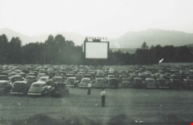
Cascades Drive-In Theatre
https://search.heritageburnaby.ca/link/landmark689
- Repository
- Burnaby Heritage Planning
- Geographic Access
- Grandview Highway
- Associated Dates
- 1946
- Heritage Value
- The Cascades Drive-In Theatre was Canada's first drive-in and was started by George and William Steel and Joe and Art Johnson in 1946. Built along Grandview Highway (Canada Way) near Smith Street, the theatre opened on August 30, 1946. In 1977, the theatre was purchased by Don Soutar, Al Chappell and Norm Green and continued to operate until 1980. The property was then redeveloped as Cascades Village - a large condominium complex.
- Historic Neighbourhood
- Broadview (Historic Neighbourhood)
- Planning Study Area
- Cascade-Schou Area
- Street Address
- 4050 Grandview Highway
Images
Montague & Marcia Moore Residence
https://search.heritageburnaby.ca/link/landmark499
- Repository
- Burnaby Heritage Planning
- Description
- The Montague and Marcia Moore Residence, situated on Sperling Avenue, is a one and one-half storey wood-frame house with Tudor Revival elements such as half-timbering and diamond-leaded windows. The landscaping includes a large hedge at the front of the property. It is located on a lakefront site w…
- Associated Dates
- 1943
- Street View URL
- Google Maps Street View
- Repository
- Burnaby Heritage Planning
- Geographic Access
- Sperling Avenue
- Associated Dates
- 1943
- Description
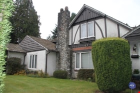
- The Montague and Marcia Moore Residence, situated on Sperling Avenue, is a one and one-half storey wood-frame house with Tudor Revival elements such as half-timbering and diamond-leaded windows. The landscaping includes a large hedge at the front of the property. It is located on a lakefront site within the scenic Deer Lake Park Heritage Precinct.
- Heritage Value
- Located within the historic Deer Lake Park neighbourhood, the Montague and Marcia Moore Residence is valued as an example of the late persistence of the historicist influence on domestic architecture, at a time when it was still considered the height of good taste for a house to be designed in a recognizable period revival style. This is reflected in the rustic Tudor Revival elements such as half-timbering, waney-edged boards in the gables, brick nogging, diamond-leaded windows, and bird houses in the main gable. The cobblestone chimney, the major focal point of the house, was constructed from river stones that were transported from Lynn Canyon. Meticulously retained in its original condition, this was the last home to be constructed by the Moore family before the Second World War construction supply rationing took effect. It was built by Danish contractor, Hans Jorgensen Hau (1878-1944), who had a flair for the construction of homes with a rustic character, and shares a number of design features with Hau’s own house at 5070 Canada Way.
- Defining Elements
- Key elements that define the heritage character of the Montague and Marcia Moore Residence include its: - location on a lakefront site, within the Deer Lake Park Heritage Precinct - residential form, scale and massing as expressed by its one and one-half storey height, rectangular plan and front gabled roof - wood-frame construction - Tudor Revival elements such as stucco and wood half-timbering, diamond-leaded casement windows, scroll-cut brackets, brick nogging on the front façade, bird houses in the main front gable, waney-edged boards at gable peaks, plank front door with strap hinges and a prominent external cobblestone chimney - associated landscape features such as a granite wall, and mature coniferous and deciduous trees
- Historic Neighbourhood
- Burnaby Lake (Historic Neighbourhood)
- Planning Study Area
- Morley-Buckingham Area
- Organization
- Canadian Institute of Mining and Metallurgy
- Builder
- Hans Jorgensen Hau
- Function
- Primary Historic--Single Dwelling
- Primary Current--Single Dwelling
- Community
- Deer Lake
- Cadastral Identifier
- P.I.D.006-082-696
- Boundaries
- The Montague and Marcia Moore Residence is comprised of a single residential lot located at 5165 Sperling Avenue, Burnaby.
- Area
- 4104
- Contributing Resource
- Building
- Ownership
- Public (local)
- Documentation
- City of Burnaby Planning and Building Department, Heritage Site Files
- Street Address
- 5165 Sperling Avenue
- Street View URL
- Google Maps Street View
Images
Moore House
https://search.heritageburnaby.ca/link/landmark497
- Repository
- Burnaby Heritage Planning
- Description
- The Moore House is a one-storey, side-gabled house with stepped roof planes and a split-level attached garage. The house faces east, and features distinct river rock porch columns and a large central tapered chimney. It is located within the Deer Lake Park Heritage Precinct, and is adjacent to a re…
- Associated Dates
- 1941
- Formal Recognition
- Community Heritage Register
- Other Names
- Ethel Moore Residence
- Street View URL
- Google Maps Street View
- Repository
- Burnaby Heritage Planning
- Other Names
- Ethel Moore Residence
- Geographic Access
- Sperling Avenue
- Associated Dates
- 1941
- Formal Recognition
- Community Heritage Register
- Enactment Type
- Council Resolution
- Enactment Date
- 26/05/2003
- Description
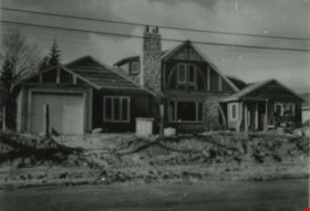
- The Moore House is a one-storey, side-gabled house with stepped roof planes and a split-level attached garage. The house faces east, and features distinct river rock porch columns and a large central tapered chimney. It is located within the Deer Lake Park Heritage Precinct, and is adjacent to a related house, the Rosalie (Moore) Barrett Residence, built the following year.
- Heritage Value
- The Moore House is significant for its relationship to first owner, Ethel Hutchings Moore (1884-1948), who purchased the property from Maud and Harriet Woodward, two of Deer Lake's first residents. Moore purchased the property with the hopes of introducing her children into the house construction business. This house, built in 1941, borrows its design from a 'California Desert House' built in Carmel a few years earlier. Rendered in traditional materials, this modern style merges comfortably with the rustic British Arts and Crafts tradition of most Deer Lake houses. Unusual for being built during wartime date, it was built at a time when domestic construction was severely curtailed due to shortages of labour and material. It is now owned by the City of Burnaby and is part of the Deer Lake Park Heritage Precinct. The Moore House is significant as a testament to Deer Lake's continued popularity as a residential neighbourhood in the 1940s. Although Burnaby was serviced by a number of transportation links at the time, the increasing availability of automobiles provided improved access to outlying suburbs. Rising real estate prices in Vancouver and New Westminster attracted residents to this neighbourhood because of its relative affordability, central location and beautiful scenery.
- Defining Elements
- Key elements that define the heritage character of the Moore House include its: - location within the Deer Lake Park Heritage Precinct - residential form, scale and massing as expressed by its one-storey height, linear plan, side gabled roof with multiple roof planes and split-level attached garage - wood-frame construction with stucco cladding - river rock porch columns and external tapered chimney - decorative embellishments including scroll-cut stickwork on the rear elevation and waney-edged boards in the gable peaks - wooden-sash casement windows with three-part, horizontal leading - associated landscaping features, including stone wall at the front of the property and coniferous and deciduous trees surrounding the property
- Historic Neighbourhood
- Burnaby Lake (Historic Neighbourhood)
- Planning Study Area
- Morley-Buckingham Area
- Function
- Primary Historic--Single Dwelling
- Primary Current--Single Dwelling
- Community
- Deer Lake
- Cadastral Identifier
- P.I.D. 011-454-521
- Boundaries
- The Moore House is comprised of a single residential lot located at 5145 Sperling Avenue, Burnaby.
- Area
- 993.39
- Contributing Resource
- Building
- Ownership
- Public (local)
- Documentation
- City of Burnaby Planning and Building Department, Heritage Site Files
- Street Address
- 5145 Sperling Avenue
- Street View URL
- Google Maps Street View
Images
Willingdon Heights Neighbourhood
https://search.heritageburnaby.ca/link/landmark670
- Repository
- Burnaby Heritage Planning
- Associated Dates
- 1925-1954
- Heritage Value
- Willingdon Heights was another new subdivision developed in Burnaby during the post-World War Two building boom. A brochure about the development published in 1948 proclaimed "the Willingdon Heights 500 home development project in Burnaby fulfills its promise to provide a self-contained community for former members of the armed services and their families...the largest single veteran housing project in Canada as far as homes for individual ownership is concerned, Willingdon Heights development was planned by the Central Mortgage and Housing Corporation...At this date the earlier built rows of homes have passable roads and the owners are improving lawns and gardens in spare time...eventually additional stores and professional services will be installed and recreational projects will add to the amenities of a community of congenial residents..."
- Planning Study Area
- Willingdon Heights Area
Images
Small family fonds
https://search.heritageburnaby.ca/link/archivedescription91819
- Repository
- City of Burnaby Archives
- Date
- 1922-2016
- Collection/Fonds
- Small family fonds
- Description Level
- Fonds
- Physical Description
- 75 photographs : b&w & col. + 1 plan
- Scope and Content
- Fonds consists of photographs documenting the transformation of the Burnaby Lake area of Burnaby, B.C. from semi-rural in the 1920s to urbanized in 2016. Photographs depict the land and houses located on the corner of Douglas Road and Dominion Street as the property was rezoned and its density quad…
- Repository
- City of Burnaby Archives
- Date
- 1922-2016
- Collection/Fonds
- Small family fonds
- Physical Description
- 75 photographs : b&w & col. + 1 plan
- Description Level
- Fonds
- Access Restriction
- Open access
- Reproduction Restriction
- May be restricted by third party rights
- Accession Number
- 2017-01
- Scope and Content
- Fonds consists of photographs documenting the transformation of the Burnaby Lake area of Burnaby, B.C. from semi-rural in the 1920s to urbanized in 2016. Photographs depict the land and houses located on the corner of Douglas Road and Dominion Street as the property was rezoned and its density quadrupled. Fonds also includes photographs of the Small family house being moved to 5496 Dominion Street and the original landscape plan for 5118 Douglas Road.
- History
- In 1915, John W. Roberts and his wife Mary Allen Roberts moved from the United States to Canada along with their daughter, Lauretta. On first moving to Canada, the family lived in a rented house in Vancouver and John worked as a movie projectionist in the city. The couple had three more children, all sons: John A., Edward, and Roland. Circa 1921, John purchased a large parcel of land at the corner of Douglas Road and Dominion Street in Burnaby. This parcel encompassed the equivalent of at least six 66-foot lots along the south side of Dominion Street and the same along the north side of Norfolk Street. On their property, a barn and small living quarters were built. The family moved in, raising goats and growing potatoes to supplement their income. They also planted cherry, apple, and pear trees; hazelnut and walnut trees; raspberries; and a large vegetable garden, the fruits of which Mary preserved for year-round use. At this time, agricultural activities were common for families in the area: the Roberts' neighbours kept chickens for personal use and for selling eggs; grew mushrooms for commercial sale; and sold manure from an old buckboard drawn by Clydesdale horses. John built a new house in the middle of the Roberts’ lots on the southwest corner of Douglas Road and Dominion Street. The house faced Douglas Road and overlooked a large, well-landscaped front yard to the east and a full-sized, clay tennis court to the north. The family moved into this new house in 1925. When the Roberts ceased raising goats, the barn and original living quarters were reduced to a double-car garage with storage space plus a sawdust-insulated “root cellar”. John also built a house on the northwest corner of the lot at Douglas Road and Dominion Street (3093 Douglas Road), which was purchased by the Hardy family. In 1957, part of this property (3071 Douglas Road) was sold to the Brocklebanks who built a house and lived there. In addition, John built a house at the northwest corner of Douglas Road and Norfolk Street (5106 Douglas Road). The original purchaser of this house is unknown, but in 1949, it was bought by the Meyers family. In 1952 or 1953, the Meyers sold part of this property and the Manahans built a house on it, facing Douglas Road. Several other lots that John owned were also sold off over the years. By the 1950s, John owned only five 66-foot lots from Douglas Road west, along the south side Dominion Street. In 1954, John sold the lot furthest from Douglas Road (5486 Dominion Street) to a builder who built a “ranch-style” house and put it up for sale. John retired from his career as a movie projectionist in the 1950s. He, Mary, and Lauretta retained their US citizenship all their lives, although they never returned to the USA except for brief visits. John A., Edward, and Roland who, as children of US citizens, also had US citizenship, eventually moved to the US, where they remained for the rest of their lives. In 1945, Lauretta married Frederick Small. The couple lived in a rented house in Vancouver for a few years before moving in with John and Mary in Burnaby. The couple had four children: Elizabeth, Kathryn, Charles, and Martin. In 1955, Frederick purchased the rancher at 5486 Dominion Street and the family moved in. The Small children grew up enjoying the freedom of having their grandparent’s large property in addition to their parent’s yard to play in. The back lane that ran between Dominion Street and Norfolk Street was filled with trees and bushes, creating a narrow bit of “forest” to explore. In 1957, John died. Mary died in 1969, as did Frederick. Lauretta was executor for her mother’s and husband’s estates. After much consideration, she decided to sell the house at 5486 Dominion Street and move back into her childhood home. By doing so, she was able to settle her mother’s estate to the satisfaction of her brothers. Elizabeth married and moved away. Over the next few years, the “Roberts” house was home to Lauretta, Kathryn, Charles, and Martin, with the three grown children moving in and out several times during the 1970s. In 1981, Lauretta died. Her children discussed at length how to divide up the property, which consisted of four 66-foot lots, according to her will. None of her children wanted to see the old family house destroyed but the house straddled two lots. They finally decided that if one of them wanted to pay to move the house to sit on one of the lots, the “value” of the house would not enter into the settlement of the estate. Kathryn chose to do this. In 1982, the old house was moved to 5496 Dominion Street and Kathryn continued to live in it. Martin died in 1982. Elizabeth and Charles each inherited one lot and the last lot, which would have gone to Martin, was sold, the funds divided equally between Elizabeth, Kathryn, and Charles. The three lots between 5496 Dominion Street and Douglas Road were subdivided into 33-foot lots and six new houses were built. In 1993, the Meyers property and the Manahan property were subdivided into 33-foot lots facing Norfolk Street and the old houses were torn down and four new houses were built.
- Media Type
- Photograph
- Technical Drawing
- Creator
- Small family
