More like '3900 Albert Street at Ingleton Avenue'
Narrow Results By
Decade
- 2020s 119
- 2010s 118
- 2000s 662
- 1990s 641
- 1980s 486
- 1970s 945
- 1960s 377
- 1950s 544
- 1940s 596
- 1930s 608
- 1920s
- 1910s 604
- 1900s 269
- 1890s 36
- 1880s 70
- 1870s 5
- 1860s 3
- 1850s 1
- 1840s 1
- 1830s 1
- 1820s 1
- 1810s 1
- 1800s 1
- 1790s 1
- 1780s 1
- 1770s 1
- 1760s 1
- 1750s 1
- 1740s 1
- 1730s 1
- 1720s 1
- 1710s 1
- 1700s 1
- 1690s 1
- 1680s 1
- 1670s 1
- 1660s 1
- 1650s 1
- 1640s 1
- 1630s 1
- 1620s 1
- 1610s
- 1600s 1
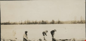
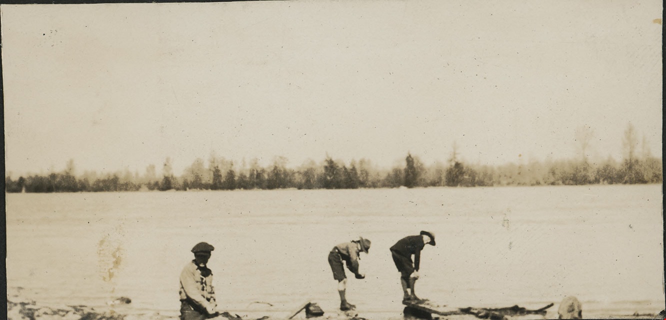
Washing up at Sunbury
https://search.heritageburnaby.ca/link/museumdescription20582
- Repository
- Burnaby Village Museum
- Date
- 1925
- Collection/Fonds
- David Geoffrey Llewellyn collection
- Description Level
- Item
- Physical Description
- 1 photograph : b&w ; 4 x 8 cm
- Scope and Content
- Photograph of three Boy Scouts from the 2nd Burnaby Boy Scouts troop washing up in the Fraser River at Sunbury.
- Repository
- Burnaby Village Museum
- Collection/Fonds
- David Geoffrey Llewellyn collection
- Description Level
- Item
- Physical Description
- 1 photograph : b&w ; 4 x 8 cm
- Scope and Content
- Photograph of three Boy Scouts from the 2nd Burnaby Boy Scouts troop washing up in the Fraser River at Sunbury.
- Subjects
- Organizations - Boys' Societies and Clubs
- Geographic Features - Natural Geographic Features
- Names
- Boy Scouts of Canada
- Geographic Access
- Fraser River
- Accession Code
- BV995.8.13
- Access Restriction
- No restrictions
- Reproduction Restriction
- No known restrictions
- Date
- 1925
- Media Type
- Photograph
- Scan Resolution
- 600
- Notes
- Transcribed title
- Photograph is part of photograph album BV995.8.1, pasted to page 4
- Inscription in white ink below photograph reads: "WASHING UP"
- Newspaper clipping with heading "SECOND BURNABY TROOP ENJOY HIKE" is adhered to page of album and provides context for the photographs mounted to the page.
Images
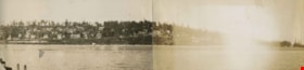
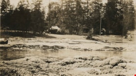
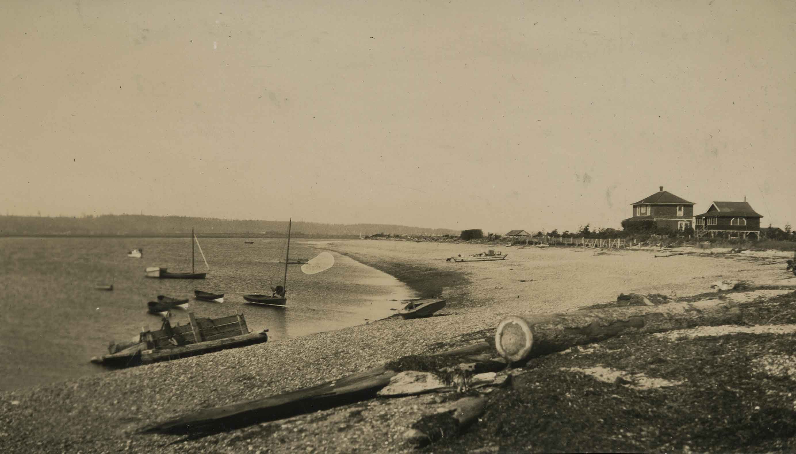
White Rock
https://search.heritageburnaby.ca/link/archivedescription34346
- Repository
- City of Burnaby Archives
- Date
- 1927
- Collection/Fonds
- Burnaby Historical Society fonds
- Description Level
- Item
- Physical Description
- 2 photographs : b&w ; 5.6 x 11.7 cm (pasted together to form panorama) on page 17.5 x 24.4 cm
- Scope and Content
- Photograph of the south half of White Rock as seen from the Pier. Swimmers and other beach-goers are visible in the background as well as the numerous houses overlooking the water.
- Repository
- City of Burnaby Archives
- Date
- 1927
- Collection/Fonds
- Burnaby Historical Society fonds
- Subseries
- Peers family subseries
- Physical Description
- 2 photographs : b&w ; 5.6 x 11.7 cm (pasted together to form panorama) on page 17.5 x 24.4 cm
- Description Level
- Item
- Record No.
- 020-053
- Access Restriction
- No restrictions
- Reproduction Restriction
- No known restrictions
- Accession Number
- BHS2007-04
- Scope and Content
- Photograph of the south half of White Rock as seen from the Pier. Swimmers and other beach-goers are visible in the background as well as the numerous houses overlooking the water.
- Media Type
- Photograph
- Notes
- Title based on contents of photograph
Images

![Women and children on top of rock, [c. 1910] thumbnail](/media/hpo/_Data/_BVM_Images/2022/2022_0032_0033_001.jpg?width=280)
Women and children on top of rock
https://search.heritageburnaby.ca/link/museumdescription19316
- Repository
- Burnaby Village Museum
- Date
- [c. 1910]
- Collection/Fonds
- Esther Love Stanley fonds
- Description Level
- Item
- Physical Description
- 1 photograph : b&w ; 8 x 10.5 cm
- Scope and Content
- Photograph of two women and three children seated on top of a large rock covered with moss. The rock is located in a clearing of a forested area. Many of trees surrounding the rock are without branches and appear to be damaged by a forest fire.
- Repository
- Burnaby Village Museum
- Collection/Fonds
- Esther Love Stanley fonds
- Description Level
- Item
- Physical Description
- 1 photograph : b&w ; 8 x 10.5 cm
- Material Details
- Photograph is over exposed, washing out some of the detail
- Scope and Content
- Photograph of two women and three children seated on top of a large rock covered with moss. The rock is located in a clearing of a forested area. Many of trees surrounding the rock are without branches and appear to be damaged by a forest fire.
- Accession Code
- BV022.32.33
- Access Restriction
- No restrictions
- Reproduction Restriction
- No known restrictions
- Date
- [c. 1910]
- Media Type
- Photograph
- Scan Resolution
- 600
- Scan Date
- 2023-04-04
- Notes
- Title based on contents of photograph
- Photograph is part of Esther Love Stanley photograph album 1 (BV022.32.1)
Images
![Women and children on top of rock, [c. 1910] thumbnail](/media/hpo/_Data/_BVM_Images/2022/2022_0032_0033_001.jpg)
![Yale, BC, [1925] thumbnail](/media/hpo/_Data/_Archives_Images/_Unrestricted/001/020-076.jpg?width=280)
Yale, BC
https://search.heritageburnaby.ca/link/archivedescription34369
- Repository
- City of Burnaby Archives
- Date
- [1925]
- Collection/Fonds
- Burnaby Historical Society fonds
- Description Level
- Item
- Physical Description
- 1 photograph : sepia ; 7 x 11.6 cm on page 17.5 x 26.4 cm
- Scope and Content
- Photograph of railway tracks along a river at a location identified as Yale, B.C. This photograph appears to have been taken by Arthur Peers, who travelled through the Fraser River Valley and worked on the construction of the Trans-Provincial Highway during the later 1920s.
- Repository
- City of Burnaby Archives
- Date
- [1925]
- Collection/Fonds
- Burnaby Historical Society fonds
- Subseries
- Peers family subseries
- Physical Description
- 1 photograph : sepia ; 7 x 11.6 cm on page 17.5 x 26.4 cm
- Description Level
- Item
- Record No.
- 020-076
- Access Restriction
- No restrictions
- Reproduction Restriction
- No known restrictions
- Accession Number
- BHS2007-04
- Scope and Content
- Photograph of railway tracks along a river at a location identified as Yale, B.C. This photograph appears to have been taken by Arthur Peers, who travelled through the Fraser River Valley and worked on the construction of the Trans-Provincial Highway during the later 1920s.
- Media Type
- Photograph
- Photographer
- Peers, Arthur Francis "Mike"
- Notes
- Title based on caption accompanying photograph
Images
![Yale, BC, [1925] thumbnail](/media/hpo/_Data/_Archives_Images/_Unrestricted/001/020-076.jpg)
![Yellow Point, [1925] thumbnail](/media/hpo/_Data/_Archives_Images/_Unrestricted/550/550-190.jpg?width=280)
Yellow Point
https://search.heritageburnaby.ca/link/archivedescription82637
- Repository
- City of Burnaby Archives
- Date
- [1925]
- Collection/Fonds
- Hill family and Vidal family fonds
- Description Level
- Item
- Physical Description
- 1 photograph : sepia ; 7 x 11 cm
- Scope and Content
- Photograph shows a lakeside.
- Repository
- City of Burnaby Archives
- Date
- [1925]
- Collection/Fonds
- Hill family and Vidal family fonds
- Physical Description
- 1 photograph : sepia ; 7 x 11 cm
- Description Level
- Item
- Record No.
- 550-190
- Access Restriction
- No restrictions
- Reproduction Restriction
- No known restrictions
- Accession Number
- 2013-03
- Scope and Content
- Photograph shows a lakeside.
- Media Type
- Photograph
- Notes
- Title based on note accompanying photograph
- Note in pencil on page reads: "Yellowpoint [sic]"
Images
![Yellow Point, [1925] thumbnail](/media/hpo/_Data/_Archives_Images/_Unrestricted/550/550-190.jpg)
![Beach, [192-] thumbnail](/media/hpo/_Data/_BVM_Images/1976/1976_0036_0022_001.jpg?width=280)
Beach
https://search.heritageburnaby.ca/link/museumdescription660
- Repository
- Burnaby Village Museum
- Date
- [192-]
- Collection/Fonds
- Burnaby Village Museum Photograph collection
- Description Level
- Item
- Physical Description
- 1 photograph : sepia ; 9.8 x 25.4 cm
- Scope and Content
- Photograph of English Bay shoreline, Vancouver populated with people, many of whom are in the water. In view of the photograph, there is a large two-storey building called the Pavillion Bathhouse. Residential housing can be seen along the bank just above the beach as well. There is a paved foot …
- Repository
- Burnaby Village Museum
- Collection/Fonds
- Burnaby Village Museum Photograph collection
- Description Level
- Item
- Physical Description
- 1 photograph : sepia ; 9.8 x 25.4 cm
- Scope and Content
- Photograph of English Bay shoreline, Vancouver populated with people, many of whom are in the water. In view of the photograph, there is a large two-storey building called the Pavillion Bathhouse. Residential housing can be seen along the bank just above the beach as well. There is a paved foot path running along the bank as well. "Marett & Reid Druggists" store can be seen on the left end of the photograph.
- Geographic Access
- Vancouver
- Accession Code
- HV976.36.22
- Access Restriction
- No restrictions
- Reproduction Restriction
- No known restrictions
- Date
- [192-]
- Media Type
- Photograph
- Scan Resolution
- 600
- Scan Date
- 17/8/2006
- Notes
- Title based on contents of photograph
Images
![Beach, [192-] thumbnail](/media/hpo/_Data/_BVM_Images/1976/1976_0036_0022_001.jpg)

![Bellinger and Baker children, [1929 or 1930] (date of original), copied 1991 thumbnail](/media/hpo/_Data/_Archives_Images/_Unrestricted/370/370-063.jpg?width=280)
Bellinger and Baker children
https://search.heritageburnaby.ca/link/archivedescription37475
- Repository
- City of Burnaby Archives
- Date
- [1929 or 1930] (date of original), copied 1991
- Collection/Fonds
- Burnaby Historical Society fonds
- Description Level
- Item
- Physical Description
- 1 photograph : b&w ; 4.4 x 3.0 cm print on contact sheet 20.2 x 25.3 cm
- Scope and Content
- Photograph of five children standing on the board sidewalk in front of 2827 Earl Avenue (later 6296 Pearl Avenue). Left to right: Marion Bellinger, Christine Bellinger, Robert Bellinger, Barbara Baker, and Barbara's sister. Adults are seated on the porch behind them.
- Repository
- City of Burnaby Archives
- Date
- [1929 or 1930] (date of original), copied 1991
- Collection/Fonds
- Burnaby Historical Society fonds
- Subseries
- Burnaby Image Bank subseries
- Physical Description
- 1 photograph : b&w ; 4.4 x 3.0 cm print on contact sheet 20.2 x 25.3 cm
- Description Level
- Item
- Record No.
- 370-063
- Access Restriction
- No restrictions
- Reproduction Restriction
- Reproduce for fair dealing purposes only
- Accession Number
- BHS1999-03
- Scope and Content
- Photograph of five children standing on the board sidewalk in front of 2827 Earl Avenue (later 6296 Pearl Avenue). Left to right: Marion Bellinger, Christine Bellinger, Robert Bellinger, Barbara Baker, and Barbara's sister. Adults are seated on the porch behind them.
- Media Type
- Photograph
- Photographer
- Bellinger, Bernard
- Notes
- Title based on contents of photograph
- 1 b&w copy negative accompanying
- Geographic Access
- Pearl Avenue
- Street Address
- 6296 Pearl Avenue
- Historic Neighbourhood
- Central Park (Historic Neighbourhood)
- Planning Study Area
- Windsor Area
Images
![Bellinger and Baker children, [1929 or 1930] (date of original), copied 1991 thumbnail](/media/hpo/_Data/_Archives_Images/_Unrestricted/370/370-063.jpg)
![Burrard Inlet, [192-] thumbnail](/media/hpo/_Data/_BVM_Images/2007/2007_0045_0011_001.jpg?width=280)
Burrard Inlet
https://search.heritageburnaby.ca/link/museumdescription3895
- Repository
- Burnaby Village Museum
- Date
- [192-]
- Collection/Fonds
- Burnaby Village Museum Photograph collection
- Description Level
- Item
- Physical Description
- 1 photograph : b&w ; 11.5 x 7 cm
- Scope and Content
- Photograph looking Northeast over Burrard Inlet from Trinity Street. The front porch of the house next door is visible on the right and a small house can be seen across street on the left.
- Repository
- Burnaby Village Museum
- Collection/Fonds
- Burnaby Village Museum Photograph collection
- Description Level
- Item
- Physical Description
- 1 photograph : b&w ; 11.5 x 7 cm
- Material Details
- "Burrard Inlet / taken from Trinity / St looking N. E. / North Vancouver / shore rather misty / 22" written in pencil on back of photo.
- Scope and Content
- Photograph looking Northeast over Burrard Inlet from Trinity Street. The front porch of the house next door is visible on the right and a small house can be seen across street on the left.
- History
- George Vincent Martin was born in 1892 in England. He married Matilda Florence Reed in 1916. He purchased a property in North Burnaby in the 1920s on Trinity Street. There was a main house and a "shack" on the property split up onto two lots.
- Accession Code
- BV007.45.11
- Access Restriction
- No restrictions
- Reproduction Restriction
- No known restrictions
- Date
- [192-]
- Media Type
- Photograph
- Scan Resolution
- 300
- Scan Date
- 29-Nov-2018
- Scale
- 96
- Notes
- Title based on notes on the reverse of the photograph
Images
![Burrard Inlet, [192-] thumbnail](/media/hpo/_Data/_BVM_Images/2007/2007_0045_0011_001.jpg)
![Burrard Inlet, [192-] thumbnail](/media/hpo/_Data/_BVM_Images/2007/2007_0045_0012_001.jpg?width=280)
Burrard Inlet
https://search.heritageburnaby.ca/link/museumdescription3896
- Repository
- Burnaby Village Museum
- Date
- [192-]
- Collection/Fonds
- Burnaby Village Museum Photograph collection
- Description Level
- Item
- Physical Description
- 1 photograph : b&w ; 11.5 x 7 cm
- Scope and Content
- Photograph looking North over Burrard Inlet Two small houses are visible across the street. A house on the left is hidden behind some trees. Soft image of mountain in the distance.
- Repository
- Burnaby Village Museum
- Collection/Fonds
- Burnaby Village Museum Photograph collection
- Description Level
- Item
- Physical Description
- 1 photograph : b&w ; 11.5 x 7 cm
- Material Details
- "__rrard Inle_ / ___king due No___ / If the day had been / clearer you would / see North Vancouver / to the left The / background is / Grouse Mountain / which backs ________" written in pencil on back of photo. "22" written vertically across previous text in pencil on back of photo.
- Scope and Content
- Photograph looking North over Burrard Inlet Two small houses are visible across the street. A house on the left is hidden behind some trees. Soft image of mountain in the distance.
- History
- George Vincent Martin was born in 1892 in England. He married Matilda Florence Reed in 1916. He purchased a property in North Burnaby in the 1920s on Trinity Street. There was a main house and a "shack" on the property split up onto two lots.
- Accession Code
- BV007.45.12
- Access Restriction
- No restrictions
- Reproduction Restriction
- No known restrictions
- Date
- [192-]
- Media Type
- Photograph
- Scan Resolution
- 300
- Scan Date
- 29-Nov-2018
- Scale
- 96
- Notes
- Title based on notes on the reverse of the photograph
Images
![Burrard Inlet, [192-] thumbnail](/media/hpo/_Data/_BVM_Images/2007/2007_0045_0012_001.jpg)
![Burrard Inlet, [192-] thumbnail](/media/hpo/_Data/_BVM_Images/2007/2007_0045_0013_001.jpg?width=280)
Burrard Inlet
https://search.heritageburnaby.ca/link/museumdescription3897
- Repository
- Burnaby Village Museum
- Date
- [192-]
- Collection/Fonds
- Burnaby Village Museum Photograph collection
- Description Level
- Item
- Physical Description
- 1 photograph : b&w ; 11.5 x 7 cm
- Scope and Content
- Photograph looking North over Burrard Inlet. A wood rail fence can be seen in the foreground. Two small houses are across the street. The house on the left is hidden behind some trees. Soft image of foreshore in the distance.
- Repository
- Burnaby Village Museum
- Collection/Fonds
- Burnaby Village Museum Photograph collection
- Description Level
- Item
- Physical Description
- 1 photograph : b&w ; 11.5 x 7 cm
- Material Details
- "The Inlet looking / N. E." written in pencil on back of photo. "22" written in pencil on back of photo.
- Scope and Content
- Photograph looking North over Burrard Inlet. A wood rail fence can be seen in the foreground. Two small houses are across the street. The house on the left is hidden behind some trees. Soft image of foreshore in the distance.
- History
- George Vincent Martin was born in 1892 in England. He married Matilda Florence Reed in 1916. He purchased a property in North Burnaby in the 1920s on Trinity Street. There was a main house and a "shack" on the property split up onto two lots.
- Accession Code
- BV007.45.13
- Access Restriction
- No restrictions
- Reproduction Restriction
- No known restrictions
- Date
- [192-]
- Media Type
- Photograph
- Scan Resolution
- 300
- Scan Date
- 29-Nov-2018
- Scale
- 96
- Notes
- Title based on notes on the reverse of the photograph
Images
![Burrard Inlet, [192-] thumbnail](/media/hpo/_Data/_BVM_Images/2007/2007_0045_0013_001.jpg)
By the water
https://search.heritageburnaby.ca/link/archivedescription82633
- Repository
- City of Burnaby Archives
- Date
- 1925
- Collection/Fonds
- Hill family and Vidal family fonds
- Description Level
- Item
- Physical Description
- 1 photograph : b&w ; 9 x 13 cm
- Scope and Content
- Photograph shows houses on the shore of a body of water.
- Repository
- City of Burnaby Archives
- Date
- 1925
- Collection/Fonds
- Hill family and Vidal family fonds
- Physical Description
- 1 photograph : b&w ; 9 x 13 cm
- Description Level
- Item
- Record No.
- 550-186
- Access Restriction
- No restrictions
- Reproduction Restriction
- No known restrictions
- Accession Number
- 2013-03
- Scope and Content
- Photograph shows houses on the shore of a body of water.
- Media Type
- Photograph
- Notes
- Title based on contents of photograph
- Note in pencil on page photograph is mounted on reads: "1925"
Images
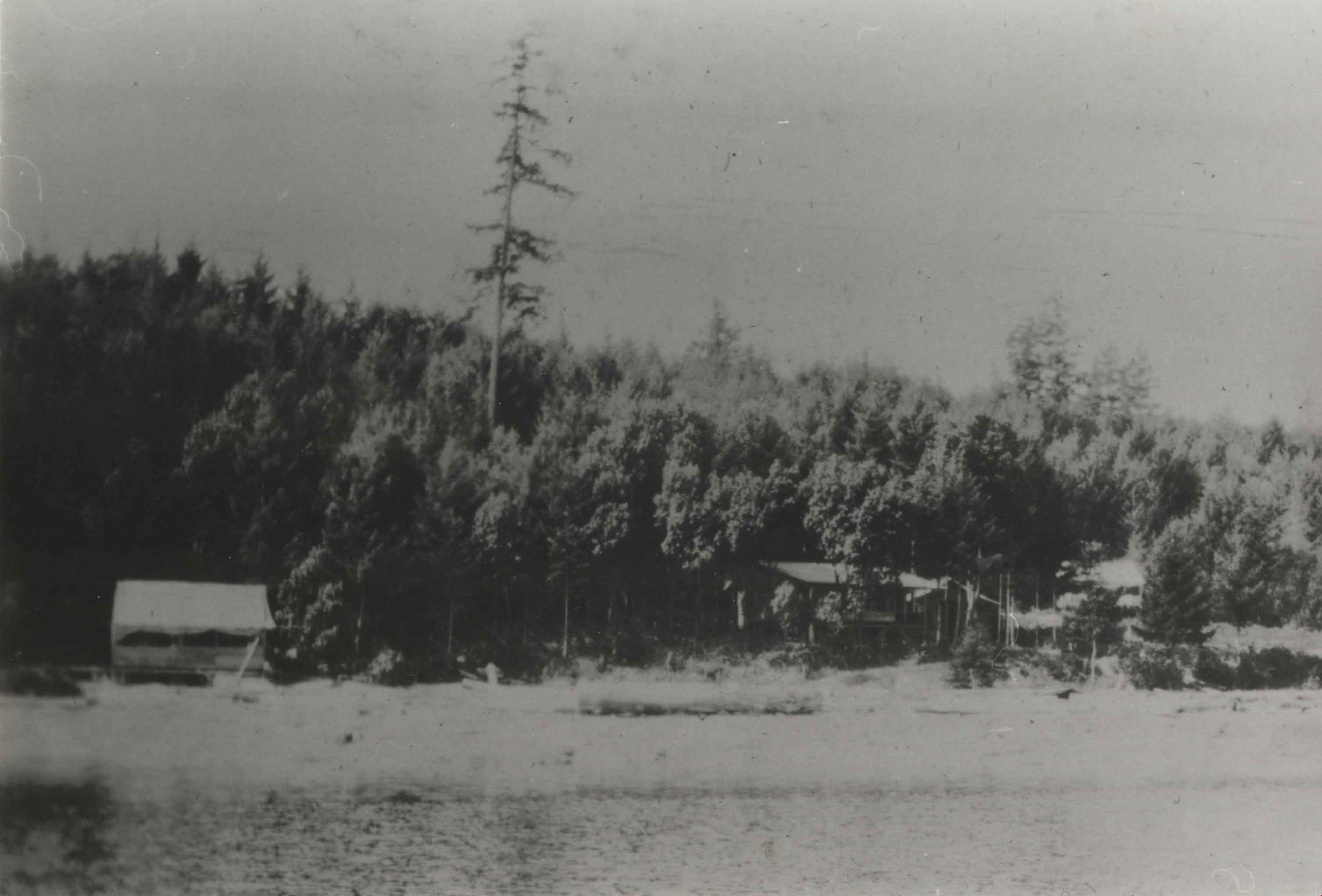
Camping at Yellow Point
https://search.heritageburnaby.ca/link/archivedescription34314
- Repository
- City of Burnaby Archives
- Date
- 1924
- Collection/Fonds
- Burnaby Historical Society fonds
- Description Level
- Item
- Physical Description
- 1 photograph : b&w : 8 x 13 cm on page 17.5 x 24.5 cm
- Scope and Content
- Photograph of a cabin, tents and campsite alongside a small stream. The location is identified as Yellow Point, which was a regular vacation spot for members of the Hill and Peers families of Burnaby.
- Repository
- City of Burnaby Archives
- Date
- 1924
- Collection/Fonds
- Burnaby Historical Society fonds
- Subseries
- Peers family subseries
- Physical Description
- 1 photograph : b&w : 8 x 13 cm on page 17.5 x 24.5 cm
- Description Level
- Item
- Record No.
- 020-021
- Access Restriction
- No restrictions
- Reproduction Restriction
- No known restrictions
- Accession Number
- BHS2007-04
- Scope and Content
- Photograph of a cabin, tents and campsite alongside a small stream. The location is identified as Yellow Point, which was a regular vacation spot for members of the Hill and Peers families of Burnaby.
- Subjects
- Buildings - Residential - Cabins
- Recreational Activities - Camping
- Geographic Features - Channels
- Media Type
- Photograph
- Notes
- Title based on caption accompanying photograph
Images
![Central Park Auto Tourist Grounds, Vancouver Canada, [1923] thumbnail](/media/hpo/_Data/_Archives_Images/_Unrestricted/371/449-007.jpg?width=280)
Central Park Auto Tourist Grounds, Vancouver Canada
https://search.heritageburnaby.ca/link/archivedescription38512
- Repository
- City of Burnaby Archives
- Date
- [1923]
- Collection/Fonds
- Burnaby Historical Society fonds
- Description Level
- Item
- Physical Description
- 1 photograph : sepia postcard ; 9 x 14 cm
- Scope and Content
- Photographic postcard of the Central Park auto tourist grounds. Two unidentified men can be seen standing in front of a car which is parked next to the campground building. In the background, a clothesline has been strung holding towels and blankets.
- Repository
- City of Burnaby Archives
- Date
- [1923]
- Collection/Fonds
- Burnaby Historical Society fonds
- Subseries
- Photographs subseries
- Physical Description
- 1 photograph : sepia postcard ; 9 x 14 cm
- Description Level
- Item
- Record No.
- 449-007
- Access Restriction
- No restrictions
- Reproduction Restriction
- No known restrictions
- Accession Number
- BHS2007-04
- Scope and Content
- Photographic postcard of the Central Park auto tourist grounds. Two unidentified men can be seen standing in front of a car which is parked next to the campground building. In the background, a clothesline has been strung holding towels and blankets.
- Subjects
- Buildings - Commercial - Hotels and Motels
- Geographic Features - Parks
- Documentary Artifacts - Postcards
- Recreational Activities - Camping
- Media Type
- Photograph
- Notes
- Title based on caption
- Geographic Access
- Central Park
- Imperial Street
- Street Address
- 3883 Imperial Street
- Historic Neighbourhood
- Central Park (Historic Neighbourhood)
- Planning Study Area
- Maywood Area
Images
![Central Park Auto Tourist Grounds, Vancouver Canada, [1923] thumbnail](/media/hpo/_Data/_Archives_Images/_Unrestricted/371/449-007.jpg)
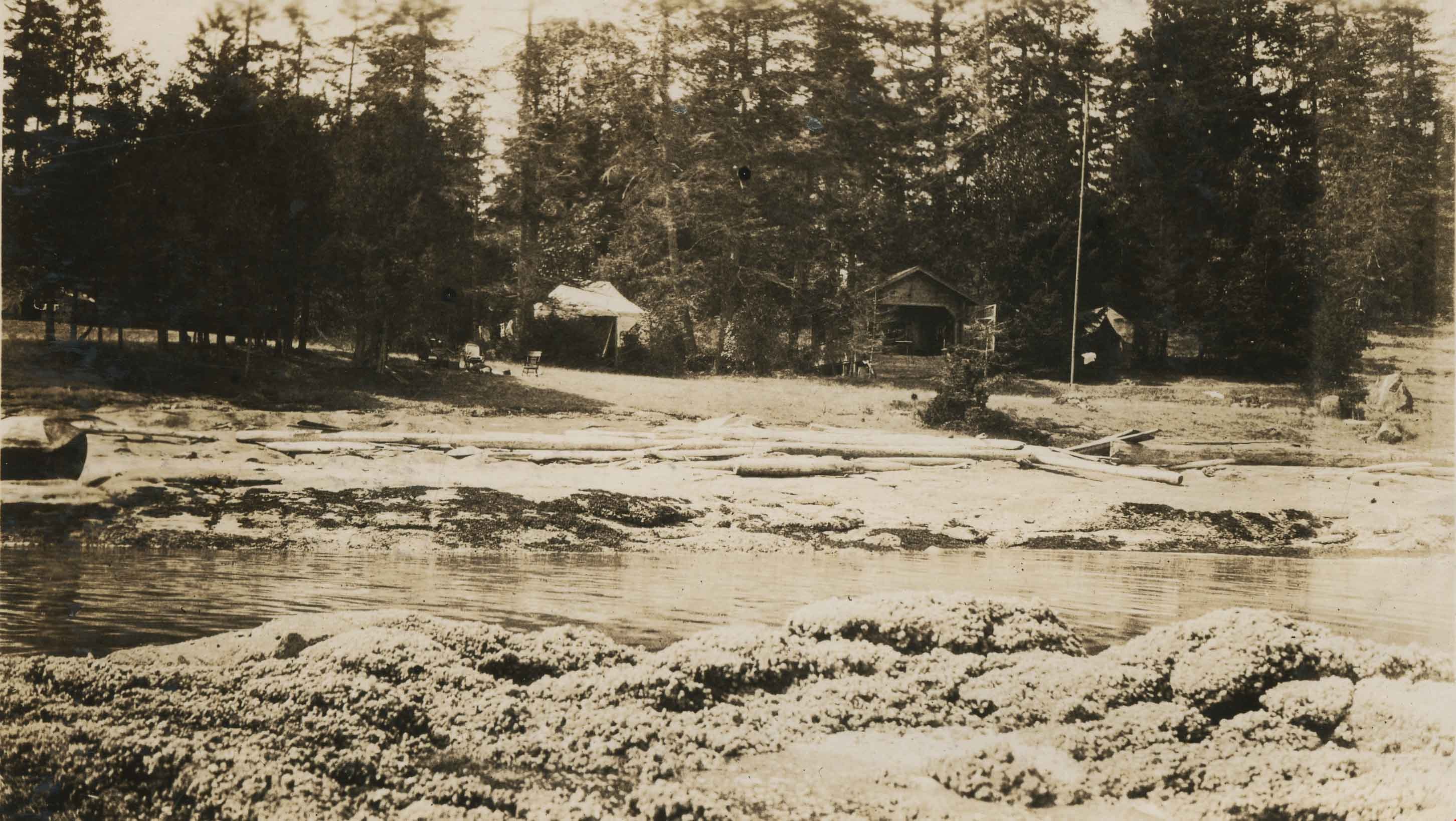
Claude Hill's Boathouse
https://search.heritageburnaby.ca/link/archivedescription34310
- Repository
- City of Burnaby Archives
- Date
- 1924
- Collection/Fonds
- Burnaby Historical Society fonds
- Description Level
- Item
- Physical Description
- 1 photograph : b&w ; 8 x 13.3 cm on page 17.5 x 24.5 cm
- Scope and Content
- Photograph of three people outside Claude Hill's boathouse - all unidentified. The boathouse was located at the mouth of Deer Lake Creek (historically known as Deer Lake Brook) This photograph was taken during the winter of 1924 and the water is frozen over with ice.
- Repository
- City of Burnaby Archives
- Date
- 1924
- Collection/Fonds
- Burnaby Historical Society fonds
- Subseries
- Peers family subseries
- Physical Description
- 1 photograph : b&w ; 8 x 13.3 cm on page 17.5 x 24.5 cm
- Description Level
- Item
- Record No.
- 020-017
- Access Restriction
- No restrictions
- Reproduction Restriction
- No known restrictions
- Accession Number
- BHS2007-04
- Scope and Content
- Photograph of three people outside Claude Hill's boathouse - all unidentified. The boathouse was located at the mouth of Deer Lake Creek (historically known as Deer Lake Brook) This photograph was taken during the winter of 1924 and the water is frozen over with ice.
- Media Type
- Photograph
- Notes
- Title based on caption accompanying photograph
- Geographic Access
- Deer Lake Brook
- Historic Neighbourhood
- Burnaby Lake (Historic Neighbourhood)
- Planning Study Area
- Morley-Buckingham Area
Images
![Construction of Elworth, [1922] thumbnail](/media/hpo/_Data/_BVM_Images/1976/1976_0037_0001_001.jpg?width=280)
Construction of Elworth
https://search.heritageburnaby.ca/link/museumdescription676
- Repository
- Burnaby Village Museum
- Date
- [1922]
- Collection/Fonds
- E.W. Bateman family fonds
- Description Level
- Item
- Physical Description
- 1 photograph : b&w ; 6.9 x 11.5 cm
- Scope and Content
- Phoptograph of the construction of Mr. and Mrs. Edwin W. and Mary Bateman's house "Elworth." The path in the garden to the front porch has already been established in the photograph, and the frames of the house are erected, with side panels being fitted for the first floor. At least three people …
- Repository
- Burnaby Village Museum
- Collection/Fonds
- E.W. Bateman family fonds
- Description Level
- Item
- Physical Description
- 1 photograph : b&w ; 6.9 x 11.5 cm
- Scope and Content
- Phoptograph of the construction of Mr. and Mrs. Edwin W. and Mary Bateman's house "Elworth." The path in the garden to the front porch has already been established in the photograph, and the frames of the house are erected, with side panels being fitted for the first floor. At least three people are sitting by the openings made for the windows. Stamped on the back of the photo: "216." The house is located at the site of what would become Burnaby Village Museum, 6501 Deer Lake Avenue.
- Geographic Access
- Deer Lake Avenue
- Street Address
- 6501 Deer Lake Avenue
- Accession Code
- HV976.37.1
- Access Restriction
- No restrictions
- Reproduction Restriction
- No known restrictions
- Date
- [1922]
- Media Type
- Photograph
- Historic Neighbourhood
- Burnaby Lake (Historic Neighbourhood)
- Planning Study Area
- Morley-Buckingham Area
- Scan Resolution
- 600
- Scan Date
- 2023-06-13
- Notes
- Title based on contents of photograph
Images
![Construction of Elworth, [1922] thumbnail](/media/hpo/_Data/_BVM_Images/1976/1976_0037_0001_001.jpg)
![Cottage in the woods, [1925] thumbnail](/media/hpo/_Data/_Archives_Images/_Unrestricted/550/550-193.jpg?width=280)
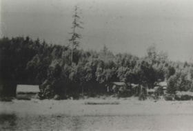
Cottage in the woods
https://search.heritageburnaby.ca/link/archivedescription82640
- Repository
- City of Burnaby Archives
- Date
- [1925]
- Collection/Fonds
- Hill family and Vidal family fonds
- Description Level
- Item
- Physical Description
- 1 photograph : b&w ; 9 x 13 cm
- Scope and Content
- Photograph shows a cottage, possibly belonging to Louisa Vidal, in the middle of the woods.
- Repository
- City of Burnaby Archives
- Date
- [1925]
- Collection/Fonds
- Hill family and Vidal family fonds
- Physical Description
- 1 photograph : b&w ; 9 x 13 cm
- Description Level
- Item
- Record No.
- 550-193
- Access Restriction
- No restrictions
- Reproduction Restriction
- No known restrictions
- Accession Number
- 2013-03
- Scope and Content
- Photograph shows a cottage, possibly belonging to Louisa Vidal, in the middle of the woods.
- Media Type
- Photograph
- Notes
- Title based on contents of photograph
Images
![Cottage in the woods, [1925] thumbnail](/media/hpo/_Data/_Archives_Images/_Unrestricted/550/550-193.jpg)
Crescent Beach
https://search.heritageburnaby.ca/link/archivedescription39206
- Repository
- City of Burnaby Archives
- Date
- 1923
- Collection/Fonds
- Peers Family and Hill Family fonds
- Description Level
- Item
- Physical Description
- 1 photograph : b&w ; 7 x 12 cm on page 24.5 x 32.5 cm (pasted in album)
- Scope and Content
- Photograph of Crescent Beach with boats in the water and houses in the background.
- Repository
- City of Burnaby Archives
- Date
- 1923
- Collection/Fonds
- Peers Family and Hill Family fonds
- Physical Description
- 1 photograph : b&w ; 7 x 12 cm on page 24.5 x 32.5 cm (pasted in album)
- Description Level
- Item
- Record No.
- 477-525
- Access Restriction
- No restrictions
- Reproduction Restriction
- No known restrictions
- Accession Number
- 2007-12
- Scope and Content
- Photograph of Crescent Beach with boats in the water and houses in the background.
- Media Type
- Photograph
- Notes
- Title based on contents of photograph
Images
![Deer Lake and Oakalla, [1929] (date of original), copied 1991 thumbnail](/media/hpo/_Data/_Archives_Images/_Unrestricted/370/370-590.jpg?width=280)
Deer Lake and Oakalla
https://search.heritageburnaby.ca/link/archivedescription38003
- Repository
- City of Burnaby Archives
- Date
- [1929] (date of original), copied 1991
- Collection/Fonds
- Burnaby Historical Society fonds
- Description Level
- Item
- Physical Description
- 1 photograph : b&w ; 2.5 x 4.5 cm print on contact sheet 20.5 x 26.4 cm
- Scope and Content
- Photograph of Deer Lake with Oakalla Prison Farm visible in the background.
- Repository
- City of Burnaby Archives
- Date
- [1929] (date of original), copied 1991
- Collection/Fonds
- Burnaby Historical Society fonds
- Subseries
- Burnaby Image Bank subseries
- Physical Description
- 1 photograph : b&w ; 2.5 x 4.5 cm print on contact sheet 20.5 x 26.4 cm
- Description Level
- Item
- Record No.
- 370-590
- Access Restriction
- No restrictions
- Reproduction Restriction
- No known restrictions
- Accession Number
- BHS1999-03
- Scope and Content
- Photograph of Deer Lake with Oakalla Prison Farm visible in the background.
- Names
- Oakalla Prison Farm
- Media Type
- Photograph
- Notes
- Title based on contents of photograph
- 1 b&w copy negative accompanying
- Geographic Access
- Deer Lake
- Historic Neighbourhood
- Burnaby Lake (Historic Neighbourhood)
- Planning Study Area
- Morley-Buckingham Area
- Oakalla Area
Images
![Deer Lake and Oakalla, [1929] (date of original), copied 1991 thumbnail](/media/hpo/_Data/_Archives_Images/_Unrestricted/370/370-590.jpg)

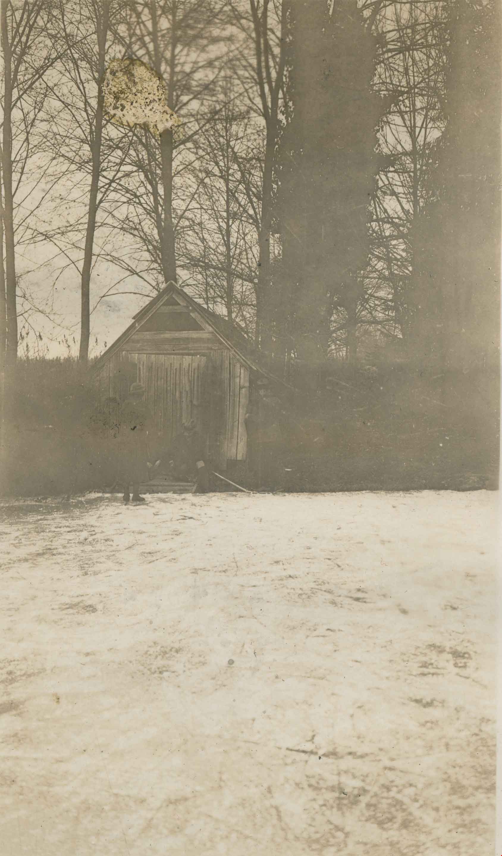
Dyke construction on Nicomen Island
https://search.heritageburnaby.ca/link/archivedescription34331
- Repository
- City of Burnaby Archives
- Date
- 1927
- Collection/Fonds
- Burnaby Historical Society fonds
- Description Level
- Item
- Physical Description
- 1 photograph : sepia ; 7 x 13.5 cm on page 17.5 x 22.7 cm
- Scope and Content
- Photograph of a home, with car in the foreground next to equipment being used in the construction of dykes on Nicomen Island.
- Repository
- City of Burnaby Archives
- Date
- 1927
- Collection/Fonds
- Burnaby Historical Society fonds
- Subseries
- Peers family subseries
- Physical Description
- 1 photograph : sepia ; 7 x 13.5 cm on page 17.5 x 22.7 cm
- Description Level
- Item
- Record No.
- 020-038
- Access Restriction
- No restrictions
- Reproduction Restriction
- No known restrictions
- Accession Number
- BHS2007-04
- Scope and Content
- Photograph of a home, with car in the foreground next to equipment being used in the construction of dykes on Nicomen Island.
- Subjects
- Construction Tools and Equipment
- Geographic Features - Dykes
- Buildings - Residential - Houses
- Media Type
- Photograph
- Notes
- Title based on caption accompanying photograph
Images


Interview with Jack McGeachie June 18, 1975 - Track 2
https://search.heritageburnaby.ca/link/oralhistory36
- Repository
- City of Burnaby Archives
- Date Range
- 1927-1930
- Length
- 0:08:22
- Summary
- This portion of the interview pertains to John Aloysius "Jack" McGeachie's teen years including the early passing of his father.
- Repository
- City of Burnaby Archives
- Summary
- This portion of the interview pertains to John Aloysius "Jack" McGeachie's teen years including the early passing of his father.
- Date Range
- 1927-1930
- Photo Info
- McGeachie family; John Aloysius "Jack" McGeachie is the eldest child, standing second from the right, 1925 (date of original). Item no. 204-464
- Length
- 0:08:22
- Geographic Access
- Formby Street
- Historic Neighbourhood
- Edmonds (Historic Neighbourhood)
- Planning Study Area
- Richmond Park Area
- Interviewer
- Bradbury, Dr. Bettina
- Interview Date
- June 18, 1975
- Scope and Content
- Recording is a taped interview with John A."Jack" McGeachie by SFU (Simon Fraser University) graduate student Bettina Bradbury June 18, 1975. Major themes discussed are: the Depression, the CCF (Co-operative Commonwealth Federation) and farming in Burnaby. To view "Narrow By" terms for each track expand this description and see "Notes".
- Biographical Notes
- John Aloysius “Jack” McGeachie was born January 14, 1914 in Little Mountain, Vancouver to Helen and John McGeachie. Helen and John had four children; John Aloysius “Jack”, Florence Mary, Thomas Joseph “Tom” and Roderick Noel “Rod.” In 1922 the McGeachie family moved from Vancouver to East Burnaby where the children attended Edmonds School. John Sr. became ill and died, leaving the eldest Jack as the main breadwinner of the family when he was still just a teenager. He began his working life at a chicken farm, later learning his trade while working for the Hudson Bay Company. Jack McGeachie married Burnaby Historian Doreen Pixie Johnson. He and Pixie raised their children Kathi (Dunlop) and David McGeachie in the house the couple built themselves in 1947. John Aloysius "Jack" McGeachie died October 12, 1981 at the age of sixty-seven. Doreen "Pixie" (Johnson) McGeachie died August 14, 2010 at the age of eighty-nine.
- Total Tracks
- 8
- Total Length
- 0:51:13
- Interviewee Name
- McGeachie, John Aloysius "Jack"
- Interview Location
- Rosewood
- Interviewer Bio
- Bettina Bradbury teaches history and women's studies at York University. She is the author of Wife to Widow. Lives, Laws and Politics in Nineteenth-century Montreal. (Vancouver: University of British Columbia Press, June 2011), 520p; Working Families. Age, Gender and Daily Survival in Industrializing Montreal. (Toronto: Canadian Social History Series, McClelland and Stewart, 1993); (Republished Toronto: Oxford University Press, 1996) (3rd edition, Toronto: University of Toronto Press, 2007). These interviews were undertaken after she completed her MA at Simon Fraser University in 1975 with the support of an LIP grant.
- Collection/Fonds
- Burnaby Historical Society fonds
- Subseries
- Oral history subseries
- Transcript Available
- None
- Media Type
- Sound Recording
- Web Notes
- Interview was digitized in 2010 allowing it to be accessible on Heritage Burnaby. The digitization project was initiated by the Community Heritage Commission with support from City of Burnaby Council and the BC History Digitization Program of the Irving K. Barber Learning Centre, University of British Columbia. It was recognized by the Heritage Society of BC with an award in 2012.
Images

Audio Tracks
Track one of interview with Jack McGeachie
Track one of interview with Jack McGeachie
https://search.heritageburnaby.ca/media/hpo/_Data/_Archives_Oral_Histories/_Unrestricted/100-13-10/100-13-10_Track_2.mp3